Cascade Canal
and soon arrives at the wilderness boundary and the Forest Service's warning sign - which is absolutely worth reading if you aren't familiar with this peak's excentricities. For example, this hike starts on one forest (the Fremont-Winema) but soon enters another (the Rogue-Siskiyou), which is good to know should you have to call for help.
 At the wilderness boundary
The trail runs level for about 1.5 miles, then becomes increasingly rocky as it starts its relentless climb to the summit. There's a small, waterless campsite at about 7,000 feet and from here I got my first view of Fourmile Lake to the northeast and of the smoke filtering in to the Klamath Lake area from nearby wildfires.
 Looking east with Fourmile Lake in the foreground and Pelican Butte beyond
Around 8,000 feet the trail starts emerging from the trees and from here I caught sight of Mount Shasta to the south, barely visible above the staggering amount of smoke from the wildfires in Northern California.
 Looking south toward Mount Shasta
 Brown Mountain in the foreground and Mount Shasta beyond
At about 8,200 feet, the official trail ends at a sandy saddle - a good place for a break - where I got my first good look at the summit, now only 1,300 rocky feet above!
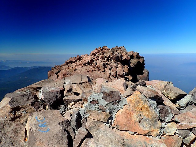
 The summit of Mount McLoughlin from the sandy saddle
What I also got from here were distressing views of the wildfires (Spruce Lake and Blanket Creek) blowing up near Crater Lake to the north,
 Smoke from fires buring in and around Crater Lake National Park
and from numerous wildfires to the west of Mount Shasta in Northern California.
 Smoke plumes from wildfires burning to the west (right) of Mount Shasta
When there's no snow up here, the use trail up from the saddle is pretty obvious and is marked with little white paint dots here and there. Other use trails can tempt you out on to McLoughlin's south side but sticking as close to the ridgeline as possible is the way to go (both ascending and descending). When all this is covered with snow, it's just a steady climb up (with skis, snowshoes, or boots) - no dodging in and around boulders - which I find is easier if you're comfortable on snow.
 The use trail (lower left) at about 8,800 feet
In summer, the last 400 feet is gravel scree, which sucks the life out of each upward step. In winter, it's a smooth climb but one that can be icy and interestingly exposed over McLoughlin's southern slopes.
 The last 400 feet is on sandy gravel
And then, mercifully, I was on top. Until 1939, there used to be an active fire lookout up here. It was no longer in service after 1940 and the harsh weather on the summit over the years since has pretty much obliterated it - only some bits and pieces remain.
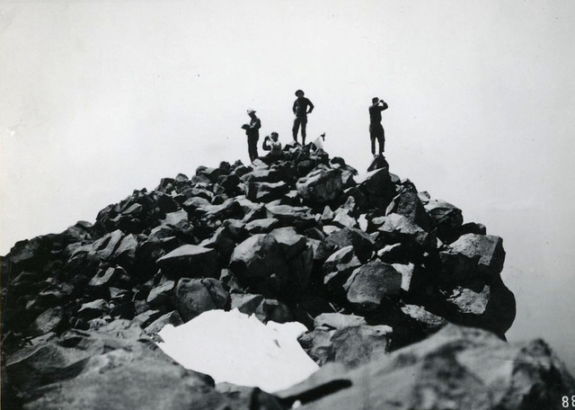
 Looking at the summit from the site of the old fire lookout
 Another hiker stands on the site of the old fire lookout
I'd gotten an early start so the entire climb up had been under pleasantly cool conditions, with what smoke there was getting less and less with each step up. The air on the summit, while thinner, was (as hoped for) clear, fresh, and smoke-free. The big views in all directions were, however, very sadly dominated by wildfires and their attendant layers of smoke.
 Looking north toward the fires around Crater Lake National Park
 Looking east toward the smoked-covered Klamath Lake (Fourmile Lake is visible on the left)
 Looking south toward Mount Shasta and the fires in Northern California
 Looking west toward the smoke-choked Rogue River Valley
I would have spent more time of the summit, but wanted to get down before the air temperature warmed toward triple digits in the afternoon. Going down, I got one more view of the North Pelican fire blazing away on the slopes of Pelican Butte to the northeast.
 Smoke (left) from the North Pelican fire on the slopes of Pelican Butte
Because of the rocky trail, going down wasn't all that much faster than going up. And by early afternoon, smoke had started infiltrating the forest and the air temperature had shot up into the high 80ºFs. Much of the trail lower down is in the shade of the forest but where I had to cross a sunny patch, I could feel the heat like an oven door opening. Gasp! So, after a stiff hike (9.1 miles roundtrip; 3,900 feet of elevation gain), I got above the smoke, only to be seriously disheartened by big views of the many wildfires burning in our area. We seem to be in the grips of one of the worst fire seasons in recent years, with the outright suppression of the old days having to give way to "management", with its tough choices as to where to hold the line, and eventally to restoration (but likely not back to the forests that I grew-up in). Fire and fire policy are enormously complex and controversial topics, but Stephen Pyne's Between Two Fires: A Fire History of Contemporary America is an approachable academic treatment of the topic, while Timothy Egan's The Big Burn is an immensely readable story about the largest wildfire in U.S. history - and the one that got us started down the path of suppression. With fire, as with all things, change happens, but I am still going to mourn for the forests I once knew.
 My track to the summit of Mount McLoughlin