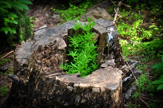
We hit the trail at 9:15. At first the forest was pretty different from what we'd seen the rest of the weekend. It was pretty lush and green and looked more like the Cascades than the dry east side of the state. Saw this little plant (lupine?) growing out of a stump.
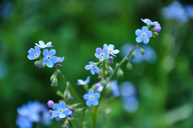
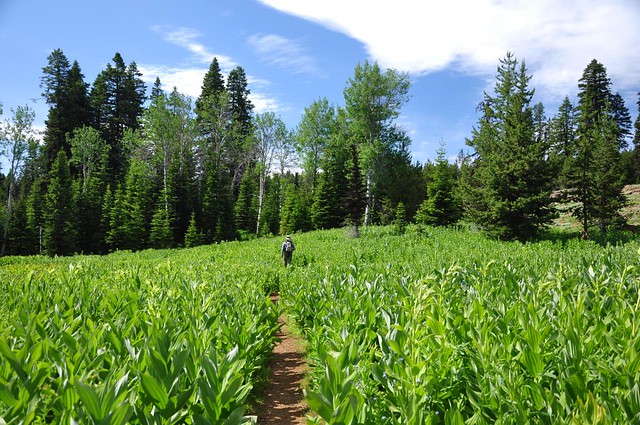
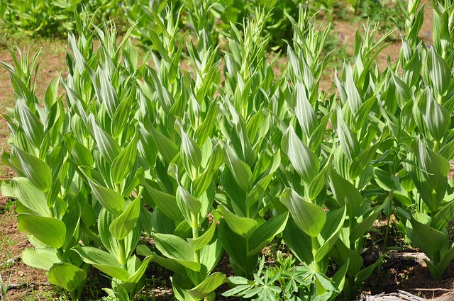
Soon enough we entered the first of MANY meadows of false hellebore. Some pretty blue wildflowers were growing amongst them:
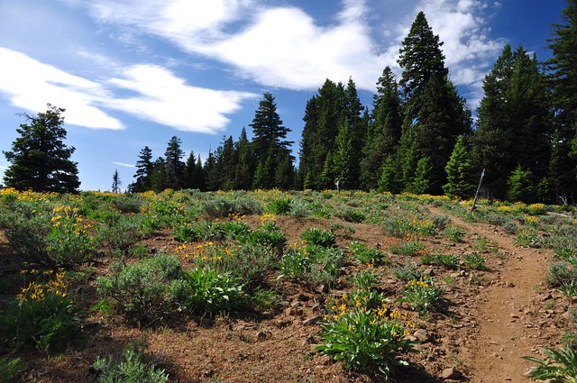
And then we entered a meadow where balsamroot and other wildflowers were blooming. We saw quite a few balsamroot on this hike, but all of it was way past peak. Probably looked great about 2-3 weeks earlier.
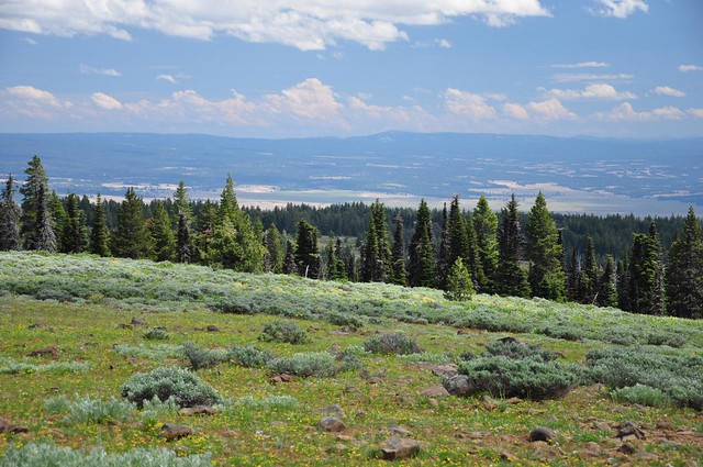
We emerged onto a rocky plateau meadow with balsamroot and other wildflowers. The rest of the hike would be a combination of forest, rocky meadows, and false hellebore meadows.
Got a nice view of neighboring Round Mountain, which we would later drive up.
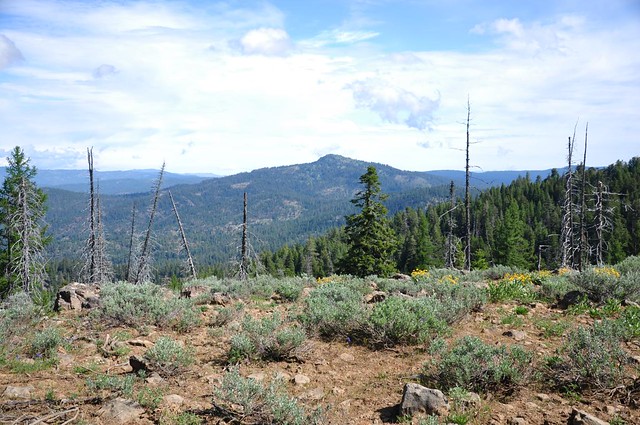
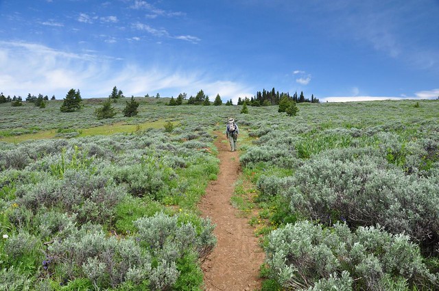
Another rocky sagebrush meadow.
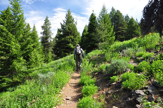
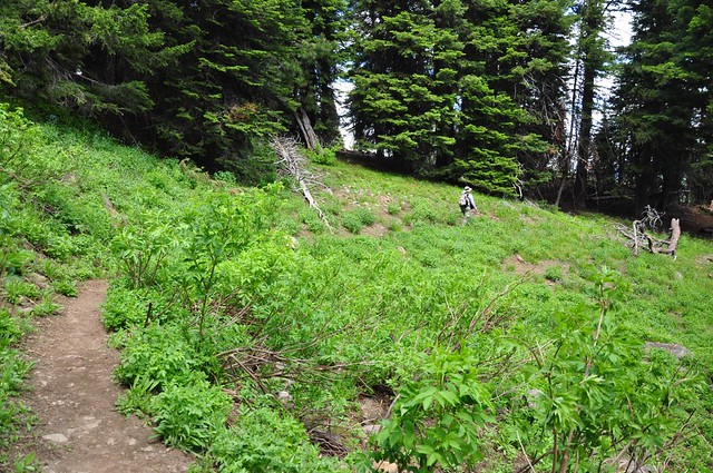
Here's Greg hiking through a meadow of false hellebore. I was BLOWN AWAY by how many of these plants we saw on this hike. Millions of them! Most were waist-high, but some were shoulder-high!
We passed a junction with the Line Butte Trail, with a spiffy new sign and everything. But we saw no sign of that trail, so it's a good thing we weren't planning on taking it!
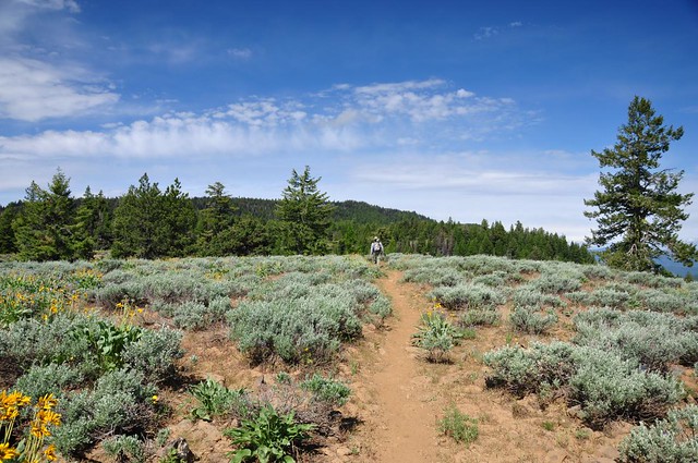
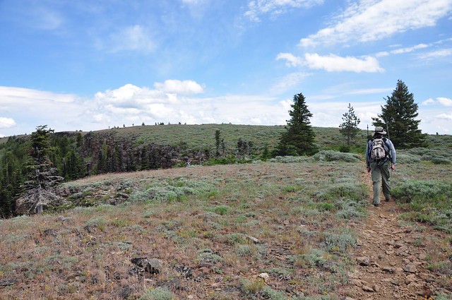
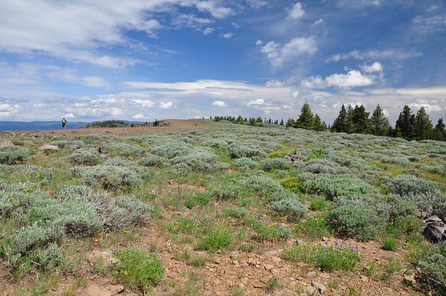
The last stretch before the summit is through a huge open sagebrush meadow area.
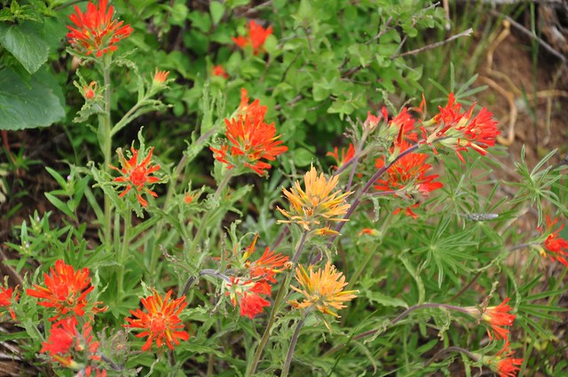
There were some wildflowers there, including paintbrush.
Almost to the summit, which is that area just beyond and to the left of Greg.
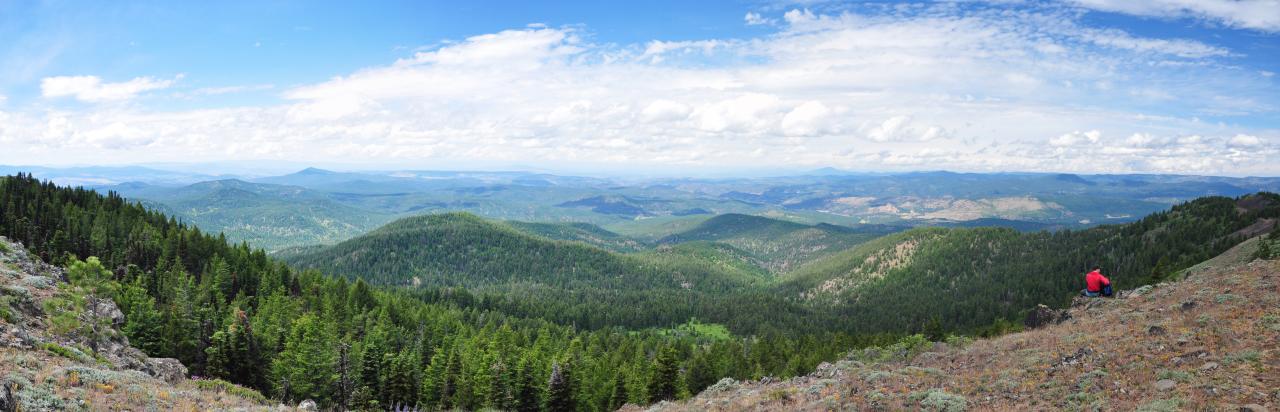
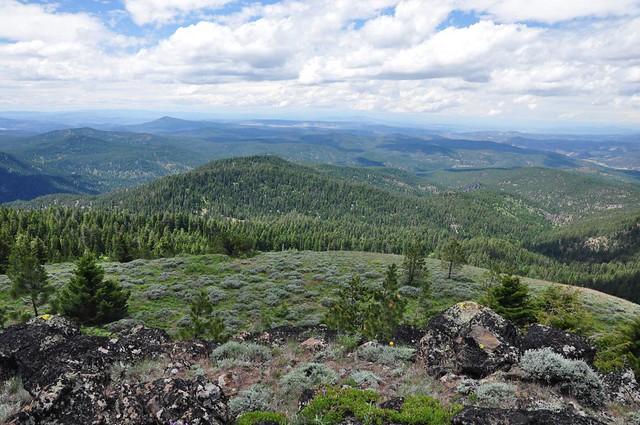
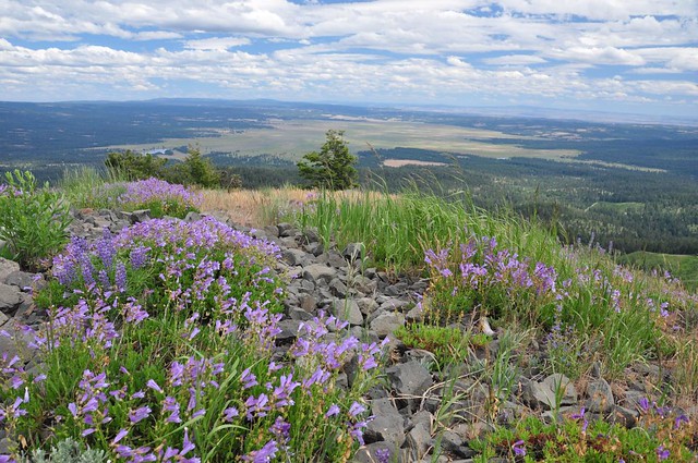
We made it! It took us about two hours to hike the 4.25 miles to the summit. This is the view to the west, where we should have seen snowy Cascade peaks. Alas, too many clouds today. Still a mighty fine view, though. And no clearcuts!
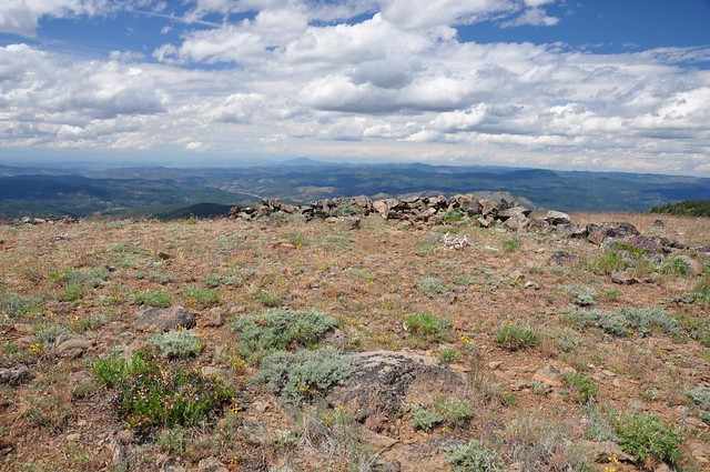
The summit is mostly sagebrush. (See little Greg on the left?)
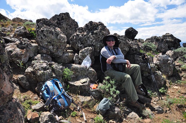
There was a large group of hikers sitting at the summit on the remnants of the stone wall of the old corral. They were too noisy for us, so we headed off to find the geocache and a quiet lunch spot. Here's a shot of the stone wall I took after lunch when the hikers had left.
Greg found us a nice protected spot out of the wind where we could eat lunch....
...and admire the view.
Post-lunch timer shot!

In addition to western views, the summit provides nice eastern views of Big Summit Prairie, which we had visited the day before. It really is humongous!
We headed back down, via the loop trail past the snow shelter (although we didn't take the side trail to see it.) Going down was pretty fast.
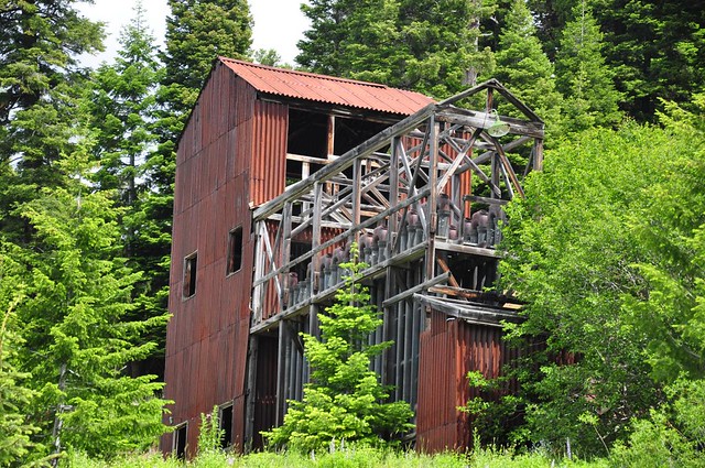
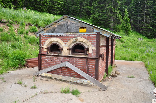
Just before the trailhead we passed the remnants of the old Mother Lode Mine. An old building:
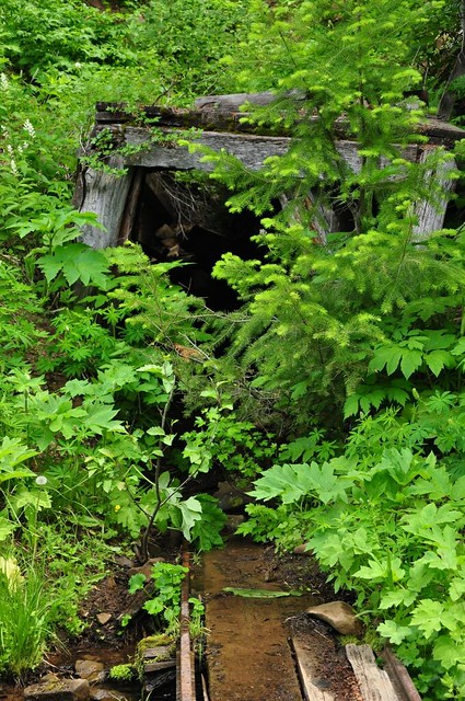
An old tunnel:
And some kind of brick furnace:
We got back to the car at 1:45, which made it a 4.5 hour hike (7.3 miles). And a great one at that! (I was testing out the Backpacker GPS Trails app on my Droid X for this hike, and here is the track it made. I haven't found a way to export this into the NG TOPO software. Maybe there isn't one. Interestingly enough, most of the trail we were hiking on does not show up on the topo maps.)
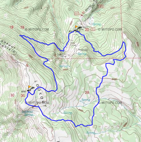
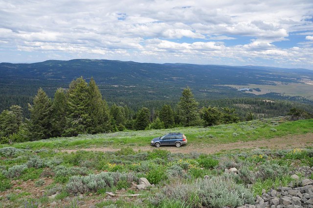
Our next stop was Round Mountain (map). There is a trail to the top, but Scott Cook recommends in Bend Overall to drive up since the road is drivable to the top, so we drove. I have to say, though, that of all the mountains we drove up that weekend, this one had the worst road! The last two miles or so were super rough and rocky. The switchbacks were tight and steep and the dusty road in those spots made it hard to get traction. My Outback made it, but it was VERY. SLOW. GOING.
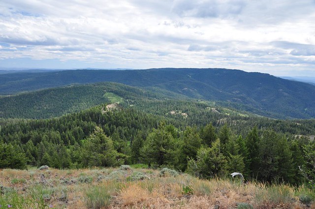
From the summit, we had nice views of Big Summit Prairie again.
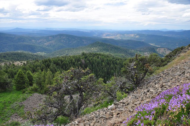
We had views in all directions:
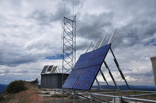
Considering all the equipment up here, you'd think they would keep the road in better shape. Maybe this is self-maintaining equipment.
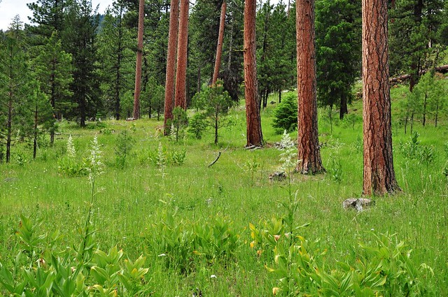
After admiring the views and finding the geocache, we headed back down. I was REALLY grateful we didn't encounter any cars coming up, because there was barely enough room for one of us on the road! Towards the bottom we stopped to admire the beautiful red-barked ponderosa pines in their meadows of green grass. Lovely!
We went back to the campground and got our tent, which we had left standing that morning to dry out after the previous night's rain. It was WAY past the posted checkout time and I mentally dared the camp host to say something. Since he felt no need to enforce quiet hour the last two nights, I would have given him a piece of my mind if he challenged us on staying past checkout. But he didn't.
Great weekend in the Ochoco NF! I highly recommend it!

