Lewis River Trail

This forum is used to share your experiences out on the trails.
Post Reply
User avatar
drm
Posts: 6127
Joined: May 28th, 2008, 10:03 pm
Location: The Dalles, OR
Contact:

Lewis River Trail

Post by drm » May 6th, 2011, 8:15 am

The Lewis River gets its start on the west slopes of Mt Adams and cuts a southwest course across the middle of the Gifford Pinchot National Forest to the Swift Reservoir. This trail follows it for many miles, sometimes remote, sometimes next to the Lewis River Highway (Forest Road 90). I did the southern/westermost section of the trail on this trip, starting from the Curly Creek Falls trailhead area. It's is a rich mossy forest, and is open to mountain bikers. I suppose Portlanders would most likely drive through Cougar to get there. I drove up through Carson and over Old Man Pass. Thanks to Water for some hints.

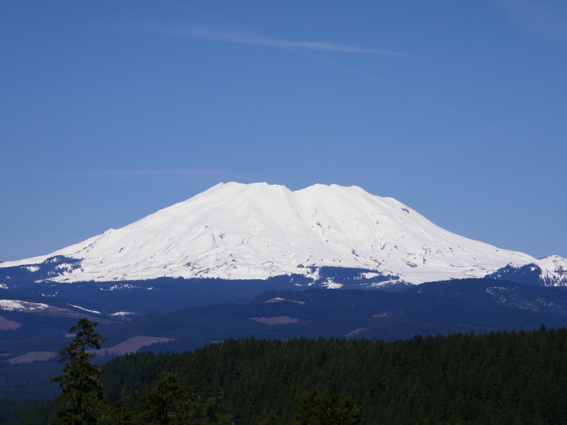
Driving there you from Carson, you pass the McClellan viewpoint. I could not pass up the shot of Mt St Helens' east side.

Image

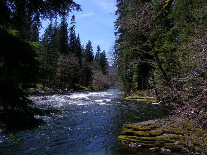
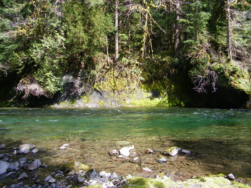
The Lewis River on a sunny spring day.

Image

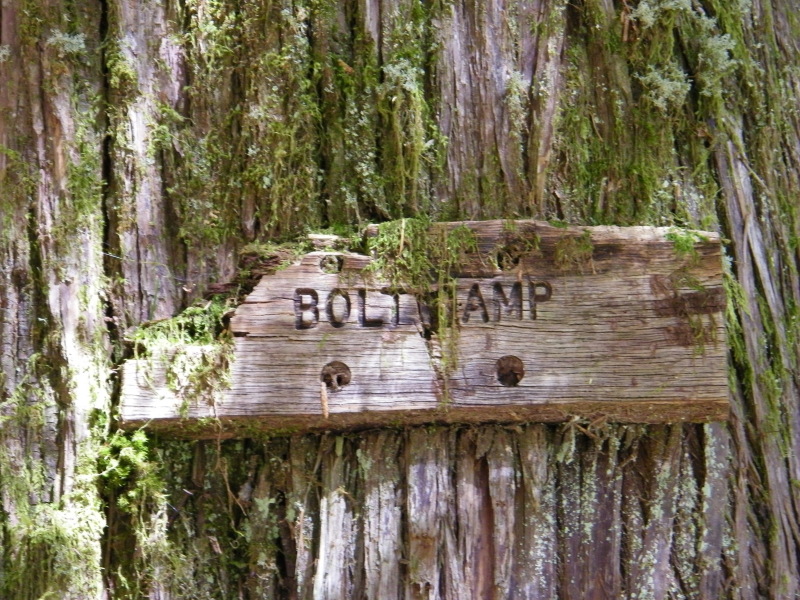
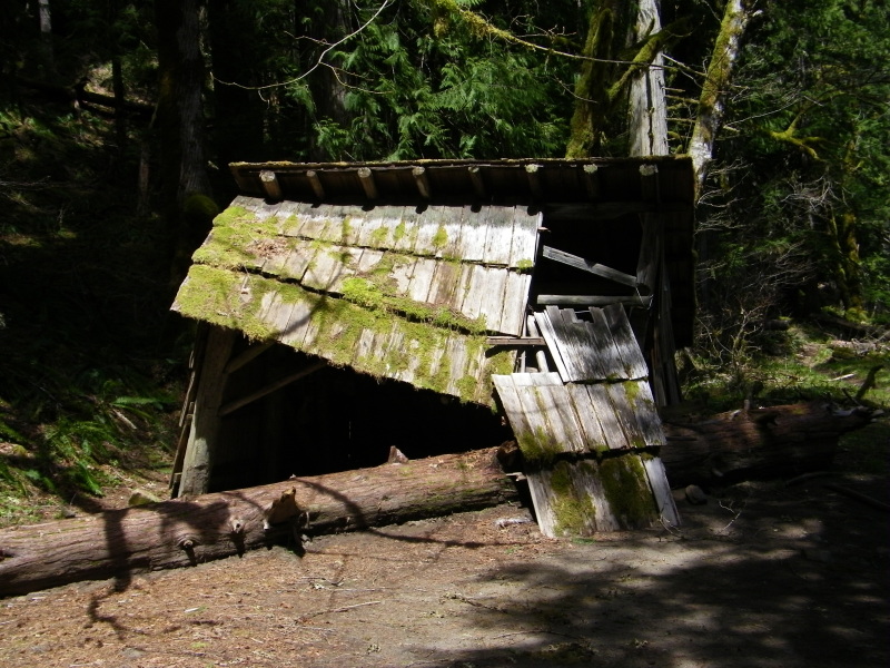
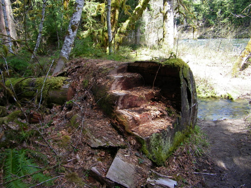
Two and a half miles up, you reach Bolt Camp

Image

The Bold Camp Shelter has seen better days.

Image

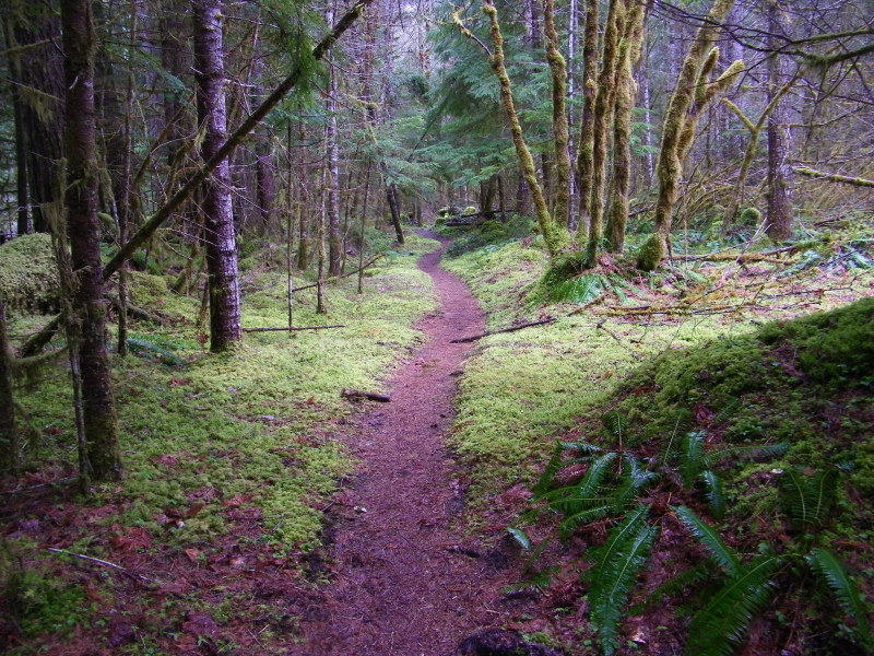
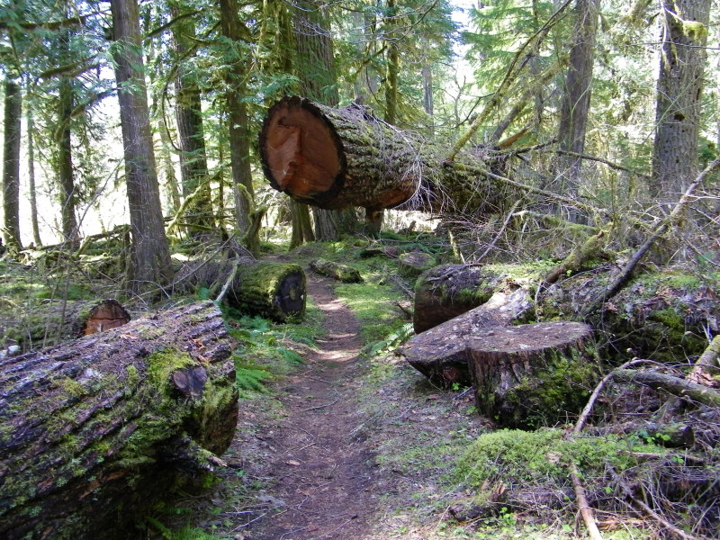
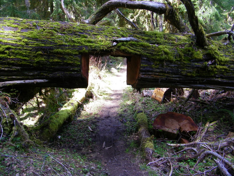
This is a forest of large trees and large trees fall down. The people who keep this trail open have their work cut out for them, literally (as in cutting the trees).

Image

Image

Image

Looking across the river from my camp

Image

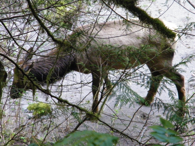
I saw elk on a number of occasions, this is the best shot I got.

Image

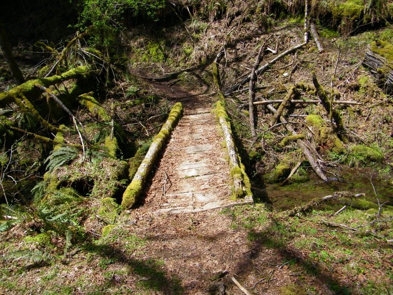
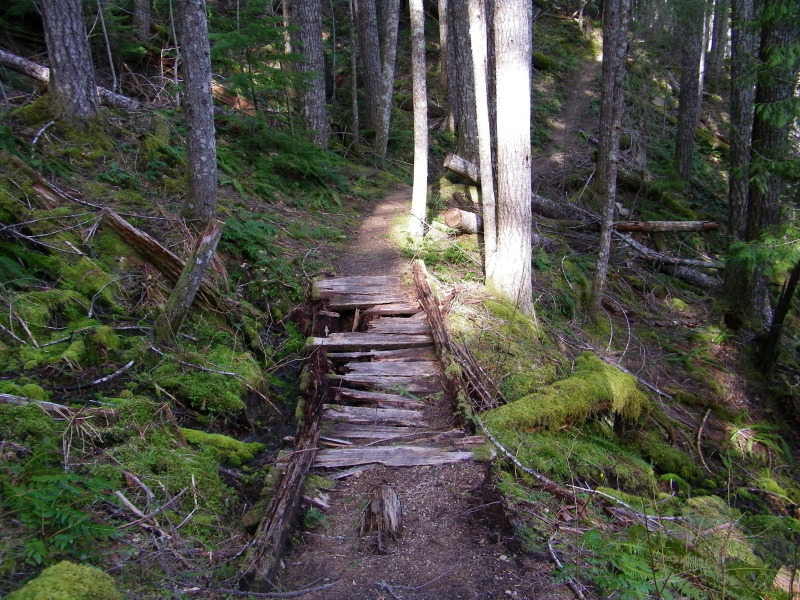
The trail has a collection of rustic and interesting bridges.

Image

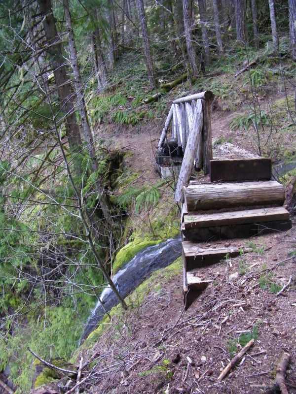
This one is at the lip of a tall waterfall

Image

In need of replacement

Image

Using the resource.

Image

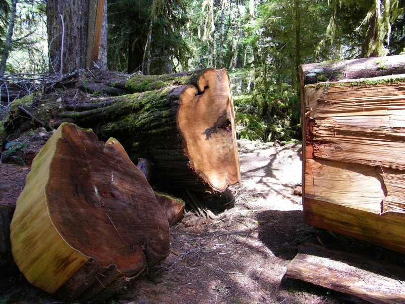
An example of nature using a resource.

Image

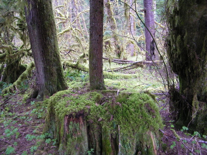
The Lewis Trail stretches through endless mossy forest

Image

User avatar
arundodonax
Posts: 1043
Joined: August 12th, 2010, 8:02 pm

Re: Lewis River Trail

Post by arundodonax » May 6th, 2011, 9:24 am

Wow, this looks really neat. Great photos! I'm putting this on my list for the next few weeks.

How are the roads?

User avatar
Water
Posts: 1355
Joined: May 28th, 2008, 10:03 pm

Re: Lewis River Trail

Post by Water » May 6th, 2011, 11:49 am

DRM,

very happy to see this report. I forgot our camera for our trip so it is nice to see shots of what we saw. Lucky with the Elk.. we saw none, though, we are two and talkative and slept in the AM... so, not so surprised.

Glad the tips helped--curious how far you went, from Curly Creek TH up to 90 crossing? beyond? etc. Also where you camped...how far past bolt, in established spot, or use a river-flat? Hope you enjoyed it and found a new trail for fun!

arundodonax, the roads are great!
Feel Free to Feel Free

User avatar
drm
Posts: 6127
Joined: May 28th, 2008, 10:03 pm
Location: The Dalles, OR
Contact:

Re: Lewis River Trail

Post by drm » May 6th, 2011, 1:47 pm

Yes, the roads are paved except for one mile of very smooth gravel at the end, which is smoother than some of the pavement. If you go a mile past the trailhead, there is a short trail to Curly Falls.

I camped probably about 5 miles up, so twice as far as Bolt. I camped on a sandy beach area that wasn't obviously a camping area (in the sense of having a fire ring and such), but any such signs would probably get washed away annually. I wanted a place that would get some sun (the best of which were on the other side of the river), and the established spots next to the trail were all in the shade.

From camp, I dayhiked a further 2-3 miles, to about the trail high spot. I think that's 1 to 1.5 miles short of the next FR90 crossing.

Yes, I think that going solo really helps with the wildlife sitings - as long as you aren't the type to talk to yourself! But all sitings were relatively midday and while walking on the trail.

Post Reply