GPS Track:
http://caltopo.com/m/0NKE
We did the Red Pass Peak Loop with a side trip to Emeric Lake on this year's long backpack adventure.

Day one:
Glacier Point to Illiloutte Creek
12.61 miles, 2,630 ft elevation gain, 1389 ft elevation loss
Today we started our Red Peak Pass Loop backpack trek from the Glacier Point trail head on a smokey day and headed south on the Panorama trail. The park was doing a prescribed burn on the Ahwahnee meadow in the valley and it obscured the views of Half Dome on the way out. Since we got a late start today, we decided to hike as long as the daylight held out and ended up about 1.5 miles short of the Merced Pass intersection. We saw a nice flat area on our climb up and found a nice open spot to camp a few hundred yards off of the trail.

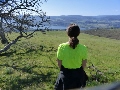
Nice view of domes on the way out including Mt Starr King.

We saw one deer, several marmots, quail, grouse, and ton's of lizards.


We made it 12 miles the first day and found a flat spot near the Illilouette creek to camp.

Clear skies on the first night.

Day two:
Illiloutte Creek to Triple Peak Fork intersection
14.52 miles, 3,470 elevation gain, 3177 ft elevation loss
Today we started about 1.5 miles below the Upper Merced Pass intersection, an hiked up and over Red Peak Pass. It was a steady and slow hike, but not as difficult as I had imagined. Thunderstorms were building and finally hit when we were on the far side of the pass. We decided to take cover since we didn't know how severe or long it was going to be. This took 1.5 hours our of our day, to get to a lower elevation and set up the tent, which meant we decided to stay at the Triple Peak Fork intersection instead of heading down to the Merced Peak Fork spot I had read about. Good thing, because our sight was much more scenic.
The next morning we hiked up past Upper Merced Pass lake, it had some great camping spots.

We continued heading up through granite lined trails heading up to Lower Ottoway Lake.

There were many very large pine trees all along the loop.

We made it to Lower Ottoway Lake where we filled up with water.

Panoramic view of Merced Peak on the way up to Red Peak Pass.

Looking up the trail to Red Peak Pass

Red Peak Pass Panorama

Looking back down the trail to Merced Peak, Upper Ottoway Lake, and other backpackers making their way up Red Peak Pass.

At the top of Red Peak Pass, you could see the different shades of rock.

Looking to the northeast from Red Peak Pass as the thunderstorm builds all around us.

When the thunderstorm hit our area, we decided to take shelter in our tent until it passed. We received winds and some snow.


With our day shorted by 1.5 hours due to our taking shelter in our tent we decided to camp at the Triple Peak Fork intersection.

Day Three:
Triple Peak Fork intersection to Emeric Lake
15.19 miles, 2,615 elevation gain, 2203 ft elevation loss
Today was a very scenic day, starting with some very cold temps where our water froze. We headed down to the Merced Lake Ranger station through a very scenic valley with granite cliffs and beautiful large trees. Since are starting point was well before the planned one due to yesterdays weather, we had to decide where to spend the night. We came upon some hikers who had just spent the night at Emeric Lake and talked to them. Since we had already hiked 9,5 miles, they were suggesting that we stay down at Merced Lake, but we really wanted more elevation and mileage for the day. We had hoped to do the whole Vogelsang loop, but that would have been too much now, so we choose Emeric Lake instead. The hike up to Emeric Lake was pleasant, but a lot of elevation gain real fast, with 1,000 ft in the first mile. We hiked to behind the lake where there were several campsites, and only one already taken.
A sunny frosty morning greeted us as we began our trip to Emeric Lake.

The first section was level, a nice break from yesterdays climb.

We then began to drop down to the Merced Peak fork, the park had placed rock on a lot of hilly portions of the trails.

The view was tremendous.

I loved the Cedars and their red bark.

We took our lunch at Washburn Lake.

We stopped by the Merced Lake Ranger Station before our climb up to Emeric Lake.

Looking back down to Merced Lake and the back of Half Dome on the way up the steep climb.

Beautiful granite formations were all around us.

Fletcher Creek which we would have to cross later.

Looking back as we neared to top of our climb.

Our third night was spent at Emeric Lake.

A bright moon came out to light up our night.

The waters stilled on Emeric Lake to get some nice reflection pictures.

Day four:
Emeric Lake to Little Yosemite Valley
16.63 miles, 827 ft elevation gain, 3902 ft elevation loss
Today we hiked back down to Little Yosemite Valley. The day started up cold, but soon warmed up as the sun rose. This was another very scenic stretch with a lot of photo stops along the way. We stopped by the High Sierra Camp and checked it out, they were tearing it down for the year. This section we began to encounter more and more people as we went along, and wouldn't have the solitude we experience in the middle sections of the loop again.
Fletcher Creek on our way back down to Little Yosemite Valley.

We spent our lunch at Merced Lake.

Lot's of granite on this section of trail.

Nearing the Half Dome burn area.

The Half Dome burn area from a few years ago.

Some more granite and burn area.

Composting restroom at the Little Yosemite Valley backpacker campground.

Had to camp with many other campers, not the most enjoyable experience if you are looking for solitude.

Looking up at the back of Half Dome from the campground.

Day five:
Little Yosemite Valley to Glacier Point
8.67 miles, 2291 elevation gain, 1198 ft elevation loss
Today we hiked out back up to Glacier Point. Waking up again before the sun rose was a little bit of the challenge, because of all the other campers in the camp we had to be very quiet. This section we ran into many hikers heading up for their Half Dome climb, and by the time we hit the Panorama trail, we were hitting large groups each speaking their own languages obviousness coming up on tour buses.
Our short day to head back to Glacier point started with a beautiful morning.

Half Dome and Liberty Cap

View of Yosemite Valley on this last section of the Panorama Cliff trail.

Half Dome was a lot clearer today.

Close up of the Merced River and the Ahawahnee meadow burn from Monday.

Last view at Glacier Point before we head back home.

Last notes:
Even though most of the small streams were either dry or flowing very low this late in the summer, there was plenty of water available. We encountered no bugs, or bears, though I would have liked to get a few bear pictures. The trails are excellently maintained with hardly any trees down.
If you are planning on a long loop, this would be a great choice.