On Saturday, I went east to avoid the impending downpours and struck out twice on red herrings before I actually started hiking on a trail.
My first choice was to head to Bald Butte from the northern Surveyor’s Ridge Trailhead. When I got to the trailhead, off of Pine Mont Drive, a sign declared the trail was temporarily closed due to the Garth Timber Sale. Even though there was no logging on a Saturday, I decided not to go rogue although a couple of mountain bikes came along and pedaled right over the red tape.
The next choice was to explore the North Section Line Trail #451, which runs along the boundary of The Dalles Watershed. Watershed signs were blaring ‘No Trespassing’ where the trail was supposed to be and there was not much evidence of usage, so I turned back to the Shellrock Mountain Trailhead, only a tenth of a mile away. Splintercat has a great posting of the Shellrock area on his blog:
https://wyeastblog.org/tag/badland-basin/
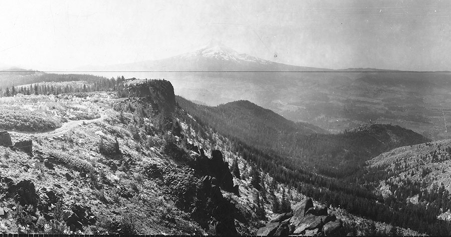
I hiked south on the Surveyor’s Ridge Trail and then did the mini-bushwhack up Shellrock (‘Shellrock’ was a word old timers used for flaking rock like platy andesite; it may be a corruption of ‘shale rock’). There’s a short passage through a thicket – I took a deer trail up and an elk trail down – and then you’re on open slopes with bitter cherry, pinemat manzanita and even sagebrush. The summit gives commanding views although on this day Mt. Hood was rapidly disappearing and the Washington volcanoes were already buried in clouds. On Shellrock’s west ridge, below the summit, is one of those little volcano monitoring stations that may be recording the current seismic activity on Mt. Hood.
 Viewed 4187 times")
, Surveyor's Ridge.jpg (223.69 KiB) Viewed 4187 times")
 Viewed 4187 times")
 Viewed 4187 times")
 Viewed 4187 times")
 Viewed 4187 times")
 Viewed 4187 times")
Back on the Surveyor’s Ridge Trail, I headed north as the rain showers began, first checking out the Badlands by skittering down the slope to visit the largest pinnacle. Beyond the Badlands, I hit the Rimrock area and had lunch at the old Rimrock Fire Lookout site (Both this and the lookout on Shellrock Mt. were decommissioned in the 1940s).
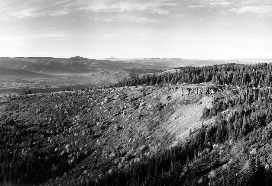
Then I continued on the undulating trail to reach a wonderful sunflower meadow (This should be in full bloom in a couple of weeks) to reach the little spur trail out what I call Yellowjacket Viewpoint – named after nearby Yellowjacket Creek. The vista here extends down balsamroot carpeted meadows to the Hood River Valley and, on a clear day, there are great views of the mountains as well.
On the way back, I ran into a mother bear and her cub. They both ran off, but the cub decided it would present less of a target by clambering 40 feet up a Douglas-fir. While mom circled anxiously in the brush, I took a couple of snapshots and then left them in peace.
 Viewed 4187 times")
I made one more stab at the North Section Line Trail on my way out. Bushwhacking down into a bowl near the Shellrock Mountain Trailhead, I found a very clear though little-used trail tread. I followed this down to a junction and soon realized that this must be one of the trails coming out of Gibson Prairie Horse Camp. I went the other way and connected to another tread that runs along the cattle fence on The Dalles Watershed boundary. This is the North Section Line Trail and it should run another 4.5 miles along the ridge to some nice open meadows with views to the east, keeping very close to the watershed boundary. The Forest Service advertises this as a great mountain biking trail, but it is better connected to the horse camp than to the Surveyor’s Ridge Trail; it also looks very unmaintained and there are no signs of any recent human or horse activity.