The Rogue-Umpqua Divide Wilderness (USFS) is a sliver of land that runs roughly N to S just W of Crater Lake NP on the W side of the divide (the E side of the divide is national forest with a lot of OHV trails).
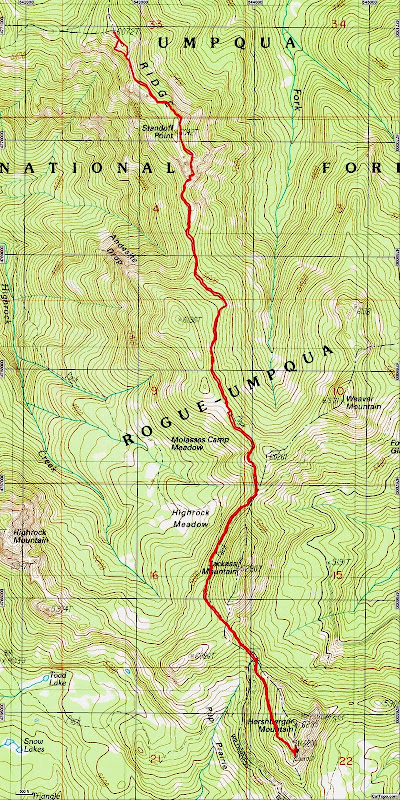
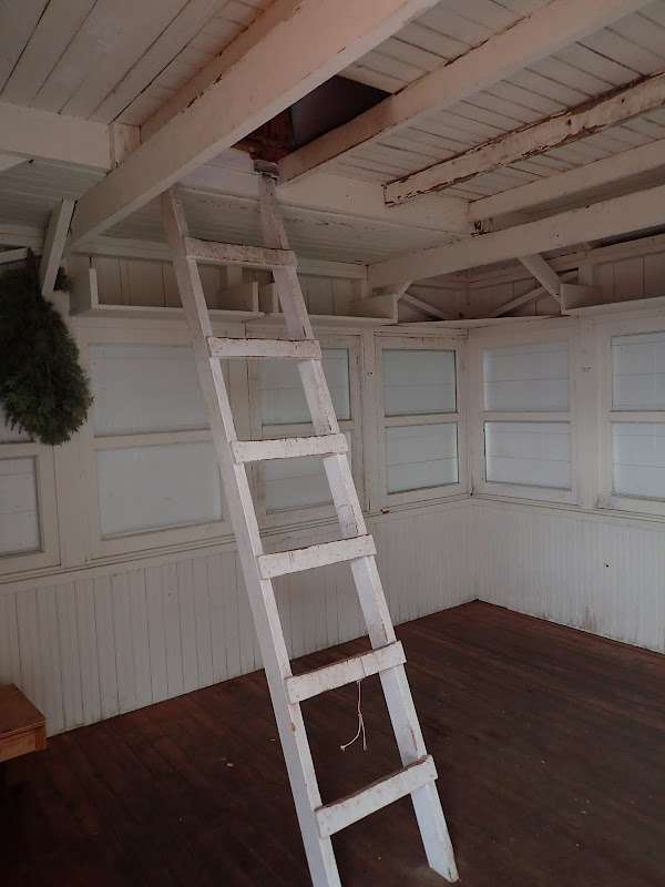
Like a lot of the smaller and less well know wilderness areas, some spots (Abbott Butte, Fish Lake) are very popular while the rest only rarely feel the hiker's boot. We began exploring this wilderness earlier this year with hikes along Muir Ck in the north (Muir Ck TR) and to Abbott Butte in the south (Abbott Butte TR). Unfortunately, the National Creek Complex fire poured heavy smoke into this area and, for a time, closed Hwy 230 and access to THs from the E. With the fire now contained (but still burning within that containment), the road open, and the smoke mostly cleared, it seemed like good time to visit the Hershberger Mtn LO (LO) and some of the trails north of there. These are Hikes #9 and #30 in Sullivan's Southern Oregon guide (3rd edition). The last 8 mi or so of the access road are rough, rocky, and high centered - slow and serious work for any low-slung sedan - which probably accounts for the pristine condition of the LO. I parked at the TH and walked up the last bit of road to the LO.
Despite the early morning cloud deck, I had a view to the S of Union Pk (U), Rabbit Ears (R), Mt. McLoughlin (M), and Mt. Shasta (S),
and to the E of Mt. Thielsen and the still-burning (arrow) National Creek fire (looks like that one will linger until we get some rain ).
After taking in these views, I walked back down the road to the start of this section of the Rogue-Umpqua Divide trail (USFS #1470) which runs generally along the divide between Huckleberry Gap in the S and Three Lakes in the N. From what little of it I've been able to hike so far, the tread quality of the 1470 ranges from very good to nearly nonexistant - so doing the whole trail as a backpack could be an adventure.
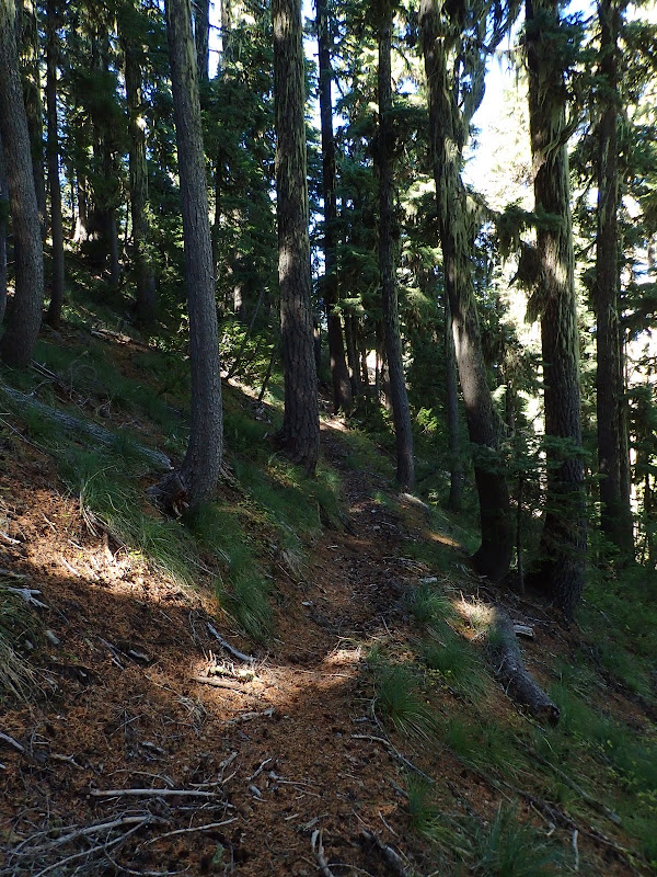
After a short hike on the 1470 through fall colors,
I came to its junction with the Rocky Rim trail (USFS #1572), the full length of which does not appear on most topo maps of this area. Turning N on the 1572,
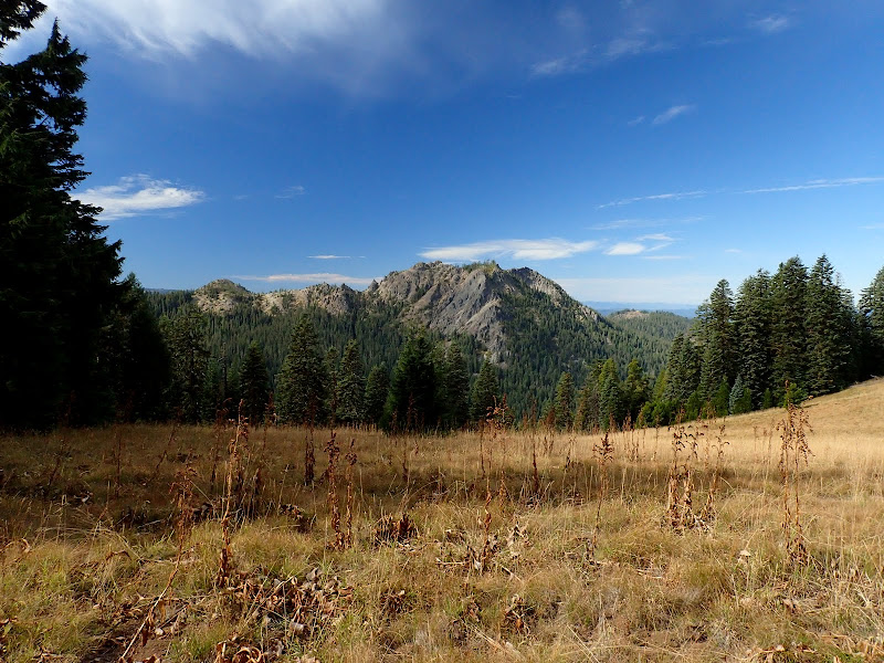
I soon crossed one of the meadows that characterize this wilderness,
and got a great view of Highrock Mtn to the W. By now the morning clouds had dissipated and the usual full bluebird day was fully on.
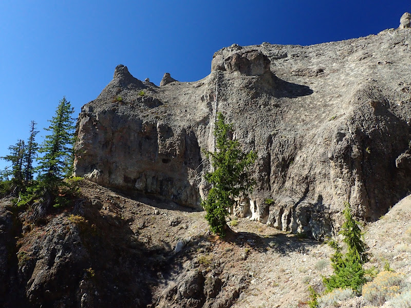
About 2.5 mi from the TH, the trail makes its way around the E side of Standoff Point, through some truly spectacular basalt/ash cliffs, along a line of weakness below a solid band of basalt (reminded me just a little of the traverse to Mt. Whittier near Mt. St. Helens).
The trail then passed through a brief stretch of cool, N-facing forest,
before emerging on the narrow Rocky Ridge,
with a view W down to Fish Lake,
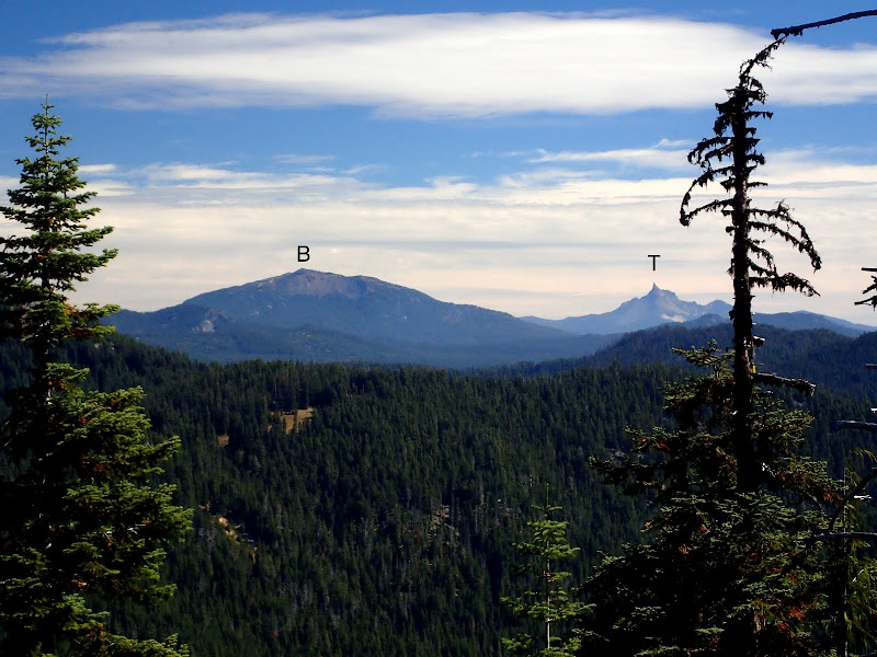
E to Bailey (B) and Thielsen (T),
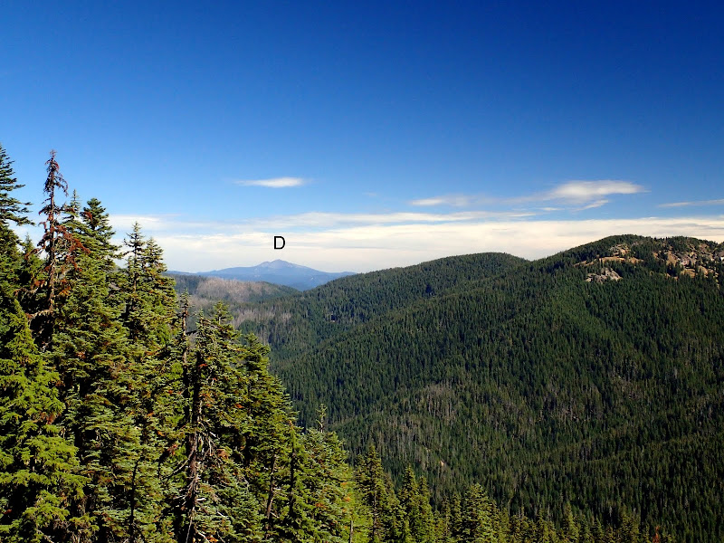
and N to Diamond (D).
After lunch atop Pt 6075 (from here the 1572 trail starts its descent to the Beaver Swamp TH), I re-traced my steps along the 1572, catching a few more fall colors along the way.
On the drive out, I caught a glimpse of the gigantic volcanic plugs that form the Rabbit Ears.
A short (10 mi RT, 1000' EG) but pretty interesting hike, what with the pillars at Standoff Point and the views from Rocky Ridge. And, of course, the charmingly well-preserved LO. The downside is the challenging road access - which likely helps protect the LO on one hand but lessens enthusiasm for a short trail like the 1572 on the other. It's possible to do this as a loop from Beaver Swamp TH (Sullivan's Hike #9) - something we'll have to look into on a future hike.
Rogue-Umpqua Divide Wilderness 24-Sep-2015
Last edited by VanMarmot on October 2nd, 2015, 8:11 am, edited 1 time in total.
Re: Rogue-Umpqua Divide Wilderness 24-Sep-2015
Nice report on this obscure little wilderness: When I retire, I hope to visit all of Oregon's wildernesses, and this is one I've never seen - you certainly have whetted my appetite!
Re: Rogue-Umpqua Divide Wilderness 24-Sep-2015
We all wish we were van marmot & bobcat! Uber jealous dude, here.
"The top...is not the top" - Mile...Mile & a Half
Instagram @pdxstrider
Re: Rogue-Umpqua Divide Wilderness 24-Sep-2015
Thanks! Some folks suggest I've been retired for years but only quit going to work last year.bobcat wrote:Nice report on this obscure little wilderness: When I retire, I hope to visit all of Oregon's wildernesses, and this is one I've never seen - you certainly have whetted my appetite!
But I have to get a lot of hikes in before my body fails and we start looking at RVs.
-
- Posts: 3069
- Joined: May 28th, 2008, 10:03 pm
- Location: Portland, OR
- Contact:
Re: Rogue-Umpqua Divide Wilderness 24-Sep-2015
Cool! We tried to do a loop hike up and over Grasshopper Mountain on the west side of that wilderness, but it was during that brutal heat wave at the end of June and we only ended up going to Buckeye Lake and back. (As I shiver in my over air-conditioned office on my lunch break it's really hard to remember being that hot! )
When I was doing research for my lookout book I came across something somewhere (can't find it online now, but it's probably in a stack of papers at home) that mentioned Hershberger lookout was a possible candidate for the rental program. It was even refurbished in 2012. I wrote to the Forest Service in May asking whatever happened with that and they said "At this time, we aren't planning to bring it online for that purpose."
It's a miracle that the lookout hasn't suffered from vandalism because in my experience, rough roads do nothing to keep out determined vandals. It may deter some, but not all.
Re: Rogue-Umpqua Divide Wilderness 24-Sep-2015
As I understand it, Hershberger didn't qualify for the rental program because the road didn't meet USFS requirements for access by regular passenger cars. This I understand, as the last 2-3 miles are a real roller-coaster of washouts and rocks. Despite this roughness, I think the thing that saves it from vandalism is the comm system the USFS maintains just below the LO. It's also used as a radio link / command post for fires - and was in heavy use during the National Creek Complex fire in the valley below - and that also likely limits inappropriate use.justpeachy wrote:When I was doing research for my lookout book I came across something somewhere (can't find it online now, but it's probably in a stack of papers at home) that mentioned Hershberger lookout was a possible candidate for the rental program. It was even refurbished in 2012. I wrote to the Forest Service in May asking whatever happened with that and they said "At this time, we aren't planning to bring it online for that purpose."
It's a miracle that the lookout hasn't suffered from vandalism because in my experience, rough roads do nothing to keep out determined vandals. It may deter some, but not all.