

sits just W of the Kalmiopsis Wilderness,
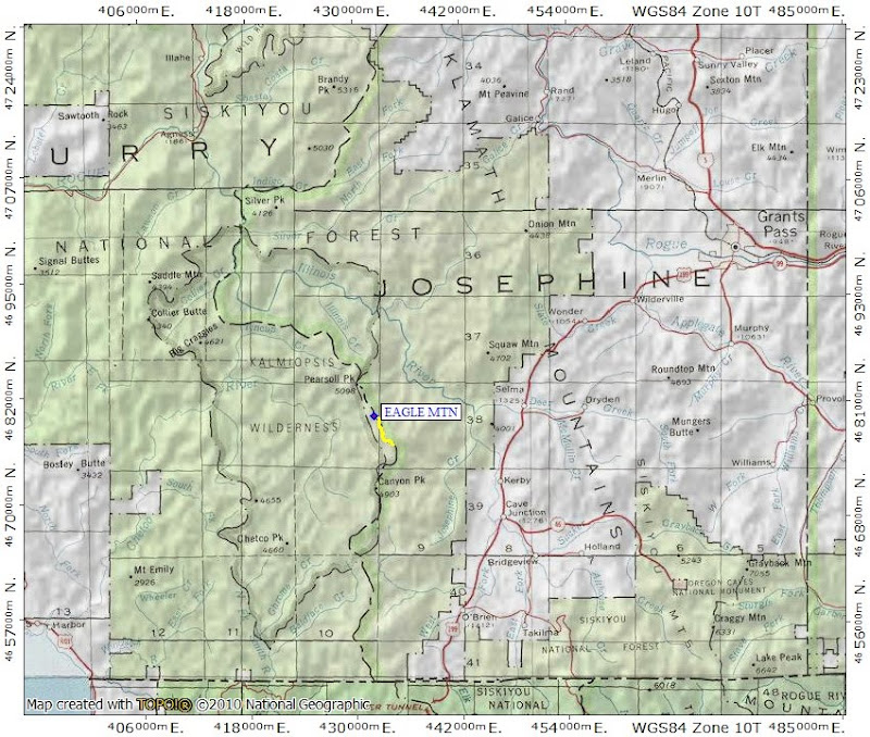
and so would give us a chance to see how the wilderness looked 10+ years after its devastation by the 2002 Biscuit Fire. One of my few regrets in this life (other than not having bought Apple shares at $5 in 1992

While the little sign near the trail itself didn't send out waves of hiking happiness,

it didn't dissuade us from heading down the trail through the "forest."

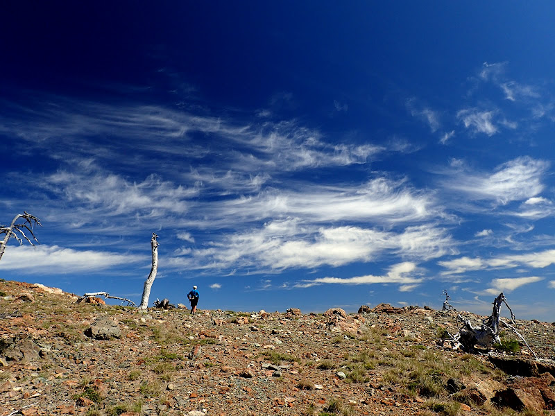
The trail soon passed out of the snags and we could see Whetstone Butte in the distance, under the requisite bluebird skies.

This part of the trail runs along the rocky, open part of the ridge, with expansive views all around and different colors of serpentine under foot.
The Rim trail goes to the W of Whetstone Butte (foreground), then over Eagle (middle peak), and used to continue on to Pearsoll Pk (in the distance) but the fire did heavy damage to that part of the trail.

We went toward Whetstone Butte (which is another scramble opportunity),

then down the trail along its W side.

It's our understanding that local volunteers have labored to keep this trail open and they've done a good job on the southern half (white arrow) below Whetstone but it's been awhile since anyone got to the second half (orange arrow).

This meant plowing for a mile (out and back) through long, sharp buckbrush thorns nastier than razor wire. Too bad we were both wearing shorts.

and were able to continue our climb to the summit (arrow) on rocky, open slopes.

The Biscuit fire burned almost 500,000 acres and its burn severity was highest in this area of the wilderness.

500,000 was just a number until we looked SW from summit into the heart of the wilderness, with its mile after mile of burned, dead trees.

The little pockets of trees that remain gave us a sense of what this area was like before the fire. To the N is Pearsoll Pk,

with its fire LO.

After a quick snack on the summit, we headed back, glad for the good weather and great views but more than a little sobered after seeing what a big fire can do to a forest (5.6 mi RT, 1700' EG). Unforunately, yet another fire - the 1100 acre Buckskin - is currently working its way into the southern end of the wilderness, where old snags from the Biscuit fire now pose a threat to fire crews.
