Pamelia Lake - 5/25/2015
-
- Posts: 10
- Joined: May 28th, 2015, 5:50 pm
Pamelia Lake - 5/25/2015
We took advantage of Memorial Day to hike the beautiful trails around Pamelia Lake.
The location is a few hours from Portland, near Mt. Jefferson, out past Detroit Lake:
The hike starts with a few miles through old growth forest to reach the lake.
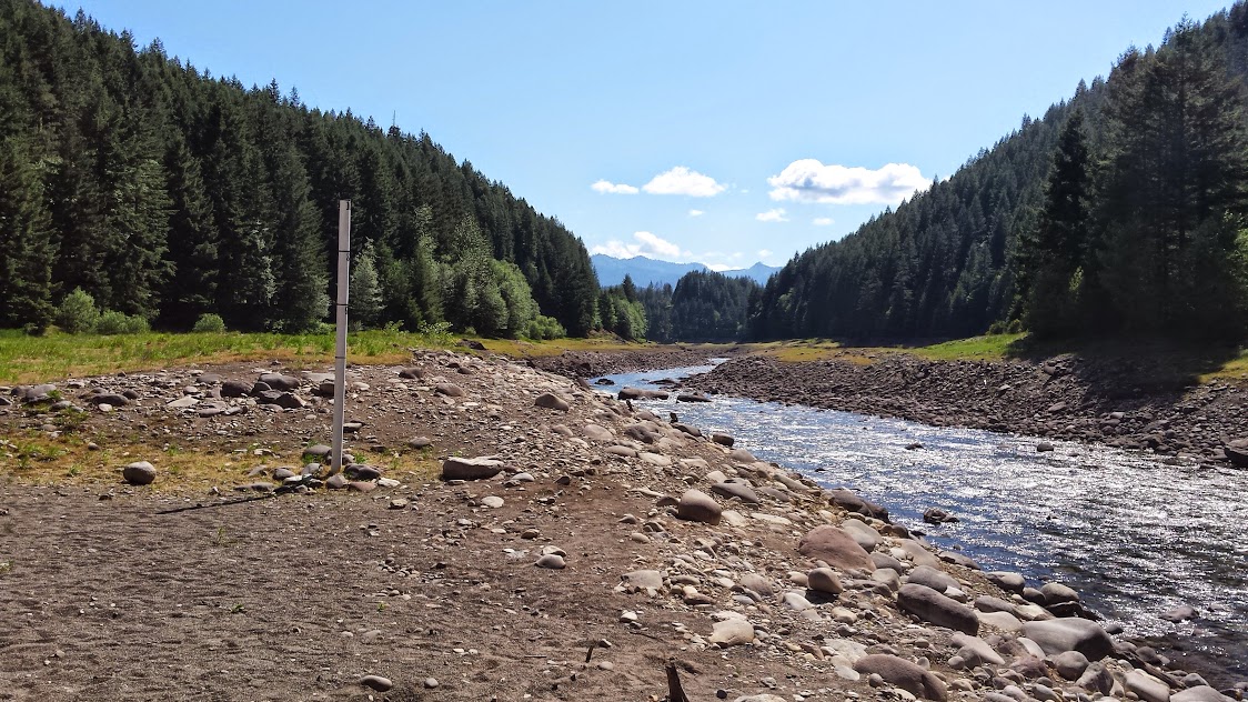
Some of the trails follow old, dried-up stream beds:
Then you reach the lake!
Lot's of birds hanging around, making little bird babies:
You can follow trails in the area up the streams that feed the lake:
In a past hike, I've gone up to Grizzly Peak above and seen the beautiful view of the lake below and snowy Mt. Jefferson over the ridge. I didn't go up to Grizzly Peak this time. You can't really go wrong with a hike into this area.
This particular hike was about 12 miles with about 2,100 feet of climbing and a few stream crossings. I ran into no snow anywhere.
The trails in this area require a limited entry permit at this time of year. It's easy to get one at recreation.gov (just Google pamelia lake permit and it's the first link): http://www.recreation.gov/unifSearchInt ... kId=111433
The cost is $6 per day. There are nice campsites at the lake I've used in the past. Since the hike is only 3 or so miles from the trailhead to the campsites at the lake, this is a great trip for a first-time backpacker or backpackers with kids. I've enjoyed a backpacking trip here in the past.
Bottom line: easy hiking, lots of reward, nice backpacking, $6/day permit.
Re: Pamelia Lake - 5/25/2015
Wow, the lake is low! We went to Pamela Lake 2 years ago for our first backpacking trip. I believe around the beginning of July. The lake was completely full then. Looks like it will be a lot lower this year.
Nice report.
Nice report.
I've been wandering early and late, from New York City to the Golden Gate, and it don't look like I'll ever stop my wandering.
-James Taylor
-James Taylor
Re: Pamelia Lake - 5/25/2015
That is some seriously low water for Pamelia this early in the season. I've seen it higher than that in October. Holy cow.
"Going to the mountains is going home."
— John Muir
— John Muir
-
- Posts: 10
- Joined: May 28th, 2015, 5:50 pm
Re: Pamelia Lake - 5/25/2015
Yeah Detroit Lake was super low when we drove past. Lots of docks just laying on bare ground.
- mattisnotfrench
- Posts: 1318
- Joined: May 28th, 2008, 10:03 pm
- Location: SE Portland
- Contact:
Re: Pamelia Lake - 5/25/2015
That's a frighteningly low amount of water. Hopefully it isn't Pamelia Meadow by the fall!
Author of Extraordinary Oregon!, PDX Hiking 365, 101 Hikes in the Majestic Mount Jefferson Region, and Off the Beaten Trail. Website: www.offthebeatentrailpdx.com
Re: Pamelia Lake - 5/25/2015
mitchystan wrote:Yeah Detroit Lake was super low when we drove past. Lots of docks just laying on bare ground.
These markers at Upper Arm on the Breitenbush are "normally" under water? I wonder what's going on? We might be in trouble like California soon...
"The top...is not the top" - Mile...Mile & a Half
Instagram @pdxstrider
- oldandslow
- Posts: 175
- Joined: August 22nd, 2012, 12:47 pm
Re: Pamelia Lake - 5/25/2015
More than 30 years ago Pamelia lake went pretty much dry--just like someone had pulled the plug. I didn't see it but read about it in the newspaper. The next year when the snow melted and hikers went there, it was reported to be full again. It has been full each time I have been by there since then.
- greglief
- Posts: 640
- Joined: May 28th, 2008, 10:03 pm
- Location: Northern and Western Hemispheres
- Contact:
Re: Pamelia Lake - 5/25/2015
Thank you very much for the report and photos. Echoing everyone else... the water level is shockingly low.
-
- Posts: 77
- Joined: June 1st, 2009, 9:33 am
Re: Pamelia Lake - 5/25/2015
We were up there on Sunday May 31. From the trail head to the lake, when taking the official trail to Hunts Cove instead of the users trail near the lake there is significant blow down and blocked trail. We completely missed the trail and started to continue on the segment that connects to the PCT until luckily my wife saw the sign which confused us. Once we backtracked a little and started really looking around, we found the trail around the lake. It was not easy to see. On the way back from Hunts, we took the lakeside users trail and it was much easier. Having never been up there is was a pleasant surprise, though the lake was seemingly very low. We couldn't believe how low Detroit Lake was as well. It will probably be a rough year for the people that count on the boaters for their income.
Re: Pamelia Lake - 5/25/2015
That blowdown is huge for sure.tednottodd wrote:We were up there on Sunday May 31. From the trail head to the lake, when taking the official trail to Hunts Cove instead of the users trail near the lake there is significant blow down and blocked trail. We completely missed the trail and started to continue on the segment that connects to the PCT until luckily my wife saw the sign which confused us. Once we backtracked a little and started really looking around, we found the trail around the lake. It was not easy to see. On the way back from Hunts, we took the lakeside users trail and it was much easier. Having never been up there is was a pleasant surprise, though the lake was seemingly very low. We couldn't believe how low Detroit Lake was as well. It will probably be a rough year for the people that count on the boaters for their income.
Big 'ole mess up there