Our plan was to spend a few days out there checking out some of the classic and not so classic hikes, staying in the Frenchglen Hotel for the first time (after visiting the area for almost 40 years!), and starting to celebrate our 25th wedding anniversary.

We'd hoped for warm, dry, sunny weather but a low pressure area circling over the Nevada-Utah border - which kept throwing walls of water at us - forced us to keep our hiking plans flexible.

DAY 1 Sightseeing
We woke to sunny weather than began to deteriorate almost before we'd finished breakfast. Unsure of where conditions were headed, we opted to explore some "tourist" attractions that we'd missed on previous visits. First off, we headed up the Steens Mtn Loop road (still closed by snow above the 2nd gate),

to Fish Lake and a sighting of blue sky.

Then it was down across the southern end of the Malheur Refuge,

to the Diamond Craters Outstanding Natural Area (yes, that's its official name) for views of (yes) actual craters.

Then on to the Round Barn, a 100' diameter enclosure bulit in the late 1870s to handle horse during the winter.

Today it's a tourist attraction and home to lots of swallows

and a raven. We found pictures of the barn taken in the mid-1960s that show the same raven's nest woven into the intricate bracing of the roof.

From there we visited the refuge headquarters and Krumbo Reservoir. From a distance, it looks like nothing is blooming, but up close the desert is covered with mid-season blooms of various kinds - you just have to get down on your hands and knees to appreciate them.

It started raining shortly after lunch and we took refuge in the hotel - as did a number of soggy campers - as it continued to rain all night long.
DAY 2 Little Blitzen River hike
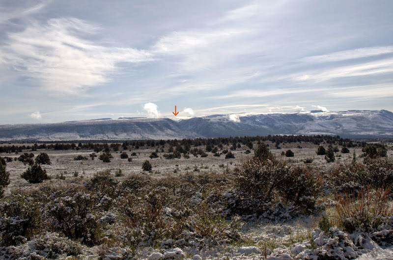
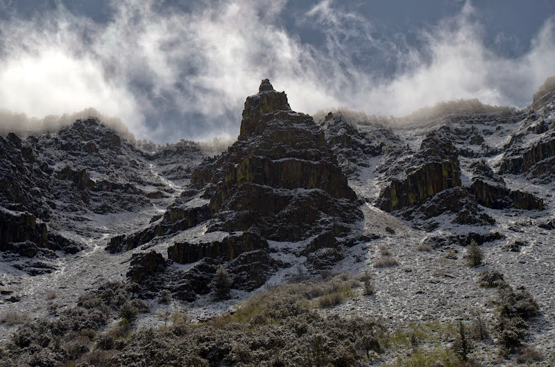
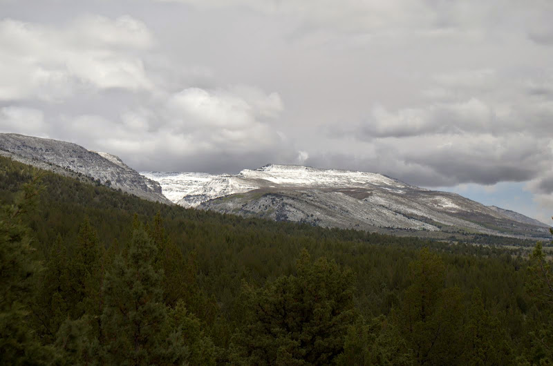
We woke to clear, almost cloudless skies and new snow on Steens Mountain! We decided to take advantage of these good conditions - which didn't last all day - to hike one of the classics - the trail into Little Blitzen canyon (This is hike #93 in Sullivan's Eastern Oregon guide). The unique combination of clear skies and fresh snow made for an amazing hike! The canyon is obvious (arrow) as you approach it along the southern leg of the loop road.
The TH parking is just beyond the 2nd gate (open - but the road is still impassable further up),

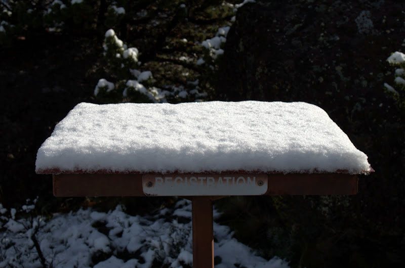
and from there it's a short walk up to the actual TH. No permits are required but the BLM would like you to register so they can judge trail use. The register also served as a handy snow guage!
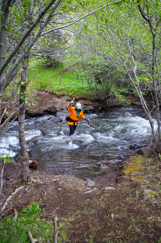
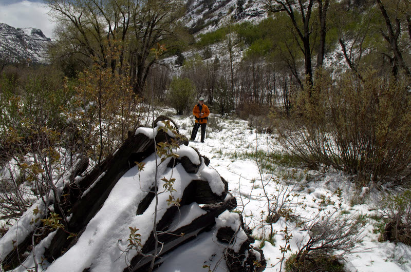
The trail started by descending the canyon,

and then offered up a really, really cold creek crossing.
The trail itself is narrow but easily followed - even with a coating of snow - and climbs gradually up into the canyon,

which encompassed us in its 1000' high walls.

After a clear start, clouds started forming-up right after we crossed the creek and just continued to do so for the rest of the hike. We kept an eye on them as we didn't particularly want to get caught in the canyon during a thunderstorm.
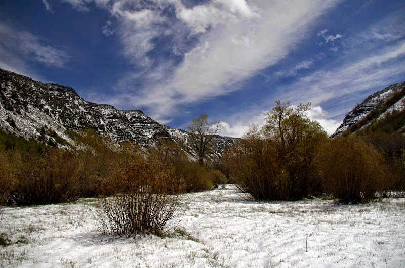
After climbing gently for about 2 mi, the trail starts to level out in the marshes and meadows that border the creek.

We were greeted by a sun dog
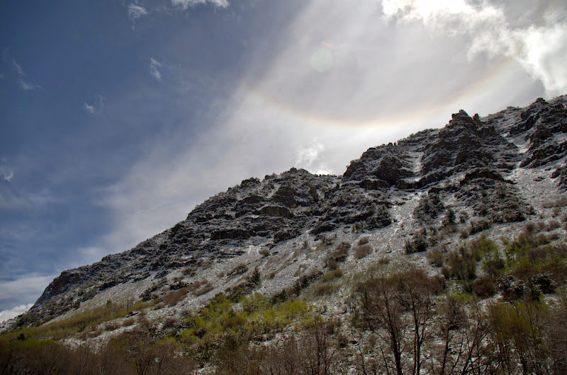
as we moved further up the nearly level part of the canyon through 6" of fresh snow.
After a little over 4 mi, we came to an old corral and collapsed line shack where we decided to call it a day.

It's possible to continue along the canyon floor and even climb the canyon wall to the loop road above - something best done under drier conditions and when the loop road is fully open. As we headed back, the clouds began to build in earnest,

and by the time we got back to the creek crossing, the sky was obscured.

On the drive out, we caught a glimpse of the continuation of the Steens to the S,
of the now cloudy canyon we'd just exited,

and of some wild horses which we'd been told might be in this area. But to actually see them was special!

Later we talked to some hikers who'd tried to hike Big Indian Gorge (the drainage just S of the Little Blitzen) but had gotten a late start (noon!) and had been completely soaked by a heavy rain squall that swept in over Steens Mtn. We, fortunately, were enjoying a cold beer at the hotel at the time of their drenching.
8 mi RT, 1000' EG

DAY 3 Alvord Peak hike
It was raining when we got up and rained during the whole 60 mi drive to the turn-off to Alvord Pk - located at the southern end of the Steens, about 5 mi N of Fields, OR. This is scramble #72 in Bond's 2005 75 Scrambles in Oregon, the difference being that the eastern Steens road is now paved to the turn-off and beyond. After a 1 mi 4x4 journey to the TH at the BLM wilderness boundary, we sat in the truck until the rain quit. Although our objective was shrouded in clouds,

we headed out to give it a try anyway. It wasn't raining but the wind was up and it was cold. We were glad to have the climb to keep us warm(er).
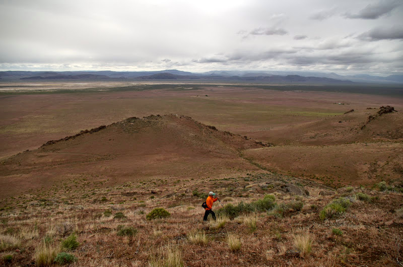
The route is essentially XC up an obvious ridge.

Although it looks like a sea of grass from a distance, the whole area is festooned with numerous low-growing and colorful wildflowers.

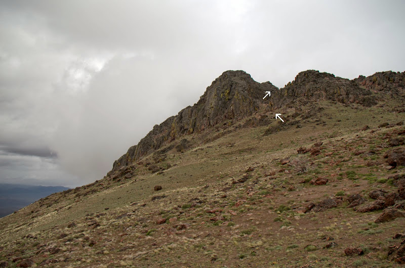
Bond has you circling around to the N and W of the peak but we decided it seemed more direct to just go up the obvious gully (arrows) below the summit. Given the touchy weather situation, we also didn't want to take the extra time to circle the peak.
While the summit had been cloud-free and had taunted us during most of our ascent, by the time we actually got to the summit gully, clouds started rolling in from the W,
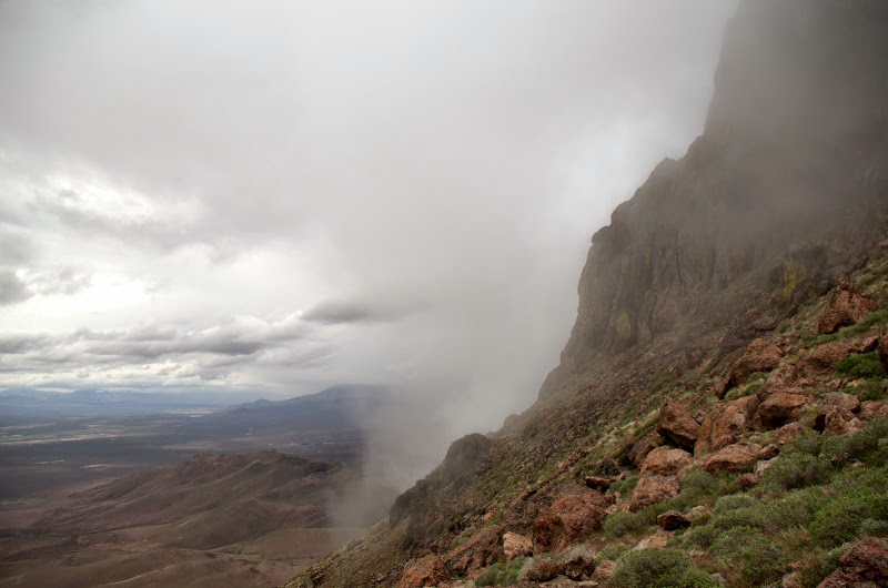
and visibility dropped to 100' or less. It also got a lot colder.

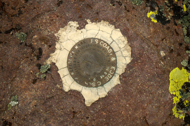
But we pushed on up through the mists and soon reached the viewless summit,

which we identified by its benchmark.
No views were to be had from the summit, so we had to descend below the clouds to see the Pueblo Mtns to the S,

the Crooked Creek and Sheepshead ranges to the E (along with some approaching dark clouds),
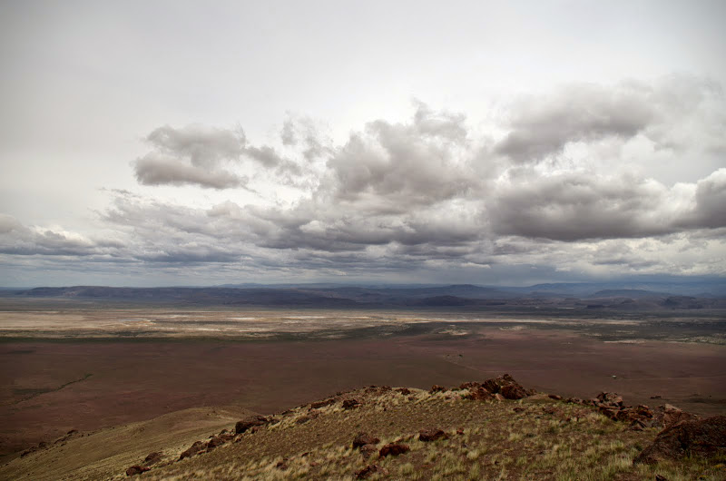
the Alvord Desert to the NE,

and the Steens to the N.
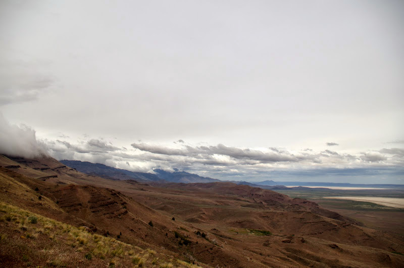
The clouds kept coming as we headed back down to the TH.

Despite the weather it was a good hike - well worth doing for the views in good weather. The excellent milkshake we got at the cafe in Fields was a great way to finish this hike!
4.6 mi RT, 2600' EG

Despite the weather, we had a good time in the Steens and are considering a return in the Fall to hike Big Indian Gorge and to explore the Pueblo Mtns. (Fortunately) the hiking to do list never seems to get any shorter!