Ozette Triangle Olympic Coast Backpack (Feb21-23)

This forum is used to share your experiences out on the trails.
User avatar
miah66
Posts: 2039
Joined: July 6th, 2009, 8:00 pm

Ozette Triangle Olympic Coast Backpack (Feb21-23)

Post by miah66 » February 25th, 2015, 10:12 am

It's been 3 months of non-winter since I camped out! Time to remedy that!

We had planned several months back to do a snowcamp over these three days, but the apparent lack of snowpack made that pretty difficult. With Spring in it's early stages and a sunny forecast for much of the local area, we decided to check out the Ozette Triangle on the Olympic Coast. Great choice!
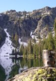
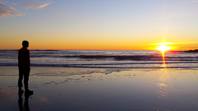
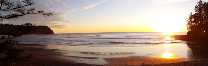
Opening pic:

Image

Hardly a breeze to be found, and the temps were near freezing at night, but mid 50's during the day. Perfect camping weather if you ask me, and it turned out to be a unique and special trip that I will never forget.

The trip to the trailhead is roughly 300 miles (6.5 hours w/ stops) from Portland, so we set off at 6:30am and arrived by 1pm after picking up a backcountry permit from the RS in Quinault. FYI, there were permits available at the Ozette RS at the TH as well. It's still the offseason, and no reservations are necessary until May 1st. You will need to pick up a National Parks pass ahead of time however, or get one at the Wilderness Information Center in Port Angeles because other Ranger Stations are closed. Display it on your dashboard.
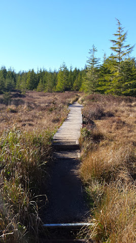
Setting off:

Image

One of my friends severely broke her leg (both tib & fib) last year on the slippery boardwalk that comprises most of the overland routes of this journey. One must use extreme caution to avoid falling.

Image

Image

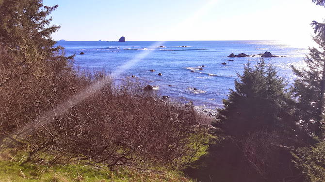
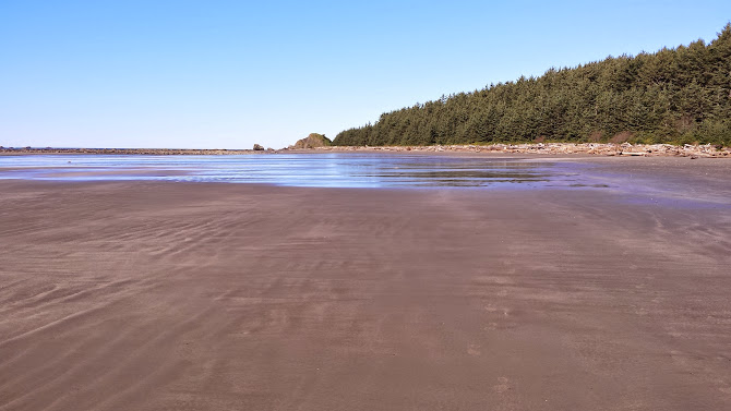
The trail splits almost immediately, we decided to head first towards Cape Alava. 3 miles later you arrive at the ocean:

Image

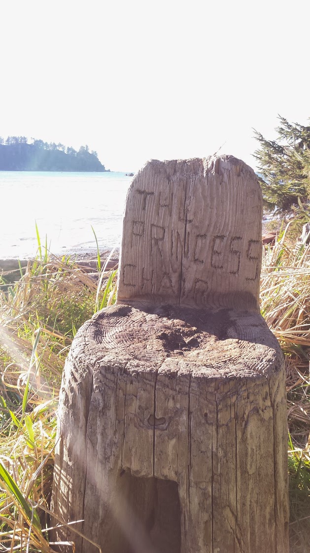
Where you too can sit in the "Princess Chair":

Image

We found many camps in the woods along the coast in the first 1/4 mile from the end of the maintained trail. From this point North and South, it's mostly a journey on the beach. Lots to see and do!
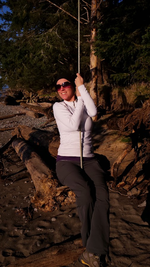
Rope swings:
Image

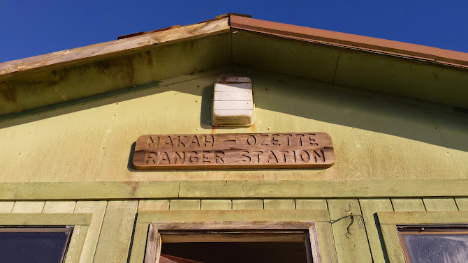
Visit the derelict Makah-Ozette RS:

Image

Play with garbage!:

Image

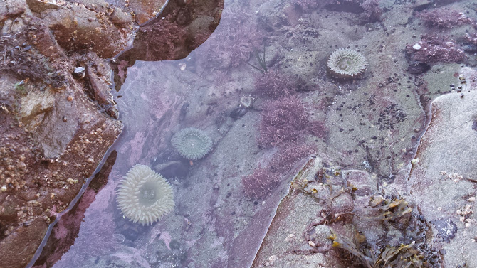
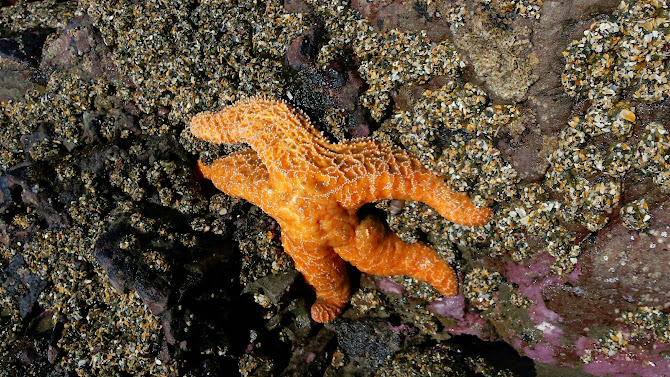
Look for marine life:
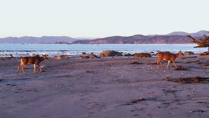
Image

Non-marine life:

Image

We moseyed Northwards up to a headland and turned back before the cold and deep ford of the Ozette River.

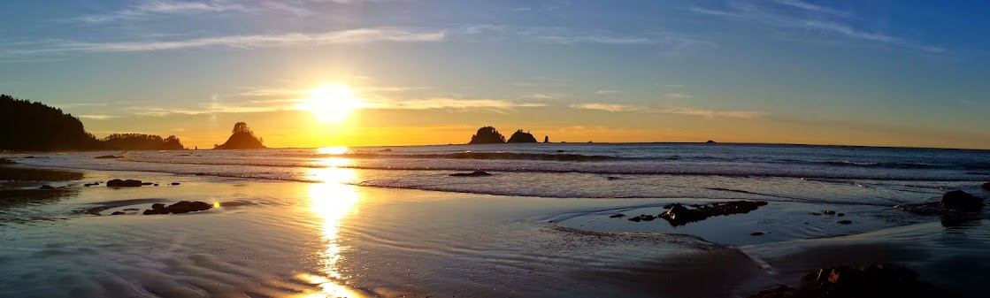
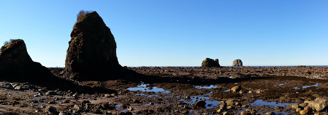
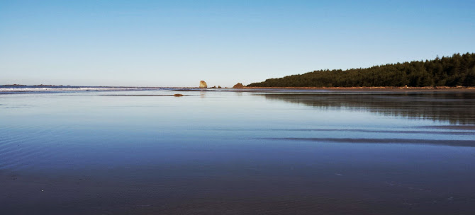
We spotted Point of Arches in the distance:

Image

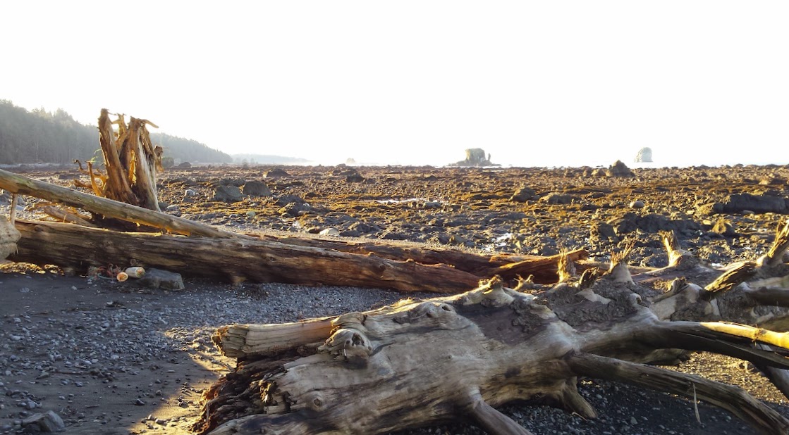
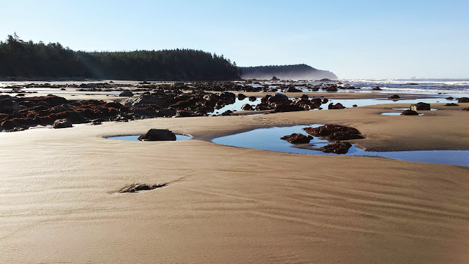
This is called "The Shipwreck Coast" for a good reason. When the tide is in, the ocean is up high near the edge of the treeline leaving almost no beach. When it recedes it goes out incredibly far, revealing large and jagged lava rock.

It goes out so far that near Cape Alava you can barely hear or see the waves at low tide, just a sea of black ragged peaks and stacks dotted with tidepools as far as you can see. Read about some of the shipwrecks here.

Image

Image

Then it was back to camp:

Image

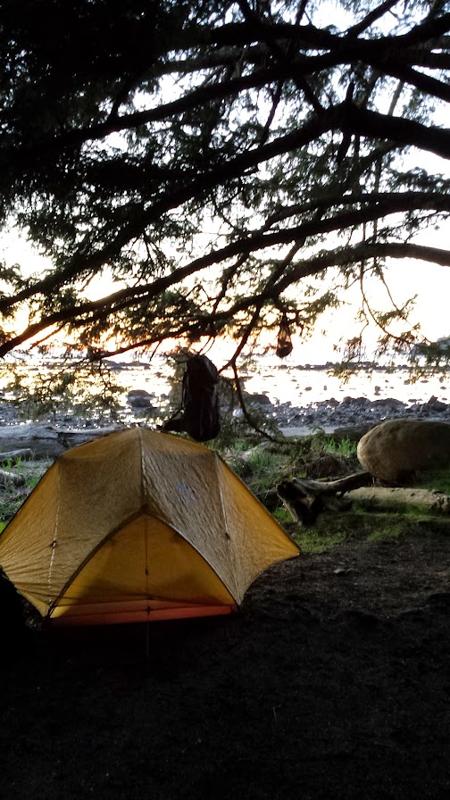
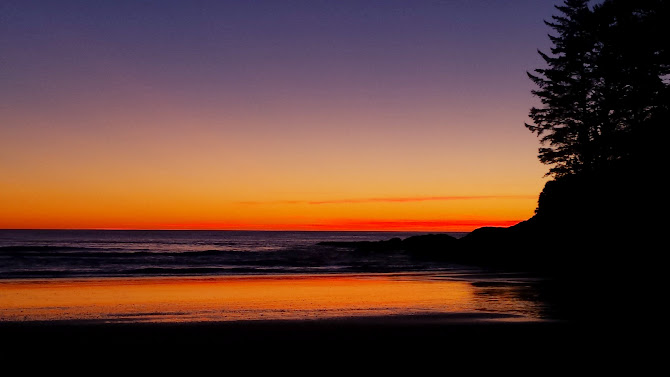
for a nice fire on the beach while we watched the sunset:

Image

Image

Image

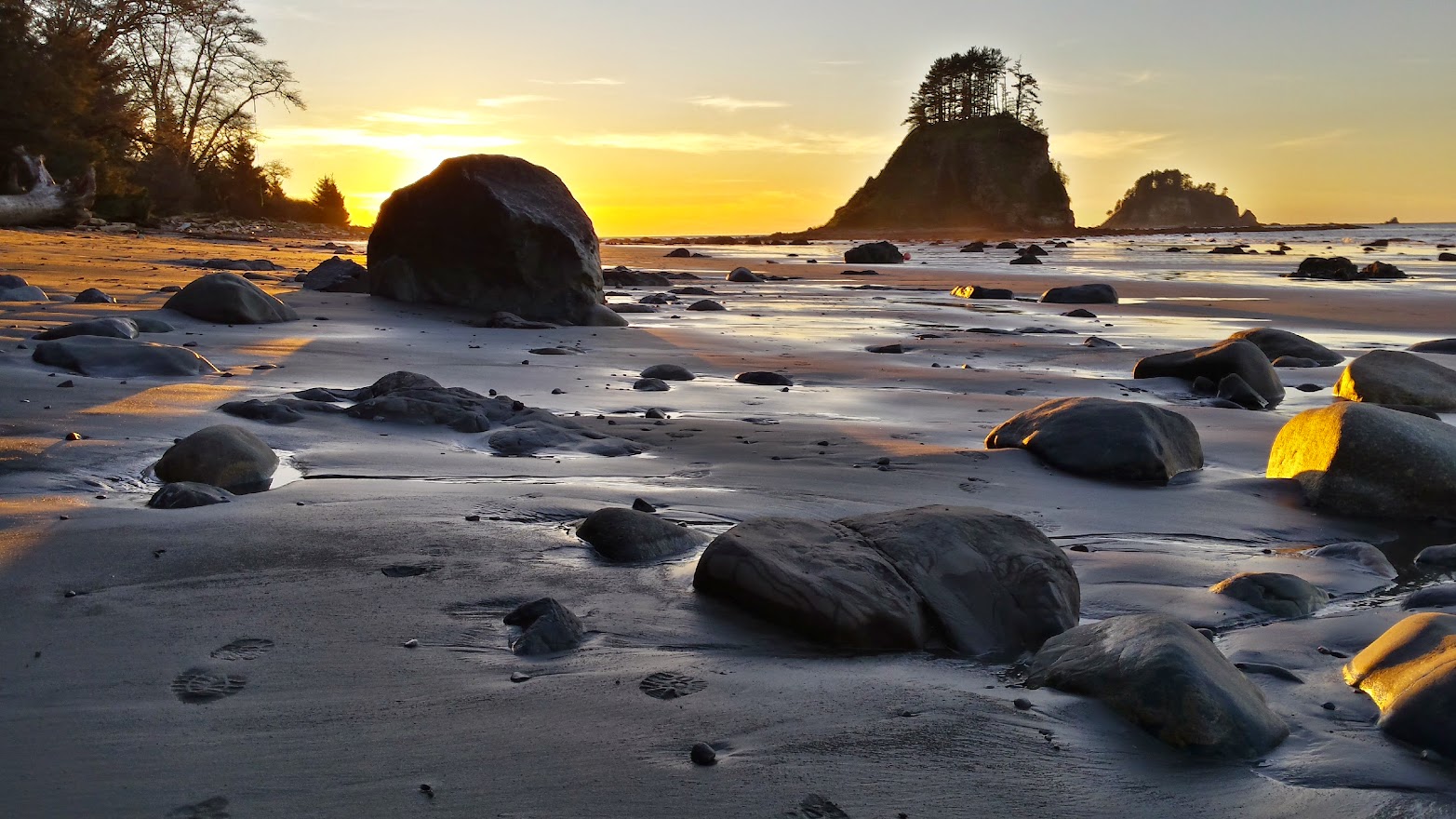
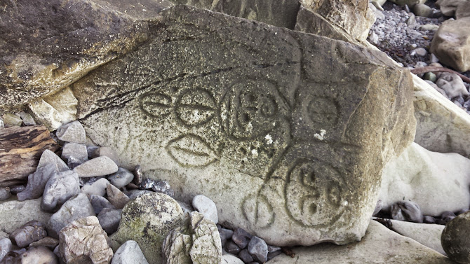
We had an early morning departure to catch our low tide window while we headed South towards Sand Point. En route, you pass Wedding Rocks with their petroglyphs hidden among the large beach stones. Really amazing:

Image

Image

Image

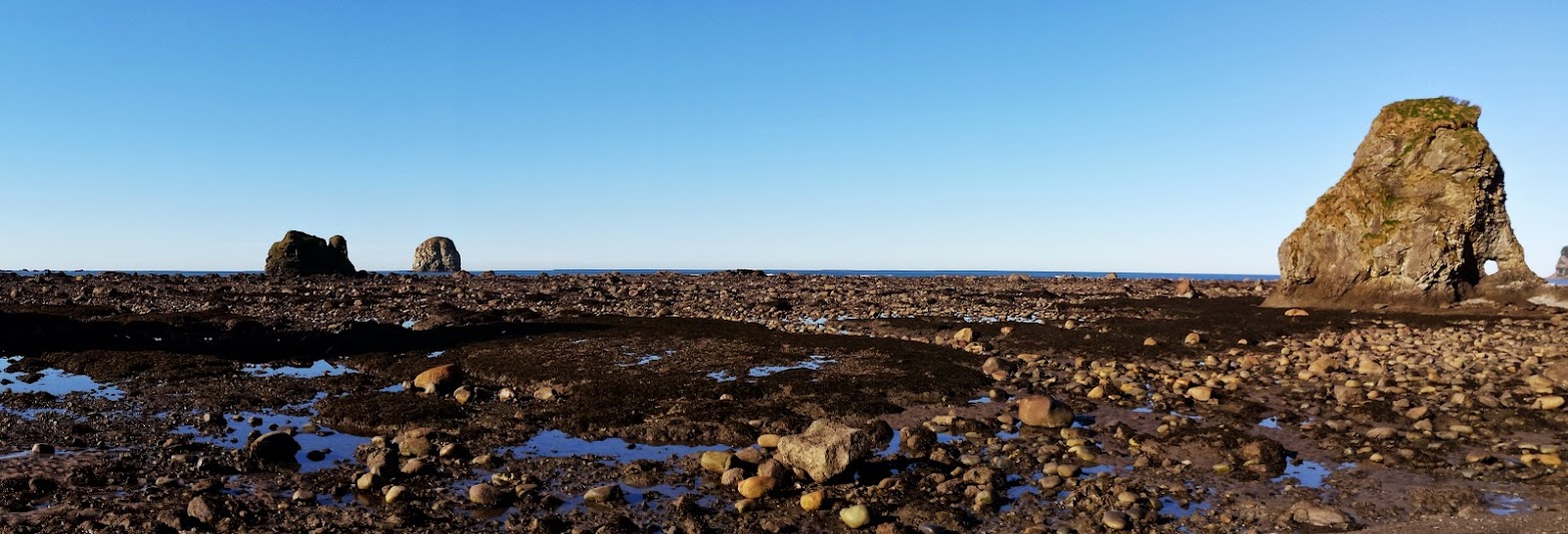
Here the tide is out and you can really see the jagged coastline:

Image

Image

Bald eagles eyed us from the treetops, the rocky outcroppings, the sea stacks. We lost track of how many, as they outnumbered the seagulls. Probably b/c they ate them all. :)

Sand Point is a large hill you can climb for nice views.

Image

Then you come to one of the largest beaches I've ever seen. It just stretches in all directions.

Image

Image

A surfer told us he had been watching a gray whale playing off shore all morning, though we never saw it. Bummer.

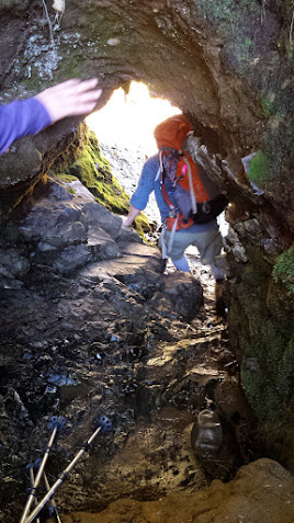
More headlands, tunnels and passageways:

Image

Image

We arrived at "Yellow Banks" just barely before the tide came in and blocked our path. Some intense moments as we saw the surf crashing just feet away from our pathway!

http://youtu.be/3pl-gIs724g

Once into the cove, we were safe though there is much less beach to walk on at high tide. Therefore you really notice how much garbage has washed up. It's incredibly sad. Much of it has come over from the tsunami in Japan:

Image

Image

Image

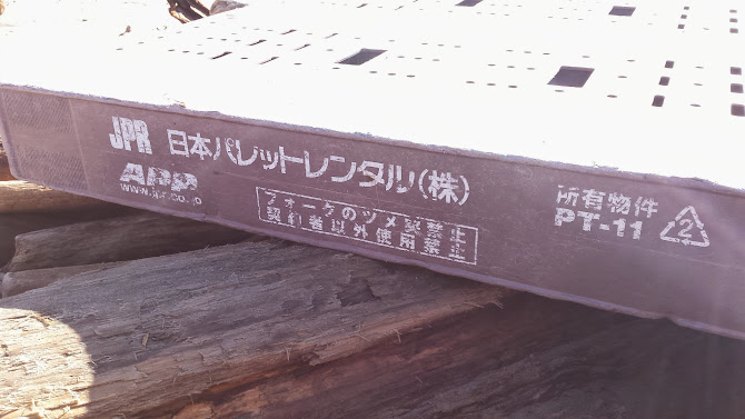
Rope and buoys EVERYWHERE! When the tide goes back out there's more beach to see and it is indeed nice:

Image

Image

Image

Image

Image

Our campsite had great views of the ocean:

Image

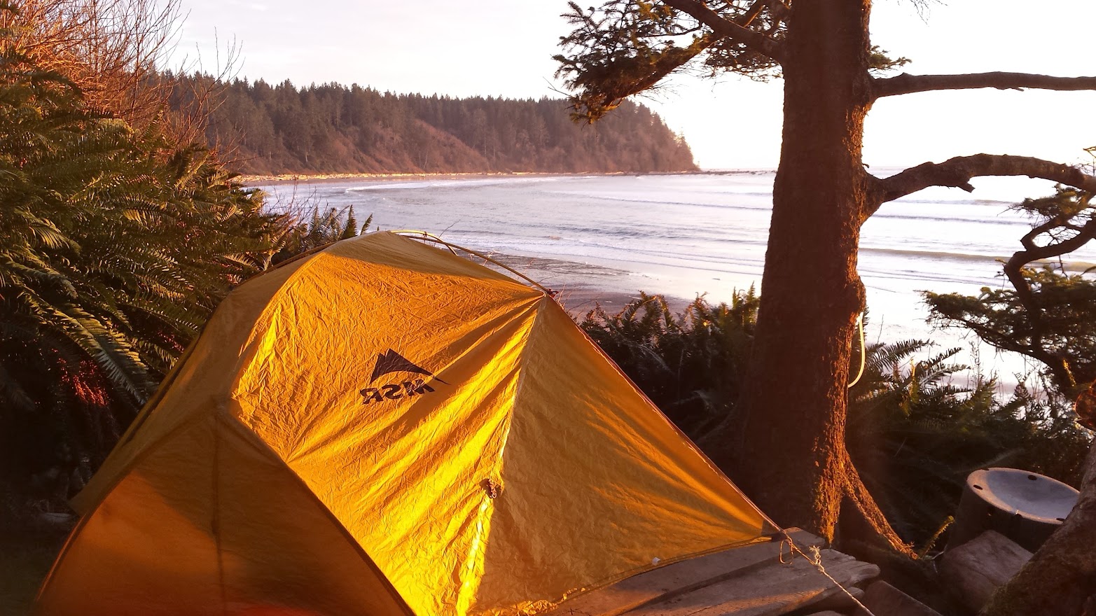
The best part is we had it all to ourselves. We settled in for another great sunset and a nice beach fire.

Image

Image

We got up early and hiked the 6 miles back to the car at the Ozette RS and then the 6 hour car ride back to Portland.

Around 19 miles and 1000 smiles.
Last edited by miah66 on March 5th, 2015, 8:06 am, edited 1 time in total.
"The top...is not the top" - Mile...Mile & a Half

Instagram @pdxstrider

olderthanIusedtobe
Posts: 488
Joined: January 2nd, 2014, 10:45 am

Re: Ozette Triangle Olympic Coast Backpack (Feb21-23)

Post by olderthanIusedtobe » February 25th, 2015, 10:55 am

Nice pictures. Looks like a fun trip. I've done that loop several times, I've never managed to find the Wedding Rocks. You aren't kidding about the eagles, I've never seen so many anywhere else.

User avatar
RobinB
Posts: 803
Joined: September 9th, 2013, 11:29 pm
Location: Portland, OR

Re: Ozette Triangle Olympic Coast Backpack (Feb21-23)

Post by RobinB » February 25th, 2015, 12:01 pm

Wow! Just incredible pictures. We'd been vaguely talking about taking a trip up there this "winter." This pretty much settles it.

User avatar
retired jerry
Posts: 14425
Joined: May 28th, 2008, 10:03 pm

Re: Ozette Triangle Olympic Coast Backpack (Feb21-23)

Post by retired jerry » February 25th, 2015, 12:10 pm

Nice story and pictures. That's a great area. I haven't been there in a few years. Must be time to go back.

aircooled
Posts: 454
Joined: May 28th, 2008, 10:03 pm
Location: Portland, OR

Re: Ozette Triangle Olympic Coast Backpack (Feb21-23)

Post by aircooled » February 25th, 2015, 1:33 pm

Great sunset photos! I love the light on the wet sands. That backpack has been on my list for a while. Good choice for an amazing weekend, weatherwise. :)

User avatar
-Q-
Posts: 1433
Joined: July 5th, 2008, 10:42 pm

Re: Ozette Triangle Olympic Coast Backpack (Feb21-23)

Post by -Q- » February 25th, 2015, 5:32 pm

Great place indeed. Love the Triangle.
I need to make a return trip up there one of these years.

User avatar
miah66
Posts: 2039
Joined: July 6th, 2009, 8:00 pm

Re: Ozette Triangle Olympic Coast Backpack (Feb21-23)

Post by miah66 » February 25th, 2015, 5:52 pm

olderthanIusedtobe wrote:I've done that loop several times, I've never managed to find the Wedding Rocks.
It was fun for sure. The wedding rocks were easy to miss if you're not looking. A group coming toward us clued us in.
"The top...is not the top" - Mile...Mile & a Half

Instagram @pdxstrider

User avatar
Rustygoat
Posts: 507
Joined: August 27th, 2012, 2:28 pm
Location: SE Portland

Re: Ozette Triangle Olympic Coast Backpack (Feb21-23)

Post by Rustygoat » February 26th, 2015, 4:21 pm

I didn't even do the hike and I had a couple of smiles looking at your pictures. Very cool TR, thanks for sharing. :)
Tim

Chasing waterfalls can be addictive.
NW Off-trail Waterfalls -Facebook Group

User avatar
cunningkeith
Posts: 209
Joined: June 26th, 2010, 4:28 am
Location: Portland

Re: Ozette Triangle Olympic Coast Backpack (Feb21-23)

Post by cunningkeith » February 27th, 2015, 7:45 am

Thanks for the excellent TR. I've only done the south section, but I've always been curious about this stretch. The extra driving to the north half always deters me, but I'm sure it's awesome.

mandrake
Posts: 389
Joined: May 28th, 2008, 10:03 pm
Location: Portland, OR

Re: Ozette Triangle Olympic Coast Backpack (Feb21-23)

Post by mandrake » February 27th, 2015, 11:04 am

Clearly this was the weekend to visit the Olympic coast! Great shots there of Cape Alava. A beautiful stretch of the coast. I don't recall seeing the Princess Chair on previous visits -- wonder if that might be a new addition. I seem to remember there used to be a pamphlet you could pick up at the ranger station at Ozette that described the location of where all the Wedding Rocks are -- apparently there are a fair number of petroglyphs out there.

Post Reply