We started at the Bowman / Francis Lake TH on Tuesday, driving from Portland that day and arriving around 3PM. A strong thunderstorm / hail storm blew through the night before so the trails up to Brownie Basin and Chimney Lake were in perfect dust-free condition. We tucked into a boulder camp on the east side of the lake and enjoyed a beautiful sunset over the Hurricane Divide.

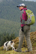
chugging up the trail to Chimney Lake, loaded up with six days of food

Chimney Lake camp (further from the water than it appears)

sunset across the Hurricane Divide

the Milky Way over camp
The next morning we packed up most of our camp and then day hiked up to Hobo Lake and a small tarn to the north of it. We scrambled up to Lookout Mountain (8,831'), a high point on the ridge between the Chimney/Hobo/Wood Lake basin and Bear Lake, and got a great preview of our route and the various peaks in the Eagle Cap. It was a slightly hazy morning, but beautiful.

Hobo Lake from Lookout Mountain

Chimney Lake

Hurricane Divide from Chimney Lake
Returning to Chimney Lake, we packed up the rest of our camp and headed back to Brownie Basin and climbed up the pass to Wilson Basin. It was a hot, dry climb in the late morning sun, but we had great views into both basins and of John Henry Lake. We continued down the forested trail through Wilson Basin (lots of flowers and creeklets) to North Minam meadow, where we stopped for the night at a horse camp at the south end of the meadow. It wasn't the greatest camp, but it was peaceful and the meadow was beautiful. That night, bold deer came visiting looking for salt.

the hot, dry climb to Wilson Basin

North Minam meadows (Camp 2)

berry jackpot
We had a long, somewhat viewless climb out of the North Minam drainage (the only place I saw bear sign) to Steamboat Lake, where we stopped for lunch and a swim, before climbing out of that basin to Swamp Lake for the night. It was early and we hadn't intended to stop at Swamp Lake, but it was so inviting that we pulled up for the night to explore. The meadows were filled with thousands of onion blooms, and a nervous but friendly doe introduced herself to me by squatting and peeing about 30 feet from me as I was sitting on the edge of a meadow.

launching into Steamboat Lake

lunch nap on the shores of Steamboat Lake

enjoying the top six inches of Steamboat Lake

exploring the talus around Swamp Lake

Swamp Lake

This deer and I had some special moments together...

...like this one.

thousands of onion blooms

sunset in the Swamp Lake basin
We climbed up and out of the Swamp Lake basin the next morning in a red-yellow haze, fire smoke from the east somewhere distant. It made the traverse to the Copper Creek drainage all the more surreal. We dropped into the Copper Creek drainage (gorgeous and invites more exploring), and then climbed the West Fork of the Lostine River to Minam Lake. It was Friday, so we started to run into a few other people along the way, mostly groups of equestrians headed to Minam Lake. Until now, we hadn't seen anyone. We traversed Minam Lake and then made the short climb to Blue Lake for the night, which we had for ourselves. After dinner, I climbed to the base of the talus fields at the south end of Blue Lake for great sunset views of Eagle Cap, the Matterhorn, and the Hurricane Divide. Still no animals.

Swamp Lake basin from above

traverse above Swamp Lake (strange fire smoke haze)

dropping down, down, down to Copper Creek and the Lostine River

Copper Creek

levitating on Blue Lake

view over Blue Lake to the Matterhorn (?)

red headlamp, stars and camp at Blue Lake
The last day, we dropped to Minam Lake and then climbed up Carper Pass for an outstanding view of the West Lostine Valley, Minam River valley, and the Lakes Basin. We dropped into the Lakes Basin briefly and then hiked out to the Two Pan TH along the beautiful East Fork of the Lostine. We walked the road another 3.5 miles to our car at the Bowman TH, for a total of about 16 miles.

sunny, dusty, and beautiful - the trip summarized

The Lakes Basin and Eagle Cap from Carper Pass

down, down, down again

from whence we came...

wildflowers and Eagle Cap in the East Fork of the Lostine River valley
Stats:
4 nights, 5 days
50 miles
11,000' elevation gain
many chipmunks, 6 deer, 1 peeing
lots of swimming, stargazing, and relaxing


