
With that goal in mind, we decided to tackle the unofficial trail over Cedar Mountain this weekend, with a stop at the popular Aldrich Butte along the way. You can find some other trip reports on the Cedar Mountain trail on this site, written by VanMarmot, romann, and Guy. Our route was nearly identical to romann's, with a side trip to Aldrich Butte.
............................................................................................................................................
Aldrich Butte via the Aldrich Cutoff Trail
As described in our trip report of Table Mountain, we started once again from the unofficial Aldrich Butte trailhead on Shelly Lane (10 T 579732 5055525 UTM). There is a little parking area located at the confluence of some jeep roads. To access the parking, you need to take a jeep road located just about 1.1 miles past Bonneville Hot Springs on Cascade Drive. The parking is located just a couple hundred yards up that road.
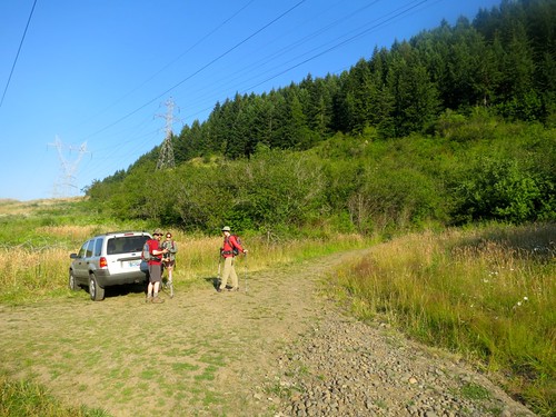
The Aldrich Butte TH Parking
From the parking lot, you need to head up the jeep road to the north, almost into the trees. After 0.1 miles and just before you reach the tree line, you'll see a different jeep road heading off to the west (10 T 579760 5055652 UTM). This is the road you'll want to take. I've heard this trail alternatively called the “Aldrich Cutoff Trail” and the “Aldrich Butte Trail”. In order to avoid confusing it with the Aldrich Butte road that climbs to the summit from Carpenters Lake, I'll refer to it as the “Aldrich Cutoff Trail”.
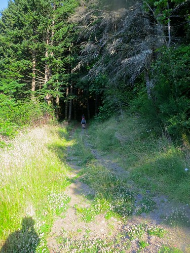
Aldrich Cutoff Trail
The Aldrich Cutoff trail follows the jeep trail for just under 0.4 miles, where the road appears to dead-end (10 T 579343 5055414 UTM). You'll see a trail split off from the jeep road, heading north up the butte. You'll need to take this trail to continue on your way.
At this point, the Aldrich Cutoff trail begins climbing more aggressively as it circles around the western edge of Aldrich Butte. After 0.6 miles, climbing 337 feet, and dropping back down a bit, you'll come to an unmarked junction in the trail (10 T 579248 5056195 UTM). If you keep left at this junction, you'll be on a trail that leads to Cedar Mountain and Cedar Creek Falls. I've heard this trail called the “Cedar Creek Falls Trail”, while others insist it is the “Aldrich Falls Trail”. I prefer “Cedar Creek Falls”.
We decided to take the trail leading to the right, which continues around Aldrich Butte until it intersects with Aldrich Butte Rd (or the “Aldrich Butte Trail”). I'm going to assume that this trail is still referred to as the “Aldrich Cutoff Trail”. If you don't wish to go to Aldrich Butte, you'll want to stay left.
Junction. Left goes to Cedar Creek/Mountain. Right goes to Aldrich Butte.
After turning right towards Aldrich Butte, it's just another 0.3 miles and 180 feet of climbing until you reach the intersection with another jeep road – the Aldrich Butte Road/Trail (10 T 579585 5056487 UTM). You'll want to turn right on the road in order to head up to the summit of Aldrich Butte. You won't get lost: the road is clearly inclined and you've been circling around Aldrich Butte the entire time.
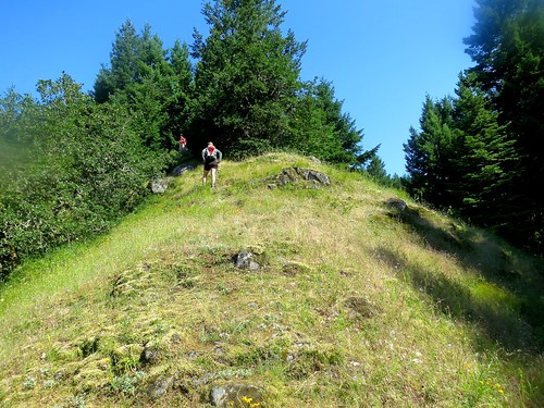
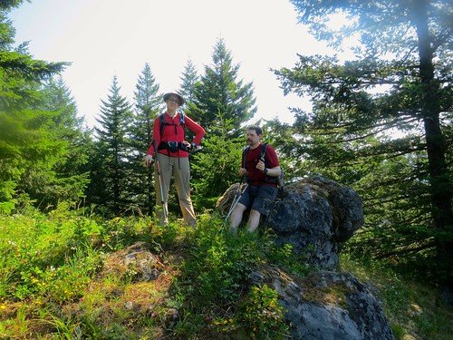
From the intersection, it's an uneventful walk up to the top of Aldrich Butte. The distance is around 0.4 miles from the intersection and involves 340 feet of elevation gain. Once on top, you'll have a commanding view of Bonneville Dam and the area. Be sure to check out the old WWII remnants and the benchmark on the summit.
Bonneville Dam from Aldrich Butte
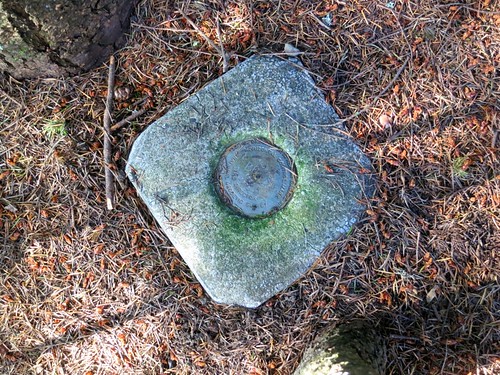
Aldrich Butte Benchmark
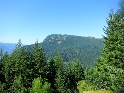
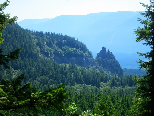
Additionally, you'll be able to get a great view of Cedar Mountain from the summit. Since we're going to be headed up to Cedar Mountain, it's a great chance to view what lies ahead.
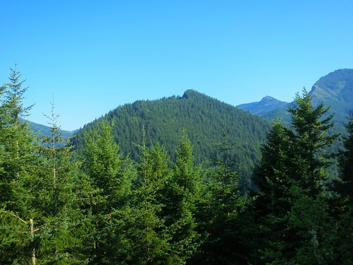
Cedar Mountain from Aldrich Butte
From this point, you can simply walk back down Aldrich Butte road to the aforementioned intersection with the Aldrich Cutoff Trail and head back to the junction with Cedar Creek Falls trail. Or, if you're done for the day, you can follow the Aldrich Butte Road/Trail down to Carpenters Lake and head back down Shelly Lane to the trailhead parking to complete a loop.
............................................................................................................................................
Cedar Mountain
If you've decided to continue on, you'll want to retrace your steps to the junction with the Cedar Creek Falls trail, located back on the Aldrich Cutoff trail. From this point, you'll drop down a short distance to Cedar Creek. Here, you'll have to cross, but it isn't difficult. You can either hop the stones or walk across on some logs located just downstream of the trail crossing.
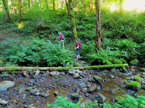
Crossing Cedar Creek
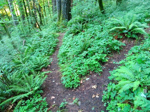
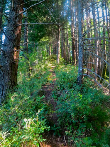
After crossing the creek, you'll climb gently for just over 0.1 miles to reach the junction with the unofficial Cedar Mountain trail (10 T 579104 5056182 UTM). The junction is not marked, but is located at a sharp turn in the Cedar Creek Falls trail just before it begins dropping down. You'll spot a steep spur trail running up the side of the ridge line. This is the trail you want.
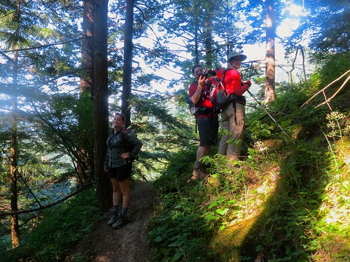
Cedar Mountain Trailhead
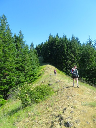
You'd better be prepared to climb. The trail climbs the ridge line relentlessly for 0.6 miles, rising 915 feet in the process. According to my data, it's an average grade of 30.6%, but there are sections in it that rise to 38% grade. We all agreed that we were glad it was a dry, summer day. I don't think I'd want to scramble on this trail when it was muddy and saturated.
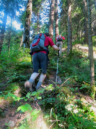
And away we go...
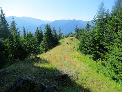
After the 0.6 miles, you'll come to a grassy clearing (10 T 579029 5056929 UTM) with views of Hamilton Mountain. There is a nice set of rocks here to rest on while you prepare for the continued ascent.
The 1st Clearing
Hamilton Mountain from the Clearing
A Brief Rest at the Rocks
After the break, you'll pick up the trail again near the rocks and continue climbing another 0.2 miles until you reach a larger grassy area (10 T 579021 5057128 UTM), almost near the summit.
Cedar Mountain “Meadow”
Looking back down from the top
From this point, it's just another 0.1 miles to the summit, but there are no real views once you reach the top. Thankfully, however, the climbing does stop for a bit as you head along the ridge and eventually drop back down the backside of Cedar Mountain. After 0.5 miles and dropping 300 feet, we came to an unmarked junction (10 T 578968 5057947 UTM) with spur trails leading north and south. Since we knew we needed to head north, we took that trail and it soon became a much better trail. We're not sure where the other leads, if anywhere at all.
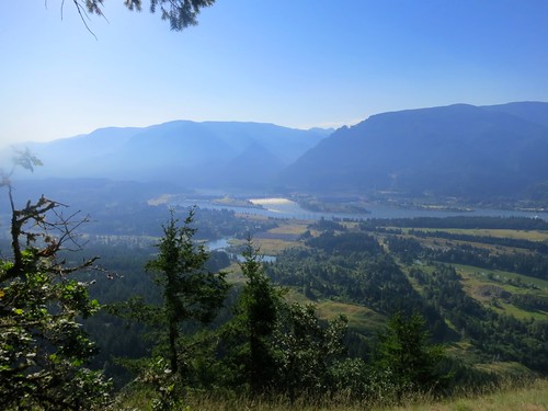
Alas, your climbing is not finished. After winding around a bit, the trail soon begins to climb another ridge line. After 0.4 miles and climbing 370 feet, you'll come to a viewpoint area (10 T 578978 5058536 UTM) alongside the trail with great views of Table Mountain and Sacagawea & Papoose Rocks. It was a much needed break for us.
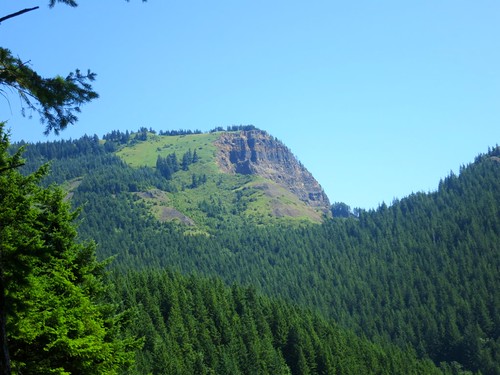
Table Mountain
Sacagawea and Papoose Rocks
After this viewpoint, it's just another 60 feet of climbing to reach the summit of this second climb. Around 0.35 miles after the viewpoint, you'll come to a fire ring and campsite. You're almost done.
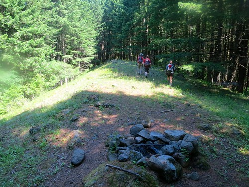
The Fire Ring
From this campsite, it's just another 0.1 miles to the PCT. You'll intersect the PCT right at the Westway Trail kiosk (10 T 579090 5059144 UTM) that marks the beginning of the Westway trail up Table Mountain. We had always wondered where the trail heading south from the kiosk went. Now we know!
From this point, we were tired from the climb and headed back down the PCT and Shelly Lane, past Carpenters Lake, all the way back to the trailhead parking. We stopped for lunch along the way and savored a quick meal while getting pestered by flies.
......................................................................
Trip Summary
Total Mileage: 8.3 miles
Elevation Gain: 2907 feet
Aldrich Cutoff to Aldrich Butte Summit: 1.8 miles / 1030 feet elevation gain
Cedar Mountain Trail: 2.2 miles / 1740 feet elevation gain
Thoughts: The Cedar Mountain trail is unmaintained and definitely a scramble. However, we found it easy to follow and did not get lost during the entire trek. It was surprisingly easy to follow. However, it is definitely a difficult hike. In fact, we found it more physically exhausting than Table Mountain, which has much more elevation gain, but a better grade. The trail averages between a 20% and 30% grade, with much steeper inclines near the start of the trail. We thought it might be a bit dangerous to navigate in wet weather if the trail conditions were slick. We were thankful to have trekking poles. The one member of our group who did not have poles had to scramble on all fours for large sections of the trail and did not have fun doing so.
All in all, it was a cool hike that we may attempt again at some point. It's cool to have such an ambitious route and trail that does not appear on any of our maps.
I've attached a GPX File of the hike, along with the waypoints mentioned in the report.
 Aldrich Butte_Cedar Mountain.GPX
- A GPX file containing our track data and associated waypoints.
- (367.71 KiB) Downloaded 235 times
