Tilly Jane Loop Hike
From Oregon Hikers Field Guide
- Starting Point: Tilly Jane Trailhead
- Ending Point: Cooper Spur Shelter
- Trail Log: Trail Log
- Hike Type: Loop
- Distance: 3 miles round-trip
- Elevation gain: 1100 feet
- High Point: 6800'
- Difficulty: Moderate
- Seasons: Summer and early Fall
- Family Friendly: Yes
- Backpackable: Yes - connects to Timberline Trail
- Crowded: On summer weekends
Contents |
Hike Description
An alternate to the Cloud Cap Trailhead is the Tilly Jane Trailhead.
If you're going clockwise on the Timberline Trail, for example to Cooper Spur, Tilly Jane is 0.1 mile closer but 130' more elevation gain Cloud Cap. If you're going counter-clockwise, for example to Elk Cove, Tilly Jane is 0.5 miles further and 130' more elevation gain. In other words, the distance and elevation gain isn't significantly different.
The road to Tilly Jane is a little better, there are way fewer people parked here, and the campground is bigger.
There is only one hike specified for Tilly Jane - up directly to Cooper Spur Shelter and back via Cloud Cap. This covers the two trails unique to Tilly Jane. You could also do any of the hikes given from Cloud Cap Trailhead.
The Tilly Jane Trail 600A, comes into Tilly Jane from Cloud Cap from the West, and leaves Tilly Jane steeply up to the South. For this hike, take the South trail.
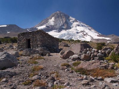
The trail goes steeply up to the junction with the Timberline Trail at mile 1.1. Keep going straight, another 0.1 mile to the Cooper Spur Shelter.
When you're done with Cooper Spur Shelter, go back down 0.1 mile to where you first hit the Timberline Trail. Turn left (North) on the Timberline Trail and go one mile to the junction with the side trail to Cloud Cap Trailhead. Go 0.2 mile to the trailhead.
The final leg of the hike goes East out of Cloud Cap Trailhead, 0.5 miles, back to Tilly Jane.
Maps
Fees, Regulations, etc.
- Northwest Forest Pass required at Cloud Cap Trailhead
Trip Reports
- (Click here to add your own)
Related Conversations / Q&A
- (Click here to ask a question or start a conversation)
Guidebooks that cover this destination
- 60 Hikes within 60 Miles of Portland, by Paul Gerald


