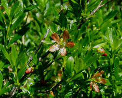
Saddle Mountain Hike
From Oregon Hikers Field Guide
- Start point: Saddle Mountain Trailhead
- End point: Saddle Mountain
- Trail Log: Trail Log
- Hike Type: Out and Back
- Distance: 5.2 miles round trip
- Elevation gain: 1600 feet
- Difficulty: Moderate
- Seasons: April-November
- Family Friendly: Yes, for older kids
- Backpackable: No
- Crowded: Yes, on summer weekends
Contents |
Hike Description
Mountaintop views that reach from the Pacific Ocean to Mt Hood await you on this steep climb to the top of a doublepeaked summit of basalt. The upper part of the mountain is decorated with vast steep wildflower meadows in summer.
From the parking area, the trail begins in the campsite area. Get on the paved trail, and for left, passing several walk-in campites. The pavement soon ends, and you will enter a lush forest of red alder, with salmonberry lining the path. At a quarter mile, the trail flattens amidst a carpet of oxalis. You have an option to take a short spur trail to the right for the Humbug Mountain viewpoint, but it is not necessary, you will see it from the summit as well.
Soon the alders will be replaced with Douglas-firs and spruces as you switchback up the hillside. The trail skirts around sedum-covered house sized boulders, a preview for the upper portion of the hike. Nearing the one mile mark the woods are periodically opened for steep meadows-which are in bloom from May through July. The top 500 feet of the mountain is made up of huge basalt dikes. There is very little topsoil. The trail is loose gravel, and recently the tread has been completely covered with a chain link fence material to aid in traction. By a mile and half, you will be traveling mostly through the steep rocky meadows that make this hike famous. Admire the flora and the expansive views, but please watch your step. After a short descent through the saddle area, you will make the final steep climb up to the summit- a triangular cement pad that is the former site of a lookout tower.
Maps
- Maps: Hike Finder
Regulations or Restrictions, etc.
Because of the mesh fencing on the upper half of the trail, this hike is not recommended for dogs.
Trip Reports
- Search Trip Reports for Saddle Mountain Hike
- (Click here to add your own)
Related Discussions / Q&A
- Search Trail Q&A for Saddle Mountain Hike
- (Click here to ask a question or start a conversation)
Guidebooks that cover this hike
- 60 Hikes within 60 Miles by Paul Gerald
More Links
- Don Bain's Virtual Guidebook of Saddle Mountain
- MD Vaden's Saddle Mountain Page
- NW Hiker's Saddle Mountain Page
- Phil Thomas' YouTube Video of Saddle Mountain
Contributors
- CFM (creator)


