

Mount Bolivar Hike
From Oregon Hikers Field Guide


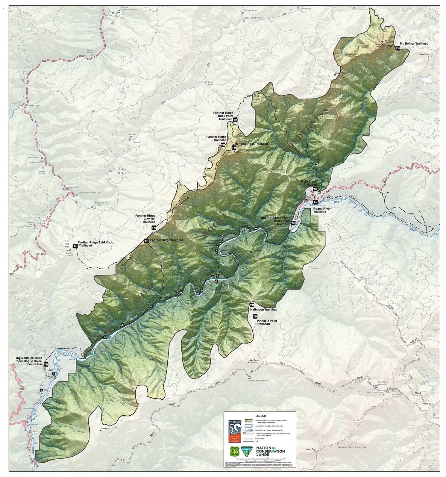
- Start point: Mount Bolivar Trailhead

- End Point: Mount Bolivar
- Hike Type: In and out
- Distance: 2.8 miles
- Elevation gain: 1160 feet
- High Point: 4,319 feet
- Difficulty: Moderate
- Seasons: Mid-spring into fall
- Family Friendly: Yes, for older kids
- Backpackable: No
- Crowded: No
Contents |
Description
Mount Bolivar, at the north end of the Wild Rogue Wilderness, has a somewhat schizophrenic identity. It rises at the interface of the Siskiyou Mountains and the Coast Range, and is thus sometimes termed the highest peak in the Coast Range (Marys Peak is the highest “pure” Coast Range peak). Mount Bolivar is the also the highest peak in Coos County. And then there’s the vegetation: the south and east slopes were charred by the 2005 Blossom Fire and are cloaked mostly by an open chapparal of canyon live oak and manzanita. This is in distinct contrast with the north slope, where massive Douglas-firs and a mossy yew wood survive. Finally, there’s the name. The mountain was named by Simon Bolivar Cathcart, a Coos County surveyor, after his eponym Simón Bolívar (1783-1830), the Venezuelan liberator of Venezuela, Colombia, Ecuador, and Peru. A plaque on the summit acknowledges Venezuela’s appreciation of the honor.
The trail heads in from the parking area past a tall and isolated sugar pine. Manzanita, chinquapin, rhododendron, bear-grass, and salal crowd the tread as you reach the area of the 2005 Blossom Fire. At the first switchback, get views down into the wooded valley of the Arrastra Fork, a tributary of Mule Creek. Pass into a patch of unburned Douglas-fir with an understory of tanoak and canyon live oak shrubs. Switchback again on an open slope of oak shrubbery. Six more switchbacks keep you ascending to get more views southwest over the Wild Rogue Wilderness.
Another switchback leads you to a traverse of an open slope before you enter a lovely old-growth forest guarded by a Brewer’s spruce and a Douglas-fir. Mossy rock outcroppings loom in an understory of branching yew trees. Switchback three times among some large Douglas-firs. Then traverse an open rocky slope, getting views down Cow Creek to the Middle Fork Coquille River, before switchbacking twice more to reach the summit of Mount Bolivar.
Concrete blocks remain as the pedestals of a 1955 lookout that was decommissioned in 1958. There were two other lookout structures before the last one: those were constructed in 1914 and 1928. A plaque at the summit of Mount Bolivar reads “The United States was the first to teach us the path to independence – Simon Bolivar, Jamaica, 1815 – from Venezuela to the people of Oregon – Mt. Bolivar, 1984.” Views extend north to the valleys of the Coquille and the Umpqua and southwest down Mule Creek to the Rogue River. On clear days, it is said you can see from Mount Hood to Mount Shasta as well as to the Pacific Ocean.
Fees, Facilities, etc.
- Wilderness regulations apply
Maps
- Maps: Hike Finder
- Wild Rogue Wilderness (BLM)
- U.S. Department of Agriculture, Forest Service: Powers and Gold Beach Ranger Districts
- U.S. Department of Agriculture, Forest Service: Siskiyou National Forest
Trip Reports
- Search Trip Reports for Mount Bolivar
Related Discussions / Q&A
- Search Trail Q&A for Mount Bolivar
Guidebooks that cover this destination
- Oregon’s Wilderness Areas: The Complete Guide by George Wuerthner
- 75 Hikes in Oregon’s Coast Range and Siskiyous by Rhonda & George Ostertag
- Hiking Southern Oregon by Art Bernstein & Zach Urness
- Hiking Oregon’s Southern Cascades and Siskiyous by Art Bernstein
- 76 Day-Hikes Within 100 Miles of the Rogue Valley by Art Bernstein
- Pacific Northwest Hiking by Scott Leonard & Sean Patrick Hill
- Oregon Hiking by Sean Patrick Hill
More Links
- Mt. Bolivar Trail #1259 (USFS)
- Mount Bolivar (Oregon – Like No Other)
- Mount Bolivar (Summit Post)
- “Funky history and great views at Mount Bolivar” (Zach’s Adventures)
- Backpacking with Baby – Mount Bolivar and Hanging Rock (Forest Adventurer)
- Mount Bolivar (oregonnater)
- Wild Rogue Wilderness (USFS)
- Wild Rogue Wilderness Area (BLM)
- Wild Rogue Wilderness (Wilderness Connect)
- Mount Bolivar (Forest Lookouts)
- Simón Bolívar (Encyclopaedia Britannica)
Page Contributors
- bobcat (creator)