Difference between revisions of "Lone Pilot Loop Hike"
From Oregon Hikers Field Guide
(Created page with "Category:Southern Oregon Category:Moderate Hikes Category:Wildflower Hikes Category:Loop Hikes Category:Hikes Category:Under Development Image:LoneP...") |
|||
| Line 35: | Line 35: | ||
{{TripReports|{{PAGENAME}}}} | {{TripReports|{{PAGENAME}}}} | ||
| − | * [http://www.oregonhikers.org/forum/viewtopic.php?f=8&t= | + | * [http://www.oregonhikers.org/forum/viewtopic.php?f=8&t=21056 Lone Pilot Trail Loop 15-Feb-2015] |
{{RelatedDiscussions|{{PAGENAME}}}} | {{RelatedDiscussions|{{PAGENAME}}}} | ||
| Line 44: | Line 44: | ||
=== More Links === | === More Links === | ||
| − | * [http://www. | + | * [http://www.blm.gov/or/wilderness/sodamountain/ BLM Soda Mountain Wilderness Fact Sheet] |
| − | * [http://www. | + | * [http://www.blm.gov/or/resources/recreation/files/soda_mtn_map.pdf BLM Monument and Wilderness map] |
| − | + | ||
=== Page Contributors === | === Page Contributors === | ||
* [[User:VanMarmot|VanMarmot]] (creator) | * [[User:VanMarmot|VanMarmot]] (creator) | ||
Revision as of 16:43, 22 August 2015
- Start point: Pilot Knob Trailhead
- Ending Point: Pilot Knob Trailhead
- Trail Log:
- Hike Type: Loop
- Distance: 17 miles
- Elevation gain: 3,000 feet
- High Point: 5,300 feet
- Difficulty: Moderate
- Seasons: Late spring; Early fall
- Family Friendly: No
- Backpackable: Yes
- Crowded: No
Contents |
Hike Description
The Soda Mountain Wilderness is a 24,707 acre wilderness area within the Cascade–Siskiyou National Monument in southwestern Oregon and was created by the Omnibus Public Land Management Act of 2009. The 53,000 acre Monument was designated in 2000 to protect the extraordinary biological diversity in this area. All of this wilderness is located in Oregon and is managed by the Bureau of Land Management (BLM). This wilderness is an ecological mosaic where the state's eastern desert meets towering fir forests. The biodiversity of the area includes fir forests, sunlit oak groves, meadows filled with wildflowers, and steep canyons. The area is home to a spectacular variety of rare species of plants and animals including Roosevelt elk, cougars, black bears, golden and bald eagles, goshawks and falcons.
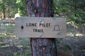
Wilderness designation did, however, seem to bring with it the resources needed to build trails into this new wilderness. Fortunately, the Siskiyou Mountain Club (SMC) in Ashland, Oregon stepped up and converted an abandoned road into the Lone Pilot Trail which gives hikers and backpackers ready access to the deepest recesses of the wilderness.
Maps
- Maps: Hike Finder
Trip Reports
- Search Trip Reports for Lone Pilot Loop Hike
Related Discussions / Q&A
- Search Trail Q&A for Lone Pilot Loop Hike
Guidebooks that cover this destination
- The Siskiyou Crest: Hikes, History & Ecology by Luke Ruediger (pages 116-118)
- 100 Hikes in Southern Oregon by William L. Sullivan (Third Edition, Hike #63)
More Links
Page Contributors
- VanMarmot (creator)


