Difference between revisions of "Hamilton Mountain Loop Hike"
From Oregon Hikers Field Guide
SasquatchBot (Talk | contribs) m (Elevation) |
SasquatchBot (Talk | contribs) m (Elevation_Gain) |
||
| Line 21: | Line 21: | ||
* Hike Type: Out and Back | * Hike Type: Out and Back | ||
{{Distance|7.6 miles}} | {{Distance|7.6 miles}} | ||
| − | + | {{Elevation gain|2100 feet}} | |
* Difficulty: Moderate | * Difficulty: Moderate | ||
* Seasons: March to November | * Seasons: March to November | ||
Revision as of 03:33, 23 March 2007
- Start Point: Hamilton Mountain Trailhead
- End Point: Hamilton Mountain
- Trail Log: Trail Log
- Hike Type: Out and Back
- Distance: 7.6 miles
- Elevation gain: 2100 feet
- Difficulty: Moderate
- Seasons: March to November
- Family Friendly: No
- Backpackable: No
- Crowded: Yes
Contents |
Hike Description
This trail has a feast of features for hikers, including waterfalls, craggy cliffs, deep forests, superb vistas, and a nice loop option for the trek.
The trail begins with a moderate climb, going through second-growth Douglas firs, under power lines, and after about a mile, you can take a side trail to the right for a limited view of Hardy Falls. Continue then back on the main trail a few hundred yards and go left on a side trail that ends at a railed lookout to view of Pool of the Winds, and Rodney Falls. Hardy Creek pours into the Pool of Winds from the right, tumbling 50 feet before hitting the pool in the rocks. Then the water breaks free and cascades out along a stream bed worn in the rock, and then slides down water slide-like channel until it hits a rocky labyrinth, splitting the flow in many ways, before it all comes together again below. A beautiful falls indeed!
Return to the main trail and switchback down to a sturdy footbridge below the falls for more cooling spray and photo opportunities. To continue the ”more difficult” route, switchback uphill then keep left at an unmarked fork and climb .2 mile to a junction. In the warmer seasons, your trail may be lined with ferns, Oregon Grape, thimble berries and wild rose. Now keeping right, follow steep switchbacks leading up a cliff-edged ridge, and you will be rewarded with spectacular views across the Columbia River. After 1.8 miles you'll reach a T-shaped junction at the summit ridgecrest. The path to the right will dead-end at Hamilton's summit, 2488', but the view there is somewhat obscured by brush.
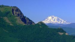
Turn around, and follow the ridgecrest trail to a plateau with better viewings of Mount Hood, Mount Adams, Mount St. Helens and Table Mountain, as well as the Bonneville Dam on the Columbia River.
You now will have hiked a little over three miles and climbed some 2000 feet, so take a leisurely lunch break here if it's not too windy.
To continue on your counter-clockwise loop, after .9 miles turn left down an old road. This entire trail is very popular, and besides other hikers, you may find yourself sharing this stretch with horseback riders. Keep left on the road for one mile to a little meadow and creek crossing. Here you will veer onto a level path through a cool alder forest, and after 1.1. mile will join back on the main trail. Turning right will bring you back to the parking lot.
This balloon loop is a total of 7.6 miles with 2100 feet of elevation gain.
During winter the gate to the parking lot may be closed, but you can park your car across the road and walk up to the trailhead.
Maps
- Maps: Hike Finder
Fees, Regulations, etc.
- $5 Washington State parking no longer needed
Trip Reports
- Search Trip Reports for Hamilton
(Click here to add your own)
Related Discussions / Q&A
- Search Trail Q&A for Hamilton
- Aldrich Butte/Cedar Falls (photo of Cedar Falls from Hamilton summit
- Gorge Guess (Hamilton is one photo clue)
- Table Mt/Three Corner Rock 6/10/06 (brief mention)
(Click here to ask a question or start a conversation)
Guidebooks that cover this hike
- 60 Hikes Within 60 Miles: Portland - 2nd Edition, by Paul Gerald
- Hiking in the Columbia River Gorge - 2nd Edition, by Russ Schneider


