Difference between revisions of "Eagle Creek to Wahtum Lake Hike"
From Oregon Hikers Field Guide
(-pass required- for trailheads only) |
(Add closure) |
||
| (26 intermediate revisions by 6 users not shown) | |||
| Line 1: | Line 1: | ||
| − | [[Category: | + | [[Category:Backpackable Hikes]] |
[[Category:Columbia River Gorge]] | [[Category:Columbia River Gorge]] | ||
| − | |||
| − | |||
[[Category:Creek Hikes]] | [[Category:Creek Hikes]] | ||
| + | [[Category:Difficult Hikes]] | ||
| + | [[Category:Exposed Hikes]] | ||
| + | [[Category:Lake Hikes]] | ||
[[Category:Northwest Oregon]] | [[Category:Northwest Oregon]] | ||
| + | [[Category:Old Growth Hikes]] | ||
| + | [[Category:Pass Required]] | ||
[[Category:Viewpoint Hikes]] | [[Category:Viewpoint Hikes]] | ||
| + | [[Category:Waterfall Hikes]] | ||
| + | [[Category:Wilderness Hikes]] | ||
| + | [[Category:Hikes]] | ||
| − | [[Image: | + | [[Image:WahtumNearJunction.jpg|thumb|400px|Wahtum Lake ''(Jeff Statt)'']] |
| + | [[Image:MetlakoFalls.jpg|thumb|250px|Metlako Falls ''(Jeff Statt)'' ]] | ||
| + | [[Image:TunnelFallsSideView.jpg|thumb|250px|Tunnel Falls ''(Tom Kloster)'']] | ||
| + | [[Image:EagleCreekGorge01.jpg|thumb|250px|Eagle Creek, just past the last major waterfall ''(Jeff Statt)'']] | ||
| + | [[Image:VertigoMile02.jpg|thumb|250px|The 'Vertigo Mile' near Twister Falls ''(Jeff Statt)'']] | ||
| − | + | {{Start point|Eagle Creek Trailhead}} | |
* End point: [[Wahtum Lake]] | * End point: [[Wahtum Lake]] | ||
* Trail Log: [[Eagle Creek to Wahtum Lake Hike/Log|Trail Log]] | * Trail Log: [[Eagle Creek to Wahtum Lake Hike/Log|Trail Log]] | ||
| − | * Hike Type: | + | * Hike Type: Loop |
| − | + | {{Distance|26.5 miles}} (loop) | |
| − | + | {{Elevation gain|5310 feet}} | |
| − | + | {{Difficulty|Difficult}} | |
* Seasons: summer, fall | * Seasons: summer, fall | ||
* Backpackable: Yes | * Backpackable: Yes | ||
* Crowded: Yes, especially the first 7 miles | * Crowded: Yes, especially the first 7 miles | ||
* Family Friendly: No (Due to exposure) | * Family Friendly: No (Due to exposure) | ||
| + | {{Hazards|f=y}} | ||
=== Hike Description === | === Hike Description === | ||
| − | + | <b><font color=red>NOTICE: Most trails on the Oregon side of the Columbia River Gorge are closed until further notice because of damage from the Eagle Creek Fire. The closure involves ALL trails between Rooster Rock State Park and Hood River. It is anticipated that most of these trails may not reopen until Spring or Summer 2018. Please check the list of [https://www.fs.usda.gov/recmain/crgnsa/recreation Columbia Gorge trail closures] before you plan for a hike.</font color></b> | |
| − | This hike assumes a four day/three night hike which is the most common way to do this, but you can do it in fewer days. | + | This is a famous multi-day backpack trip. You go up scenic and crowded Eagle Creek, then steeply up to Wahtum Lake. This hike returns on the Pacific Crest Trail and Ruckel Creek Trail which is much less crowded but also less scenic. You could just as easily return the way you came on Eagle Creek. This hike assumes a four day/three night hike which is the most common way to do this, but you can do it in fewer days. |
| − | Start out at the Eagle Creek Trailhead. | + | Start out at the [[Eagle Creek Trailhead]]. Park at the lower parking area next to the fish hatchery and camp host for better security. The first 8 miles follows scenic Eagle Creek (see [[Eagle Creek to Tunnel Falls Hike]], [[Eagle Creek to High Bridge Hike]], and [[Eagle Creek to Punch Bowl Falls Hike]]). |
| − | + | For the first night camp at [[Seven and a Half Mile Camp]]. There is easily room for half a dozen parties, but they may all be occupied on summer weekends. You should be able to find a spot regardless. | |
| − | + | The second day hike the steep trail up to Wahtum Lake, elevation gain 2300'. This is the hardest day. The second night camp at [[Wahtum Lake]]. You can drive to Wahtum Lake so it's busy, but there are campsites all around the lake so you should be able to find something. | |
| − | + | This hike assumes you go back via the Pacific Crest Trail/Ruckel Creek, but you could just as easily go back the way you came. The third day head back on the PCT. Make sure and do the short side trip to [[Chinidere Mountain Hike|Chinidere Mountain]], where you'll get your best views of the hike. The third night camp at [[Camp Smokey]], at the junction with the Eagle Benson Trail #434. There's a campsite on the PCT, and another on the Eagle Benson Trail. Reportedly there is water a short distance down the Eagle Benson Trail. | |
| − | + | ||
| − | + | ||
| − | + | ||
| − | This hike assumes you go back via the Pacific Crest Trail/ | + | |
| − | + | ||
| − | The third day head back on the PCT. Make sure and do the short side trip [[ | + | |
| − | + | ||
| − | The third night camp at [[Camp Smokey]], at the junction with the Eagle | + | |
The fourth day you could go down the Eagle Benson Trail, and then back on the Eagle Creek Trail to the trailhead. The Eagle Benson Trail is steep and less well maintained than other trails in the area. | The fourth day you could go down the Eagle Benson Trail, and then back on the Eagle Creek Trail to the trailhead. The Eagle Benson Trail is steep and less well maintained than other trails in the area. | ||
| − | This hike assumes you continue on the PCT. The trail soon reaches the Benson Plateau, a large, flat, forested area. You want to turn left onto the | + | This hike assumes you continue on the PCT. The trail soon reaches the Benson Plateau, a large, flat, forested area. You want to turn left onto the Ruckel Creek Trail #405. There is a confusing network of trails. Maybe someone can put in a better description of how to find this route. |
| − | The | + | The Ruckel Creek Trail goes steeply down to next to the freeway and ends at the Gorge Trail #400. Turn left (West) on the Gorge Trail and go back, next to the campground, and out on the road to the campground. Follow the road 0.1 miles back to the lower parking area. |
=== Maps === | === Maps === | ||
| − | + | {{TripReports|Eagle Creek}} | |
| − | + | ||
| − | + | {{RelatedDiscussions|Eagle Creek}} | |
| − | + | ||
=== Guidebooks that cover this hike === | === Guidebooks that cover this hike === | ||
=== More Links === | === More Links === | ||
| + | |||
=== Contributors === | === Contributors === | ||
* [[User:jeffstatt|jeffstatt]] | * [[User:jeffstatt|jeffstatt]] | ||
* [[User:retiredjerry]] | * [[User:retiredjerry]] | ||
Revision as of 15:57, 26 September 2017
- Start point: Eagle Creek Trailhead
- End point: Wahtum Lake
- Trail Log: Trail Log
- Hike Type: Loop
- Distance: 26.5 miles (loop)
- Elevation gain: 5310 feet
- Difficulty: Difficult
- Seasons: summer, fall
- Backpackable: Yes
- Crowded: Yes, especially the first 7 miles
- Family Friendly: No (Due to exposure)
|
Contents |
Hike Description
NOTICE: Most trails on the Oregon side of the Columbia River Gorge are closed until further notice because of damage from the Eagle Creek Fire. The closure involves ALL trails between Rooster Rock State Park and Hood River. It is anticipated that most of these trails may not reopen until Spring or Summer 2018. Please check the list of Columbia Gorge trail closures before you plan for a hike.
This is a famous multi-day backpack trip. You go up scenic and crowded Eagle Creek, then steeply up to Wahtum Lake. This hike returns on the Pacific Crest Trail and Ruckel Creek Trail which is much less crowded but also less scenic. You could just as easily return the way you came on Eagle Creek. This hike assumes a four day/three night hike which is the most common way to do this, but you can do it in fewer days.
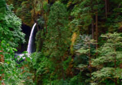
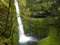
Start out at the Eagle Creek Trailhead. Park at the lower parking area next to the fish hatchery and camp host for better security. The first 8 miles follows scenic Eagle Creek (see Eagle Creek to Tunnel Falls Hike, Eagle Creek to High Bridge Hike, and Eagle Creek to Punch Bowl Falls Hike).
For the first night camp at Seven and a Half Mile Camp. There is easily room for half a dozen parties, but they may all be occupied on summer weekends. You should be able to find a spot regardless.
The second day hike the steep trail up to Wahtum Lake, elevation gain 2300'. This is the hardest day. The second night camp at Wahtum Lake. You can drive to Wahtum Lake so it's busy, but there are campsites all around the lake so you should be able to find something.
This hike assumes you go back via the Pacific Crest Trail/Ruckel Creek, but you could just as easily go back the way you came. The third day head back on the PCT. Make sure and do the short side trip to Chinidere Mountain, where you'll get your best views of the hike. The third night camp at Camp Smokey, at the junction with the Eagle Benson Trail #434. There's a campsite on the PCT, and another on the Eagle Benson Trail. Reportedly there is water a short distance down the Eagle Benson Trail.
The fourth day you could go down the Eagle Benson Trail, and then back on the Eagle Creek Trail to the trailhead. The Eagle Benson Trail is steep and less well maintained than other trails in the area.
This hike assumes you continue on the PCT. The trail soon reaches the Benson Plateau, a large, flat, forested area. You want to turn left onto the Ruckel Creek Trail #405. There is a confusing network of trails. Maybe someone can put in a better description of how to find this route.
The Ruckel Creek Trail goes steeply down to next to the freeway and ends at the Gorge Trail #400. Turn left (West) on the Gorge Trail and go back, next to the campground, and out on the road to the campground. Follow the road 0.1 miles back to the lower parking area.
Maps
Trip Reports
- Search Trip Reports for Eagle Creek
Related Discussions / Q&A
- Search Trail Q&A for Eagle Creek


