Difference between revisions of "Eagle-Benson Loop Hike"
From Oregon Hikers Field Guide
m (E&D) |
m (Searches) |
||
| Line 52: | Line 52: | ||
* Northwest Forest Pass required at Trailhead | * Northwest Forest Pass required at Trailhead | ||
| − | {{TripReports| | + | {{TripReports|Benson Plateau}} |
| − | + | ||
| − | {{RelatedDiscussions| | + | {{RelatedDiscussions|Benson Plateau}} |
| − | + | ||
=== Guidebooks that cover this hike === | === Guidebooks that cover this hike === | ||
Revision as of 19:56, 26 November 2009
| This page is marked as a Lost Hike. The "trail" may be dangerous and hard to follow and is not recommended for beginning hikers without an experienced leader. Carry detailed maps of the whole area and/or a GPS unit and compass. |
- Start point: Eagle Creek Trailhead
- End point: Eagle Creek Trailhead
- Trail Log: Trail Log
- Hike Type: Loop
- Distance: 15.8 miles
- Elevation gain: 4260 feet
- Difficulty: Difficult
- Seasons: June-Oct
- Family Friendly: No
- Backpackable: Yes
- Crowded: Yes (on Eagle Creek Trail)
|
Contents |
Hike Description
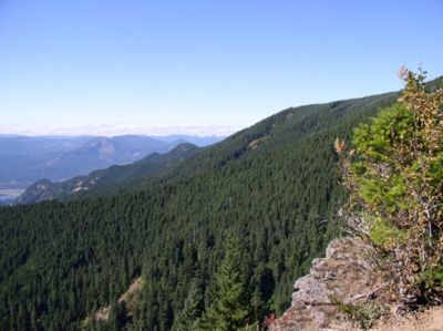
This hike is a demanding loop, showing off all the Gorge has to offer. You encounter everything from cliffside trails and waterfalls to incredible vistas and quiet sub-alpine forests. Trails vary from extremely well maintained to not at all. Some sections are easy and well graded, while others offer rugged climbs and knee pounding descents. There is limited seasonal water availability on this route, so bring enough for the entire trek. Potential water sites are Ruckel Creek near the top of the Ruckel Ridge route, a small spring .1 miles below Camp Smokey on the Eagle-Benson Trail, and a few spots on Eagle Creek where creek access is feasible.
The Eagle Creek Trail can be crowded, while most of the rest of the hike offers relative solitude. There are several variations to this hike. You can start out easy (Eagle Creek) and finish hard (Ruckel Creek or Ridge), or get the hard stuff out of the way first and cruise to a finish. I recommend the latter for several reasons: 1) You will get the toughest climb out of the way first while you're fresh. 2) You start out enjoying solitude rather than the throngs of people hiking Eagle Creek. 3) It is easier to descend the Eagle-Benson Trail due to the overgrown tread and the extensive blow-down. 4) You finish with a leisurely stroll down the Eagle Creek Trail in the late afternoon or early evening when it is less crowded.
When starting the hike, you must first decide on your route to the Benson Plateau. You can choose between Ruckel Ridge and the Ruckel Creek Trail. While both trails are a stiff climb, Ruckel Ridge is a more demanding but rewarding thrill ride. The Ridge doesn't lead to a destination as much as it is a destination. The Ruckel Creek Trail offers the single best viewpoint between the two trails, and impressive hanging meadows laced with wildflowers in the spring. You can't go wrong either way. Pick your poison and make your way to the Benson Plateau. See the Ruckel Ridge Loop Hike for specific route descriptions for this first section.
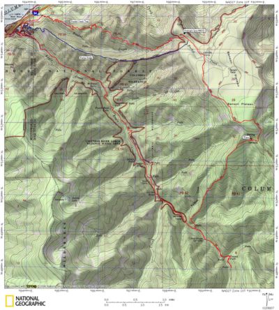
Following either route, you will eventually end up at the junction of the Ruckel Creek Trail and the Ruckel Ridge route. There is a large network of trails and camps on the Benson Plateau, some marked and some not. Your goal is to end up on the Pacific Crest Trail on the southern end of the plateau. The most direct route for this loop is to follow the Ruckel Creek Trail south into the heart of the plateau. Take the Benson Way Trail #405B to the right (SW) when it intersects with the Ruckel Creek Trail. Benson Way generally follows the western edge of the Benson, connecting with the Pacific Crest Trail 1.8 miles later.
Continue on the Pacific Crest Trail about .4 miles to Camp Smokey at the intersection with the Eagle-Benson Trail #434. This trail is no longer maintained, and the middle 1/3 needs a lot of work. The trail has a lot of downed trees and may be difficult to follow. This trail is bordering on the "lost" category. Follow the Eagle-Benson Trail as it takes a 3 mile, 3000' dive into Eagle Creek Canyon. Afternoon winds can really whip through the trees as the trail skirts a ridge line. At .5 miles, check out the incredible view north and west. Tighten your laces, as the descent only gets steeper. After a mile or so, you start hiking through a burned out area. This area is extremely overgrown with salmonberry and other undergrowth, so watch your step. You will also be climbing over and under a myriad of blown down trees before reentering the forest.
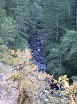
As you approach Eagle Creek from above, the trail narrows to a cliff-side 12" tread, many places covered in small loose rocks. Watch your step here, as a fall would be very bad. Pass a waterfall and make the final descent to Eagle Creek. From here, you can choose to add the short 2 mile out and back trip to Tunnel Falls, or simply head back down the Eagle Creek Trail to the trailhead. Unless you're running low on energy or daylight, I highly recommend the additional miles, as Tunnel Falls is a Gorge highlight.
On the return trip, follow the well graded Eagle Creek Trail back down to the trailhead, taking in the waterfalls along the way.
Maps
- Maps: Hike Finder
Fees, Regulations, etc.
- Northwest Forest Pass required at Trailhead
Trip Reports
- Search Trip Reports for Benson Plateau
Related Discussions / Q&A
- Search Trail Q&A for Benson Plateau
Guidebooks that cover this hike
- Day Hike! Columbia Gorge, by Seabury Blair, Jr.
- 60 Hikes within 60 Miles of Portland, by Paul Gerald
- Afoot and Afield Portland/Vancouver, by Douglas Lorain
- 35 Hiking Trails, Columbia River Gorge, by Don & Roberta Lowe
- Columbia River Gorge, 42 Scenic Hikes, by Don & Roberta Lowe
- Hiking the Columbia River Gorge - 1st and 2nd Editions, by Russ Schneider
- 100 Hikes in Northwest Oregon - 3rd Edition, by William L Sullivan
More Links
- See more information at Describe the link here
Contributors
- Stevefromdodge (outline)
- Jim Sifferle


