Mt Defiance Explorations - June 3, 2012

Discussions and Trip Reports for off-trail adventures and rediscovering lost trails
Post Reply
pablo
Posts: 1451
Joined: May 28th, 2008, 10:03 pm

Mt Defiance Explorations - June 3, 2012

Post by pablo » June 4th, 2012, 9:20 pm

A couple of goals for this and a previous outing, one to finish out the route up Cabin Creek Ridge to Warren Lake, the other was to follow the logging road that crosses Defiance Trail at 1300'. On the logging road I knew it ended in a clearing due north of Warren Lake based on the DOGAMI LIDAR viewer so the plan was to drop down the little ridge west of Warren Lake to catch the road for the return to Defiance Trail. The previous week I explored the logging road going east but did not get to the end - that part of the road is in the blast zone and covered with the same stuff that clogged up Defiance Trail. I did follow a branch of the road up to where it crosses Defiance Trail again at the 2200' level - that was a bit of a surprise but at least I know now how they got the logs out of that upper piece.

So Sunday I finished my exploration of Cabin Creek Ridge by continuing on up the hill to the plateau above Warren Lake. Very nice off-trail route the entire distance. I looked for the elusive trail found on the USGS TOPO as I made my way up the hill but saw nothing but deceptively nice game trail. I'm very skeptical and would need something like a 3' bench, blazed trees, and maybe a sign or 2 to convince me there was ever any trail through here.

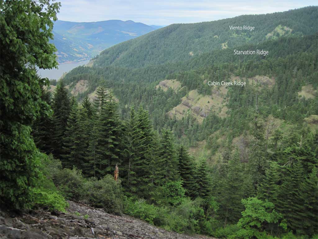
Cabin Creek Ridge is a wonderful place:
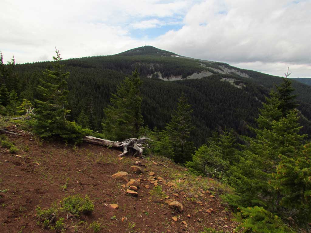
Off to Dog:

Image

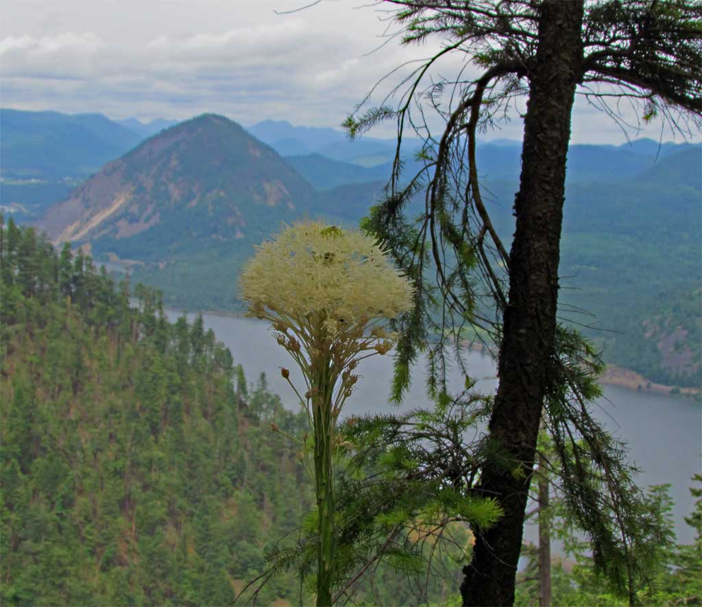
Saw my first beargrass bloom of the season:

Image

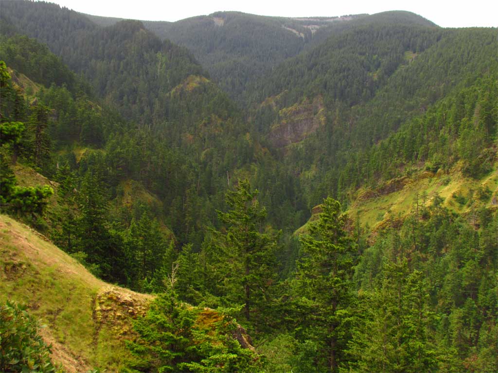
Warren Creek Canyon is very beautiful:

Image

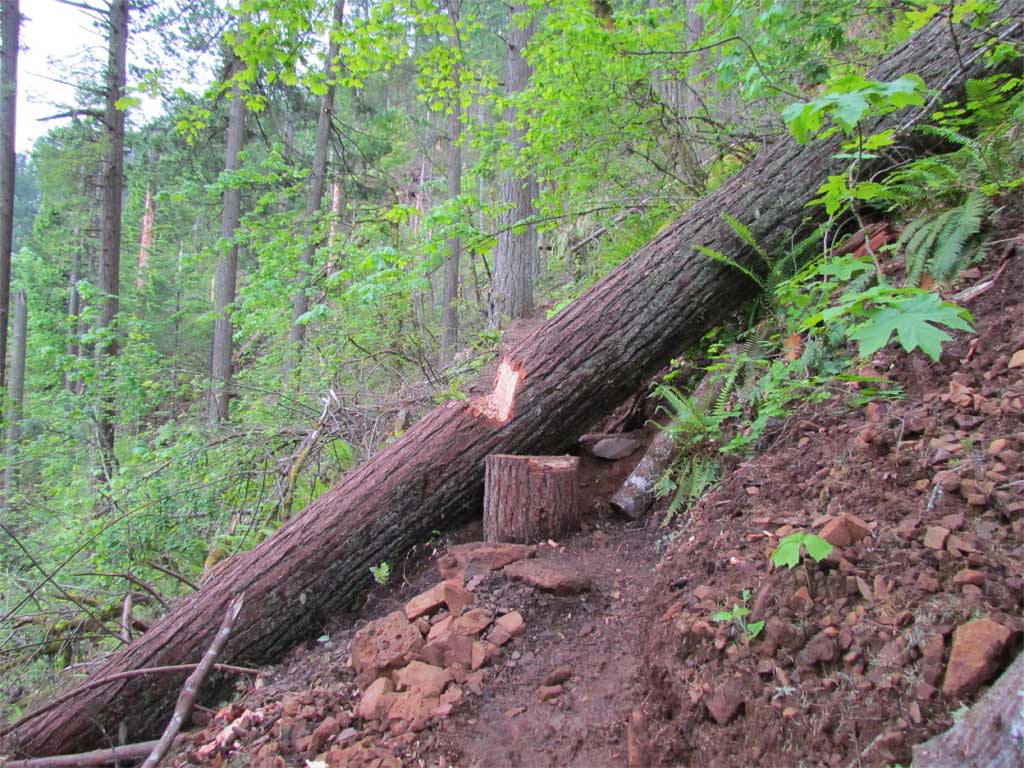
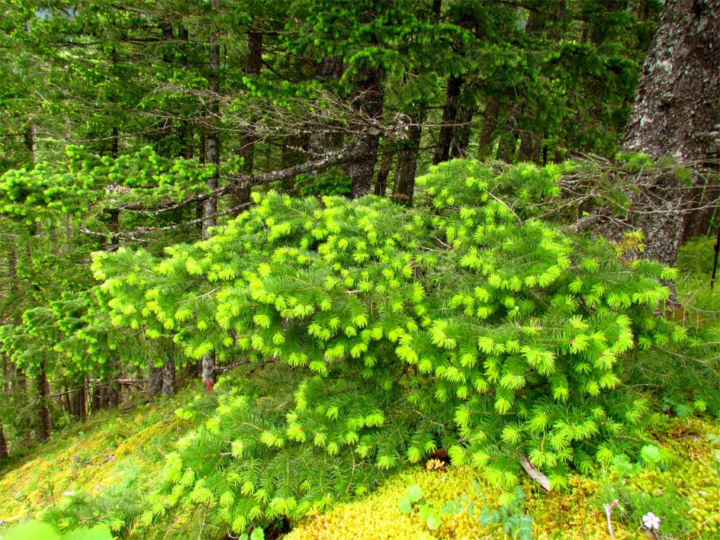
For me, I find the spring growth on Doug Fir to be as pretty as any flower.

Image

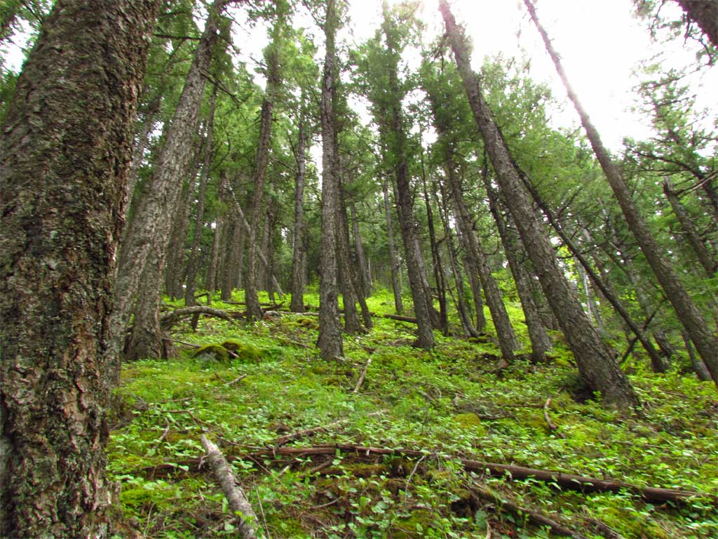
The approach to the plateau above Warren Lake is steep but very clear and full of game trail to follow.

Image

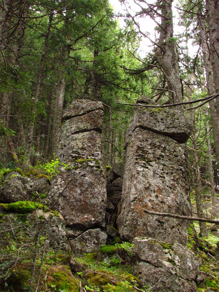
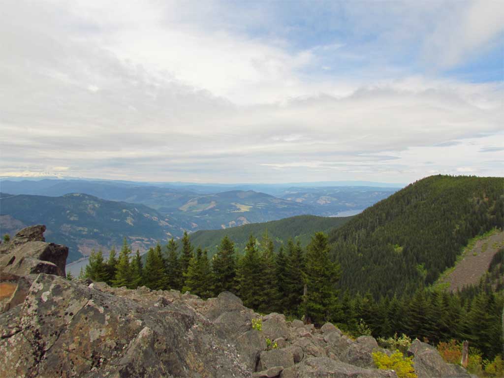
Lots of interesting rock outcrops:

Image

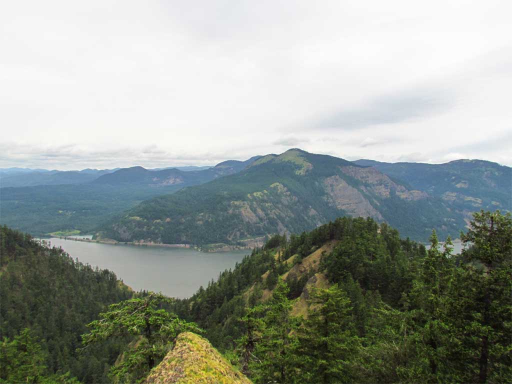
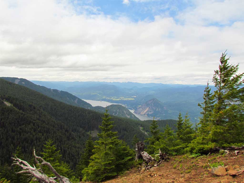
A couple of openings afforded views from little meadows found along the way:

Image

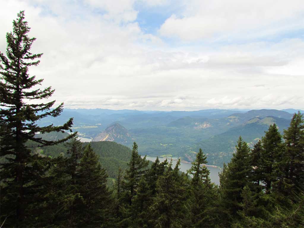
I followed the edge of the plateau on my way to intersect the Mitchell Pt trail - ran into a nice opening that I don't think gets many visitors but is worth the detour:

Image

Image

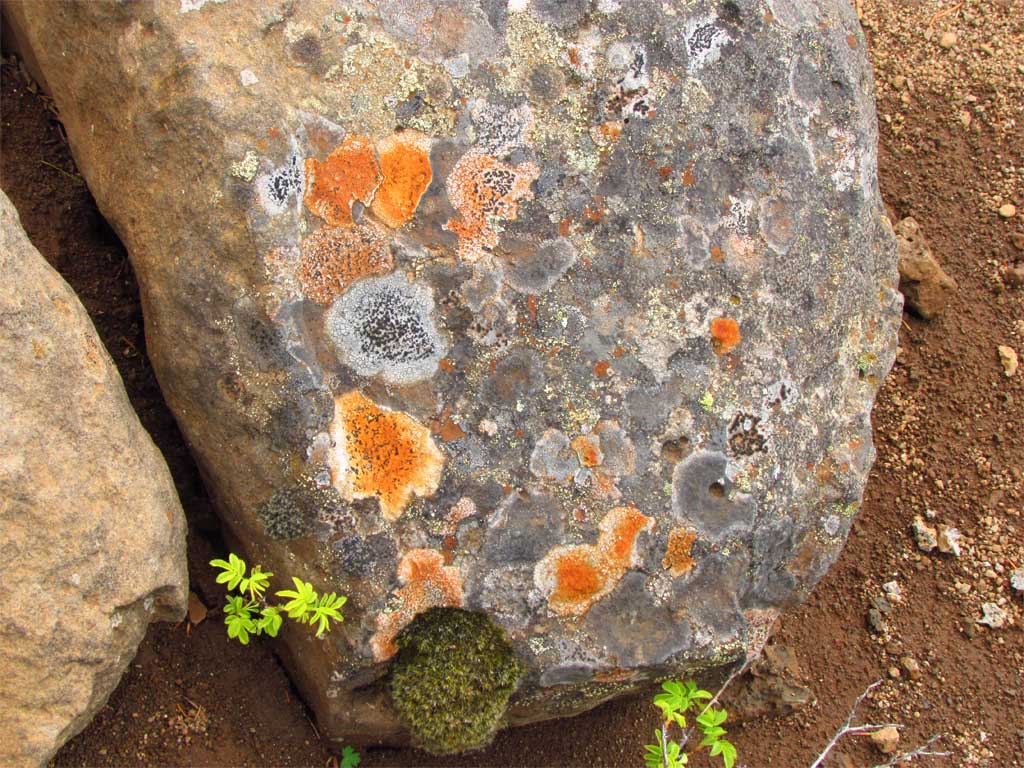
Bright orange lichen caught my eye:

Image

I made it to Warren Lake, a couple of hikers, no campers. I went west from Warren Lake to start the descent to the logging road and followed a bit of trail to a wonderful rock garden that I did not know was there. From the rock cairns and path this is a known spot - huge boulders and great views.

Image

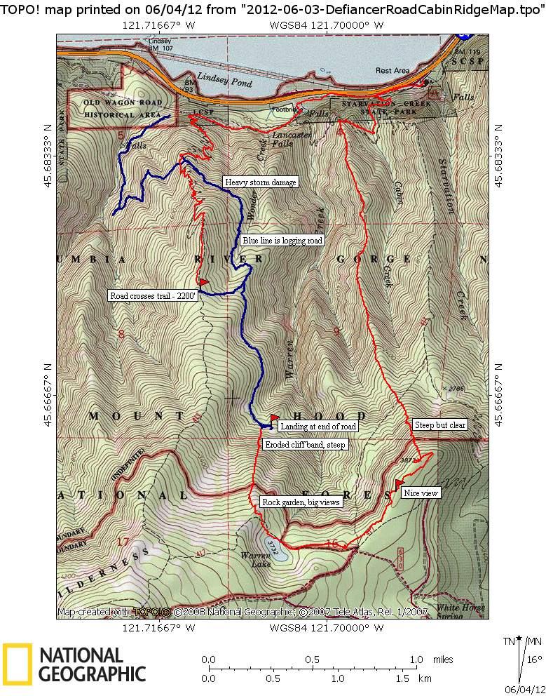
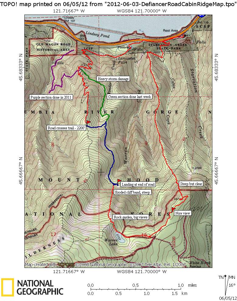
From there I continued north down the ridge which was fairly clear of brush with the only obstacle a decaying and very steep cliff band about halfway down to the the target road and landing. As I got closer to the landing area, stumps started popping up which was comforting and I made the road in good shape. The road is overgrown but easy traveling. I followed the road, stopping at an opening along the road to take a photo at the ridge I'd just ascended.

Image

8.8 miles, 4200' cumulative elevation gain in 7.75 hours. Great day, I'll likely never return to the abandoned logging road but Cabin Creek Ridge to the plateau is a gem.

Image
The future's uncertain and the end is always near.

User avatar
Peder
Posts: 3401
Joined: May 28th, 2008, 10:02 pm
Location: Lake Oswego

Re: Mt Defiance Explorations - June 3, 2012

Post by Peder » June 5th, 2012, 6:54 am

That is quite the loop! I was actually heading to your Cabin Creek Ridge Saturday but the rain made me drive further east. Interesting with the logging road that leads from 2,600' and all the way down.
The road is overgrown but easy traveling
I followed the road up along Lindsey Creek last month but turned back what must have been shortly before the first hairpin; as I found a section that was strenuous:
DSC05723.jpg
Easy travel? May 9, 2012 just below the first hairpin.
Some people are really fit at eighty; thankfully I still have many years to get into shape…

mcds
Posts: 802
Joined: April 7th, 2012, 4:25 pm

Re: Mt Defiance Explorations - June 3, 2012

Post by mcds » June 5th, 2012, 8:44 am

Totally impressive again, pablo. At a point on the Defiance trail that is perhaps 50 yards uptrail from the 30' washout, there is what has looked like an old road. If that is a road, is that the one you were on? not that I am going to follow it, I shy away from offtrail to avoid poison oak, but when it's chaparral or above treeline, like Tam MacArthur Rim, cross country is best. FWIW, it looks like "Nice View" is directly northwest of what is currently the uppermost blowdown on the Starvation trail route. Maybe when I go to clear it, I'll try to find the view.

User avatar
rick6003
Posts: 330
Joined: March 30th, 2010, 7:00 pm

Re: Mt Defiance Explorations - June 3, 2012

Post by rick6003 » June 5th, 2012, 8:58 am

Pablo,

Awesome as always, now to find the time to trace your foot steps.

pablo
Posts: 1451
Joined: May 28th, 2008, 10:03 pm

Re: Mt Defiance Explorations - June 3, 2012

Post by pablo » June 5th, 2012, 9:45 pm

Peder wrote:That is quite the loop! I was actually heading to your Cabin Creek Ridge Saturday but the rain made me drive further east. Interesting with the logging road that leads from 2,600' and all the way down.
The road is overgrown but easy traveling
I followed the road up along Lindsey Creek last month but turned back what must have been shortly before the first hairpin; as I found a section that was strenuous:
Peder,

The ridge is a lot of fun from start to finish, you'll enjoy it.

I should have spent more time on the map - I actually did the road in three sections, the lower part in 2011, the middle part last week, then the upper part on this day. Unfortunately, the middle part looks like your photo and I suppose the lower part above where you were is just as bad. I wish I'd done the whole thing last year.

Here's an updated version, the red (trail/off trail) and blue (road) lines are what was done this weekend, the purple in 2011, the green was last week.

Image
The future's uncertain and the end is always near.

pablo
Posts: 1451
Joined: May 28th, 2008, 10:03 pm

Re: Mt Defiance Explorations - June 3, 2012

Post by pablo » June 5th, 2012, 9:55 pm

mcds wrote:Totally impressive again, pablo. At a point on the Defiance trail that is perhaps 50 yards uptrail from the 30' washout, there is what has looked like an old road. If that is a road, is that the one you were on? not that I am going to follow it, I shy away from offtrail to avoid poison oak, but when it's chaparral or above treeline, like Tam MacArthur Rim, cross country is best. FWIW, it looks like "Nice View" is directly northwest of what is currently the uppermost blowdown on the Starvation trail route. Maybe when I go to clear it, I'll try to find the view.
mcds,

You'll like the view, easy to get to not much brush.

The spot where the road crosses at the 1300' level is very flat and wide, unmistakable if you are looking for it. I do not recall seeing road above the washout (which BTW, is pretty bad) and nothing shows up on the LIDAR.

I neglected to post this picture (I think you already mentioned this one in a previous post) that displays your creative trail solutions - I admire the effort you made putting this log crossing together - you have an eye for detail. Thx --Paul

Image
The future's uncertain and the end is always near.

pablo
Posts: 1451
Joined: May 28th, 2008, 10:03 pm

Re: Mt Defiance Explorations - June 3, 2012

Post by pablo » June 5th, 2012, 10:02 pm

rick6003 wrote:Pablo,

Awesome as always, now to find the time to trace your foot steps.
Hey Rick,

Thx, the ridge part is a great hike...

--Paul
The future's uncertain and the end is always near.

Post Reply