To get my monies worth out of the $10 "access fee" at Beacon Rock State Park, I felt I needed to do both Hamilton Mtn and Hardy Ridge, plus a little XC bush whacking. Thus economically motivated, I headed up the trail past Rodney Falls, where I got to wondering how that little round rock (on top of the main rock mass) managed to stay where it is (not to mention how it got there in the first place).
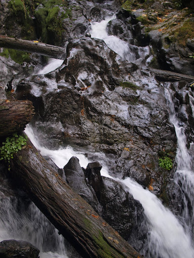
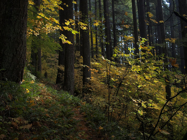
It was overcast and windy when I left the car, but by the time I passed Rodney Falls, the clouds had been replaced by sunshine that illuminated the Fall colors. Overall, it was a really great day to be out hiking (but tomorrow the cubicle awaits ).
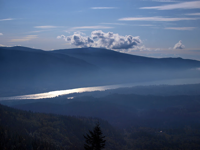
There was a cloud deck over the river,
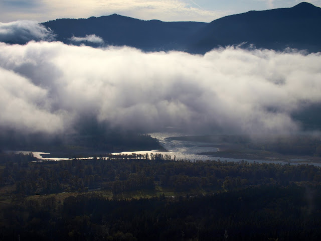
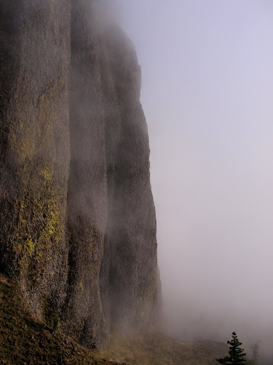
that was pushing in from the E against the cliffs below Hamilton Mountain.
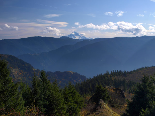
Hamilton's summit was clear, however, and both Table and Adams were in view above the clouds.
From there, it was N to Dons Cutoff, then down to the equestrian bridge over Hardy Creek, then up the almost new trail to Hardy Ridge. The WTA has done an amazing amount of work putting great trails in this area - thanks! From the ridge, I could see Hood directly to the S,
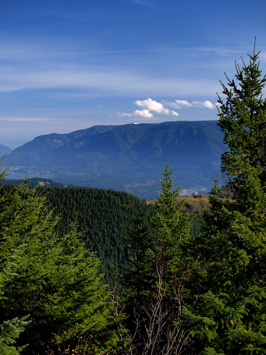
Larch Mtn (under the cloud) to the W,
and Mt. Defiance (the white spot under the cloud) to the E.
I took the trail/old road down the W side of Hardy Ridge to its junction with the road down to the equestrian parking lot. In the past, I've just followed this road E to where it joins the Hardy Creek Trail and then taken that back to the TH. Today I headed due S XC from Pt 1338 to intersect with the Hamilton Mtn trail about where it passes under the powerlines. There was a little faded flagging right when I started and a faint use/game trail from time to time, so I'm sure other folks have gone this way, just not very often. Not too bad going down but looks like it would be a pain going up.
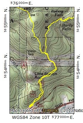
After about 0.5 mi in the brush, I popped out on the Hamilton Mtn trail about 100' up-trail from the power lines. Great day, comfortable classic hike with a different ending, and no one else on the trail - all told, about 10.9 mi and 3300' gain.
The Hamilton Mtn / Hardy Ridge $10 Loop Hike 07-Nov-2011
Last edited by VanMarmot on January 31st, 2016, 4:56 pm, edited 3 times in total.
Re: The Hamilton Mtn / Hardy Ridge $10 Loop Hike
Nice loop! I've wondered about that little bushwhack to connect back to the Hamilton Mountain Trail. Tanner Butte looked a lot nicer when you were looking at it (I was there on Sunday).
John
John
- Eric Peterson
- Posts: 4097
- Joined: May 11th, 2009, 5:39 am
- Location: Oregon
- Contact:
Re: The Hamilton Mtn / Hardy Ridge $10 Loop Hike
Ahh, Van Marmot Tuesday strikes again!
Very cool!
I think one can park up Kueffler(sp?) RD a ways to avoid the 10er? I seem to have
lost the thread that was discussing this a few months ago...
Very cool!
I think one can park up Kueffler(sp?) RD a ways to avoid the 10er? I seem to have
lost the thread that was discussing this a few months ago...
Re: The Hamilton Mtn / Hardy Ridge $10 Loop Hike
I did one loop (before the $10 fee) where I returned via Kueffler Road. However, the parts of the road with trail access are also within the park boundary, so I think you'd have to park along Hwy 14 just W of its junction with Kueffler to avoid the access fee (and then hope there isn't some rule about not parking along 14?).Eric Peterson wrote:Ahh, Van Marmot Tuesday strikes again!
Very cool!
I think one can park up Kueffler(sp?) RD a ways to avoid the 10er? I seem to have
lost the thread that was discussing this a few months ago...
Re: The Hamilton Mtn / Hardy Ridge $10 Loop Hike
I love this park, especially now that it has so many more loop options!
Another good option for the full loop is to head back down the road from the equestrian trailhead to the powerline access road. Follow this up til just before it ends in a head-scratching spot overlooking a steep drop. Downhill to the right you can see the water tank at the campground. It's a steep and brushy but very short shwack between the two.
Ryan, if you guys decide to "complete the loop" this spot gets my vote for best-connector with least-amout-of new trail Let me know when/if it happens and I'll come out and help move some rocks around!
-payslee
Re: The Hamilton Mtn / Hardy Ridge $10 Loop Hike
I've often hiked from the equestrian trailhead to the Hamilton trail a little uphill from the bench. Easy bushwhack. I woke a sleeping bear in there a few years back. Not sure who was scared the most. The bear took off like a rocket. There's an old cabin on the hill above the bench. It had running water and electric. Nice location with a great view of Beacon Rock. As far as I know it was private whether it has been bought by the state, I dont know. About 6 years ago Dick Thomas flagged a route from the first intersection on the road up to Hardy Ridge down to the area around the bench. The Park Rangers also hiked the possible trail but they also said there was private property in there.
- Excursionista
- Posts: 425
- Joined: May 28th, 2008, 10:03 pm
Re: The Hamilton Mtn / Hardy Ridge $10 Loop Hike
Great report! Hamilton/Hardy were on my list for a fall hike, but then that fee was instituted and, well... I picked other places. At least I get to live vicariously through you!
Please correct me if I'm wrong, but isn't the summit that you called Tanner Butte actually Larch Mountain? I think Tanner Butte is visible in your photo looking south, towards Mt. Hood.
So, who gets that $10?VanMarmot wrote:The WTA has done an amazing amount of work putting great trails in this area - thanks!
Please correct me if I'm wrong, but isn't the summit that you called Tanner Butte actually Larch Mountain? I think Tanner Butte is visible in your photo looking south, towards Mt. Hood.
Re: The Hamilton Mtn / Hardy Ridge $10 Loop Hike
Nice job of getting your money's worth. Yet another Vanmarmot blue sky day! I've wanted to get up there again this year, but of course I don't want to cough up $10 to hike there.
Re: The Hamilton Mtn / Hardy Ridge $10 Loop Hike
Not sure who gets the $10. It would be best if it were dedicated to the park but I suspect it just flows into the general fund.Excursionista wrote:
So, who gets that $10?
Please correct me if I'm wrong, but isn't the summit that you called Tanner Butte actually Larch Mountain? I think Tanner Butte is visible in your photo looking south, towards Mt. Hood.
And, you're right, Larch Mtn. is under the cloud, with Tanner off to the left (S).
- Eric Peterson
- Posts: 4097
- Joined: May 11th, 2009, 5:39 am
- Location: Oregon
- Contact:
Re: The Hamilton Mtn / Hardy Ridge $10 Loop Hike
As far as parking, in the active map above click on the Terrain drop down menu and select
MyTopo to see the park boundaries and most likely park where the I put the flag. Walk back down the road a ways to get onto that AWD road.
Or walk under the powerlines?
Will have to check into this sometime this winter, as I've never walked
on those roads that might connect over to the main areas trail system.