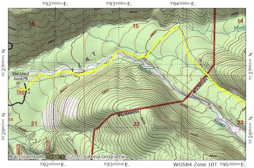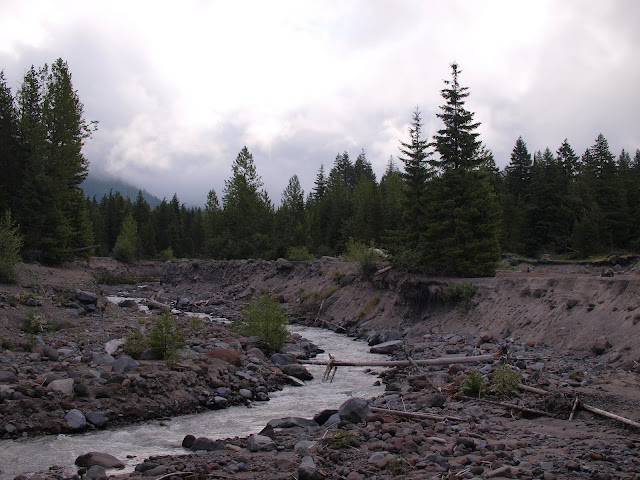
then followed the path (Tr 770), previously trod by thousands, over the Sandy River bridge (well, one of them at least),
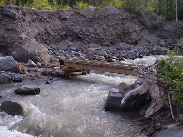
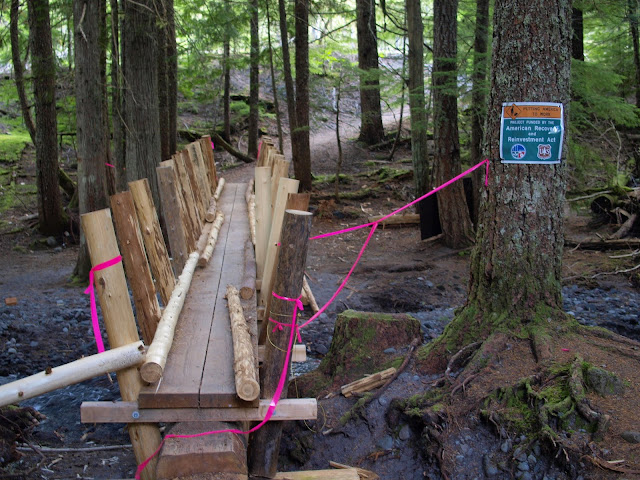
then the PCT across the “Stimulus Bridge” (still under construction),
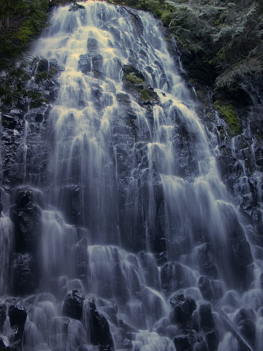
then Tr 797 past Ramona Falls (which I had to myself at this early hour on a weekday),
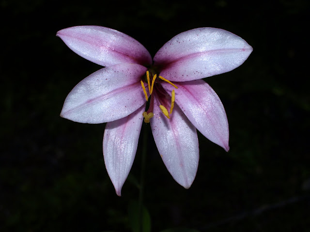
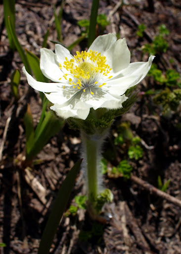
then Tr 600 (toward Muddy Fork) past a few late blooming flowers,
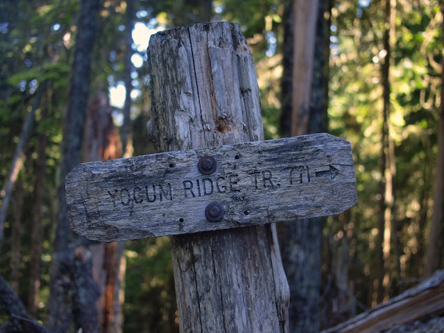
to the Yocum Ridge trail (771).
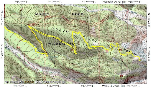
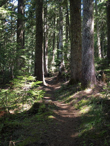
The gentle grade of this trail, and its good condition (only a few old blow downs to clamber over or around), made it a real pleasure to hike. Of course, by this time, the clouds had burned off and it had become the most bluebird of bluebird days, while only made the hiking experience that much better.
At about 5100’, the trail hooks around a little unnamed tarn lake set on a bench in the ridge. This was the only time on the entire hike where I encountered any flying insects and then not very many.
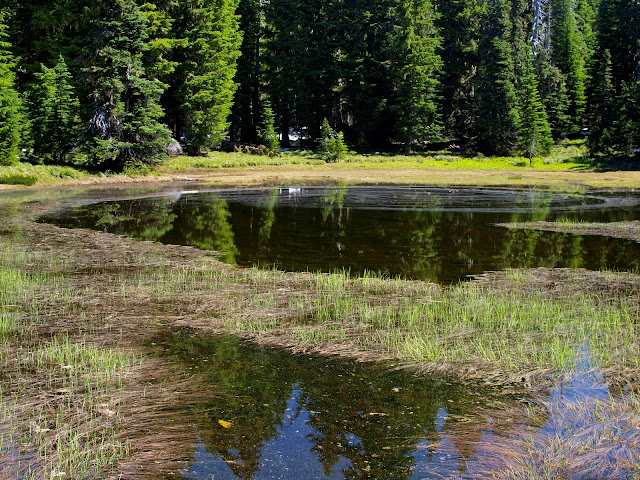
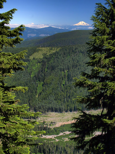
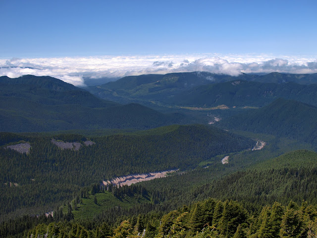
The trail up to this point runs entirely within the forest, with no particularly good views. Just past the lake, I got a “teaser” view of the Muddy Fork drainage, with Rainier and Adams in the distance.
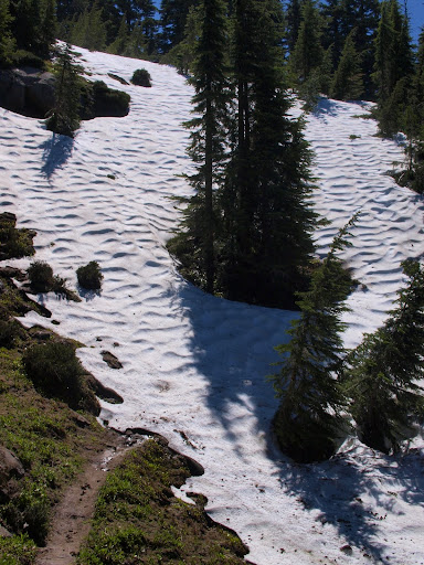
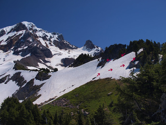
At about 5700’, as the trail begins a long gentle climb to the SE, it starts getting obscured by remnant snow chutes. There’s no significant snow on the trail up to this point.
Here it seemed easier to just head directly upslope following the snow chutes. Soon I reached the ridge crest to find a small patch of pasque flowers (which are supposed to bloom in early spring!),
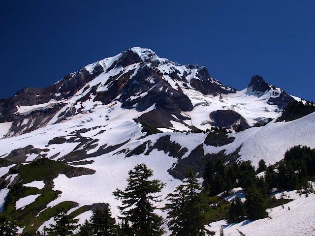
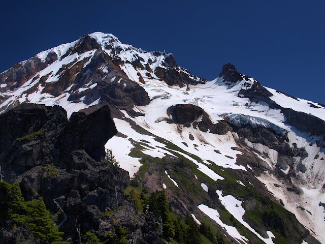
and a nearly overwhelming view of Mt. Hood.
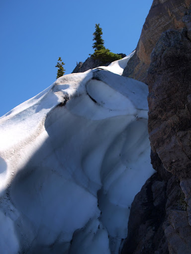
The trail – much diminished but still visible – officially ends just below 6200’ but I really wanted to reach the ridge top at around 6400’. So after some snow climbing (arrows),
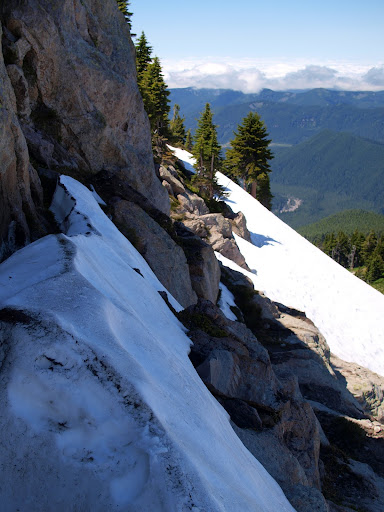
and a traverse of a ledge system,
I got head-walled by a snow pile that my common sense detector (yes, it had finally gone off) said was probably not a good idea to try climbing solo without an ice axe. It’ll probably be 1-2 weeks before enough snow melts off to allow snow-free access to the upper ridge.
I thought about going down and trying to circle farther left but, as it was already past lunch, I contented myself with a lunch perch on the ridge that provided views to the E, including Reid Glacier and Illumination Rock,
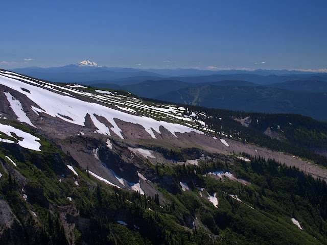
Mt. Jefferson,
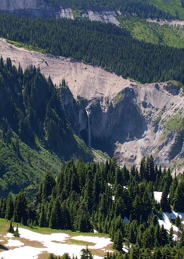
a large waterfall on the upper Sandy River,
and the Sandy River itself, with a cloud covered Portland in the distance.
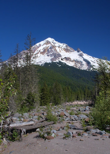
I was tempted to just sit on the ridge enjoying the sun and the views indefinitely, but appropriate adult beverages were waiting at home, so I reluctantly started back. I passed only about a dozen people the whole day – and only 1 of those on Tr 771 – which might be a record low for the Ramona Falls TH. Just before crossing the Sandy, I got a last view of Hood and could see where I’d been perched on Yocum Ridge (arrow).
In my opinion, this is one of the great hikes in the Portland area. I was lucky to be able to do it on a weekday when there were fewer people filling the TH parking and the trail to the Falls. Will definitely have to do this again once there’s snow-free access to the upper ridge. 17 mi RT, 3700’ gain.