Cast Creek / Horseshoe Ridge Loop 30-July-2010

This forum is used to share your experiences out on the trails.
Post Reply
User avatar
VanMarmot
Posts: 1924
Joined: May 28th, 2008, 10:03 pm
Contact:

Cast Creek / Horseshoe Ridge Loop 30-July-2010

Post by VanMarmot » July 31st, 2010, 7:00 am

Yesterday’s effort was a loop hike up the Cast Creek Trail (#773) and down the Horseshoe Ridge Trail (#774), with visits to East ZigZag Mountain and Cast Lake enroute. The TH for #773 is about a ½-mile past Riley Campground – very visible but unsigned at the start - there’s not much in the way of signage until you get to the top of the ridge.

Image

The trail is designed for horses (none were seen) so it’s wide, with a gentle slope that made 1800’ of climbing seem easy. There was also a youth group doing maintenance of the trail so it was completely free of any obstacles.

Image

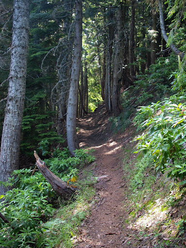
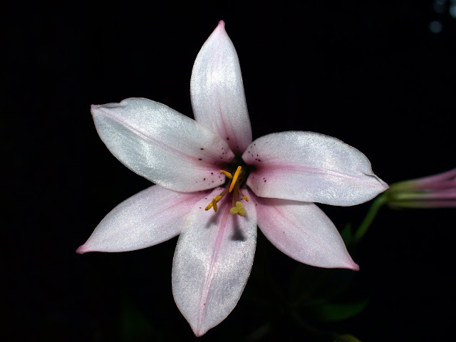
Most of the trail is under canopy, so there were only a few flowers showing in the understory.

Image

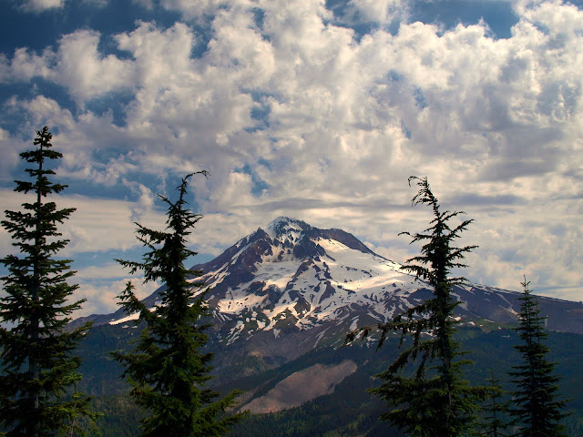
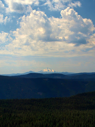
Shortly before the junction with the ZigZag Mounatin trail, I came out of the forest and got the first of many iconic views of Hood. I then headed up to East ZigZag for more views of Hood and a long view of Jefferson.

Image

Image

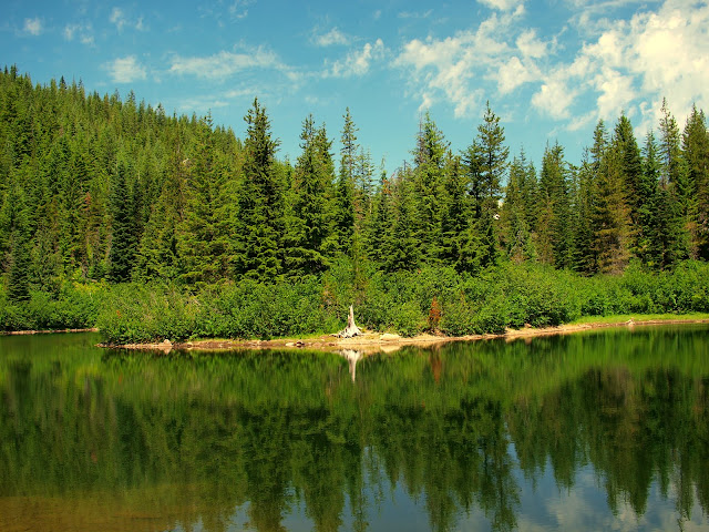
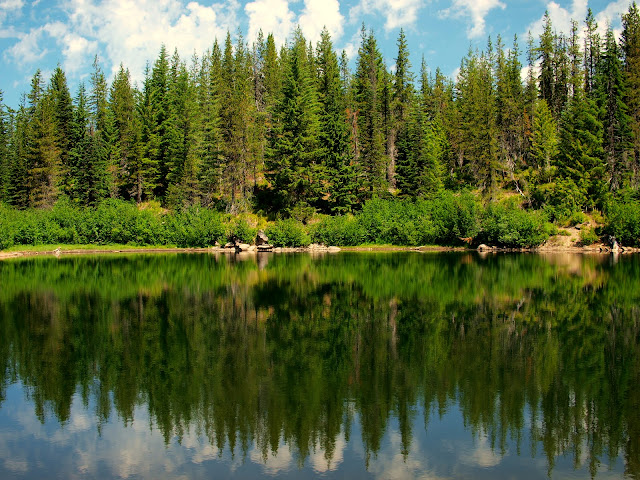
Then it was back down and over to Cast Lake where I ran into the first significant mosquitoes of the day – not clouds of them, just pesky.

Image

Image

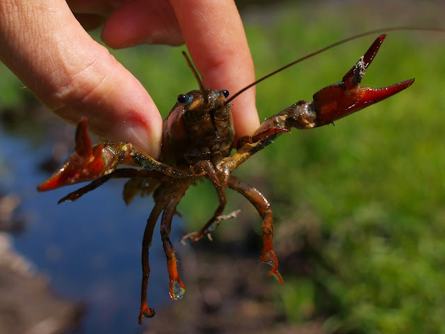
Heading back to the ZigZag trail, I crossed a small inlet to the lake and some movement caught my eye. Crayfish (“mud bugs”) are supposedly common but I didn’t expect to actually see one,

Image

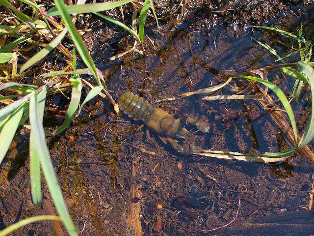
or go hand to pincher with it (yes, this was a catch and release).

Image

After my wildlife encounter for the day, I continued on to Point 4877 (which should probably be West ZigZag Mountain but apparently isn’t) for yet another view of Hood.

Image

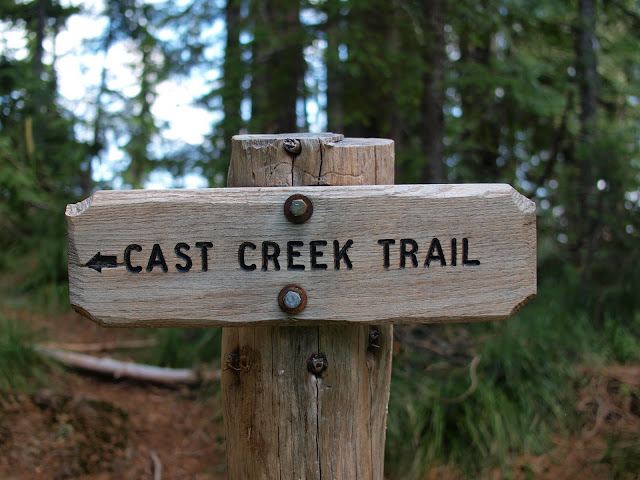
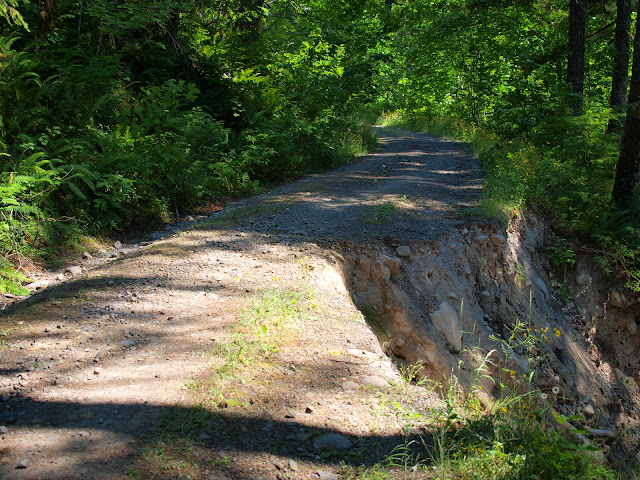
The Horseshoe Ridge Trail heads consistently downhill with a moderate, knee-sparing grade and generous switchbacks. At just short of 3 miles from the junction with the ZigZag trail, it crosses an old road (not shown on the Green Trails map) and then continues down to Road 380 (incorrectly shown on the Green Trails as Road 382). It was about a mile down Road 380 to my car. The road is damaged about 100 yards above the Cast Creek TH (signs say it’s washed out and closed) but folks were getting through by hugging the inside track (however, without some shoring-up before winter, it might really be impassable by next Spring).

Image

You can do this loop in either direction, but going Cast Creek > Horseshoe Ridge means your return to the TH is all downhill and there are no worries about a “washed out” road. This was a delightful loop hike – good trails, great views, wonderful weather – definitely recommended. The loop is about 14.5 miles with 3200' total gain.
Last edited by VanMarmot on August 2nd, 2010, 7:10 pm, edited 1 time in total.

User avatar
retired jerry
Posts: 14418
Joined: May 28th, 2008, 10:03 pm

Re: Cast Creek / Horseshoe Ridge Loop 30-July-2010

Post by retired jerry » July 31st, 2010, 7:40 am

Nice hike and report. I like it because there are fewer people, in my experience.

West Zigzag is a couple miles west of 4877.

4877 is an excellent viewpoint, and again, fewer people than other places on the Zigzag ridge.

I can't believe cars are getting by that washout :)

User avatar
VanMarmot
Posts: 1924
Joined: May 28th, 2008, 10:03 pm
Contact:

Re: Cast Creek / Horseshoe Ridge Loop 30-July-2010

Post by VanMarmot » July 31st, 2010, 5:20 pm

retired jerry wrote: I can't believe cars are getting by that washout :)
Two guts squeezed by in a Ford Ranger as I was hiking out. Any vehicle wider than that would have been a dicey proposition. Just a little more slumping and the road will be impassable to cars.

Barb Adams
Posts: 62
Joined: October 20th, 2008, 4:21 pm

Re: Cast Creek / Horseshoe Ridge Loop 30-July-2010

Post by Barb Adams » July 31st, 2010, 8:20 pm

Road 380 is on the decommission list for Zigzag Ranger District. Comments from users support its conversion to a trail.

barb

pdxgene
Posts: 5073
Joined: May 28th, 2008, 10:03 pm

Re: Cast Creek / Horseshoe Ridge Loop 30-July-2010

Post by pdxgene » July 31st, 2010, 9:18 pm

Does Road 380 ever lead to anything except those trailheads? It seems to stretch on for miles on a map. I walked up that way for a couple hours the year the bridge on 1825 was out to see if there were any good mountain views but never got far enough to see anything. I'm still wondering if there's anything to see?

User avatar
retired jerry
Posts: 14418
Joined: May 28th, 2008, 10:03 pm

Re: Cast Creek / Horseshoe Ridge Loop 30-July-2010

Post by retired jerry » July 31st, 2010, 9:56 pm

Keep walking up road 380 and it eventually connects to Horseshoe Ridge trail.

I've gone up Horseshoe Ridge trail from Riley, and then back down on road 380. Slightly different scenery, same distance. No views that I remember.

Post Reply