Laurance Lake Trail #632, July 3, 2010

Discussions and Trip Reports for off-trail adventures and rediscovering lost trails
pablo
Posts: 1451
Joined: May 28th, 2008, 10:03 pm

Laurance Lake Trail #632, July 3, 2010

Post by pablo » July 3rd, 2010, 10:44 pm

A big thanks to Tom, et. al., for reviving the abandoned segment of the Vista Ridge trail, I now more fully appreciate the effort that went into doing this work.

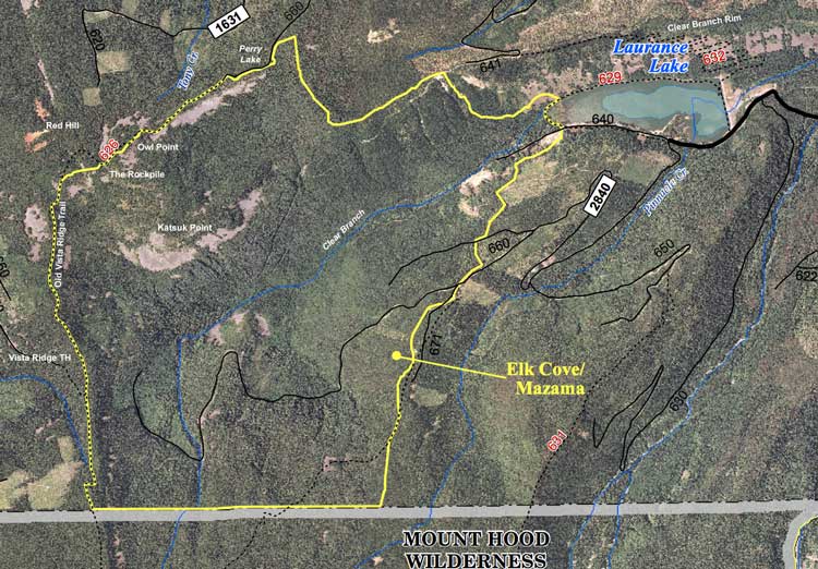
Tom posted some interesting images and information about a possible trail coming out of Laurance Lake dam and a couple of other images giving the trail as #632. I've not been able to locate anything on the MHNF site that describes this trail but I was able to locate a reference from a mountain biking site that mentioned this trail and one going to Red Hill.

The references are in an XLS spreadsheet here. The page this link is found resides here. This page looks dated but I found it interesting as it may explain some things I saw between the end of the #632 trail and Perry Lake.

Here's the two relevant lines from the spread sheet - raises some questions about how all this would work, I wonder what happened to all this proto-planning?
Red Hill 626 2 Laurance Lake Part of unfinished loop west of Laurance Lake
Laurance Lake Trail 632 2.0 Laurance Lake Bicyclists are working with FS on connecting this to #626.
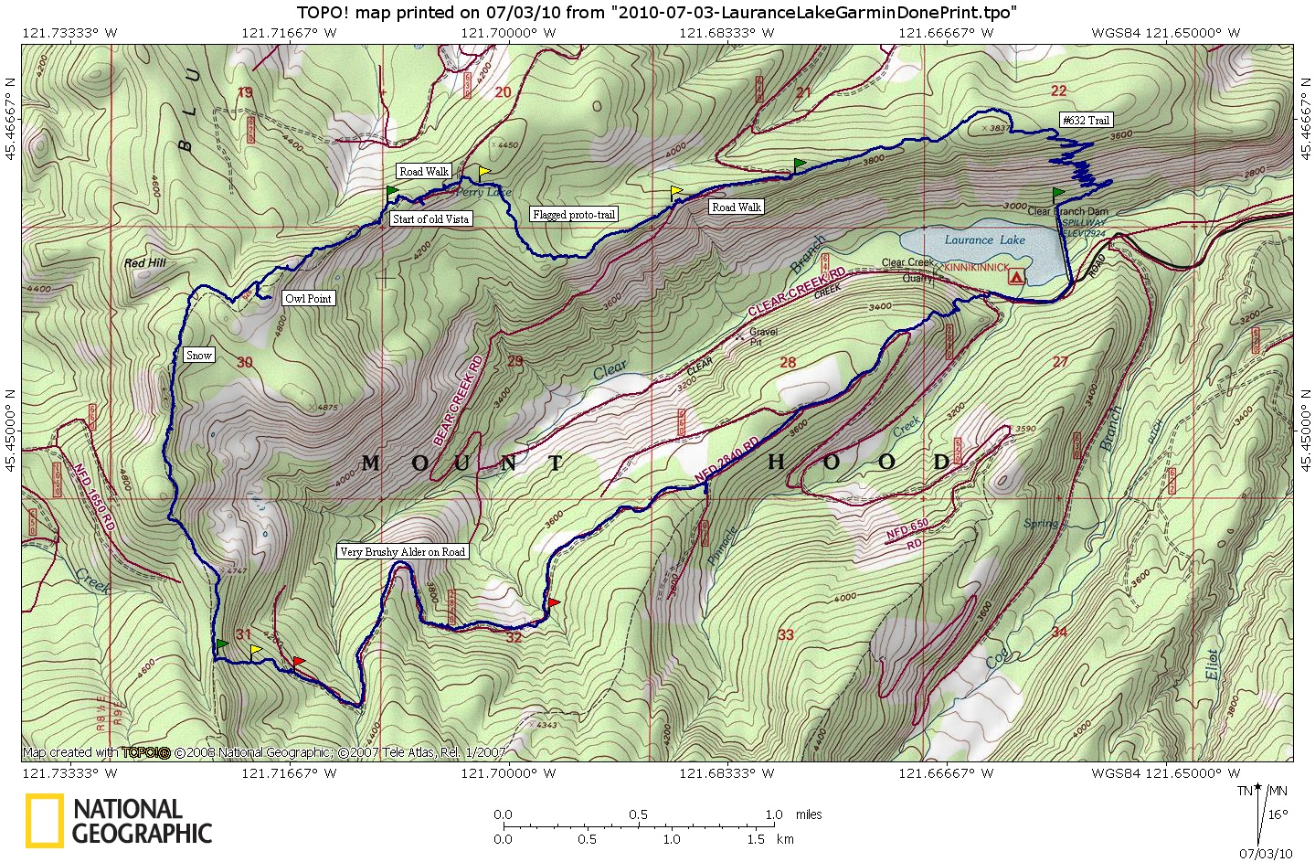
So I decided to do a big loop starting from Laurance Lake up the #632, if it existed, connect to Bear Creek Rd and follow it until it dropped into the canyon then bushwhack along the ridge to get to Perry Lake and the old Vista Ridge TH. From there off on to Tom's recovered trail segment, Owl Point, then up Vista Ridge to return on the Pinnacle Ridge Trail then back to Laurance Lake. At least that was the plan - I cut it short.

Directions to Laurance Lake can be easily found by using Google Maps, just punch in "Laurance Lake, OR" as your destination. The Kinnikinnick Campground is the name of the campground - I think it is a fee required place.

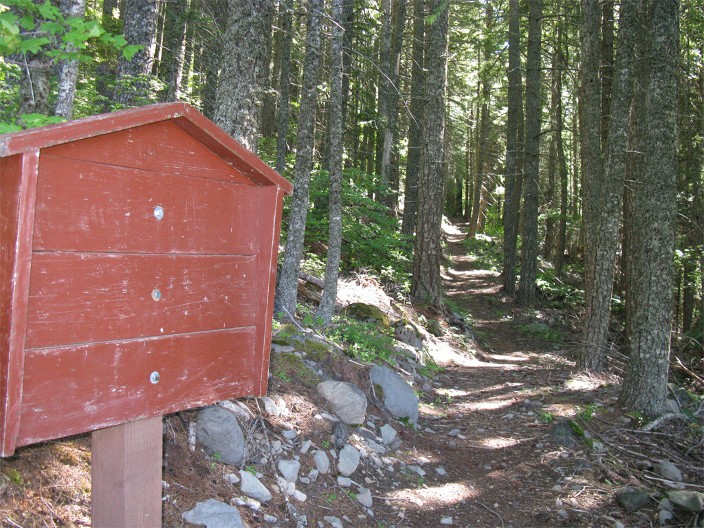
To get to the #632, park near the dam (or grab a camp site), don't block the locked gate at the dam, etc. and walk across the dam. The trail starts immediately on the other side. The #632 is Grade A Trail - obviously built to horse travel standards with a 3-4 foot bench and a very easy grade. Has an official looking board at the trailhead.

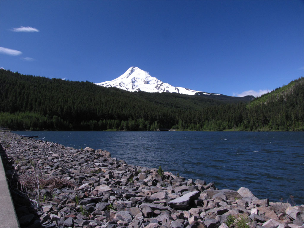
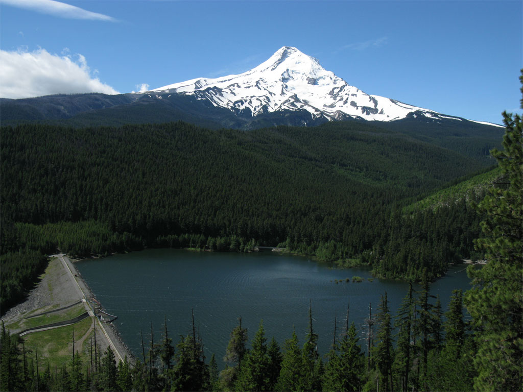
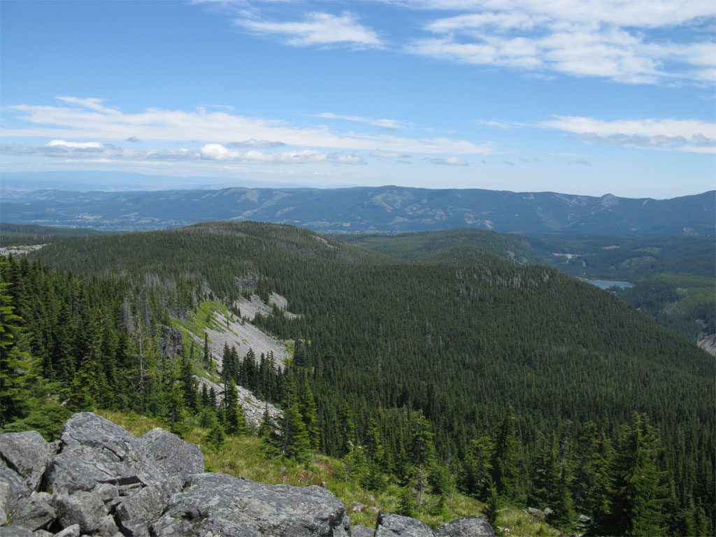
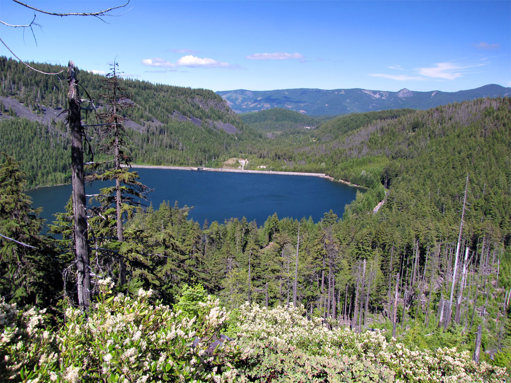
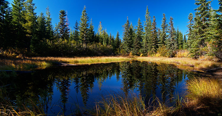
Here's the view from the dam, the light colored clearcut on the right is where I short-cutted the road walk on my return.

Image

Board at the trail head, not a lot of information posted.

Image

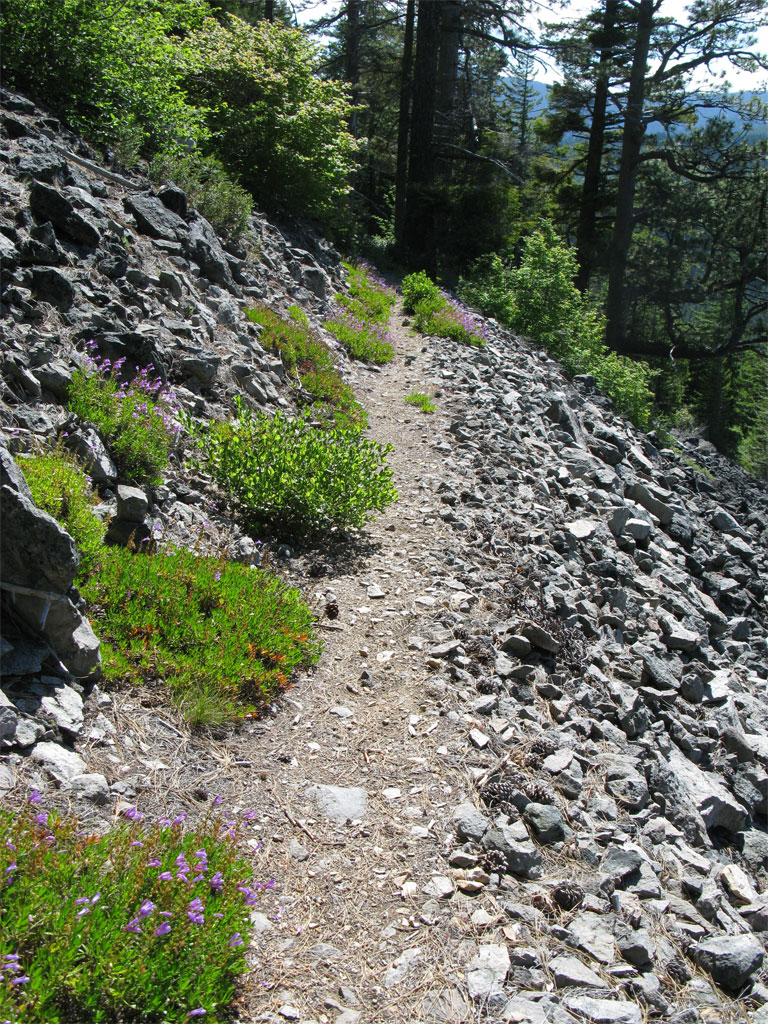
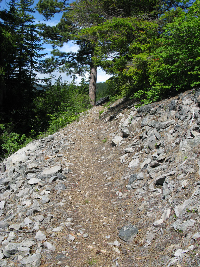
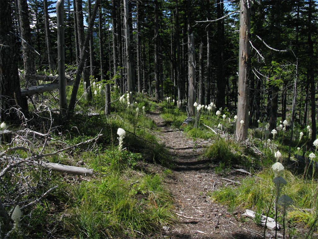
Trail is in excellent condition.

Image

Image

Great views from the side of the ridge:

Image

Once on the ridge, the trail passed through a partial cut full of blooming beargrass.

Image

It ended unceremoniously and unmarked except for a blazed tree at a berm on the Bear Creek Rd. I did not get the feeling this trail sees much use. I proceeded down Bear Creek Rd on the ridge until it dropped into the Clear Branch canyon where it is obviously decomissioned from that point on as it is washed out and covered with brush.

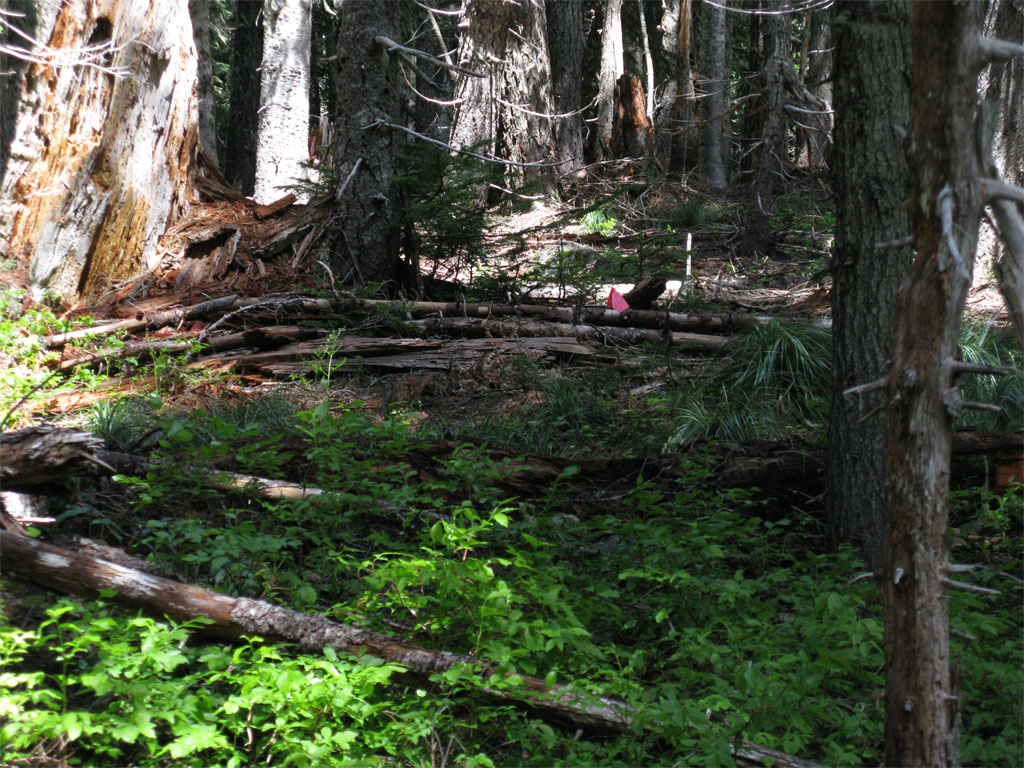
It was here I started to get a little nervous about the amount of brush I was going to have to deal with, it started out with young trees, manzanita, and other brush but about 100 feet into the bushwhack my fears were eliminated by what looks like a trail layout along a fire road that follows the ridge. Not that there is trail, just a ton of flagging and not just the ribbon type, the little flags on a wire - someone is/was planning a trail along the ridge through here (consult map below for details).

Flags and ribbon, people don't use flags for flagging unless they are laying out a trail - I claim.

Image

The flagging rolled on for almost all the way to the 1630 Rd where the guard station was located and Perry Lake. For some reason about .15 of a mile from the road, the flagging stopped - perhaps I missed a segment and I went one way to connect to the road and the trail planners went another.

I reached Perry Lake in time for lunch where I found that I was on the menu, in fact, I was the main course - mosquitoes swarmed and limited my picture taking of the lake to a couple of shots before I had to dash down the road to safety.

Image

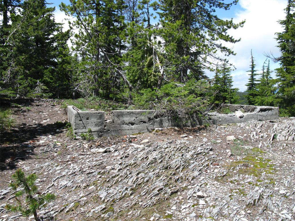
In Tom's post on this topic he mentioned the foundations of the guard station and lookout - not sure which is which:

Image

Image

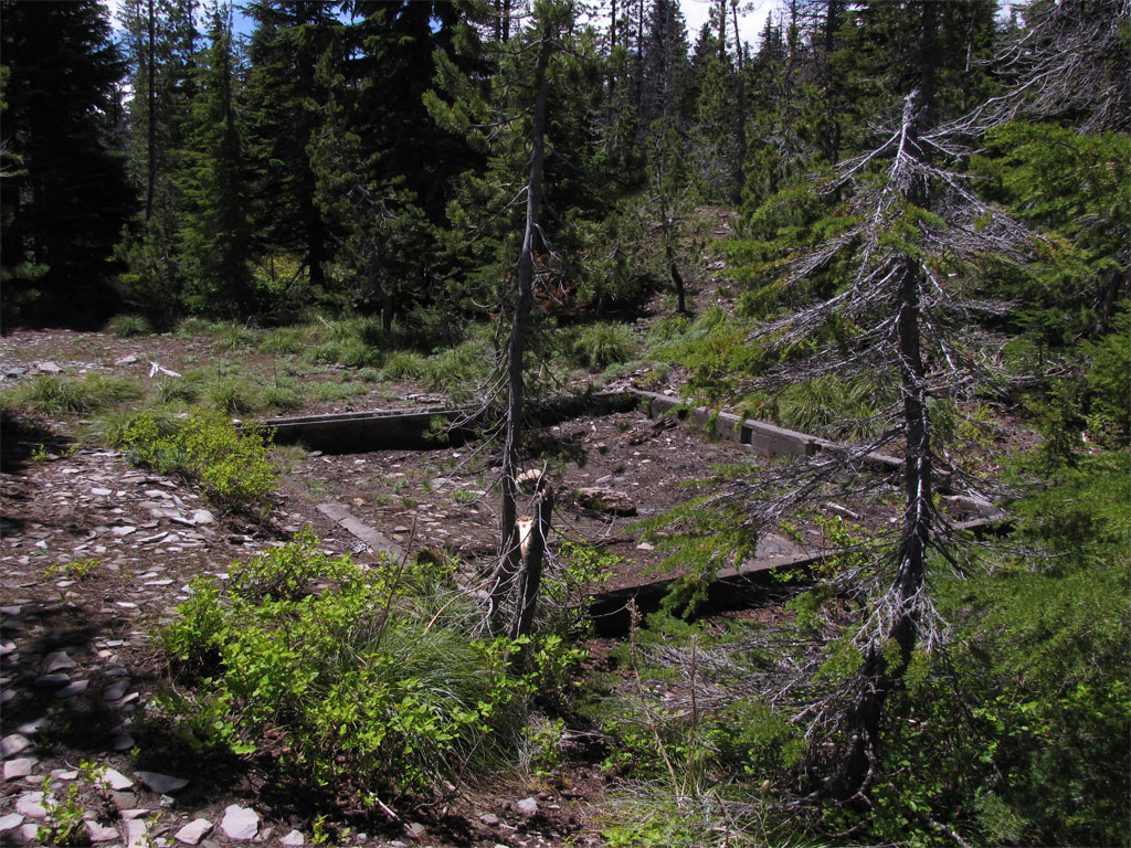
Just a few feet beyond the foundations is the old Vista Ridge Trail Head (I guess, first time there, correct me if I'm wrong). That's the road ending on the left and the trail headed off to the west.

Image

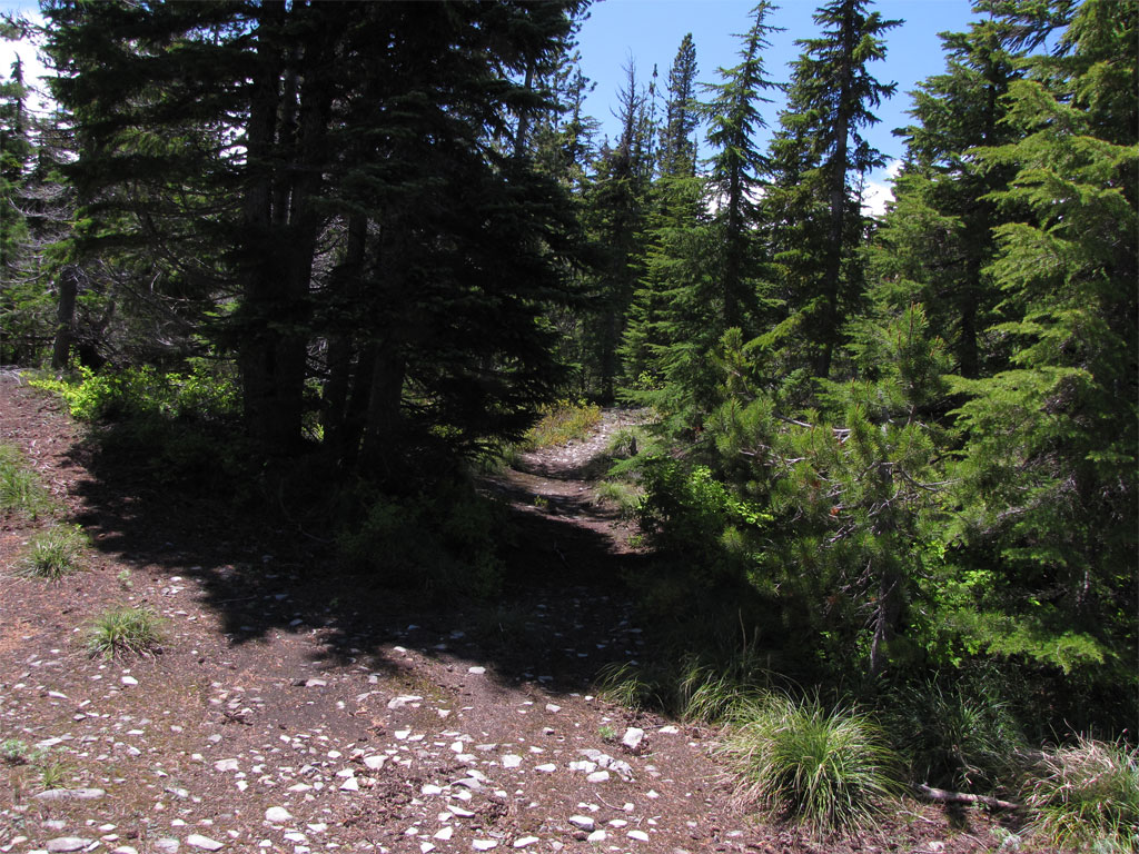
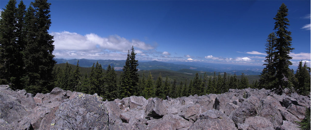
The trail is in great shape, the segment up to Owl Point had no snow and only a couple of small stems across the trail. There are a nice viewpoints along the way, one from a big boulder field opening to the north to a view of Adams and Defiance.

Image

I visited Owl Point and looked back on the ridge I'd just traveled with a bit of the lake in view.

Image

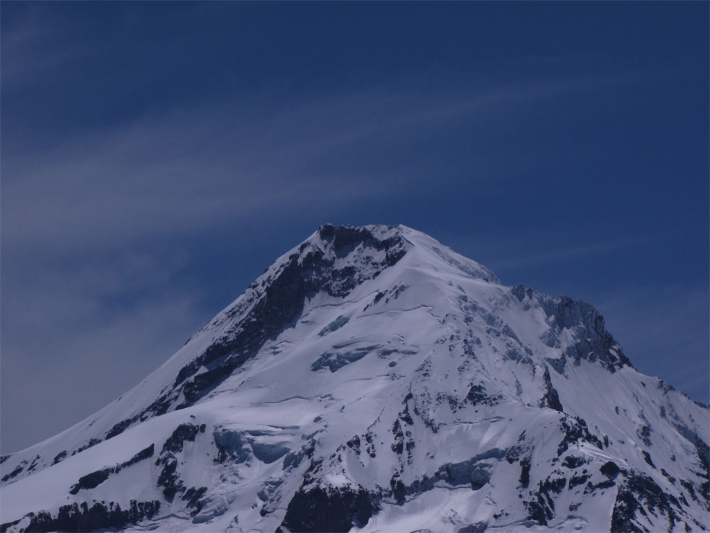
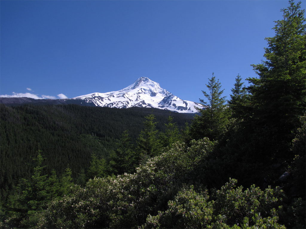
Great views of Hood.

Image

From here I made the cutoff to the Rockpile, but declined as all the picture taking had eaten up my margin of error. I ran into fairly solid snow from there on to just before the connection to the current Vista Ridge Trail. Pretty deep in spots and I had to pay attention to keep on trail. There were a few downed trees in the recovered segment, one that will require a bit of effort to clear but most can be done with a handsaw.

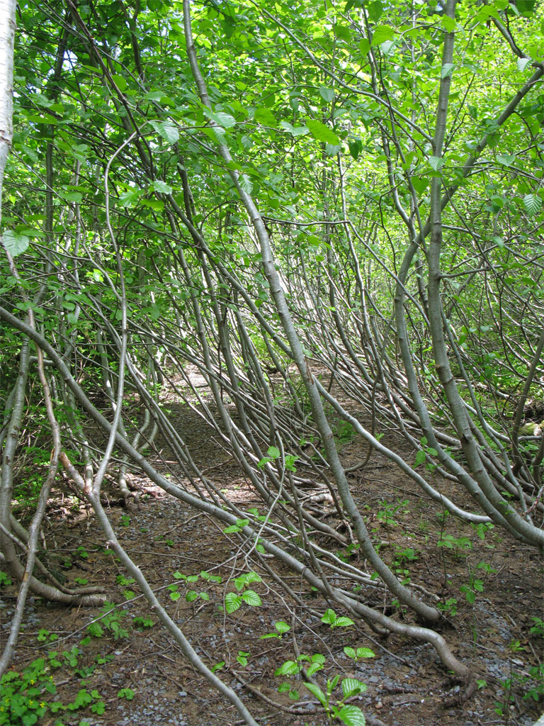
The plan was to go up Vista Ridge then cutover to return on the Pinnacle Ridge trail but from Thomas' recent report, it's all under snow so having never been on either I decided to cut it short by going up Vista Ridge a way then bushwhack down to the 2840 Rd and return. I do at times place a lot of faith in the accuracy of USGS maps and all too often have come away disappointed but this time the road was there but it has long since been abandoned to scrub alder. Yuck, toughest bushwhacking all day was for about a mile on this road.

Image

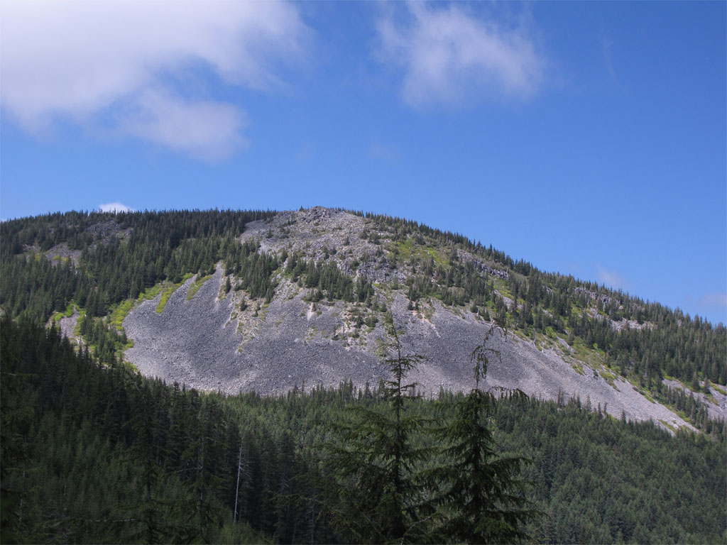
There were nice views in spots where the brush thinned - originally I thought this was Owl Point but now I think Owl Point is off to the left in this picture.

Image

I made it out of there and followed the road down to where I hopped off into a clearcut to return to the lake. The clearcut was filled with wonderfully fragrant ceanothus.

Image

One last look at the mountain.

Image

So 12-13 miles, 2300' cumulative elevation gain. Great day and I'm going to return to this later this summer when the snow is gone at all elevations to do the loop I originally planned except toss in a bicycle to return to the lake from the Pinnacle Ridge TH. Click on the image for the big print version. Green flags for easy travel, yellow flags for mild bushwhack, red flags mean misery.

Image
The future's uncertain and the end is always near.

User avatar
BrianEdwards
Posts: 2405
Joined: February 2nd, 2010, 1:32 am
Location: Oregon City, OR
Contact:

Re: Laurance Lake Trail #632, July 3, 2010

Post by BrianEdwards » July 4th, 2010, 4:06 am

Fantastic report, Pablo. #632 is in suprisingly nice shape. Even still has the trailhead sign standing. Had to have felt good finding all this, especially when you're expecting a bushwack and find a nice path, it makes the day soo much easier. We're blessed to have someone like Tom on this site, always tossing out neat projects like these for us eager beavers to go find! Again great report.
Clackamas River Waterfall Project - 95 Documented, 18 to go.

User avatar
Splintercat
Posts: 8334
Joined: May 28th, 2008, 10:03 pm
Location: Portland
Contact:

Re: Laurance Lake Trail #632, July 3, 2010

Post by Splintercat » July 4th, 2010, 9:35 am

Thanks, Paul - that's very exciting! Odd that it's not mentioned anywhere on the MHNF, but encouraging that you found reference to bikes. The mountain biking community has done an outstanding job of maintaining/reclaiming trails on the eastside, so that makes sense. The trail to the top of the rim looks GREAT, so I'll definitely be exploring that one, too. Neat!

The only catch is that the wilderness additions run right up to the Old Vista Ridge trail, so a loop like yours won't be possible for bikes (unless the Wilderness Act is amended). Since the Old Vista Ridge trail is still classified as unmaintained and off-system, it would be a good thing if the mountain bikers get this added in as part of their network. I just hope it's the mountain bikers, and not OHVers, however -- there are identical flags all over the east slope of Red Hill and north slope of Owl Point that mark "play" areas for OHVs. This idea seems to be dead, in part, thanks to the wilderness expansion and a lot of opposition from conservation groups.

Here's a small version of the expanded wilderness boundary, with my unofficial names attached to landmarks in the Owl Point area -- you were looking at the business end of Katsuk Point from below, and it looks like Owl Point might be peeking over the top:

Image

Here's a larger version of that map.

The most exciting part of this (for me) is a decent late fall access to Owl Point, when snows levels have dropped down low enough to make the Vista Ridge TH inaccessible. I'm dying to get up there after an early snowfall, and photograph the view off toward Hood!

Thanks, Paul!

Tom :)

User avatar
Splintercat
Posts: 8334
Joined: May 28th, 2008, 10:03 pm
Location: Portland
Contact:

Re: Laurance Lake Trail #632, July 3, 2010

Post by Splintercat » July 4th, 2010, 9:42 am

Oh, BTW -- that's the first decent GPS track that I've seen for the Owl Point area, though I take it you ran into snow beyond the Rockpile Junction (typical)? Do you know if you were substantially off the trail corridor in this area? The departure from the mapped trail makes sense near Owl Point, but the section at the little meadow below Red Hill surprises me a bit.

Tom

pablo
Posts: 1451
Joined: May 28th, 2008, 10:03 pm

Re: Laurance Lake Trail #632, July 3, 2010

Post by pablo » July 4th, 2010, 10:46 am

Splintercat wrote:Oh, BTW -- that's the first decent GPS track that I've seen for the Owl Point area, though I take it you ran into snow beyond the Rockpile Junction (typical)? Do you know if you were substantially off the trail corridor in this area? The departure from the mapped trail makes sense near Owl Point, but the section at the little meadow below Red Hill surprises me a bit.

Tom
I'm pretty sure I was on trail for the distance through here but then this is my first outing in the area. At the little meadow (some snow+water there) I wandered around a bit to find the trail at the other end but no more than 50-100 ft. GPS reception was good throughout the day, attached is a second opinion from my backup GPSr.
LauranceLakeTriton.JPG
Magellan Triton track
Here's the meadow.
Meadow.jpg
Meadow below Red Hill
On trail with a bunch of snow.
SnowTrail.jpg
Snow on the trail
The future's uncertain and the end is always near.

User avatar
Splintercat
Posts: 8334
Joined: May 28th, 2008, 10:03 pm
Location: Portland
Contact:

Re: Laurance Lake Trail #632, July 3, 2010

Post by Splintercat » July 4th, 2010, 6:50 pm

BTW, Paul - great photos! You must be using a new camera... lots more zoom range, if I'm not mistaken?

Okay, on the Red Hill Guard Station: according to Lookouts.com, the Red Hill site (at Perry Lake) had a "1930s: platform atop frame cabin." I have no idea where this information comes from, but lacking anything better from the USFS on the lookouts, gotta go with it. Therefore, I've always assumed the first (lower) foundation to be that of a garage or barn, and the upper foundation to be the guard station site. There are also some footings on a rock just off the trail, a few yards up from the end of the road that might have been a lookout structure, not sure. Lots of tidbits around in the trees, so I think this saw some fairly consistent use back in the day.

Most puzzling is the name of the guard station -- as far as I can tell, Red Hill, proper, never had a structure, though it would have been an obvious candidate for a lookout. The view is sweeping in the open directions, and if a tower were built above tree level, it would be a full 360 for miles. There is also a jeep road to the summit (unfortunately, since OHVs now use it to tear up the slopes). But for whatever reason, the Red Hill name was attached to the spot near Perry Lake, instead.

The lake, itself, is a bit of a puzzle -- it might just be the smallest named lake in Oregon, who knows? It rivals Dollar Lake for tiny-ness..! :lol: It's quite pretty in Autumn, though:

Image

By then, it's down a foot or so from the seasonal high. I suppose it was the main reason for the guard station & lookout -- water source (albeit buggy) near a ridgetop.

Tom

User avatar
jaimito
Posts: 850
Joined: May 28th, 2008, 10:03 pm
Location: Kenton
Contact:

Re: Laurance Lake Trail #632, July 3, 2010

Post by jaimito » July 6th, 2010, 7:58 am

Cool Pablo, That lower section of by the lake after Alki point has been an area that I want to do some work on this year, still a lot of tread and brush work that has to be done. Tom it is cool that the Old section is getting some press this year : )

Jamie

justpeachy
Posts: 3068
Joined: May 28th, 2008, 10:03 pm
Location: Portland, OR
Contact:

Re: Laurance Lake Trail #632, July 3, 2010

Post by justpeachy » July 6th, 2010, 9:50 am

Wow, that's quite a trek!
I reached Perry Lake in time for lunch where I found that I was on the menu, in fact, I was the main course.
Sounds like my trek to Observation Peak last year on the 4th of July. I was the main course for thousands of mosquitoes. Ugh.

User avatar
jeffstatt
Posts: 3820
Joined: May 28th, 2008, 10:03 pm
Location: Vancouver

Re: Laurance Lake Trail #632, July 3, 2010

Post by jeffstatt » July 6th, 2010, 10:10 am

Great report. I spent a lot of time reading it and examining your maps and photos. So glad you posted this. Now I'm going to go back and read everyone's responses!

pablo
Posts: 1451
Joined: May 28th, 2008, 10:03 pm

Re: Laurance Lake Trail #632, July 3, 2010

Post by pablo » July 6th, 2010, 8:07 pm

justpeachy wrote:Wow, that's quite a trek!
I reached Perry Lake in time for lunch where I found that I was on the menu, in fact, I was the main course.
Sounds like my trek to Observation Peak last year on the 4th of July. I was the main course for thousands of mosquitoes. Ugh.
My mosquito experience was a mild irritation where your experience was more like a medical emergency. I don't know how you survived. In case anyone has forgotten, here's a link.

--Paul
The future's uncertain and the end is always near.

Post Reply