This forum is used to share your experiences out on the trails.
-
VanMarmot
- Posts: 1924
- Joined: May 28th, 2008, 10:03 pm
-
Contact:
Post
by VanMarmot » May 8th, 2010, 7:35 am
The Rudolph Spur Trail, which has been described as the “steepest and hardest trek up to the Benson Plateau”, was first pioneered in the early 1900s by sheepherders anxious to get OFF the Plateau as quickly as possible. In and around WWI, it was further developed as a backpacking route by the Mazamas, who were seemingly anxious to get ON the Plateau as quickly as possible. The Mazamas have had a hand in maintaining this tread ever since. Don & Roberta Lowe, in their 1986 50 Hiking Trails, also credit John Carlson of Cascade Locks for keeping this old route alive. It’s not listed in most of the popular hiking guides for the Gorge (the 2008 edition of Afoot & Afield is the exception, as is Sullivan’s NW Oregon guide (where it rates only a back page mention)) and I first learned of it in detail from an article by Skip Smith in a 2008 Mazama Bulletin. Yesterday I finally had the chance to explore this new (for me) way up the Plateau, as well as test its “hardest hike” designation. I did a clockwise loop, starting from Eagle Creek (safer parking), ascending Rudolph Spur, and descending Ruckel Creek. I got an early start from Eagle Creek on what promised to be a bright, sunny day (this promise would be broken later in the day).
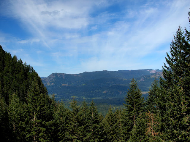
I had a good view of a snowless Table Mountain as I took the Gorge Trail (Tr 400) and then the PCT (Tr 2000) toward Cascade Locks.
The PCT crosses SW Moody, then goes under some BPA powerlines, before reaching Dry Creek Road about 3 miles from Eagle Creek. Just before Dry Creek Road (maybe 20’ before), a faint trail (marked with an old stick) goes off at a right angle (SW) from the PCT.
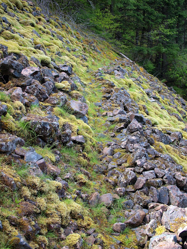
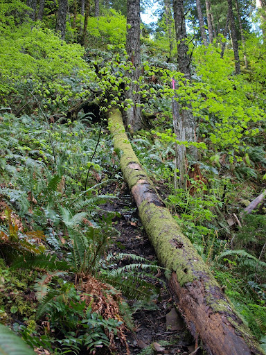
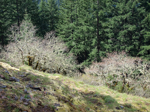
Although this use trail looks faint, it was fairly easy to follow for most of the way up to the Plateau. There were some sketchy sections right near the top – probably made even sketchier by a thin (2-4”) layer of wet snow – so some routefinding was required. From the PCT, the trail climbed somewhat gradually for about 1 mile up to a talus field at about 1600’,
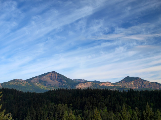
where there was a good view of Hamilton Mountain and Hardy Ridge.
So far so good, but things were about to change. Shortly after crossing the talus field, I came to a tree with notches cut in it for footholds – I used them as handholds.
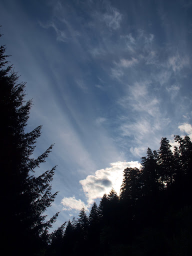
After negotiating the tree, and a little more (minimally exposed) climbing, I reached the crest of the Spur proper, with a nice view of a cloud-enveloped Adams to the NE.
From here, I would gain 2200’ in 0.8 mi to the top of the Plateau. Pretty much up, followed by yet more up, with very few sections that were not just steep.
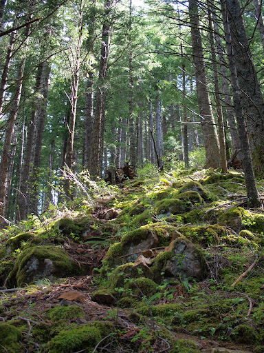
At about 2400’, I came to a meadow with some views – here the trail was less distinct but I easily picked it up again by drifting up and left to stay on the crest of the ridge. I didn’t know it at the time, but this meadow marks the end of the really steep part of the climb.
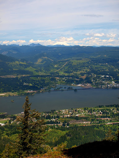
After yet more climbing, I came to another open area – this one reddish bare soil (what would be called a “bald” in Tennessee) – with a great view of Cascade Locks and St Helens.
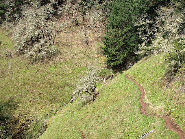
Then more climbing to a larger open area, where the trail veered off of the ridge to the left and began traversing. After almost 2 miles of narrow, sketchy use trail, it was a real surprise to encounter a section of trail that looks as good as the PCT 3000’ below.

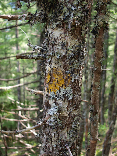
It’s in this area that I first saw one of the yellow square (now faded) blazes placed by the Mazamas.
This portion of the trail was pretty easy to follow but there was one place – at 3150’ – where I topped out on a mini-ridge and lost the trail briefly, but quickly regained it by climbing back to the ridge crest and up about 50’. At about 3400’, I encountered enough snow (2-4”) to partially cover the trail but it didn’t get all that much deeper from here to the edge of the Plateau at 3600’.

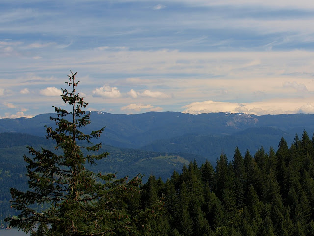
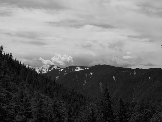
The trail was faint in this area and the snow cover, although thin, didn’t make it all that more apparent. Fortunately, there was some flagging tape (and some of the yellow blazes) in strategic locations to point me in the right direction. Failing that, I could have just headed true S for about 0.25 mi to intersect the Ruckel Creek trail. I knew that Ted had been up Ruckel Ridge on Wednesday, so it was no surprise to find the Creek trail nicely delineated with melting footprints. I headed down the trail to the open talus field at 3200’ for a quick lunch in the sun. There was no snow below 3200' on the Ruckel Creek trail, but off to the south I could see Tanner Butte, still covered by snow and being overshadowed by some suspicious clouds.
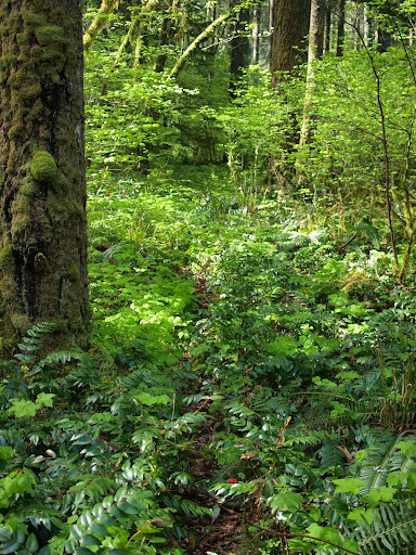
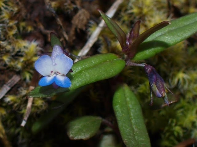
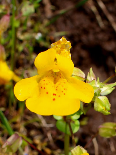
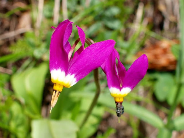
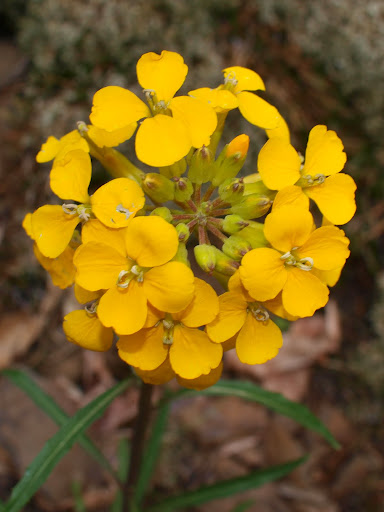
Soon the clouds rolled in, I lost my sunny lunch spot, and began to contemplate a possible thunderstorm. Fortunately, all I got was overcast for the return trip. I had hoped to find the hanging meadows along Ruckel Creek carpeted in flowers but that was not the case.
There were several different kinds of flowers out but no big areas thickly awash in flowery colors.
In 1986, the Lowes’ described Rudolph Spur as “...a bit harder than the classic Ruckle Ridge-Ruckle Creek loop but not as demanding as the Starvation Ridge-Mt. Defiance circuit.” They’re all a challenge, but I’d say that Rudolph Spur requires more continuous “up” than either Ruckel Ridge or Starvation Ridge. Take the start of the Ruckel Ridge trail where you first gain the crest of the ridge and extend that grade for a mile or take Starvation Ridge but leave out all of the little level sections between the TH and 3000’ and that’s Rudolph Spur. Needless to say, I wasn’t troubled by crowds. All told, 11 mi RT with about 4000’ of gain. A good workout and another great day hiking.
Last edited by
VanMarmot on February 22nd, 2018, 4:59 pm, edited 4 times in total.
-
Splintercat
- Posts: 8333
- Joined: May 28th, 2008, 10:03 pm
- Location: Portland
-
Contact:
Post
by Splintercat » May 8th, 2010, 8:36 am
Great report and photos -- flowers looking terrific up there! I like that shot of Tanner Butte, too -- nice perspective.
Tom

-
CherokeeDriver
- Posts: 228
- Joined: May 28th, 2008, 10:03 pm
Post
by CherokeeDriver » May 8th, 2010, 9:09 am
Thanks for the Trip Report -- very detailed! I'm looking forward to getting this one off of my hiking backlog.
-Robert
-
chameleon
- Posts: 1795
- Joined: May 28th, 2008, 10:03 pm
- Location: Oregon
-
Contact:
Post
by chameleon » May 8th, 2010, 12:32 pm
Very, very cool! Thank you for sharing the history as well as the adventure. I'll have to find some way to work it into my upcoming book. That is one trail I have not been on in the Gorge yet. Great description - I'm looking forward to giving it a try!!
-Zach
-
[email protected]
- Posts: 250
- Joined: May 28th, 2008, 10:03 pm
Post
by [email protected] » May 8th, 2010, 2:50 pm
Great trip report on a trail which should be done by many of us looking for something a little more off-trail and more challenging. Your photos are a great addition and, yes, the only place where one can get a little 'not-found' is right up at the ridge getting over and down to the Ruckel Creek trail but you had it pegged about just going south and you eventually find it. We were up on this on Wednesday and yes, the flowers are still coming on - nothing like what they should be in May. Great history but you know, I do wonder if sheep-herders were running up and down that trail. From that vantage at 2700ft and your great photo of Cascade Locks, you can see the Char-Burger so maybe they ran down to the local bar or re-supplied that way. Any way you look at it, it is fun but I think, not a great one for people to do solo since if something happen, no one would be coming along to help for a long time. Glad you made it safe and sound.
-
VanMarmot
- Posts: 1924
- Joined: May 28th, 2008, 10:03 pm
-
Contact:
Post
by VanMarmot » May 8th, 2010, 5:12 pm
[email protected] wrote:Great trip report on a trail which should be done by many of us looking for something a little more off-trail and more challenging. Your photos are a great addition and, yes, the only place where one can get a little 'not-found' is right up at the ridge getting over and down to the Ruckel Creek trail but you had it pegged about just going south and you eventually find it. We were up on this on Wednesday and yes, the flowers are still coming on - nothing like what they should be in May. Great history but you know, I do wonder if sheep-herders were running up and down that trail. From that vantage at 2700ft and your great photo of Cascade Locks, you can see the Char-Burger so maybe they ran down to the local bar or re-supplied that way. Any way you look at it, it is fun but I think, not a great one for people to do solo since if something happen, no one would be coming along to help for a long time. Glad you made it safe and sound.
According to the history I've found, the herders took the sheep up and down via what is today the PCT and used Rudolph Spur only for themselves. In the sheepherder days, the Plateau and surrounds had been swept by two major fires, so I suspect they could see a route down that was not obscured by too many trees or brush. I'm also guessing that their headlong plunge down to town was motivated by a wider selection of earthly pleasures than just the Char-Burger? But you're right, today I'd call it more of an "adventure hike" - so anyone doing it solo should be a little extra cautious, particularly when there is real snow up on the Plateau.


