I returned to the land of my birth and upbringing (Malawi) for a visit along with various members of my brother’s and sister’s families as well as my son, Jake (My wife declined the opportunity and stayed home). After everyone else had returned to the U.S., I was able to depart Blantyre, the city where I was born and raised, for the precipitous slopes of Mount Mulanje for five days of hiking/scrambling. It is worth noting that Malawi regularly finds itself listed among the 10 poorest countries on the planet, but it remains a very safe country to travel in, with a people whose friendliness more than compensates for the regular electricity blackouts and somewhat frayed infrastructure.
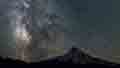
Mulanje, at 9,850 feet, is the highest mountain in Malawi, and the highest prominence in Africa between the East African volcanoes (Kilimanjaro, etc.) and South Africa’s Drakensberg. It is, in fact, one of the world’s largest inselbergs, a series of exposed plateaux and granite prominences, with over 50 climb-worthy peaks and Africa’s tallest climbing wall, the west face of Chambe, which rises about 5,500 feet above the Phalombe Plain. The massif is skirted by tea estates, tea being one of Malawi’s major export crops, with some descendants of the original Scottish owners still in residence.
I took a small minibus from Limbe, next to Blantyre, to Mulanje town for 1,000 Malawi Kwacha (about $1.30). It took about an hour and a half, and the bus, designed to hold 10 passengers, was conveying 19 human sardines at one point. In Mulanje, I hooked up with Stanford and Maxwell, two licensed guides, and hired them both, with Maxwell acting as cook/porter and Stanford as guide (The Malawi Department of Forestry requires guides in the forest reserve). The going rate is about $25/day. We rented bicycle taxis for MK100 to Chitakale, a junction town, and purchased food for the trip there. Then we took motorcycle taxis to Likhubula, where we signed in with the Forestry Department and paid for three nights in mountain huts at a whopping MK1000 per night (There are 10 huts on the mountain; the oldest was constructed in 1899). I spent the night in the Likhubula Hiker’s Nest, which offered great views to the granite cliffs above.
The next morning, bright and early, Stanford, Maxwell, and I began our hike up the Skyline Path. This route roughly parallels a cableway that was constructed by British colonials to convey timber down the mountain. The cable is no longer used, and the hike wound up through brachystegia (miombo) woodland to the Chambe Plateau, one of several grassy expanses on this vast mountain. On the plateau, it’s clear the hand of human interference is much evident. The British planted Mexican weeping pine here for its timber value, but also inadvertently seemed to have imported golden Himalayan raspberry, the devil’s club of the berry world. The mountain is home to one of the most aromatic trees in the world, Malawi’s national tree, the critically endangered Mulanje cedar (Whiddringtonia whytei) – like our “cedars” a member of the cypress family. At various points, I could smell it, but only where a poacher had illegally chopped one down and dismembered the remains to produce small logs for the woodcarving industry.
We arrived at Chambe Hut and had the rest of the afternoon to loll about and stare at Chambe’s south face, a mere 1,600 feet of sheer granite. Mulanje is a big draw on the African backpacker circuit, and soon a couple of young German women, two Englishmen, and an Irish national showed up. The hut caretakers hire porters to bring up a supply of beer, and the price was only double that of Blantyre supermarkets, so in the evening we eagerly contributed to the caretaker’s meager income.
Early the next morning, Stanford and I embarked on the conquest of Chambe, one of the more difficult peaks on the Mulanje. We tackled the crest of Chambe’s fin from the east end, and soon found ourselves clambering up cracks in what is one continuous, very steep granite face. We passed from the plateau to slopes dotted with otherworldly aloes and vellozias. Views began to open up to other peaks on the eastern side of Mulanje, including the three “sisters” of Nandalanda, Khuto, and Dzole. Eventually swinging to the north face, we scrambled up to the summit. Views were not spectacular as it was the dry season. Much dust hung in the air, bush fires – some set by hunters – were at their peak, and most Malawian villagers still use wood fires for cooking. A brown smog layer rendered the Phalombe Plain below barely visible.
Stanford and I returned to Chambe Hut, took a lunch break, and then, with Maxwell, spent the afternoon hiking to Chisepo Hut. We followed a route up off the Chambe Plateau and along a ridge known as the Knife Edge, passing through native cloud forest crashing with blue monkeys. The steep walls of the Thuchila Valley bisected the massif to the north. Then we rose over a pass for the final descent to Chisepo, here getting a view to Nakodzwe, the second highest peak on the mountain.
The Mulanje Massif, along with its sister massif in Mozambique, Namuli, is host to several endemic species of plants. I was fortunate to encounter some of these as I hiked around. (Run your cursor over the pictures to see the IDs):
Chisepo is the staging ground for Sapitwa, the highest peak on Mulanje. It is also the highest hut on the mountain, and temperatures were close to freezing at night. The next morning, Stanford and I headed up the slopes, a steep scramble up domed granite, like Chambe, but then a lengthy exercise in clambering between, under, and over massive boulders. Gnarled hobbit copses of Mulanje’s other cypress, the more common Widdringtonia nodiflora, alternated with lichen-draped grottoes. Sapitwa means “Don’t go there”, and local lore narrates that the summit area is the hangout of spirits of nebulous intentions. We suffered no untoward conseqences, and duly returned to Chisepo Hut for a second night, this time with my toes bleating bitterly over the torture of steep granite descents.
My exit from the mountain took a different route as we headed down the Chapaluka Path which runs close to major mountain streams. Woodcutters danced passed us with loads of logs on their heads, and we passed several cool pools but held out until we reached 60-foot-deep Dziwe la Nkhalamba, the “pool for old men” – aptly named in my case – at the foot of Likhubula Falls. I took an extended swim in the freezing waters there and then, much refreshed, trotted on down to Likhubula for my last night at Mulanje before the return to Blantyre.
A hiking guide available online describes numerous routes on the mountain: Hiking Guide to Mount Mulanje
Mount Mulanje (Malawi): August 2019
Re: Mount Mulanje (Malawi): August 2019
Super cool TR, John. I didn't know you were born in Malawi! For the trekking there, do you need to bring or rent gear (like sleeping bags), or does lodging in the huts include a warm blanket or something? (In Nepal, the lodges around Annapurna all had comforters, so the sleeping bag I rented for that trek was unnecessary.) Africa is the last continent (aside from Antarctica) for me to visit, so maybe I will have to add Malawi to the list.
#pnw #bestlife #bitingflies #favoriteyellowcap #neverdispleased
Re: Mount Mulanje (Malawi): August 2019
What is provided is firewood and mattresses. Most huts have four foam mattresses. If you're the 5th person, you sleep on the hard floor! However, both Chisepo and Chambe had seven mattresses. Also, if Forest Service employees or Mulanje Mountain Club members are there, they have keys to the closet that has more mattresses as well as lots of blankets. They seem to be generous about sharing.
I brought my own sleeping bag and eating utensils, but rented cooking utensils. All of these things can be rented in Likhubula or Mulanje or just ask your guide to do it. I'm very glad I brought my own backpacking sleeping bag on the trip (I needed it also for a 10-day camping trip in Namibia). Those who rented sleeping bags locally froze to death at night! There are only a few Forestry employees on the massif itself (as well as itinerant hunters and woodcutters), no roads, no stores, no restaurants, no wifi!
The hut caretaker will heat water for a bucket bath. However, the mountain is losing its forests, and I chose to do a cold (very cold) wash each day rather than burn up more wood. Most huts are near a mountain spring, so you don't need to treat water.
Mulanje guides belong to a union, and the Forest Service office hires them out in turn. However, I had Stanford's information from a recommendation, which is also O.K. The guides are very fit and usually very knowledgeable. If you are alone, a single guide is sufficient if you are willing to carry and cook your own food.
Mulanje is one of the more affordable trekking experiences in Africa (if you can put out for the air fare, that is) although obviously not as revered in Instagram world as the crowded slopes of Kilimanjaro. April might be the optimal month to go: after the main rainy season and before winter drizzle, without the smog of the dry season, and everything will be quite lush. However, if it is actually raining, Forestry doesn't permit ascents of any peaks.
Re: Mount Mulanje (Malawi): August 2019
So how much have these mountains and paths changed since you first hiked them, presumably when young?
Re: Mount Mulanje (Malawi): August 2019
Wow. Stunning!
Some of those shots have so much prominence they could pass for Ariel shots!
Thanks for sharing!
Some of those shots have so much prominence they could pass for Ariel shots!
Thanks for sharing!
Re: Mount Mulanje (Malawi): August 2019
We left Malawi in 1975, when I was 18. I spent my teenage years in boarding school in another African country (Zimbabwe), and my parents weren't rugged outdoorsy people. We went to Mulanje and had picnics at the lower pools and waterfall, that's about it. That's why I felt the glaring omission had to be redressed on this trip.
In 1975, Malawi had a population of 5 million; now it's 18 1/2 million (despite the scourge of AIDS) with a median age of 16 1/2 years (5th lowest in the world). That about sums it up in terms of the effects on the environment. The plains around Mulanje are some of the most densely populated areas of the country. During the Mozambique Civil War (1977-1992), the area hosted the world's largest population of refugees. There have been recent flareups of that conflict.
Mulanje and its neighboring pluton, Mchese, are a Forest Reserve. The British colonials selectively logged the mountain for valuable Mulanje cedar and then planted Mexican weeping pine. The Mulanje Mountain Conservation Trust (MMCT) has overseen removal of the pine plantations in recent years, but the tree is still invasive. The pine removal aroused the ire of villagers, who saw the trees as an easy source of firewood. Attempts to restore the cedar have largely failed. Areas of native cloud forest are decreasing. Locals move in and out of the reserve with impunity and are, indeed, permitted to harvest dead timber, supposedly with a permit. However, I passed spots where critically endangered living cedars had been recently logged. Now there's a plan to mine for bauxite on one of the plateaus (The guides/porters association has protested strongly against this) although access would be a major challenge. In addition, the City of Blantyre, 65 km. away, is building a pipeline to tap the mountain for fresh water. Locals have attempted sabotage against that effort, which doesn't bode well for the bauxite mine (According to local lore, the mountain is home to numerous powerful spirits who would react with punishing force if these projects go ahead; a landslide on Mchese in 1991 killed 400-500 people and was seen as the spirits' reaction against illegal logging).
Despite all this, the mountain is still a beautiful place to be even though the plateaus are criss-crossed with Forestry fire breaks. You are usually hiking alone (with your guide), and there are a variety of natural environments. The MMCT seems to have secure funding, and there are numerous programs in place to reduce firewood needs and make for more efficient cooking practices.
Re: Mount Mulanje (Malawi): August 2019
Super report and super trip. I was happy to virtually get to the top of Muljanje with you. I had planned to go to Nyanga in the Zim at one point, but settled for a couple weeks in the Drak further south. Great pics and write up!
- Pick-a-Pika
- Posts: 34
- Joined: June 23rd, 2016, 7:14 pm
- Location: Upper Hood River Valley
Re: Mount Mulanje (Malawi): August 2019
Spectacular scenery and report. I'm surprised by the flowers. Vivid colors.
I just watched the film "The Boy Who Harnessed the Wind," and this post came to mind. Malawi is intriguing.
Re: Mount Mulanje (Malawi): August 2019
What the boy who harnessed the wind, William Kamkwamba, demonstrated was that local solutions often provide a better path to the future than the "sophisticated" technology of Western aid agencies since they take into account what's sustainable on the ground in a poor country as well as the local culture. There is a man in Mulanje who got rich by inventing a cooking apparatus that can serve large groups of people, helping to institute free meals for K-12 students in rural Zambia and Malawi at minimal cost.
-
- Posts: 194
- Joined: December 3rd, 2009, 3:19 pm
- Location: Goldendale
Re: Mount Mulanje (Malawi): August 2019
Super report bobcat. It's neat to see that one size fits all doesn't apply to great hikes or hiking terrain and what can be sighted during treks. Also great to be reminded that stewardship of our planet is something universal.