
Twice on this hike, we caught sight of two rockslide events cascading down from just below the summit. Photos of those later!
Edit: Title and references incorrectly attributed to avalanches now fixed in report, as per DRM clarifying the terms in the comments. All should be 'rockslide events,' or in some cases, 'lahars.'
The diagrams will still say avalanche, but just keep in mind that it should read 'lahar and rockslide areas.'
drm wrote: ↑August 30th, 2019, 9:06 amJust as a technical matter, an avalanche is a purely snow/ice event, so these recurring slides due to the degradation of the rock on Mt Adams are either rock slides, or if enough water and debris are mixed in, maybe a lahar. Lahars are most often caused by eruptions, but that isn't required. I think a lahar is defined by it's mixed contents: water, rocks, logs if low enough, etc - everything in it's path once it gets going.
Opening Photo:
(All names in "" are unofficial names that I just went with. I prefer going with names, rather than "the meadow at 3.5 miles in.")
Map of the hike:


Started out at the Crofton Ridge TH, walked up Road 8040 and the Morrison Creek Campground loop road, to meet up with the Shorthorn Trailhead. The campground loop road is high clearance ONLY!

The trail makes its way through an old burn from the 2012 Cascade Creek Fire, which burned much of the western and southern flanks of Mt Adams.

The forest floor is alive with life, though. Spent fireweed blossoms, grasses, and spent beargrass blossoms line the trail.

A few minor blowdowns, and constant views of Mt. Adams through the bleached white tree canopy.

Rocky in places

First major view of Mt. Adams, as you round the bend and pass through the small, unnamed "Shorthorn Meadow."

Shorthorn Meadow has a pretty stunning view. Clouds rolled over the mountain, revealing and hiding the summit.

After the meadow, the trail flattens out, passes by some surviving trees, and crosses (a tributary of?) Shorthorn Creek.

Fall is in the air, even in mid August this year. The air is crips, the grass is golden, and leaves are starting to turn color.

A chunk of an interesting mass of colorful rock, with many smaller rocks fused together (under pressure, formed under the summit, I believe). Then probably broke off in a rockslide event, and landed here. It may not look very solid, but it is! Whatever brought it down, it is no doubt because of how geologically active and unstable this face of Mt Adams is.
This section of trail is covered in all sorts of rocks that came down from higher on the summit. Various rocks of all different colors: red, orange, yellow, purple, grey, black, and white.


Deep channel here. Much of it carved out in the flooding events of 2006. The trail skirts the edge, then switchbacks up to the Round the Mountain Trail.

Mt Hood from the switchbacks.

At the junction with the RTM Trail, it was at this point that we saw the first of two rockslide events.

If hiking off-trail is not something you want to do, the view from the junction is fantastic and a worthy destination in and of itself.

Just as we got to the junction, it wasn't no more than a minute before the first rockfall happened.

Close-up. It happened over a long time–almost seeming as if it were happening in slow motion. It took at least 20-30 seconds to make it all the way down and start to clear up.
Not only was the rockfall impressive, but the views of the heavily-crevassed White Salmon Glacier hanging off of a ledge on Mt Adams were equally stunning.

To get to "Shorthorn Butte," we left the Round the Mountain Trail, and followed the top of ridgeline. At first, it was wooded, but soon opened up.

Open meadows along the ridge, below the summit of Point 6227.


Views of Mt Adams began to open up. It was here, on the summit, that we saw our second rockslide for the day. My camera was busy with a timelapse, though. Caught it on camera, but it looked practically the same as the earlier rockfall photos.
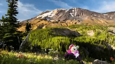
Animated GIF of the 2nd rockfall, every second in the time-lapse represents 10 seconds passed in real time.

For general reference only. (Edited into the trip report after it was submitted.)

Mount Adams at sunset, with pink alpenglow. While the view of Mt Adams is perhaps more photogenic from just below the summit, the view of the surrounding area, including the view to the west toward Mt St Helens, is far better from the actual summit.

Stayed at the summit until sunset, quickly retreated back down to the Shorthorn Creek crossing in twilight, then hiked back the rest of the way in the dark.

The most bizzare thing I've seen happen on Mt Adams occured on our way down, though. This creek was dry on the way up, only wet on the surface. I figured it was still wet from a recent thunderstorm or something. But instead, by 10
PM it was rushing and full.
On the map, it appears that it is a brand new re-routed channel of Morrison Creek, yet it felt odd that in both times hiking this trail before, I've never crossed any sort of running creek here (the other time was mid June). Morrison Creek, as far as I know, is a continuously running creek that both crosses the Round the Mountain Trail (I've seen it running there), and passes by Morrison Creek Campground. So, for it to just not be running on the surface across the Shorthorn Trail in all previous times I've hiked here, felt bizarre.

