What: Wallowas Super Loop
When: 8/1/19-8/2/19
Who: Just Me (Born2BBrad)
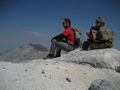
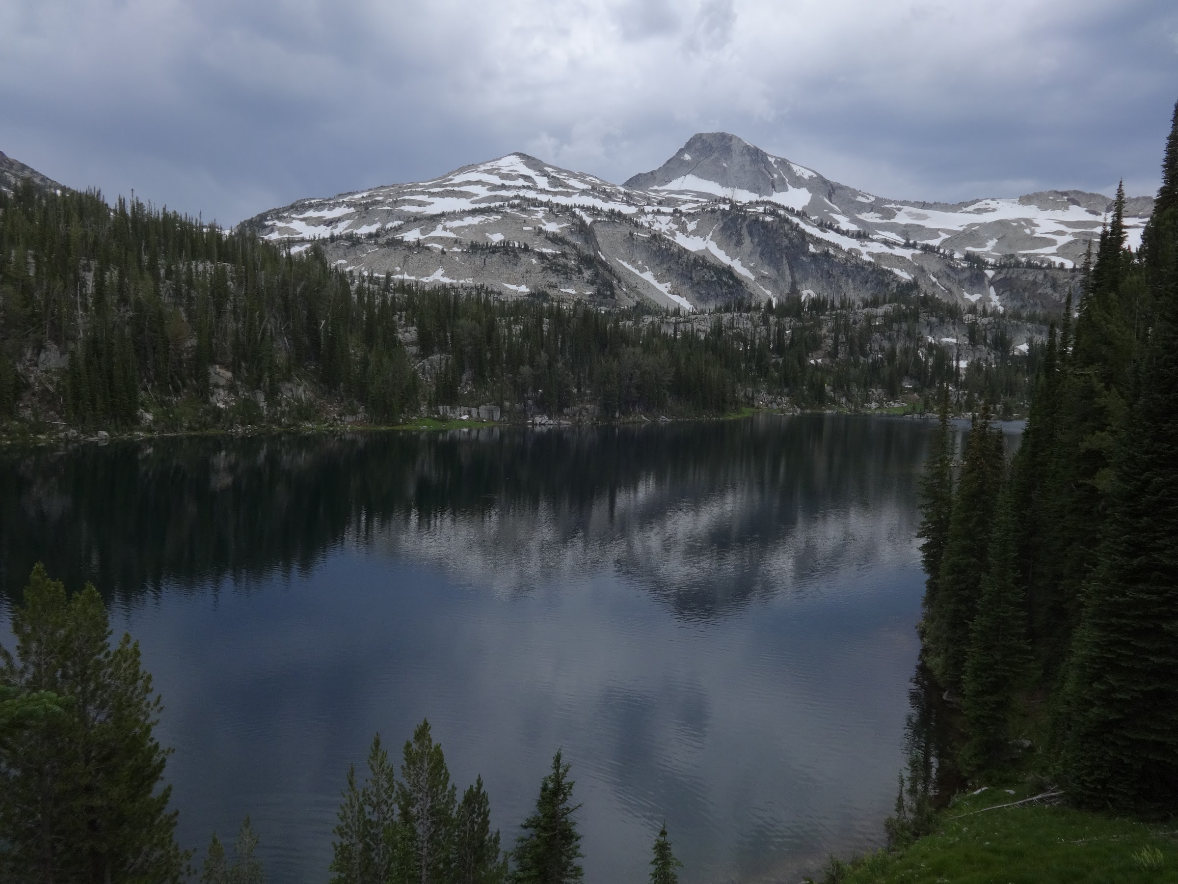
Opening picture, Petes Point from Dollar Lake:
-----------------------------------------------------------------------------------
General Information
Day 1
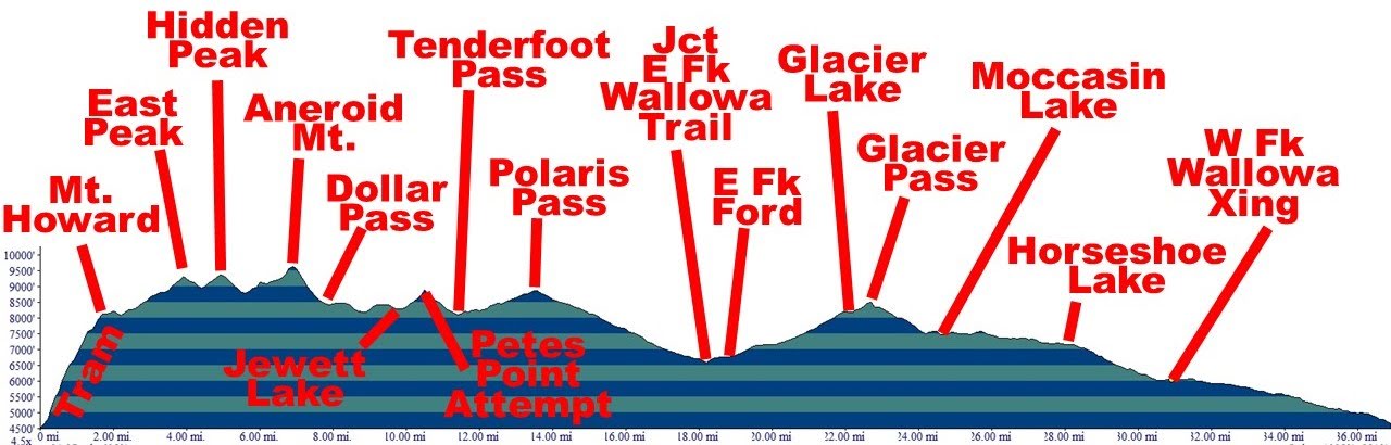
Route: Wallowa Lake tram (4415’-8150’), Mt. Howard (8255’), East Peak (9380’), Hidden Peak (9460’), Aneroid Mountain (9701’), Dollar Pass (8420’), Jewett Lake (8280’)
Miles: 10.9 (GPS unedited)
EG: 6872’ (GPS unedited)
People encountered on the route: 2 on Mt. Howard
Number of mosquito bites: 0
Day 2
Route: Jewett Lake (8280’), Petes Point (9675’) attempt, Tenderfoot Pass (8550’), Polaris Pass (8900’), Jct w/E. Fk Wallowa Tr (6550’), Ford E. Fk Wallowa (6900’), Glacier Lake (8166’), Glacier Pass (8500’), Moccasin Lake (7475’), Lakes Basin Tr to W. Fk Wallowa double crossing (6030’), W. Fk Wallowa Tr back to TH (4655’)
Miles: 29.4 (GPS unedited)
EG: 4284’ (GPS unedited)
People encountered from Jewett Lake to Glacier Lake: 4
People encountered on Lakes Basin Trail: Lots
Number of mosquito bites: 0 (I was too fast for them)
Number of RetiredJerry sightings: 0
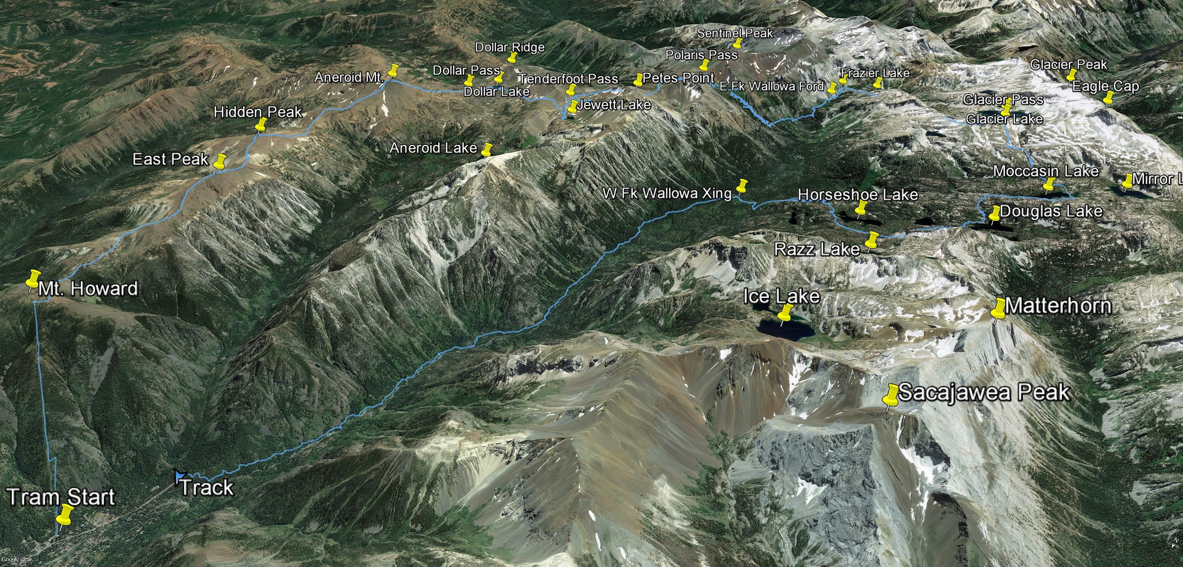
Google Earth overview:
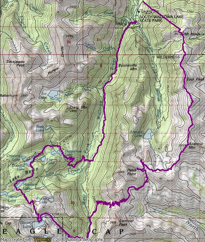
Topographical overview:
Elevation profile:
Google Earth video tour of trip (7:24 minutes):
https://youtu.be/M-UIWXTPgYM
Note: Some pictures used from my 2017 TR.
-----------------------------------------------------------------------------------
Preamble
In 2017 I did a trip to the Wallowas and did not accomplish all points on my itinerary. The time was right for another try.
Similar to the 2017 trip, a route was created utilizing the Wallowa Lake Tram to gain access to a high-elevation ridge. You can’t beat gaining 3700’ of elevation in 15 minutes.
Some interesting facts about the tram pulled from my 2017 TR:
• The tram takes passengers from 4450' in elevation to 8150', a gain of 3700'.
• When constructed in 1970, the tram was the steepest vertical lift in North America.
• The tram ride is fifteen minutes.
• Highest point off ground: 120 feet.
• Lowest point off ground: 3 feet.
• Cable length: 19,300 feet (nearly 4 miles long).
• There are 25 towers total.
• When the tram was built in 1970, the original master plan called for more lifts and a ski area.
As is becoming a habit, I drove to Wallowa Lake the evening before the day of the hike. The reason was twofold. One to maximize daylight hiking. The other to acclimatize at above 4000’ for 12 hours before the tram ride. Gaining too much elevation too quickly has caused problems before.
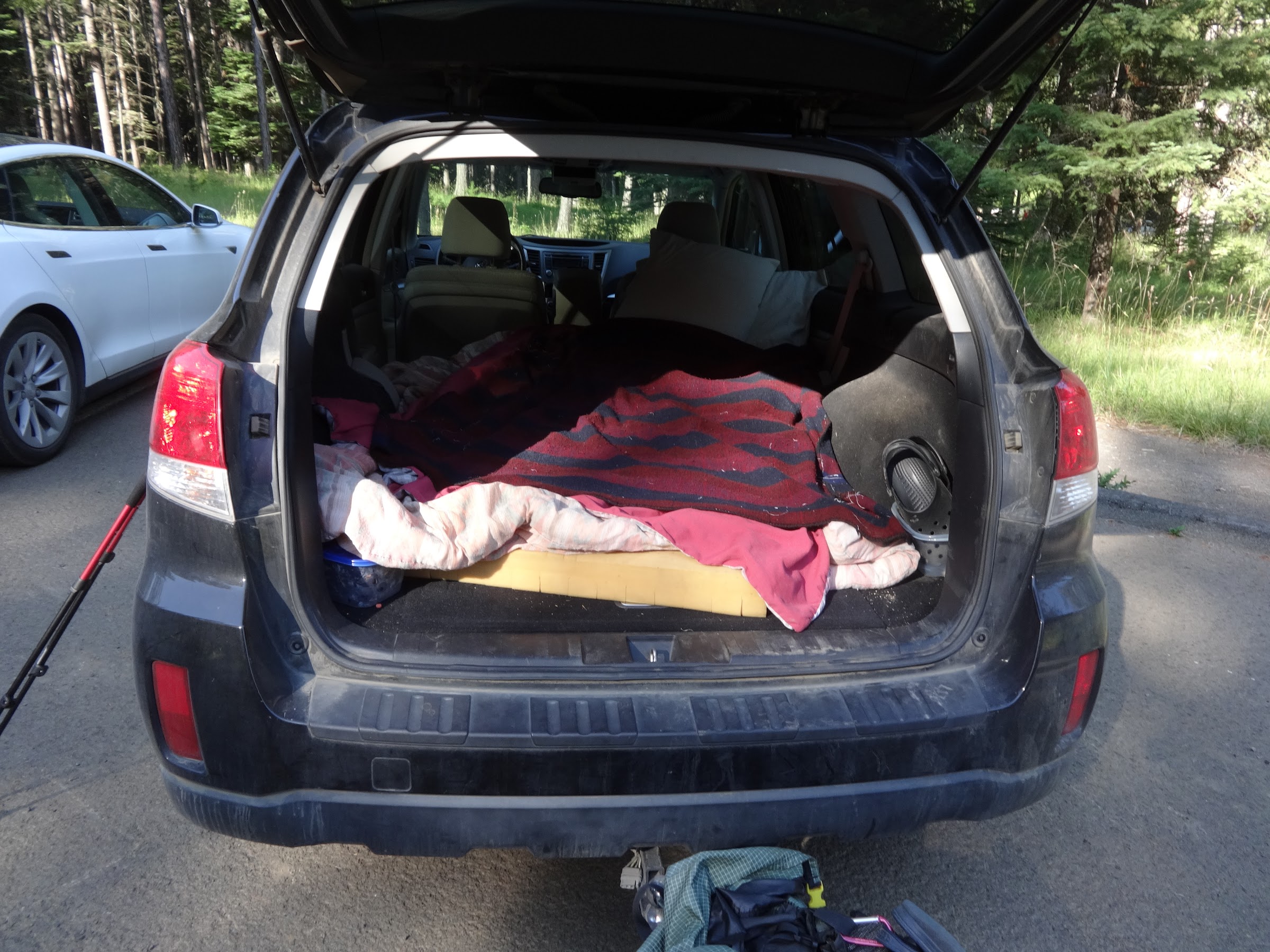
As was done on many of my trips, I slept in my car at the trailhead parking lot. It was very quiet and peaceful. Much better than the nearby mini-city at Wallowa Lake State Park.
Nothing beats Hotel Subaru:
The plan was to wake up in time to be at Wallowa Lake Lodge by 7AM for a power breakfast. That would give plenty of time to be ready for the opening 9AM tram ride.
----------------------------------------------------
Trip Narrative and Pictures
After paying $35.00 (a $2 increase), by 9:05AM I was on the tram up to Mt. Howard:
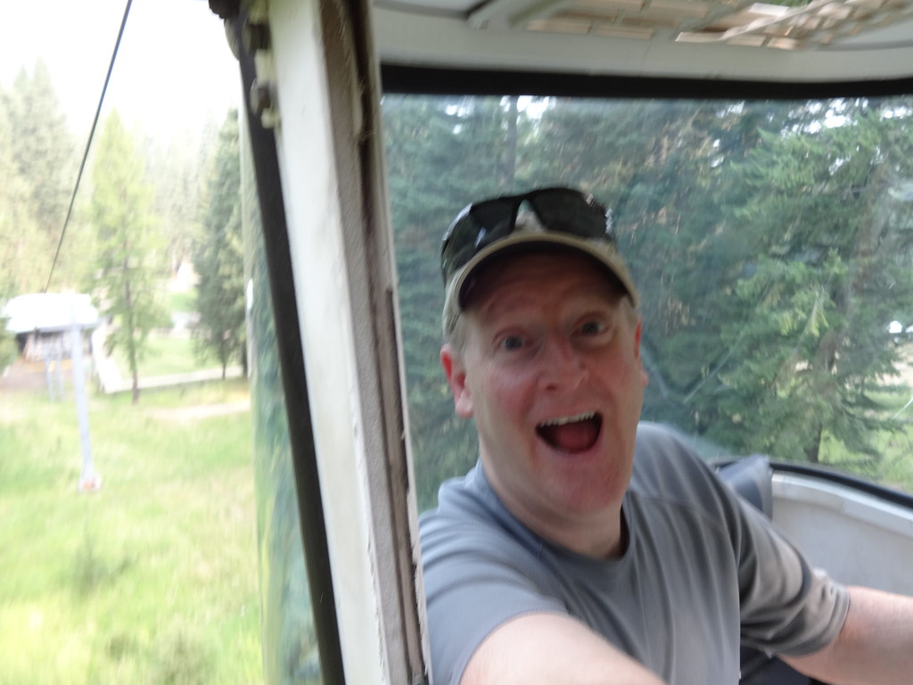
In case you were curious, the average speed of the tram ride is:
In addition to the Summit Grill, there are almost 2 miles of easy trails on Mt. Howard. The trail I was looking for departs from the main trail near Summit Overlook and heads towards East Peak. Google Earth and trail descriptions led me right to it.
East Peak (second peak from right) from Mt. Howard:

The trail from Mt. Howard to East Peak is a true trail. No bushwhacking or route finding.
The approach to East Peak:

There does come a point where the trail splits. Up to the right goes to East Peak. Down to the left skirts below East Peak and goes to Hidden Peak. It could be called East Peak Bypass Trail.
Where the trail splits:
The final ridge scramble is not too difficult. No climbing or hand holds are necessary.
Almost to the top of East Peak:
The scramble down the other side is about the same as coming up:
Cool natural cairn on the saddle between East Peak and Hidden Peak:
The climb up to Hidden Peak is pretty much the same as East Peak, only easier because there is not as much elevation gain from the saddle. Just stay near the ridgeline and pick your route accordingly.
Hidden Peak is not an officially named peak by USGS standards, but that is what is has come to be known. It’s interesting that it is higher than East Peak, yet East Peak is an official USGS name and is listed on government maps.
Summit cairn and register box on Hidden Peak:
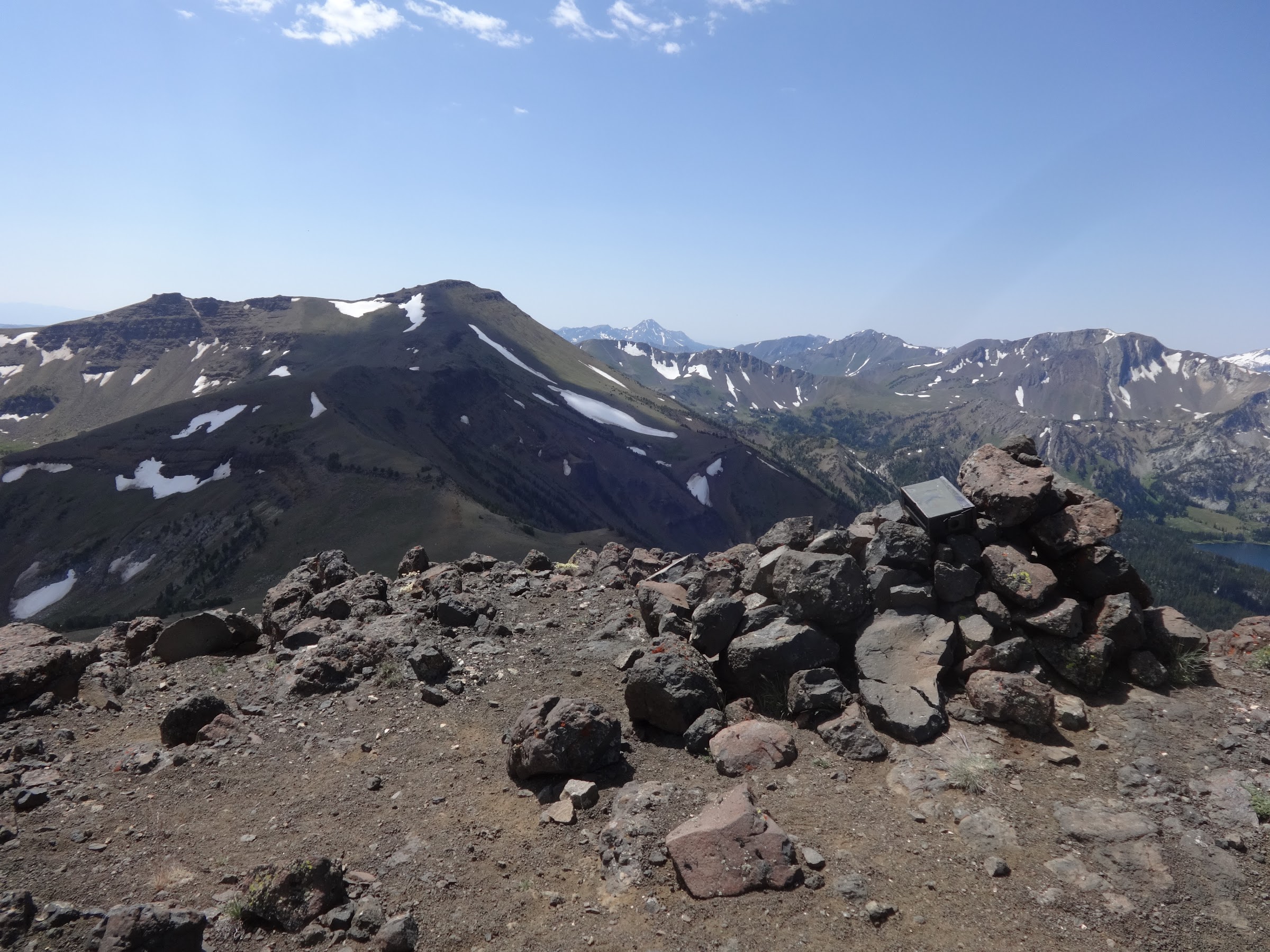
The scramble down Hidden Peak to the next saddle is similar to the scramble up. No climbing or hand holds necessary, but there is some loose rock scrambling. There is a discernable trail all the way to the saddle.
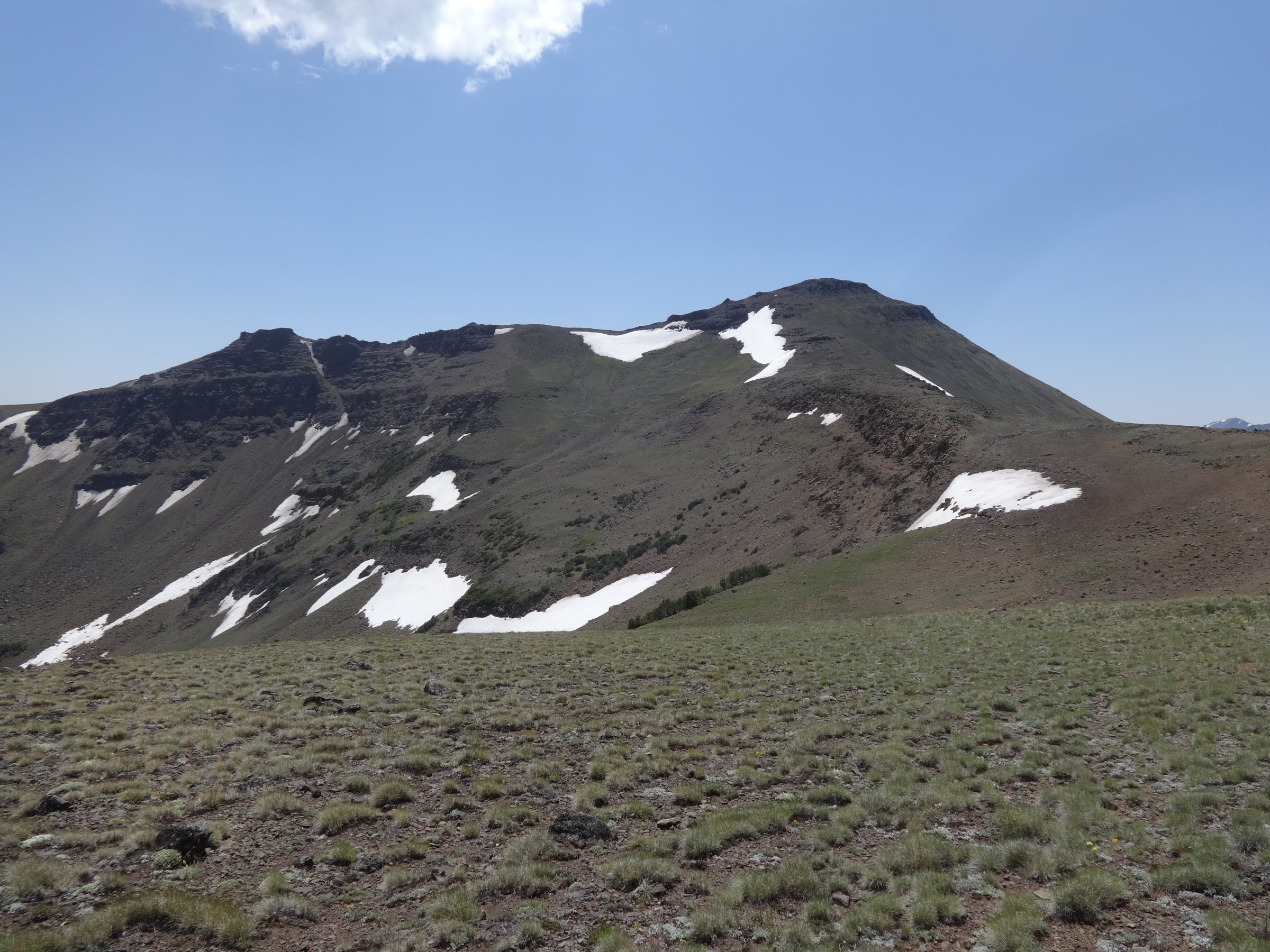
The climb up to Aneroid Mt. was the most difficult of all the peaks. It was the steepest, had the loosest footing and was at the highest elevation. It had the least defined trail, often times disappearing or braiding all over the place. Even so, no special skills or equipment is needed.
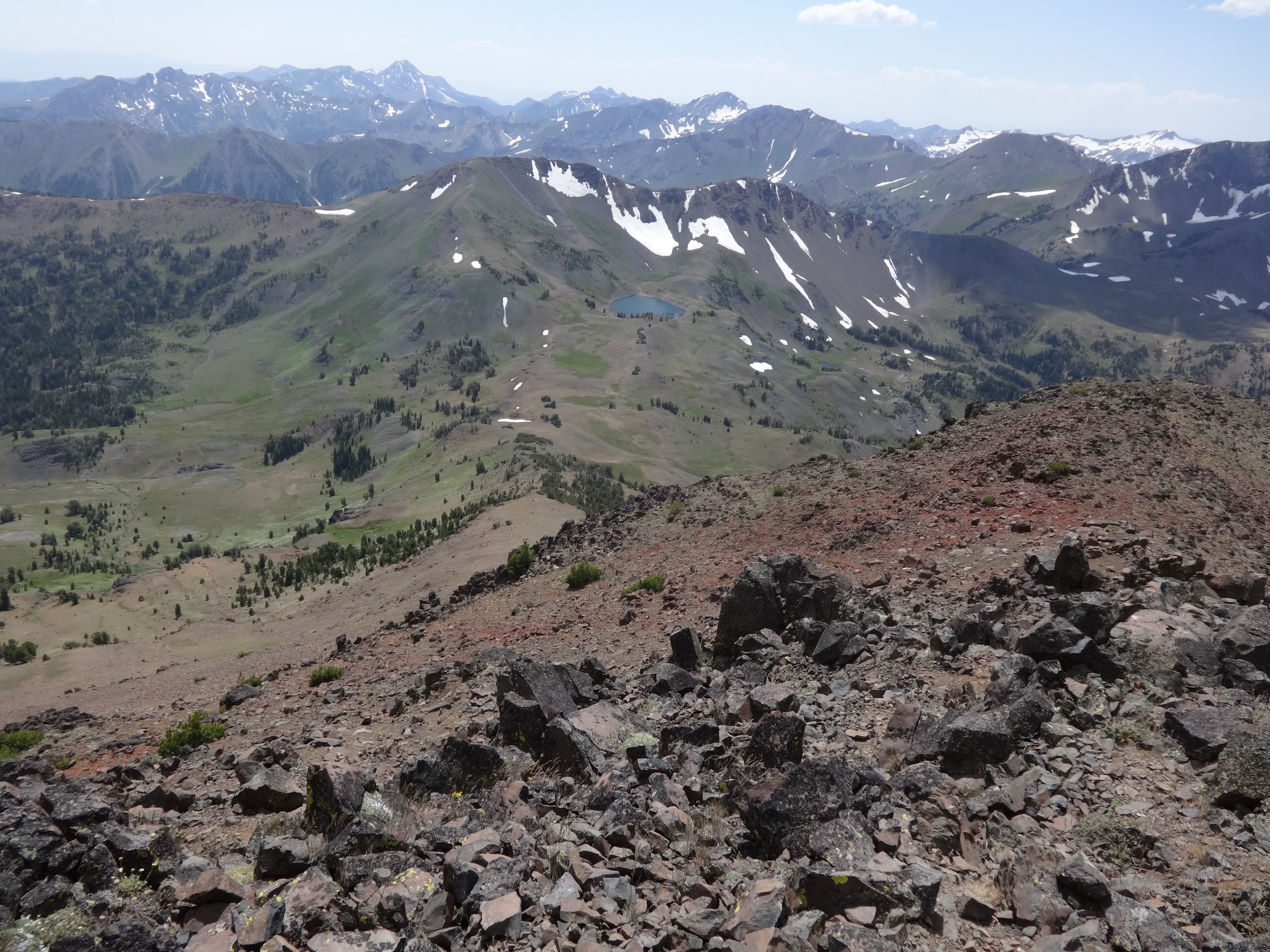
Aneroid Mt. from Hidden Peak:

Getting closer to the top:
Looking back at Hidden Peak (R) and East Peak (L):
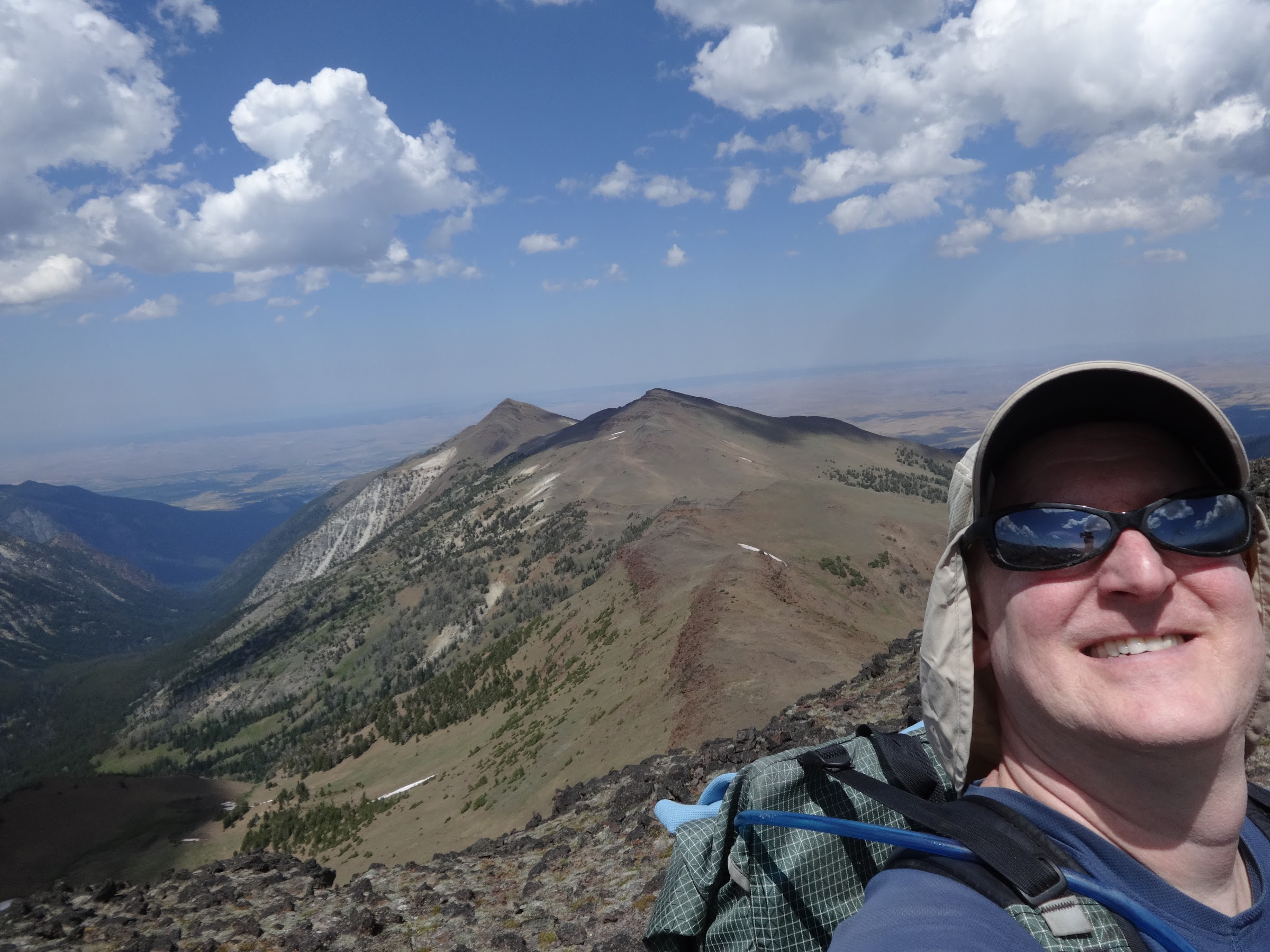
Cairn and register box at the top of Aneroid Mt.:
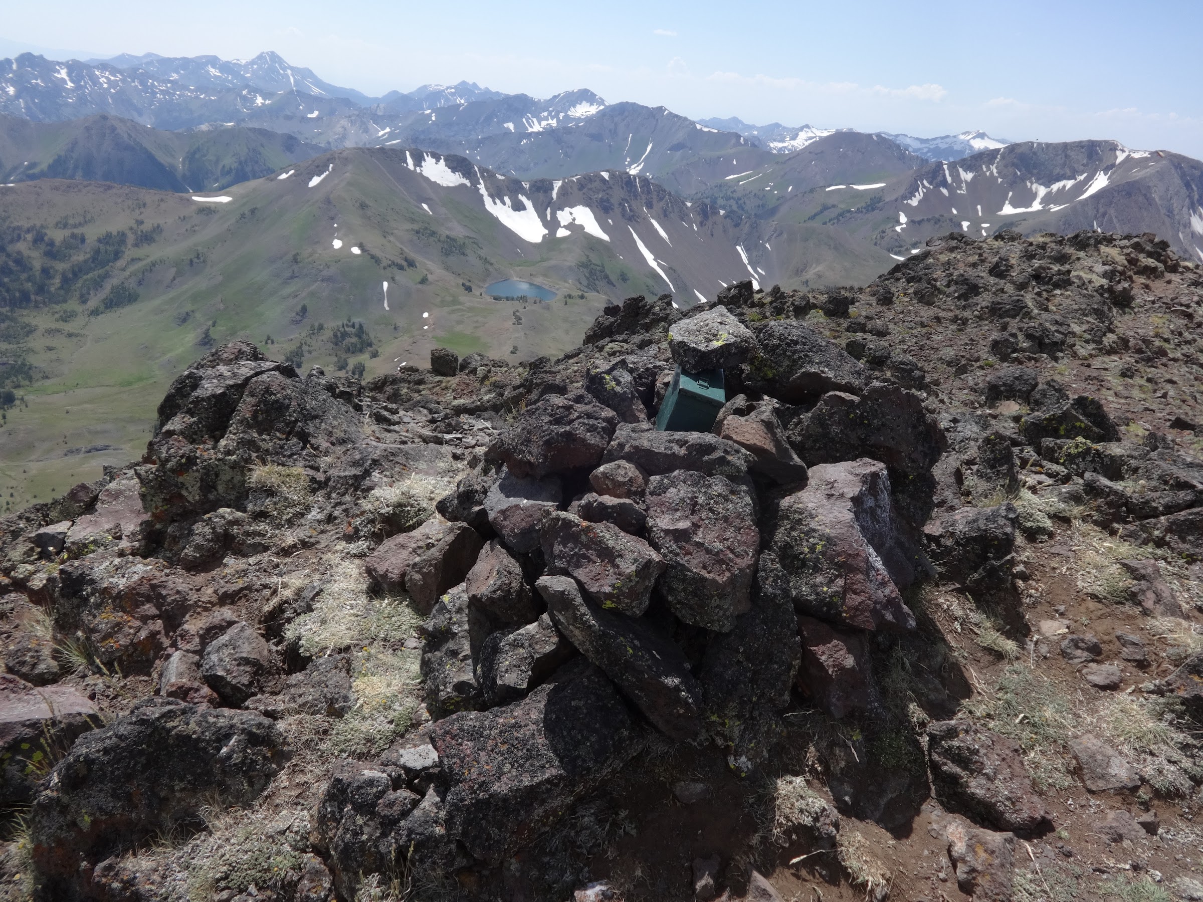
Me on Aneroid Mt.:
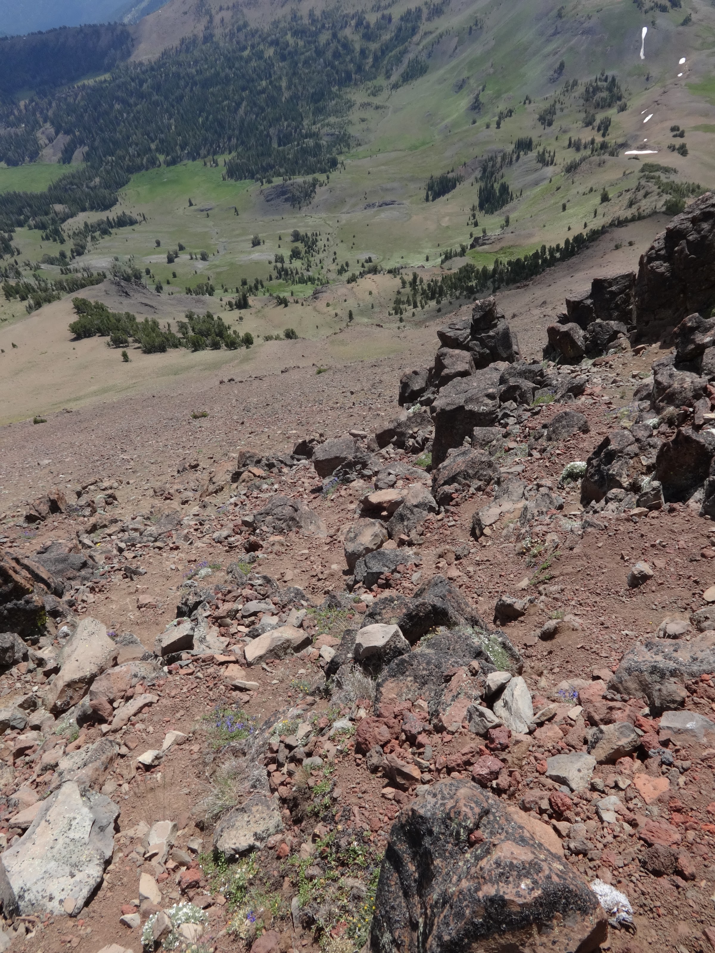
The route down from Aneroid Mt. to Dollar Pass is straightforward: straight down the SW ridge. The terrain is steep, on deep, loose scree and dirt. Somewhat going down for the sure-footed, but it would be very difficult going up. Two steps up and one step back.
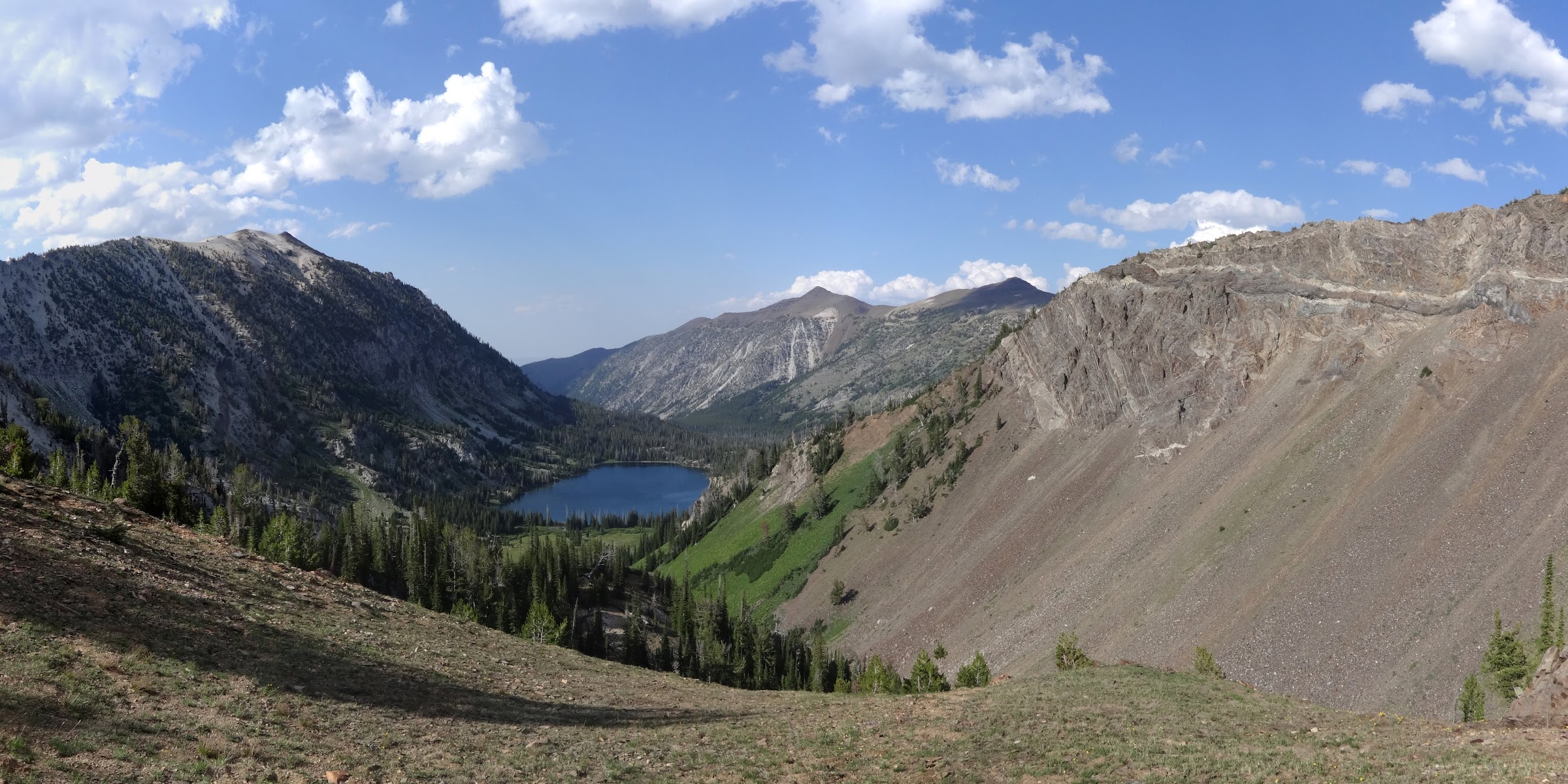
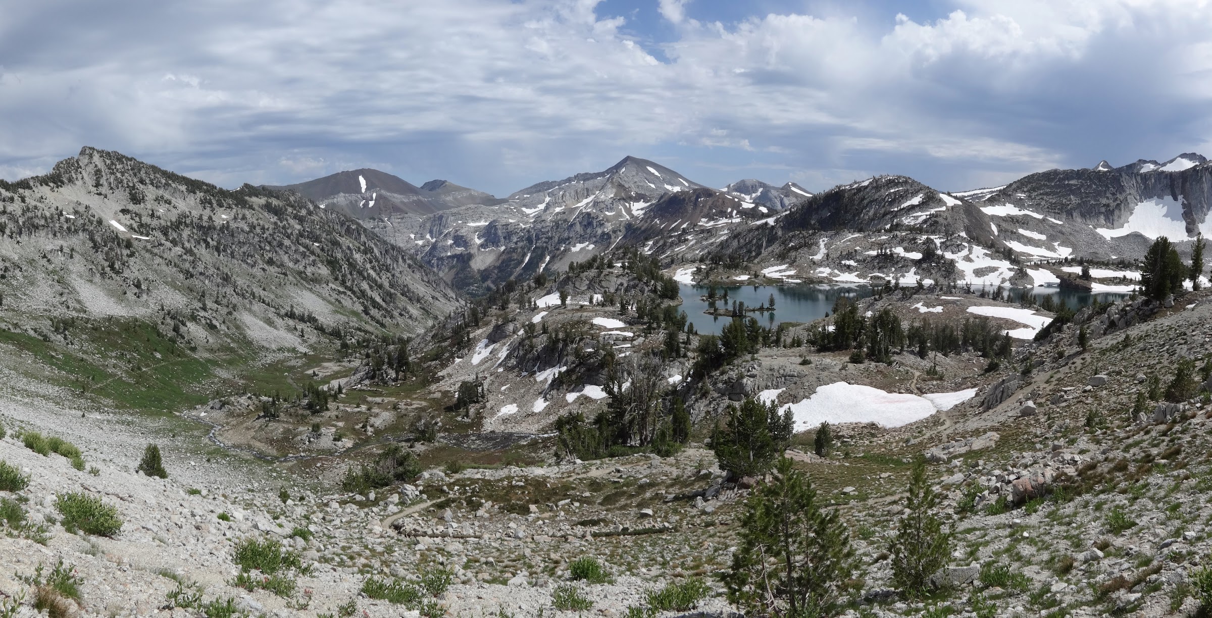
Looking down to Dollar Pass and Dollar Lake:
An example of some of the steep, deep, loose scree on the way down:
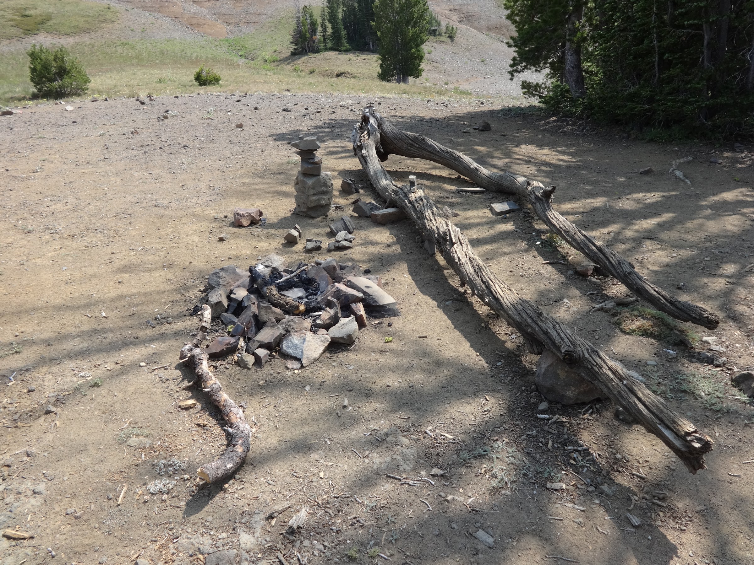
After an uneventful descent to Dollar Pass, it was time for my first break of the day at Dollar Lake.
I was happy to see this fire ring I destroyed in 2018 had not been rebuilt:
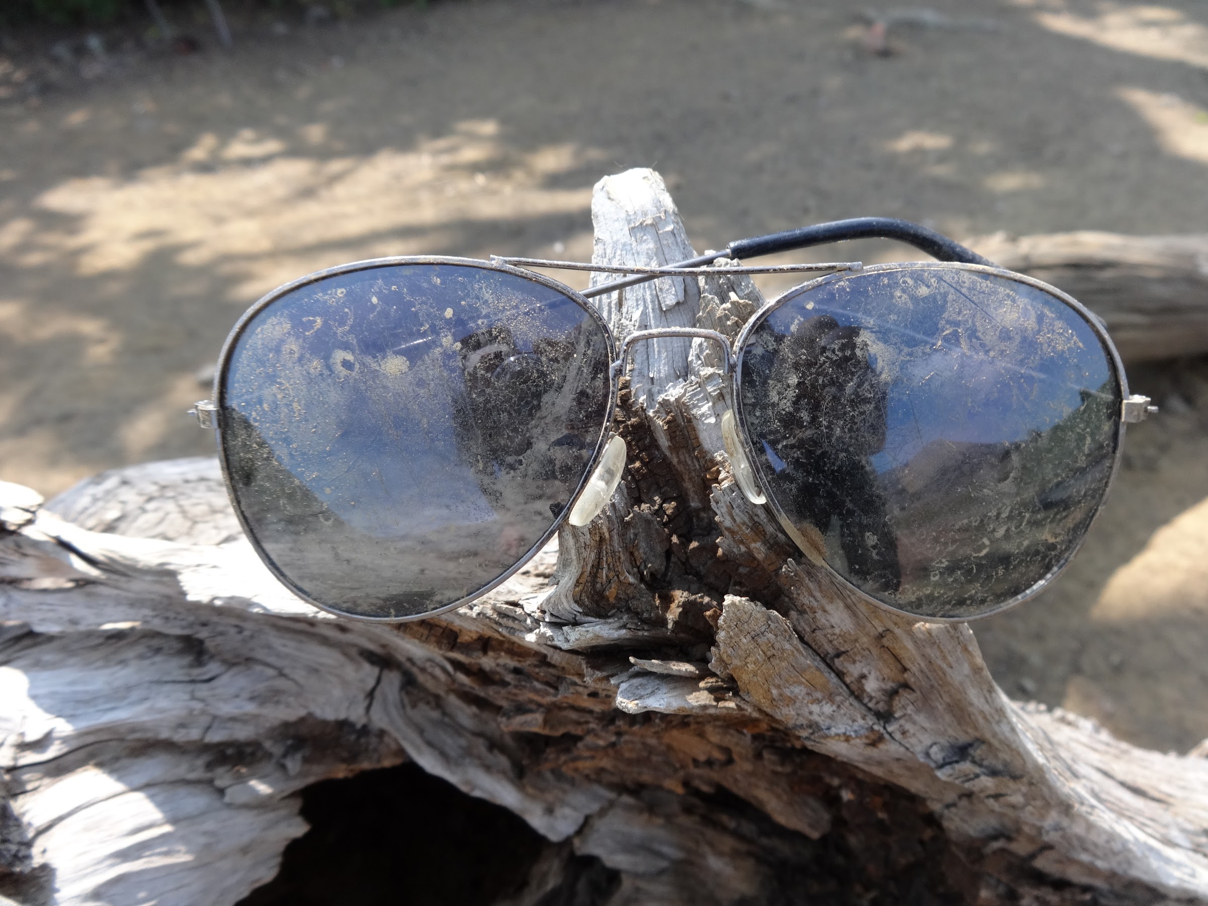
However, some dad in 1983 forgot his sunglasses:
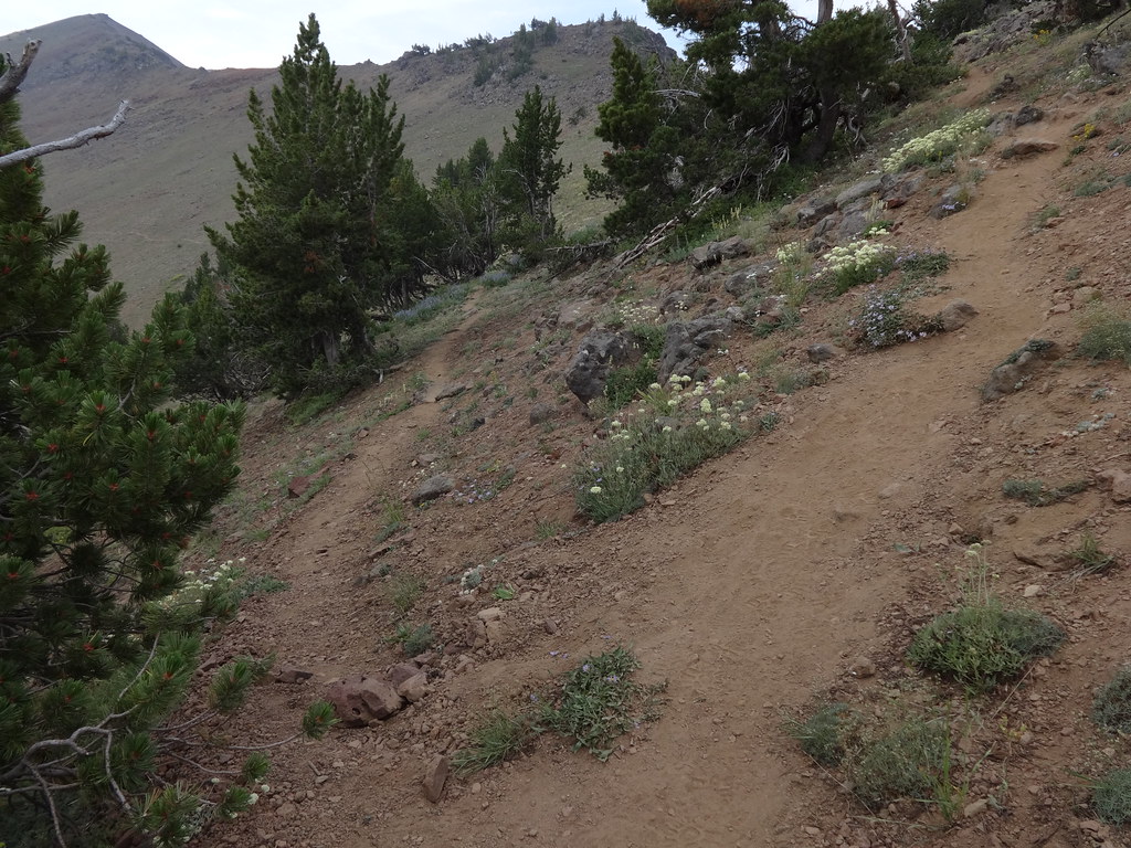
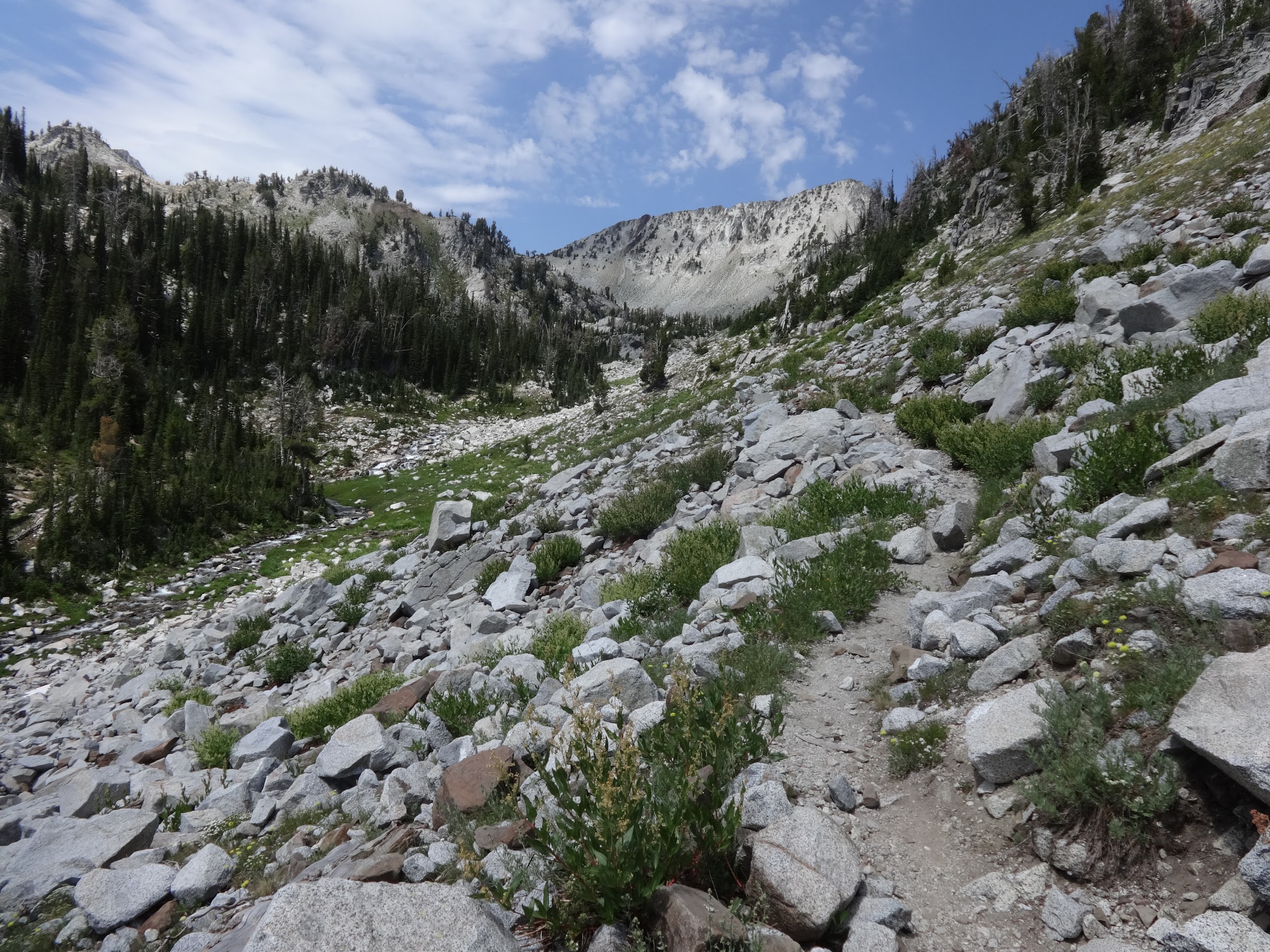
Originally, the plan was to traverse Dollar Ridge, as was done in 2018, but I decided to conserve energy for climbing Petes point the following morning. FYI, the Dollar Ridge traverse is very simple and worth the effort. It gets you to Tenderfoot Pass. Instead, I took a shortcut direct from Dollar Lake to Tenderfoot Pass, then over to Jewett Lake.
Shortcut from Dollar Lake to Tenderfoot Pass:

Camp was set up on the north side of Jewett Lake. A short walk leads to an overlook of Aneroid Lake and the E. Fk Wallowa valley, as well as several peaks.
View from overlook:
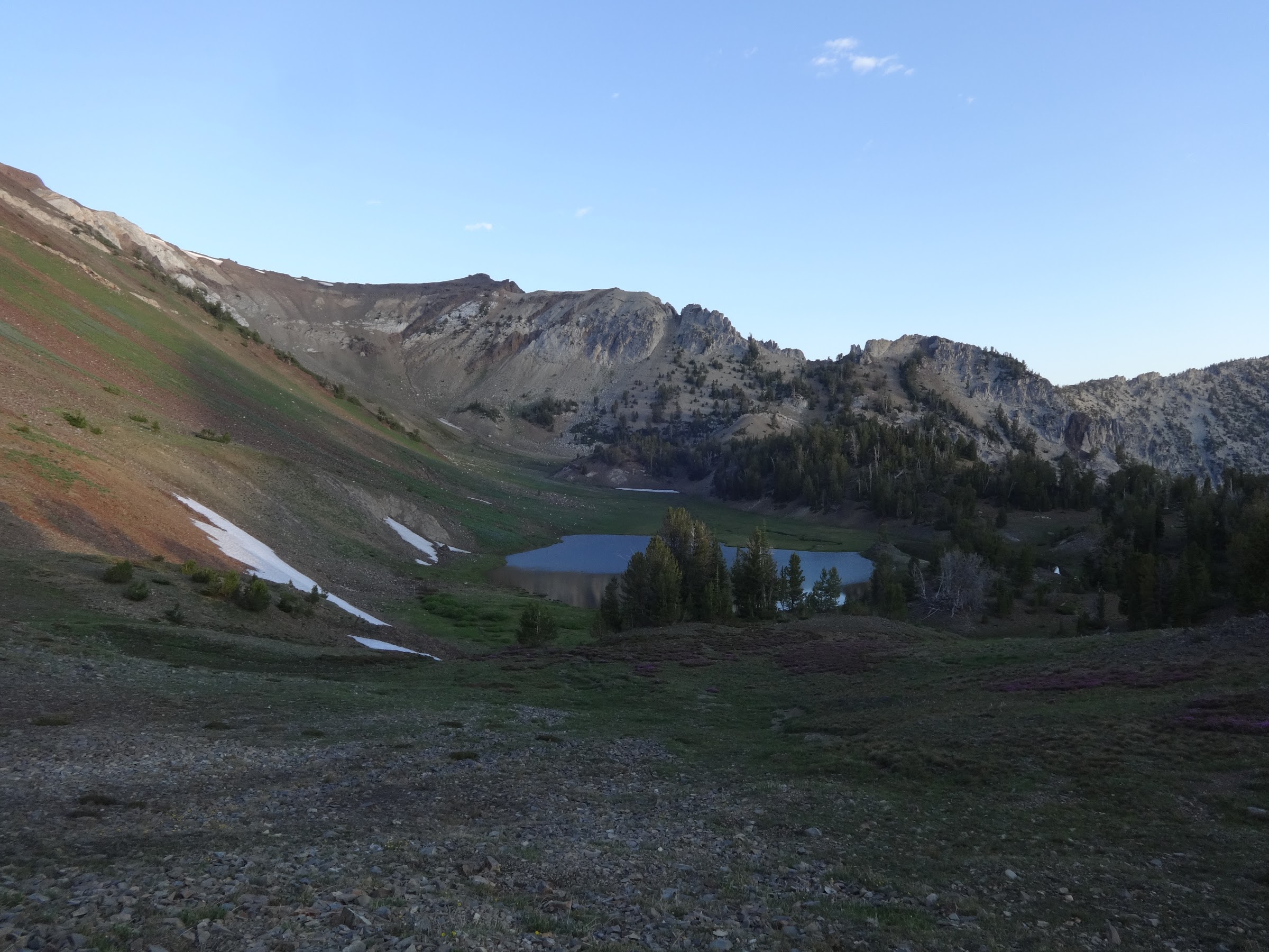
Jewett Lake the next morning:
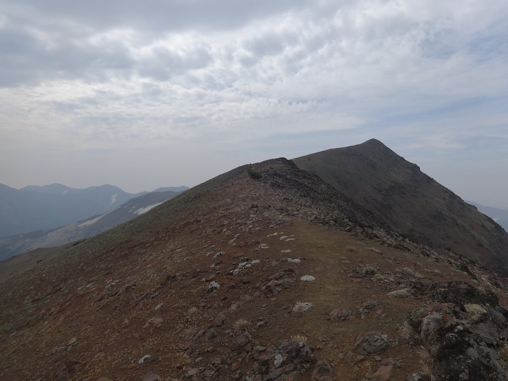
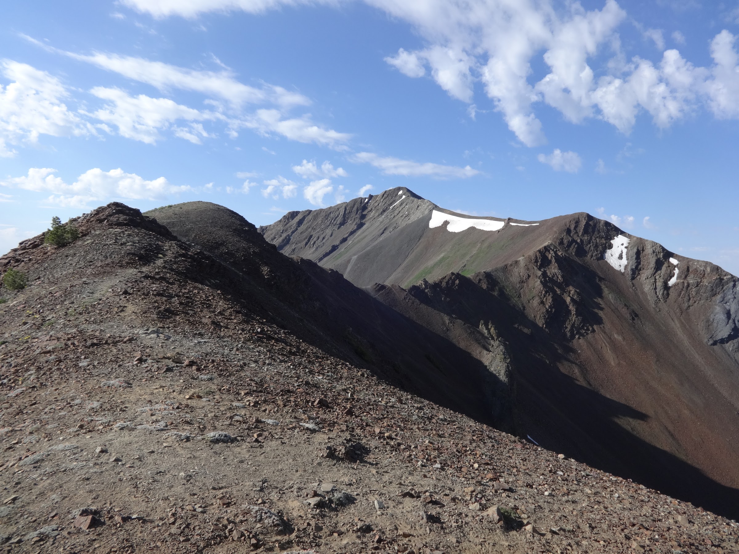
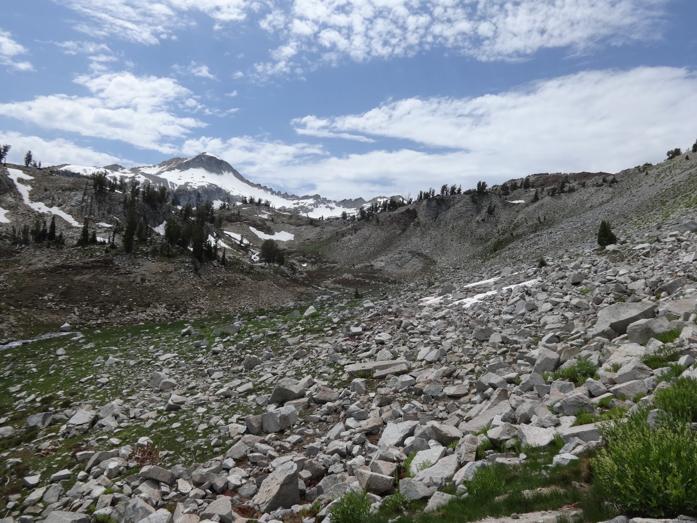
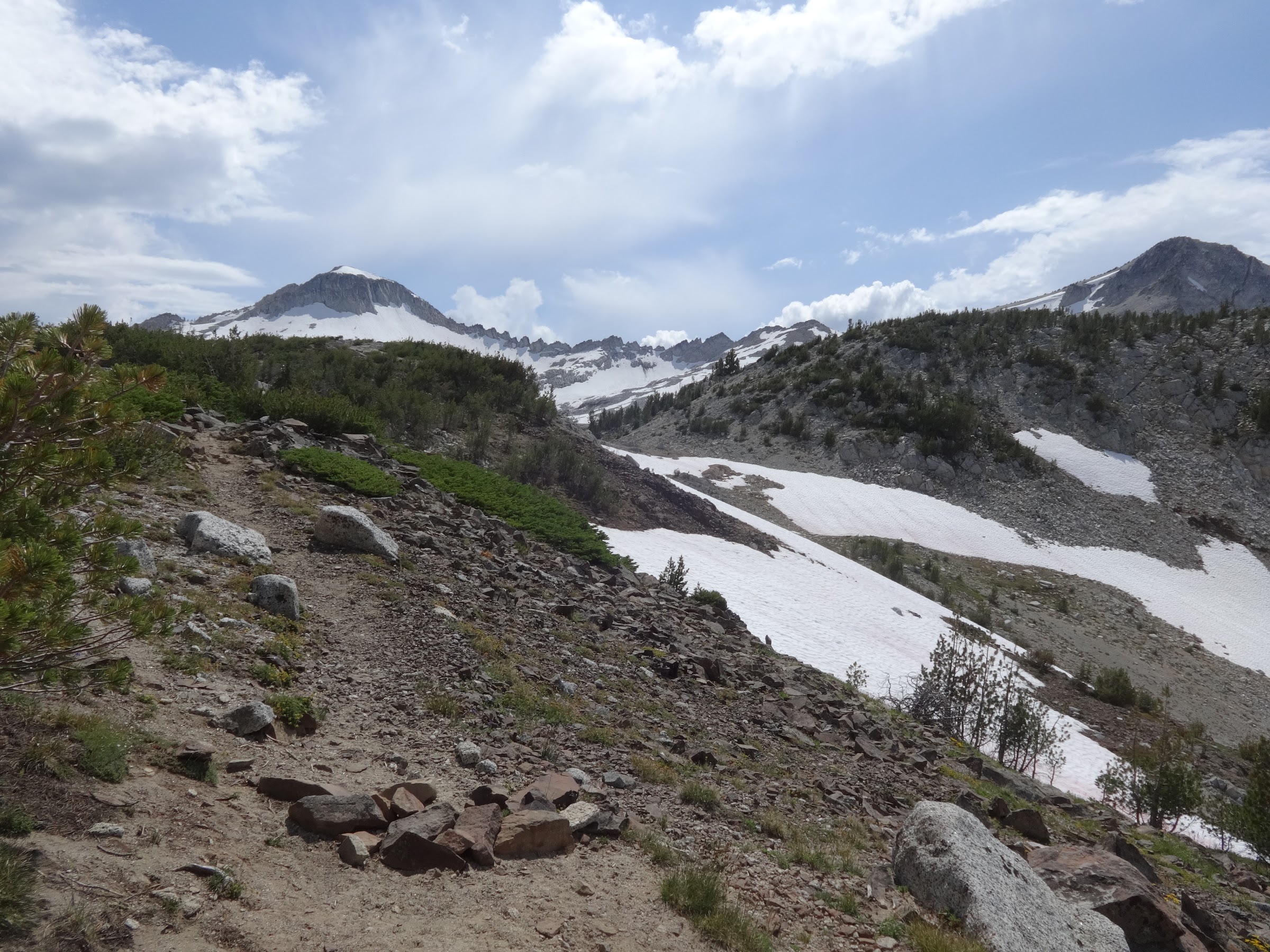
The plan was to get up early, as usual, climb Petes point, then take the south ridge directly to Polaris Pass. Research indicated climbing Petes Point requires no special equipment or mountaineering skills. The route from Petes Point (9675’) direct to Polaris Pass (8900’) goes down to a saddle (8920’) and over an unnamed peak (9395’) first.
However, the wind increased as the ridge was gained, and kept increasing the higher I got. It was only going to get windier as elevation was gained. In addition, certain points of the ridge get narrow. After only 250’ of elevation gain, there were gusts strong enough to move me. It was time to give up and try another day. FYI, there is a discernable path. Back down to Tenderfoot Pass I went.
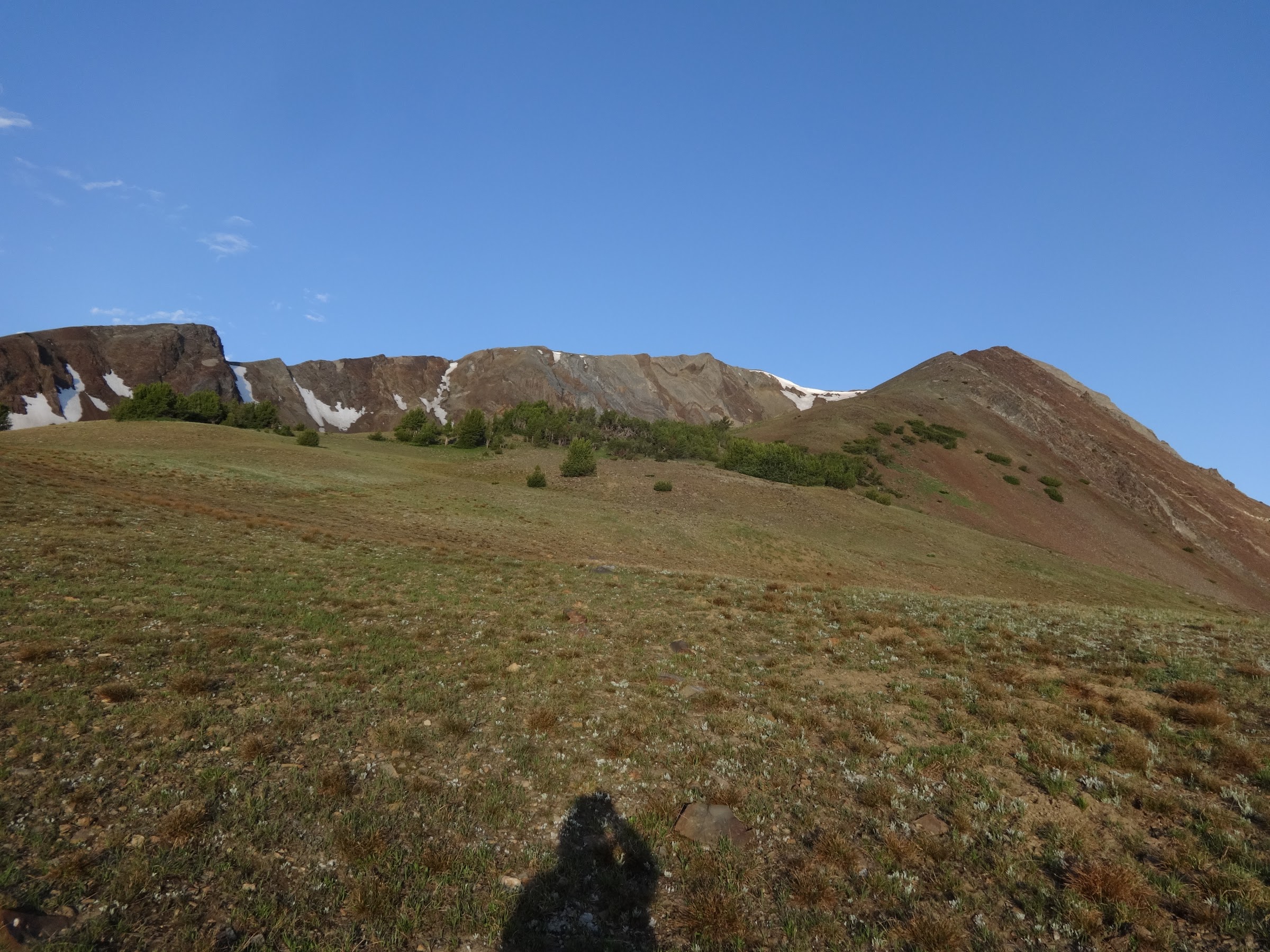
The start of the ridge up to Petes Point:
From Tenderfoot Pass I took the trail over to Polaris Pass. Going up the east side of Polaris Pass is much easier than going up the west side. It’s much shorter and has much less elevation gain.
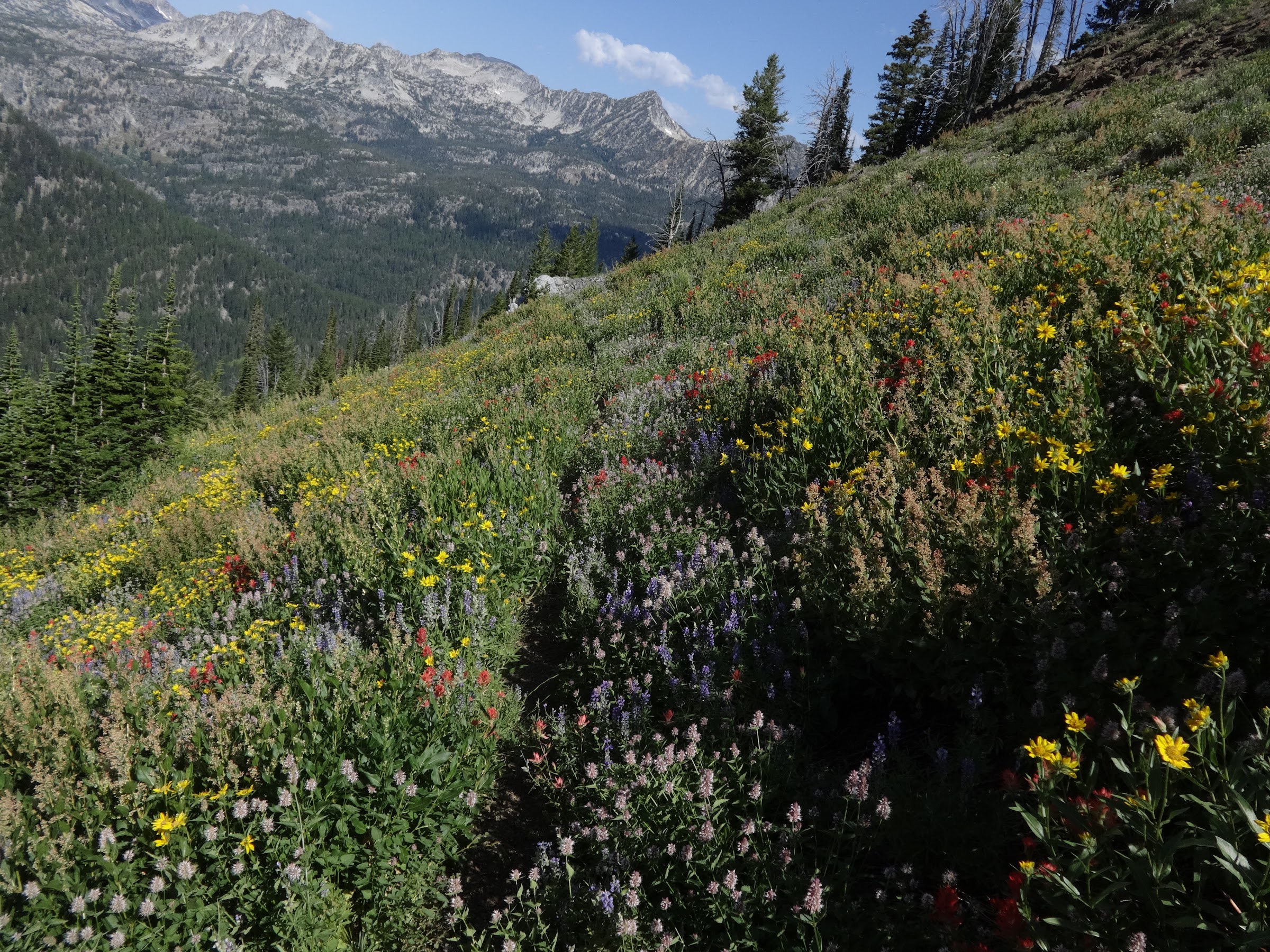
Hillsides of lupine on the way to Polaris Pass:
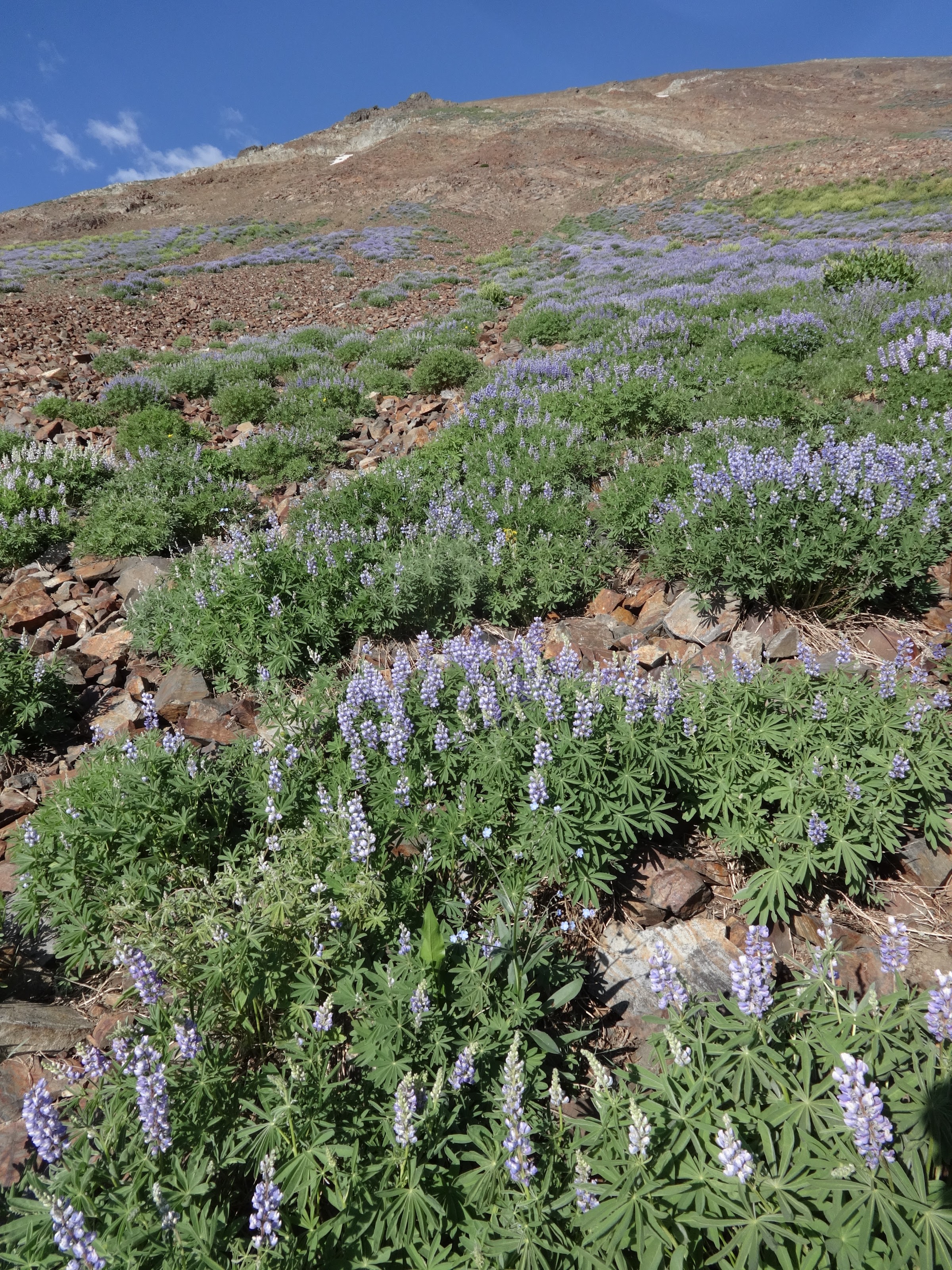
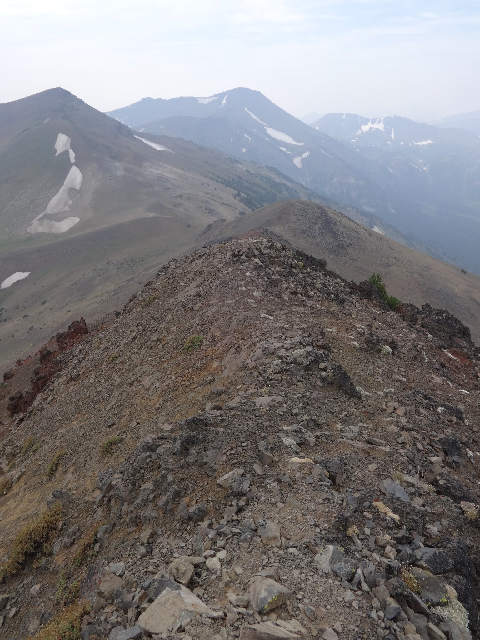
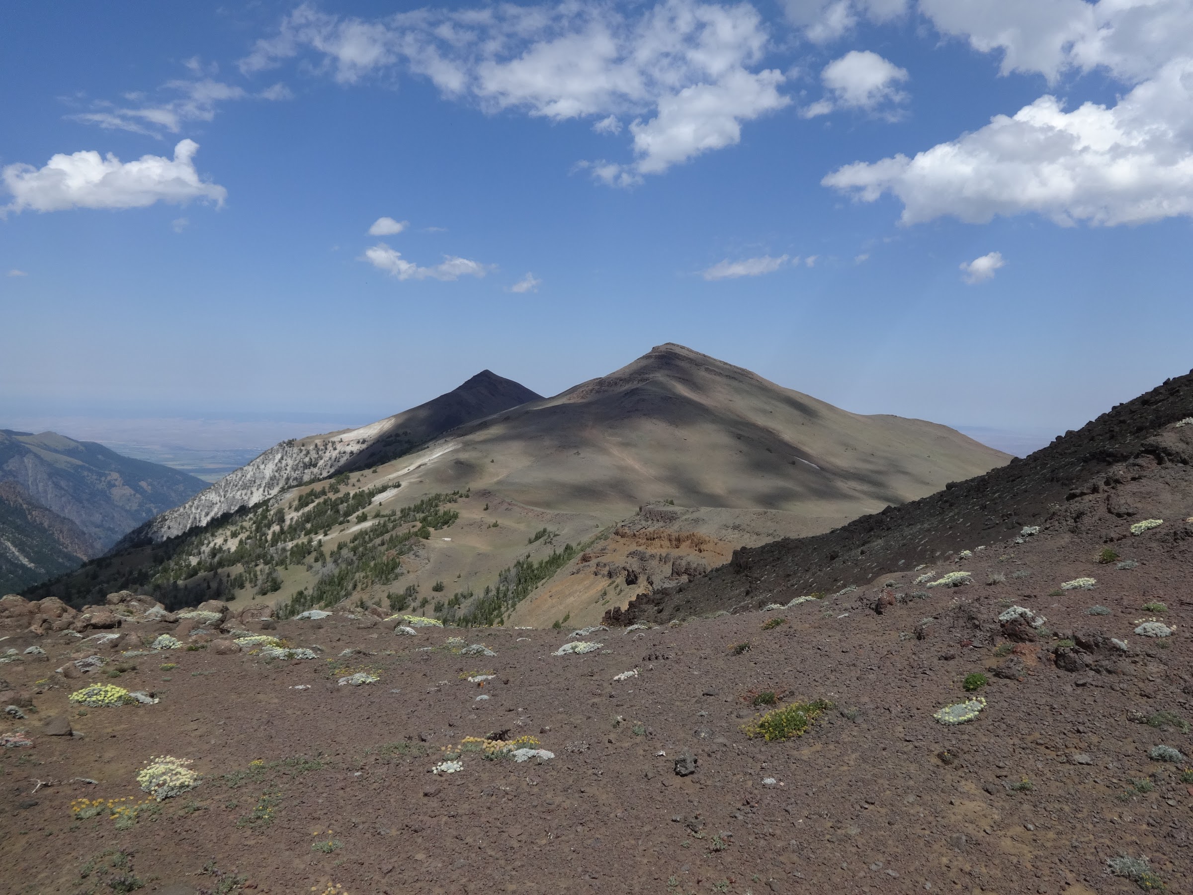
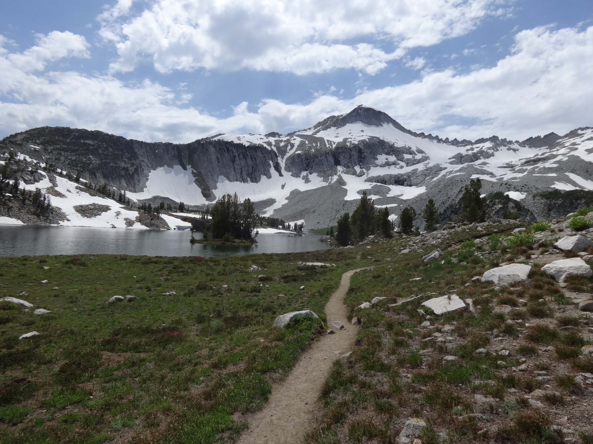
The view from Polaris Pass is phenomenal:
Once at Polaris Pass, the original plan was to climb up Sentinel Peak (9400’) and back. It’s only 500’ higher than Polaris Pass and very close in distance. However, the wind was still blowing hard enough to make me decide against that plan. Again, a narrow ridgeline and gusty winds are not good combinations.
Sentinel Peak from Polaris Pass:
Instead, I took the trail down the west side of Polaris Pass. There have been many questions about this trail, especially the top part of the west side. The first mile or so is rocky with some loose scree and rocks. It is a well-defined trail, graded for horses, so it is not steep. As long as a person watches their step, they should have no problem. Hiking poles are very useful and highly recommended. The rest of the way down is on much more solid ground. There are exactly 50 switchbacks going down to the junction with the W. Fk Wallowa Trail. Various sources note the distance from 4 to 5.5 miles. My numbers came in at 4.8 and 5 miles. Split the difference and call in 4.9 miles for this section. It is a 2350’ elevation loss from Polaris Pass (2350’ gain if going up).
Start of going down Polaris Pass:
Lots of wildflowers lower down the Polaris Pass trail:
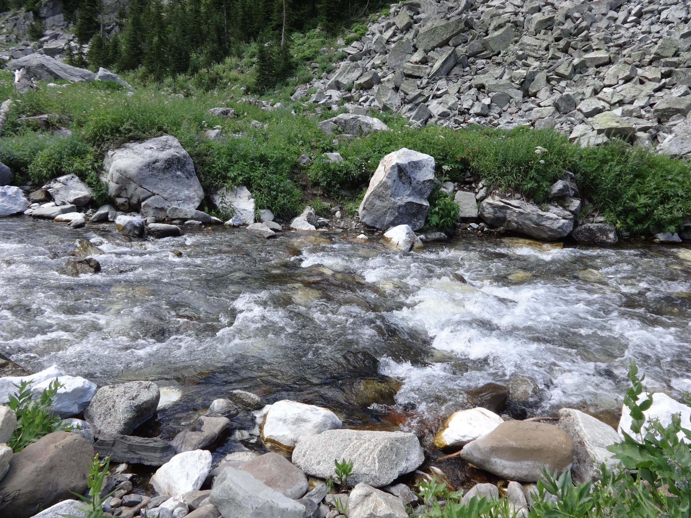
The Polaris Pass trail eventually meets the W. Fk Wallowa Trail. From there I went upriver towards Glacier Lake. After 1.3 miles is a wet crossing of the W. Fk Wallowa River. There is no dry option. No logs, no rock hopping. Off with the boots and on with the Crocs. The actual crossing is not dangerous. Pick a spot that the river is calmer and you can see the bottom. It’s almost refreshing to cool down your feet. Off with the Crocs and back on with the boots.
The crossing spot:
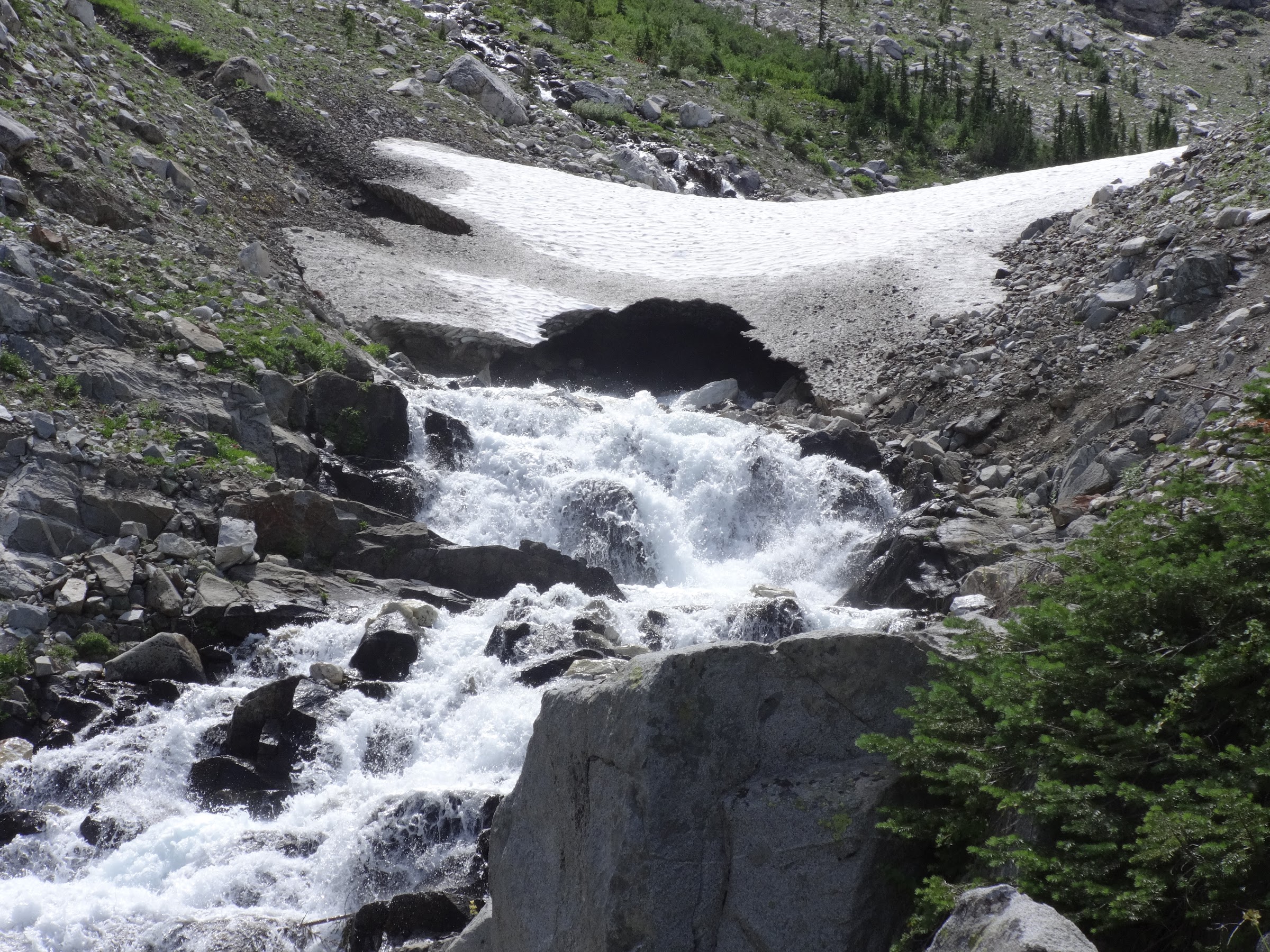
Upriver from the crossing is a snow bridge that seems to never melt out completely. Too bad the crossing wasn’t there.
Snow bridge:
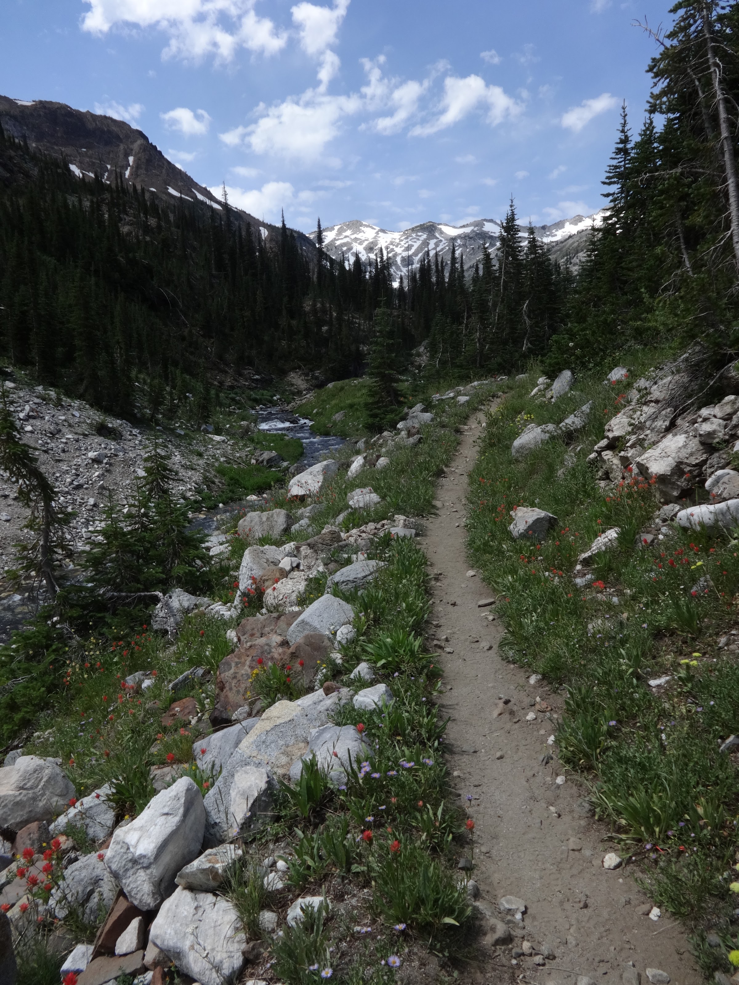
The trail continues following the river:
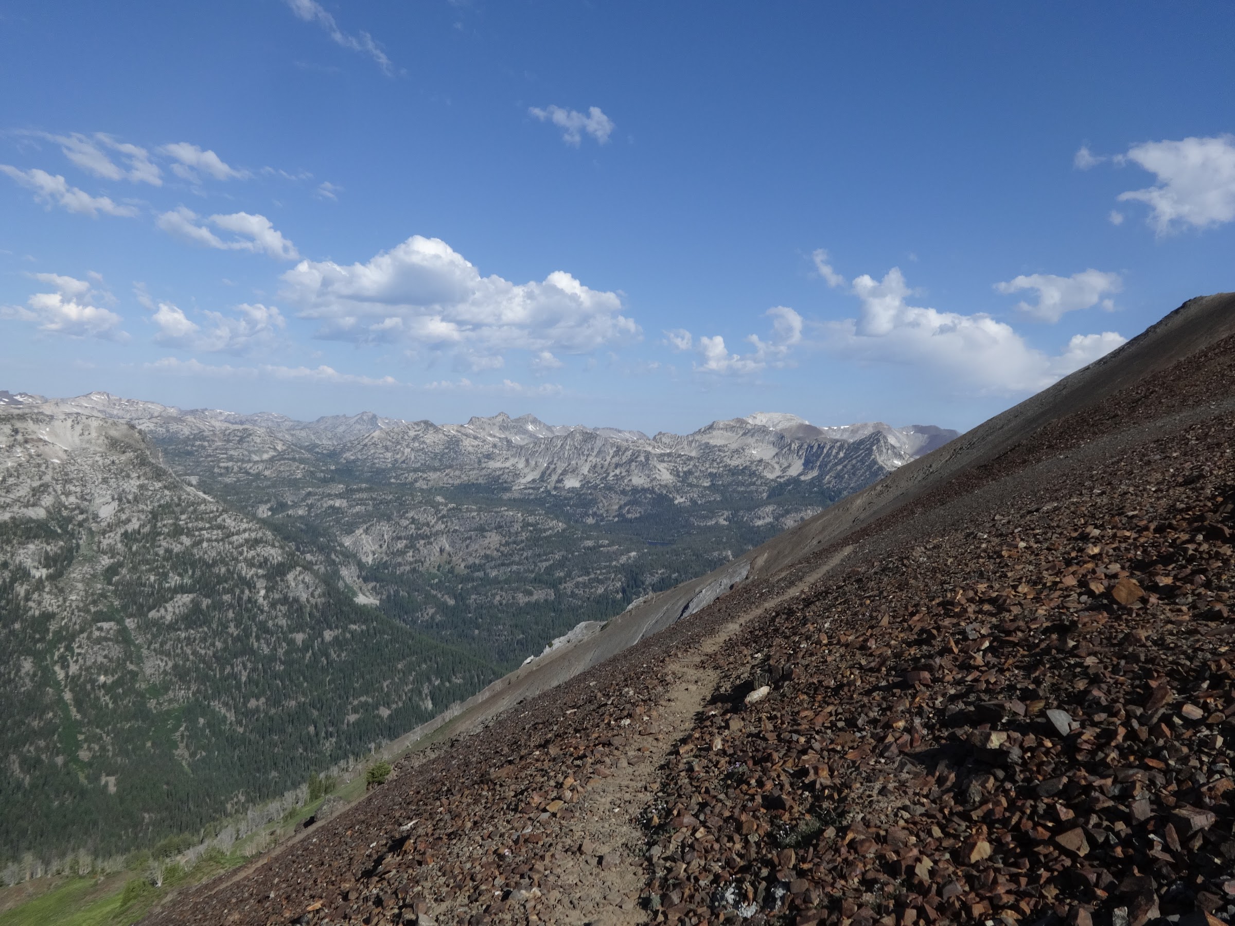
After passing Frazier Lake and the junction with the trail to Hawkins Pass, the W. Fk Wallowa Trail becomes treeless and passes through granite rock fields. This section is about 1.75 miles long and very hot. No shade at all, and the white granite reflects the sun.
Granite trail section:
Almost at Glacier Lake:
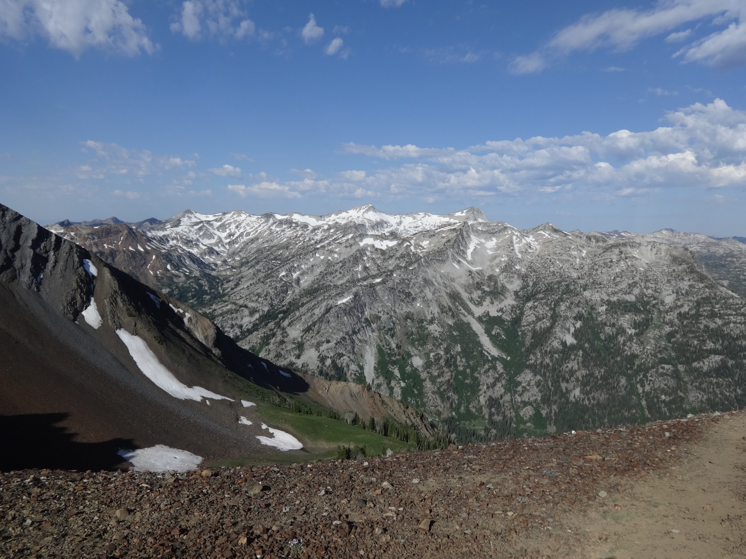
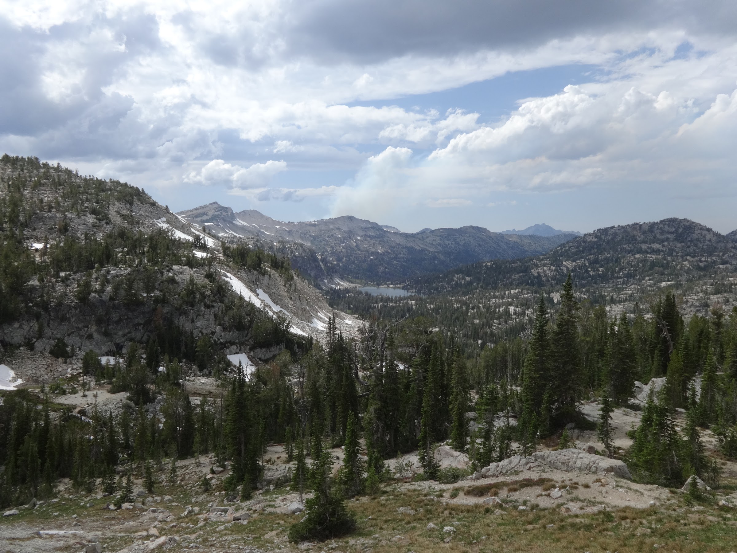
At Glacier Lake I took my first extended break of the day. During that break some decisions had to be made. The original plan was to climb Glacier Pass, then go directly to Eagle Cap, bypassing the descent of the north section of Glacier Pass. A route directly up to Eagle Cap had been researched and plotted. Others have done it, so it is possible, with considerable effort. However, by that time the skies were almost completely overcast with dark clouds. I didn’t want to be trying to summit Eagle cap in lightning or rain. The clouds, while not yet raining, dampened my spirits for the rest of my planned trip. A calculation was made that it would be about 16 miles back to Hotel Subaru and hot food. Since most of that would be downhill, 3 MPH could be averaged, with a TH ETA of 8 PM.
Glacier Lake with Glacier Peak behind it:
Don’t these clouds look threatening to you?:
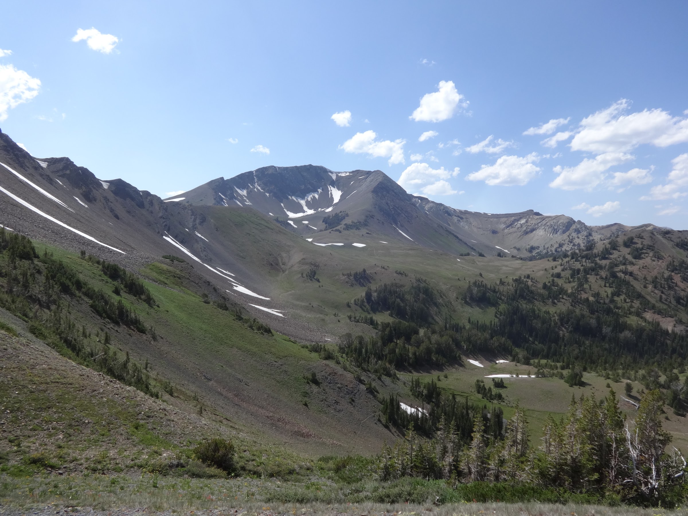
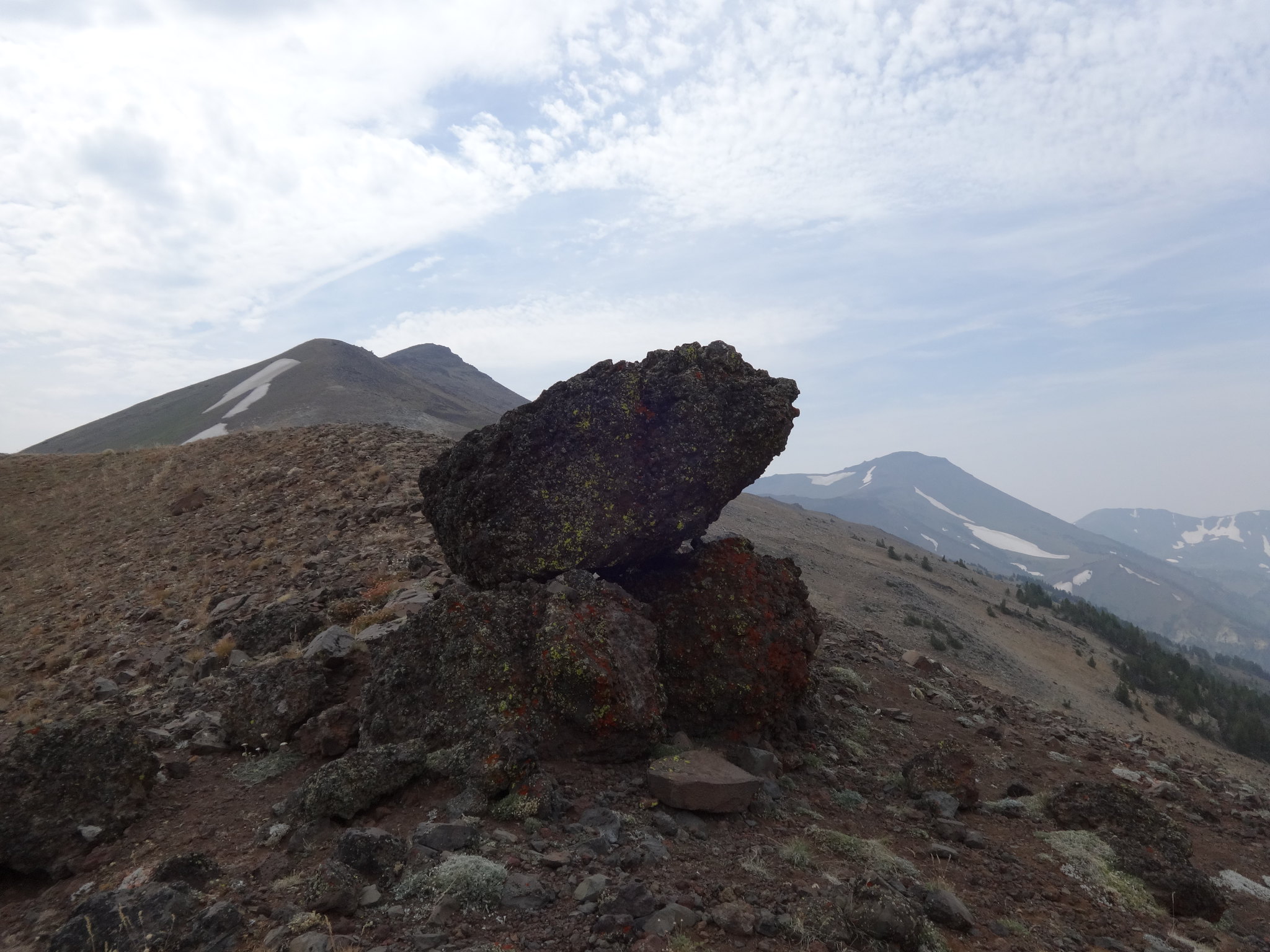
On the way up to Glacier Pass I got the picture of the trip:
Once at Glacier Pass I discovered the beginning of the direct route to Eagle Cap:
The view down Glacier Pass to Moccasin Lake:
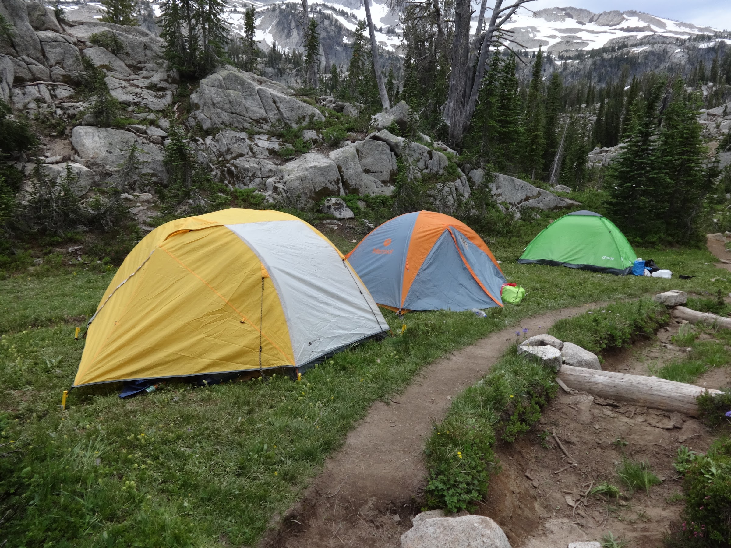
These people camped near Moccasin Lake obviously don’t practice LNT:
On the long way back to the TH, it did rain, but not that much. However, once back in Joseph for dinner, there was evidence of recent heavy rain. Thunderstorms can be spotty and unpredictable, and it was not a bad decision to forgo the Eagle Cap direct route.
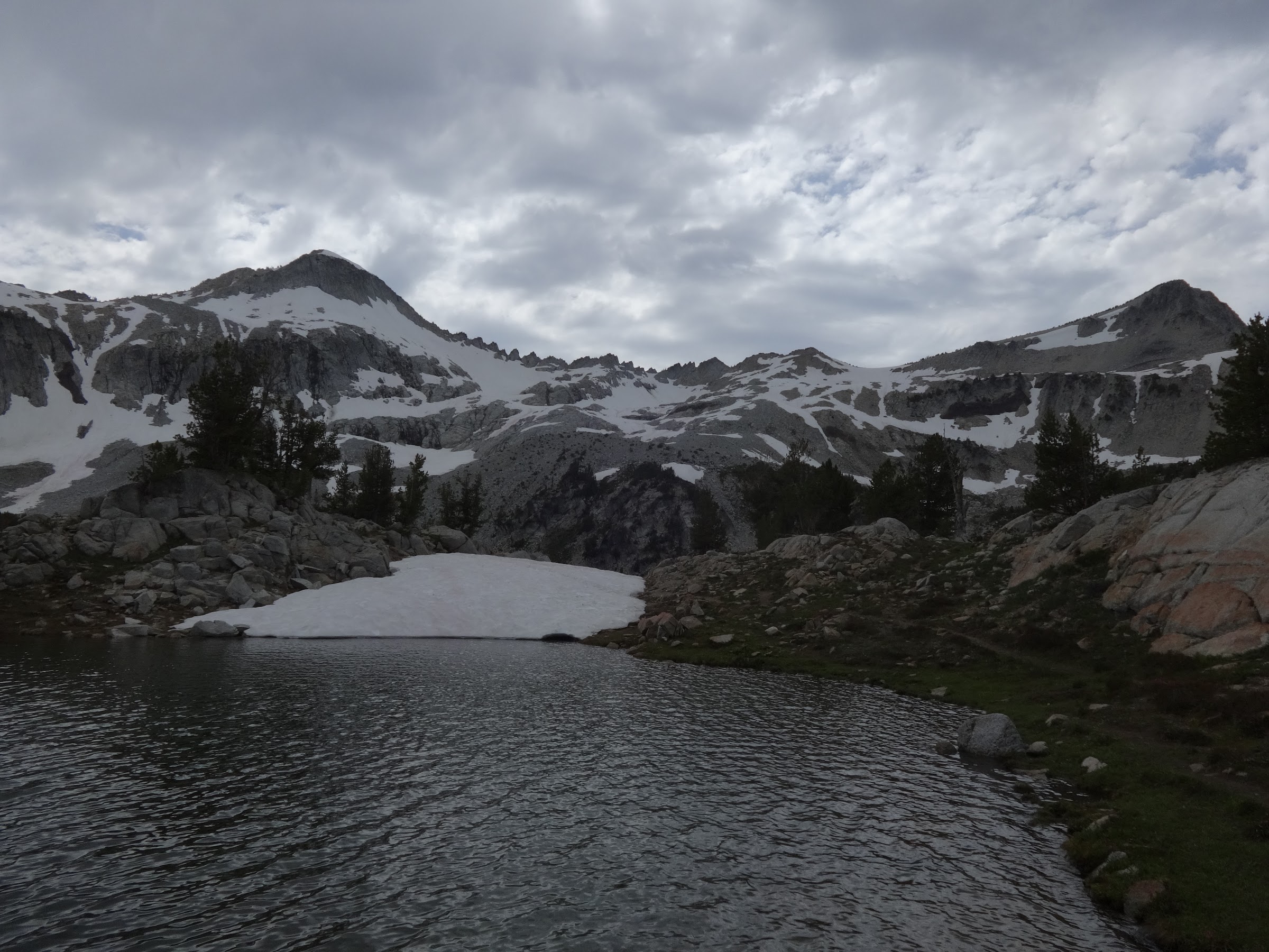
Obligatory picture of Moccasin Lake (and dark clouds):
----------------------------------------------------
Final Notes
• I have one more chance in late August to scratch some Wallowas goals off my list. Petes Point, Eagle Cap direct and Hurwal Divide. Cross your fingers for good weather.
• There is no water available on the route from Mt. Howard until just below Dollar Pass. Bring plenty of water.
Link to lots more pictures on Google Photos:
Link 1: https://photos.app.goo.gl/vt2Nk3v8crdSAsd4A
Link 2:https://lh3.googleusercontent.com/CpHic ... yA-Q=w2400
Keep on hiking,
Brad