Funny place for a first time post (long time lurker), but like some others here I am also planning on a 3 day loop in the Wallowas this coming weekend.
Does anyone know if the brownie basin area (off bowman) or the swamp lake area (off copper creek) tend to hold snow similarly to the main lakes basin area or do they tend to melt out earlier/later? Obviously this is very aspect dependent.
Concerning Polaris Pass, the first couple hundred feet with no snow are steep but it is very doable, wouldn't necessarily call it sketchy.
6/26/19 - Lake Legore, Wallowa Mountains
Re: 6/26/19 - Lake Legore, Wallowa Mountains
Last edited by McCarter on July 2nd, 2019, 11:59 am, edited 1 time in total.
-
retired jerry

- Posts: 14424
- Joined: May 28th, 2008, 10:03 pm
Re: 6/26/19 - Lake Legore, Wallowa Mountains
http://adamschneider.net/hiking/snow_depth.html
pan and zoom to get to your area
click on "usgs topo" to get topo so you can see where the snow is
in my experience, it has to go to no snow before it's pretty clear but there will be patches of snow. If it, for example, says 2 to 4 inches of snow, there can be quite a bit more, that's an average over a large area

Re: 6/26/19 - Lake Legore, Wallowa Mountains
The valley bottom of Lostine is a similar orientation and elevation to Brownie Basin... I would suspect the conditions are similar. But a lot can change in two weeks, so the valley will most likely be snow-free.
Swamp Lake is even higher than the main Lakes Basin, but has a better orientation for melt.
My guess is that you'll contend with a bit of snow, but shouldn't be too much of an issue if you are prepared.
instagram: @remyodyssey
-
MariposaMan
- Posts: 40
- Joined: April 14th, 2014, 10:04 pm
- Location: Eugene, OR
Re: 6/26/19 - Lake Legore, Wallowa Mountains
sparklehorse wrote: ↑July 2nd, 2019, 10:49 amI'm thinking of doing an East Fork - West Fork loop in August. How is that decent from Polaris Pass down to the West Fork when there is no snow? I've read some varying opinions on it. Some say the first few hundred feet down from the saddle are a bit sketchy. What say you folks that have done it?
Thanks!
From what I recall, from many years ago, the descent from Polaris Pass is steep but not impossibly so. I'd agree that the first part of the descent is the steepest/sketchiest; the switchbacks (and there are many) become gentler as you work your way down the mountain. If you're an experienced hiker/backpacker with healthy knees, and take your time, then you should be fine. (Trekking poles would be extremely beneficial here.) Plus, the views are spectacular.
-
sparklehorse

- Posts: 828
- Joined: May 28th, 2008, 10:03 pm
- Location: over the hill
- Contact:
Re: 6/26/19 - Lake Legore, Wallowa Mountains
Might be too late to matter, but if you're planning to hike out from Swamp Lake down Copper Creek to the Two Pan trailhead this weekend, I would think you're going to encounter quite a bit of snow on your ascent up out of the Swamp Lake basin. That climb is on an east-facing slope, all of it above 7800', and you'll eventually top out at about 8600'. That's a GREAT loop though, from Brownie Basin through the Wilson Basin, then the beautiful North Minam Meadows, then Steamboat, Swamp and out. I did it many years ago; it's one of my favorite loops in Eagle Cap. If it were me I'd wait another month though. Will be interested in your trip report!McCarter wrote: ↑July 2nd, 2019, 11:51 amFunny place for a first time post (long time lurker), but like some others here I am also planning on a 3 day loop in the Wallowas this coming weekend.
Does anyone know if the brownie basin area (off bowman) or the swamp lake area (off copper creek) tend to hold snow similarly to the main lakes basin area or do they tend to melt out earlier/later? Obviously this is very aspect dependent.
-
backcracker
- Posts: 38
- Joined: July 25th, 2013, 11:55 am
- Location: Tri-Cities
Re: 6/26/19 - Lake Legore, Wallowa Mountains
The trail rounds the east side of Swamp Lake before passing the large marshy area at the lake’s south end that gave the place its name. From here the trail climbs a steep hillside onwell-graded switchbacks up to a fork in the trail atop a windswept alpine plateau. Note: Before late July snow may cover this slope making it dangerous to cross.
You will have to cross this, the size of the snowfield varies from year to year. Stay above the snow field if you are not comfortable.
You will have to cross this, the size of the snowfield varies from year to year. Stay above the snow field if you are not comfortable.

Re: 6/26/19 - Lake Legore, Wallowa Mountains
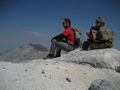
I climbed up Chief Joseph on Sunday, July 1. It was a snow free trip up to 9,616'. I could see that there was a LOT of snow deeper into, and lower in, the mountains. I climbed Sacajawea and Hurwal Divide last summer and was dumbfounded at how these mountains shed the snow sooner than the valleys and lakes below. Here are a few views from Sunday:
Here's a view into BC Creek drainage, with Hurwal Divide looking overhead:
Here's a view to the South, with Hurwal Divide, Sacajawea and Matterhorn nearby:
Here's a view into BC Creek drainage, with Hurwal Divide looking overhead:
Believe it or not, I barely ever ride a mountain bike.
Re: 6/26/19 - Lake Legore, Wallowa Mountains
Please, please, Charley: Would you please describe the route to get to Chief Joseph? Accounts on the web of the route from the perimeter Chief Joseph trail are vague and incomplete. I've tried from the east on the switchbacking user trail from the state park. I followed the steep user trail up to the flat area around 7500 ft but didn't find any obvious way past it so I returned. On my return, I bushwacked up the ridge a quarter mile up from the Chief Joseph trail further south. I never found any signs of human travel there either. It can't be all bushwacking. What is the secret?