Now that the BV Platter is open for business I thought I check on Primrose Path conditions and it is about what I expected knowing the the burn went through the ridge the route follows. There are bits and pieces of tread but the trail, such as it was, has taken a serious hit. Others had preceded me and one person with a set of clippers helped with route finding by snipping bits of the brush that has grown since the fire.
I should say at this point, in light of some recent posts, that the BV Platter is new again, and this doesn't bother me all that much. I do not attribute to malice any of the actions the FS has taken during and since the fire; looks like standard forest practices. I don't have to like it but I'm a glass half full kinda person and will enjoy exploring new areas up there.
The plan was go up Palmer Mill Rd from Angels Rest and see what the condition of Palmer Mill Rd and at what point did the decommissioning that Lurch mentioned in a previous post start. From there I would go to Devils Rest and take the Primrose Path to intersect the trail to Angels Rest for the return.
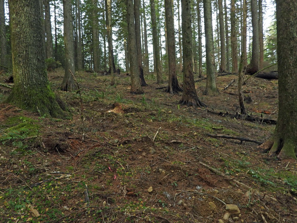
I parked at the Angels Rest trail head parking lot and walked up Palmer Mill road to the barricade and continued. The road from the barricade to the old washout has never been in better shape. It was getting overgrown and there were a couple of trees across the road prior to the fire, no more of that.
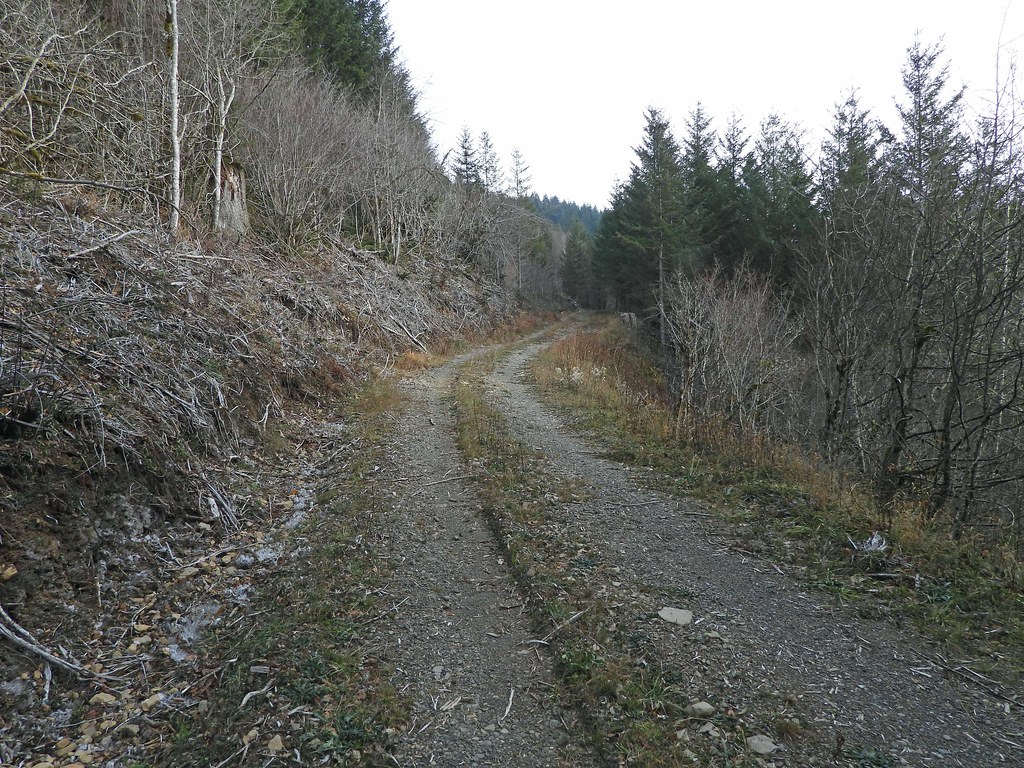
DSCN0997 by pauljess999, on Flickr
All good things must come to an end - in this case the old washout is where the FS chose to end the decom for a fire break I guess. Bummer as Palmer Mill Rd was a favorite of mine for doing bike and hikes with Larch Mtn.
DSCN1000 by pauljess999, on Flickr
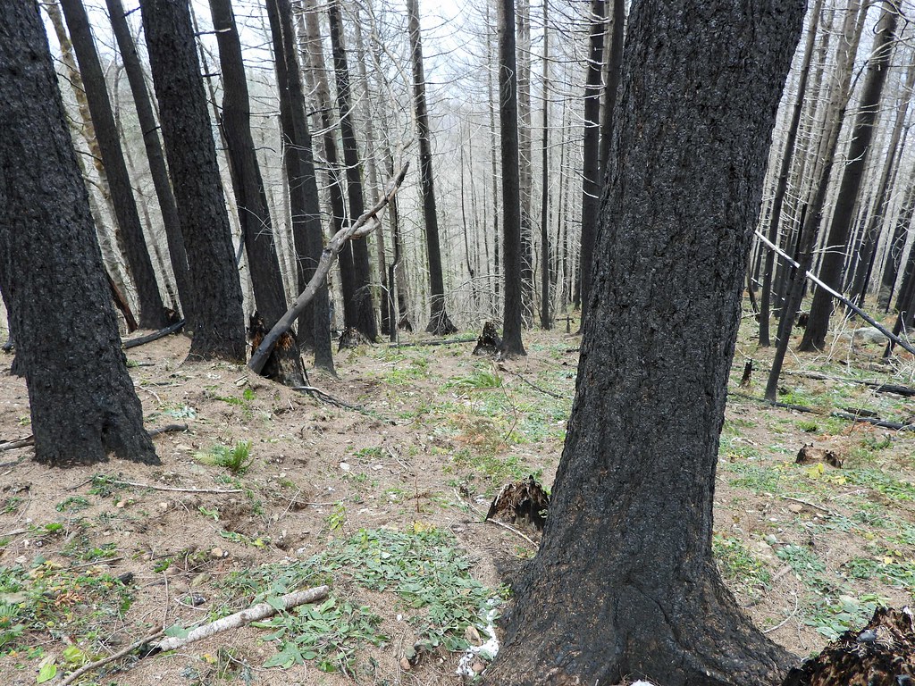
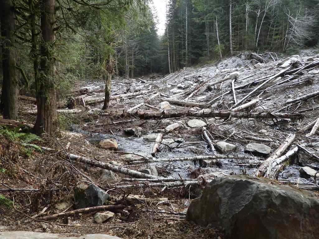
DSCN1002 by pauljess999, on Flickr
As Lurch had reported on the decom at the Multnomah Basin Rd end of Palmer Mill I have to assume this goes on until that junction. OK, I'm good with that - and it doesn't look as bad as some of the photos I've seen in other places. One thing that is new for me is that I located a road just a little beyond the start of the decom on the south side of Bridal Veil creek that will need exploring. I followed it up until a switchback.
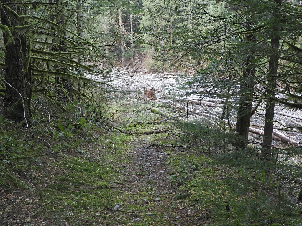
DSCN1009 by pauljess999, on Flickr
Looking up from the switchback to the road heading southwest.
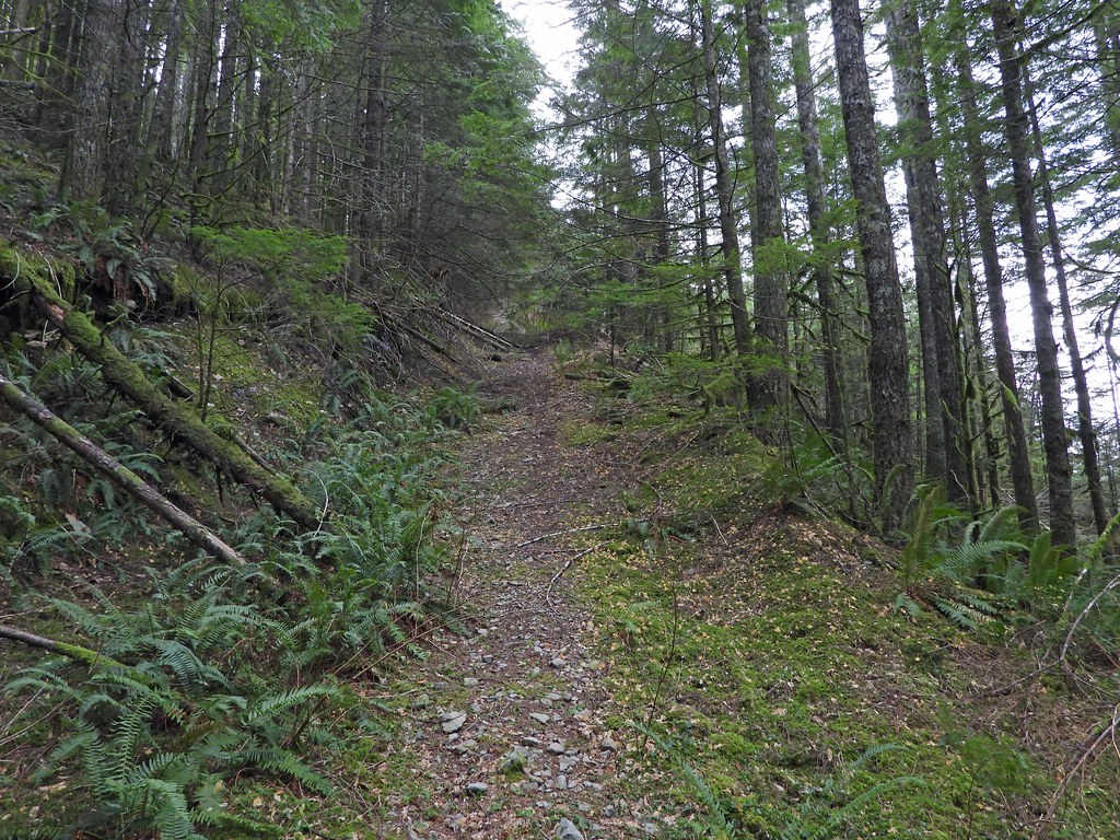
DSCN1011 by pauljess999, on Flickr
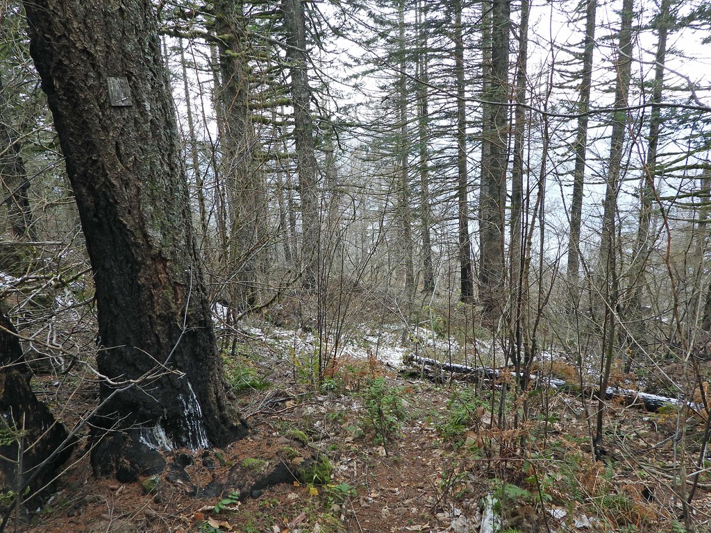
I wanted to go up Palmer Mill to the junction with Multnomah Basin Rd but I did not feel like traveling on decom'd road (which doesn't look quite as bad as some of the pics I've seen of other roads) so I went up the hill direct to Devils Rest. Brush is almost non-existent through un-burned areas which was nice.
DSCN1025 by pauljess999, on Flickr
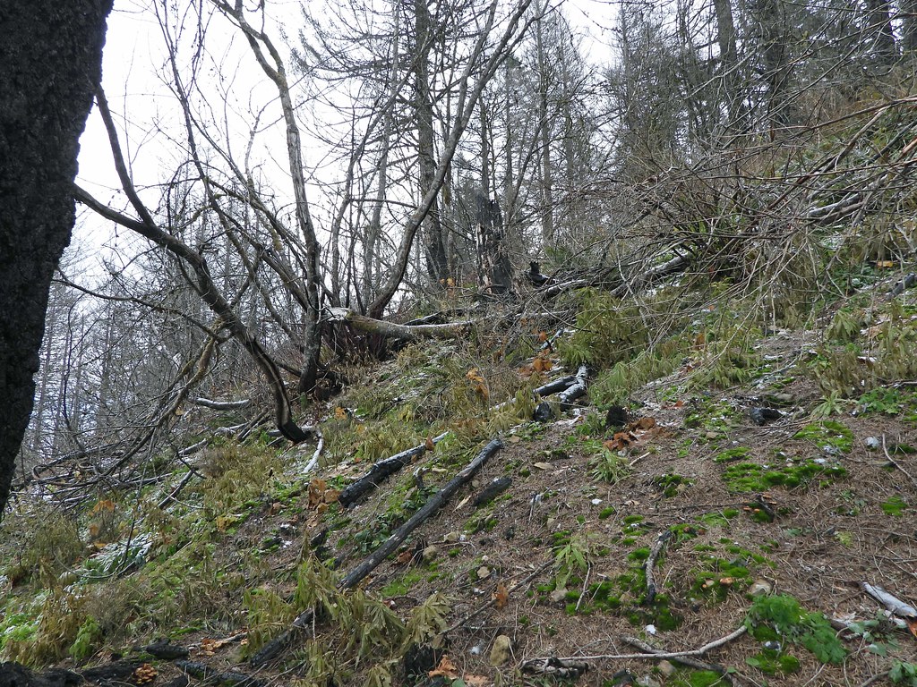
Burned areas were OK also.
DSCN1037 by pauljess999, on Flickr
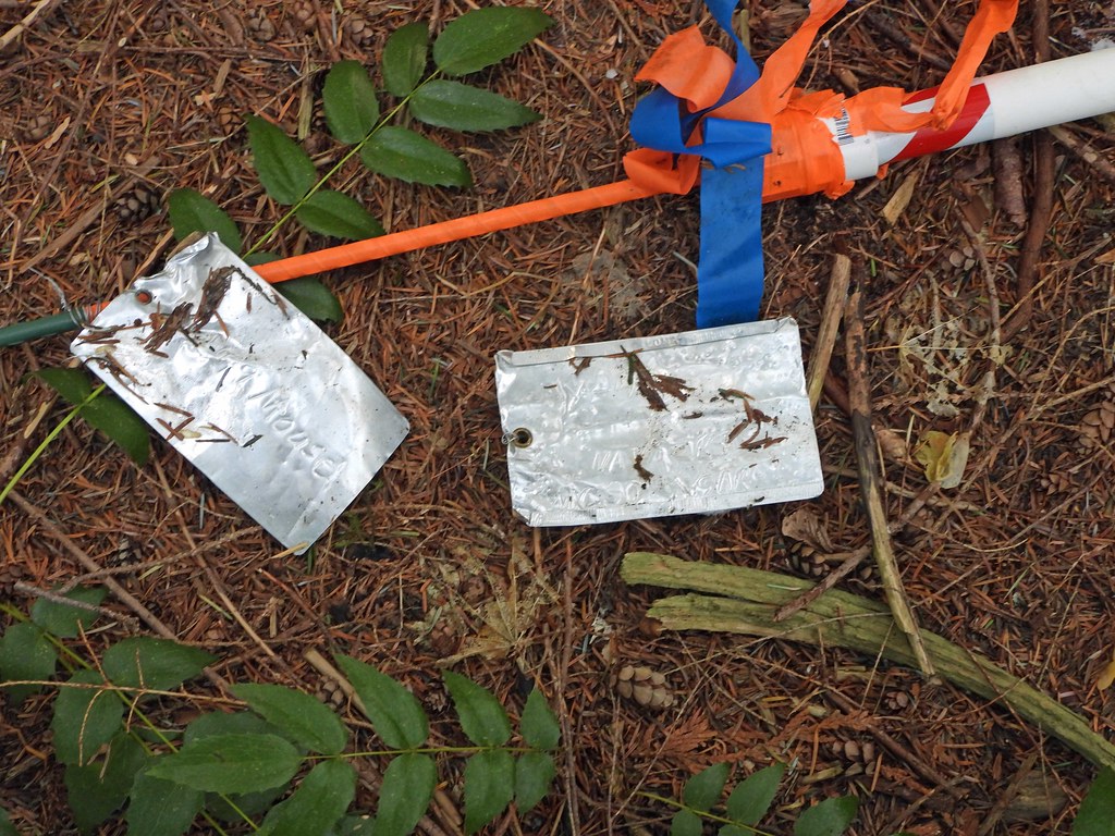
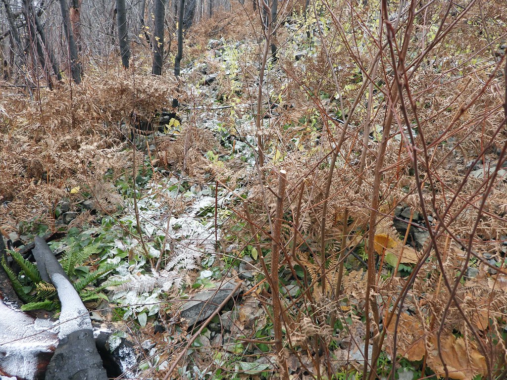
I ran into a road, followed it for a while, I think it is marked on maps - I don't have the number handy. A pile of trash from 20-30 years ago. Historical artifacts at this point, I guess.
Ran into something that looks SAR-like, the aluminum tag one on the left sez something 'Mouse' and the right one something about 'MCSO SAR'. Please translate.
DSCN1046 by pauljess999, on Flickr
Ran into a little brush but the way to Devils Rest trail was pretty straightforward. Once there I headed down Primrose and at this point I have to say the only part that looks like the old Primrose is the start.
As has been reported, the sign is still there.
DSCN1052 by pauljess999, on Flickr
From there on near total destruction - this is looking back up the hill at that first section through the brush. My Primrose GPS track kept me close.
DSCN1054 by pauljess999, on Flickr
That nice little forested section got hammered but no brush, not sure if I was on trail through here or not, close.
DSCN1059 by pauljess999, on Flickr
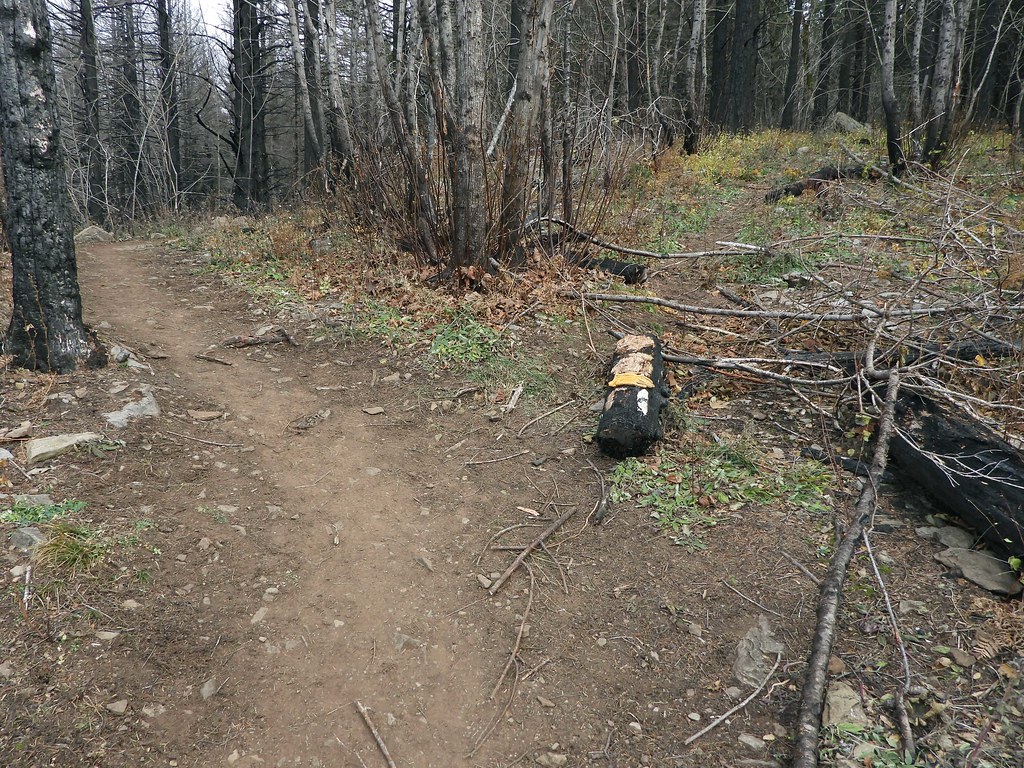
Some clipping along the path has been done.
DSCN1068 by pauljess999, on Flickr
Looking down the ridge.
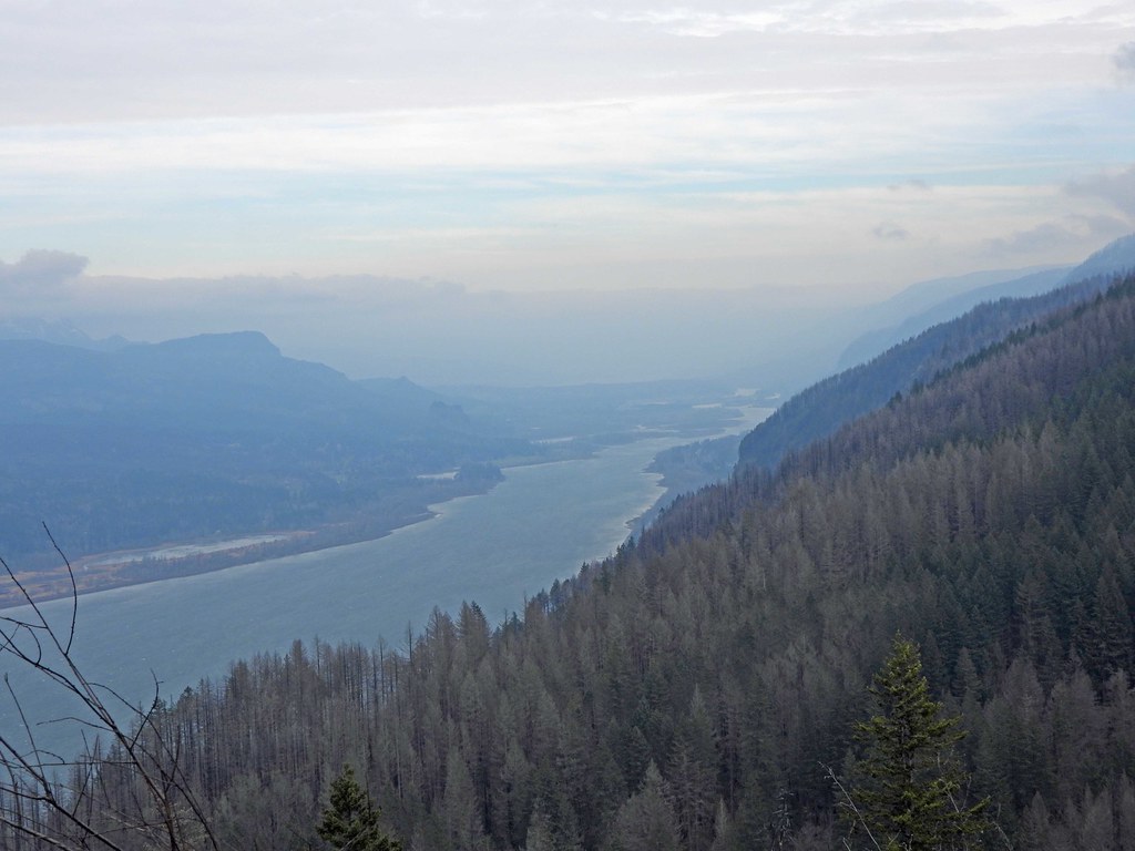
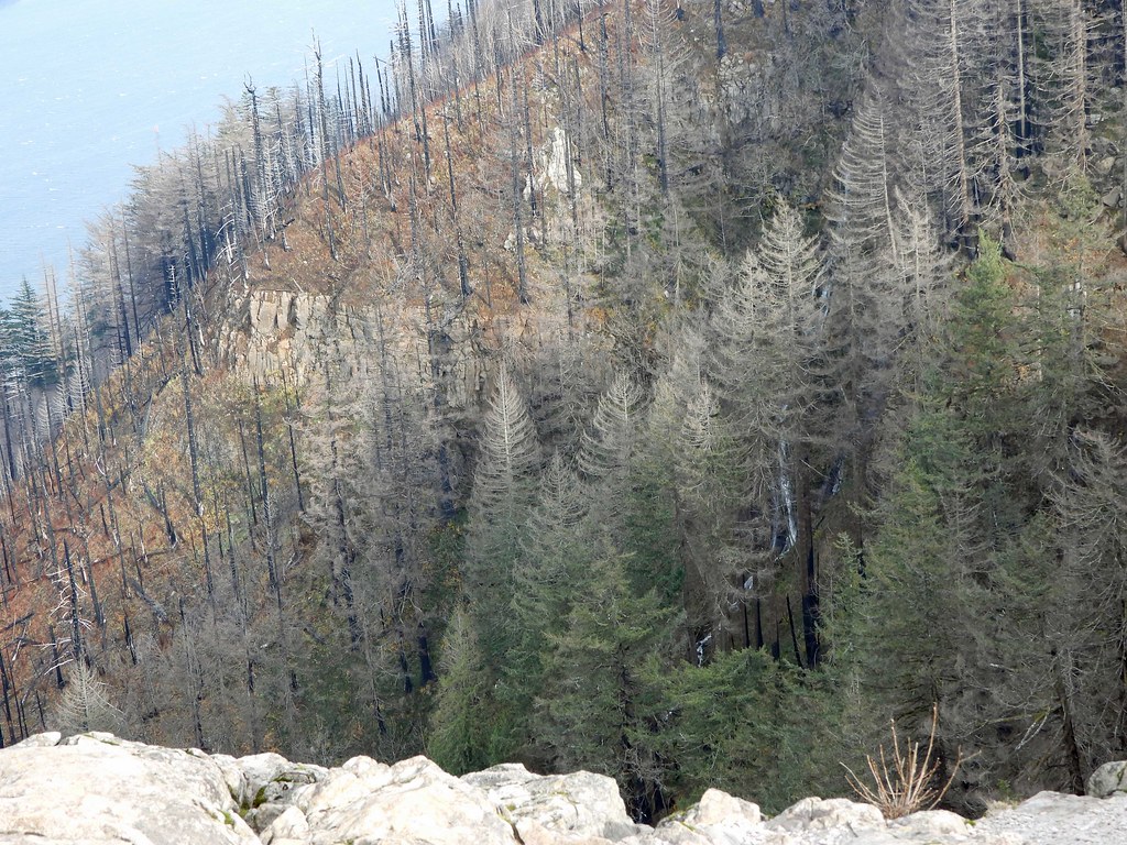
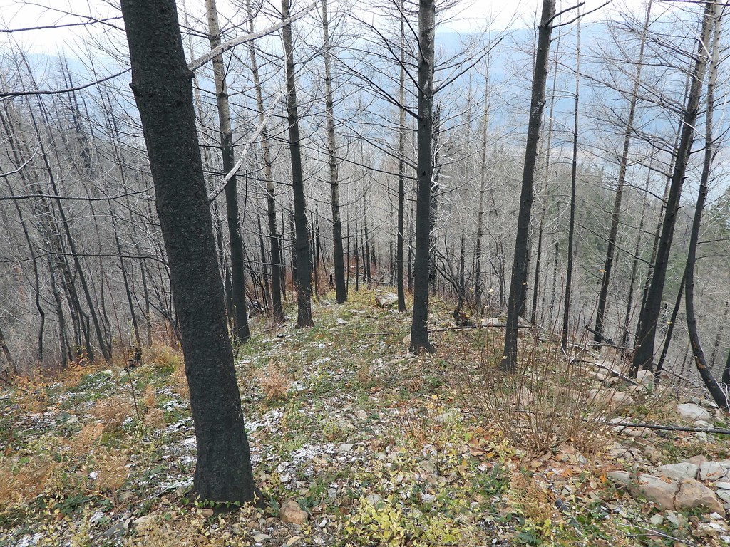
DSCN1070 by pauljess999, on Flickr
Fire opened up this nice look up the Columbia
DSCN1079 by pauljess999, on Flickr
I intersected the trail to Angels Rest and headed back.
One thing to note, the trail from Angels Rest to Devils Rest got no love. In the photo below, to the left is the trail to Wahkeena on the right the trail to Devils Rest.
DSCN1104 by pauljess999, on Flickr
Wind on Angels Rest was fierce, hard to stand up. I noticed there is a waterfall in view now I hadn't noticed before. I think if I looked hard enough I could find an old chameleon post about it.
DSCN1105 by pauljess999, on Flickr
Phoca Rock was getting hammered by wind driven waves.
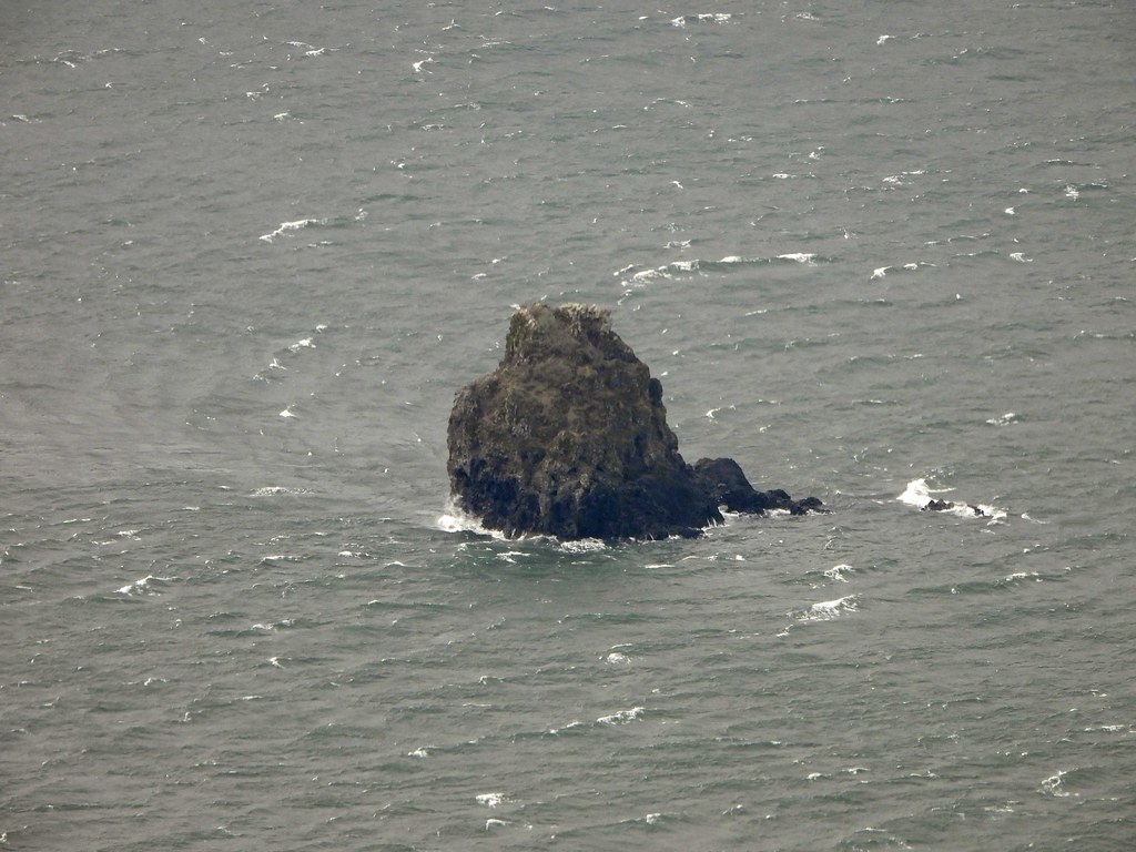
DSCN1153 by pauljess999, on Flickr
About 10 miles, 2900' EG. Lots of new explorations to do. Someone needs to check out that trail along Coopey Creek up to Wine Bottle Junction.
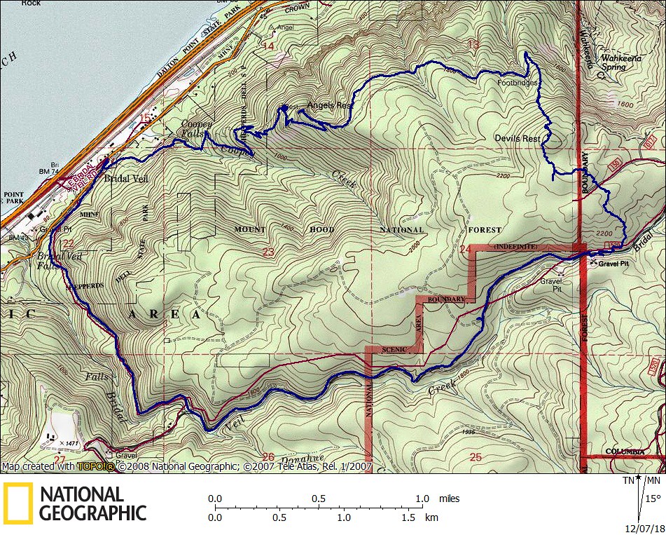
PalmerMillPrimroseMap by pauljess999, on Flickr
Palmer Mill Rd/Primrose Path - Dec 7, 2018
The future's uncertain and the end is always near.
Re: Palmer Mill Rd/Primrose Path - Dec 7, 2018
Thanks for the photos. It looks interesting, but it's going to take some getting used to.
I wish they would open Palmer Mill Road to vehicles as far as the decommissioning; that section of road looks in great shape now.
Re: Palmer Mill Rd/Primrose Path - Dec 7, 2018
Thanks for the update. I took a more conventional approach in this area the day before. Primrose has been large on my mind, and it's clear the trail fairies have been in the area doing a modicum of brush work.
Re: Palmer Mill Rd/Primrose Path - Dec 7, 2018
I think I know the road you mean. I followed it once a few years ago. It climbed to the top rim of the gravel pit before fading into the bushes. At that point, two flags on the left indicated something of interest in the woods to the southeast, but I couldn’t figure out what and didn’t see any flags further into the woods.I located a road just a little beyond the start of the decom on the south side of Bridal Veil creek that will need exploring. I followed it up until a switchback.
Re: Palmer Mill Rd/Primrose Path - Dec 7, 2018
Thx for the info, I'll put it on my list. I think I saw on a map that it ends like you say right above the pit but there is a flat spot and a nice ridge going south east that might be worth exploring.arlohike wrote: ↑December 25th, 2018, 2:58 pmI think I know the road you mean. I followed it once a few years ago. It climbed to the top rim of the gravel pit before fading into the bushes. At that point, two flags on the left indicated something of interest in the woods to the southeast, but I couldn’t figure out what and didn’t see any flags further into the woods.I located a road just a little beyond the start of the decom on the south side of Bridal Veil creek that will need exploring. I followed it up until a switchback.
--Paul
The future's uncertain and the end is always near.
Re: Palmer Mill Rd/Primrose Path - Dec 7, 2018
Just a thought, but depending which pit you're talking about, you're either getting onto or very very near to private property, so be aware of that in your wanderingspablo wrote: ↑December 25th, 2018, 10:02 pmThx for the info, I'll put it on my list. I think I saw on a map that it ends like you say right above the pit but there is a flat spot and a nice ridge going south east that might be worth exploring.arlohike wrote: ↑December 25th, 2018, 2:58 pmI think I know the road you mean. I followed it once a few years ago. It climbed to the top rim of the gravel pit before fading into the bushes. At that point, two flags on the left indicated something of interest in the woods to the southeast, but I couldn’t figure out what and didn’t see any flags further into the woods.I located a road just a little beyond the start of the decom on the south side of Bridal Veil creek that will need exploring. I followed it up until a switchback.
--Paul
Re: Palmer Mill Rd/Primrose Path - Dec 7, 2018
Well, just walking the length of the non-decommed part Palmer Mill Rd puts you on private property and the PP is on both sides of the road. I went to the MC tax lot mapping app and captured the following. Location of the Pit is my mark so I think the road in question is entirely on public ground but likely ends at the boundary of public property. Obviously the FS has been given an easement by the landowner for the portion of Palmer Mill Rd that crosses the PP part - likely one that has FS maintain the road and culverts. Explains why FS didn't decomm the entire length of the road to the barrier on the west end.Lurch wrote: ↑December 26th, 2018, 12:39 amJust a thought, but depending which pit you're talking about, you're either getting onto or very very near to private property, so be aware of that in your wanderingspablo wrote: ↑December 25th, 2018, 10:02 pmThx for the info, I'll put it on my list. I think I saw on a map that it ends like you say right above the pit but there is a flat spot and a nice ridge going south east that might be worth exploring.arlohike wrote: ↑December 25th, 2018, 2:58 pm
I think I know the road you mean. I followed it once a few years ago. It climbed to the top rim of the gravel pit before fading into the bushes. At that point, two flags on the left indicated something of interest in the woods to the southeast, but I couldn’t figure out what and didn’t see any flags further into the woods.
--Paul
--Paul
The future's uncertain and the end is always near.
- Splintercat
- Posts: 8333
- Joined: May 28th, 2008, 10:03 pm
- Location: Portland
- Contact:
Re: Palmer Mill Rd/Primrose Path - Dec 7, 2018
Paul, that’s Foxglove Falls. The fire has made what was once illusive much more visible!
https://www.oregonhikers.org/archive/view/16909
Tom
https://www.oregonhikers.org/archive/view/16909
Tom
- Eric Peterson
- Posts: 4097
- Joined: May 11th, 2009, 5:39 am
- Location: Oregon
- Contact:
Re: Palmer Mill Rd/Primrose Path - Dec 7, 2018
Color me stupid but does this mean people can't drive to the Trails Club Lodge anymore?
Re: Palmer Mill Rd/Primrose Path - Dec 7, 2018
Road to Nesika is unchanged Eric, we drove in this past summer for a volunteer weekend. Also walked it this fall and no change.Eric Peterson wrote: ↑December 29th, 2018, 7:34 amColor me stupid but does this mean people can't drive to the Trails Club Lodge anymore?
https://photos.smugmug.com/Outdoors-Hik ... e-1280.mp4