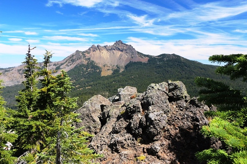
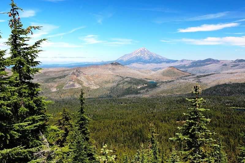
Three Fingered Jack from Maxwell Butte.
The hike to Maxwell Butte, trail No 3391, is glowingly described in the old “The Mount Jefferson Wilderness Guide Book” by Tony George, so we had to give it a shot.

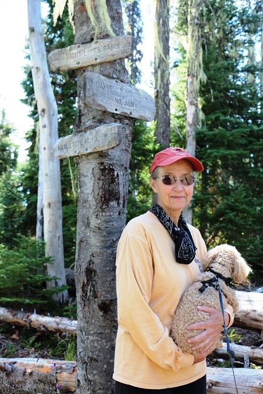
Trail Kiosk
The trailhead is located behind (East) of the Maxwell Butte Snowpark on Hwy 22. We drove thru the snopark and up the Maxwell Butte road to the small parking area about ¼ mile further on.
The trail follows an old cat road and is very evenly graded. The lower section is part of the Maxwell Butte ski trail area, and was well brushed out. At every fork in the ski trail system a blue signpost with a detailed topographic map showed your location and the direction of the branching ski trail.
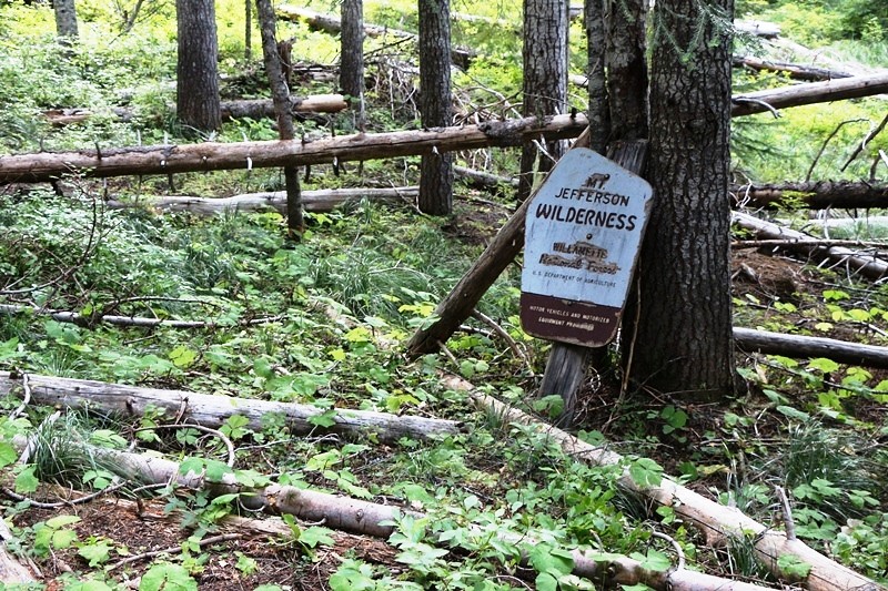
Beyond Ski Trail Point #6 a few trees were across the trail. And then we came to the Wilderness Boundary, marked by a sign whose post had rotted off—the sign now propped up against a couple trees. The Wilderness Boundary sign’s condition was a harbinger of the trail's condition ahead.
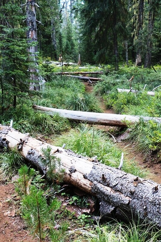
Mostly the trail is in good soil, meaning that the current trail tread is 6” to 24” below ground level. This makes clambering around the deadfalls that much more difficult. At 2.3 miles the cat road split.
Trail Junction with the Lava Trail NO 3433, equally cluttered with deadfall as far as we could see.
Hope springing eternal, we thought the volume of deadfall might decrease. Foolish thought, because as soon as we passed Twin Lakes., we found:
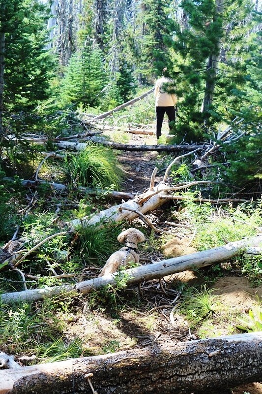
Which continued a good while, so we took a break, using a large downfall tree as a sit log. We were both feeling tired but neither of us felt like calling it quits just yet. And it just so happened we had stopped at the end of the downfall. Sure, there were quite a few more down trees, but we had our strides back. At about 4 miles the trail leaves the ridge crest to traverse the south side of Maxwell Butte. Evidence of the old cat road disappears, and the trail tread becomes mostly cinders.
Lupine filled meadow.
The trail switchbacks a bit but mostly maintains a constant grade to the summit at 4.7 miles.
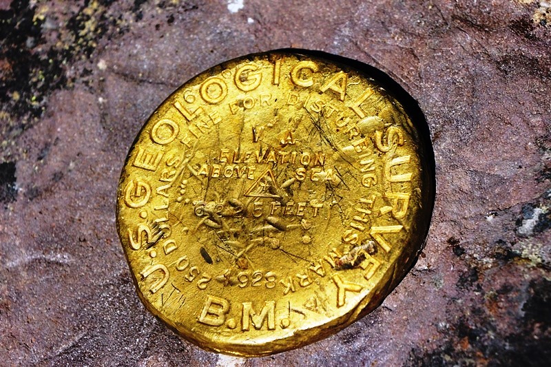
Summit VABM.
Maxwell Butte was the site of a fire lookout, subsequently burned, but melted glass, nails, and pieces of the woodstove remain to memorialize the lookout and its faithful fire spotters.
The views are stupendous. Maxwell Butte sits high enough to have a commanding view of all of the surroundings, although trees have grown tall enough to block the western views of the Old Cascades.
North to Jeff, Hood, and (L-R) Duffy, Mowich, and Santiam Lakes.

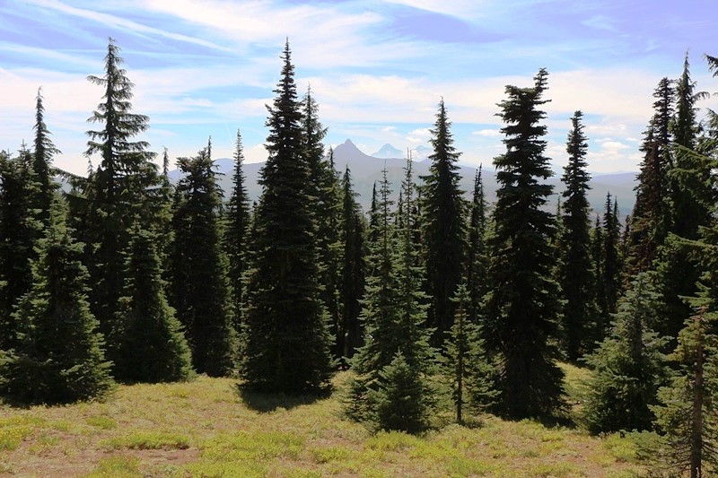
East to Three Fingered Jack.
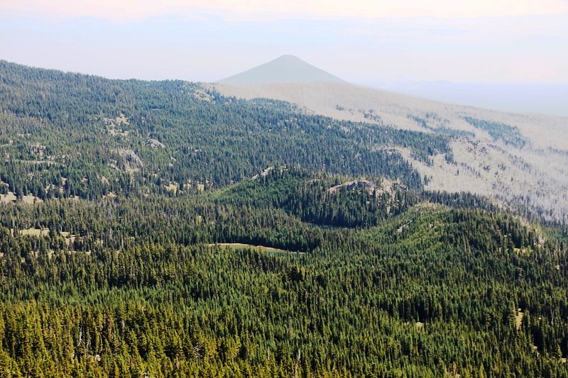
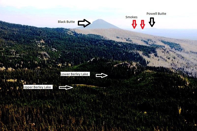
East South East to Berley Lakes, Black Butte, and left of Black Butte, Powell Butte with a fire burning near it.

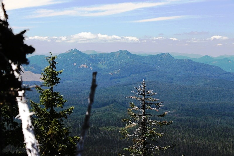
South East to Craig Lake, barely visible on top of closer butte.
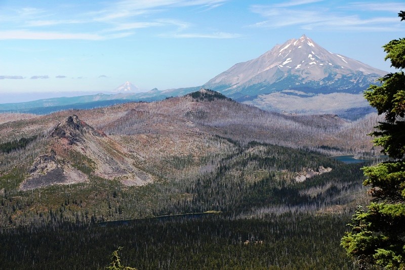
South to Hoo Doo, Mt Washington, Broken Top, Three Sisters, and the Husband.
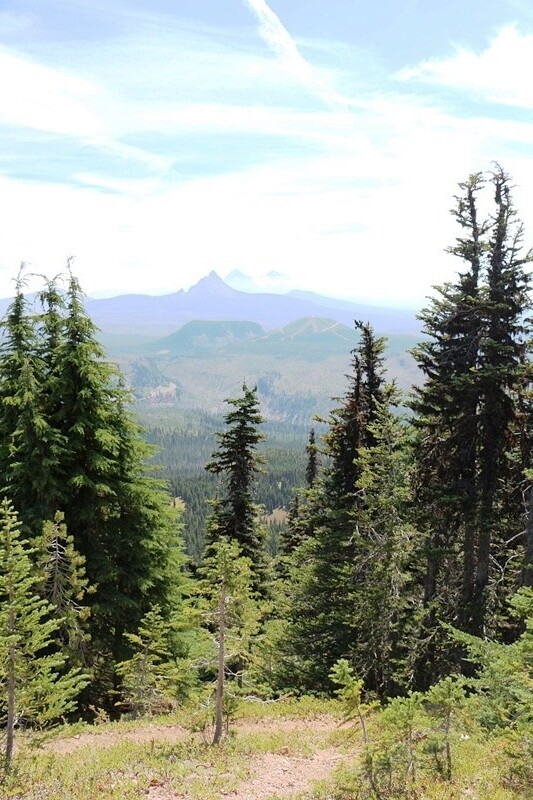
To look west, moved to a rocky point north of the high point to get this view of the Three Pyramids,
Where I found this:
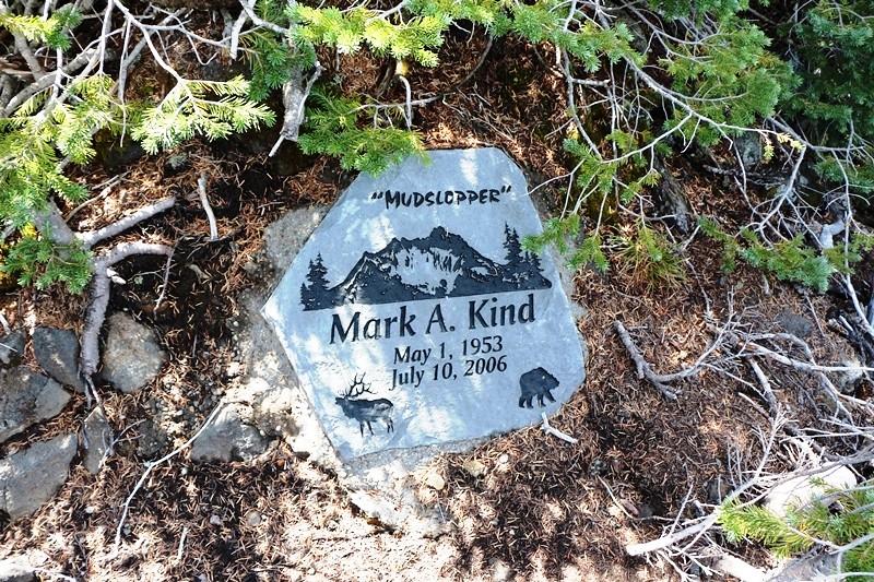
Memorial north of summit.
* * * * * * * * *
Of all these places, Santiam Lake, with its bright green necklace, was most inviting.
But Duffy and Mowich Lakes looked inviting, too.
[
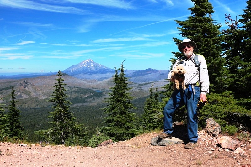
Yours, Truly.
On the return, Susan counted the obstacles. She had her own rules. Multiple deadfalls counted as one if you get around them in one move. Obstacles that you could get by without breaking your stride didn’t count.
“Burnside, how many obstacles were there?”
“I don’t know. A 150?”
“212. So since we passed each twice, that’s 424 for the hike.”
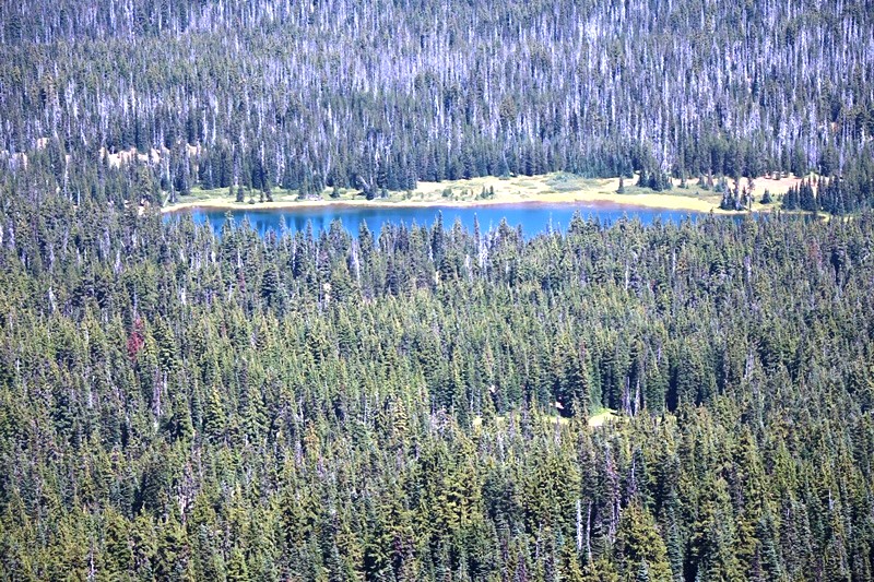
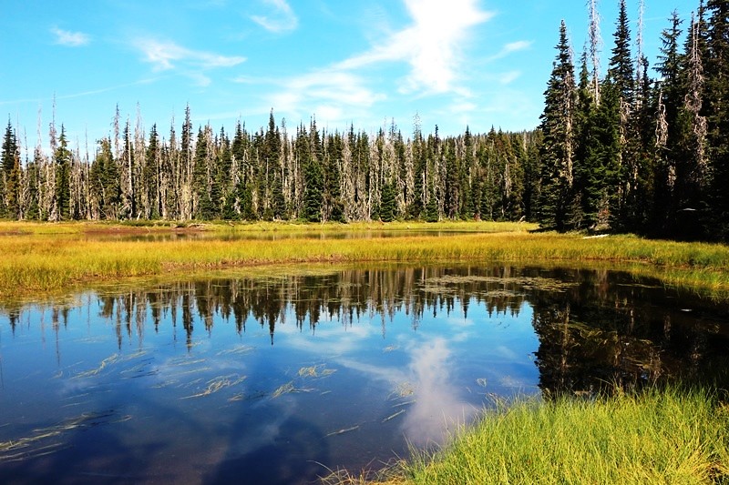
And we stopped at Twin Lakes on the way out. As the photo shows, there are a lot of dead trees in the forest—mostly pines killed by the pine beetle epidemics of past years. Above the pine belt, there were few dead trees and fewer deadfalls.
* * * * * * * * * * * *
So there you have it. A glorious hike offering some of the best views around (unless you are climbing one of the big guys). An under-rated hike where we didn’t see a soul. Just be ready to climb over some deadfall to get to the best views.