
When: 8/12/17
Who: Just Me (Born2BBrad)
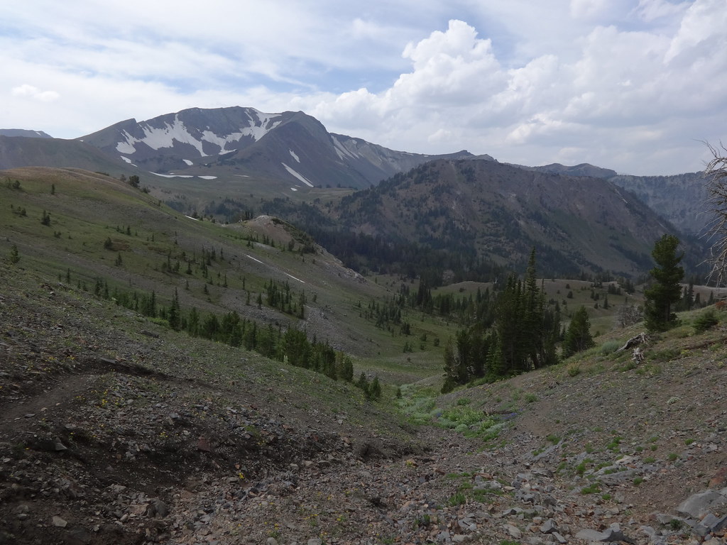
Opening picture:
-----------------------------------------------------------------------------------
General Information
Route: Wallowa Lake tram (4450’-8150’), Mt. Howard (8255’), East Peak (9380’), Hidden Peak (9460’), Aneroid Mountain (9701’), Dollar Pass (8420’), East Fork Wallowa River Trail back to the trailhead (4645’)
Total miles: 17.5 (1.8 on the tram)
Total EG: 6500’ (3700’ on the tram)
Number of mosquito bites: 0
Number of peaks reached: 4
People encountered on the route: 20
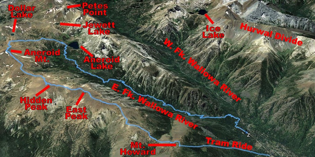
Google Earth overview:
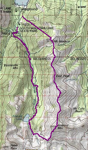
Topographical overview:
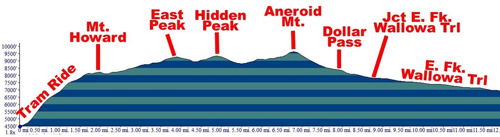
Elevation profile:
Google Earth video tour of trip (2:43 minutes):
Link in case the YouTube embed does not work.
-----------------------------------------------------------------------------------
Preamble
One of the advantages of living in the East end of the Columbia River Gorge is that a one-night trip to the Wallowas is much more achievable. It’s only a four-hour drive to Wallowa Lake.
Now for some facts about the Wallowa Mountains and Eagle Cap Wilderness taken from a previous TR:
• Located in the Wallowa Mountains of NE Oregon.
• In 1930, it was established as a primitive area and in 1940 earned wilderness designation.
• At over 360,000 acres it is by far Oregon’s largest wilderness.
• Named after a peak in the Wallowa Mountains, which used to be called the Eagle Mountains.
• The highest point at 9838’ is Sacajawea Peak. A total of 31 summits exceed 8000’ in the Eagle Cap Wilderness.
• Contains Legore Lake, at 8880’ the highest lake in the state of Oregon.
• Wildlife includes black bears, cougars, bighorn sheep, mountain goats, white-tailed deer, mule deer and Rocky Mountain elk. Moose have recently returned to the wilderness and there is evidence that grizzly bears and wolverines have returned. The Imnaha wolf pack has been known to roam the Eagle Cap Wilderness, as well.
• 47 trailheads lead into the wilderness, with approximately 534 miles of hiking trails.
• The wilderness contains four designated Wild and Scenic Rivers that originate in Eagle Cap Wilderness: The Lostine, Eagle Creek, Minam and Imnaha Rivers.
This trip was not organized in advance enough to find a hiking partner, so a special solo backpacking wife pass had to be procured. Having a PLB made that easier. With that done, plans for a one-night adventure ensued.
A route came together utilizing the Wallowa Lake Tram to gain access to a high-elevation ridge. Sure, it’s cheating, but 3700’ feet can be gained in only 15 minutes. Lots of research was done for several mountains and peaks. All indications were that my route could be done without any special gear or physical abilities… other than being in shape and sure-footed.
Some interesting facts about the tram:
• The tram takes passengers from 4450' in elevation to 8150', a gain of 3700'.
• When constructed in 1970, the tram was the steepest vertical lift in North America.
• The tram ride is fifteen minutes.
• Highest point off ground: 120 feet.
• Lowest point off ground: 3 feet.
• Cable length: 19,300 feet (nearly 4 miles long).
• There are 25 towers total.
• When the tram was built in 1970, the original master plan called for more lifts and a ski area.
Rather than providing links to the Internet research and describing what was discovered on those websites, this trip report will provide the details. My GPS Tracks on GPSFly, pictures and narrative will provide a one-stop-shopping resource for those wanting to repeat all, or part of this trip. Even Fred Barstad’s book, as informative as it is, does not describe the details on much of the route for this trip.
I drove to Wallowa Lake the evening before the day of the hike. The reason was twofold. One to maximize daylight hiking. The other to acclimatize at above 4000’ for 12 hours before the tram ride. Gaining too much elevation too quickly has caused problems before.
As was done on my Wallowas trip last year, I slept in my car at the Wallowa Lake Trailhead parking lot. It was very quiet and peaceful. Much better than the nearby mini-city at Wallowa Lake State Park.
The plan was to wake up in time to be at Wallowa Lake Lodge by 7AM for a power breakfast. That would give plenty of time to be ready for the opening 9AM tram ride.
----------------------------------------------------
Trip Narrative and Pictures
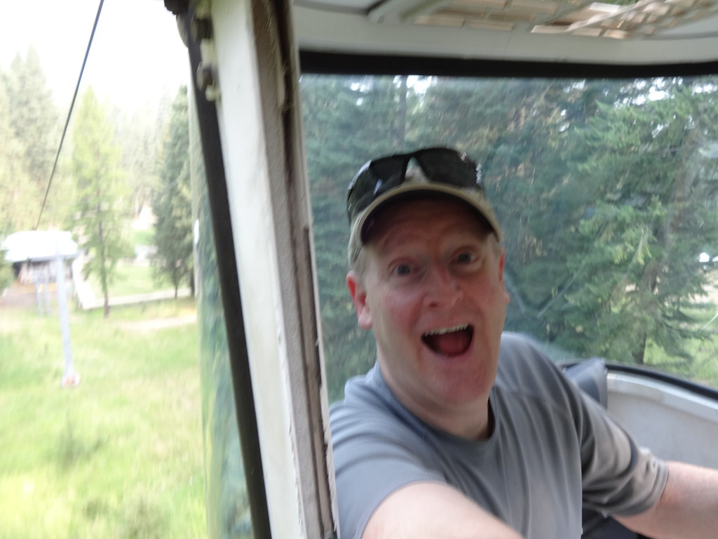
After paying $33.00, by 9:00AM, I was on the tram up to Mt. Howard:
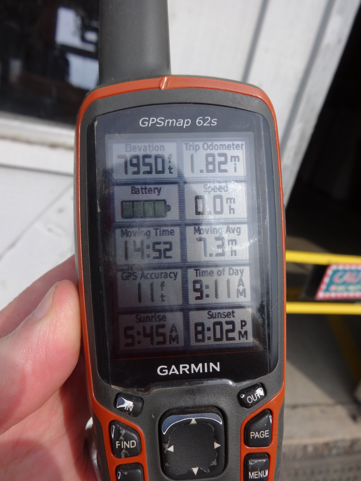
In case you were curious, the average speed of the tram ride is:
In addition to the Summit Grill, there are almost 2 miles of easy trails on Mt. Howard. The trail I was looking for departs from the main trail near Summit Overlook and heads towards East Peak. Google Earth and trail descriptions led me right to it.
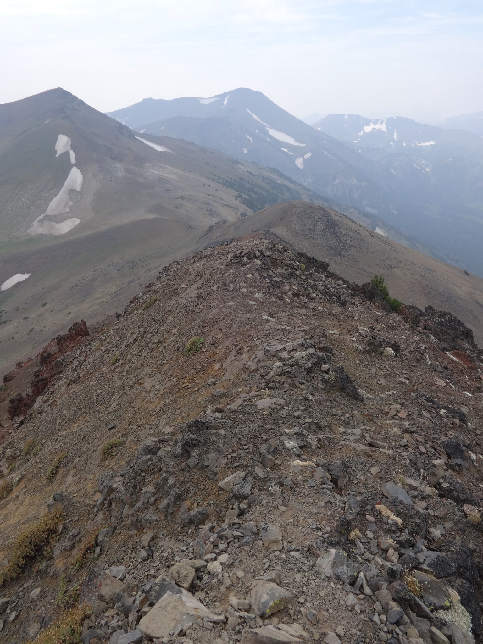
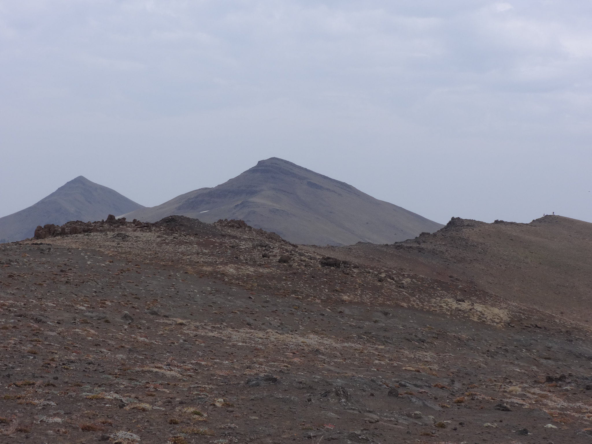
East Peak (second peak from right) from Mt. Howard:

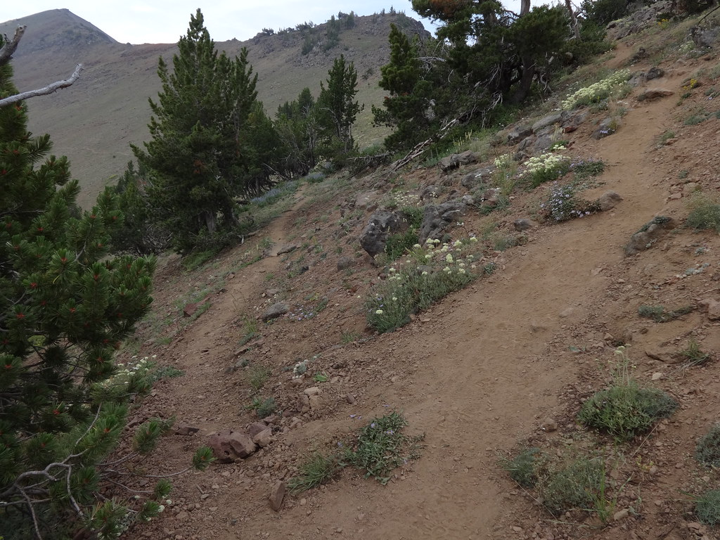
The trail from Mt. Howard to East Peak is a true trail. No bushwhacking or route finding.
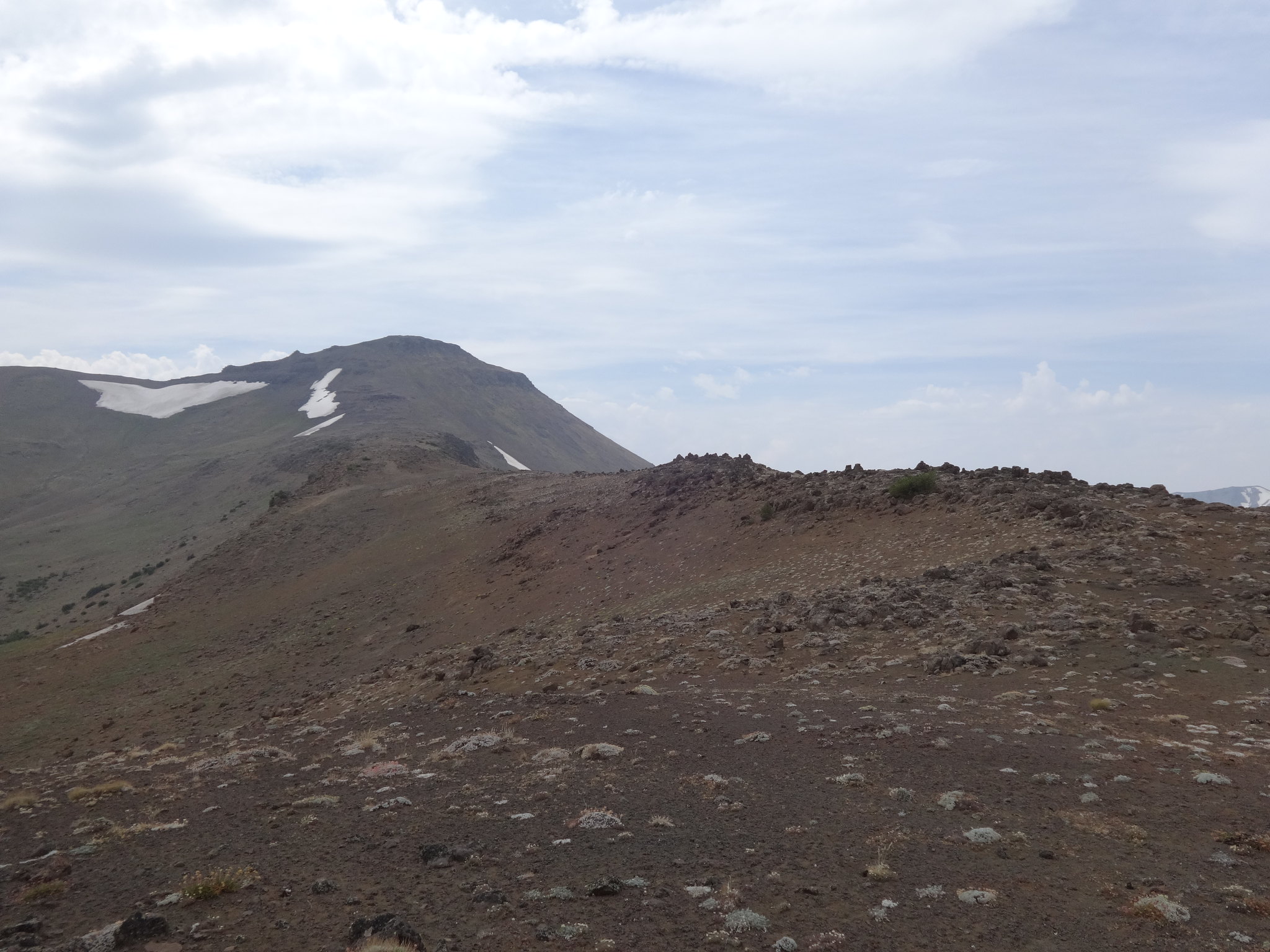
The approach to East Peak:

There does come a point where the trail splits. Up to the right goes to East Peak. Down to the left skirts below East Peak and goes to Hidden Peak. It could be called East Peak Bypass Trail.
Where the trail splits:
The final ridge scramble is not too difficult. No climbing or hand holds are necessary.
Almost to the top of East Peak:
The scramble down the other side is about the same as coming up:
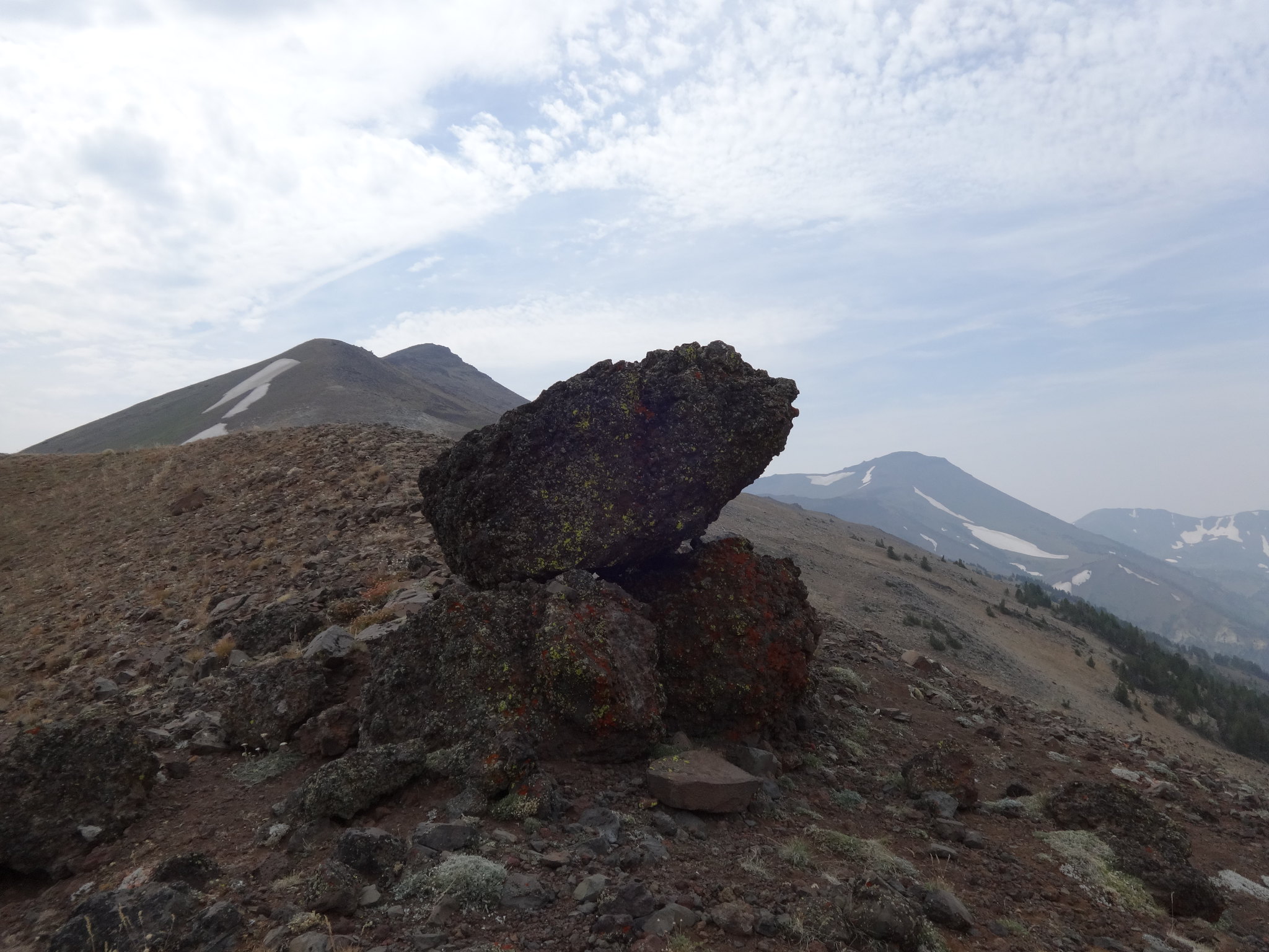
Cool natural cairn on the saddle between East Peak and Hidden Peak:
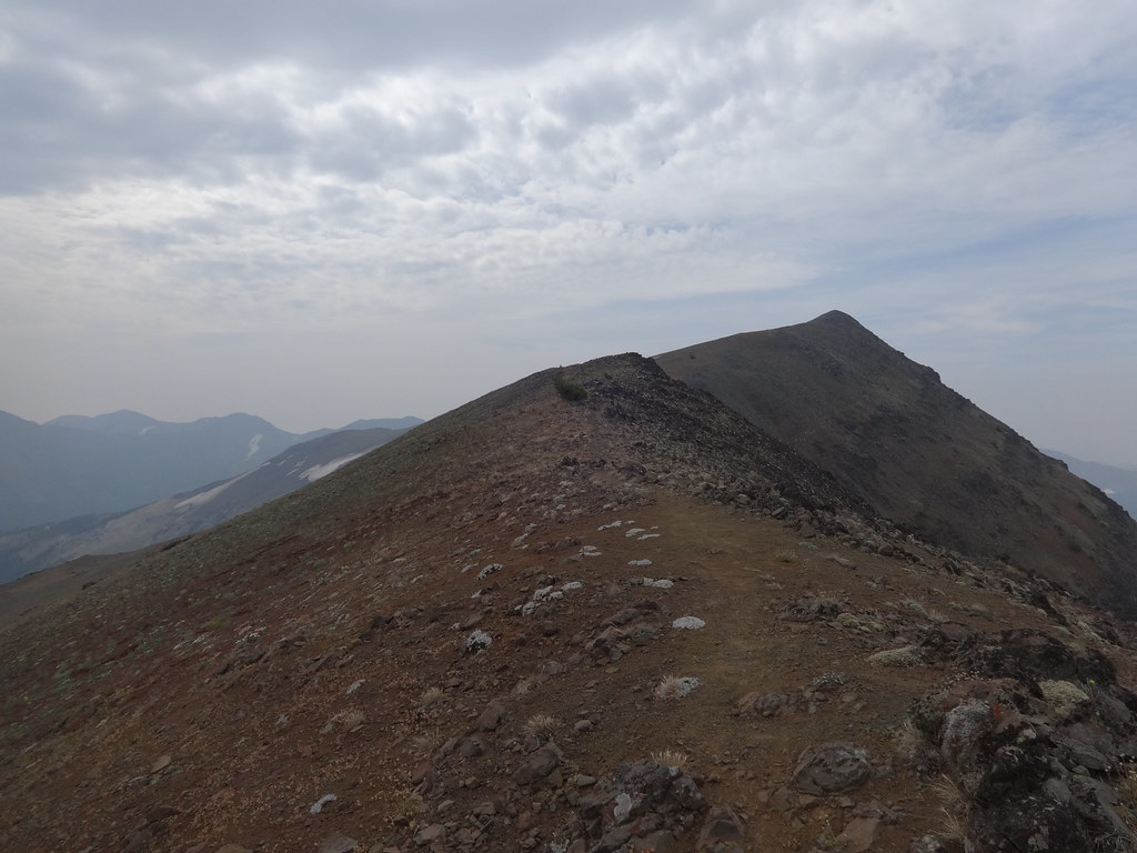
The climb up to Hidden Peak is pretty much the same as East Peak. One difference is the trail is much less discernable. In places it braids, and sometimes disappears. Just stay near the ridgeline and pick your route accordingly.
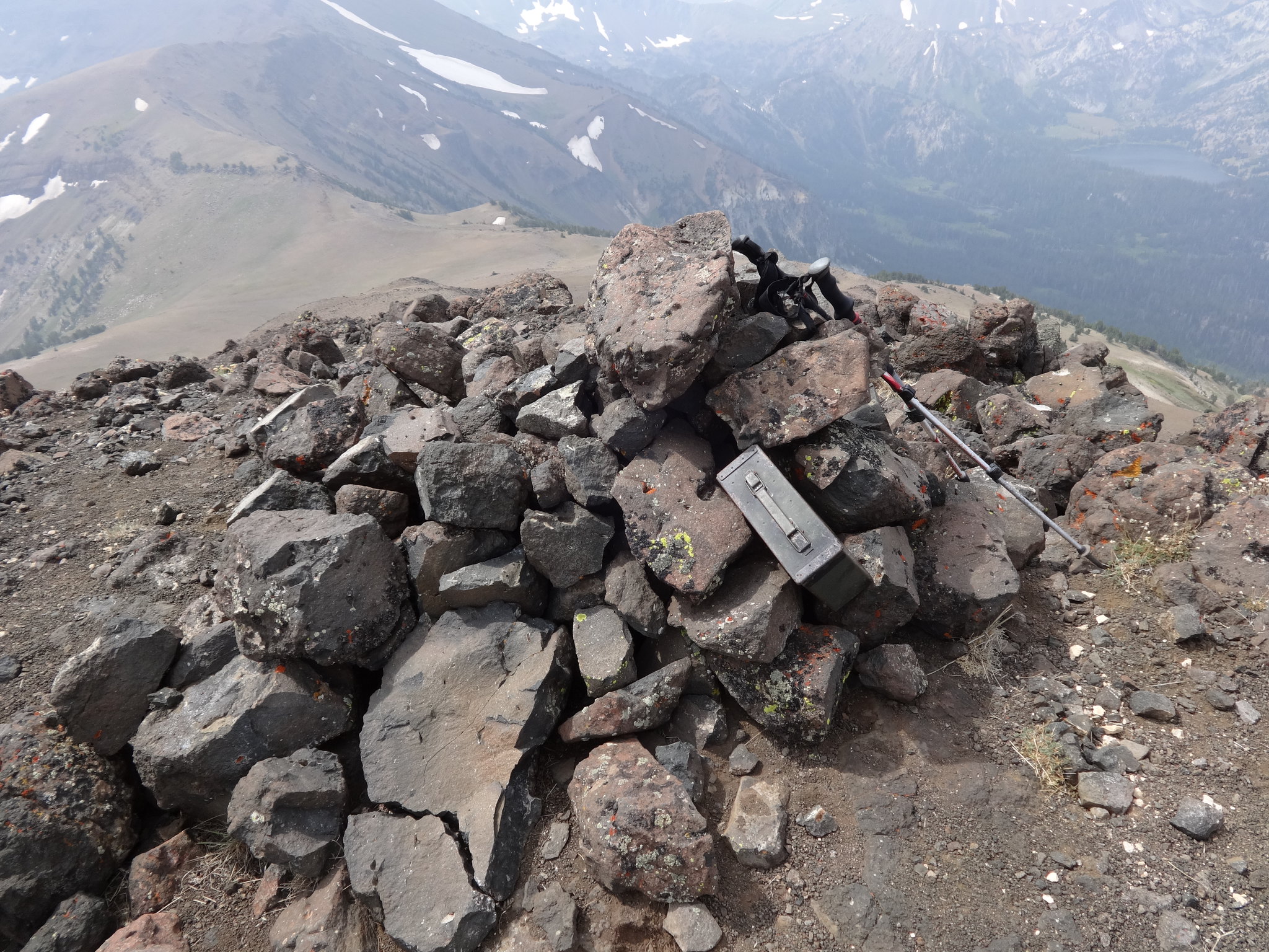
Hidden Peak is not an officially named peak by USGS standards, but that is what is has come to be known. It’s interesting that it is higher than East Peak, yet East Peak is an official USGS name and is listed on government maps.
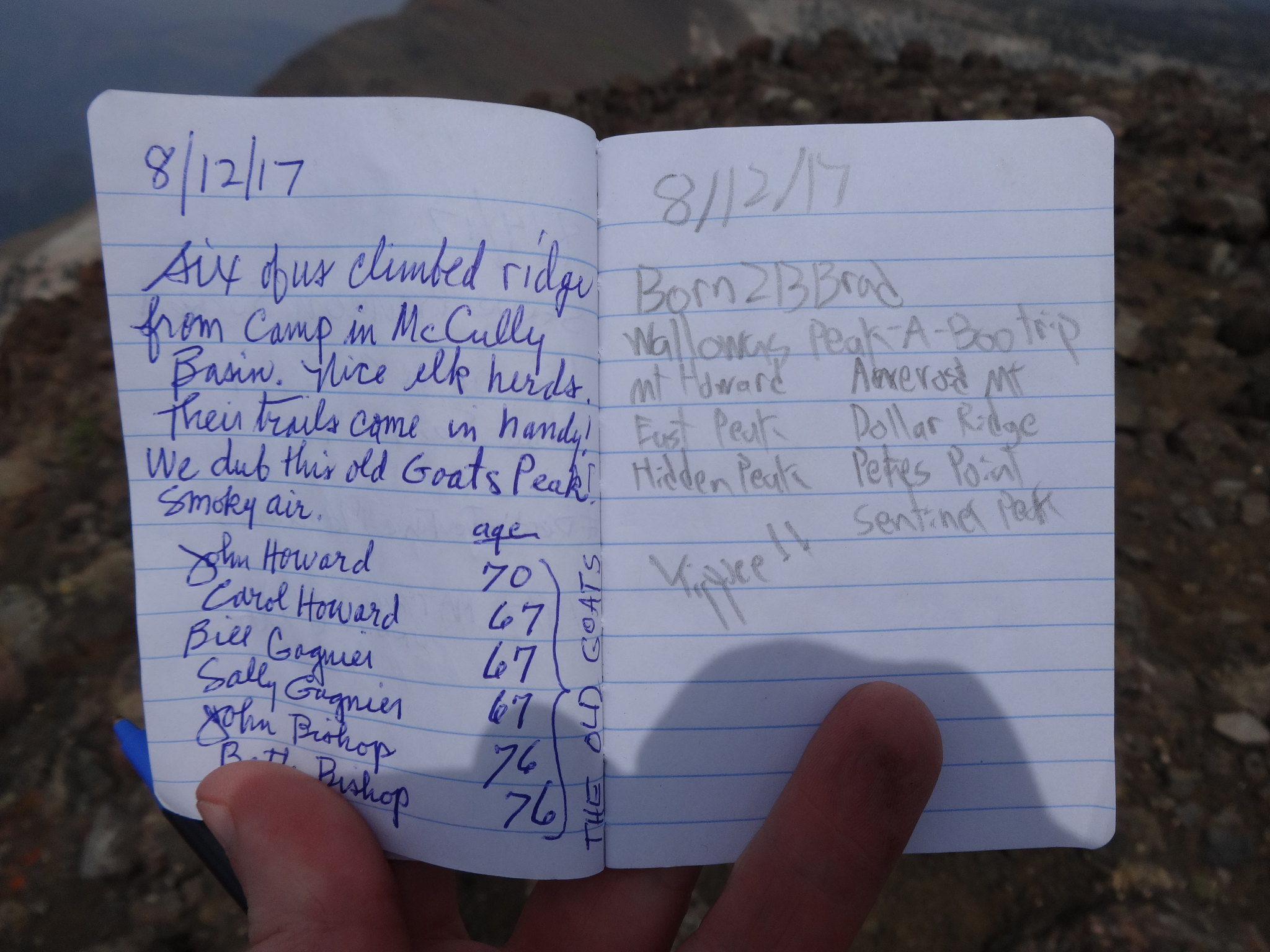
Summit cairn and register box on Hidden Peak:
There were six senior citizens atop Hidden Peak when I got there. Way to go!
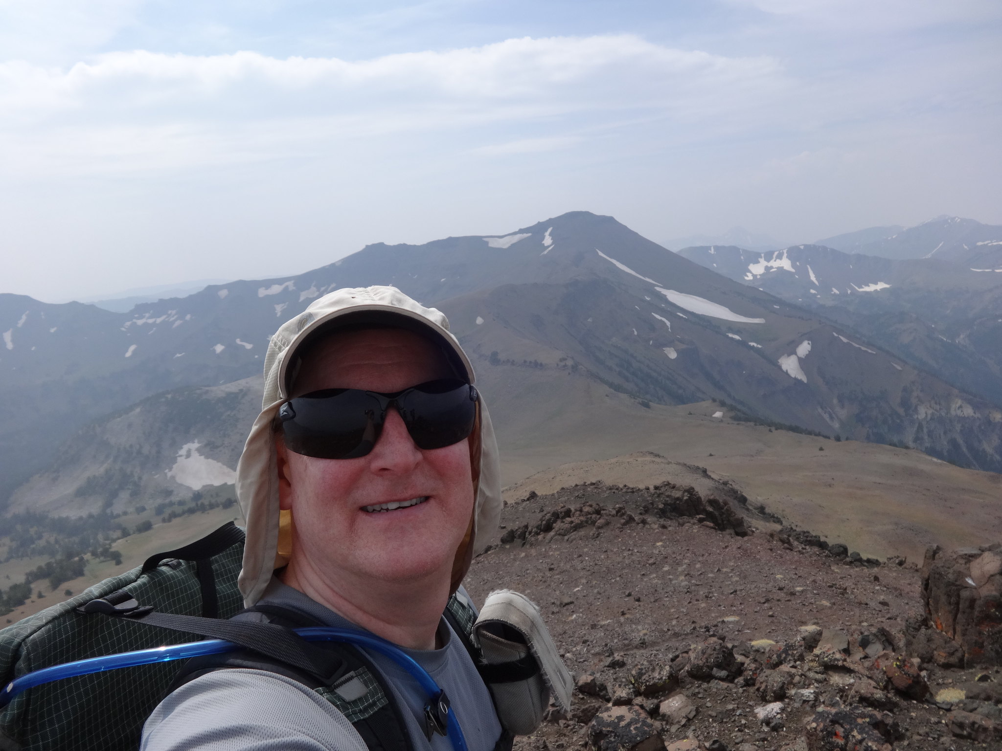
Yours truly from Hidden Peak, with the ridge leading up to Aneroid Mt. behind me:
The scramble down Hidden Peak to the saddle is like the scramble up. No climbing or hand holds necessary. There is a discernable trail all the way to the saddle.
From the start at Mt. Howard, I played a game of “Catch Me If You Can” with a young couple from Portland. They would catch up to me on the peaks. Ah, to be young again. It did give my wife comfort to know other human beings were never too far away while hiking solo.
Can you find the two people in this picture?
The climb up to Aneroid Mt. was the most difficult of all the peaks. It was the steepest, had the loosest footing and was at the highest elevation. It had the least defined trail, often times disappearing or braiding all over the place. Even so, no special skills or equipment is needed.
Getting closer to the top:
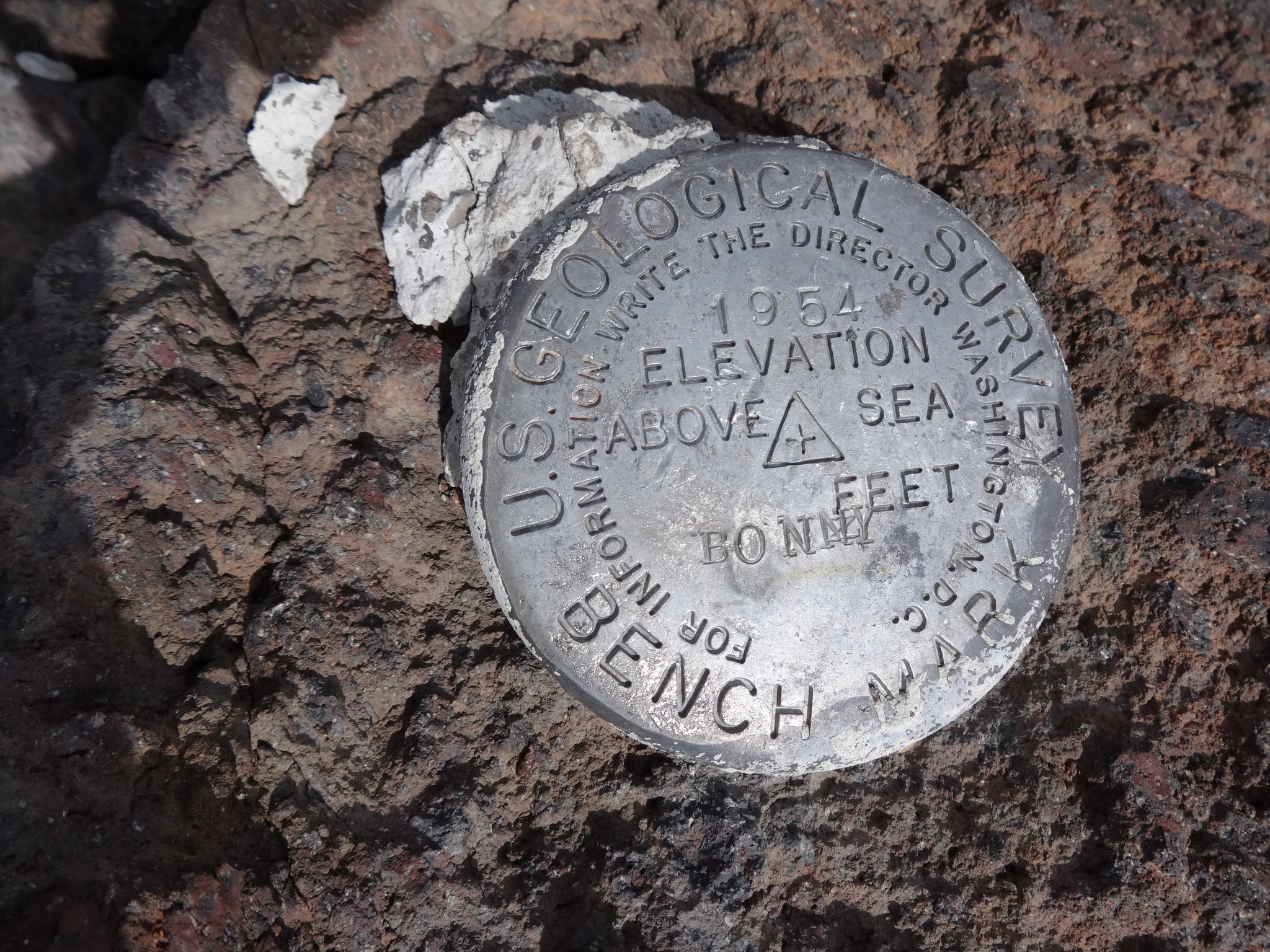
USGS marker at the top of Aneroid Mt.:
Once at the top, I immediately began descending. Due to the elevation (9701’) and only half a day of acclimatization, the nausea got the best of me. There is one cure, and that’s losing elevation.
Much research was done about the best route to get from Aneroid Mt. down to Dollar Pass. Nothing specific was found. Just reports of people doing it. From the top looking down, a route presented itself: straight down the SW ridge leading to Dollar Pass. The terrain was steep, on deep, loose scree and dirt. Easy going down, but it would be very difficult going up. Two steps up and one step back.
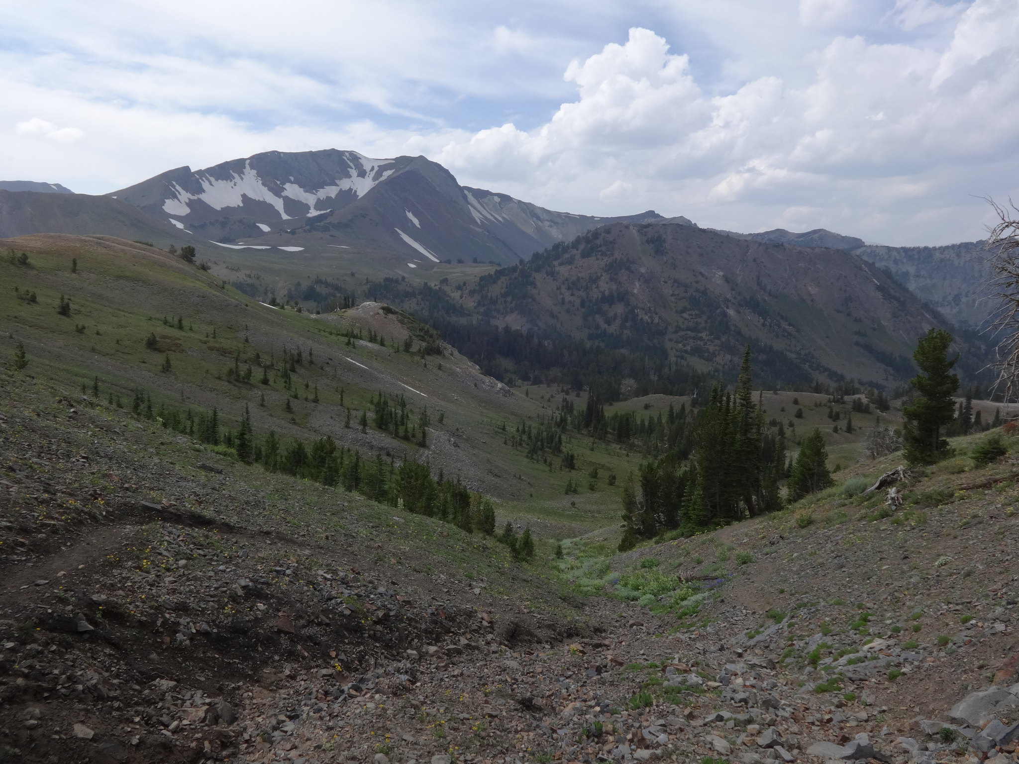
Looking down to Dollar Pass and Dollar Lake:
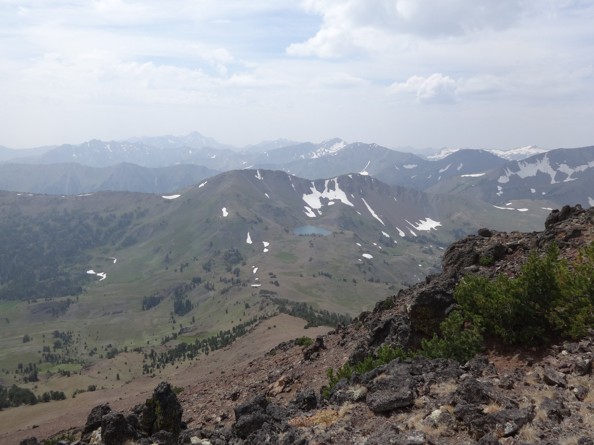
After an uneventful descent to Dollar Pass, it was time for my first break of the day. My appetite had returned so nibbling commenced. I also put a couple Nuun electrolyte pills in a bottle for drinking. Tip: Nuun pills are great for staying properly hydrated. Water is sometimes not enough.
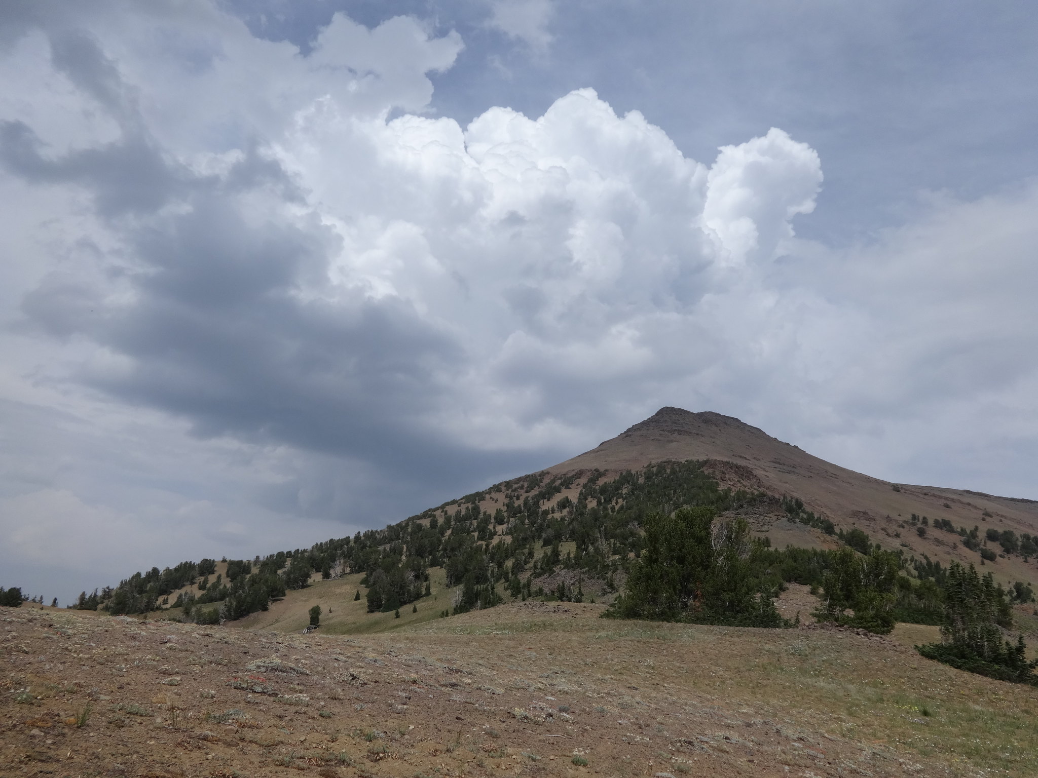
While resting, the puffy white clouds in the sky that had been building started causing me some concern. The forecast had called for more than a chance of thunderstorms. High on a mountain ridge is not where you want to be when lighting is anywhere nearby.
My planned route was to cross Dollar Ridge (9100’) direct to Tenderfoot Pass (8450’), possibly camp at Jewett Lake (8280’), climb Petes Point (9675’), take the south ridge over Peak 9395 directly to Polaris Pass (8900’), up to Sentinel Peak (9401’), back to Polaris Pass, down Polaris Pass to the West Fork Wallowa River Trail (6400’), then back to the trailhead.
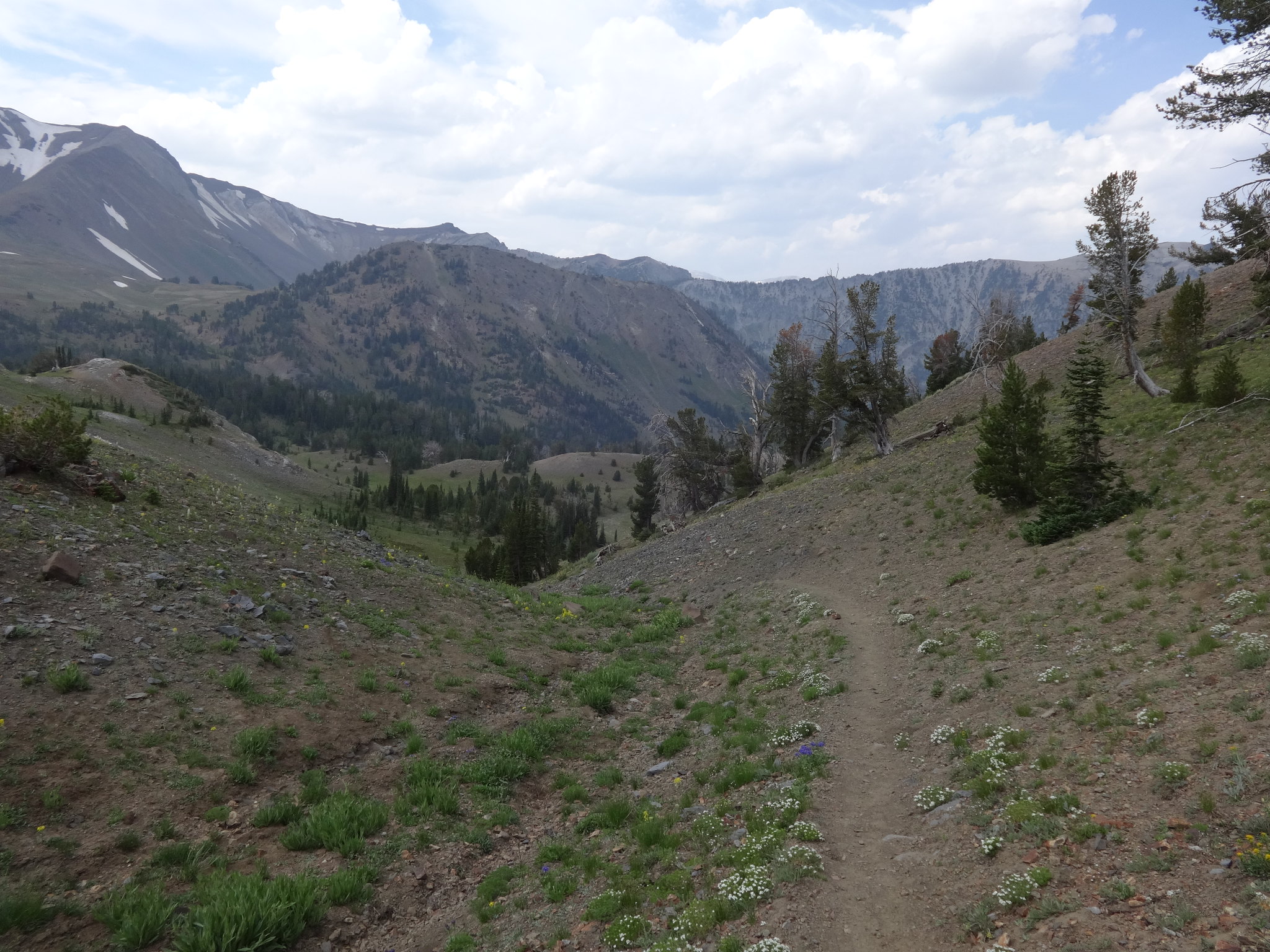
With ominous clouds increasing, an executive decision was made to take the E. Fk. Wallowa Trail back to the trailhead that day. I would be home in time to sleep in my own bed. Otherwise there was an increasing chance I would be stuck in my tent weathering the storm from 4 PM all through the afternoon into evening.
Puffy white clouds over Aneroid Mt.:
Descending from Dollar Pass towards E. Fk. Wallowa Trail:
Looking back up towards Dollar Pass and some mare’s tail clouds:
Peats Point (upper left) with Tenderfoot Pass just below it:
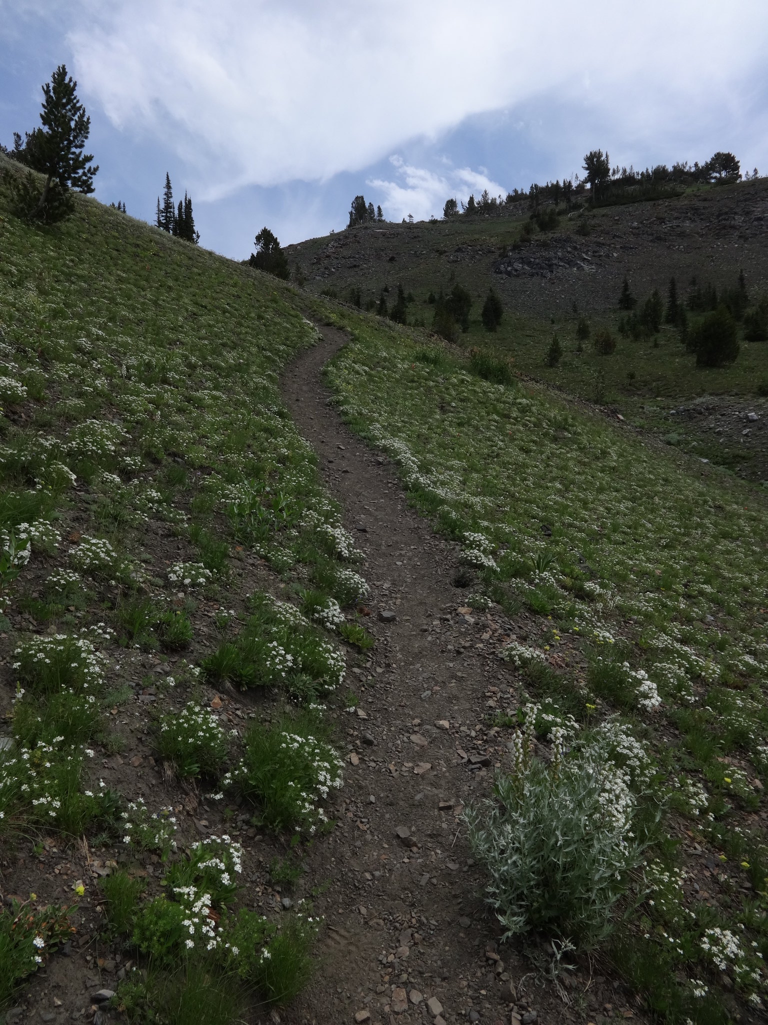
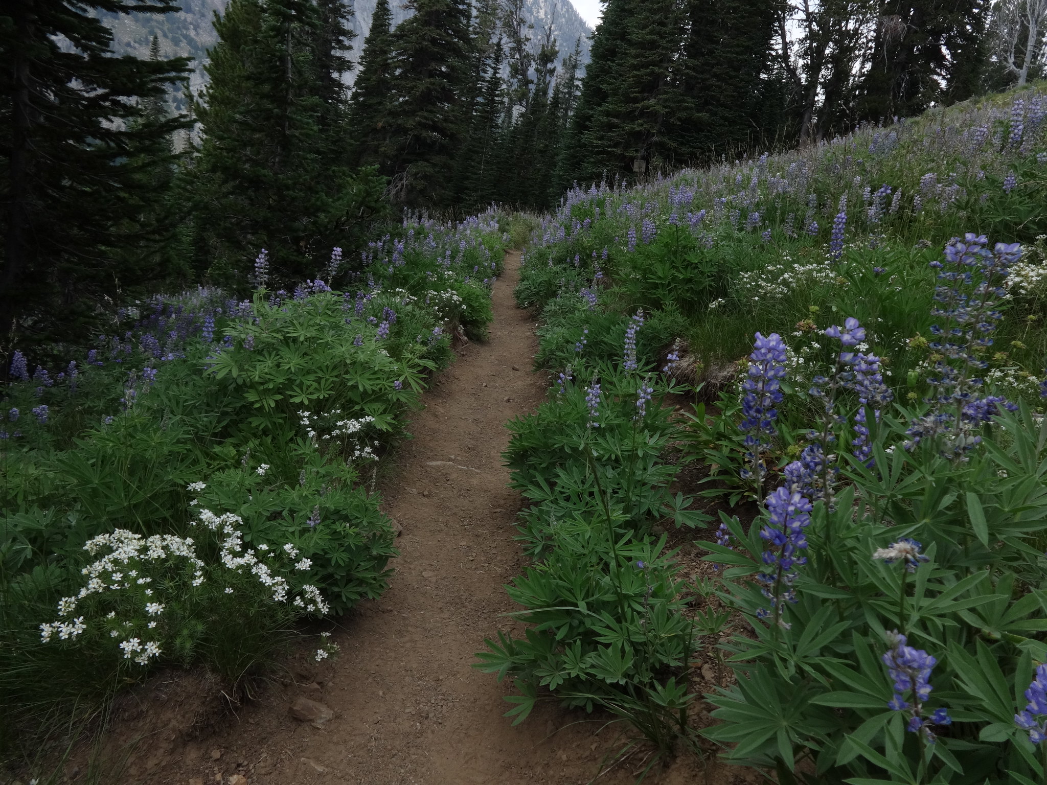
Lots of white Phlox along the trail:
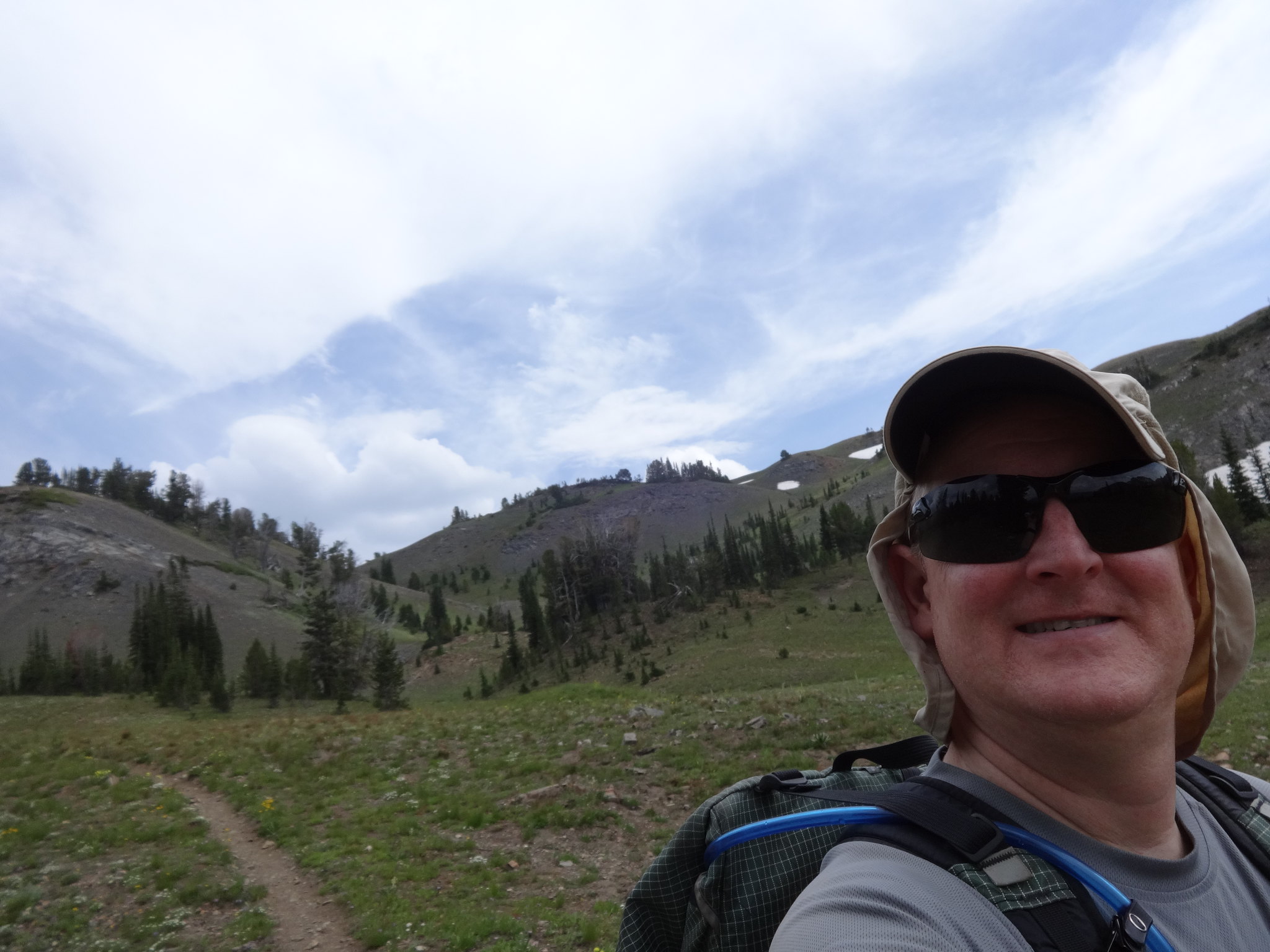
Who needs a selfie stick? Not me!
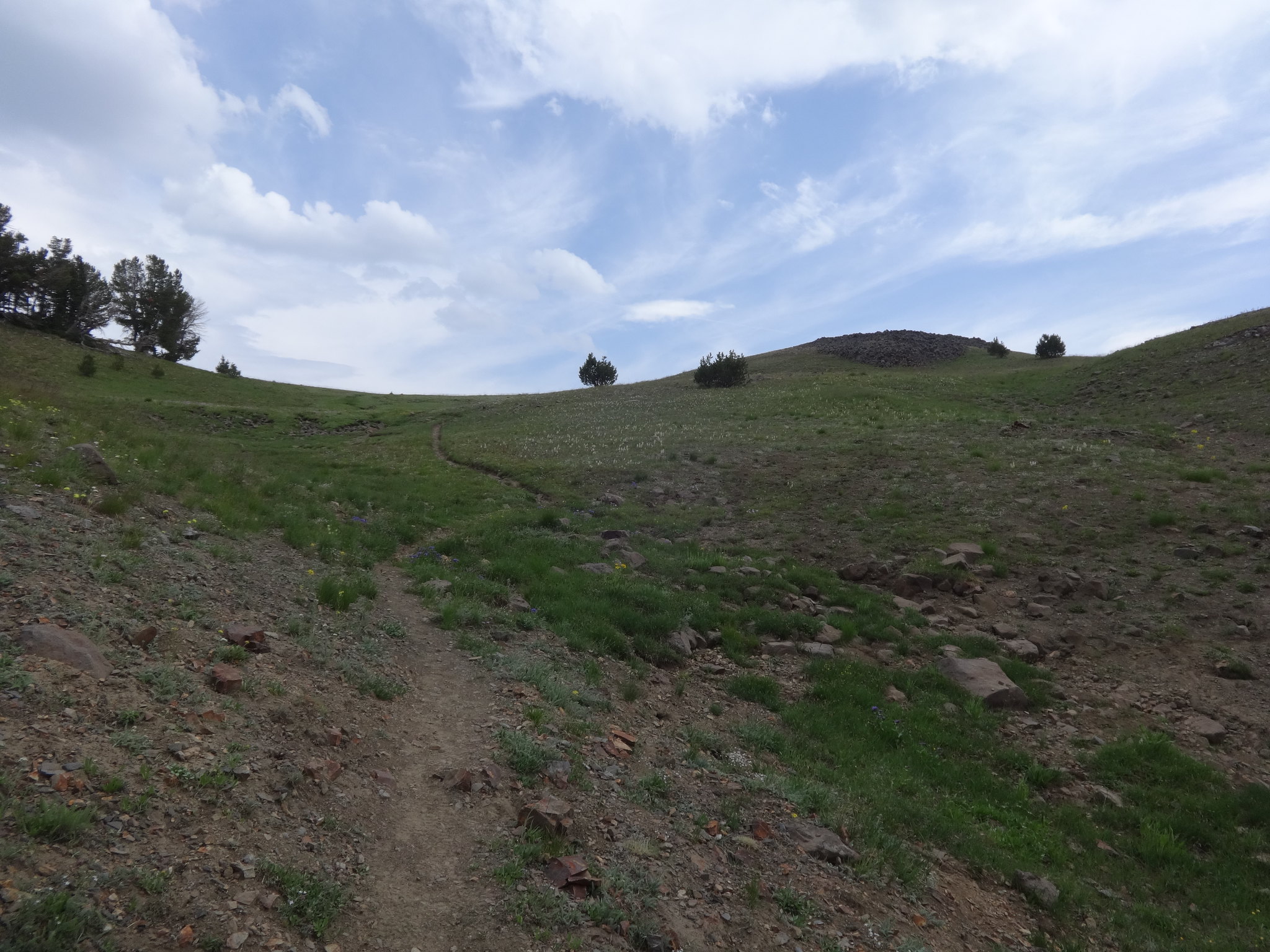
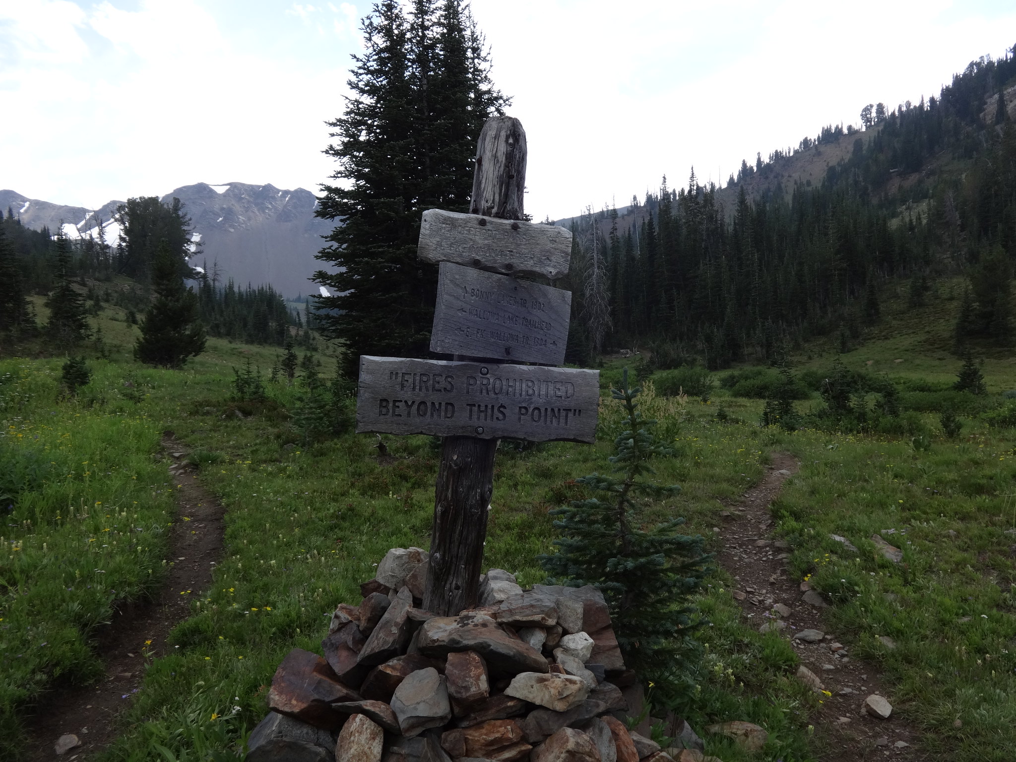
Cairn at the junction of the E. Fk. Wallowa Trail and Bonny Lakes Trail:
The smell of Lupine filled the air here:
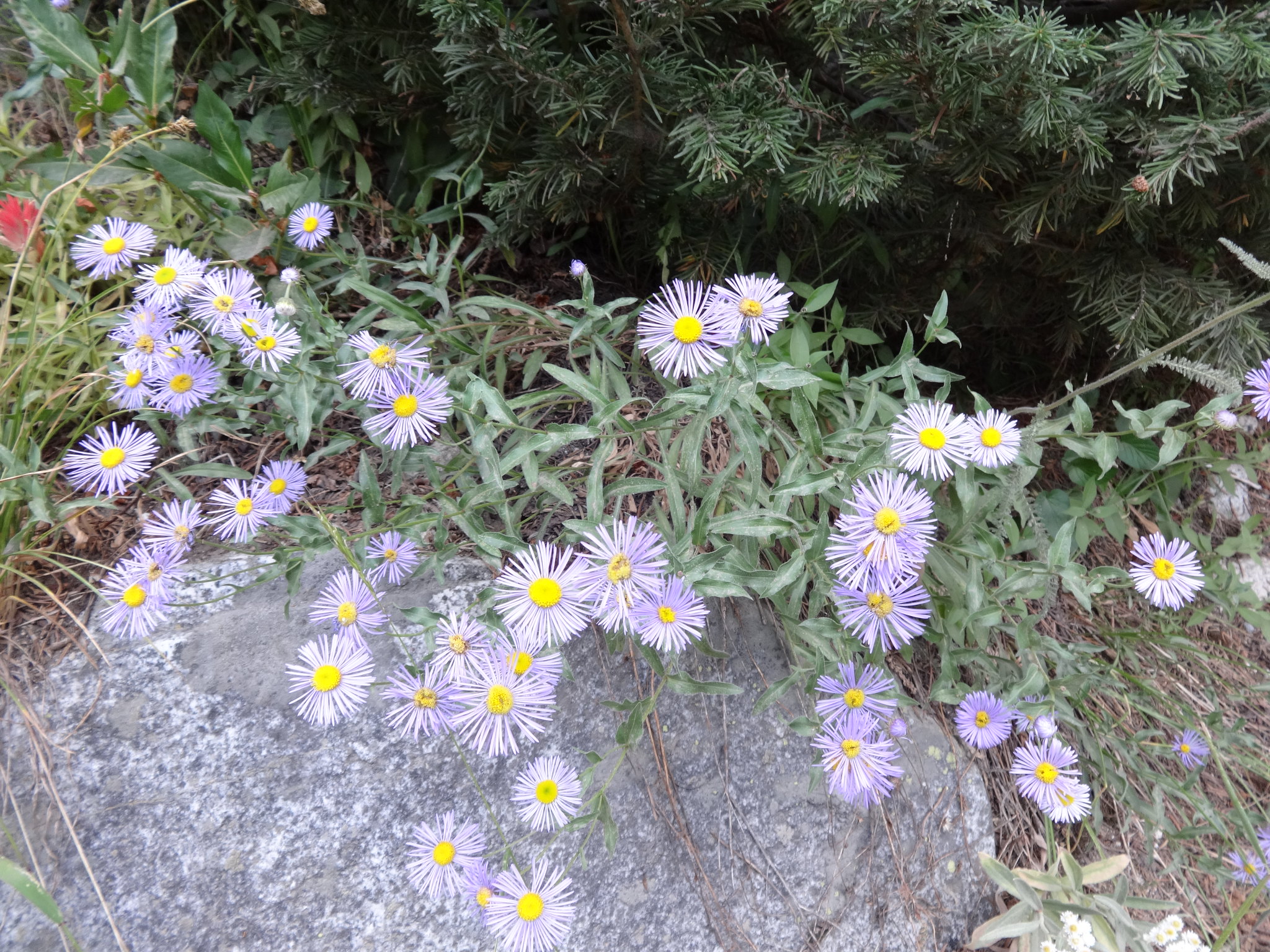
Still some Asters blooming:
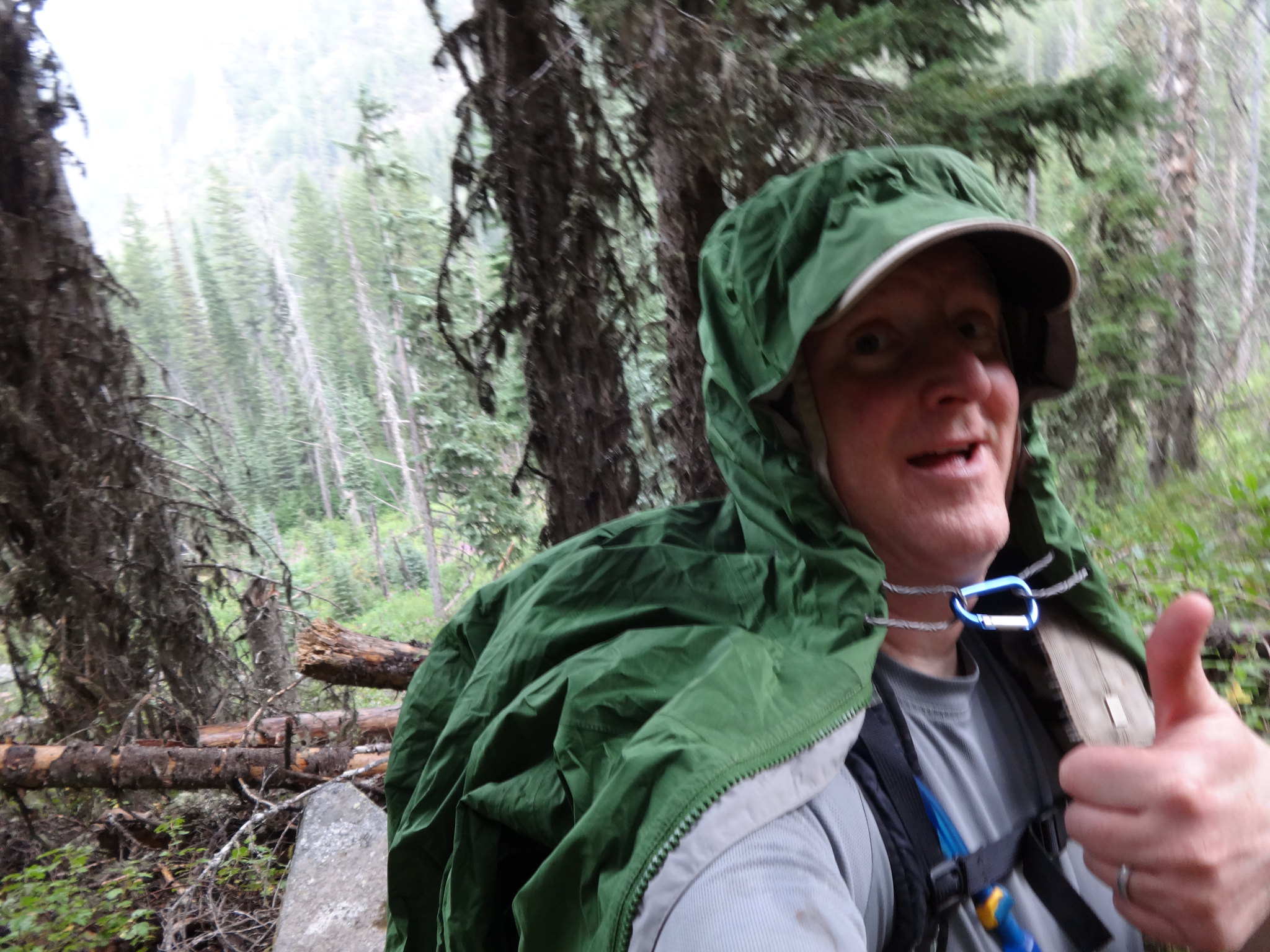
The thunder began at 3:45 PM and sprinkles started soon after. Not long after that sprinkles turned to rain, then the rain became a downpour with much hail mixed in. The thunder continued, with an occasional bolt of lightning. I had made the right decision to stay off the ridges and get back to the car.
The beginning of the rain:
Ayyy! I can handle the rain. At least it’s warm:
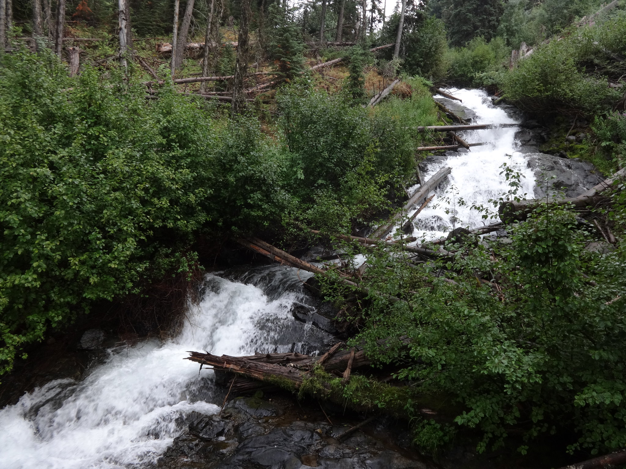
One of the many waterfalls along the E. Fk. Wallowa River:
On the drive home, the rain and lightning continued until reaching La Grande. Sure, I could have stayed up in the mountains in my tent, but that gets boring after many hours. It can also be a frightening experience to have thunderboomers and lighting crashing all around with nowhere else to go.
----------------------------------------------------
Final Notes
• The evening the route up the Wallowa Lake Tram and over to Aneroid Mt. was decided upon, I received an accidental call from OregonHiker Jim57. He meant to call a different Brad. Off-hand he asked, “Have you ever taken the Wallowa Lake Tram up to Mt. Howard and walked the ridge over to Aneroid Mt.?” No joking. I told him I was taking that route that very weekend.
• Next year I have another route in mind for the Wallowas. One part will take the off-trail scramble shortcut direct from Glacier Pass up to Eagle Cap. Another part follows the Hurwal Divide. Bruce? Chase? Nat? Jeremiah? Anyone else?
• There is no water available on the route from Mt. Howard until just below Dollar Pass. Bring plenty of water.
• My summer weight loss continues. Pretty soon my moobs will be down to an A cup manssiere.
Link to lots more pictures on Flickr:
https://www.flickr.com/photos/54959080@ ... 546878525/
Hike the good hike my friends,
Brad


