When: 7/21/16-7/23/16
Who: Me (Born2BBrad), Bruce (VanMarmot)
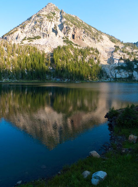
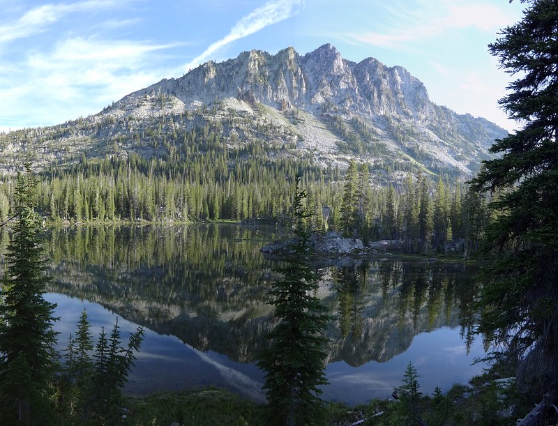
Opening picture:
-----------------------------------------------------------------------------------
General Information
Route Day 1: Hurricane Creek TH (5120’), up the Hurricane Creek Trail to the Thorp Creek Trail (5440’), up the Thorp Creek Trail to campsite (7500’), 6.64 miles & 2665’ EG
Route Day 2: Thorp Creek campsite (7500’), up to Sacajawea Peak (9843.7’), cross the ridge over to the Matterhorn (9834.8’), down to Ice Lake (7850’), up and over Van Marmot Gap (8685’) to campsite at Unit Lake (7040’), 11.36 miles & 4404’ EG
Route Day 3: Unit Lake campsite (7040’), up to the Lakes Basin Trail (7170’), past Horseshoe Lake, Lee Lake, Douglas Lake, Moccasin Lake, Mirror Lake and Upper Lake, up to Horton Pass (8450’), to the top of Eagle Cap (9572’), back down Horton Pass, to the intersection of the Lakes Basin Trail and Hurricane Creek Trail (7600’), down the Hurricane Creek Trail all the way back to the TH, 23.3 miles & 3464’ EG
Total Miles: 41.3
Total EG: 10533’
Number of Mosquito Bites: 3
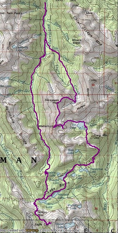
Google Earth overview:
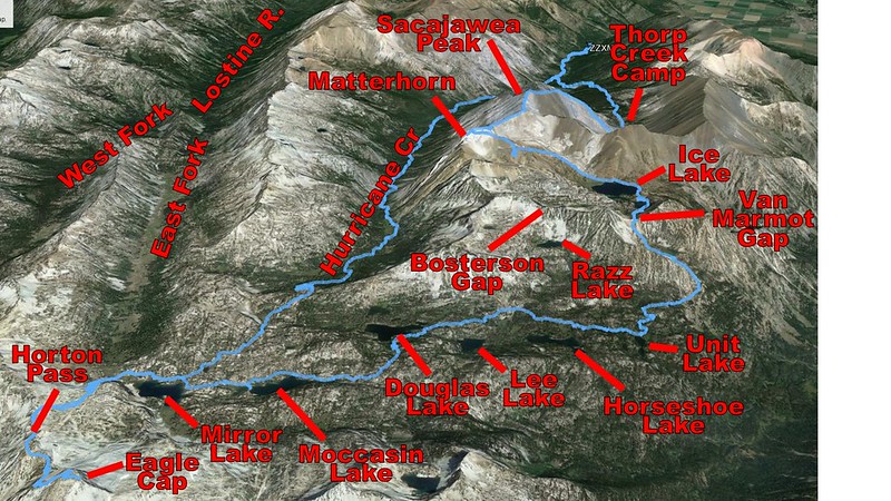
Topographical overview:
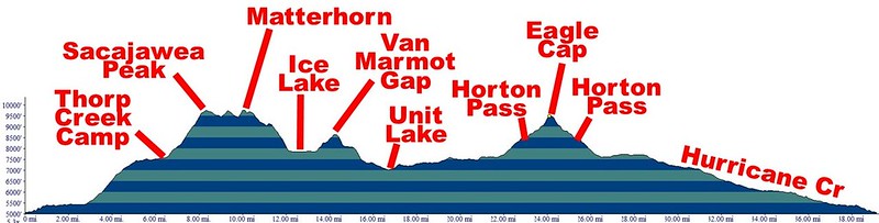
Elevation profile:
Google Earth video tour of trip (5 minutes):
-----------------------------------------------------------------------------------
Trip Narrative and Pictures
Since Bruce and I had a successful trip last year, we thought we would try again this year. Once again, he put together a creative route, this time in the Wallowa Mountains.
There were five goals for the trip:
• Climb Sacajawea Peak (accomplished)
• Take the ridge from Sacajawea Peak over to the Matterhorn (accomplished)
• Cross the ridge south of Ice Lake as a shortcut to the Lakes Basin Trail (accomplished)
• Climb Eagle Cap (accomplished)
• Take the saddle shortcut from Eagle Cap down to Glacier Lake (not accomplished)
In the past, I have had issues with elevation sickness when ascending too quickly before acclimatizing. Because of this, I hung out in the Enterprise/Joseph/Wallowa Lake area (3800’-4600’) the day before the trip began.
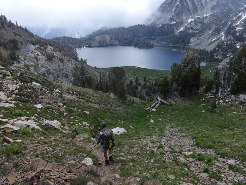
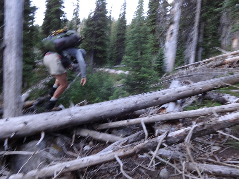
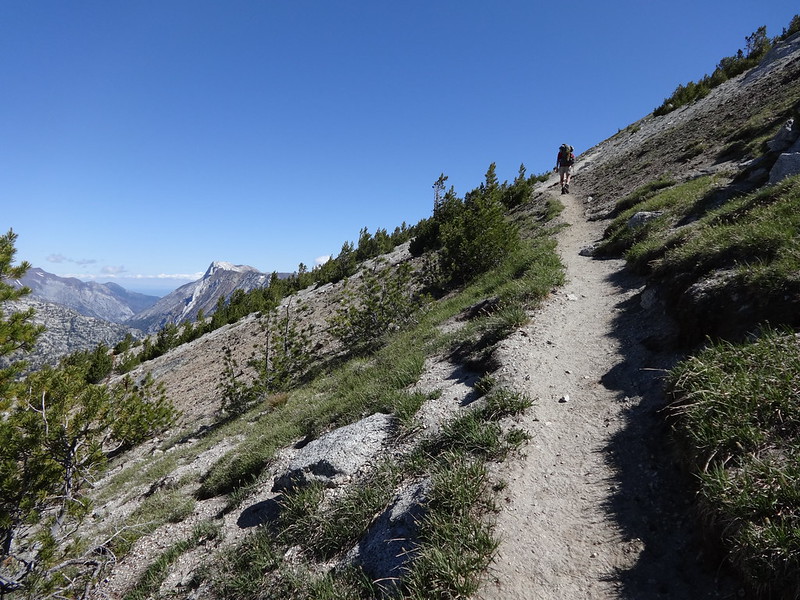
We started out at 7:00 AM on the Hurricane Creek Trail.
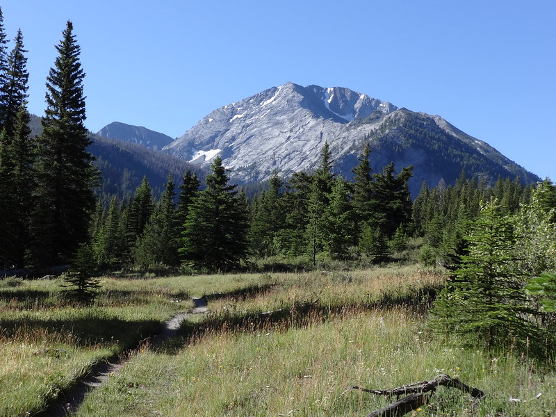
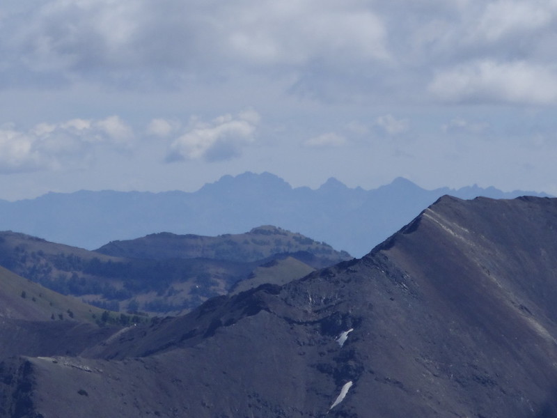
First good view of Sacajawea Peak (lower appearing peak on the left):
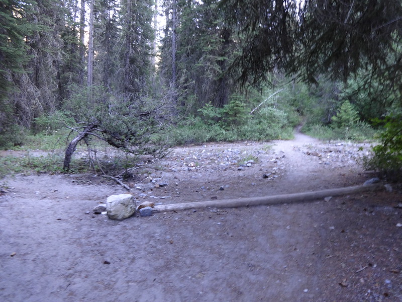
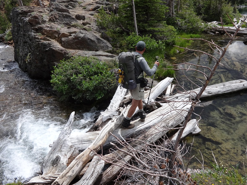
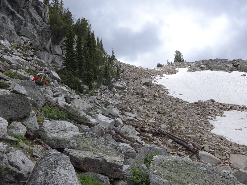
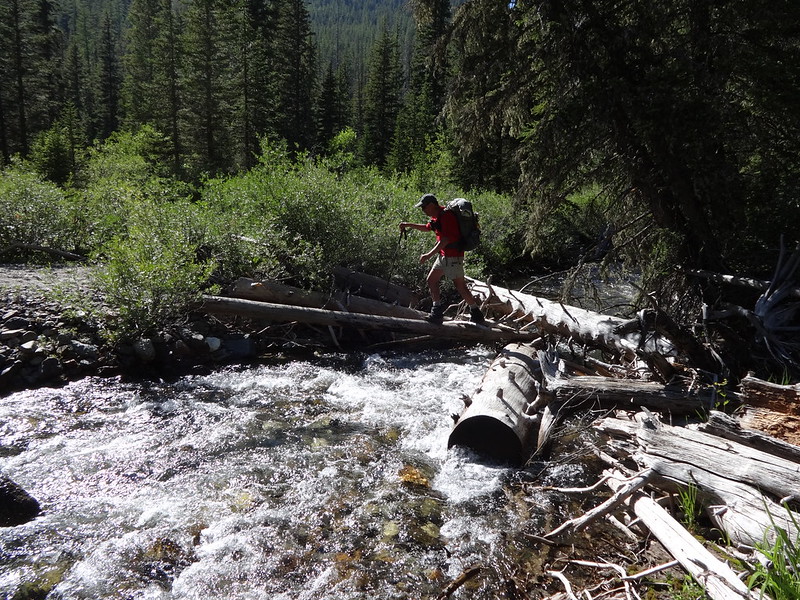
Once at the 1.5 mile, keen eyes were out for an unmarked trail to the left that leads to a crossing of Hurricane Creek to the Thorp Creek Trail. The trail was vaguely described in Fred Barstad’s book “Hiking Oregon’s Eagle Cap Wilderness”. A trail was found that led to Hurricane Creek and the creek was crossed. It was not a dry crossing. On the other side, trail finding skills were needed to find the Thorp Creek Trail. We didn’t find out until later that day when we met a couple guys up the trail, that we crossed too soon, following a trail to a campsite and not to the place we were supposed to cross.
The key is to look for two log water bars and a much more well-used trail that leads to the creek. The guys told us that there were two logs across the creek, making for a dry crossing. On passing back on day three, Bruce and I saw the log water bars and the logs crossing the creek.
Log water bar:
Logs crossing the creek:
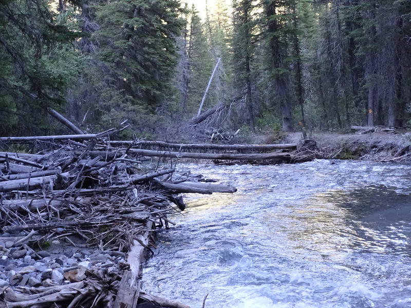
The guys said the logs crossing the creek have been there for years, and the logs are described in the Fred Barstad book. It’s hard to believe that a creek that turns into a raging river almost every year would not wash out those logs. Maybe someone puts new logs up every year.
The Thorp Creek Trail, while steep, is maintained and very well defined.
Someone maintains this trail, as evidenced by recent log cuts:
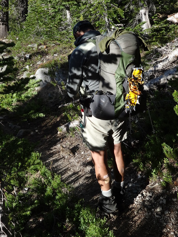
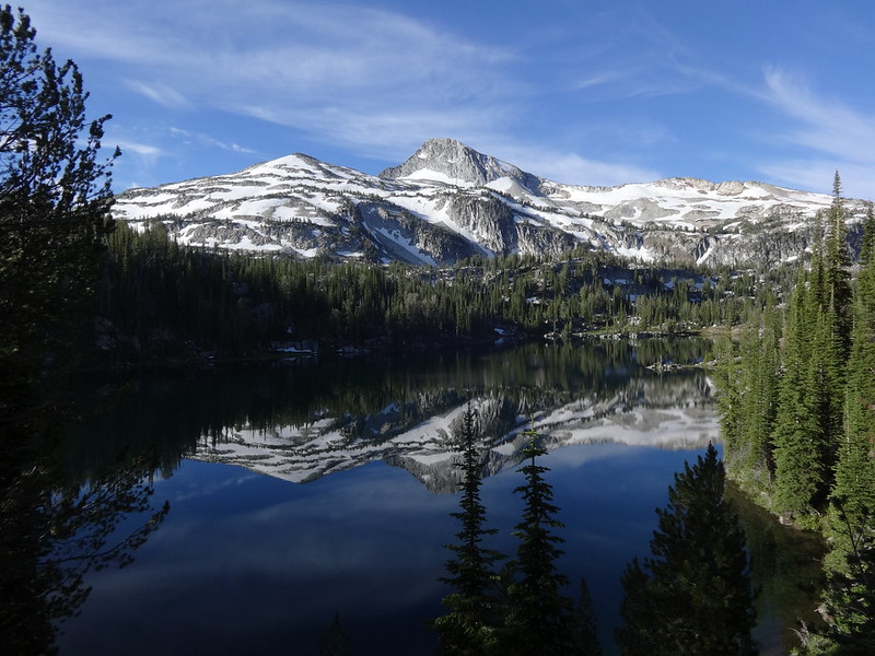
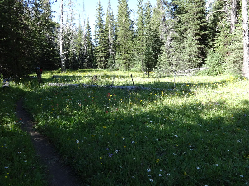
The trail eventually levels out as it leads to the upper reaches of Thorp Creek Valley. The valley is quite large, with many options for campsites, in addition to being absolutely gorgeous. Bruce and I picked a site where Thorp Creek splits. Getting there early and staying at that elevation (7500’) overnight allowed for more acclimatization.
The next day we were on the trail before 6:00 AM:
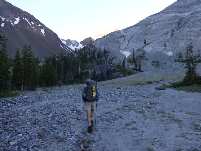
Surprisingly, there is a clear, well-used user trail along a spur ridge all the way to the top of Sacajawea Peak. The footing is really good too, hardly ever being loose or scrambly. To me, climbing South Sister and Mt. St. Helens are more difficult.
You will notice that Bruce is ahead of me in every picture. My God that guy is in great shape for a guy 12 years older than me! And I’m old too!
The spur ridge leading to Sacajawea Peak:
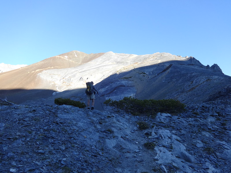
Stitch pic showing us getting higher:
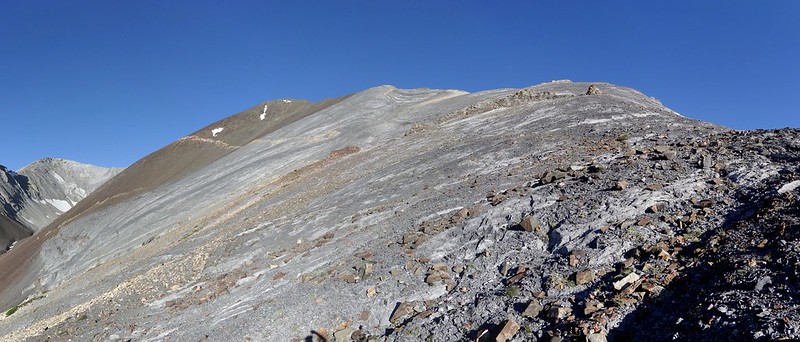
Looking back down the way we came:
We made it !!
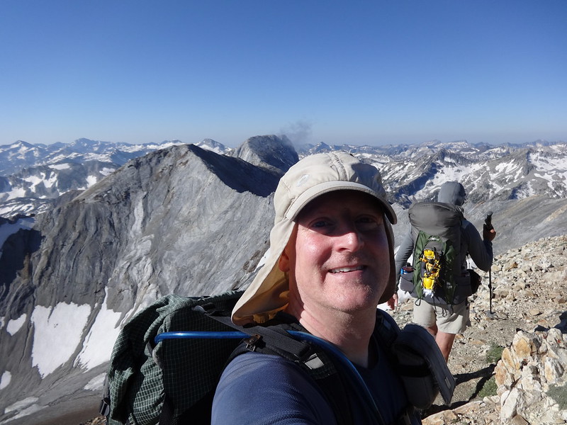
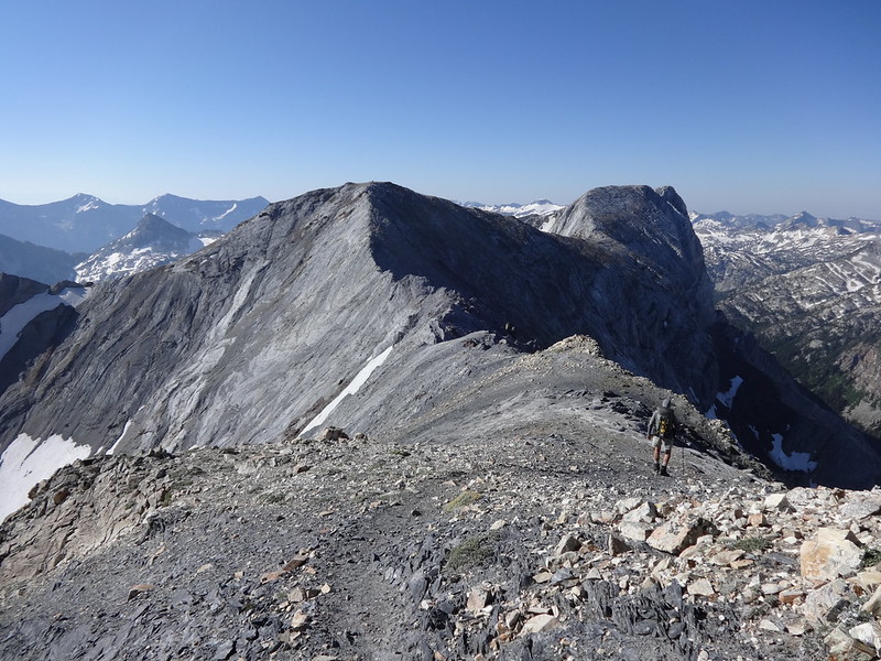
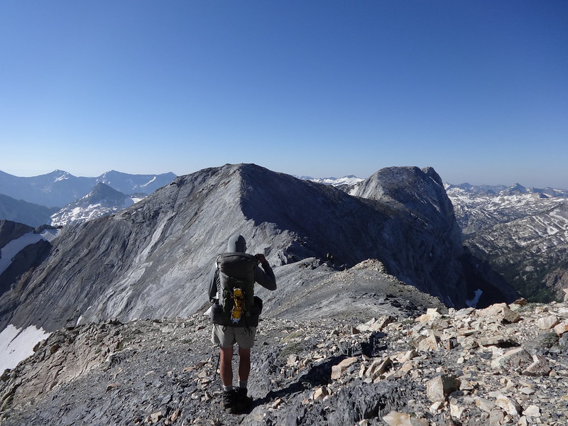
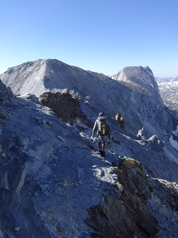
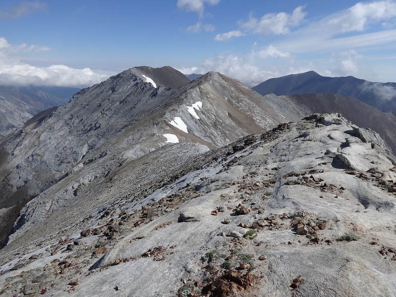
Then we had to follow that ridge over to the Matterhorn:
There has been debate for many years as to the elevation of both Sacajawea Peak and the Matterhorn. Decades ago, it was thought that the Matterhorn was higher, then that was flipped in 1990 to list Sacajawea Peak higher (9838’) than the Matterhorn (9826’). Arguments and wars continued to be fought for years.
In 2012, the matter was solved using the most sophisticated, high-precision equipment available. The results: Sacajawea Peak 9843.7’ and the Matterhorn 9834.8’. There is a much more detailed news article about this on the OPB website.
Even so, information on the Internet has not been updated, including Wikipedia, Summit Post and OregonHikers.org.
Unless icy, snowy or extremely windy, the ridge from Sacajawea Peak is not difficult or too dangerous for experienced hikers. A clumsy person or someone afraid of heights or cliff exposure should avoid it.
Sometimes you have to go to the right…
Sometimes you have to go to the left…
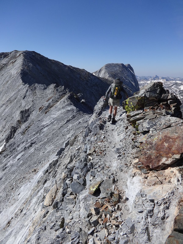
Sometimes you have to climb over the gendarmes*:
* In doing my research, I learned a new word: gendarme. A gendarme is a pinnacle of rock on a mountain ridge. The name originates from the French Alps, where they were seen as resembling the gendarmerie police
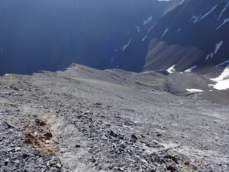
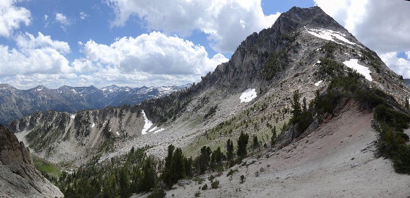
Along the ridge, the elevation drops, then must be gained again to a peak in the middle unofficially called Peak 9775. After climbing Peak 9775, the elevation drops again, then must be gained again, and then some, to get up to the Matterhorn.
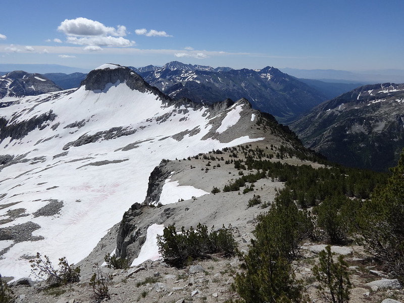
The view of the Matterhorn from Peak 9775:
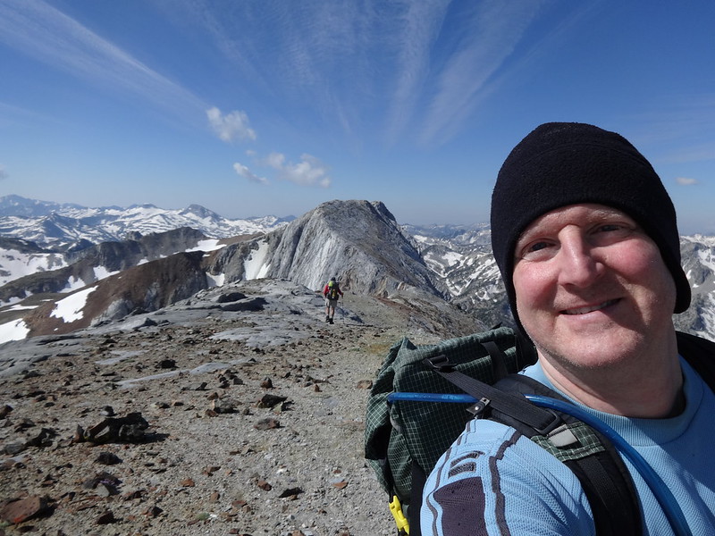
Looking back at Sacajawea Peak and Peak 9775:
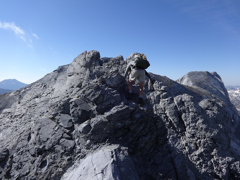
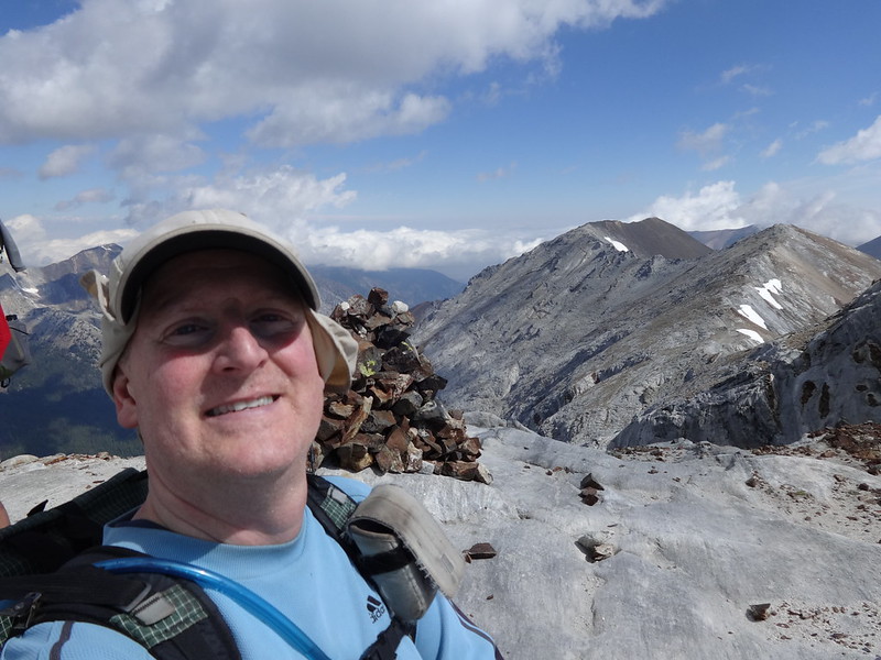
Look at me Mom! I’m on top of the Matterhorn!
As expected, there is a trail going down from the Matterhorn to Ice Lake:
Originally, we had planned to go over the ridge south of Ice Lake to a pass we dubbed Bosterson Gap, named so from a TR he wrote in 2012. There he described a route over the ridge down to Razz Lake. Due to a steep field of snow covering a boulder field, we decided against that route. Snow covering boulders can be hazardous to walk on because of the danger of breaking through the snow into a gap in between boulders. Breaking or spraining a body part there would be disastrous.
Bruce surveying the route over Bosterson Gap:
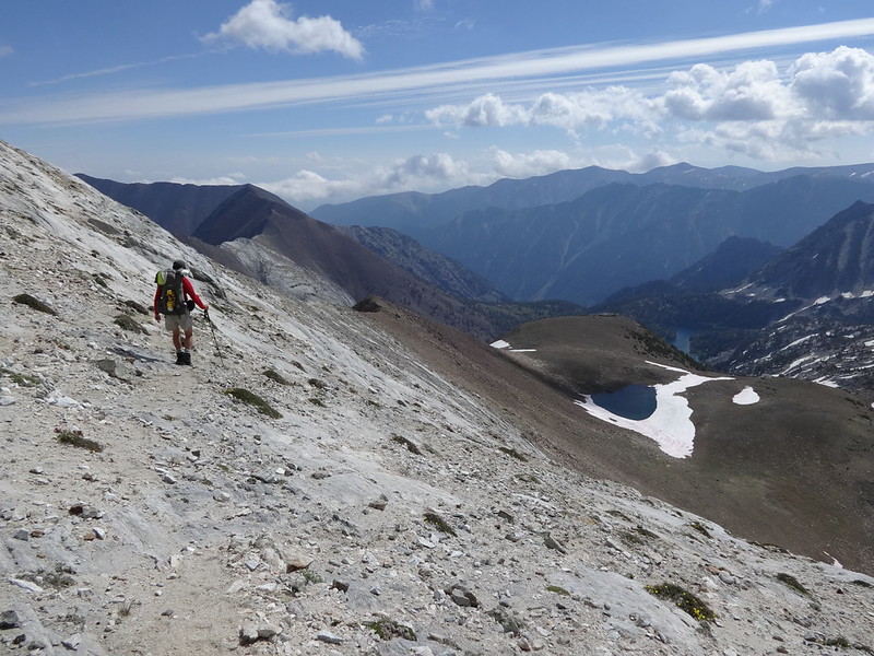
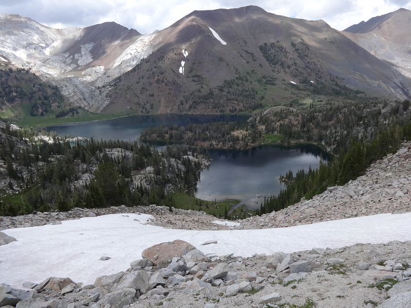
Instead we decided to go down to Ice Lake, camp there, then go over a different gap, I am calling VanMarmot Gap, the following morning. I was OK with that, but leery of crowds and concerned about the noises coming from the lake. From almost all the way up on the Matterhorn, we could hear what sounded like people yelling or a dog barking.
Almost all the way down to Ice Lake:
Crossing the outflow stream (Adam Creek) of Ice Lake:
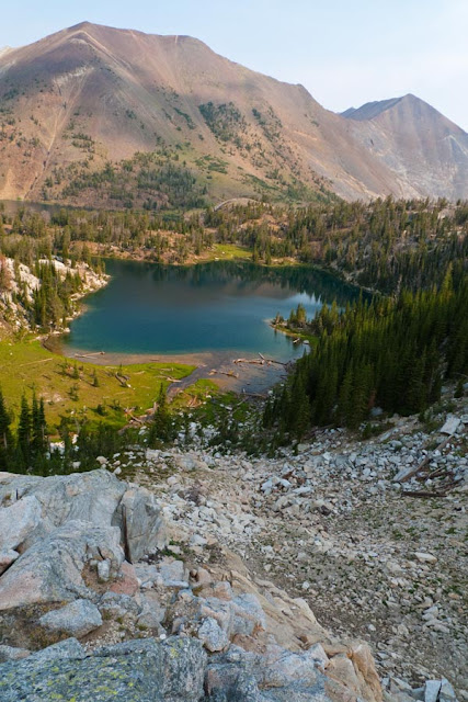
This is why Ice Lake is so popular:
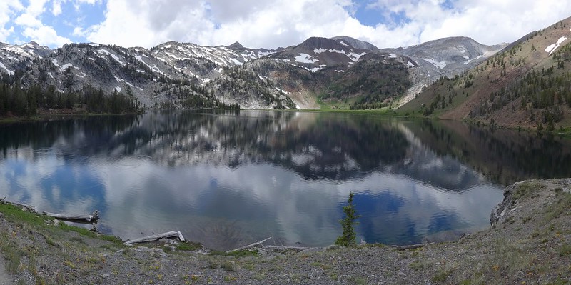
Once at the main camping area on the peninsula, the source of the noise was confirmed. It was a dog someone left tied up at camp. Ten seconds did not go by without it going on a barking tirade. Who brings their dog to a place like that and leaves it tied up at camp? Not only is it not fair to the dog, but it ruins the experience for others. It had been barking continuously for hours and was not going to stop. Don’t bring your dog if you’re not going to keep it with you!!!! A$&h@/%!
Because of this, and because it was still early in the day, the decision was made to go over VanMarmot Gap that day. A trip report described taking that gap between Craig Mt. and Peak 9314, describing going over the gap and rounding a ridge over to Razz Lake. They made it sound easy. Getting over VanMarmot Gap was fairly easy, as was going down. Getting around the ridge was another thing. There was no easy way to round the ridge and over to Razz Lake without losing more elevation that we didn’t want to regain.
VanMarmot Gap:
Going up VanMarmot Gap:
Looking back down at Ice Lake:
Looking down the other side of VanMarmot Gap (Peak 9314 on the right):
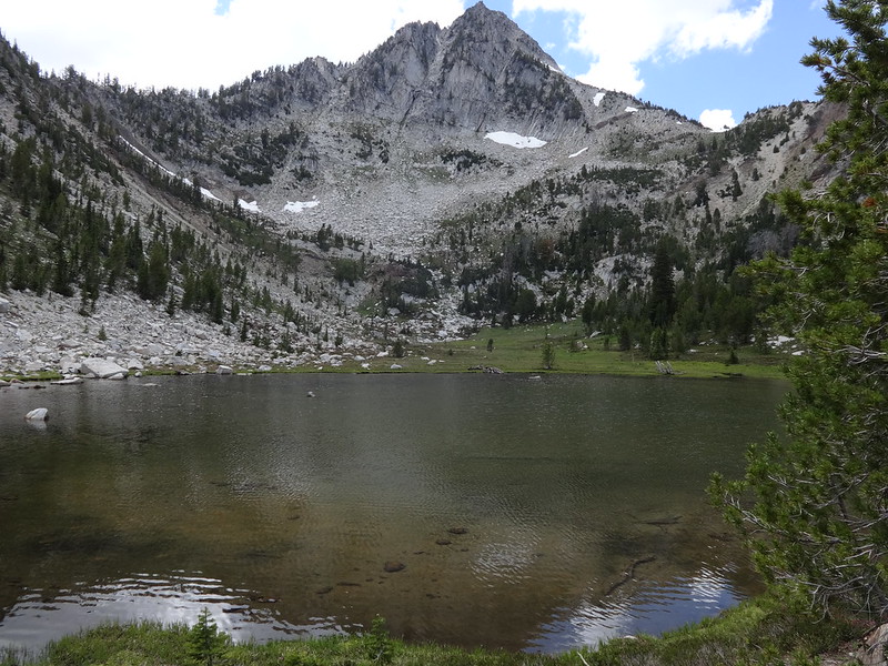
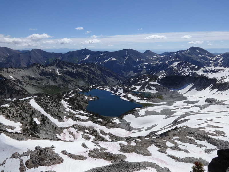
Heading down the valley on the other side of the gap, was a stunning lake that would be a secret gem to camp at. Scenery as good as any lake in the Wallowas, fresh water, plenty of camp spots and best of all, no people or barking dogs. It was clear people had been there before, but the difficulty in reaching the lake, and getting back out, keeps out only but the strongest hikers.
Unnamed secret lake:
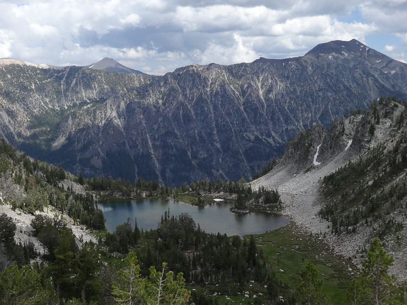
Secret lake, Peak 9314 and VanMarmot Gap:
Since Razz Lake was no longer an option, the plan was to continue off-trail taking the path of least resistance…
… through boulders…
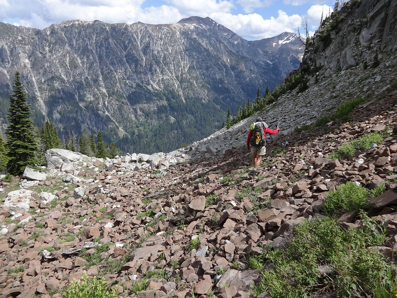
… meadows…
… animal trail and gaps in trees to a place to set up camp. After trudging for quite a while, we could see by looking at our GPSes, that we were not far from Unit Lake. We made it there and set up camp.
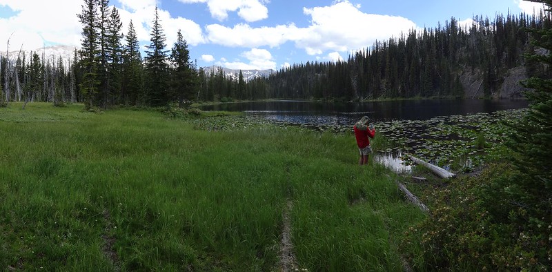
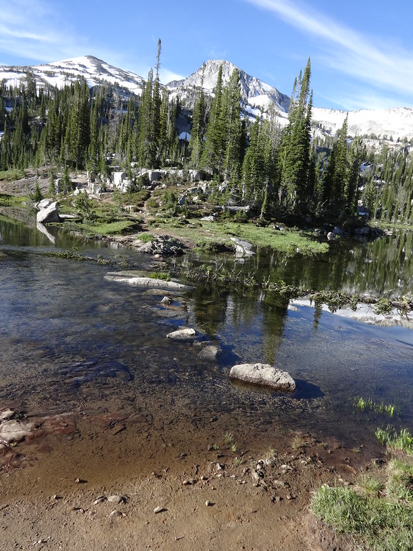
Unit Lake is another gem. There used to be a trail to the lake a third of a mile from the Lakes Basin Trail. That trail from the Lakes Basin Trail is no longer maintained and has many large logs blocking the path. That keeps most people away. Unit Lake is very pretty, has at least one great campsite, has fresh running water nearby and not many visitors.
View from Unit Lake:
This is the kind of stuff that keeps most people away from Unit Lake:
Bruce and I had discussed forgetting the idea of climbing Eagle Cap and heading back a day earlier. I have to admit, the thought of stuffing my face with an after-hike meal and sleeping in my own bed sounded real good. You backpackers know what I’m talking about
Because it was on his bucket list, Bruce convinced me to climb Eagle Cap. That’s why it’s always good to have a hiking partner for motivation. So by 5:00 AM, we were off on our way to Eagle Cap!
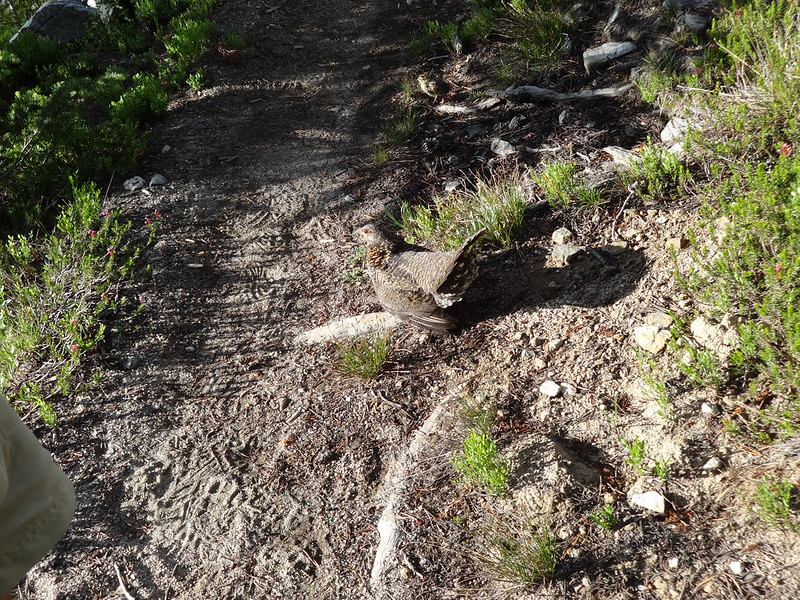
Along the Lakes Basin Trail was a grouse sitting in the middle of the trail. These are the birds that loudly and unexpectedly fly off and give hikers heart attacks. It did not move, even when Bruce got within three feet of it. After a picture taking frenzy, we had to get past it. When Bruce attempted to slide past the grouse, it slowly stood up, then five chicks scurried from underneath and went in different directions. Rather than scurrying away like the chicks, the mama grouse ruffled its feathers, flared out its wings, then charged us. It was the only wildlife sighting of the trip, and possibly the highlight as well. How often do you get charged by a mama grouse?
Grouse on the trail:
Grouse with a chick (upper center):
So we continued along the Lakes Basin Trail, once again seeing why it is so popular and teaming with backpackers. There is one scenic lake after another, surrounded by mountains of incredible beauty.
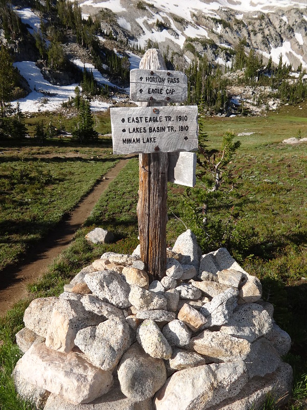
So… who are all these signs quoting?
Horseshoe Lake:
Moccasin Lake, with Eagle Cap in the background:
The isthmus separating Moccasin Lake that is also the route up to Glacier Pass:
Even the cairns in the Wallowas have their own beauty:
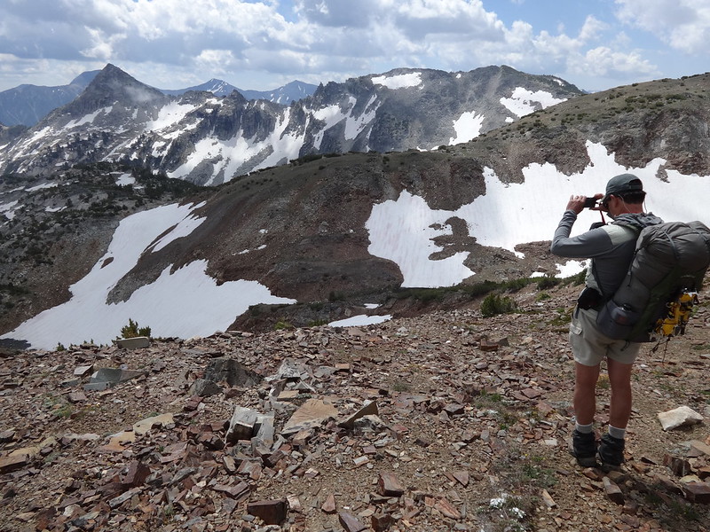
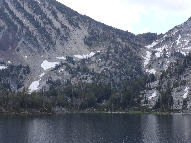
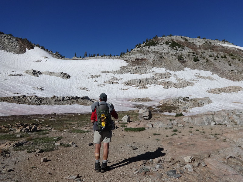
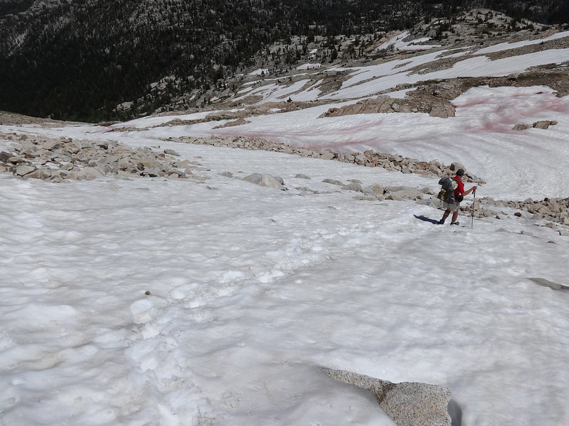
There was still quite a bit of snow on the way up to Horton Pass to get to Eagle Cap. Because it was still early in the morning, the patches of snow in the shade were still icy. Most of that could be avoided by walking around them. The patches of snow in the sun had melted enough so they were not slippery, but we still walked on bare earth or boulders when that was an option.
One of the icy sections on the way to Horton Pass:
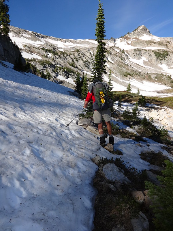
Lots of snow on these north facing slopes:
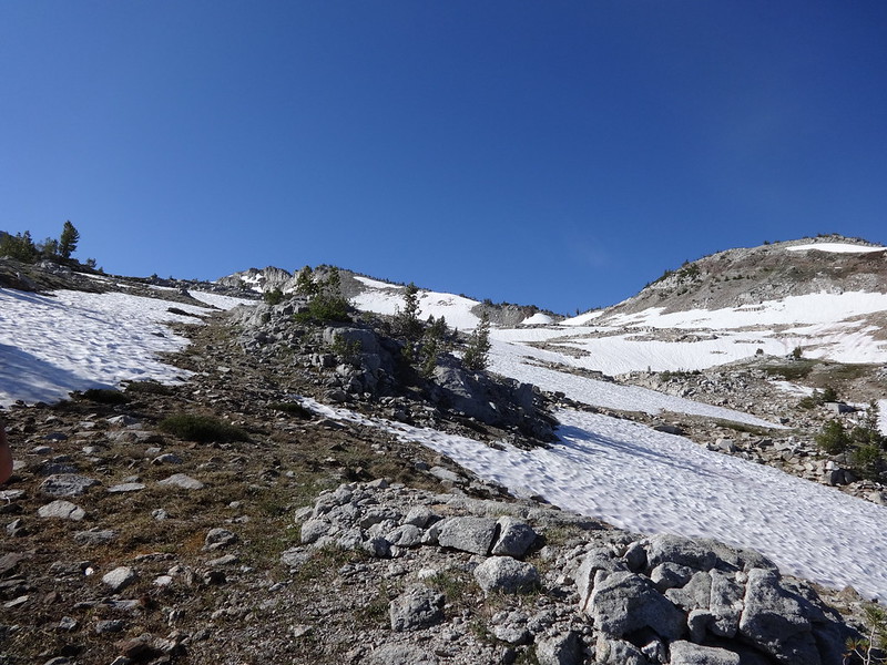
Pondering the route up the final slope to Horton Pass:
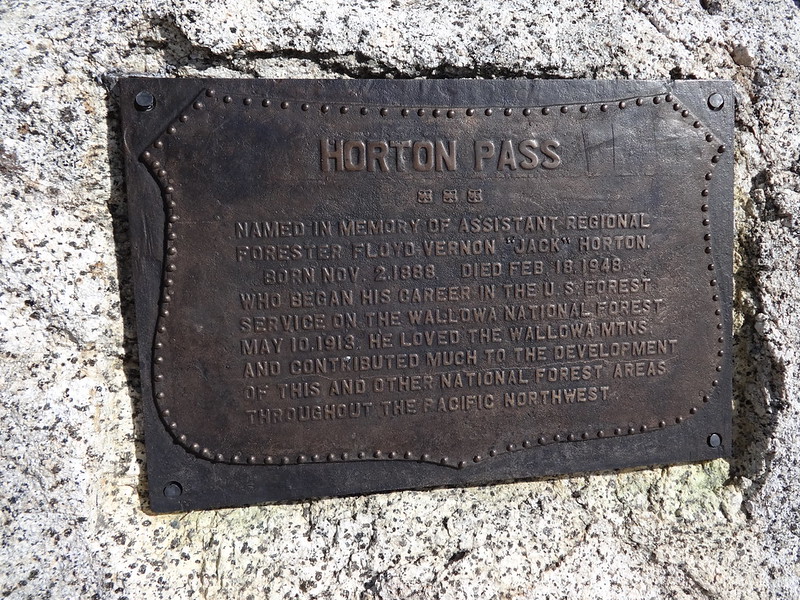
Horton Pass is not named after a guy who heard a who. No word on whether he thought a person’s a person, no matter how small:
The trail from Horton Pass to Eagle Cap is 100% clear of snow. It is a highly used trail, clearly defined, as well as not being very steep, when compared to many other mountain climbs. Plus, the views along that entire stretch are eye candy to the highest degree.
The trail nearing the top of Eagle Cap:
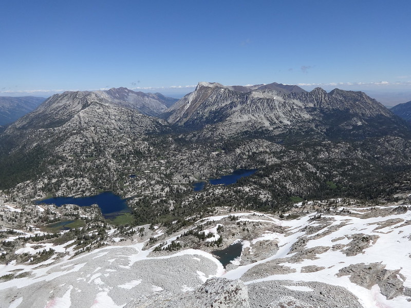
It’s hard to describe the view from the top of Eagle Cap, so the pictures will do it for me. What makes Eagle Cap one of the best views in the Wallowa Mountains is that it is in the middle of the Wallowa Mountains. There are eight drainages and even more major ridges radiating from this granite slab.
Interesting fact about Eagle Cap: It is the highest point in Union County.
Glacier Lake:
The Lakes Basin and many other geographical features:
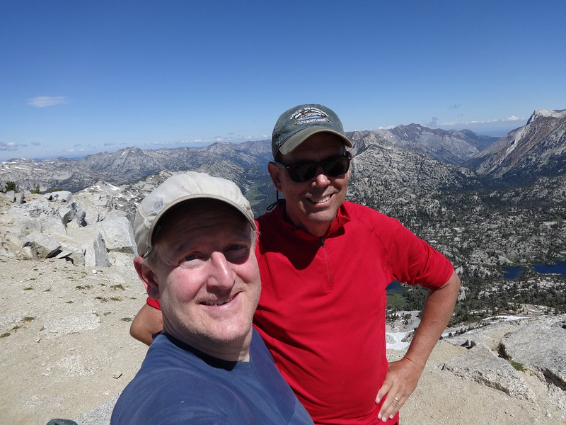
TFFs at the top:
The Seven Devils in Idaho can be seen:
Shaky Eagle Cap walk-around (1 min 17 sec). I was watching my feet and not what I was filming:
From a previous trip done in 2013, I had wondered if there was a shortcut from Glacier Lake to Eagle Cap. The shortcut would avoid going all the way down the Glacier Pass Trail to the Lakes Basin Trail and all the way around the other side of Eagle Cap. RobinB wrote an awesome TR, as usual, where he did that shortcut, and that it was not difficult for experienced hikers.
Now that Bruce and I could get a good look at the situation, once again, due to snow covering boulder fields, we opted not to chance breaking an ankle by taking the shortcut down to Glacier Lake.
Ridge saddle that is the shortcut down to Glacier Lake:
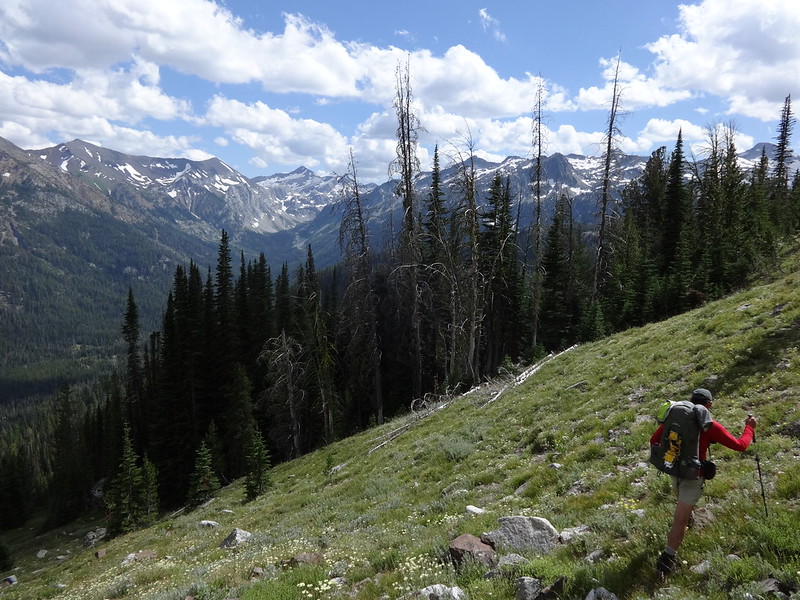
So back we went down to Horton Pass and to where the Lakes Basin Trail meets the Hurricane Creek Trail. After a short section of uphill, the Hurricane Creek Trail is downhill all the way, with plenty of scenery along the way.
Headed down from Horton Pass:
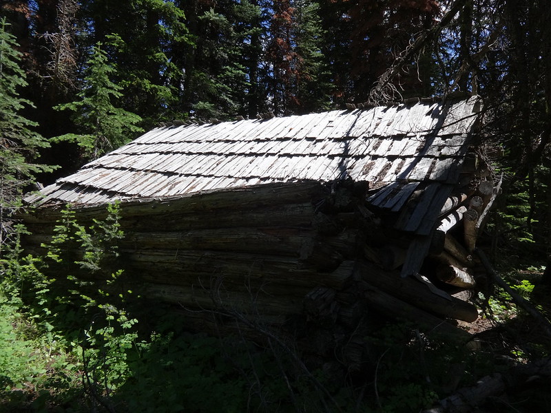
An old decrepit log cabin along the trail. No reservations required:
One of the more difficult of the twenty or so creek crossings of the trip:
This picture doesn’t capture the flowers like the human eye, but this meadow near Granite Creek was a flower explosion:
After hiking down the Hurricane Creek trail for some hours, Bruce looked at his GPS and commented that we were about five and a half miles from the trailhead. That got me computing what time I would get home if we powered through the last miles. Originally we were going to stay one more night on the trail. The motivation of a good meal and my own bed was all I needed to ignore the pain and fatigue.
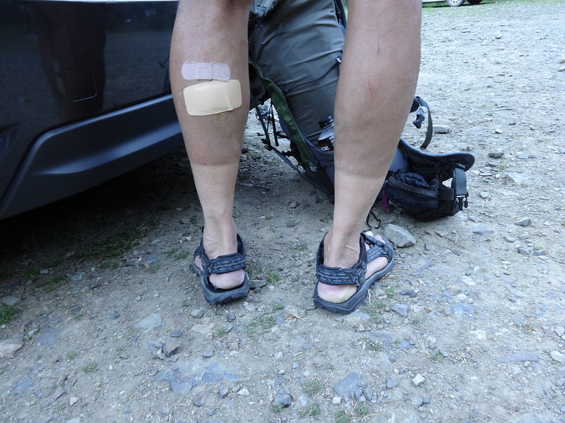
Bruce’s dirt tan line:
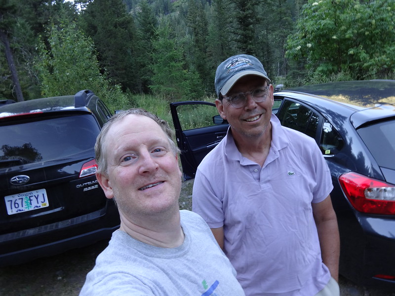
We don’t look too bad for a couple of old guys who just backpacked 23 miles that day:
----------------------------------------------------
Final Notes
• I had not been above 3500’ this year and this was my first backpacking trip this year. It’s easy to forget how much more difficult hiking is when there is less oxygen and with a heavier pack.
• No heating of water again for Mountain House meals. It’s not that bad. In fact, for a hungry backpacker, it’s quite delicious.
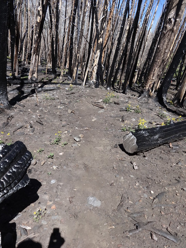
• The Wallowa trails are definitely brown booger makers.
• Will 2017 be another amazingly successful trip for Bruce and Brad? Only the future knows.
Link to lots more pictures on Flickr:
https://www.flickr.com/photos/54959080@ ... 493956006/
Hike the good hike my friends,
Brad