
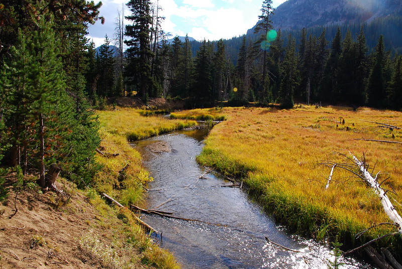
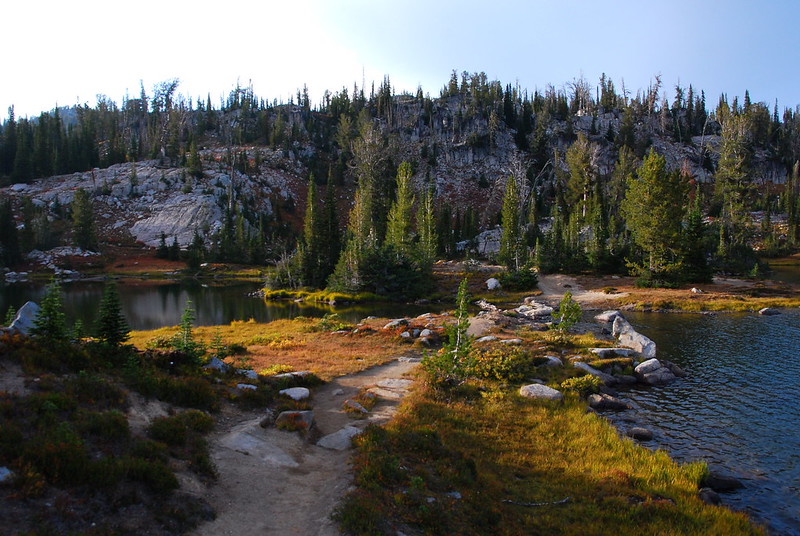
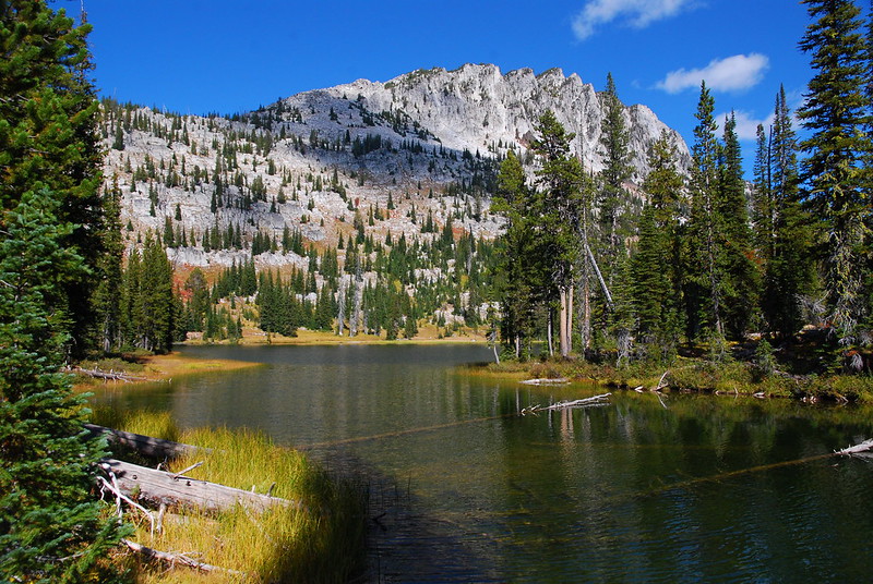
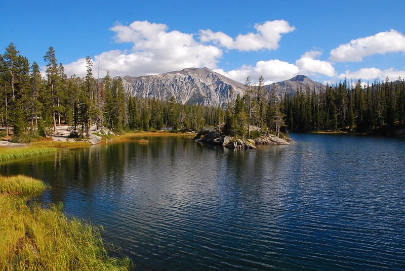
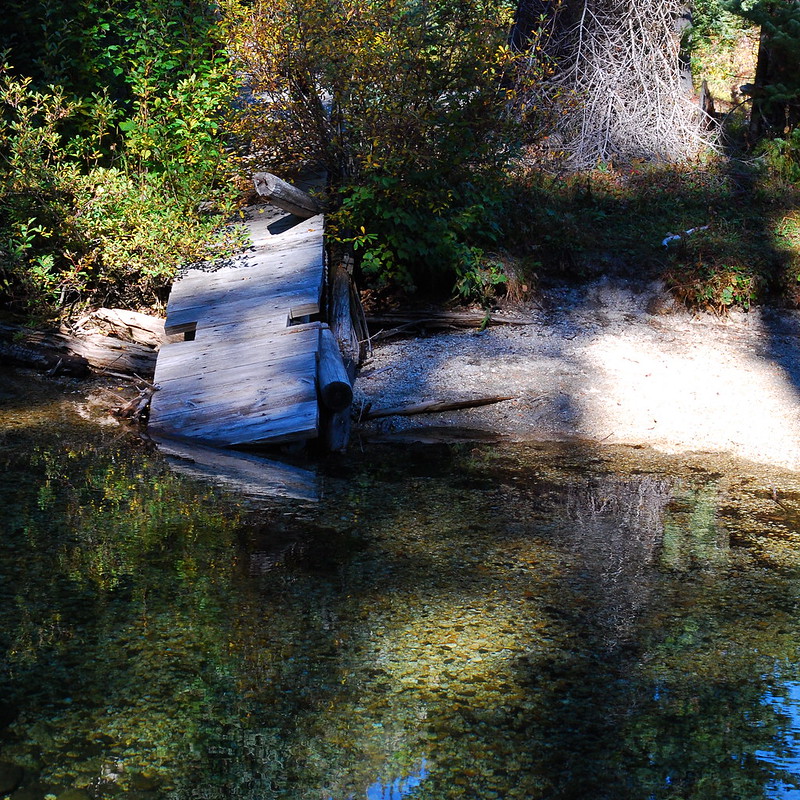
Opening picture: it's already autumn in the Wallowas.
Last week my wife Krista and I took a trip to Wallowas to celebrate the end of summer. (Is “celebrate” really the right word here? Maybe “mourn”?) We were thinking about a few other possibilities - Alpine Lakes, North Cascades, maybe even the Olympics - but weather forecasts dictated Eagle Cap. I'm glad they did.
The basic plan was to do a loop up to the Lakes Basin, with a couple low-mile days in the middle to fool around / take pictures / swim / be amazed at where we were:
Tuesday: drive from Portland to Wallowa Lake TH, hike up the East Fork trail to Aneroid Lake.
Wednesday: walk from Aneroid over Tenderfoot and Polaris passes, then over to Frazier Lake.
Thursday: short walk to Glacier Lake / Glacier Pass, then down to Sunshine Lake (next to Mirror, but infinitely less crowded)
Friday: another short day, from Sunshine Lake to Horseshoe Lake.
Saturday: walk out along the West Fork trail, go for a swim in Wallowa Lake, smell bad anyway, drive home, shower.
Tuesday
We woke up at four or five or something (I've blocked it out) and drove through the familiar gorge to the unfamiliar fields and finally to the somehow familiar rivers and hills around Joseph. Whenever we leave early, Krista starts out stoic, making like she's going to stay up the whole way in solidarity while I drive. But then, like clockwork, she's asleep within half an hour. It's adorable. I listen to audiobooks.
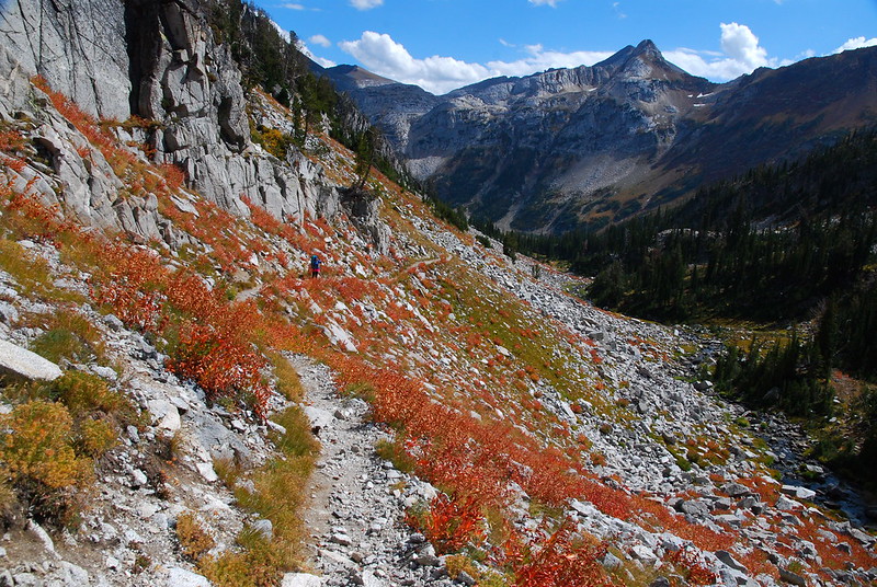
There'd been a small fire near the West Fork Trail, just northwest of where the Ice Lake trail splits off, but it reopened the day we got there. We happily headed up the East Fork.
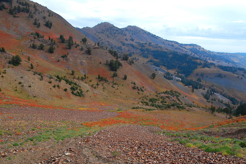
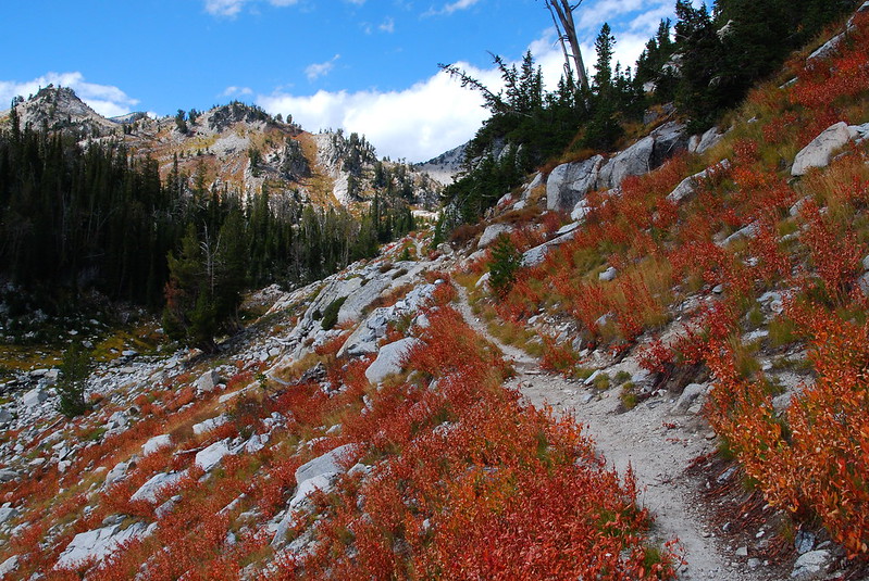
Again: it's autumn up there!
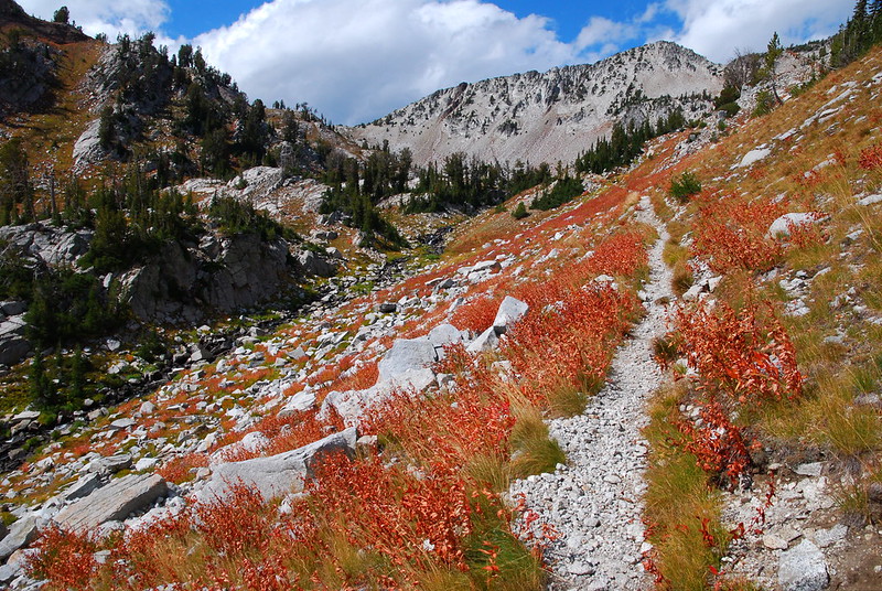
Like the West Fork, most of the delights on the East Fork trail are small.
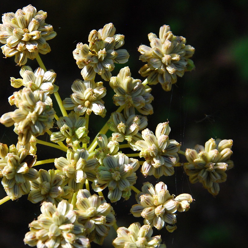
Plants.
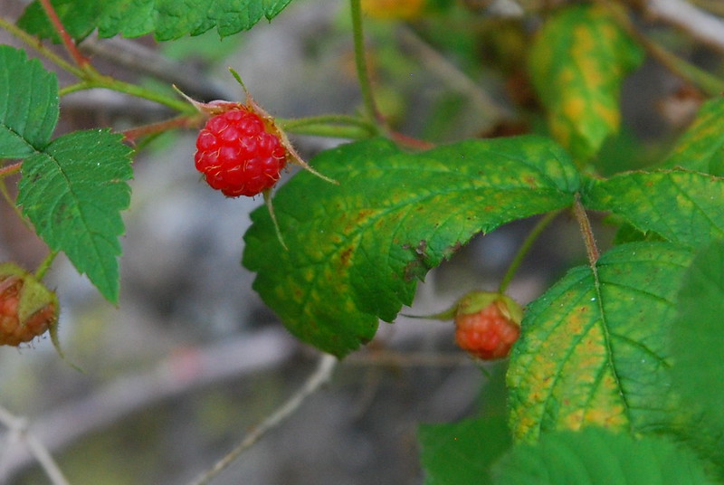
And (wild?) raspberries!
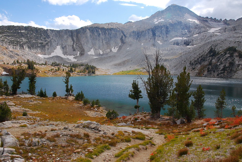
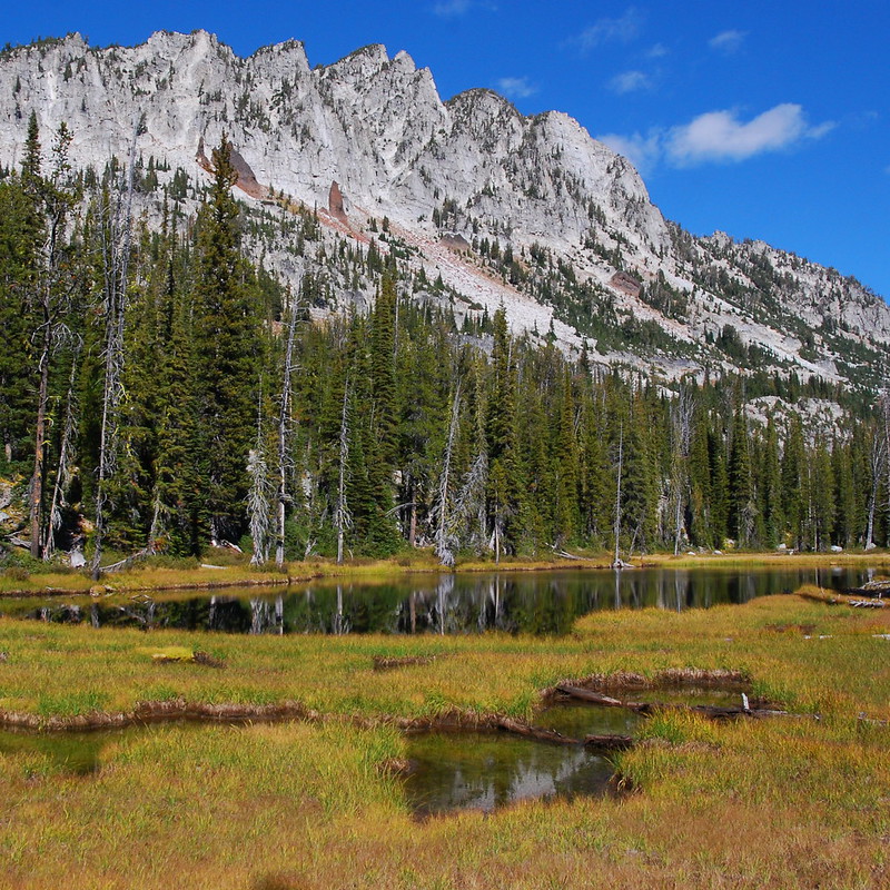
After a few dusty, horsey miles, we crossed the East Fork and entered the meadows below Aneroid Lake. I couldn't quite capture it, but it's gorgeous up there.
Almost looks man-made, doesn't it?
When we got home, I realized that I'd taken almost the exact same photo in Indian Heaven a few days prior. Tis the season...
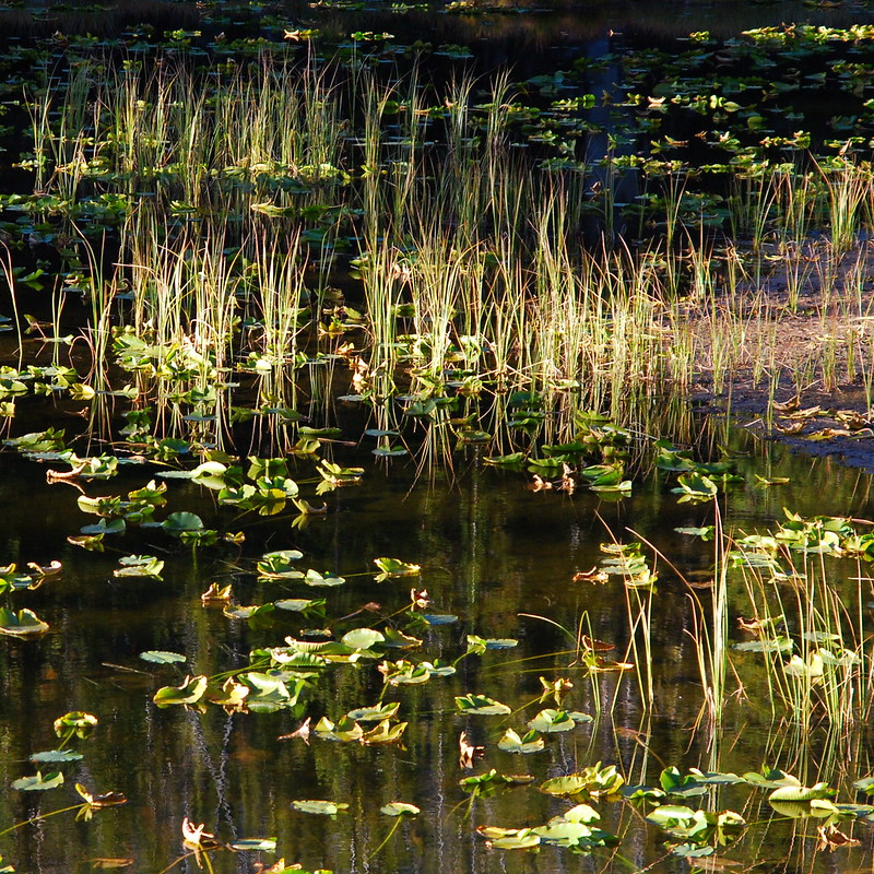
Just after entering the meadows, the trail hits Roger Lake, which is swampy and over-loved.
Hard to get a picture without fire rings in it.
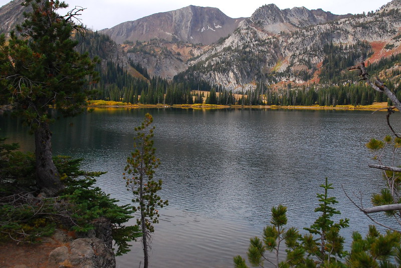
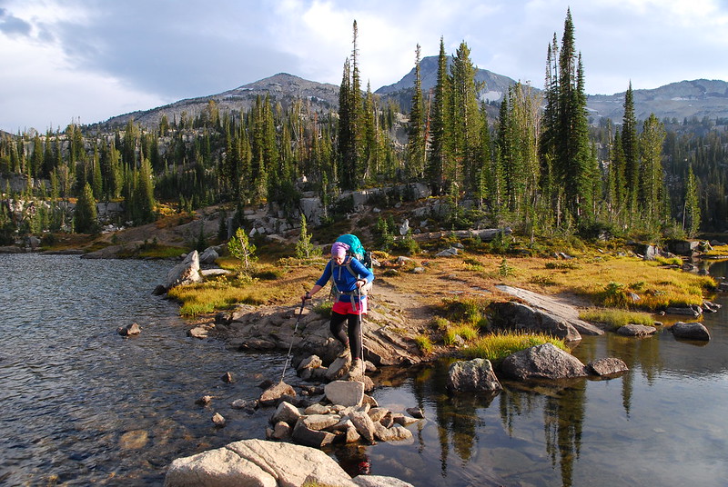
Then Aneroid. We followed a well-trodden use trail to the right just after Roger Lake to some glorious campsites on the northeastern shore. I can imagine this being packed in peak season, but had it almost entirely to ourselves (there was another couple camped by the private cabins). We took a quick swim, filtered water, ate a leisurely dinner, and turned in early. What a beautiful place.
Krista, considering the water.
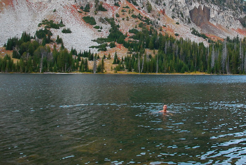
Me, considering the cold: "Take the picture already! It's freezing!"
Wednesday
We woke up early by our standards - which is, I suspect, a little late by most people's - ate breakfast, and reluctantly made our way up toward Tenderfoot Pass.
The view from breakfast. "Can't we just stay here?"
"Seriously! We could kill a day just looking at that rock!"
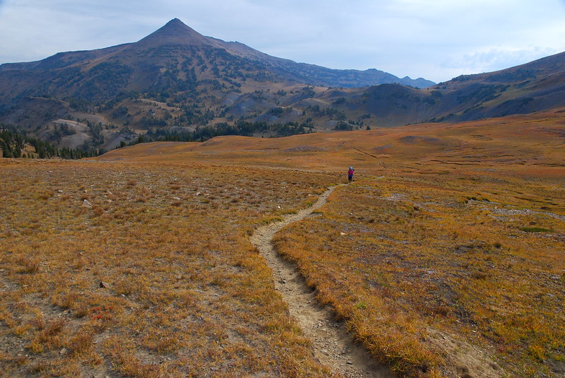
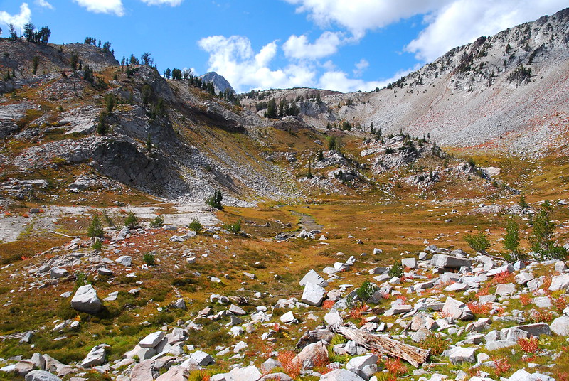
This always happens to me: early on, I think I've reached the prettiest point we'll reach; but then, as we keep going, things just keep getting better. It's a nice problem to have. The meadows above Aneroid Lake and up toward Tenderfoot are lovely, maybe lovelier than the lake itself.
First view.
Is that Aneroid Mountain in the background?
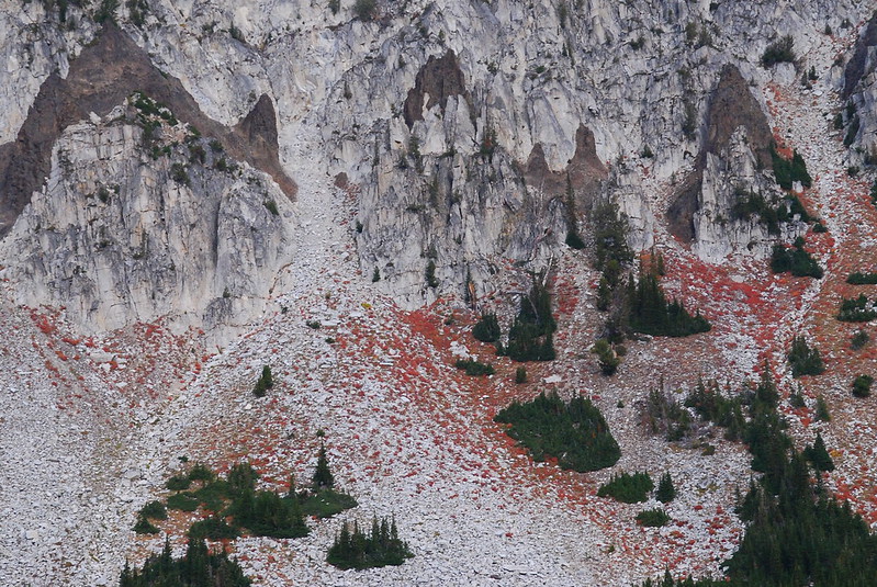
It was tempting to take the short trip to Jewett Lake, but we had miles to go before sleep, so I settled for a few pictures of the basin. What cool rocks!
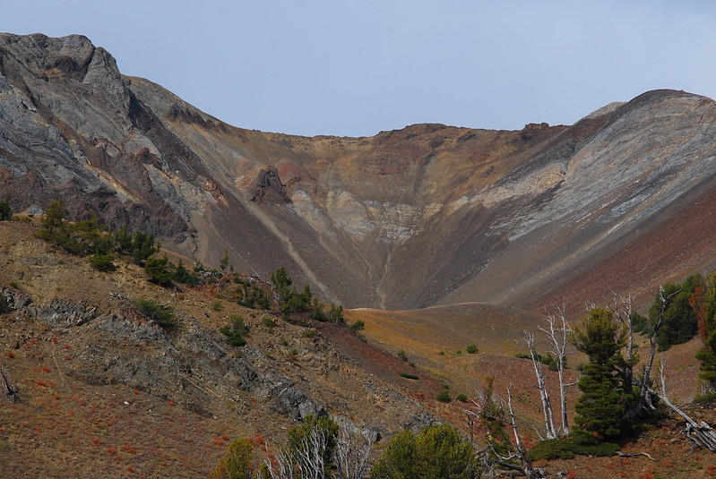
Old ocean floor?
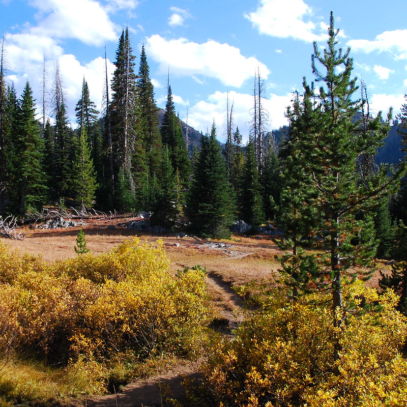
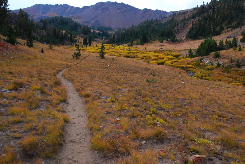
Passing over Tenderfoot, we entered some of the most beautiful alpine meadows I've ever seen. They must be a wonder when the flowers are blooming. They're a different sort of wonder in their fall coats.
Looking down toward the Imnaha River.
And up toward Polaris Pass.
And back toward where we'd been.
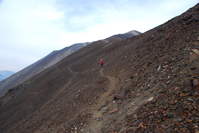
Passing over Polaris Pass there was a stark change in scenery. In contrast to the meadows of the east, on the west side it's all scree and trail that seems more goat than human. It's not exactly sketchy, but we slowed way down, and were definitely careful with our footing.
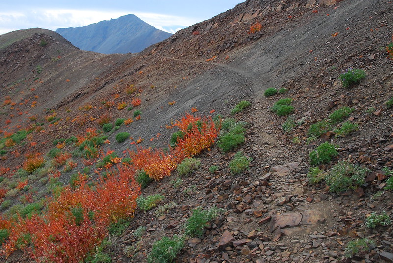
Before.
After.
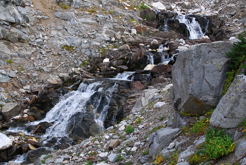
From the pass, the trail meanders gently - for my money: too gently - down toward the West Fork Wallowa River. The grade is so gradual that at times I wondered if the trail builders had somehow built a loop out of switchbacks and we were actually just staying constant in elevation. There were some nice water features, though.
Trail reentering the grass.
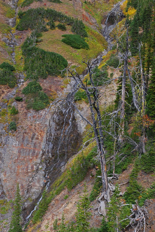
Falls to the north.
And falls to the south.
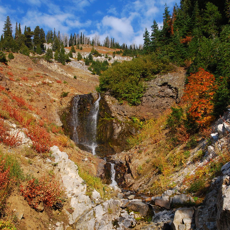
I think the south side wins.
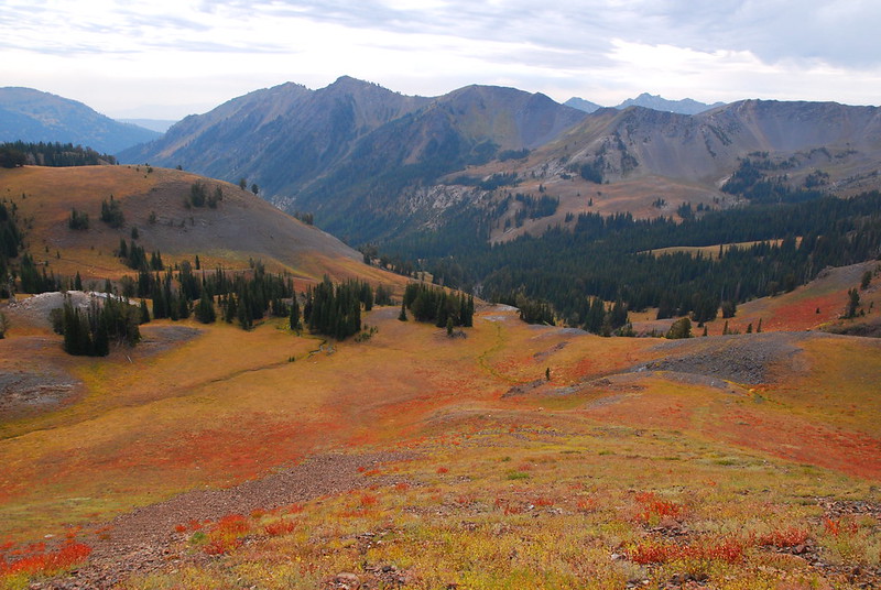
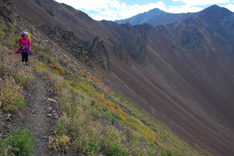
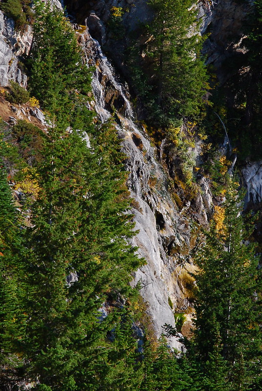
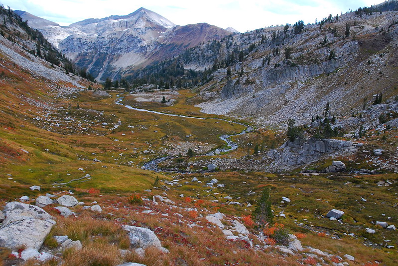
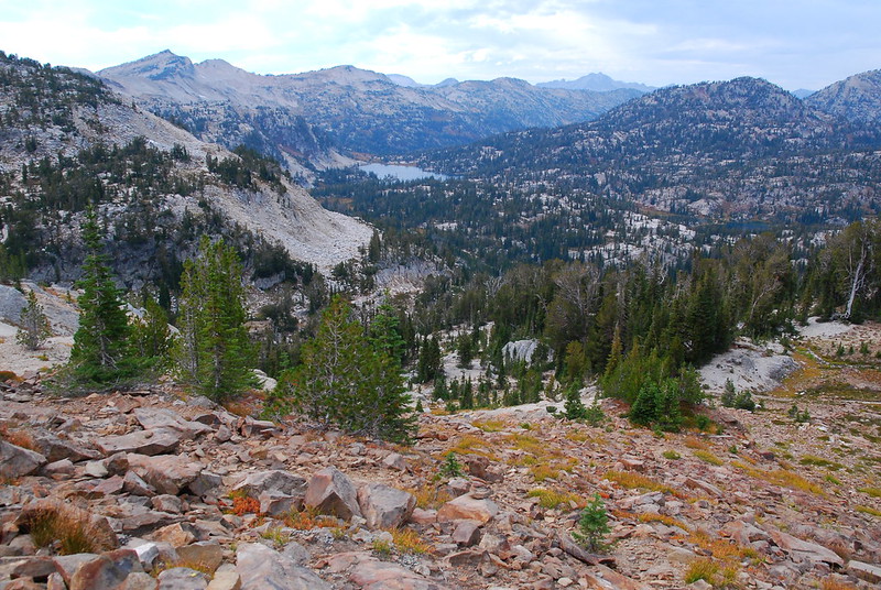
After seemingly descending two switchbacks for each foot of elevation lost, we eventually hit the (unmarked) junction with the West Fork trail, and headed left (south) toward the Lakes Basin. The area between the junction and Frazier Lake is just gorgeous. For neither the first nor the last time, I told Krista that this was probably the prettiest thing we'd see on the trip.
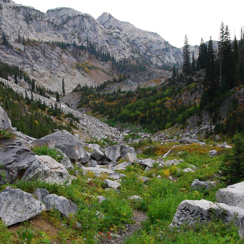
Granite!
West Fork Waterfalls.
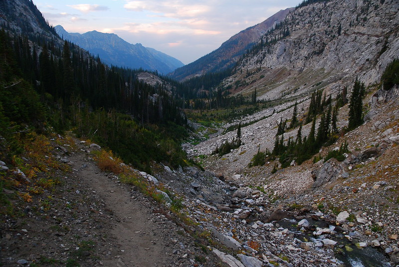
Looking down the river basin. "See you in a couple days!"
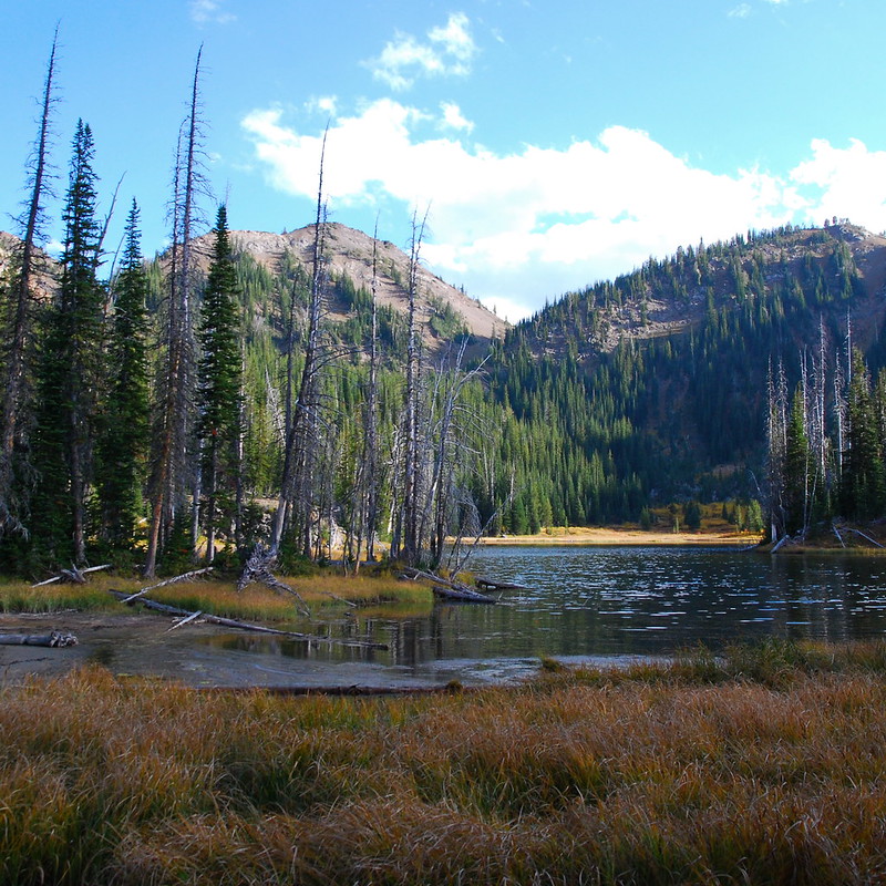
We arrived at Frazier Lake a little late, and found it surprisingly crowded for a Wednesday. Everyone was camped right along the north shore, but we found an excellent spot further along the trail, maybe a hundred feet up the trail to Little Frazier Lake. After a quick dinner, we fell right asleep.
Thursday
Wednesday night was rainy and windy - the only appreciable rain we got all trip. And it was crazy smokey when we woke up Thursday morning. Like: so smokey that it was almost as though we were in a cloud. I'm not sure what it was from. Maybe the last remains of the fire near Ice Lake? In any case, after an hour the smoke cleared and the sun came out. It stayed out for the rest of the trip.
We yard saled our stuff on the rocks, ate a long breakfast, packed up our now nearly dry stuff, and started the short walk to Glacier Lake.
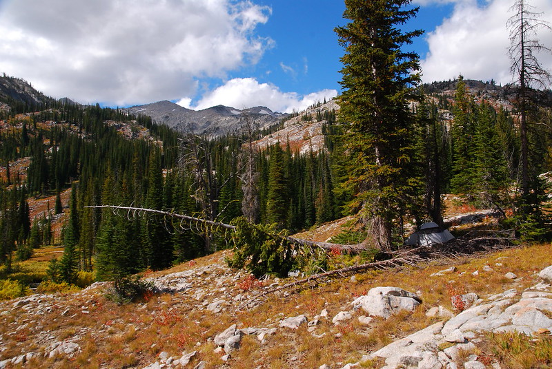
Looking up from camp. Our tent is in the middle right.
Frazier Lake from camp.
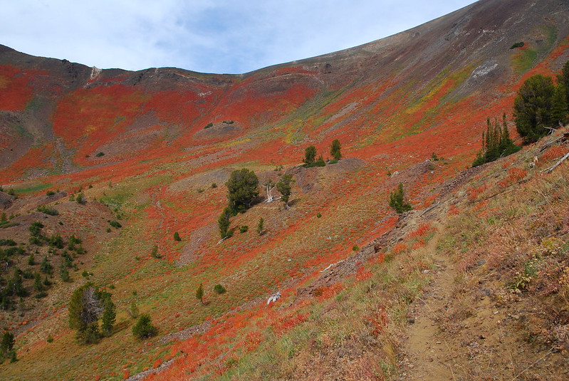
The trail between Frazier and Glacier is just fantastic. (This TR contains roughly a dozen versions of that sentence.) For the third time: "This might be the most prettiest part of our trip!"
Except for that, this time, I may have been right.
Seriously.
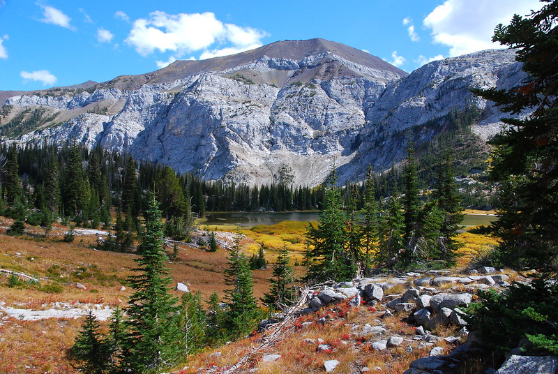
There's a large basin just under Glacier Lake that I initially mistook for the lake basin itself. I think I took twenty pictures of the same thing.
This.
"This" from another angle.
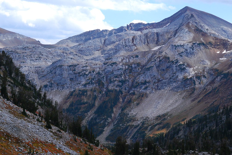
Closeup of... Cusick Mountain?
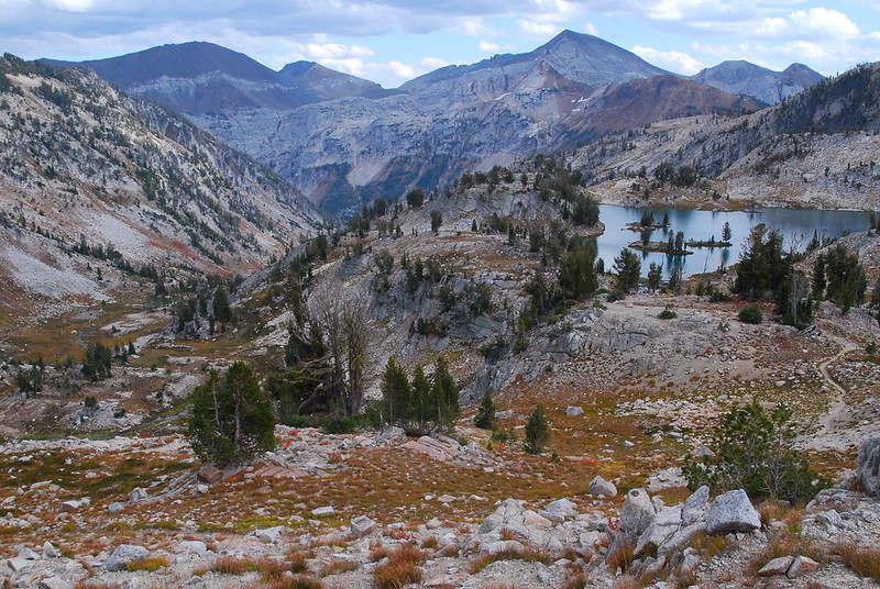
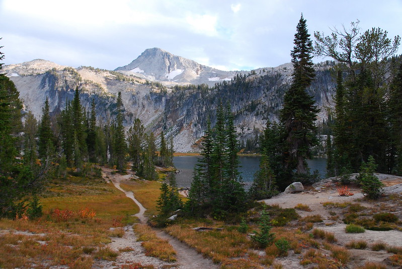
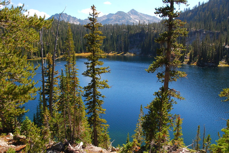
Because the trail leads up into the Glacier Lake basin, when you first come out the lake's at eye level. And the thing is huge. Eventually, we gave up on getting a good picture of the whole thing.
First views.
The view from lunch.
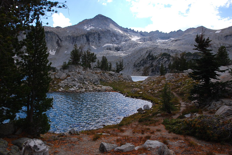
Eagle Cap over Glacier Lake. I didn't understand the name until seeing it from this angle.
On the walk toward Glacier Pass, I kept looking back. If you could find an out of the way spot, this would be a great place to camp.
Eagle Cap again.
The way we came.
After Polaris, Glacier Pass felt tiny. There was a use trail from the pass heading toward Eagle Cap. Anyone know if it goes all the way up? In any case, the views on the north side of the pass are a little less epic than on the south.
Lakes!

For the second / sixtieth time: granite!
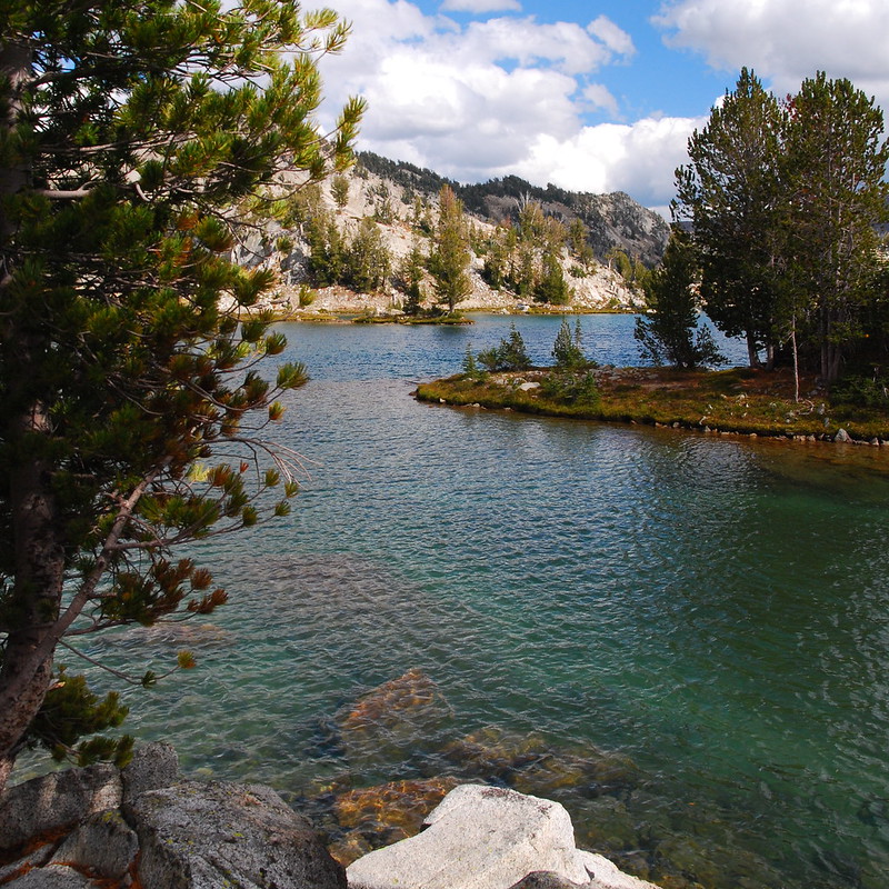
After a short descent, we hit the Moccasin Lake area, and there were suddenly campsites everywhere. My favorite thing about the lake is the way that the trail crosses it. Rather than going all the way around, the trail hops over a thin spot on the southwest side.
Stream meadow just before Moccasin.
Crossing.
Krista Crossing.
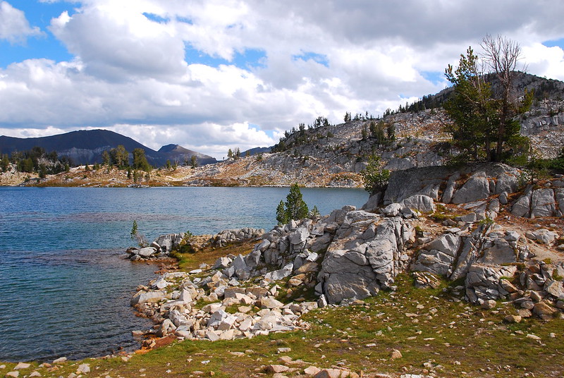
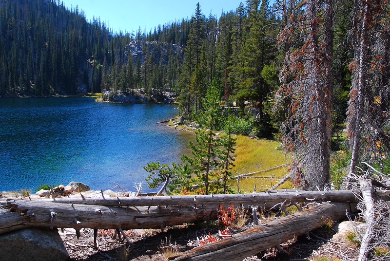
Mirror Lake is just up from Moccasin - at most a quarter mile. I was surprised at how uncrowded Mirror was, though the area looks like it sees more than its share of visitors in the high season. Big parts of the shore are closed for regrowth. Bigger parts are bald and sort of sad looking.
Eagle Cap above Mirror Lake.
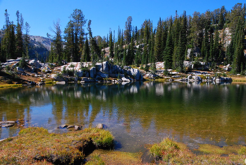
We kept going a little ways further to Sunshine Lake, a small, totally deserted tarn just north of Mirror. By the look of things, it too gets a lot of visitors, but we had it all to ourselves for the night. We set up camp, lounged around, ate a leisurely dinner, and sat out on the granite, watching the sunset and some of the best stars I've ever seen.
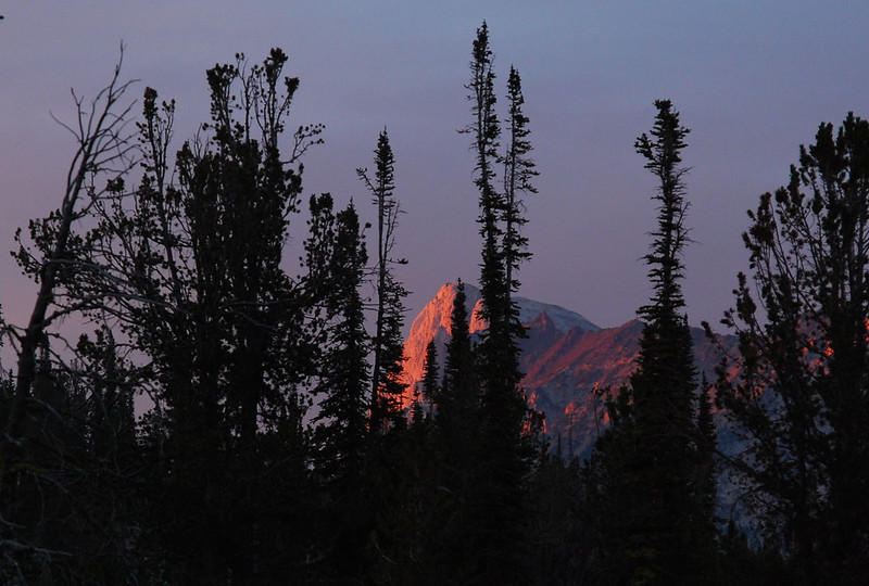
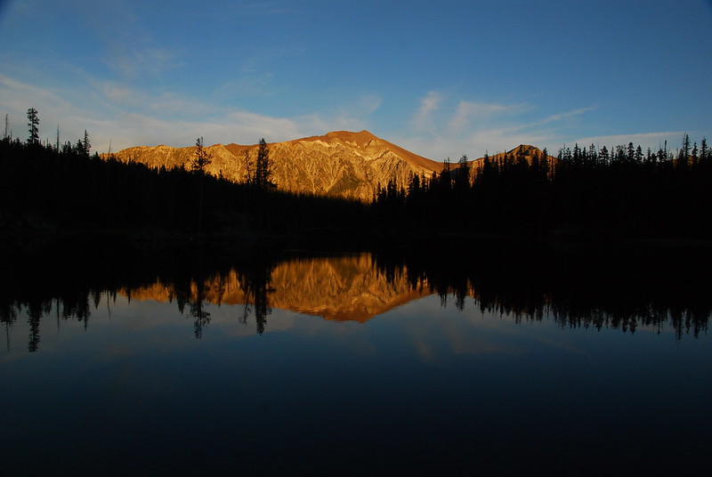
Sunset on the Matterhorn.
Friday
We spent most of Friday morning staring at the piles and piles of frogs that had somehow materialized on the shores of Sunshine Lake overnight. Maybe they just hatched? Maybe they fell from the sky? It was the weirdest thing. There were some dead ones, some in advanced states of being reabsorbed by the soil, but there were still hundreds of very much life ones hopping around. We walked very carefully.
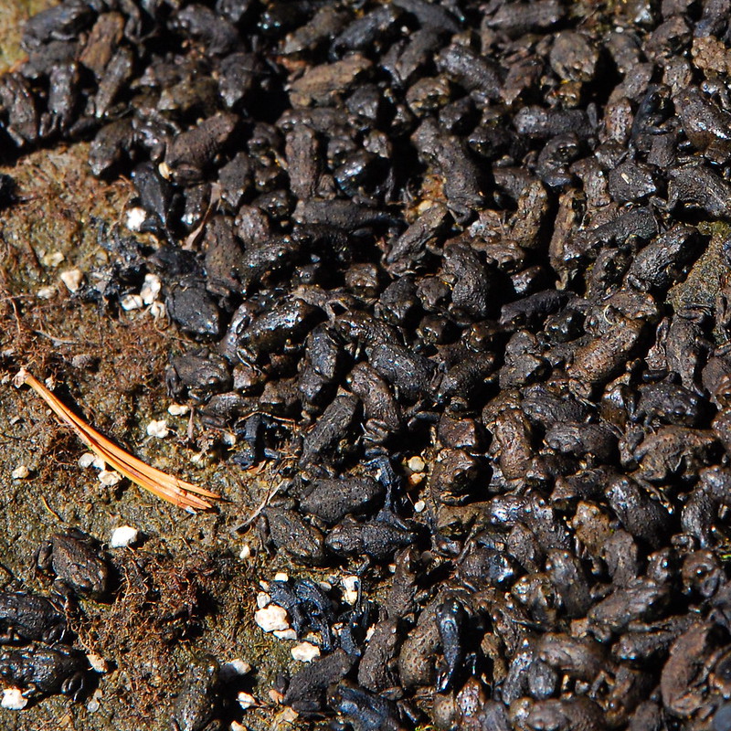
Frog pile!
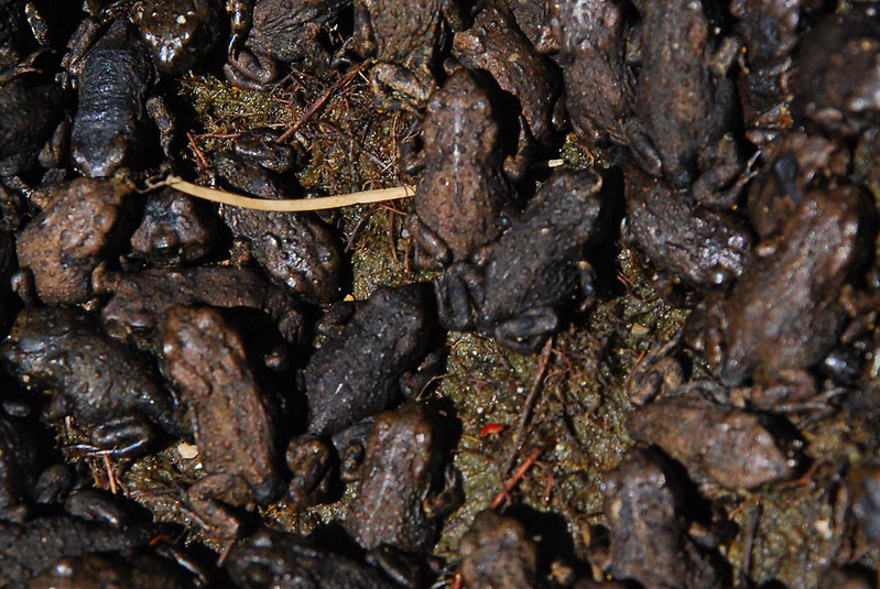
Out of focus closeup.
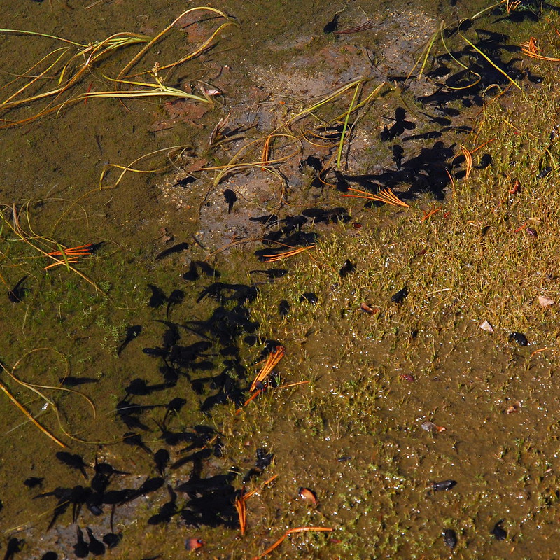
Tadpoles: here's your future.
We packed up, making sure that no frog friends hitched rides in our bags, and headed on to more lakes.
Saying goodbye to Sunshine Lake.
Then, quickly, hello to Crescent Lake.
And Douglas Lake.
And Craig Lake.
Our destination for the night was Horseshoe Lake, just a couple miles down the trail. The best way to get there, at least if you're heading the way we were heading, is to take a well-established but unsigned side trail south maybe half a quarter mile past Douglas Lake. The trail leads down a few switchbacks to Lee Lake - which would itself be a pretty great destination - before cutting over to Horseshoe.
Lee Lake.
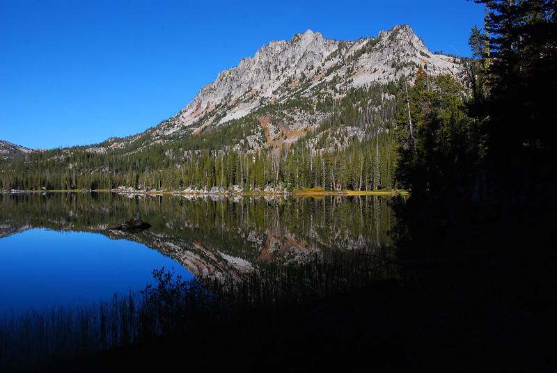
Horseshoe Lake, from just down from camp.
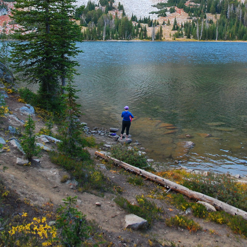
We made camp well before lunch, and spent the rest of the day just soaking it in: swimming, taking pictures of small things, reading, taking a nap. There was someone clear on the other side of the lake, but otherwise we had it to ourselves.
Swamp type thing behind camp.
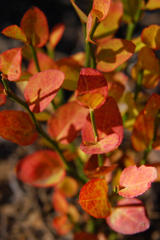
Fall leaves.

Year-round lichen.
The night was much like the day: unhurried and full of pictures. I couldn't get a picture, but the lake was so calm that, when the stars came out, you could look down into the water and it was almost like looking down into the sky.
Sunset on Pete's Point.
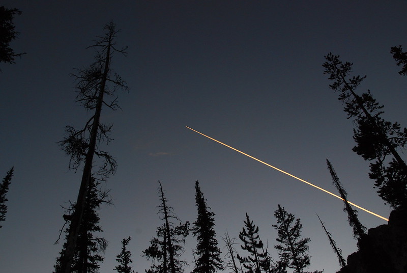
Goodnight planes.
Saturday
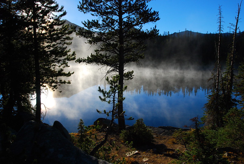
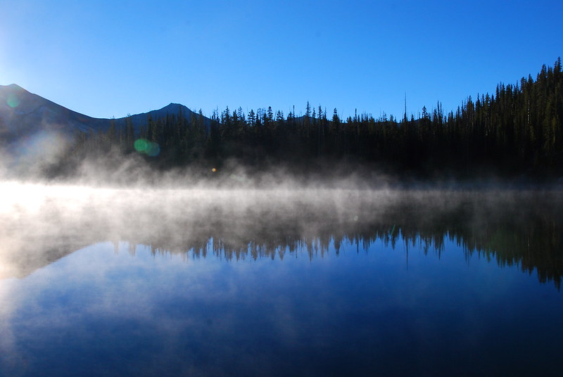
We woke up to frost-covered foliage and a mist-covered lake. After reluctantly packing up, we got back on the main trail, and took the short walk down to Six Mile Meadow.
The view from camp.
Filtering water for the last time.
View from the main trail, saying goodbye to Horseshoe.
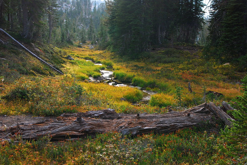
We got to Six Mile Meadow right around breakfast time, and stopped by a branch of the West Fork for some oatmeal.
The bridge is out, but this time of year it's an easy walk across.
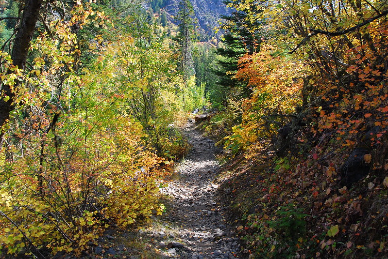
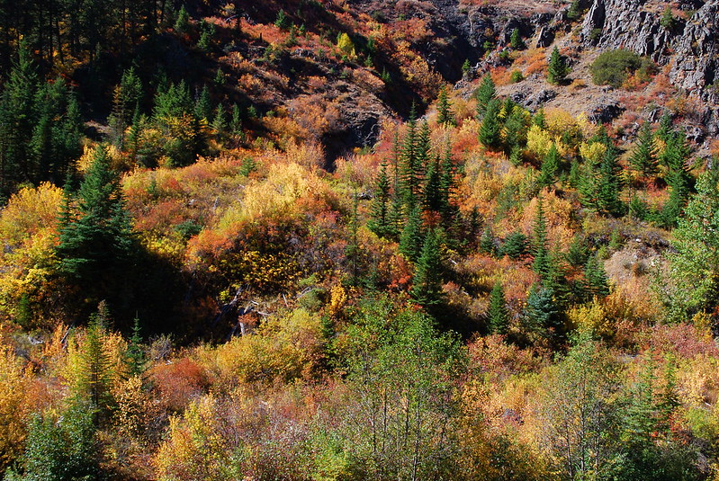
From the meadow, it was just an uneventful walk back down to Wallowa Lake. The fall colors seem to have gotten even more intense while we were up there.
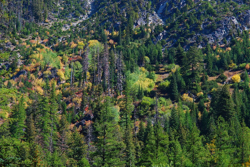
Hillside just down from Ice Lake.
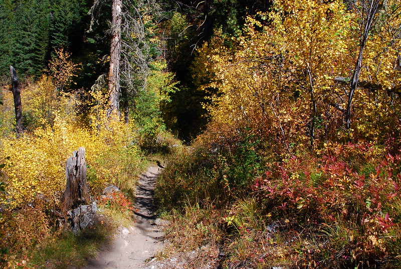
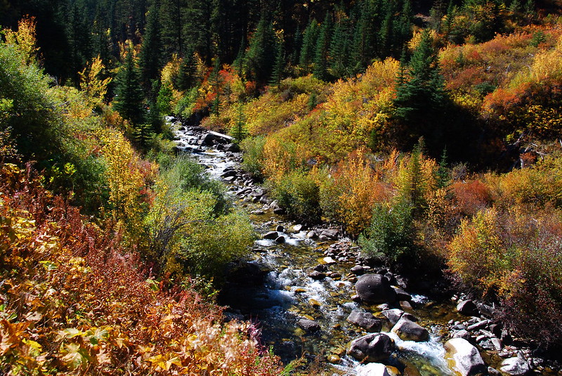
The trail was like this pretty much the whole way down.
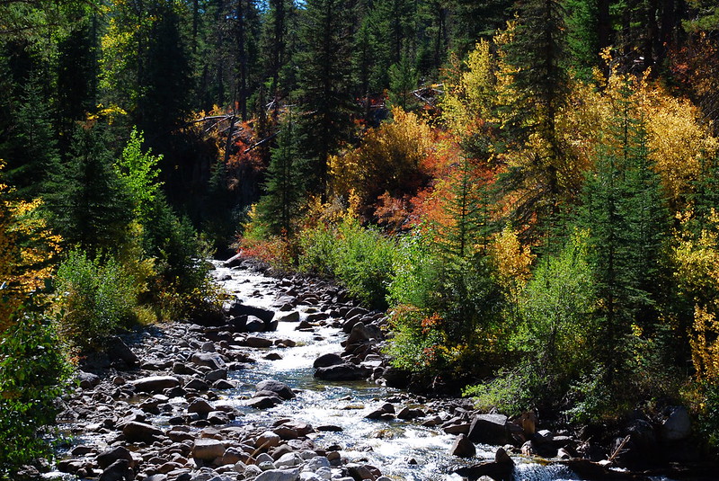
West Fork.
Another hillside.
Same river, maybe a mile before the car.


