Making Passes in the Wallowas: 7/18/14-7/19/14

This forum is used to share your experiences out on the trails.
User avatar
Born2BBrad
Posts: 1086
Joined: May 1st, 2011, 7:26 pm
Location: The Dalles

Making Passes in the Wallowas: 7/18/14-7/19/14

Post by Born2BBrad » July 21st, 2014, 7:19 pm

What: Wallowa Mountains E/W Wallowa River backpack loop
Who: Brad (Born2BBrad) and Chase
When: 7/18/14-7/20/14

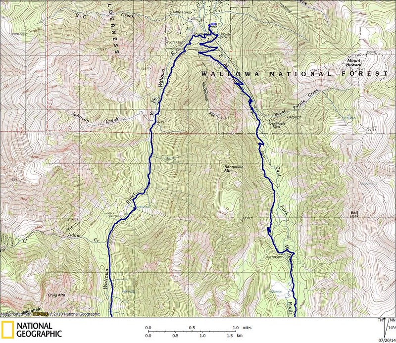
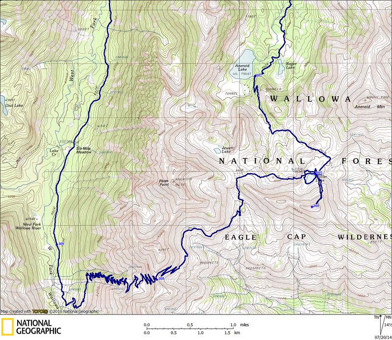
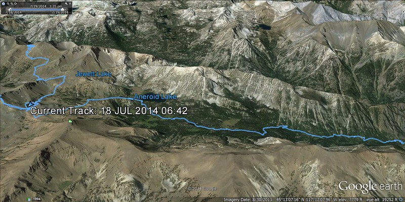
Route Day 1: Wallowa Lake trailhead (4645’), East Fork Wallowa River trail past Aneroid Lake (7560’), up to Dollar Pass (8420'), over to Dollar Lake (8465') where we made camp, up to Dollar Ridge (9100') and back to camp.

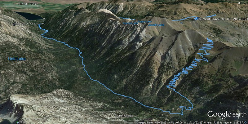
Route Day 2: Shortcut from Dollar Lake to Tenderfoot Pass (8540’), up and over Polaris Pass (8900’), down to the West Fork Wallowa River trail at 6400’, down the West Fork Wallowa River past Sixmile Meadow (6050') and back to the Wallowa Lake trailhead.

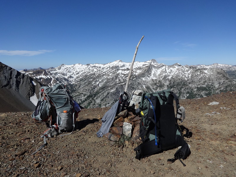
Opening picture/Chase coming down Polaris Pass:
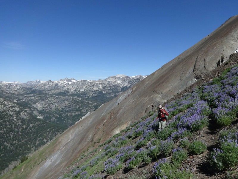
Image

A few weeks ago I noticed a spot on the calendar in mid-July with no outdoor activity penciled in. That had to be remedied. So I pinged a few of my Portland Hiker comrades to check their availability for the weekend of July 19th. As luck would have it, Chase’s schedule aligned with mine. Score! A bonus summer trip for 2014!

I suggested to Chase that we do a similar trip to one I did the same weekend last year to the Eagle Cap Wilderness. He was all for that, as he had never been there before. I had wanted to go back to climb at least one peak I hadn’t been to before.

Chase and I left Portland at 5:00 PM on Thursday 7/17 after I got off work and drove straight to the Wallowa Lake trailhead, only stopping for a quick bite in The Dalles and to gas up in La Grande. Once we arrived at Wallowa Lake at 11:15 PM, we looked for the stealth campsite Bosterson told us about. It's next to the PacifiCorp Wallowa Falls Campground. It was a great spot away from the noise of the Wallowa Lake State Park campground, plus it didn't cost anything. Thanks Bosterson!!

The next morning we were on the trail at 6:45 AM.

Now for some facts about the Eagle Cap Wilderness courtesy of Wikipedia (so they must be true):
• Located in the Wallowa Mountains of NE Oregon.
• In 1930, it was established as a primitive area and in 1940 earned wilderness designation.
• At over 360,000 acres it is by far Oregon’s largest wilderness.
• Named after a peak in the Wallowa Mountains, which used to be called the Eagle Mountains.
• The highest point at 9838’ is Sacajawea Peak. A total of 31 summits exceed 8000’ in the Eagle Cap Wilderness.
• Contains Legore Lake, at 8880’ the highest lake in the state of Oregon.
• Wildlife includes black bears, cougars, bighorn sheep, mountain goats, white-tailed deer, mule deer and Rocky Mountain elk. Moose have recently returned to the wilderness and there is evidence that grizzly bears and wolverines have returned. The Imnaha wolf pack has been known to roam the Eagle Cap Wilderness, as well.
• 47 trailheads lead into the wilderness, with approximately 534 miles of hiking trails.
• The wilderness contains four designated Wild and Scenic Rivers that originate in Eagle Cap Wilderness: The Lostine, Eagle Creek, Minam and Imnaha Rivers.

On to the pictures...

Brad and Chase at the TH before becoming stinky and dirty:
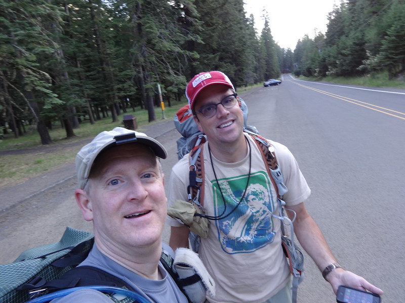
Image

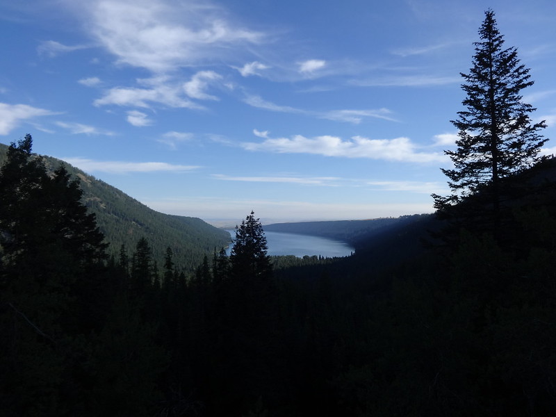
First view of Wallowa Lake:
Image

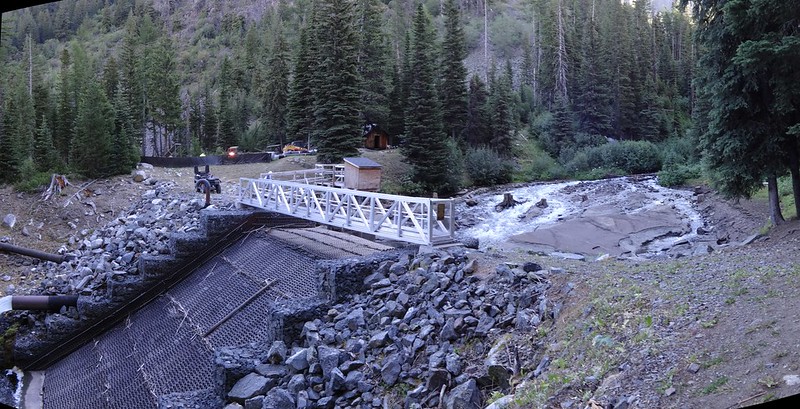
Apparently there was some damage this winter to the pipes that divert the flow out of the man-made lake:
Image

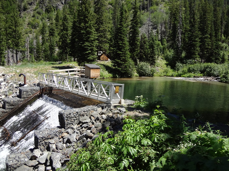
Here's what it looked like last year:
Image

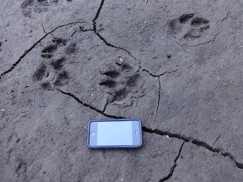
Looks like wolf prints in the mud next to where the lake used to be:
Image

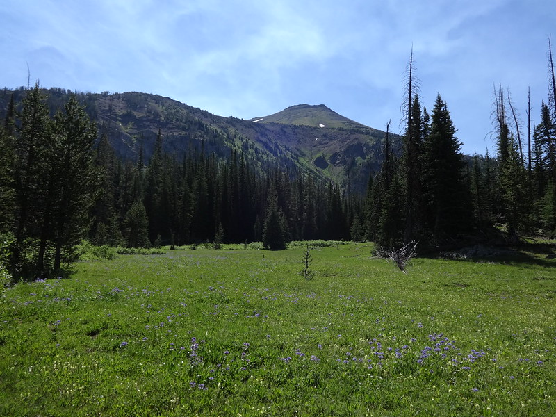
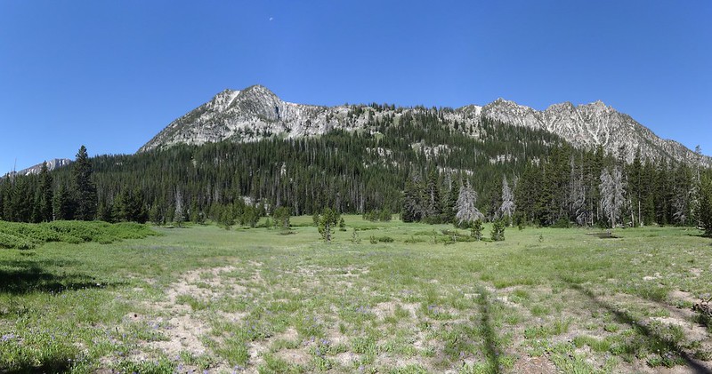
Meadow with what I think is Bonneville Mountain behind it:
Image

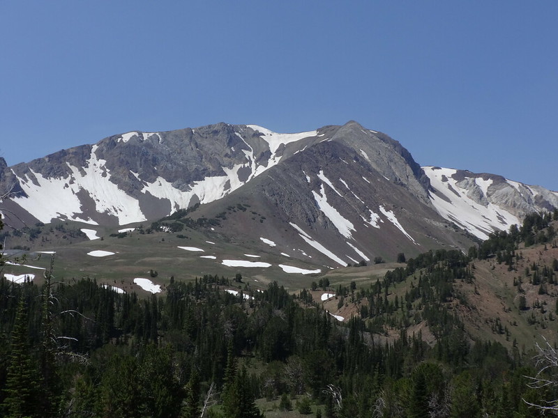
First view of Aneroid Mountain:
Image

Above Aneroid Lake:
Image

Fact about Aneroid Lake courtesy of PH member Bobcat:
According to Oregon Geographic Names, Aneroid Lake was named in 1897 when a member of a U.S. Fish Commission survey party used an aneroid barometer to gauge the elevation of the lake.

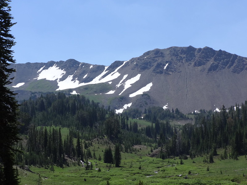
East Fork Wallowa River headwater valley with Dollar Ridge in the background:
Image

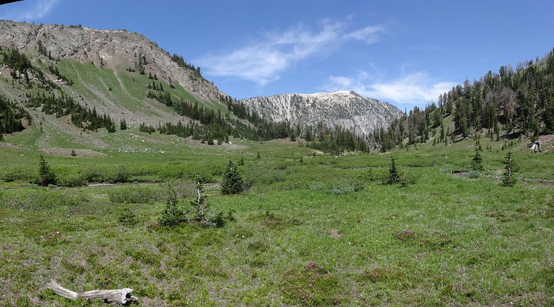
Looking downriver back at Bonneville Mountain:
Image

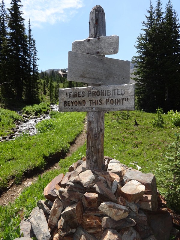
Weathered signposts sometimes look so cool:
Image

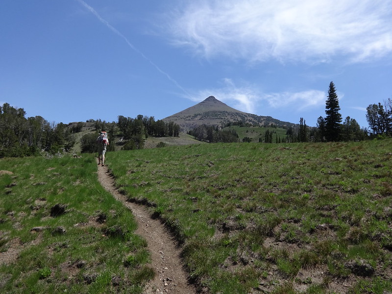
Heading up to Dollar Pass/Aneroid Mountain in the background:
Image

Looking over at Petes Point:
Image

Facts about Petes Point courtesy of Summit Post:
• At 9,675’, Petes Point is the fifth highest named mountain in the Wallowa Range.
• It forms a massive east-opening horseshoe that opens on the high alpine plateau at Tenderfoot Pass and forms the northern anchor of the extensive Wallowa/Imnaha divide.
• The east opening of the mountain drains into the North Fork Imnaha River. The north wall rises above Jewett Lake and the headwaters of the East Fork Wallowa River. The western scree slopes of fall into the West Fork Wallowa River.
• The summit gets a lot of traffic as evidenced by the presence of two register boxes containing many entries. With winter outfitters nearby, this mountain probably has more winter ascents than most big Wallowa peaks.
• The east running arms of the horseshoe provide two easy walk up routes to the summit from the vicinity of Tenderfoot Pass. The south arm is a longer and gentler climb, while the north arm is steeper, but shorter. Together they provide an excellent alpine loop hike on one of the Wallowas most massive mountains. Other more difficult routes can be had from the west and north.

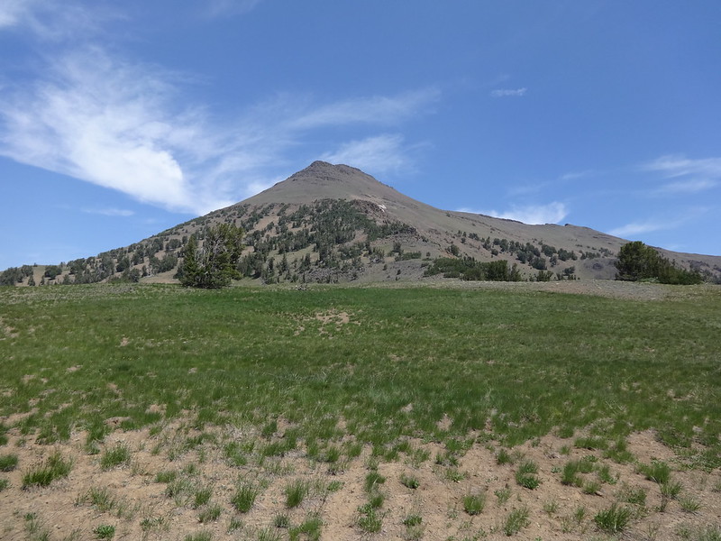
Aneroid Mountain from Dollar Pass:
Image

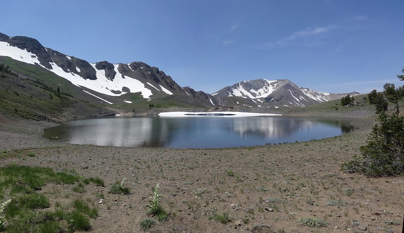
Dollar Lake with Dollar Ridge (L) and Petes Point (R):
Image

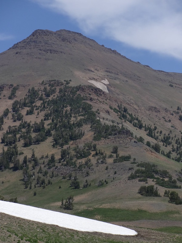
The southern climbing ridge of Aneroid Mountain:
Image

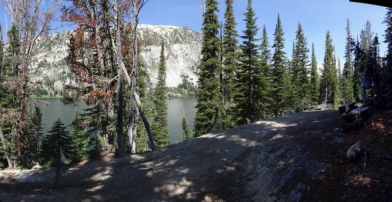
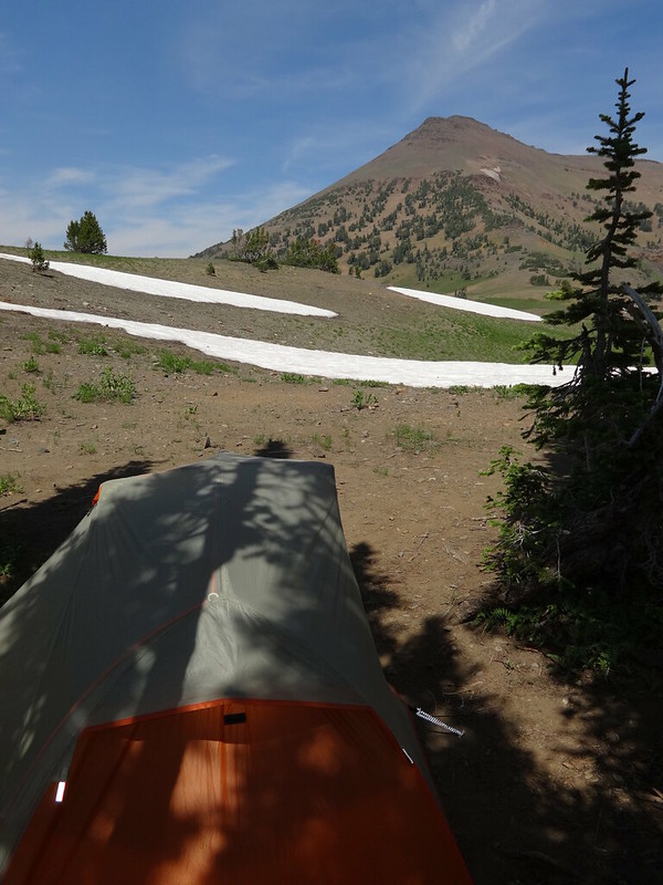
View from our campsite at Dollar Lake:
Image

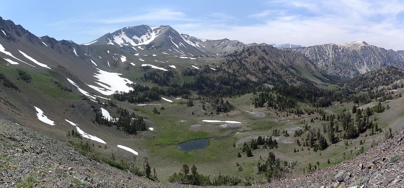
View from above Dollar Lake looking west. The smoke from the Hurricane Creek fire is just starting to roll in:
Image

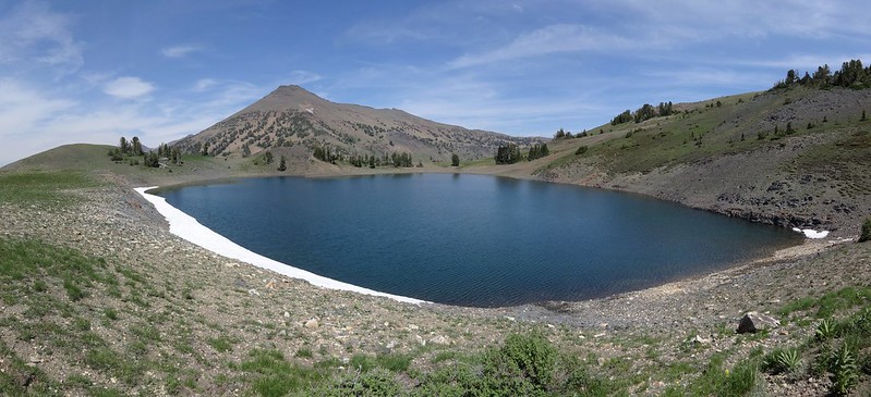
View from above Dollar Lake looking NE over to Aneroid Mountain:
Image

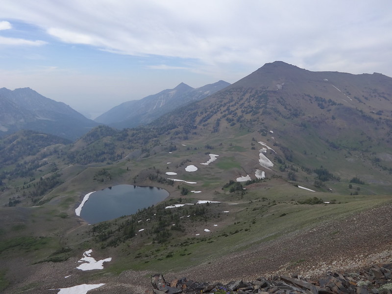
Climbing up Dollar Ridge the smoke really became apparent:
Image

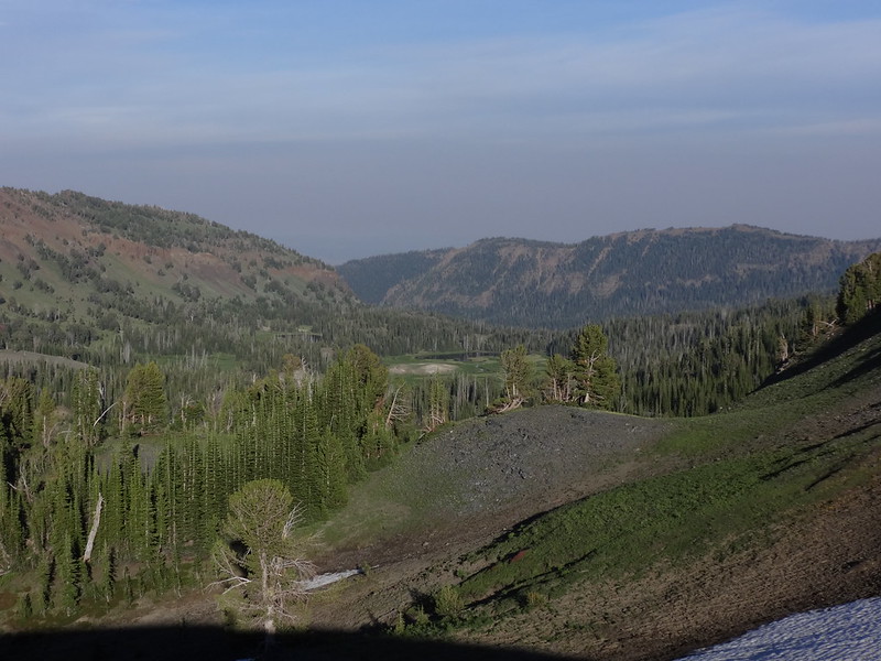
Looking over to Bonny Lakes and Bonny Meadows:
Image

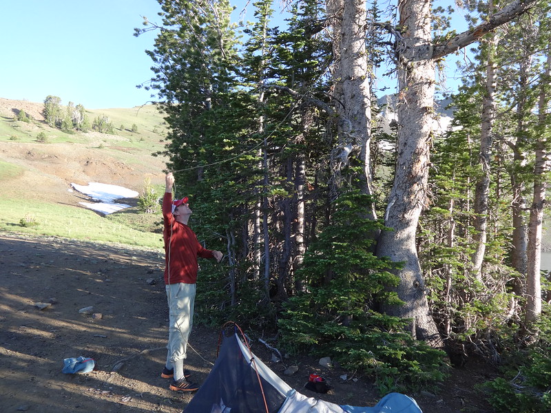
Chase hanging his food:
Image

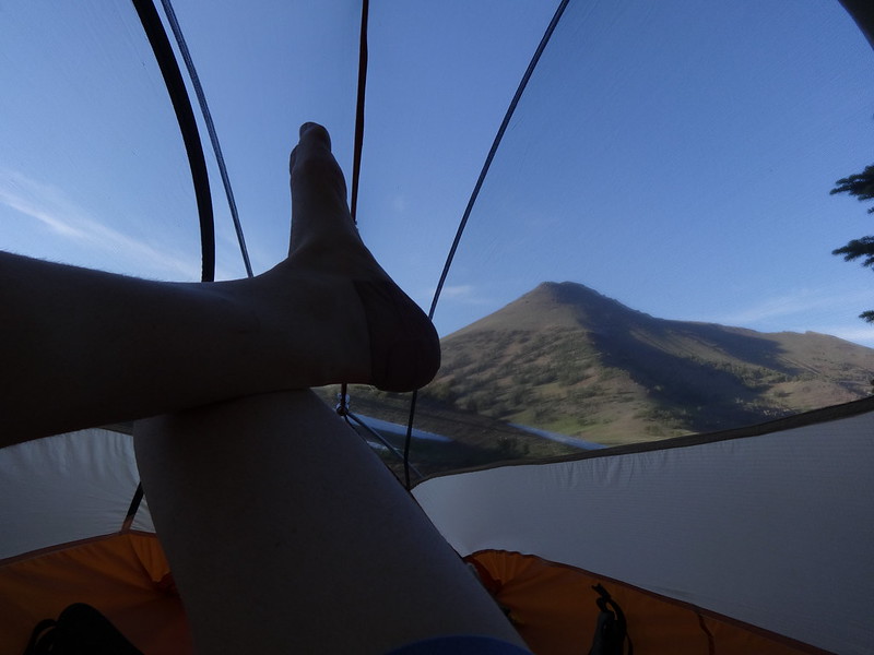
Kicking back in my tent:
Image

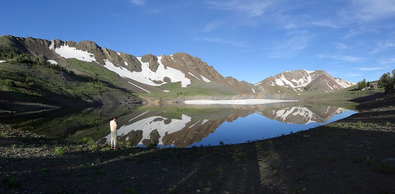
Reflections in Dollar Lake the next morning:
Image

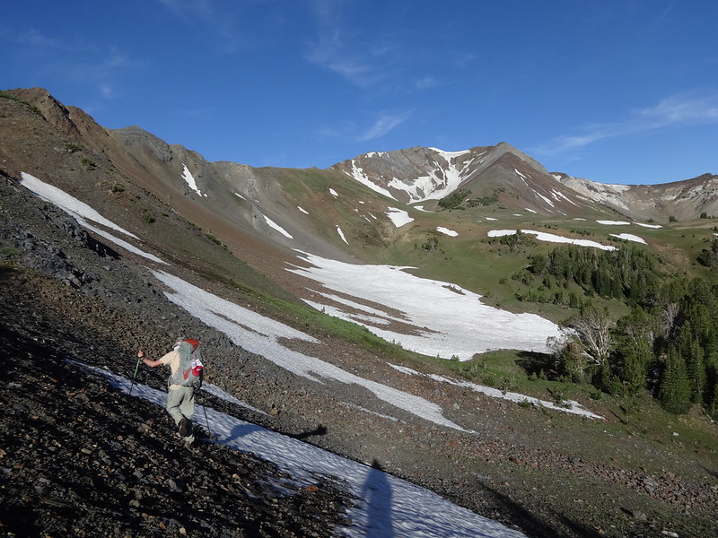
Taking a shortcut cross country from Dollar Lake to Tenderfoot Pass:
Image

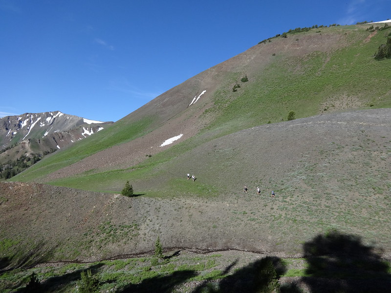
Some trail runners on the trail up to Polaris Pass:
Image

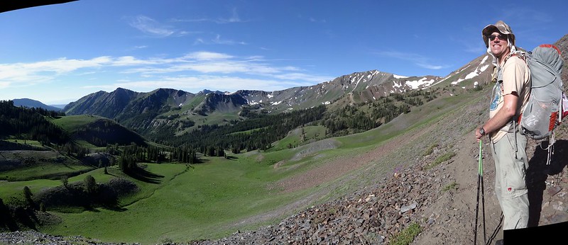
Chase enjoying the view of the North Fork Imnaha River valley:
Image

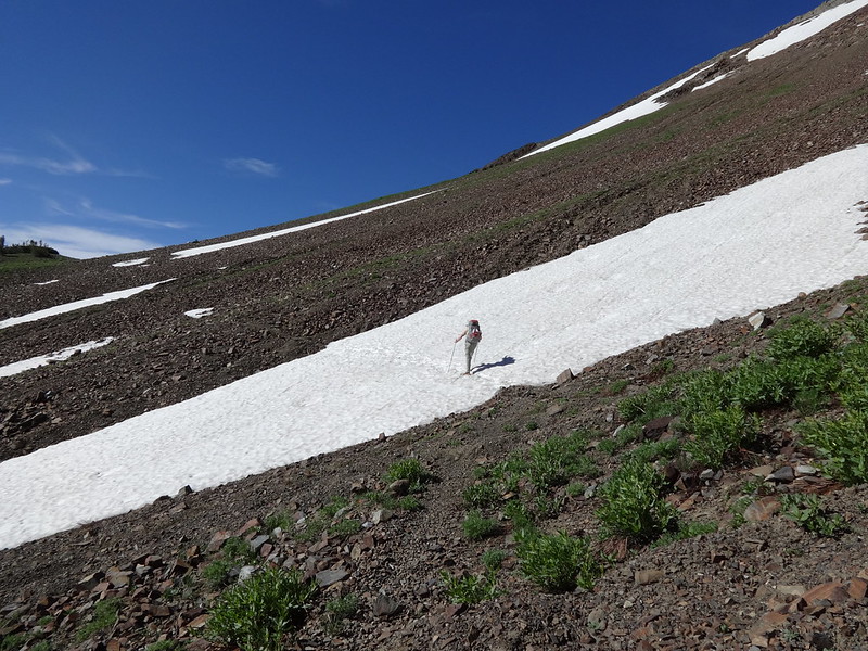
There were a few patches of snow to cross on the way up to Polaris Pass:
Image

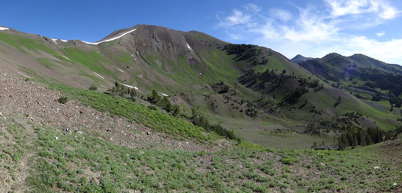
The south side of Petes Point with Aneroid Mountain and Dollar Ridge still in view:
Image

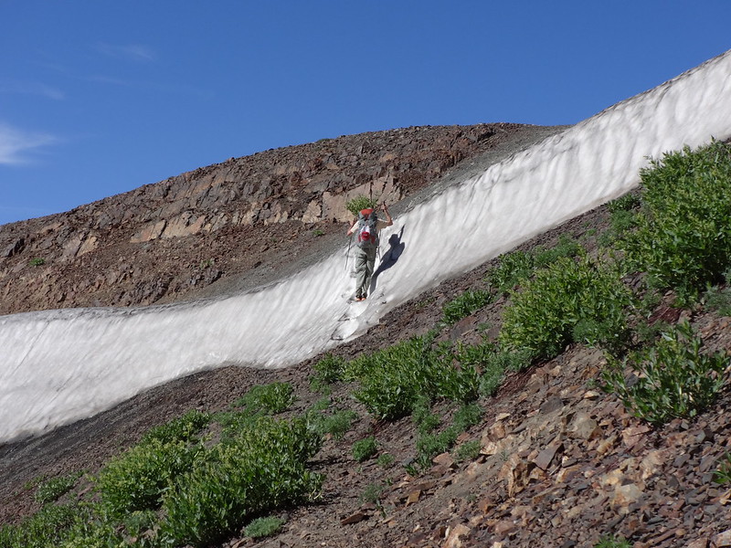
This snow bank just below Polaris Pass was not there last year at that same day of the year:
Image

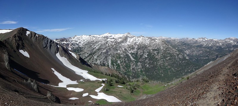
The view from Polaris Pass looking west:
Image

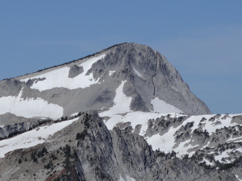
Zoom of Eagle Cap and its big crack:
Image

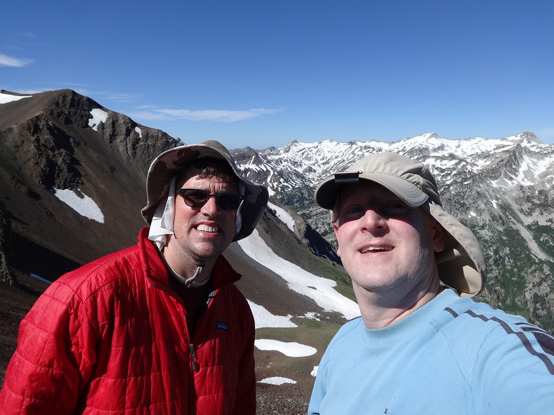
TFF selfie at Polaris Pass:
Image

I thought this looked pretty cool:
Image

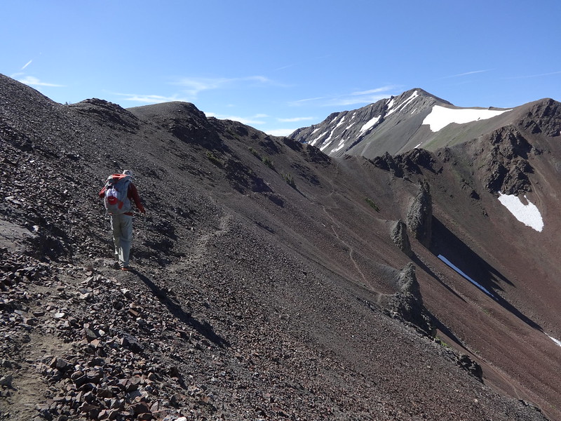
The beginning of the 53 switchbacks down from Polaris Pass:
Image

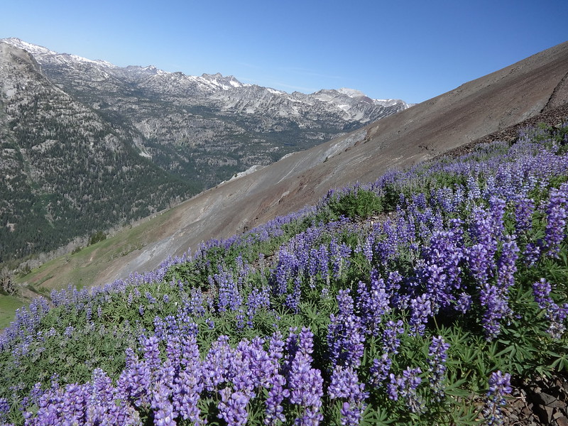
Many large pungent fields of lupine along the way down:
Image

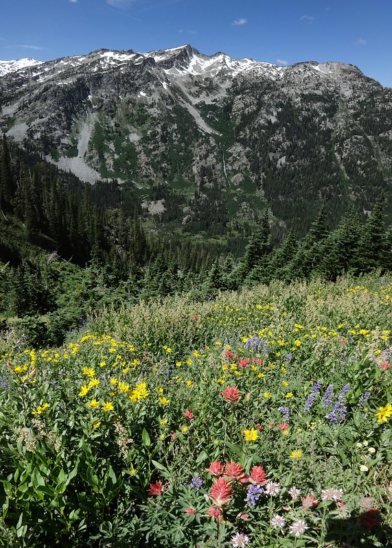
Flowers and the West Fork Wallowa River valley:
Image

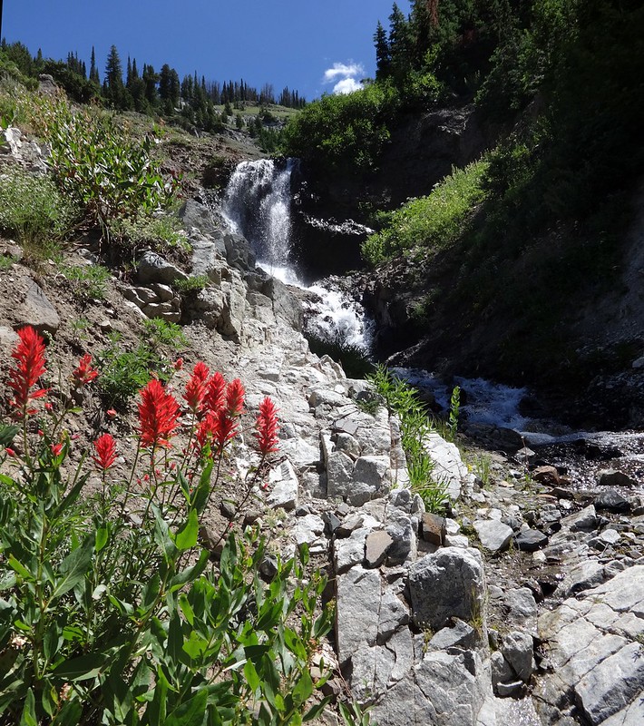
Flowers and a waterfall:
Image

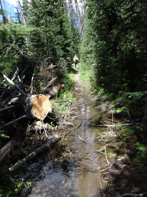
The rest of the way going down the West Fork Wallowa River trail was uneventful, save for a few wet places:
Image

Tracks in Nat Geo:
Image
Image

Tracks in Google Earth (east side):
Image

Tracks in Google Earth (west side):
Image

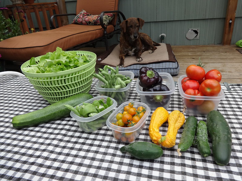
Just like last year, my garden exploded when I was away:
Image

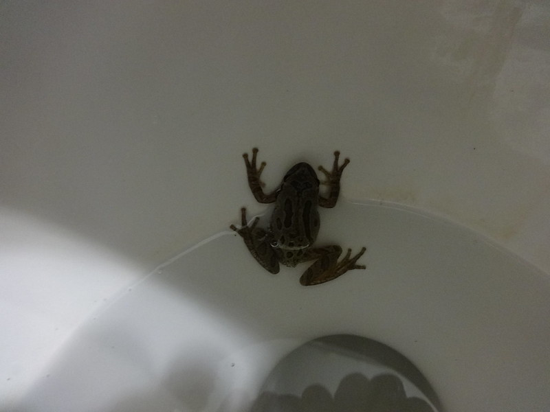
On a completely unrelated subject, when I came into the house after I got home, there was a frog in the toilet. I have no idea how it got there:
Image

Link to all the pictures from the trip:
https://www.flickr.com/photos/54959080@ ... 798654891/

Trip computer miles: 29.9
Trip computer EG: 6184'

The mosquitoes were not too bad, but we spent much of the time above 8000', and were moving quickly much of the time in the valleys.

Also, on the drive back through the Blue Mountains I saw a moose by the side of the road on I-84. That's right, a moose. To make sure I wasn't seeing things, I searched the Internet for "moose", "Blue Mountains" and "Oregon". Sure enough, there are moose in NE Oregon, including the Blue Mountains.

Hike the good hike,

Brad
Last edited by Born2BBrad on July 21st, 2014, 8:47 pm, edited 1 time in total.
Make now always the most precious time. Now will never come again.
- Jean Luc Picard

Link to GPX tracks
Link to Trip Reports

User avatar
Chase
Posts: 1265
Joined: May 28th, 2008, 10:03 pm

Re: Making Passes in the Wallowas: 7/18/14-7/19/14

Post by Chase » July 21st, 2014, 7:42 pm

Fun times and thanks to Brad for introducing me to the wonders of the Wallowas.

Image

Image

Image

Image

Image

Image

Image
You can match up some of the peaks with Peakfinder:
Image

Image

Image

Bonus #1 Brad and a half
Image

Bonus #2 Don't use your imagination
Image

User avatar
texasbb
Posts: 1175
Joined: July 26th, 2008, 8:16 pm
Location: Tri-Cities, WA

Re: Making Passes in the Wallowas: 7/18/14-7/19/14

Post by texasbb » July 21st, 2014, 8:28 pm

Very nice. Some of the best views of/over Dollar Lake I've seen. And how 'bout that Polaris Pass view!

BTW, I've been confused whether that's Bonneville Mtn over that nice meadow with the meandering water. Google brings up conflicting accounts. You'd think it's the high point on that bulky mountain you photographed, but the map labels a small point to the north about 1000 feet lower than the high point.

Thanks for the report.

User avatar
jessbee
Posts: 877
Joined: May 28th, 2008, 10:03 pm
Contact:

Re: Making Passes in the Wallowas: 7/18/14-7/19/14

Post by jessbee » July 21st, 2014, 9:35 pm

What the what? No summits? Chase, you must be saving it all up for next week...

Great photos and a sweet trip!
Will break trail for beer.

Blog and photos

User avatar
mschratten
Posts: 28
Joined: June 19th, 2013, 1:58 pm

Re: Making Passes in the Wallowas: 7/18/14-7/19/14

Post by mschratten » July 22nd, 2014, 6:03 am

Excellent TR! Headed there in a couple of weeks. We'll head over Polaris to Frazier, Glacier and Lakes Basin, then out the West Fork. Glad for you that the bugs weren't too bad. How were evening temps? Wondering about Wiki's statement re: grizzlies. Hmmm...
"The mountains are calling and I must go."
~John Muir

User avatar
dixhuit
Posts: 99
Joined: July 10th, 2008, 10:27 am

Re: Making Passes in the Wallowas: 7/18/14-7/19/14

Post by dixhuit » July 22nd, 2014, 8:58 am

Weathered signposts sometimes look so cool:
Image
What is the deal with the quotes on the sign--"FIRES PROHIBITED BEYOND THIS POINT"? I see the same sign all over the Wallowas. Who's being quoted? Smokey Bear?

User avatar
retired jerry
Posts: 14417
Joined: May 28th, 2008, 10:03 pm

Re: Making Passes in the Wallowas: 7/18/14-7/19/14

Post by retired jerry » July 22nd, 2014, 9:11 am

I've noticed the quotes around the "Fires Prohibited"

Does that mean fires are really permitted, it's just a regulation that doesn't need to be followed :)

User avatar
Mariposa Man
Posts: 15
Joined: September 6th, 2013, 1:43 pm
Location: Oregon

Re: Making Passes in the Wallowas: 7/18/14-7/19/14

Post by Mariposa Man » July 22nd, 2014, 1:38 pm

Nice report and wonderful photos. I enjoy the snowbank and wildflower shots since a September visit of this (similar) route revealed dusty trails and primarily autumnal hues (different but equally beautiful). And congrats on managing Polaris Pass--it's quite the long haul, indeed. In fact, I'm surprised you spotted trail runners on the ascent! Whew! I'm headed for the grandeur of Eagle Cap next week, and now I'm more jazzed than ever... Thanks!

aircooled
Posts: 454
Joined: May 28th, 2008, 10:03 pm
Location: Portland, OR

Re: Making Passes in the Wallowas: 7/18/14-7/19/14

Post by aircooled » July 22nd, 2014, 1:41 pm

Thanks for the TR! Love stealth camping at a TH. :)

User avatar
Born2BBrad
Posts: 1086
Joined: May 1st, 2011, 7:26 pm
Location: The Dalles

Re: Making Passes in the Wallowas: 7/18/14-7/19/14

Post by Born2BBrad » July 22nd, 2014, 4:16 pm

texasbb wrote: BTW, I've been confused whether that's Bonneville Mtn over that nice meadow with the meandering water. Google brings up conflicting accounts. You'd think it's the high point on that bulky mountain you photographed, but the map labels a small point to the north about 1000 feet lower than the high point.
That’s why I said “I think it was Bonneville Mountain”. Two maps indicate Bonneville Mountain is at the lower, northern end of the ridge. However, Summit Post says that Bonneville Mountain is the high point on that ridge above Aneroid Lake. I think it is the high point on the ridge and that the maps are wrong.
----------------------------------------------------------------------------------
jessbee wrote:What the what? No summits?
Technically, we did make it to a summit, which was Dollar Ridge. At 9100’, it wasn’t Aneroid Mountain or Petes Point, but it was something.
----------------------------------------------------------------------------------
mschratten wrote:Excellent TR! Headed there in a couple of weeks. We'll head over Polaris to Frazier, Glacier and Lakes Basin, then out the West Fork. Glad for you that the bugs weren't too bad. How were evening temps? Wondering about Wiki's statement re: grizzlies. Hmmm...
Yeah, the bugs weren’t too bad during our stay, but they are probably be out in force in the Lakes Basin. Probably in the meadows too, but like I said, we were moving fast and didn’t stop for long in any one spot.

It was warm both nights. The first at the stealth campsite at Wallowa Lake was so warm I didn’t even use my tent fly. The second night at Dollar Lake was relatively warm, as well. I never even put on a long-sleeve shirt.

Regarding grizzly bears, Wikipedia notes “there is possible evidence grizzly bears and wolverines are returning as well” and has a footnote. The footnote links to a Tri-Cities Herald article. What I got out of the article is that it is possible, but not likely that solitary grizzlies have wandered into NE Oregon from Idaho.
----------------------------------------------------------------------------------
dixhuit wrote:
Weathered signposts sometimes look so cool:
Image
What is the deal with the quotes on the sign--"FIRES PROHIBITED BEYOND THIS POINT"? I see the same sign all over the Wallowas. Who's being quoted? Smokey Bear?
I thought about that too when I looked at the picture at home. I thought, “What is the purpose of the quotation marks?”
----------------------------------------------------------------------------------
Mariposa Man wrote:Nice report and wonderful photos. I enjoy the snowbank and wildflower shots since a September visit of this (similar) route revealed dusty trails and primarily autumnal hues (different but equally beautiful). And congrats on managing Polaris Pass--it's quite the long haul, indeed. In fact, I'm surprised you spotted trail runners on the ascent! Whew! I'm headed for the grandeur of Eagle Cap next week, and now I'm more jazzed than ever... Thanks!
I didn’t think Polaris Pass was that difficult, but we came from the east. It would be much harder going up from the west.

Have fun next week!
----------------------------------------------------------------------------------
aircooled wrote:Thanks for the TR! Love stealth camping at a TH. :)
Gottta thank Bosterson for that one. His directions were spot on.
Make now always the most precious time. Now will never come again.
- Jean Luc Picard

Link to GPX tracks
Link to Trip Reports

Post Reply