No way was I going to stay inside on this rare sunny day. No, just wasn't going to happen. So I went E toward the rising sun. The clouds hadn't made it past Starvation Creek and by the time I pulled into the Catherine Ck TH it was awesomely sunny and clear, with a light wind. Everything was green, with leaves just itching to emerge, but few flowers yet.
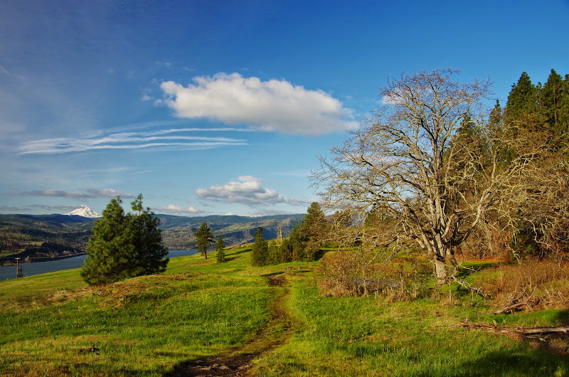
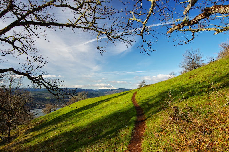
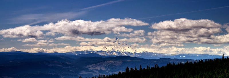
Hood was fully visible at first, but as the day progressed it got taken out by clouds wandering in from the W.
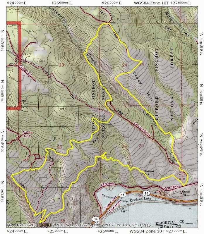
From the TH, I went W on the Labyrinth Trail past the Indian Rock Pits and through the meadows above Rowland Lake.
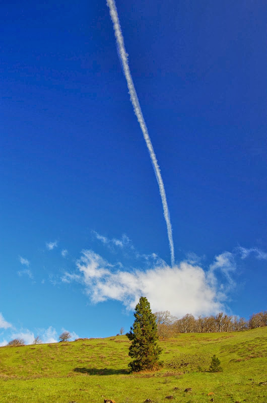
The clouds and contrails were busy all day drawing and erasing unusual images in the sky above.
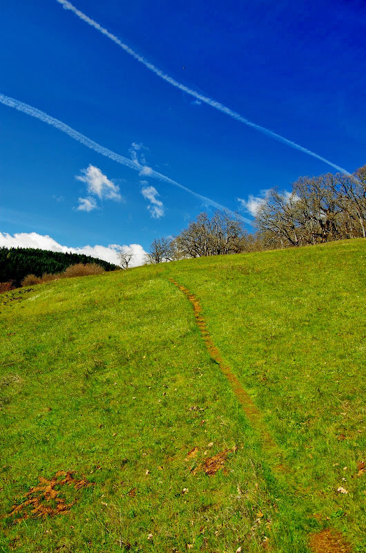
Where the Labyrinth Trail starts down, I contoured across some delightful open terrain,
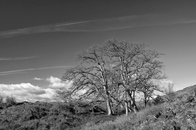
past another sculptural tree,
to reach the Little Maui Trail at the 750' elevation. It was a day for birds, not flowers, and this Western Meadowlark was singing his heart out. Since this is the Oregon state bird (since 1927), my guess is he plans to nest on the Washington side for tax purposes.
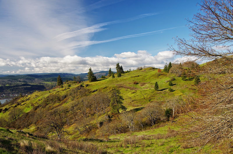
Little Maui took me to the Rim Rd, a very brisk breeze, and a view of Coyote Wall.
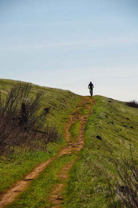
At about the 1250' level, the Green Trails Map shows a trail/road (CO2) heading E toward Atwood Rd. I followed it up to where it headed uphill past several private property signs and then went downhill a bit and continued contouring over to Atwood Rd. Up to this point I'd seen no one but was soon passed by a lone mountain biker,
and then by a large group of hikers heading W. I continued E into Catherine Ck canyon on the old road, crossed the creek at the easy crossing point, always on the look out for ravenous hoards of blood-sucking fiends...
Although none were encountered, it was hard to escape a faint crawling sensation as I climbed out of the canyon through groves of old oaks. I forgot about the ticks when a flock of wild turkeys burst out of the trees, did a number on my heart rate, and then flew/glided down into the canyon.
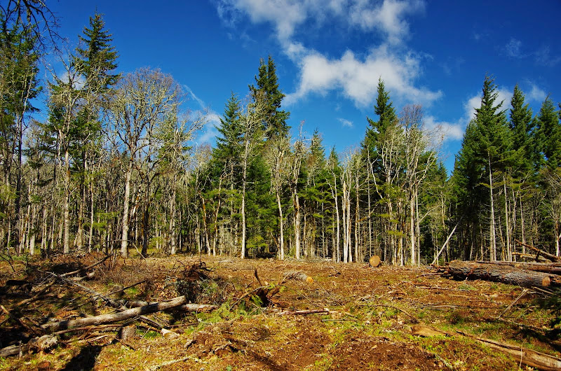
I was angling a little to the S as I went up, in hopes of intersecting the old road on the ridge S of the logged area but ran into it anyway. Maybe they'll come back and clean things up some but, at the moment, this hardly looks like the result of responsible forest management practices.
Fortunately, I was soon past the logging and out into the meadows atop Tracy Hill, for a restorative big view of Hood.
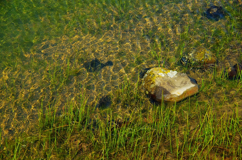
Then it was down to the frog pond (only very small tadpoles so far) for lunch,
and then down a trail (not shown on the Green Trails Map - but passed 7 people using it) that runs along a bench below Tracy Hill and above the creek,
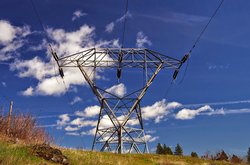
and connects with trail CA3 where it crosses under the power lines.
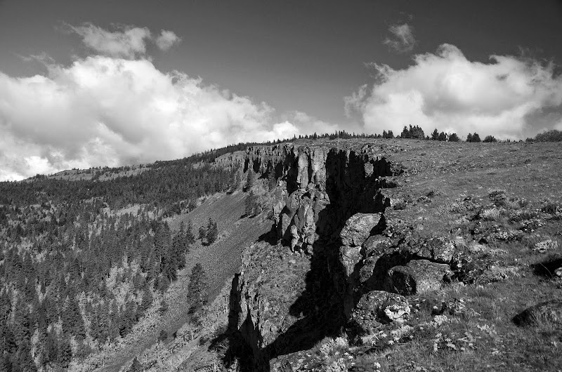
From there, it was past the arch and back to the TH. Mine was the first car at the TH but there were many, many more cars there when I got back. A great hike on a wonderful day! 10.3 mi, 1800' EG.
Coyote Wall to Tracy Hill Loop 02-Apr-2014
Re: Coyote Wall to Tracy Hill Loop 02-Apr-2014
Great loop - and you got the weather window (Not surprisingly). This nicely complements a loop I did around the western side of that complex on the weekend - it just takes me several days to get things together to post . . . .
Re: Coyote Wall to Tracy Hill Loop 02-Apr-2014
Your photos are excellent. What kind of camera are you using?
"The top...is not the top" - Mile...Mile & a Half
Instagram @pdxstrider
Re: Coyote Wall to Tracy Hill Loop 02-Apr-2014
It seems like a missed opportunity to not link these two areas with a more formal connection at that upper creek crossing. Or maybe it should just be kept a Rogue Connection, for ticks, deer, and VanMarmots.
You picked a good day, Van! I am a little jealous! I was there the day before. While it was a little drizzly, there were no other people around and that's worth a little something. Just us and the meadowlarks.
a range of color
the last of the Grass Widows
drizzle-tastic
You picked a good day, Van! I am a little jealous! I was there the day before. While it was a little drizzly, there were no other people around and that's worth a little something. Just us and the meadowlarks.
a range of color
the last of the Grass Widows
drizzle-tastic
Rambling on at Allison Outside
Re: Coyote Wall to Tracy Hill Loop 02-Apr-2014
Thanks! It's a Pentax K-30 with either a 21mm fixed lens or a 18-130mm zoom (which has issues with battery life) - always with a circular polarizing filter. Lately I've been experimenting with hard edge 0.9 ND filters to cut the exposure difference between earth & sky - sort'a works, but this is still an experiment in progress. I've tinkered with the K-30's numerous (too numerous?) custom settings to generally mostly get what I want right out of the camera - any post processing is confined to cropping and/or highlights (yeah, this is so old school - I'm just not of the Photoshop generation). The K-30 is a little heavy but it is water & dust resistant so I can just carry it and shoot as I hike. I also have a Nikon AWD100 which takes pretty good pictures, is waterproof, and very easy to carry.miah66 wrote:Your photos are excellent. What kind of camera are you using?
Re: Coyote Wall to Tracy Hill Loop 02-Apr-2014
Looks like a great loop! Have any trouble with off trail navigation? Did you need to avoid unopen trails or private property issues. The "Field Guide" page for this loop is super confusing and outdated. Thanks.
- woodswalker
- Posts: 835
- Joined: November 25th, 2012, 4:51 pm
Re: Coyote Wall to Tracy Hill Loop 02-Apr-2014
Nice pics! Soon I will have a camera and can do real trip reports. I was up there that day as well. I just strolled up Tracey Hill. Thought about looping over west, but was too lazy. Totally perfect weather! I saw no one once I was on Tracy Hill, except a couple wildflower whisperers down near the bottom. I also saw a few Yellow Bells, Fritilaria pudica, which was fun.
Woodswalker
Woodswalker
Re: Coyote Wall to Tracy Hill Loop 02-Apr-2014
There are private property concerns, particularly between the Rim Road trail and the Atwood Road trail - this is all private land and I believe its OK to cross as long as you stay on the road - but the signage isn't great. Where CO2 crosses from the Rim Rd to Atwood is also a likely tricky since you have to intentionally swing S to avoid private land. I think staying on the obvious and/or marked roads or trails is the least problematic.Surridge wrote:Looks like a great loop! Have any trouble with off trail navigation? Did you need to avoid unopen trails or private property issues. The "Field Guide" page for this loop is super confusing and outdated. Thanks.