Table (NW Ridge) / Cedar Loop 02-Jan-2014

This forum is used to share your experiences out on the trails.
Post Reply
User avatar
VanMarmot
Posts: 1924
Joined: May 28th, 2008, 10:03 pm
Contact:

Table (NW Ridge) / Cedar Loop 02-Jan-2014

Post by VanMarmot » January 3rd, 2014, 7:25 am

I thought New Years Day was a holiday for most folks but no, not for some of my clients, so part of that day was spent reading reports (oh joy! :( ). Broke free yesterday for a quick trip up Table on what proved to be a mostly sunny day with interesting clouds. Started from Bonneville Hot Springs because it offers a secure place to park.

Image

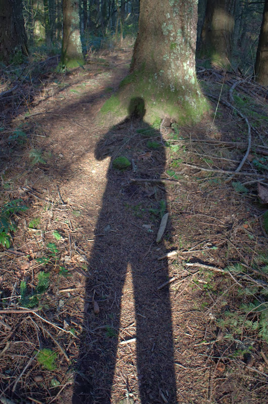
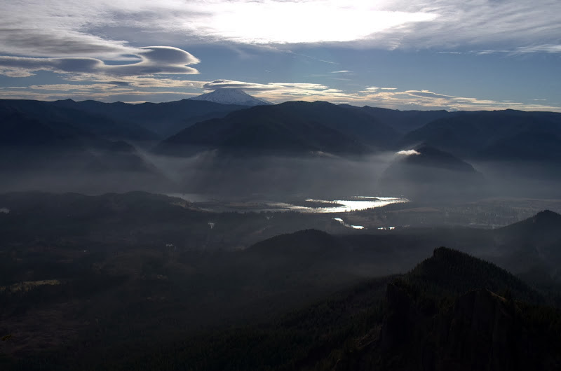
Went up Heartbreak Ridge (which isn't getting any less steep with the passing years) for a view E into a fog-shrouded Gorge,

Image

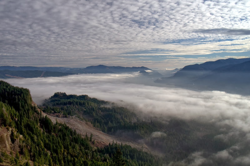
and of my favorite headwall.

Image

Judging from the lenticular forming on Hood (and later on Adams), something was coming.

Image

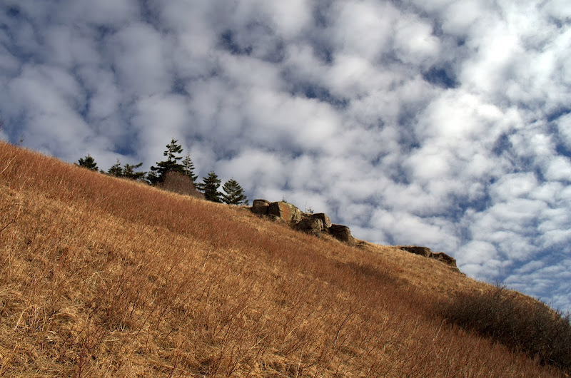
Rather than cut over on the established trail, I stayed E, hugging the very edge of Table's S face (to avoid the brush), and went straight up.

Image

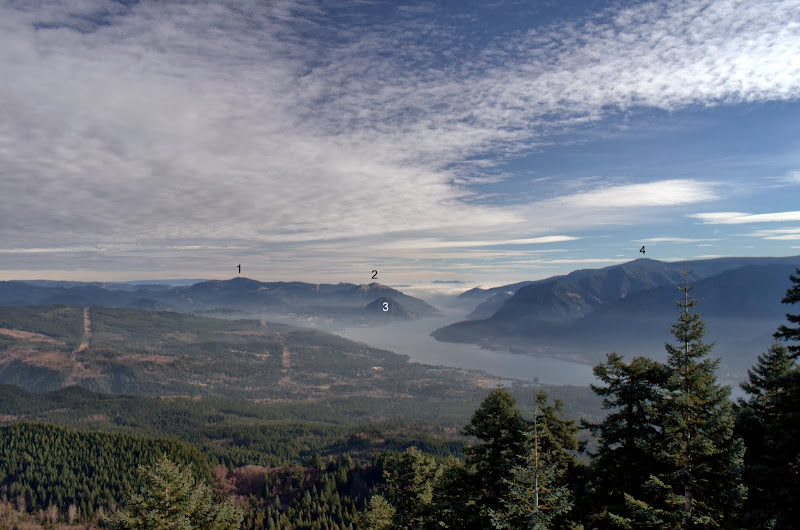
I'd started early but there was a runner waiting for me on the summit! I guess I stopped feeling spry at that point. But I kept on, traversing the top of Table to the NW, where I had a view E to Augspurger (1), Dog (2), Wind (3), and Defiance (4),

Image

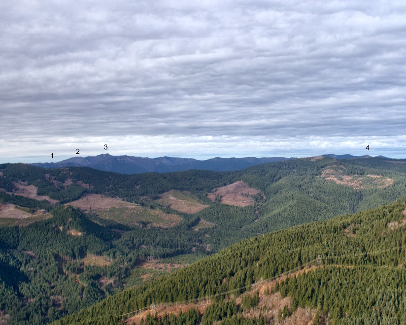
and W to Pyramid Rock (1), Indian Pits (2), Silver Star (3), and Three Corner Rock (4).

Image

My plan was to descend Table's NW ridge - either along the road or via the direct variant - and had brought along my saw in anticipation of brush. I was very pleasantly surprised to find that the old road portion of the NW ridge trail had been completely brushed-out and was now wide open! I did a little token sawing but mostly just for show. In no time at all, I was on the PCT heading back.

Image

I'd saved so much time not having to thrash down the NW ridge that I decided to return via Cedar Mtn. Ran into about a dozen people on the Dick Thomas trail on the way back - sounded like they were staying at the lodge, wanted to go for a hike, but were a little fuzzy about where they expected the trail to take them. Ah, adventure. A classic but good hike (11.8 mi RT, 3800' EG) but now back to those reports. :(

Image
Last edited by VanMarmot on February 1st, 2016, 9:06 am, edited 1 time in total.

User avatar
drm
Posts: 6152
Joined: May 28th, 2008, 10:03 pm
Location: The Dalles, OR
Contact:

Re: Table (NW Ridge) / Cedar Loop 02-Jan-2013

Post by drm » January 3rd, 2014, 7:58 am

Do you identify all those peaks in your photos by eye, or do you sit there with a map and compass? Some are obvious of course, but some of them are just one tiny point among a bunch of seemingly equal height.

User avatar
VanMarmot
Posts: 1924
Joined: May 28th, 2008, 10:03 pm
Contact:

Re: Table (NW Ridge) / Cedar Loop 02-Jan-2013

Post by VanMarmot » January 3rd, 2014, 8:54 am

drm wrote:Do you identify all those peaks in your photos by eye, or do you sit there with a map and compass? Some are obvious of course, but some of them are just one tiny point among a bunch of seemingly equal height.
By eye, with an occasional check of the map at home. Position relative to a known point is often more important than sheer height. But it took several years of looking from various summits toward other summits to start seeing familiar points of reference. Of course, it helps when folks erect microwave towers on known points (Defiance, Three Corner Rock).

User avatar
acorn woodpecker
Posts: 240
Joined: January 4th, 2013, 8:35 pm

Re: Table (NW Ridge) / Cedar Loop 02-Jan-2013

Post by acorn woodpecker » January 3rd, 2014, 10:27 am

Nice report and photos. Did this exact loop back in October and even took the same way up Table along the east rim of the cliffs. The NW ridge was slightly brushy then so the work must have been done recently. I've been to the Table area four times in the last couple months. It's a really enjoyable part of the Gorge in the late fall and I can't seem to stay away.
VanMarmot wrote:
drm wrote:Do you identify all those peaks in your photos by eye, or do you sit there with a map and compass? Some are obvious of course, but some of them are just one tiny point among a bunch of seemingly equal height.
By eye, with an occasional check of the map at home. Position relative to a known point is often more important than sheer height. But it took several years of looking from various summits toward other summits to start seeing familiar points of reference.
I'm amazed at how much more I can identify in the Gorge due to years of going out repeatedly and seeing points from different perspectives. Studying the map either outside or at home further solidified the information.

User avatar
miah66
Posts: 2039
Joined: July 6th, 2009, 8:00 pm

Re: Table (NW Ridge) / Cedar Loop 02-Jan-2013

Post by miah66 » January 3rd, 2014, 1:33 pm

That is an awesome picture of the clouds in the gorge with the speckled clouds up above! Nice work!
"The top...is not the top" - Mile...Mile & a Half

Instagram @pdxstrider

Post Reply