Earlier this month, I'd suggested (and partially explored) a loop to Three Corner Rock involving an old road, some XC, and the established trail (Three Corner Exploration). Pablo was intrigued by this idea and suggested we give it a try. So Saturday found us leaving the TH and heading up the old road.
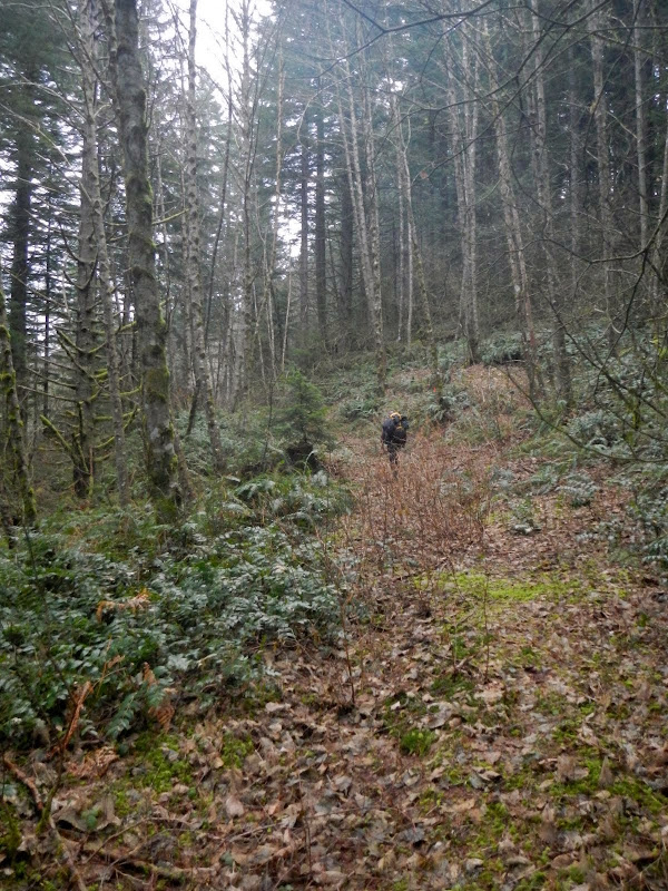
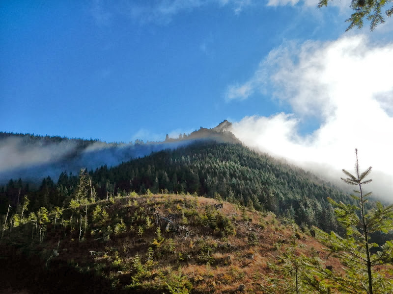
The road is evident and easy to follow and we were soon at the saddle where I'd stopped before. What followed was a lot of XC route finding through not too impenetrable brush. Occasionally we thought we'd found an old trail but nothing consistent ever appeared, so we mostly 'schwacked. Pablo was hoping that the mists would lift and we'd get some views (there are some open spots up on the ridge tops) but the gloom persisted
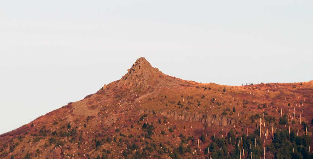
until we popped out on to the road with its full and sunny(!) view of the Rock!
We followed the road down to intersect the established trail to the Rock,
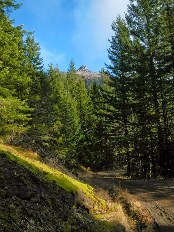
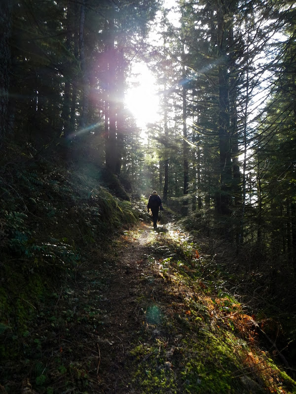
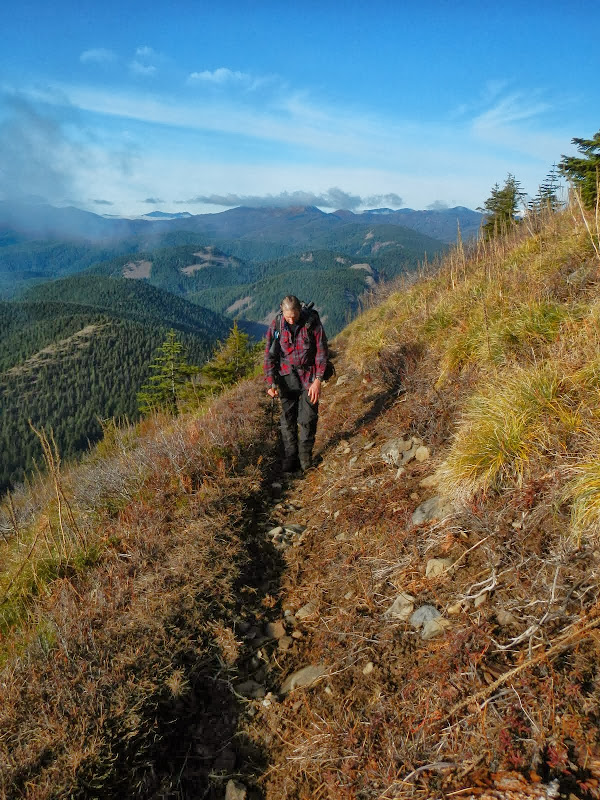
and started up the that trail, with Pablo noting (repeatedly) that it had a lot of switchbacks. Yes it does and we were going to be heartily tired of them before we got back to the TH.
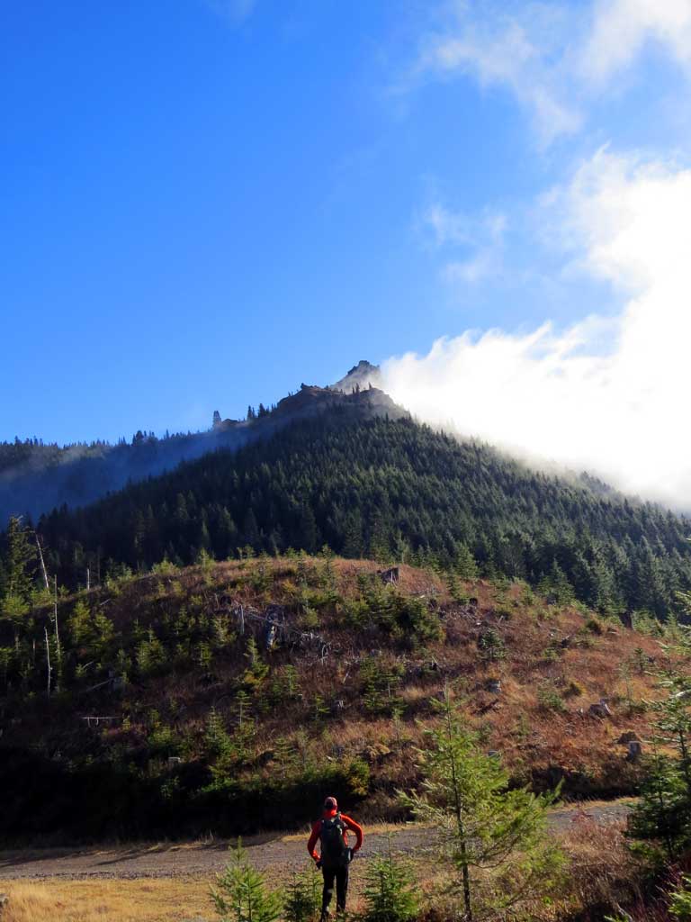
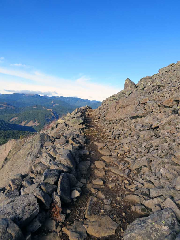
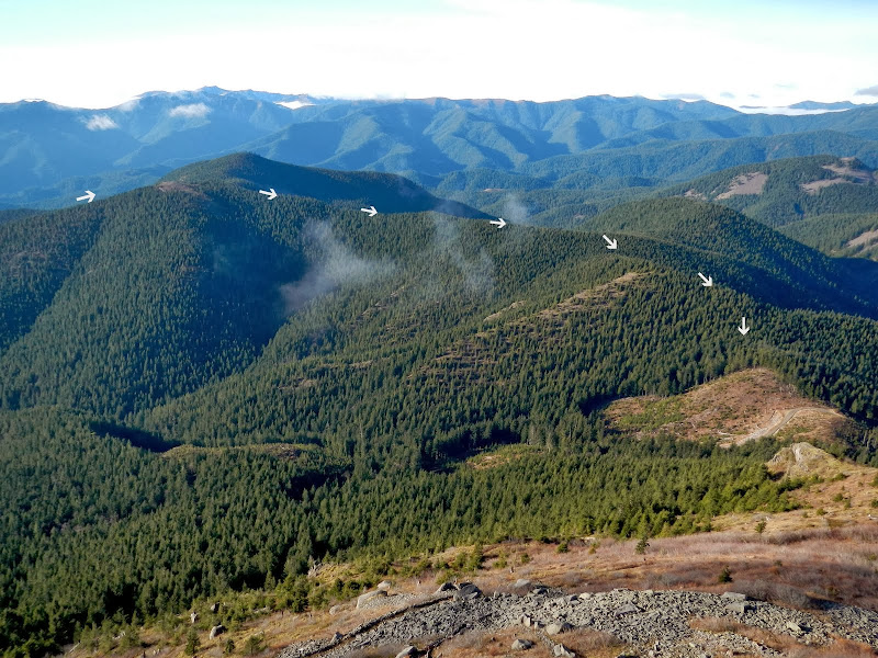
Once we climbed up out of the trees, our route up the ridge became clear - a lot clearer than it had been when we were working our way through the brush!
It always seemed like we were just one more switchback from the summit.
So close, yet so far...
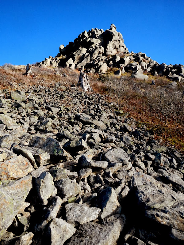
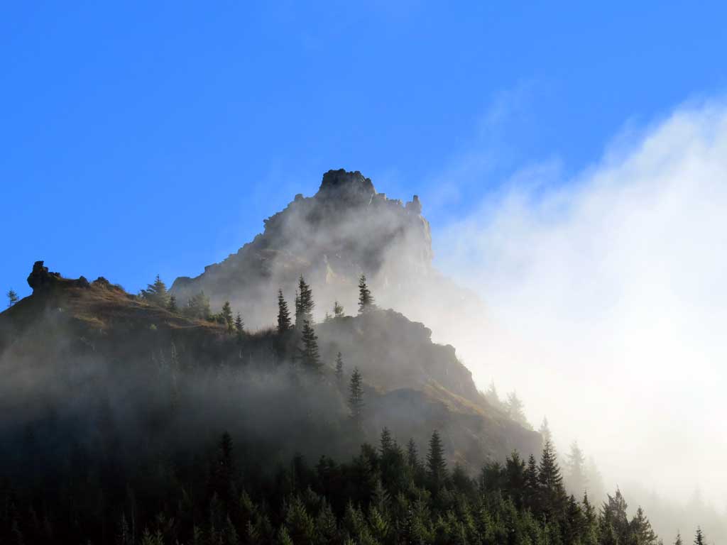
Finally we were on top under sunny, clear skies! The views were worth the walk, with the trifecta of classics (St. Helens, Rainier, Adams) to the N
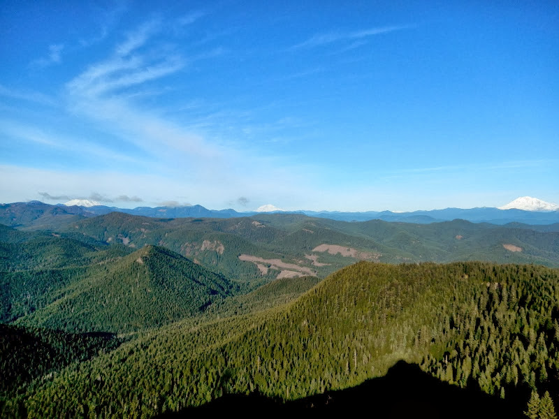
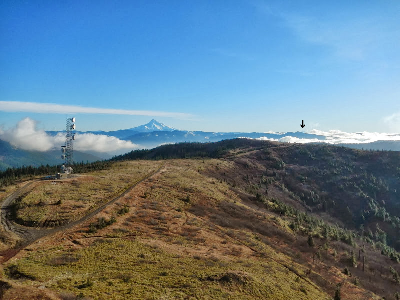
and Hood to the S (with the view delightfully enhanced by a microwave tower).
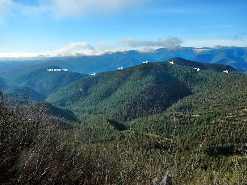
Even Jefferson (arrow) was distantly visible on the horizon.
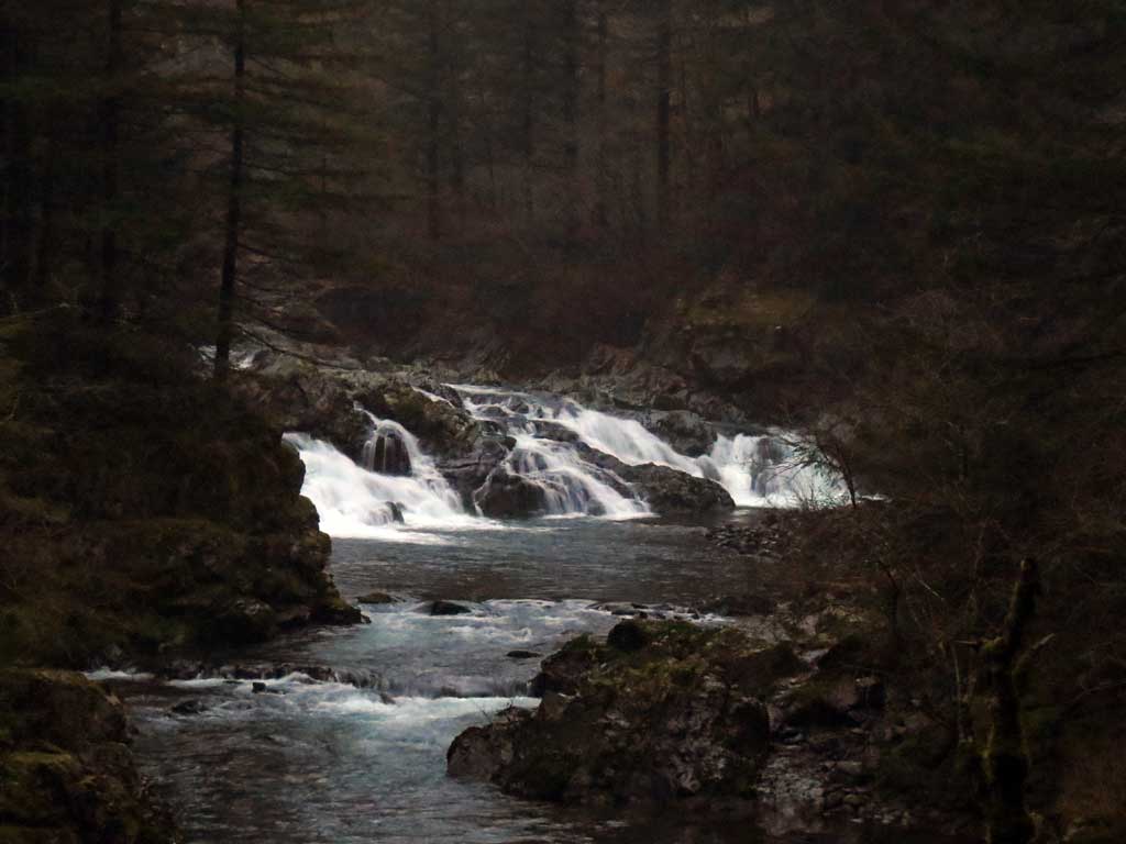
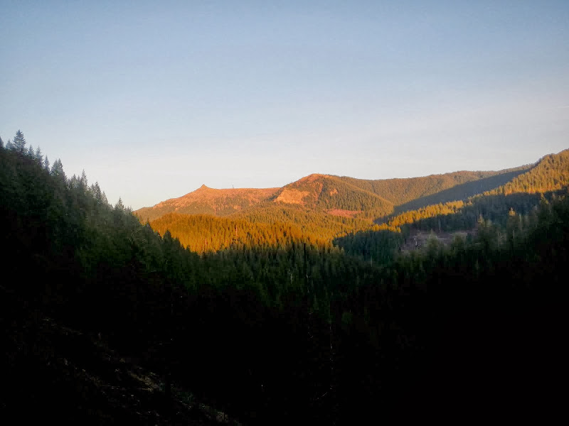
We'd burned a lot of short winter daylight getting to the summit, so we took some photos, had a snack, and headed back. We particularly wanted to get across Stebbins Creek with some daylight to spare. We did that - the creek was running a touch high for mid-winter, so it was nice to be able to see where all the wet, slippery rocks were located. After that it was one last view of the Rock,
and then a non-stop, switchback-laden race ahead of the night back to the TH.
Darkness caught up with us but we were still able to reach the cars without using headlamps. Whew - a long (17.8 mi, 4,500' EG) but excellent loop! My thanks to Pablo for suggesting we do it and for coming along for the adventure (and the joy of switchbacks!).
Three Corner Rock Loop 28-Dec-2013
Re: Three Corner Rock Loop 28-Dec-2013
Wow...quite the excursion, and in the winter. Last year at this time I couldn't even get up Rock Creek because of all the snow up there. Thanks for sharing your cool adventure.
Re: Three Corner Rock Loop 28-Dec-2013
Hey Bruce,
Thx for making this possible and for doing this TR. It was a great day and route - I think I look pretty beat up in the photo of me on the trail - I sure was by the end of the day. And thanks for putting up with my constant bleating about switchbacks and explaining to me how it was designed for horses - by the end of the day I was wishing I was a horse so I could fully appreciate the ups and downs and all the switchbacks.
In looking at the '40 and '49 GPNF maps it appears we followed part of the route of an abandoned trail that went along the ridge to end at TCR. The trail starts on a narrow ridge north of the Stebbins Creek TH and is on my list for 2014.
Here's some of my looks at things.
Pretty waterfall on the Washougal river near the Stebbins Creek trailhead seen at first light in the morning
What a relief to see blue skies just as TCR came into view. On the way up it really looked like TCR would be socked in.
A castle appearing out of the mist
On the trail up to TCR
My last look at TCR - love those snags from the Yacolt Burn - we passed many large stumps on the way up, leftovers from salvage operations, what a wonderful forest it must have been.
Here's a silent movie of the last bit of climbing to the foundation at the top of TCR.
The future's uncertain and the end is always near.
- acorn woodpecker
- Posts: 240
- Joined: January 4th, 2013, 8:35 pm
Re: Three Corner Rock Loop 28-Dec-2013
Great report and exploration Bruce and Paul! Having never been to either TCR nor Stebbins Creek before, this looks like a splendid way to make a loop. Why didn't you travel up the northwest ridge of TCR instead and go down the switchbacks? Would it have been too much of a schwack and/or steep enough in the end as to be too tiring and not save any time at all? There sure were a LOT of switchbacks on your GPS track! Have either of you been to TCR via the PCT? If so, how is it a comparable route being on trail the entire time?
Still can't believe how little snow there is! Looks like that's all going to change this weekend, though.
Re: Three Corner Rock Loop 28-Dec-2013
Thx Ben,acorn woodpecker wrote:Great report and exploration Bruce and Paul! Having never been to either TCR nor Stebbins Creek before, this looks like a splendid way to make a loop. Why didn't you travel up the northwest ridge of TCR instead and go down the switchbacks? Would it have been too much of a schwack and/or steep enough in the end as to be too tiring and not save any time at all? There sure were a LOT of switchbacks on your GPS track! Have either of you been to TCR via the PCT? If so, how is it a comparable route being on trail the entire time?
Still can't believe how little snow there is! Looks like that's all going to change this weekend, though.
That NW ridge will be a part of the plan next time I do TCR from this direction. Might have been faster but we did not have much daylight so we took the known route.acorn woodpecker wrote:Why didn't you travel up the northwest ridge of TCR instead and go down the switchbacks? Would it have been too much of a schwack and/or steep enough in the end as to be too tiring and not save any time at all?
It was like the myth of Sisyphus instead of a rock there were switchbacks.acorn woodpecker wrote:There sure were a LOT of switchbacks on your GPS track!
One of the first trip reports ever posted to PH was this PCT to TCR route:acorn woodpecker wrote: Have either of you been to TCR via the PCT? If so, how is it a comparable route being on trail the entire time?
http://www.portlandhikers.org/archive/view/709
Bruce has done a through hike from Table to Stebbins TH.
http://www.portlandhikers.org/forum/vie ... =8&t=11989
--Paul
The future's uncertain and the end is always near.
Re: Three Corner Rock Loop 28-Dec-2013
Great TR guys! I have looked at that route several times over the years, just didn't think I had what it would require to complete it. Glad that you went for it and didn't let a little whining get in the way.
My maps (as did yours) show that route up from the Washougal River as a trail, but I take it that it is not on the DLNR list of maintained trails. I know that just a few years ago, it was still shown as a road. Ridge Map (excuse the peak bagger link, that's my point of reference...). There are a number of old roads in that general area, that could easily be developed for mountain biking, but the state refuses to develop a recreation plan, and told me that it was a big NO-NO to do any unauthorized clearing.
A few years back, I drove the road from the 5 way jct down to the trail crossing. Memory is pretty vague, but I think maybe I recall looking at it then and thinking that it would be a pretty fun, clean direct line. The big question is "how thick is that timber on the lower half of it????" Your picture makes it look young & dense.
Last edited by K.Wagner on January 4th, 2014, 6:06 pm, edited 1 time in total.
Kelly
There is no shortcut to anyplace worth going to.
PM me about the soon to be released:
Skamania 231
"How to really get off the beaten path in Skamania County"
There is no shortcut to anyplace worth going to.
PM me about the soon to be released:
Skamania 231
"How to really get off the beaten path in Skamania County"
- Don Nelsen
- Posts: 4382
- Joined: May 28th, 2008, 10:03 pm
- Location: Vancouver, WA
Re: Three Corner Rock Loop 28-Dec-2013
B.ruce and Paul,
Thanks for a great TR and excellent photos, too! You've pioneered a nice route and I'm looking forward to trying it out.
dn
Thanks for a great TR and excellent photos, too! You've pioneered a nice route and I'm looking forward to trying it out.
dn
"Everything works in the planning stage" - Kelly
"If you don't do it this year, you will be one year older when you do" - Warren Miller