
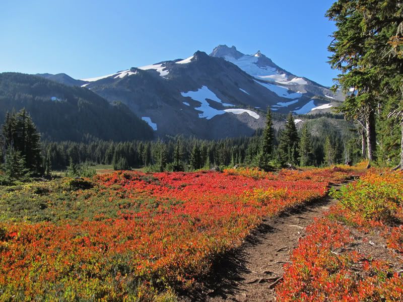
Looks like fall colors really lighting up there.
Jefferson Park Loop (9/15-16)
Re: Jefferson Park Loop (9/15-16)
Nice TR and photos! It's interesting loop idea. Is Crag trail the one starting on the far side of S Breitenbrush parking lot?
Looks like fall colors really lighting up there.
Looks like fall colors really lighting up there.

Re: Jefferson Park Loop (9/15-16)
Crag trail currently starts about 100 feet up the S. Breitenbush Trail, it branches off to the right and is barely visible. It's signed and the trail is flagged w/ orange ribbons most of the way.romann wrote:Is Crag trail the one starting on the far side of S Breitenbrush parking lot?
"The top...is not the top" - Mile...Mile & a Half
Instagram @pdxstrider
Instagram @pdxstrider
Re: Jefferson Park Loop (9/15-16)
Thanks - now I remember that sign from last year's hike, it was kind of strange to see the sign but not see the junction at first.miah66 wrote:Crag trail currently starts about 100 feet up the S. Breitenbush Trail, it branches off to the right and is barely visible. It's signed and the trail is flagged w/ orange ribbons most of the way.romann wrote:Is Crag trail the one starting on the far side of S Breitenbrush parking lot?
Re: Jefferson Park Loop (9/15-16)
I hiked this loop on 11/26/2019. And wanted to restart the discussion about the lower portion of the Crag Trail 3364. Generally, the trail is covered with rhododendrons and some fallen trees, but can be followed with some effort. Specifically, on the upper portion the trail had a major puddle on the NE traverse, fire scars on the SE facing section of the ridge, and a tree jam on the NE facing section towards the bottom of the ridge. I saw three orange markers till the Crag Creek crossing, and one yellow marker at said crossing. I must have crossed the South Breitenbush River to early, because I ended up back on the South Breitenbush Trail 3375 east of the South Breitenbush Trailhead. Does anybody have any input on if it is recommended to start out at the South Breitenbush Trailhead board and to follow the trail (at this time it is the South Breitenbush Trail 3375 and the Crag Trail 3364 simultaneously) east for a little bit and to turn south at the marked fork in the trail, or to start somewhere else in the huge parking lot (currently also occupied with some logging equipment)?miah66 wrote: ↑September 16th, 2013, 11:00 amHiked this loop this past weekend. The Crag trail ribbons are still in place and helpful for the most part until the bottom quarter mile or so near the parking lot. There is a huge tree across the river where you are supposed to cross, but there isn't a clear indication of that. At some point you walk past the intending crossing, though several flags continue before petering out completely. There is no definite trail. After turning back, noticed the big tree down and the faint tread wear on the bark. We continued across the tree bridge (which is marked w/ notches) and up the bank on the other side. The trail continues on another 1/8 mile (though not very defined) to it's meetup with the S. Breitenbush trail about 200 feet from the start of that trail.
I noticed it was shown incorrectly on the map as starting at the other side of the parking lot. Perhaps at one time it did. I theorized that a flood had perhaps destroyed this alignment and lower portion of the crag trail which led to its eventual decline as a viable trail. But that's just a theory.