
The general plan was to start at Hood River Meadows, head up to Elk Meadows, roam around a bit there, close the gap up to Gnarl Ridge from below this time, then on the way down divert over towards Mount Hood Meadows, before finally dropping the rest of the way back past Umbrella and Sahalie Falls. Whew! Only potential chinks in the plan was that I'd slept in to the ungodly hour of almost 6am, hadn't gotten any sort of prep done the night before, and needed a new Forest Pass. Yikes! Long story, short, I pulled into the Hood River Meadows trailhead about 10am, and was underway before 10:15.
TL;DR: The day was pretty warm; the sun fairly intense, when not hiding behind occasional clouds. Elk Meadows was something of a disappointment; I think I must've missed the big bloom already? Lots of black flies made the trek up to Gnarl Ridge quickly-paced and essentially non-stop. If you go there, be sure not to stop before you can see the waterfall! The lupine is over (early?). Wish I'd scrambled up Lamberson Spur, in retrospect. Newton creek's crossings are overly talked up. More surprising crossings on Clark and Heather creeks. Mount Hood Meadows is seriously under-appreciated by the colorful weed contingent! This loop would've been better started earlier, or done in reverse.
Hard to choose a classic "opening shot" for this one. The trail was just so varied. I suppose if anything though, it was the unexpected crossings on two forks of Clark Creek (one more commonly known as Heather Creek), to the south of Newton that provided more interest than anticipated. So, ...
Heather Creek appeared a bit ominous from across the valley. The trail wraps up above the spectacular falls. It ended up a non-issue.
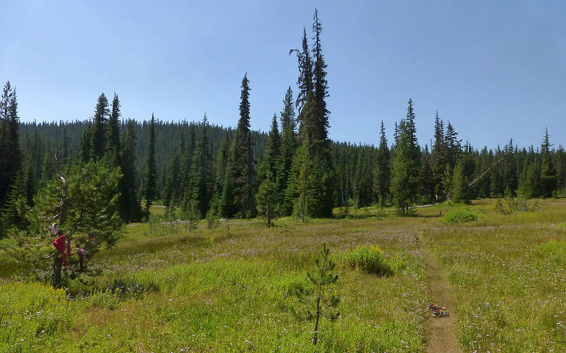
Heading up towards Elk Meadows as a pleasant jaunt through the forest, with a bit of a hill just past the lower Newton Creek crossing. It was clear the beargrass would've been spectacular here a few weeks ago! Saw some stuff that has become "familiar" to me just from reading TRs here. But wasn't paying much attention when I got the perimeter trail, and took a turn to the left, winding all the way around to the Gnarl Ridge cutoff before realizing I was circling the silly meadow. Jeeez. Okay, so I kept going a bit farther, hoping to find an ingress, and ultimately did. From there, I just wandered across the meadow, enjoying all of it, before egressing the other side and looping the lower perimeter back to the cutoff. In a word, explored!
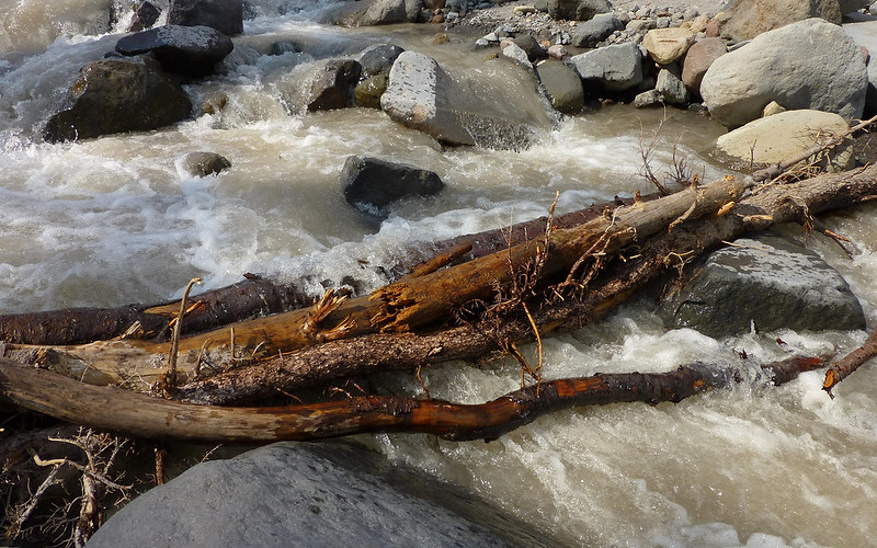
The lower Newton Creek crossing was very nicely bridged with an assortment of driftwood. Totally stable. Poles will help those unsure of themselves.
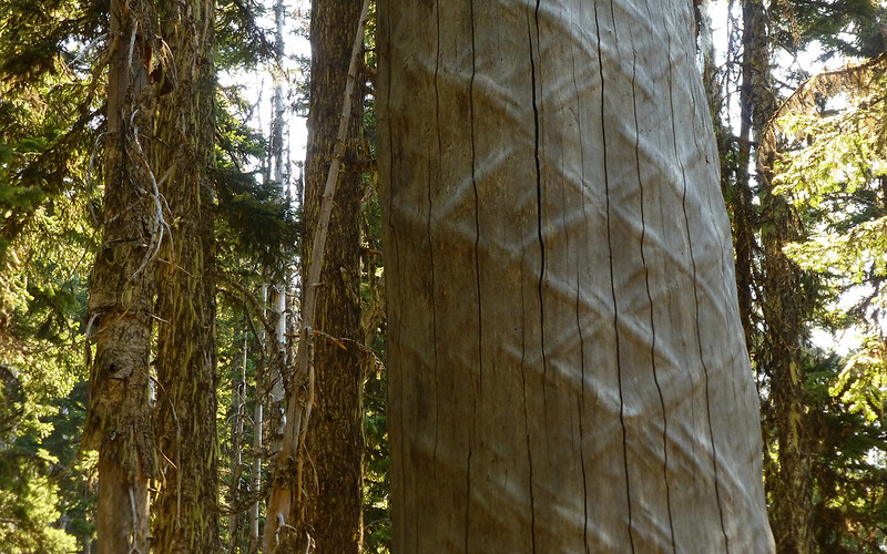
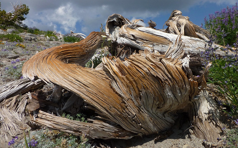
I wonder if we'll ever have a forester/biologist(?) drop in and explain WTH happened to this tree?
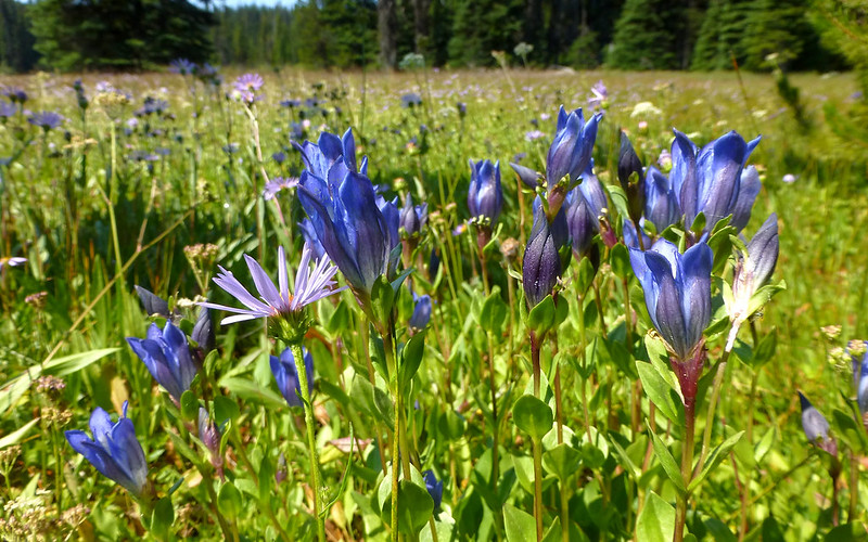
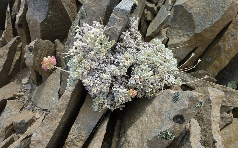
I'd really like to know what these are going to be! Bumblebees were even crawling into the closed ones. EDIT: Gentian. Thanks, Bella!
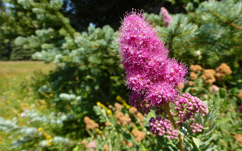
Another fairly interesting big pink thing?
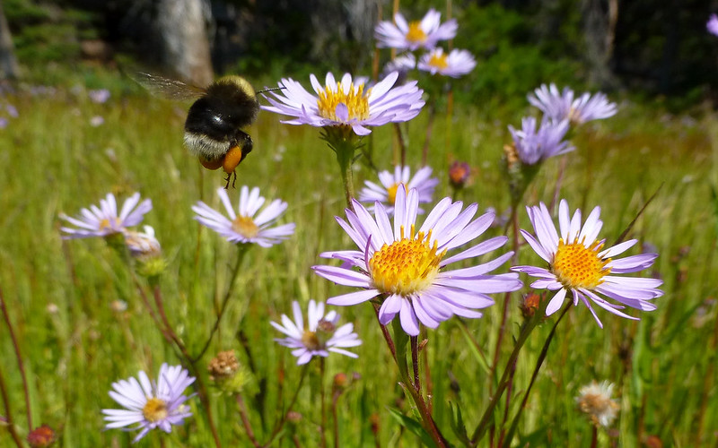
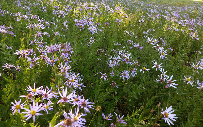
Aster was probably the most dominant flower out there. (Shot of the day?)
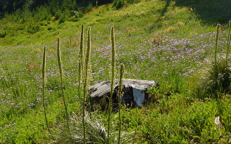
Overall though, the meadow just wasn't all that colorful. (Do you see the underwear tree?)
There was a young family camped out behind the shelter. Guess the kids had gotten a bit wet.
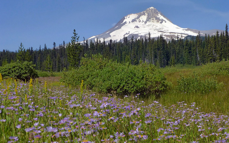
There is a resonance in the heart of any Viking fan, when in a sea of purple ...
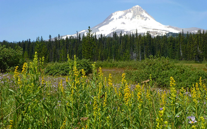
... and gold, though!
The meadow was wetter than it looked! Wandering aimlessly tended to produce wet socks!
As I said earlier, the flies pretty much gave me every reason not to take any pictures between the meadow and the ridge. Sheesh, stopping just long enough to let someone pass in the other direction was all the time they needed!
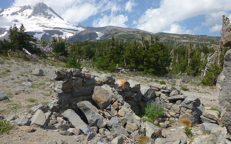
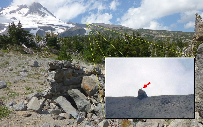
As I was just about to the timberline, I passed the ruins of what must've been a nice shelter "back in the day."
But wait! What's this? Someone climbing up Tie-In Rock? Maybe fellow PHer, Guy???
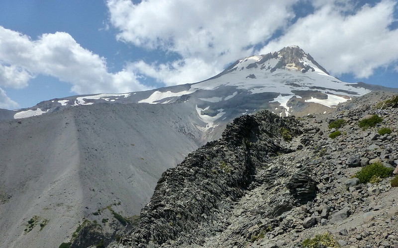
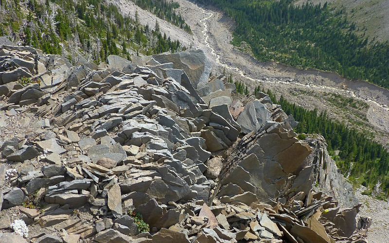
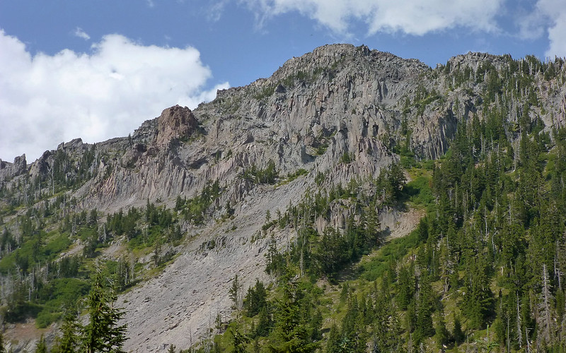
Nearing Gnarl Ridge, there's this fabulous outcropping of exquisitely fractured basalt. Very shale-like in appearance. Scree in the making!
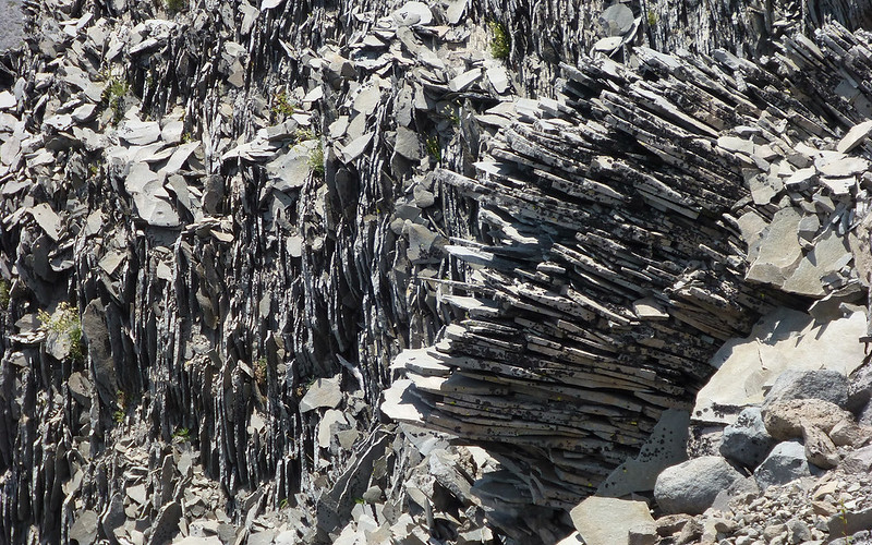
I took way, way too many photos of this stuff!
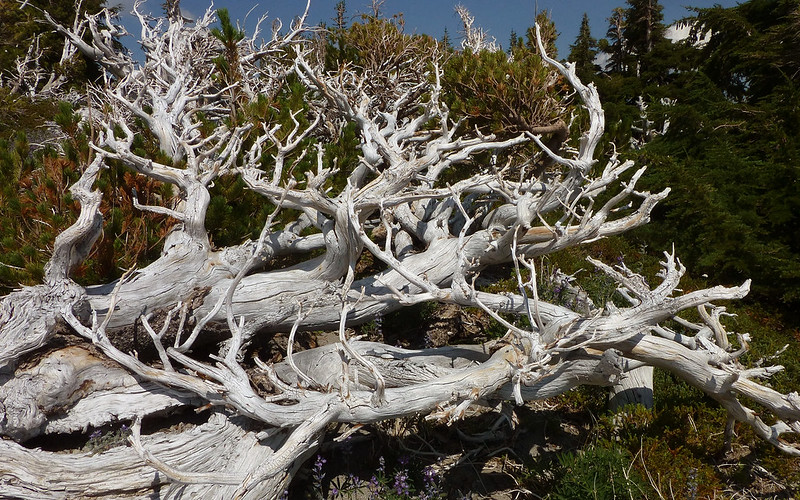
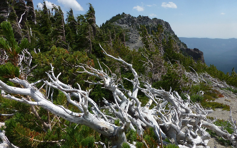
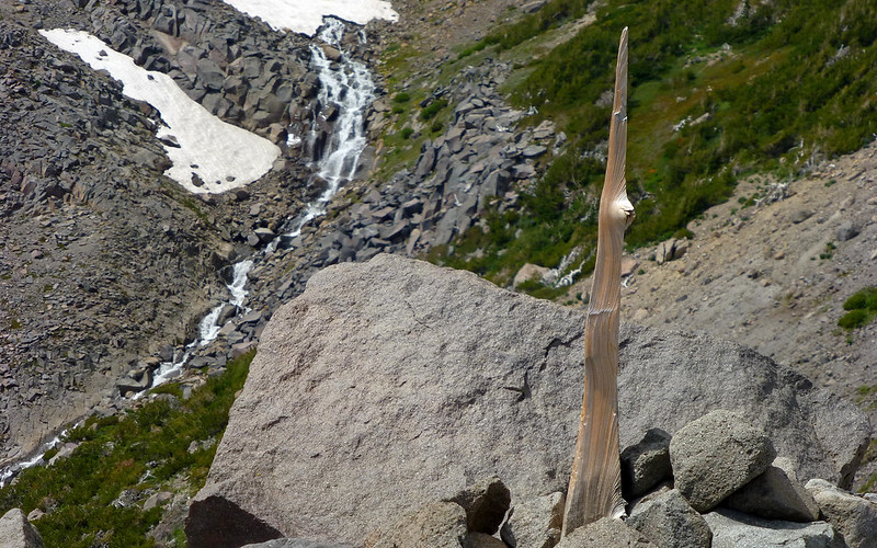
These ancient whitebark pine skeletons are just stunning. The thought that someone might burn them just devastating.
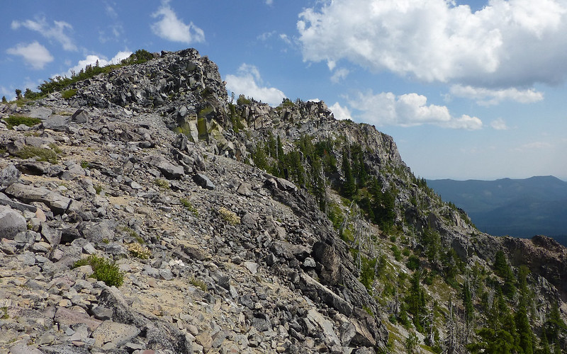
Gnarly!
For the second time today, I ran into fellow PHer Trailmom! We spent some good time chatting trails, before I headed farther up.
The burnish on some of these snags is incredible. Still a little lupine blooming way up here, too!
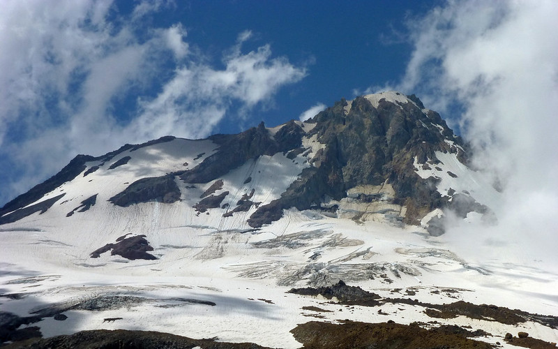
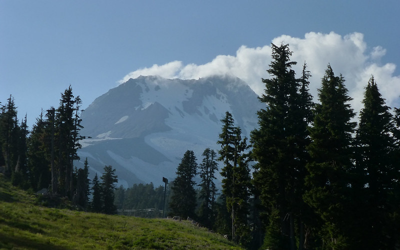
Gnarl Ridge offers a head-on view of what remains of the Newton Clark Glacier.
On arriving at the toothpick cairn, I'd closed the gap in GPS tracks, and hit my lunchspot!
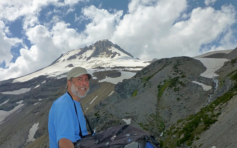
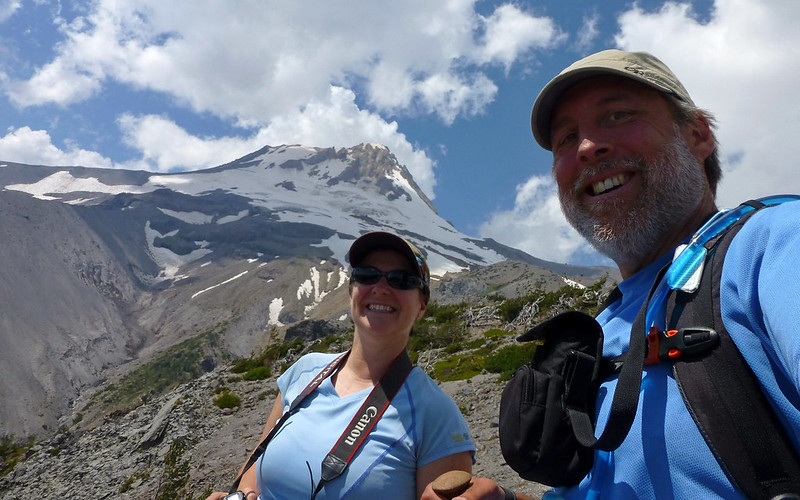
Lunch with a view! I hung out at/around "Tom's Throne" for probably 30-45 minutes. Don't stop at the first overlook on Gnarl Ridge!
Tom's Throne - one helluva bench at one helluva lunch spot! The wind kept the flies away here.
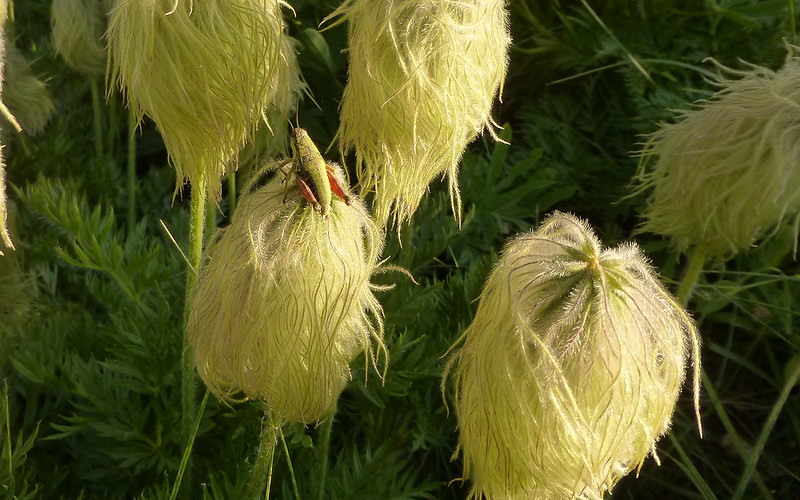
There were some unusual flowers up here, that you just don't see down lower. No idea what they are.
Cool rock gardens.
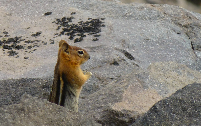
No marmots or pikas today; plenty of chippys though.
Heading back down, I gaze into the canyon wondering where this Newton Crossing that I've heard so much talk of may be.
I also started scrambling up Lamberson Spur, then realized time was running against me if I wanted to do the full loop.
Looking back at Lamberson Spur from down in the canyon, it really is quite majestic! Wish I'd allowed more time to get up there!
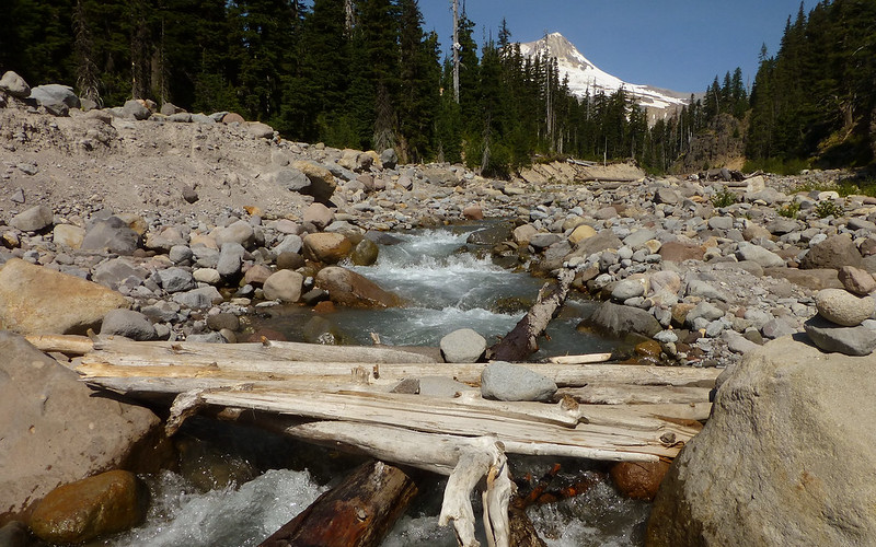
Crossing Newton proved uneventful. Little rock piles led me straight to the "bridge," which was fairly stable and only partly underwater.
And a solitary flag marked the scramble route back up to the trail. I was okay with that, really.
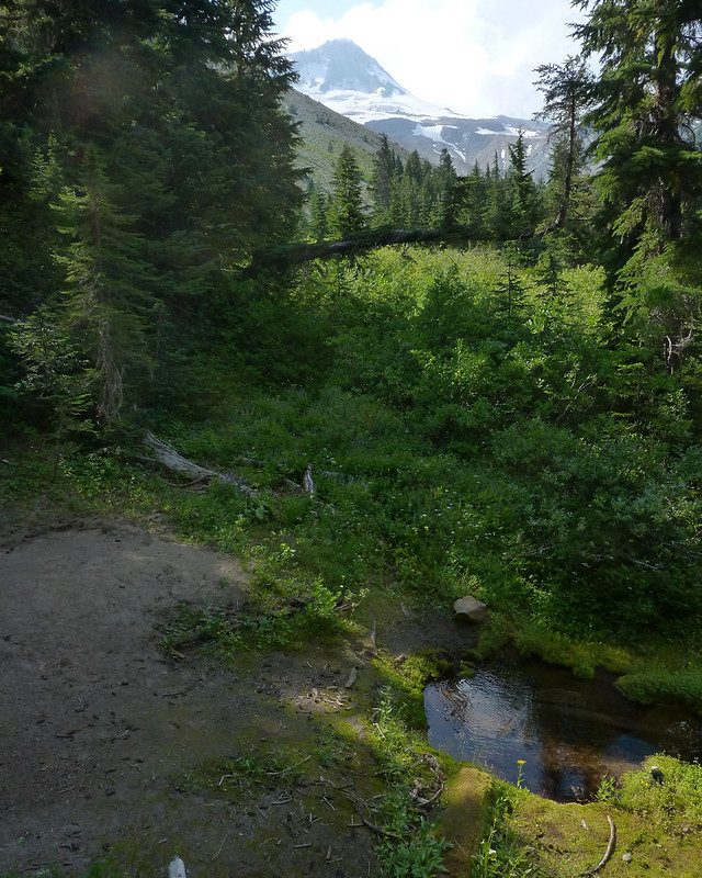
Just past Newton Creek (N45.35311 W121.64878) was a lovely little natural spring that another hiker told me he routinely refilled from.
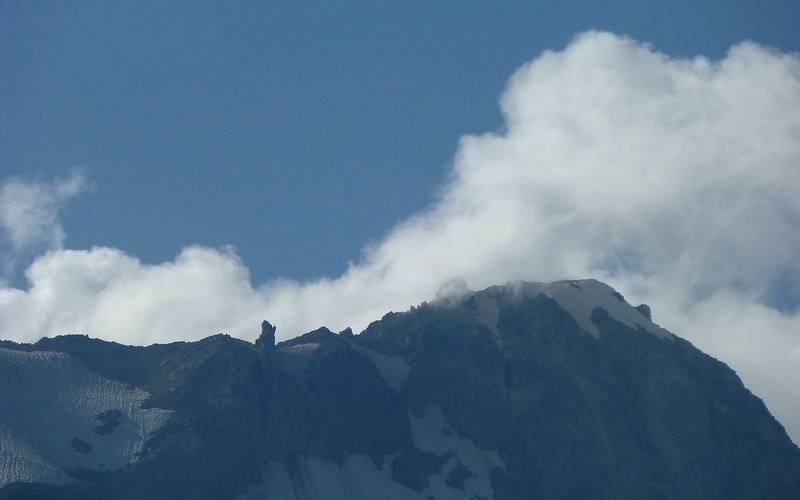
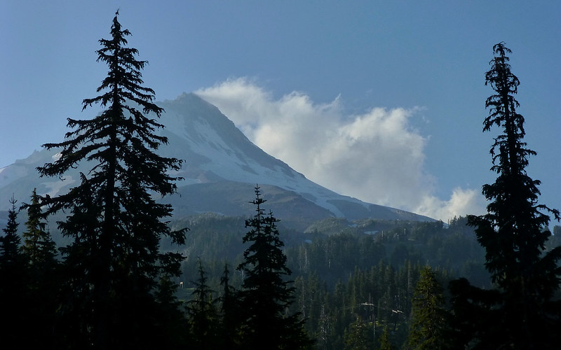
Never noticed this spire near the summit before! Always something new to see on Hood!
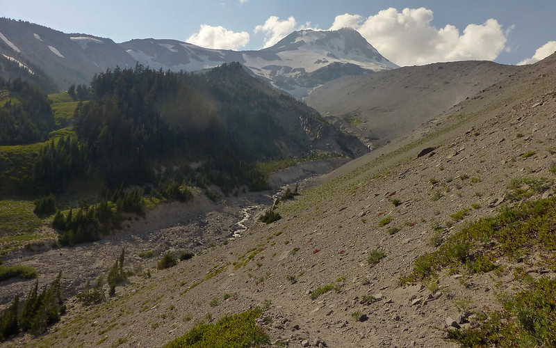
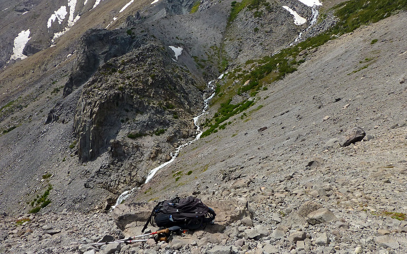
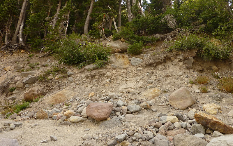
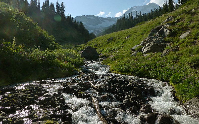
Farther on, the trail winds down another loose-ash canyon towards Clark Creek.
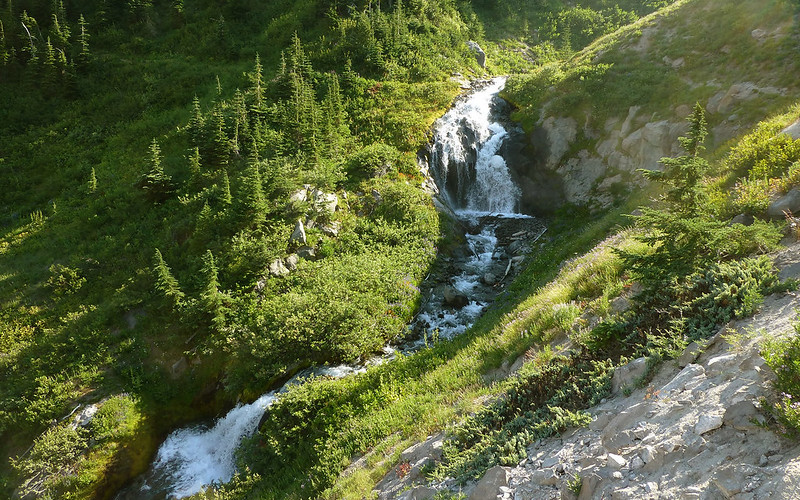
A fair bit of water coming down the Clark, there is! Nice falls.
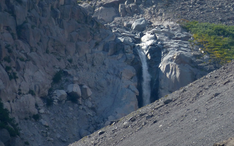
Looking across the canyon, at Heather Creek, I'm certainly seeing and hearing a lot of water!
As I'm taking these waterfall shots, another hiker catches up with me going my way. She'd left Timberline at 4am in hopes of circling the mountain with friends, gotten to the Elliot, and plans went awry. So she'd been sent back for the car. Ugh! We both felt it good to have someone else "just there" while making the next couple crossings. She also knew approximately where they'd done it much earlier that morning. Unfortunately, one of those just wasn't an option anymore, due to much higher afternoon water levels. A little exploring found dry-shoe opportunities, though!
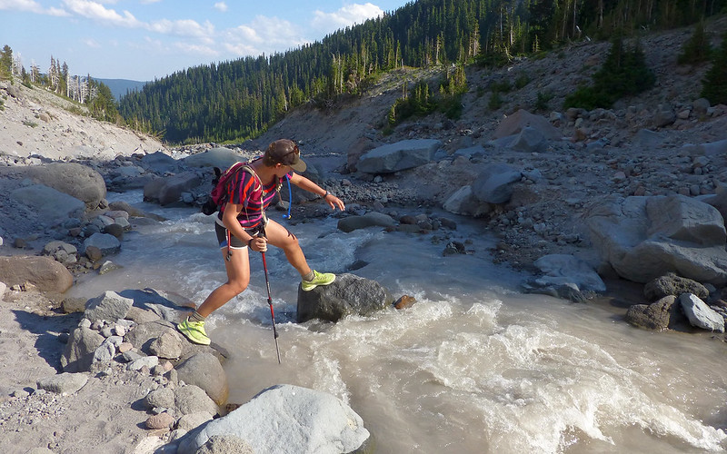
One giant step for Rachel, before yet another, across Clark Creek.
Looking upstream mid-crossing of the Heather Creek. This was 100' or so above the falls, and easily hoppable.
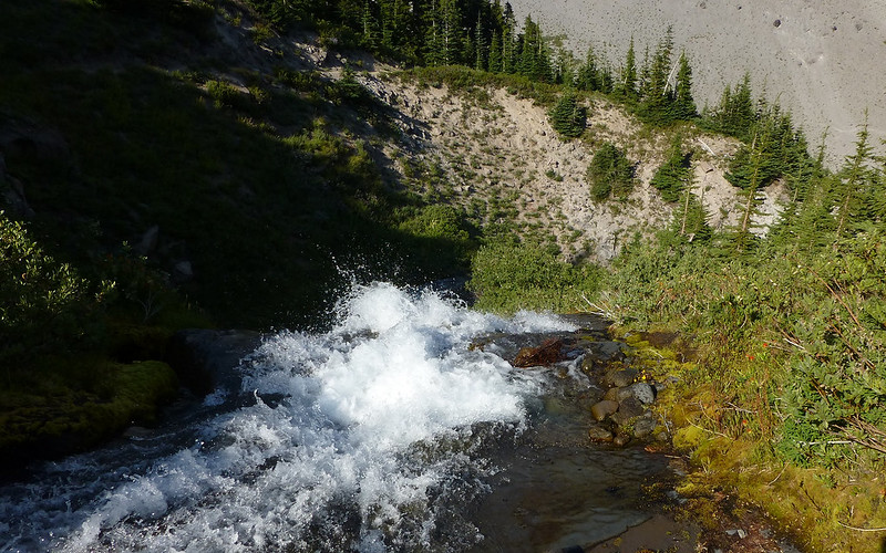
Getting back to the trail meant traversing a 30° rock "retaining" wall right up to the edge of the falls, though.
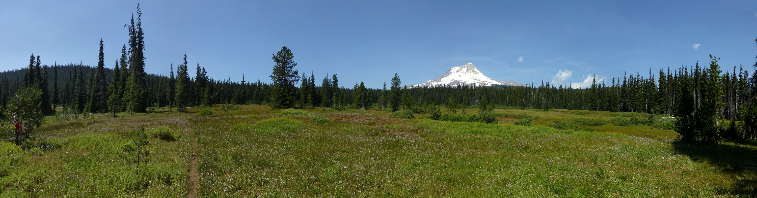
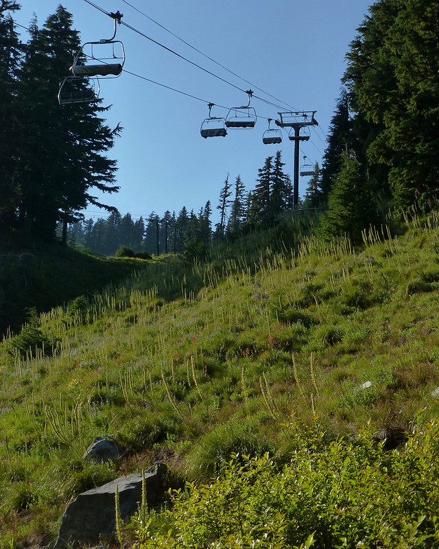
The trail then wends through Mt Hood Meadows ski area. I'm sure many would call this ugly, but I sure didn't think so!
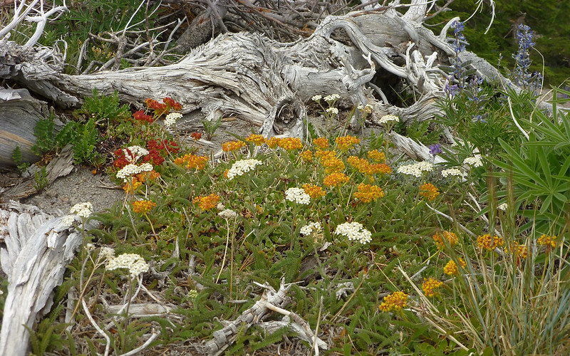
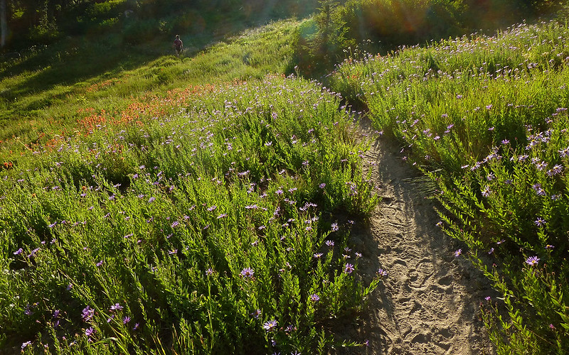
Sun was very low, so good photos were hard, but the place was alive with wildflowers. Far more so than Elk Meadows!
Another probably stunning display of beargrass. A few weeks ago.
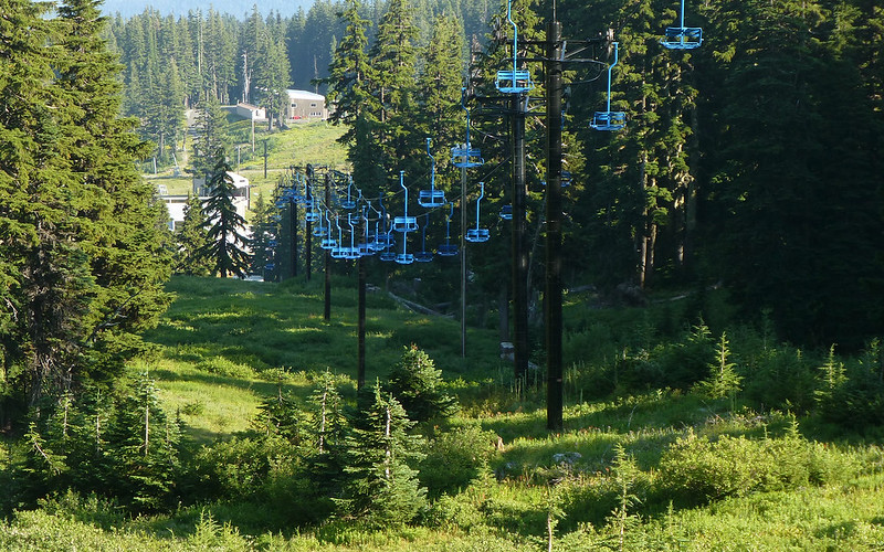
The old Blue chairlift; one I used to ride a lot in the 70s. Sure was weird seeing the runs without snow! Lots of deja vu all over.
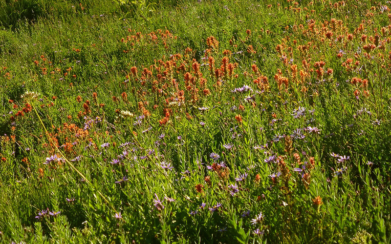
MHM offered the best displays of paintbrush all day long!
Aster fans in the house? Lots of it happening up there now.
No way to resist that shot!
Rachel and I parted ways at the far side of MHM. Her stamina, after 35 miles, was inspiring.
As I headed down the Umbrella Falls trail, the forest was beginning to darken.
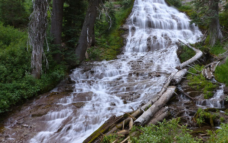
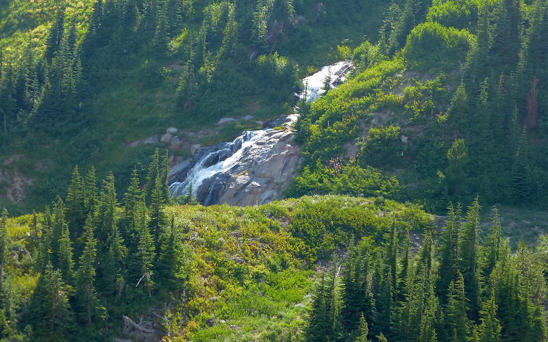
The (original) reason for extending the loop. Umbrella Falls. Marvelous!
Umbrella Falls
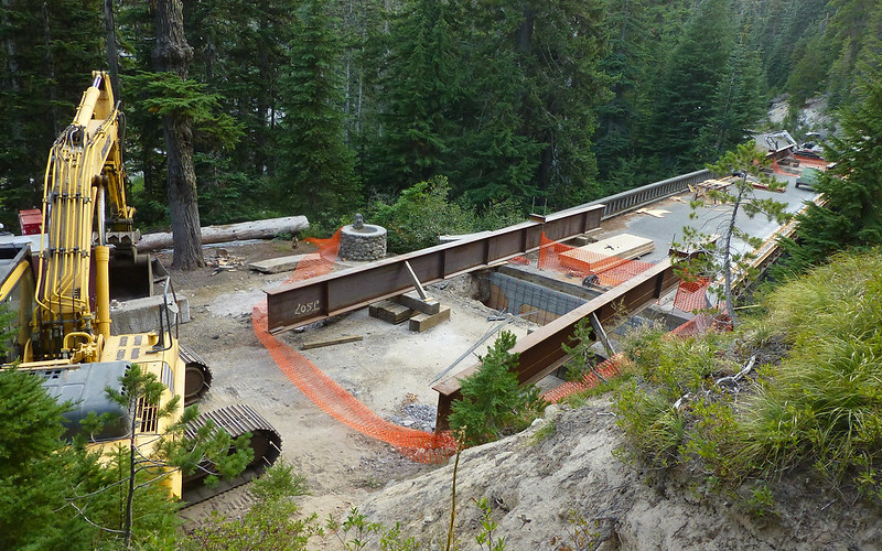
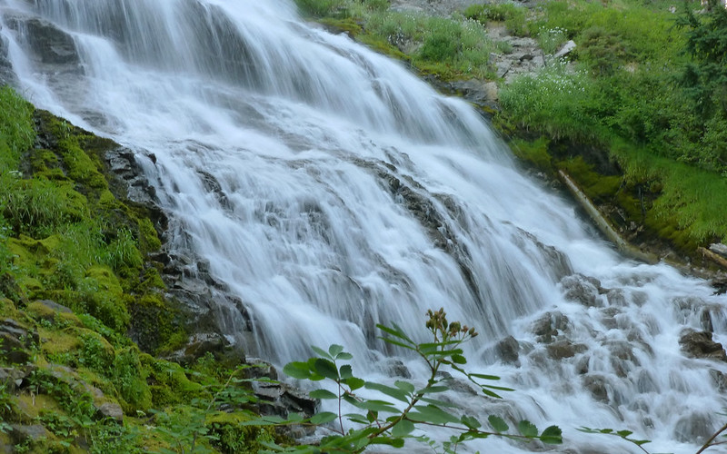
Getting a good view of Sahalie Falls wasn't as easy. The bridge was under re-construction!
Not that a little bridgework would get in the way, of course! Sahalie Falls.
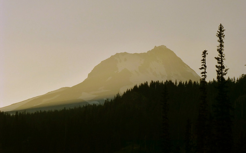
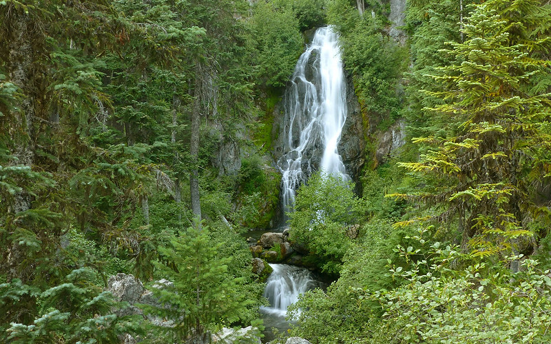
As I returned past Hood River Meadows, the last rays of sun were shining over Hood.
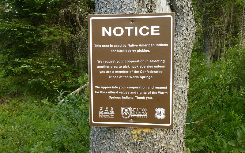
And I also passed the only huckleberry bushes I'd seen all day that were still full of berries!
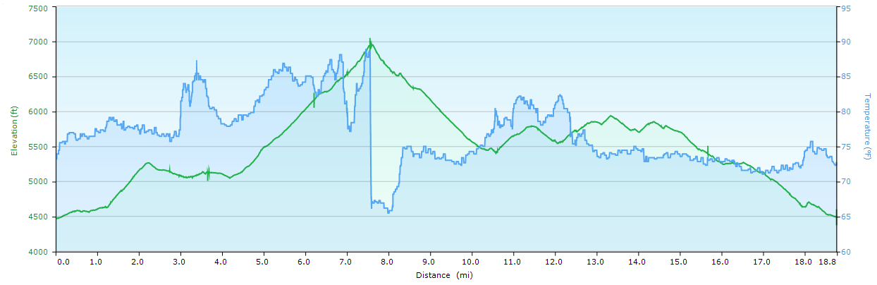
All in all, just a fabulous day in the woods! The GPS trip computer said I'd gone 19.76 miles when I got back to the jeep. The downloaded track, a more generalized view of the day, said about a mile less. Overall EG was just about 4500'.
I'd highly recommend this loop! But as I said earlier, you may want to consider going the other direction, if you'd like to see the wildflowers at Mount Hood Meadows in their best light. The show there far exceeds that in Elk Meadows presently.
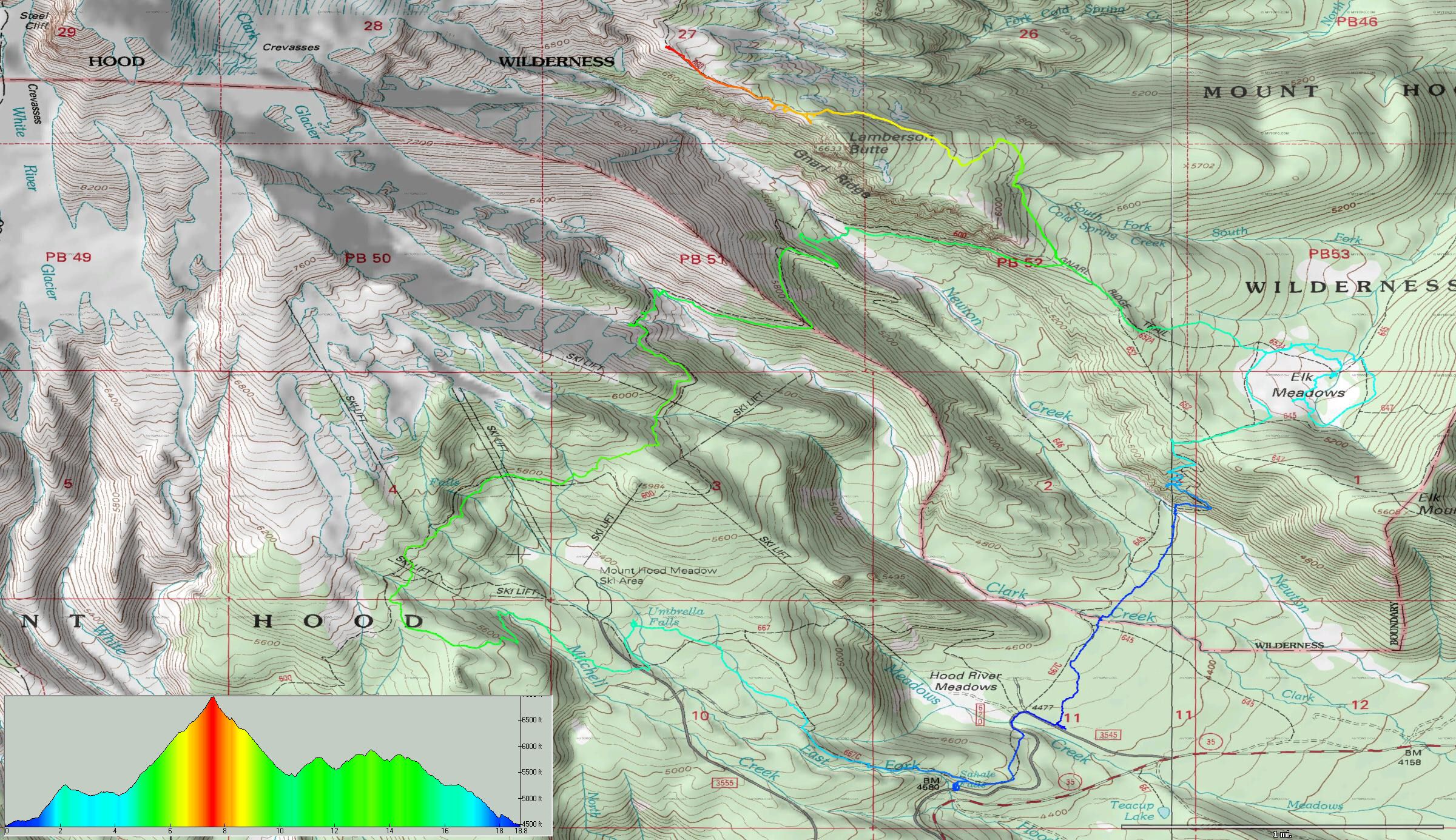
Right-click, View-Image, for full-sized map.
http://gpsfly.org/gps_map.php?gps_id=2692&w=645&h=440
And, just in case you haven't seen enough photos, here's the full slideshow.


