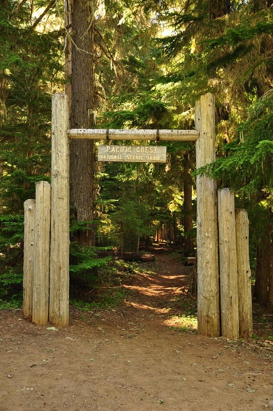
I took a stroll along the PCT for about a mile, circling around Clackamas Lake.
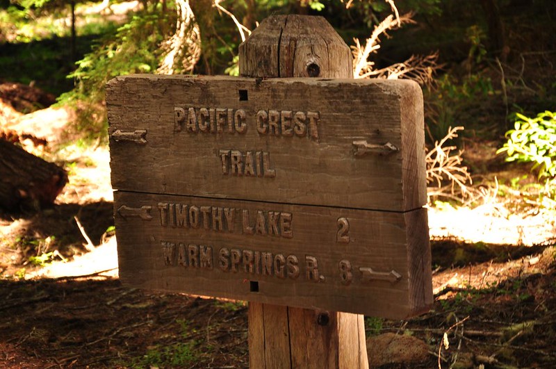
There are these big old-fashioned trail signs. This one, however, was obviously wrong. There's no way the border of the reservation was 8 miles from here. I'm wondering if there was a missing decimal point there. By the way, I thought about hiking the PCT out to Buckskin Butte, but since I didn't have any information about it and wasn't sure if there would be views, I decided not to. Anyone ever been out there?
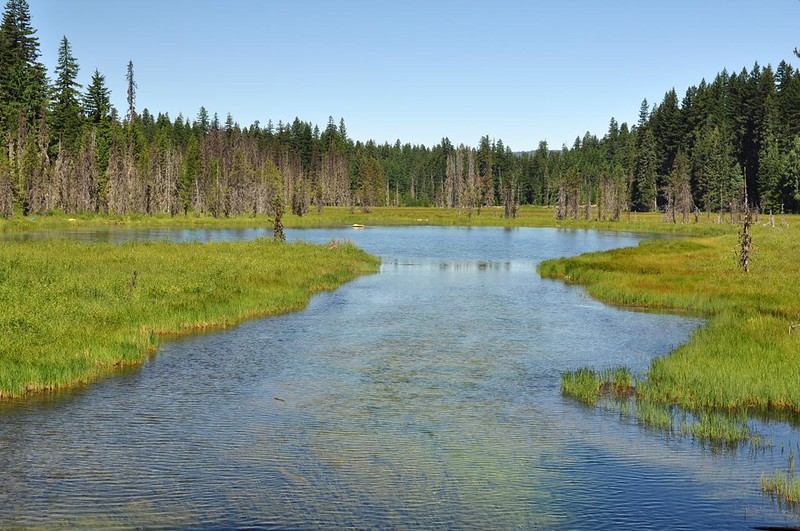
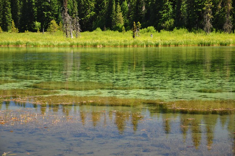
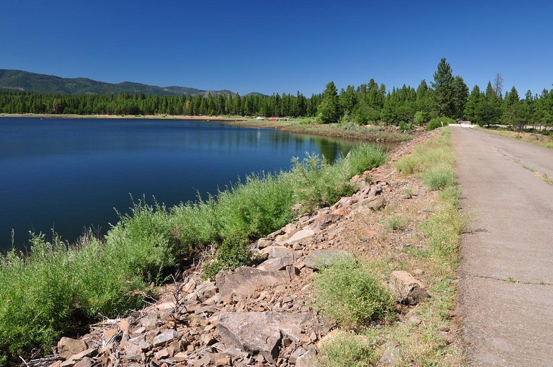
The lake is really more like a shallow marsh, but it's still quite lovely. This spot is where some kind of underground creek or spring flows into the lake. It was the most delightful sound!
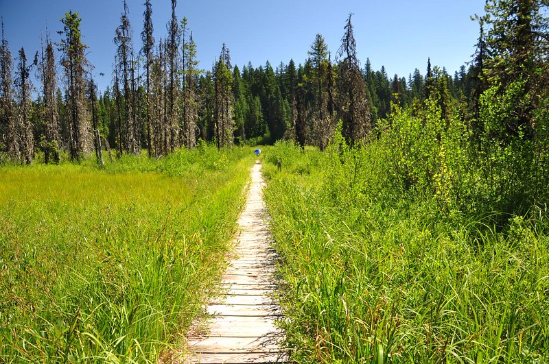
From the campground a boardwalk goes out to the water. Such beautiful clear water!

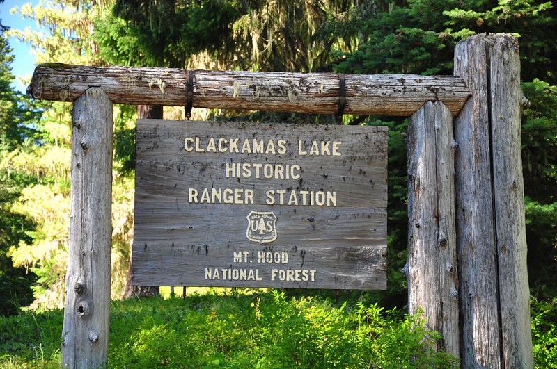
I took a look around the historic Clackamas Lake Ranger Station, which was built by the CCC in the early 1930s.
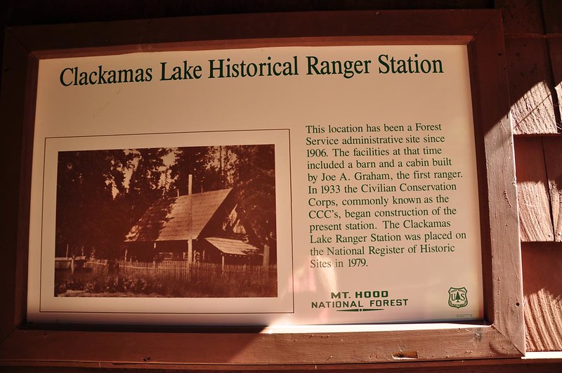
I'm sure there hasn't been money for new brochures for quite some time.

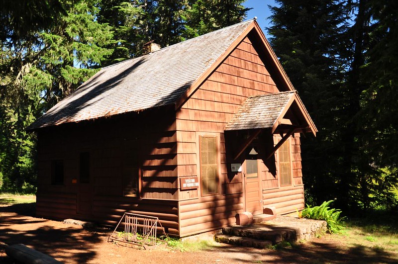
The place is neat as a pin and the buildings are in good shape, but everything is shut up tight. This appeared to be a former bathroom building, but it was all locked up.

The former ranger's office is now a visitor's center, although it didn't look like it had been staffed in awhile.
As you step through this padlocked door....

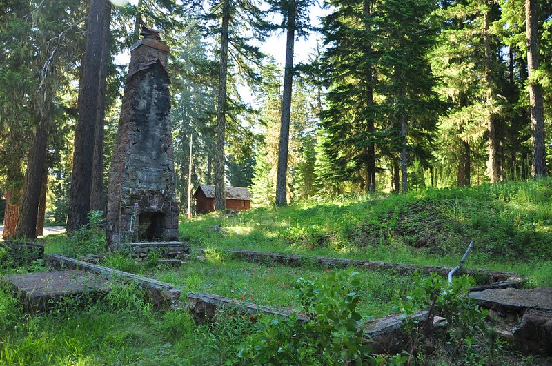
In 2003 a fire destroyed the Protective Assistant's Residence (also known as the Honeymoon Cabin). All that remains is the chimney.
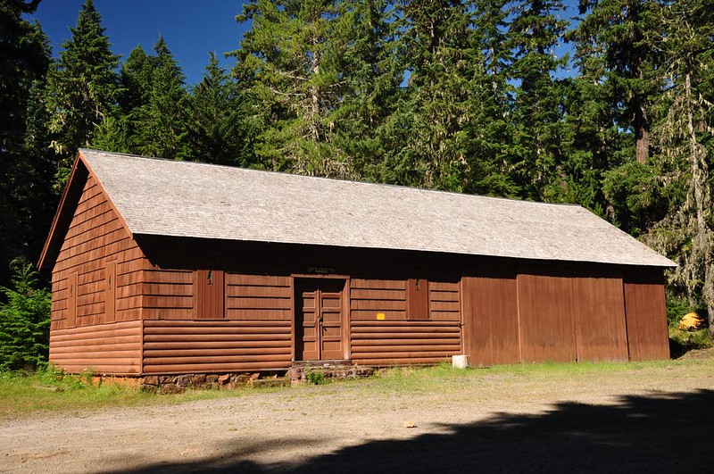
Roads and Trails Warehouse:
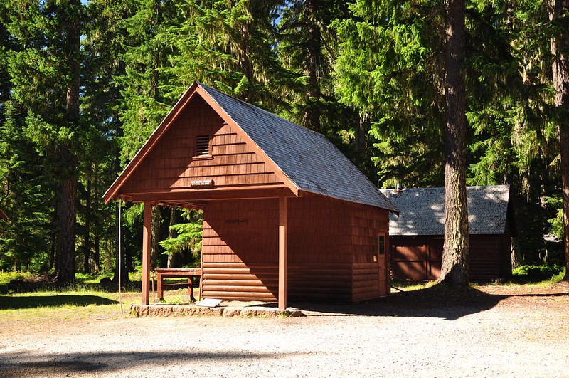
Gas & Oil House:
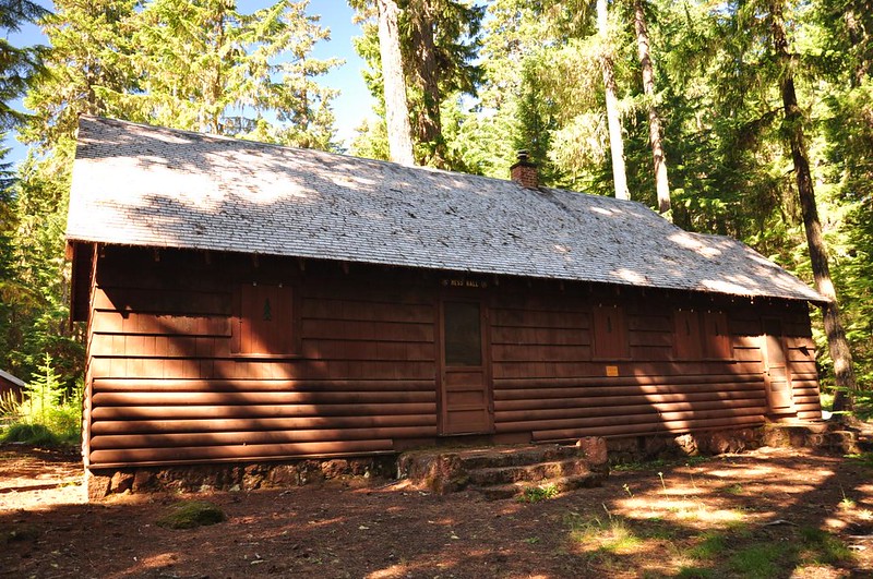
Mess Hall:
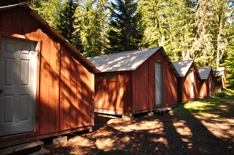
This strange row of cabin-like structures were clearly modern, but what their purpose was I couldn't tell. Maybe residences for seasonal workers? No one was staying there now.
Across the road is the former ranger's residence, which is now part of the rental program. I didn't get a picture of it since it was partially screened by trees and there were people staying there. But here's the image from Wikipedia.

I then headed over to the other side of Highway 26 for some explorations of old lookout sites. I drove up Road 4860 to get to Grasshopper Point. The road gets you close, then you have to hike a quarter mile up to the point. There is a trail, which appears to be an extension of Rocky Butte Trail #475.
It took me a little bit to find the lookout site, which is hidden in the trees. I had been hoping for halfway decent views up here, but as is often the case with old lookout sites the area looks NOTHING like it does from the old photos. The trees have grown up a lot.
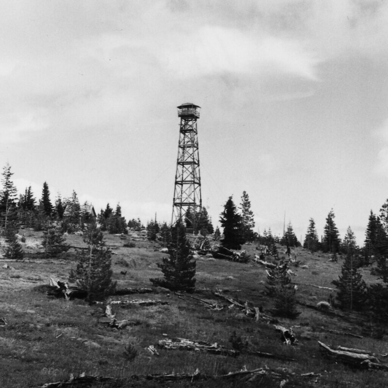
1963:
2013:

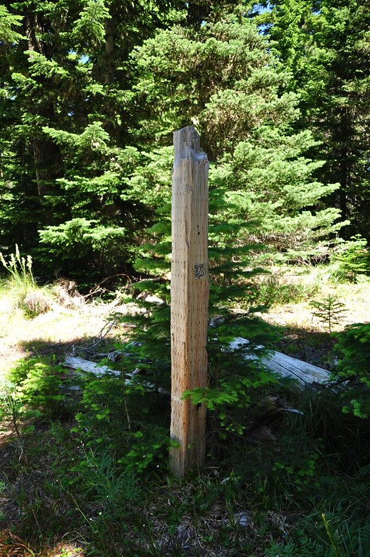
There is a very old overgrown road that goes up and over the point. I followed it north for a short distance and found an old Forest Service signpost along it. The placement is pretty random though, since it's not at any junction and is not near the lookout site.
There must have been quite a beargrass show here a few weeks ago.

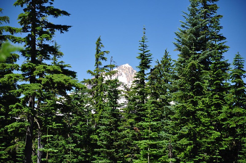
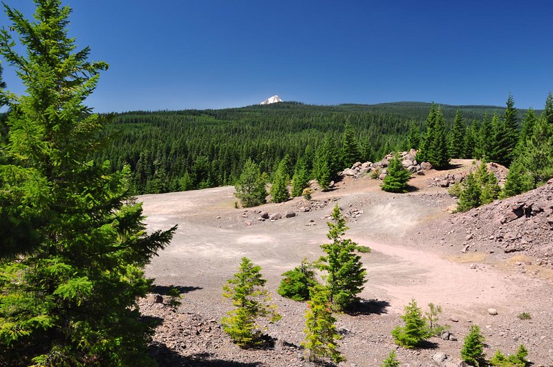
Just a tiny glimpse of Mt. Hood from the beargrass meadow:
There was also a large amount of lupine in bloom on Grasshopper Point. It was quite lovely, although none of my pictures turned out. I considered following the trail the other direction out to Rocky Butte, but the day was getting quite warm and I didn't know the condition of the trail, so I skipped it.
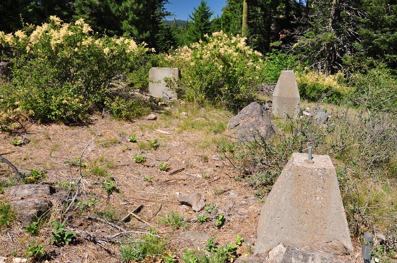
I drove over to Post Point where there is now a quarry just below the lookout site.
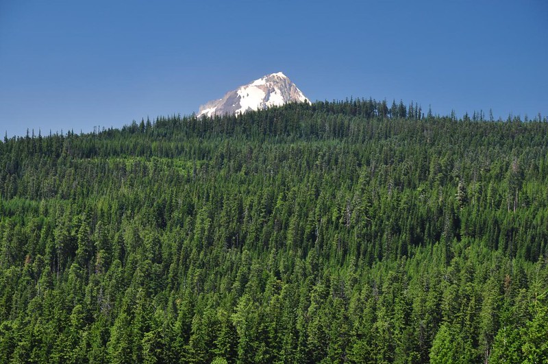
Without the benefit of a lookout tower you can only see the tippy-top of Mt. Hood.
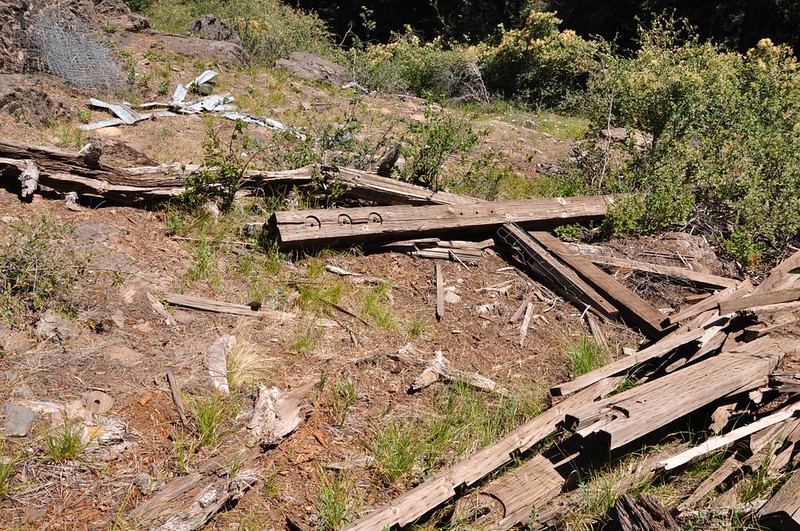
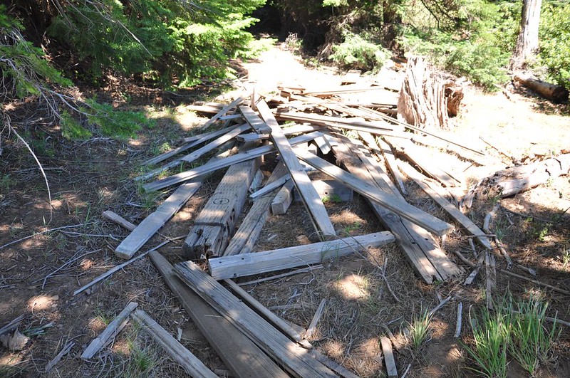
Evidently in 1994 the Forest Service tried to move the cab and upper part half of the tower to another location, but maybe they didn't do their weight calculations correct because it was too heavy for the helicopter and was dropped. From the looks of things they simply said "Ah screw it" and walked away, because there is lumber EVERYWHERE. It looks like every scrap of wood from the tower is scattered all over the summit.
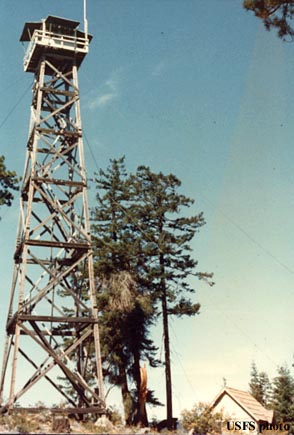
Here is the lookout in better days:
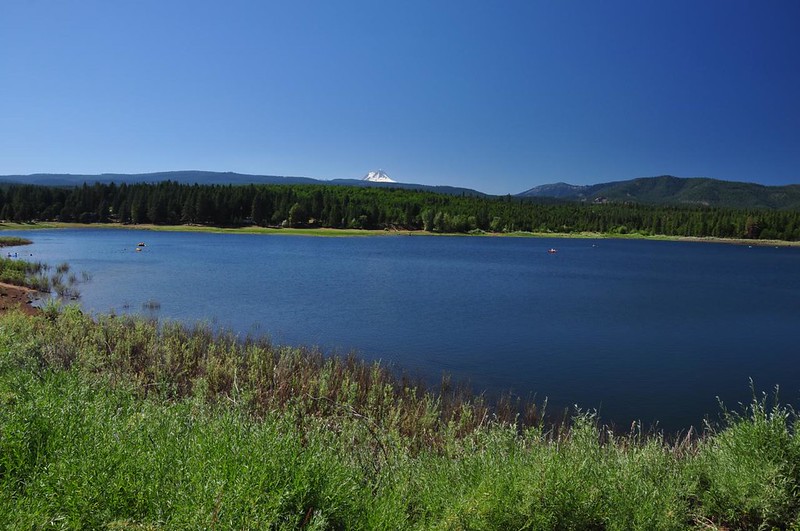
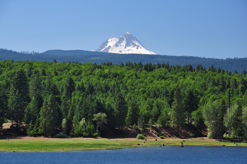
Because it wasn't that far I decided to go check out the Rock Creek Reservoir. It was very hot over on this side of the mountains, at least 90 if not higher. I felt bad for the people in the campground roasting in the hot sun. The water looked inviting but I wasn't about to pay the $6 day use fee to stay.
So the camping situation... Because Mt. Hood is in my backyard I've never tried to camp there over the weekend before and if I ever do it again I'll definitely have a different strategy. Like many people I drove up after work on Friday and started trying to find a campsite. I stopped in at Still Creek, Trillium Lake, Frog Lake, and Clear Lake before giving up. All those campgrounds were full and not a single one had a sign out on the highway stating that fact. I found in the spot in the woods just off the Clear Lake access road and camped there for the night. (Of course this was the ONE time I didn't bring my portable camp table, doh!)
In the morning when I was packing up a very nice couple stopped and asked if they could claim the spot for that night. I said sure, not a problem. Then they told me their finding-a-campsite story from Friday night, which was far worse than mine. They had spent THREE HOURS going from campground to campground along Highway 26 looking for an open site. They even went as far as Timothy Lake. Of course everything was full. They said they camped near Trillium Lake and based on their description I think they were camped near that old airstrip, where I've seen people camping before. Unfortunately a large group of people had a raucous all-night party. They played loud music through concert-sized speakers and drank lots of booze. I was very surprised that the cops and/or the Forest Service didn't put a stop to such a party. I'm guessing there aren't any rules on the books against raucous forest parties, but considering the large amount of people in that immediate area, with the Trillium Lake and Still Creek Campgrounds and Government Camp, I would think they would put the kabosh on that. Maybe not.
They also told me something I had never heard of before. They said that the guy at the Chevron up the highway told them in order to legally camp in those roadside squatter campsites that you are supposed to have a $5 pass. They sold them at the gas station. This was news to me. Anyone heard of this?
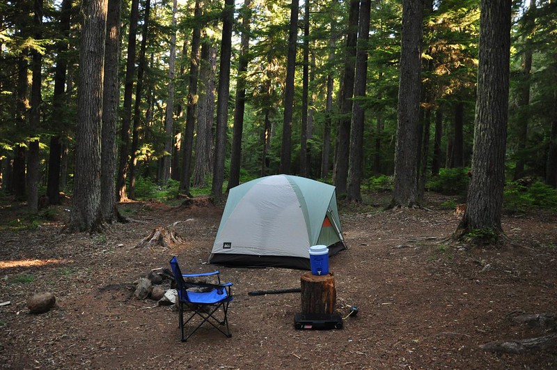
Saturday night I camped at Barlow Crossing Campground and had a very lovely spot along the gurgling creek.

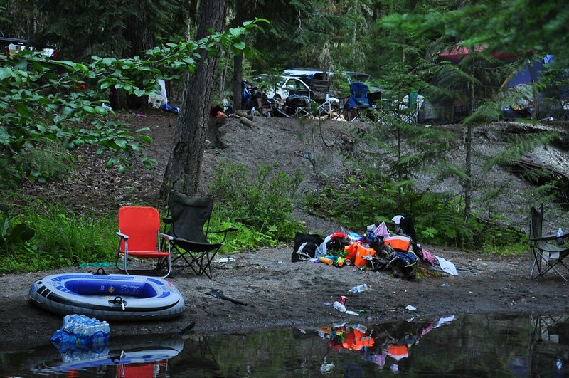
My neighbors across the creek, however, were not there to enjoy nature but to conquer it. There were three or four families with a large sprawling camp with at least six vehicles, rafts, floating mattresses, more camp chairs than you could shake a stick at, toilet tents (!), a generator, chainsaw, motorized cars for the kids, and a plastic kiddie pool. Despite all that they didn't make an excessive amount of noise until 9:15pm which is when the stereo came on and country music was blasted across the forest. I gave them until 10:00 then I waited for a break between songs before I hollered across the creek that I was trying to sleep and would they please turn off the music. I was fully expecting any variation of "**** you" or "Mind your own business" or "Go to hell" but to my amazement none of that happened and they turned the music off without complaint. I had been pondering what I would do if they DID give me grief, my favorite idea being an accidental press of the Subaru panic button on my key fob at 6am. But since they didn't give me grief I declined to follow through on that plan. Also I didn't want to get shot. Everyone over there was still sound asleep when I drove away at 7:30.
I really think the Forest Service needs a better campground strategy. I realize they don't have the funds or resources that the national parks have, but when I visited Glacier a few years ago you could find out which campgrounds were full if you checked at any visitor's center. If I remember correctly, there were also up-to-the-minute digital signs at the park entrance that said which campgrounds were full and which were not. I feel bad for families who drive up after work on a Friday and waste precious time and gas going from campground to campground looking for a spot and coming up empty-handed. Even if the highway campgrounds were required to put out "full" signs on the main drag that would help a lot. I was fortunate that I had the flexibility to camp off the side of a forest road. Many families wouldn't have been comfortable with that. I also cringe to think about families who are new to camping who might experience the kind of loud neighbors I had the second night and think that is the norm. I think most people do go out to the forest to enjoy it, not to drown it out with partying and loud music, but there are a few bad apples who ruin it for others.


