
After reading TexasBB’s (Todd) trip reports last year, like this one and this one, on his backpacking trips to the Wenaha-Tucannon Wilderness, my interest was piqued. My wife, Dawn, and I took our annual get-out-of-town-to-get-away-from-the-war-zone, A.K.A. the 4th of July in Portland, to the area just south of the wilderness. It was a great trip, but left me wanting for more. All through last fall and winter and this early spring, I had a plan to take an early backpacking trip to the area.
Facts about the Wenaha-Tucannon Wilderness:
• Located in the Blue Mountains of NE Oregon and SE Washington.
• Created in 1978 and is 177,500 acres – 111,750 in Oregon and 65,750 in Washington.
• Elevations range from 2000’ on the Wenaha River to 6401’ at Oregon Butte, which BTW is located in Washington.
• Wildlife include elk, bighorn sheep, whitetail and mule deer, black bear, cougar, coyote and rattlesnakes. The Wenaha and Walla Walla wolf packs also roam this area. There have also been reports of moose and grizzly bear.
• There are approximately 200 miles of hiking trails, with varying degrees of maintenance from none to very well maintained.
With the Wenaha River trailhead just outside of Troy, OR around 1700' and with an estimated accumulation of only 70% of typical snowpack in the Blue Mountains, the time was right. So on Wednesday, April 24th, Hiker Chris and I left Portland straight after work. Destination: The Wenaha River trailhead just outside of Troy. Bonus nugget of info on Troy: John Fogerty of Creedence Clearwater Revival fame used to own property and spend quite a bit of time around Troy.
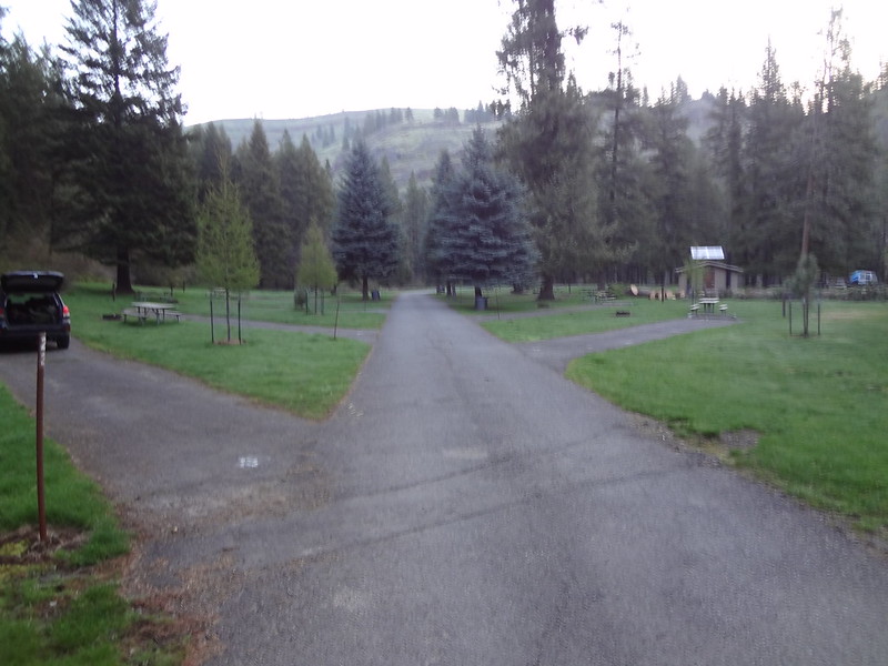
With the total drive time from Portland to the trailhead was expected to be around 8 hours, so we opted to stop for the night at the 600 acre Minam State Recreation Area, at the confluence of the Wallowa and Minam Rivers. That allowed us to get to the trailhead by 9AM the next day, after a stop in Enterprise for breakfast at the Red Rooster Cafe.
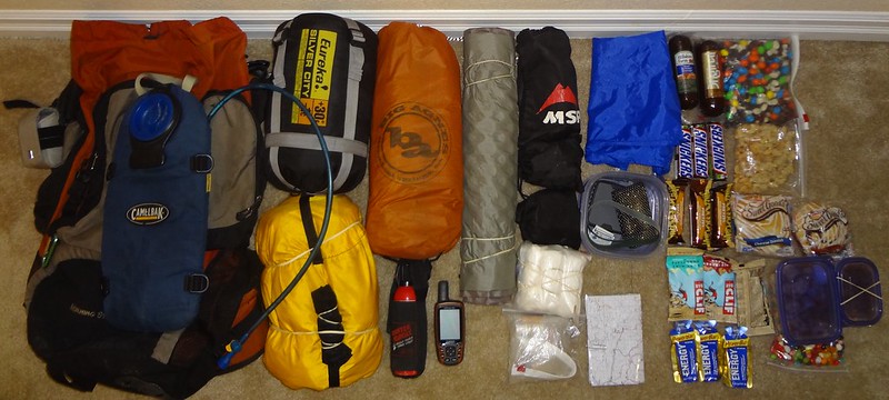
Gear and food:
Minam State Recreation Area campground:
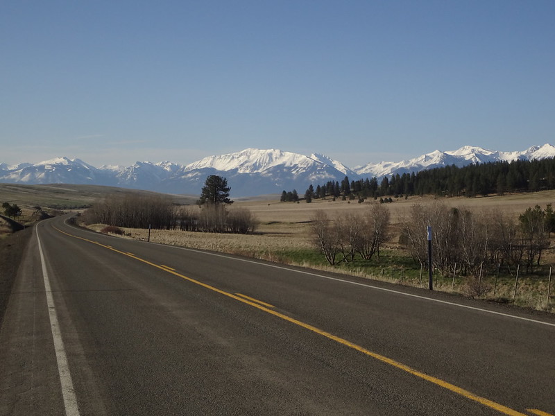
View looking back on highway 3 north of Enterprise. Lots of snow still in the Wallowas.
View from gravel road above Troy. The Grande Ronde River canyon (left) and Wenaha River canyon (center) can be seen.
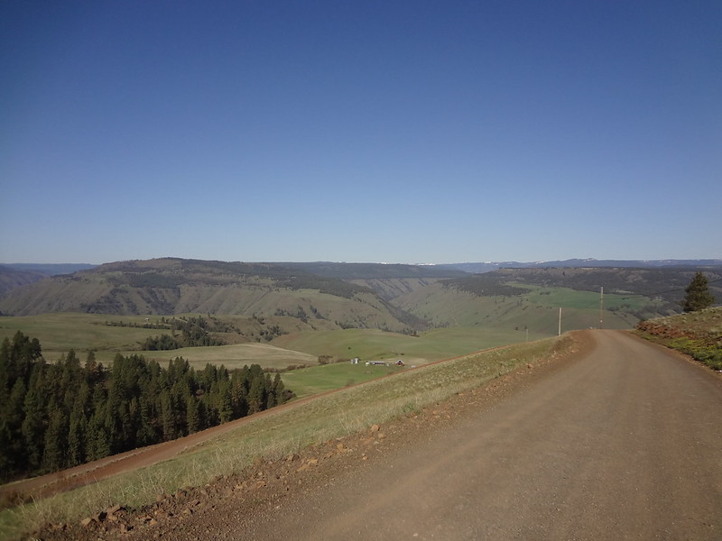
When we got there the weather was sunny and 50 degrees, with a light breeze - perfect for hiking.
Even at the start, it was undecided what trails we would take. For months I had been poring over the wilderness map and all of the trails, noting distances and elevation points. TexasBB’s trip reports were examined several times. I even contacted him for more details, which he readily supplied. Other sources were researched, as well. I wanted to avoid another Bushes from Hell trip if at all possible. The general idea was to follow the river upstream for a while, then make decisions as we went.
So off we went!
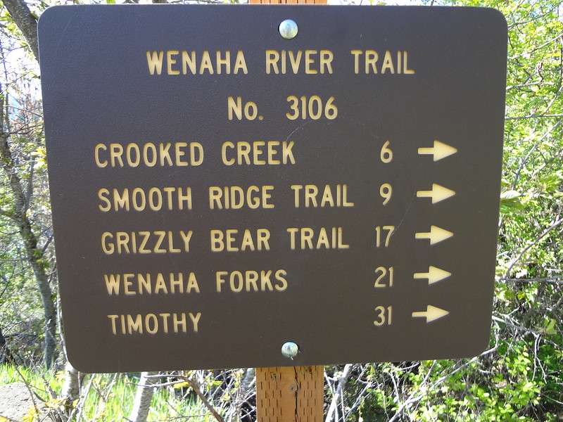
Sign at the trailhead:
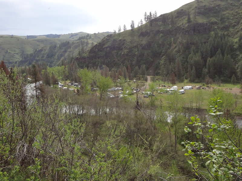
Soon after we started, we noticed on the other side of the river many RVs and campers clustered together in a RV park. We didn't think much about it until on the return, we ran into a couple of ladies who asked us if we were part of the Muzzleloader group that woke them up at 6am shooting off guns and cannons.
We said no, we weren't but were glad that we were far away during our trip.
RVs and campers at the Troy RV park:
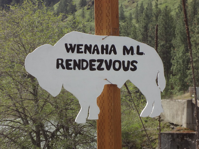
Wenaha Muzzleloader rendezvous sign:
Wenaha Muzzleloader rendezvous flyer:

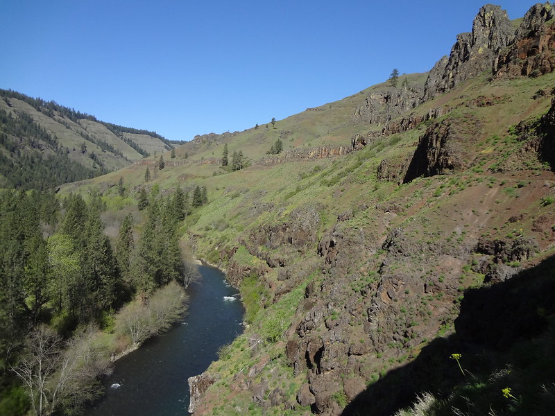
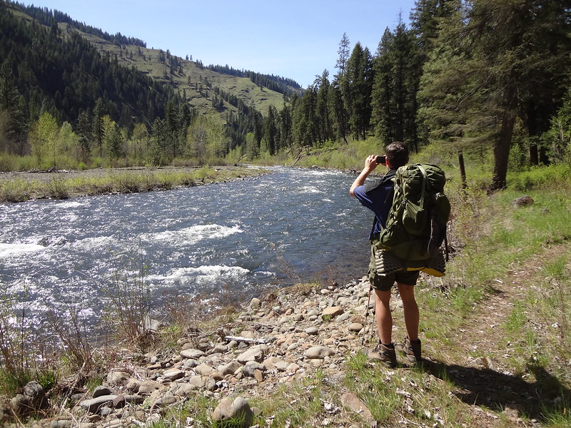
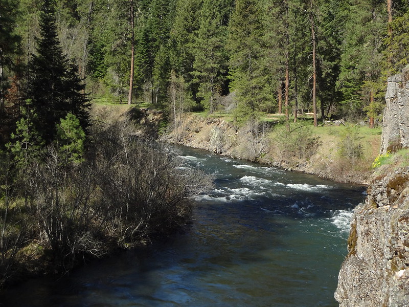
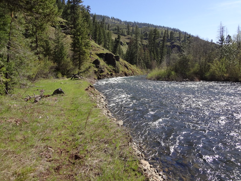
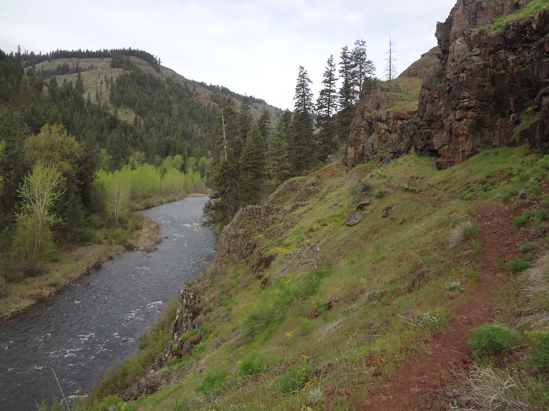
Since the trail starts 100+ feet above the river, the views started right away, and only got better as we continued along. Sometimes the trail was 100-200 ft above the river (on cliffs), while other times, it was on the many bars (not the alcoholic kind), while still others, it was right next to the river. The river was always within earshot and oftentimes, within sight along the entire trail.
View above the river:
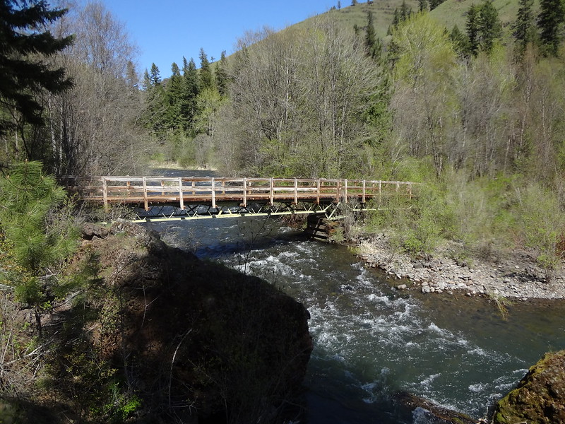
Around the 6 mile mark, we reached Crooked Creek. Fortunately, there was a bridge over the creek, as it would be difficult and dangerous to cross that waterway.
Bridge over Crooked Creek:
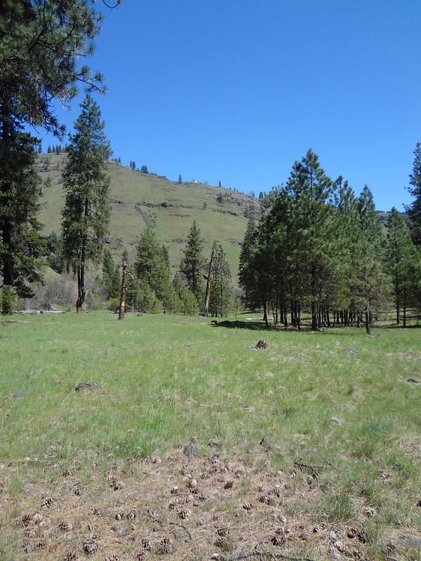
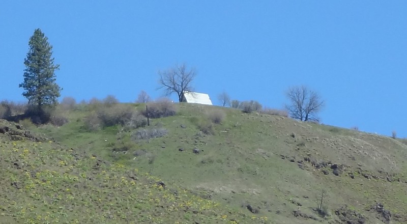
After crossing Crooked Creek, we rested at the bar. This bar was one of the better ones for camping, but we did not camp there. While resting, I noticed a structure on the canyon rim. While I never figured out what it was exactly, I still zoomed in in case someone else might.
Crooked River Bar/structure on the rim:
Zoomed in on the structure on the rim:
Chris taking a picture down by the river:
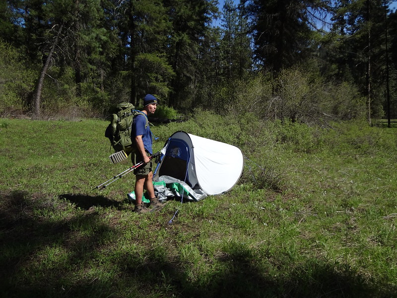
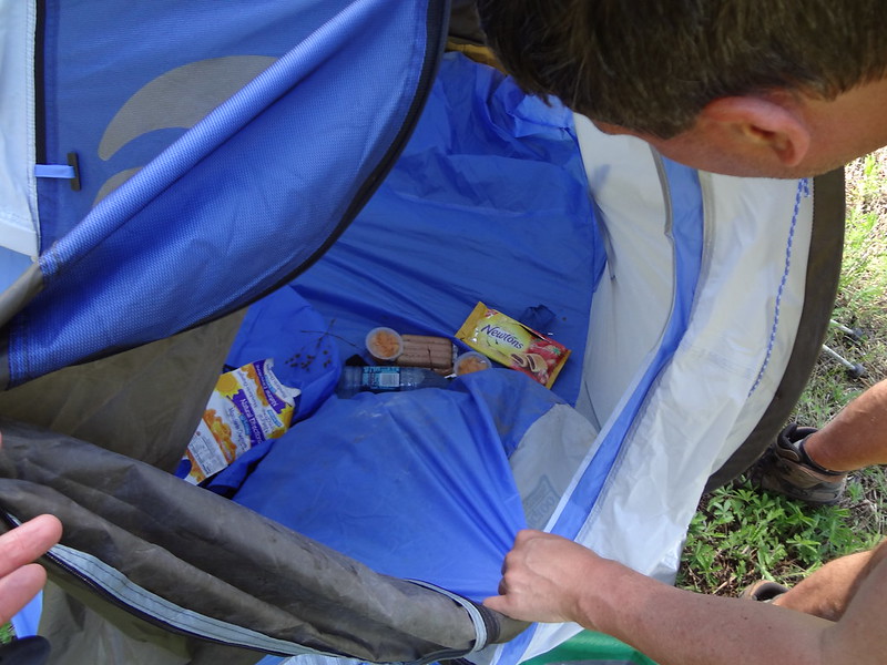
Upon reaching Fairview Bar, we noticed a tent right next to the trail. It looked out of place, and sloppily assembled, with a tarp crumpled up in front of it. The tent looked somewhat abandoned and closed up, so we called out, asking if anyone was there. There was no reply, so we looked inside, hoping somehow that there was no surprise dead body inside (!!). Fortunately, there wasn't. But it did have an odd assortment of food, including an unopened package of hotdogs. This was very strange, and rather unbelievable that with the number of bears in the area that none had ransacked the tent to get at the food. I am going to contact the ranger district to check and see if anyone is missing, and to also alert them that the food is removed so bears don't start associating tents with food.
Abandoned tent at Fairview Bar:
Food inside the abandoned tent:
Rock formation that looks like the Moai on Easter Island:

Another view of the river from above on the trail:
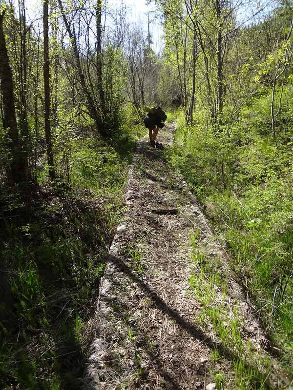
I had read in one of drm (Dean Myerson)'s trip reports that the Wenaha River Trail after Fairview Bar was un-maintained and difficult to pass because it was overgrown as well. Fortunately, this was not the case. Earlier the day in Troy, I spoke with a person very familiar with the trail systems who had first-hand knowledge that the entire Wenaha River Trail was maintained within the last 2 years and much easier to traverse.
Maintenance done on the trail along a mucky section:
After 14.6 miles, at 5:30pm, we stopped to set up camp.
Bar where we camped the first night:
Earlier that morning, while we were at Minam State Recreation Area, at 4am we heard a strange whomping sound. We didn't know what it was but figured it was some sort of bird. Now that we were at the campsite, we heard the same sound again; every 2 minutes. Going on for HOURS...while we were trying to sleep. Upon coming home, I asked my "bird nerd" wife, Dawn, what kind of bird makes that noise. She thought it was some kind of grouse. After doing some additional research, I discovered it was a ruffed grouse, trying to drum up a mate.
Video of ruffed grouse drumming:
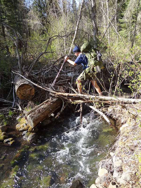
The most difficult creek crossing:
The next morning after waking up, we discussed that day's plans. We thought we would continue up the Wenaha River Trail to the Grizzly Bear Ridge Trail, just to see how far up we could get. However, to our disappointment when we reached Butte Creek, it was impassable due to fast-flowing, ice-cold high water that was at least knee-deep. While it wasn't something that we would drown in, if we slipped or fell, we would be soaked along with our gear. Shortly before reaching the creek, we had noticed another trail going off the right. We explored that trail, hoping it might lead to some sort of log crossing. After putting two-and-two together, we figured out that it was an abandoned trail that was on my GPS but not on my map or my NatGeo software. This was one of several trails on my GPS that were not on my map or software. Sometimes, trails just fade into the forest.
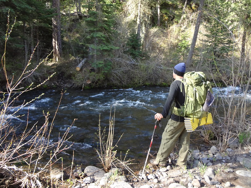
Chris contemplating crossing Butte Creek:
At this point, this was our turnaround point, and we decided to pursue Plan B. This involved going back to Fairview Bar and following the Smooth Ridge Trail up into the mountains.
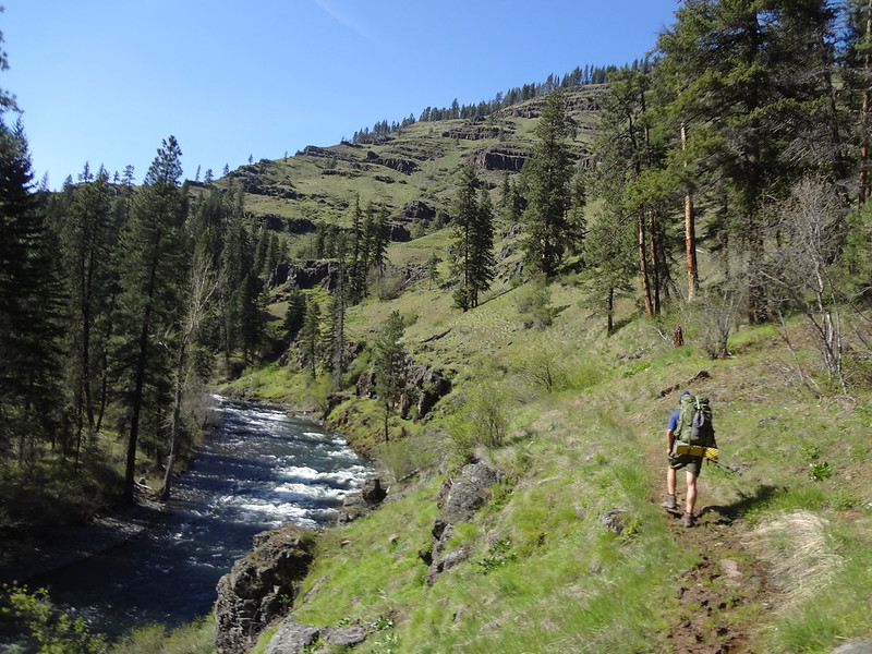
The trail right next to the river:
On the way to the ridge trail, we rested at one of the many bars. I took my shoes and socks off, then threw the socks out into the sun to help dry them off. After the resting time was over, I went to put my socks back on, and noticed that they were covered in what looked like bees or yellow jackets. Upon closer inspections, I could tell they weren't yellow jackets, and they actually looked like fake bees that try to pretend that they are bees - like "wannabees." Knowing that I wouldn't get stung to death, I shook off my socks, they swarmed around, then flew away.
Wannabees on my sweaty sock:

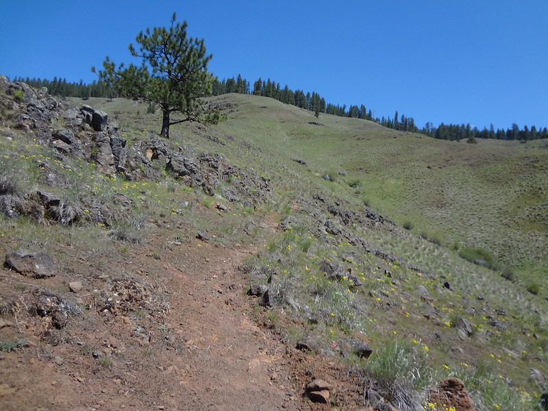
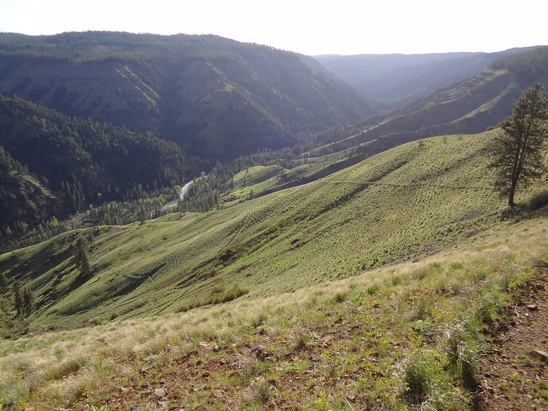
The Smooth Ridge Trail starts climbing steeply immediately from the river. At first, it was shady with some tree coverage for a short period of time, but then quickly changed to open ridgeline. Even though it was only 72 degrees, by being completely exposed to the sun and with heat radiating up from the rocks, it felt much warmer and even brutal. The section from the river up to the tree line gained 1200' within 1 mile. Wheeewww!
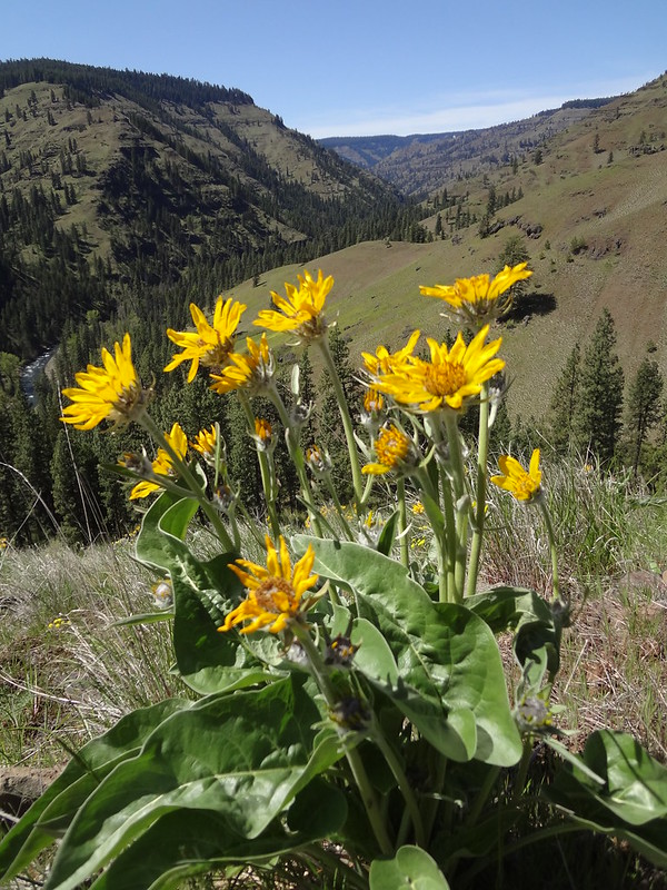
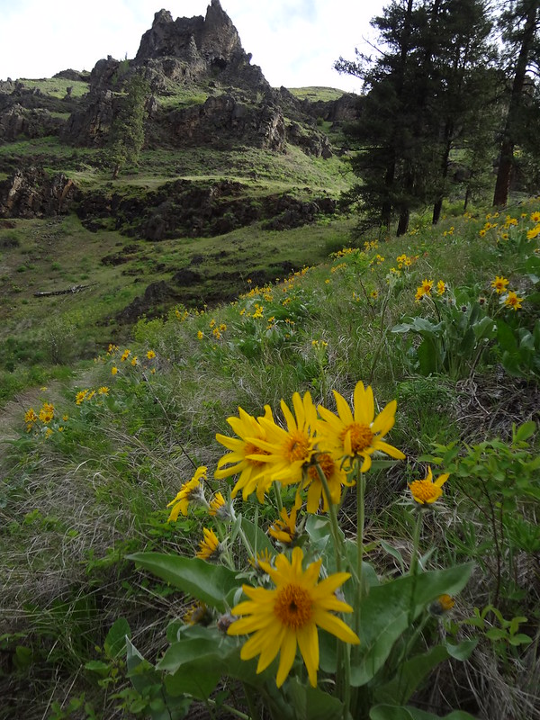
The view as we began climbing the Smooth Ridge trail/balsamroot flowers:
Only a few hundred feet to the tree line and wonderful shade:
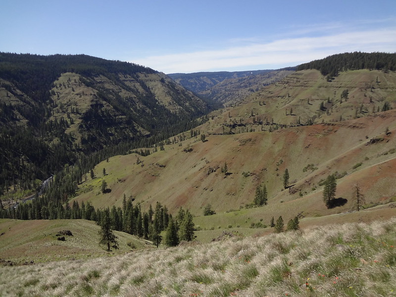
View from near the tree line:
Video of the view from Smooth Ridge:
Finally at the tree line where there was shade, we rested. It was then that Chris noticed a tick on his leg, even though he had sprayed with DEET. From then on, we were extra cautious and checking ourselves constantly for ticks.
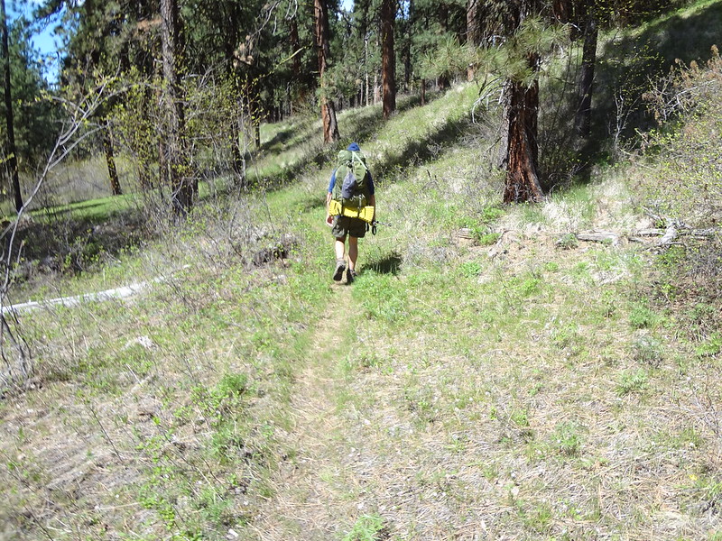
The Smooth Ridge trail once it reaches the trees:
Shortly after reaching the tree line, the Smooth Ridge Trail crosses over from Oregon to Washington. This was the first time I had walked by foot from one state to another.
USGS marker:
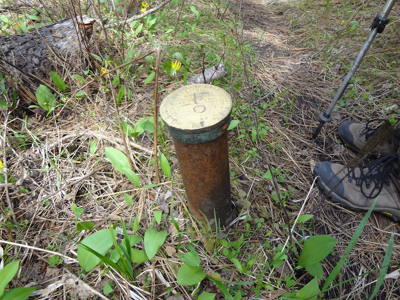
At the Oregon/Washington border:
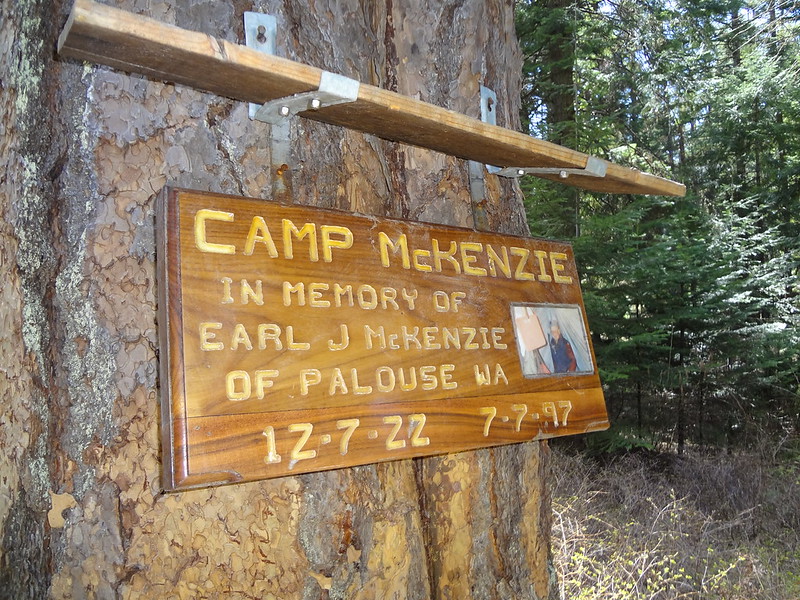
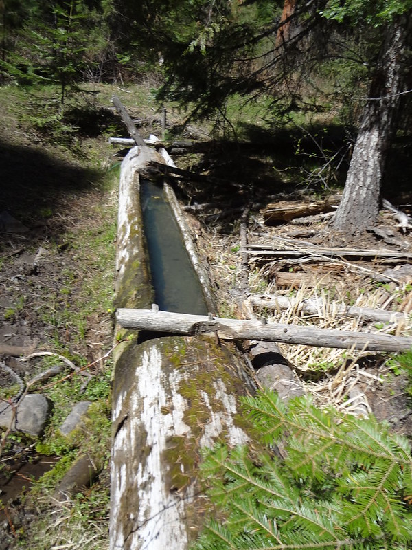
There are many springs in the Blue Mountains. One of them we found, which was called Mud Springs. At Mud Springs, there's a hunter's camp. Like many hunter's camps, it was quite an elaborate set-up with chairs, fire rings, carcass racks, and a privvy. This camp apparently has been used by a certain group/family for many years, as inscribed on a nearby plaque commemorating one of their own.
Memorial sign at Mud Spring:
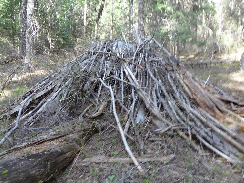
While at this camp, I looked over and saw a large pile of small limbs covering something. After investigating, I could see it was covering a tarp that was covering a large mound of what was likely equipment used by this group... sort of like a cache of sorts. I didn't feel like looking to see what it was- it would have required a lot of effort to get under there. We continued on after this rest stop was over.
Tarp covered hunting camp gear at Mud Spring:
Mud Spring:
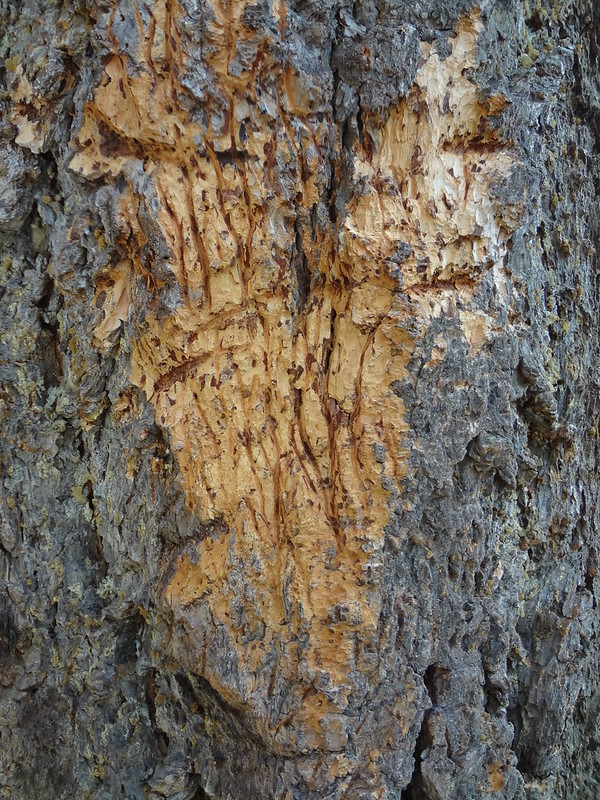
Bear scratches on a tree:
After finding and passing Pistol Springs, we began to think: "What is our goal for today?" We discussed this, and thought that we could continue on and probably find a campsite that had no view and would be higher up in elevation; however, it likely would be much colder than down by the river. Based on information provided by a man we met on the way up Smooth Ridge Trail, we knew we could make it to 5200-5500' without hitting snow that would require route-finding. Still, we decided to head back down the ridge the way we came.
Heading back down the Smooth Ridge trail:
Once back at the river trail, our plan was to make it back down as far as we could get before dark. That way, we would have an easy out the next day to the car. This would cut our trip short by one day. We ended up stopping where the Cross Canyon Trail meets the Wenaha River on the other side of the river. I meant to get a picture of this crossing as I can't believe people would even consider crossing this without a bridge, even in low water during the driest part of summer (even on horses).
The next morning, we got up early so we could get off the trail sooner. While we had already traveled this route two days prior, it was still enjoyable.
Another section of the trail above the river:
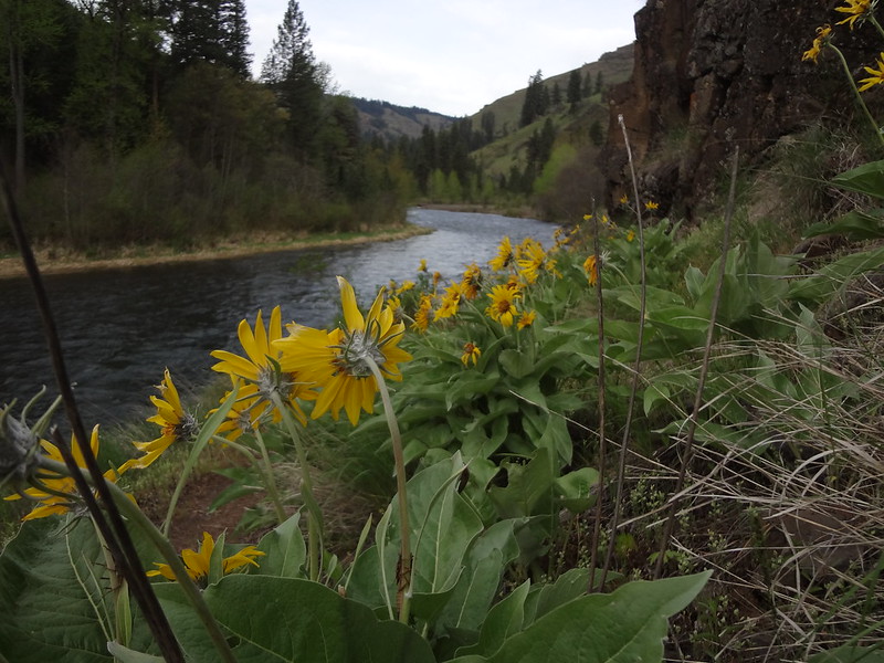
Balsamroot flowers down by the river:
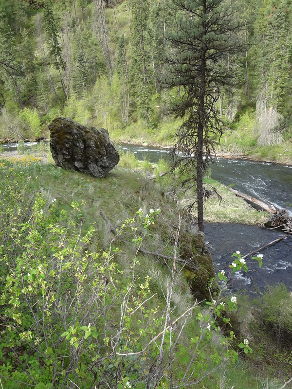
A giant rock that didn't quite make it over the edge:
My favorite picture of the trip:
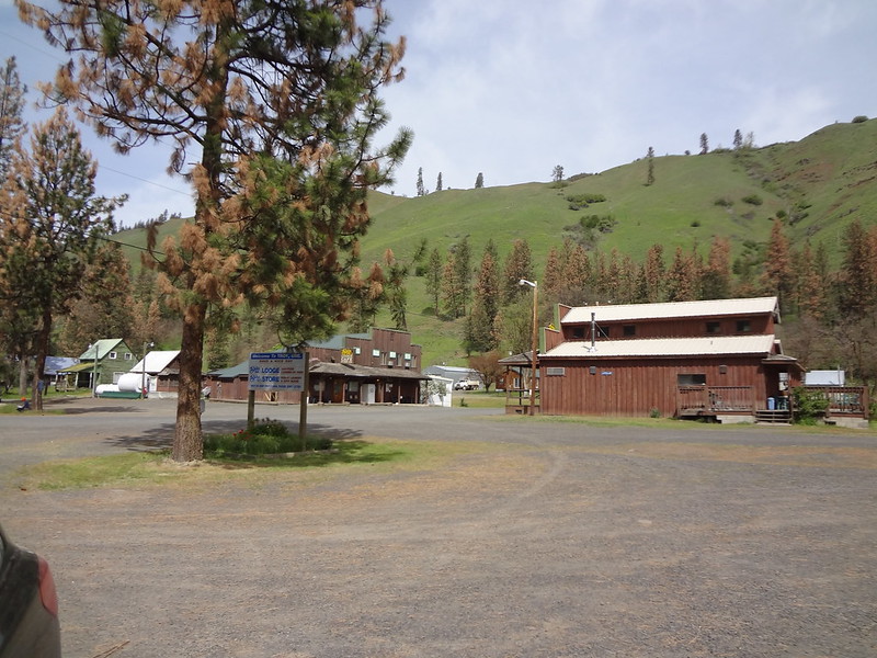
The town of Troy. Not much else here.
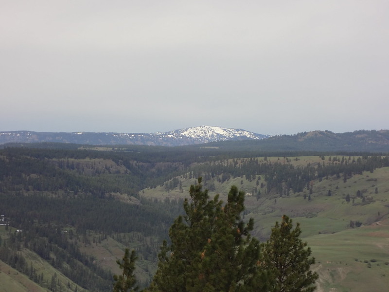
Driving back up the gravel road I zoomed in on Oregon Butte, the highest point in the Wenaha-Tucannon Wilderness:
Final comments:
• Day 1: 14.6 miles, 2187' elevation gain (EG). Day 2: 16.4 miles, 5340' EG. Day 3: 9 miles, 1129' EG. Total: 40 miles, 8656' EG.
• Brought bear pepper spray just in case. I ran into a bear last year in this area and wanted protection just in case.
• Animal bones all along the trail.
• The tree and brush coverage increased the further up the river we went. It went from 10% to 70-80%.
• Altogether, we encountered no people the first day, met 4 people the second day, and saw 5 people the third day.
• No poison oak at all along the entire trail.
• The weather was sunny and warm with highs in the mid-70's during the day the entire time we were there. It was never too cold at night, probably getting down to the high 30's or low 40's.
• Ruffed grouse are annoying birds when you are trying to sleep.
• Made it up to 4200' but could have easily gotten higher.
• Turning off the GPS tracking uses much less battery power.
• Back at the car by 11:00 AM. Home by 6:30 PM. It's about a 6 and a half hour drive (not including stops) going a consistent 5 MPH over the speed limit.
Here is a link to scans of the map of the Wenaha-Tucannon Wilderness I made. This is for anyone else who might need a map of the area. It's in pieces so you will have to print it out and stitch it together.
Link to all the pics on Flickr.
As always, hike on,
Brad


