Back in June 2012, EP and other assorted loonies did a loop (in the poor weather they so cherish) from Elowah Falls over Wauneka Point and back via Tanner Ck (EP on Wauneka). Looked like fun (weather aside). I had done Upper Munra before owning a GPS and had always wanted to repeat it for that purpose. So, voila(!), smash the two ideas together and a Wauneka-Munra Loop emerged. So Sunday found me leaving the Nesmith Pt TH (in very bluebird weather) for Upper Elowah Falls.
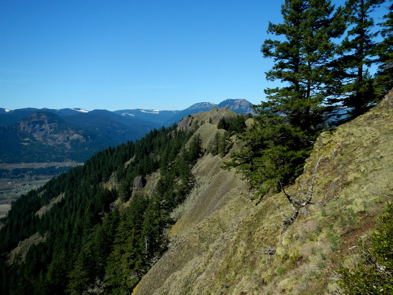
After crashing across McCord Ck, I headed up the side of Wauneka Pt. Higher up, there were good views of Table and Adams,
back toward Portland,
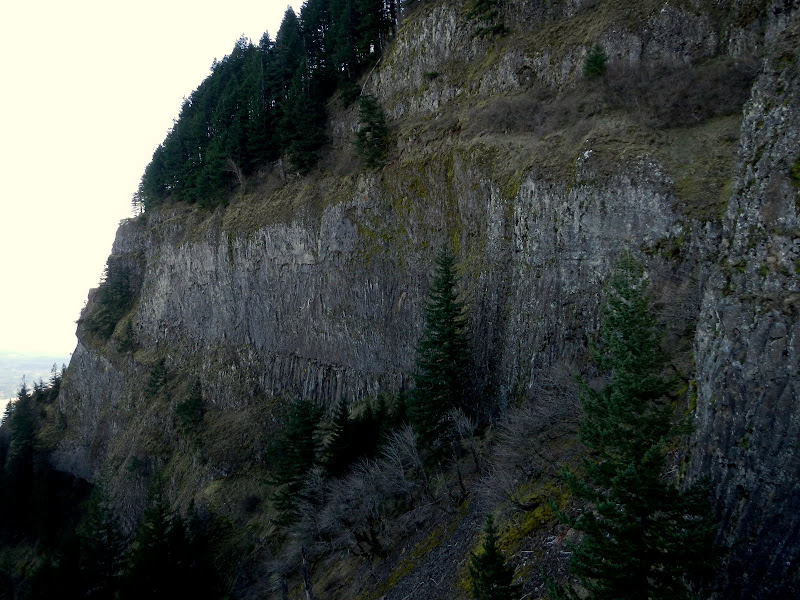
and of the sheer cliff faces that front the point.
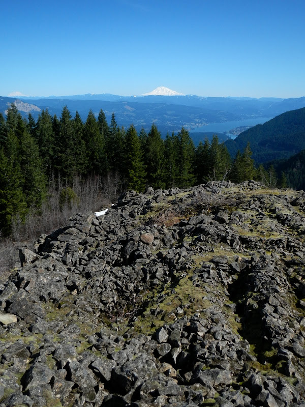
Following up the ridge was steep but fairly easy – it was just hard to tell the animal trails from the faint human use trail. 2000’ later, I popped out of the trees on to the open boulder field with its vision quest pits and view of Adams.
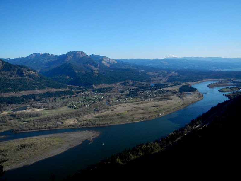
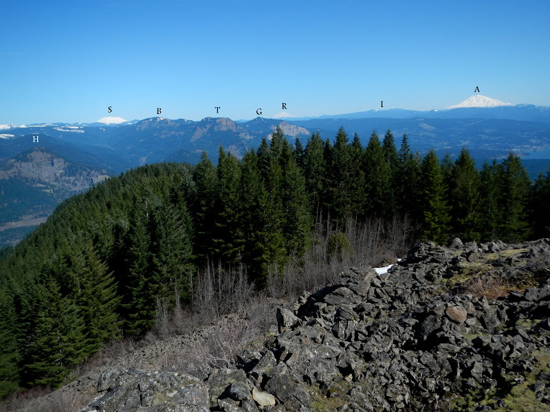
This is one of the most amazing views in the Gorge – Hamilton (H), St Helens (S), Birkenfeld (B), Table (T), Greenleaf (G), Rainier (R), summits in Indian Heaven (I), and Adams (A) – were all clearly visible.
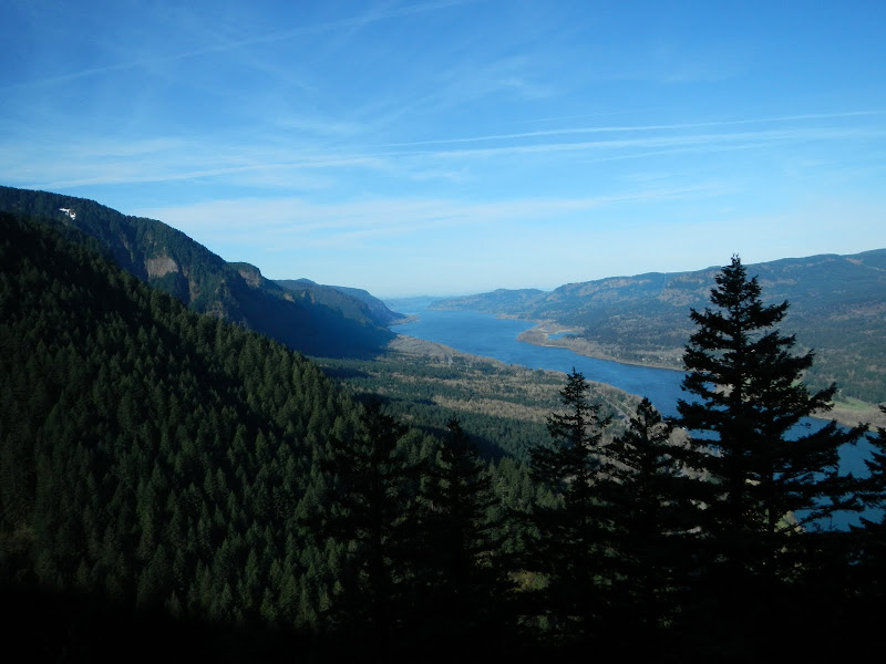
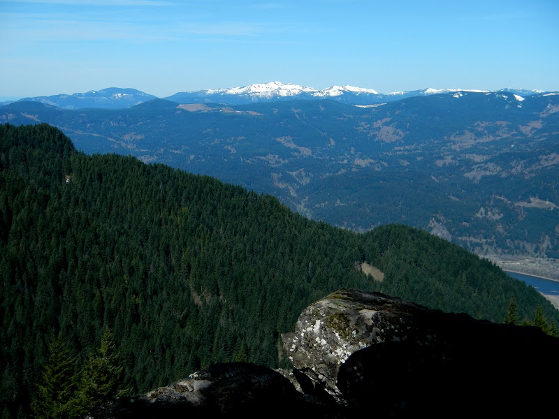
The trail from the tip of Wauneka Pt is sketchy at best, and currently covered with snow in a few places, but did provide a nice view of Silver Star.
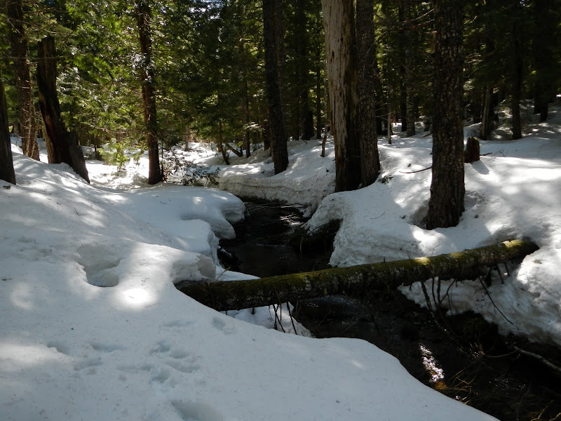
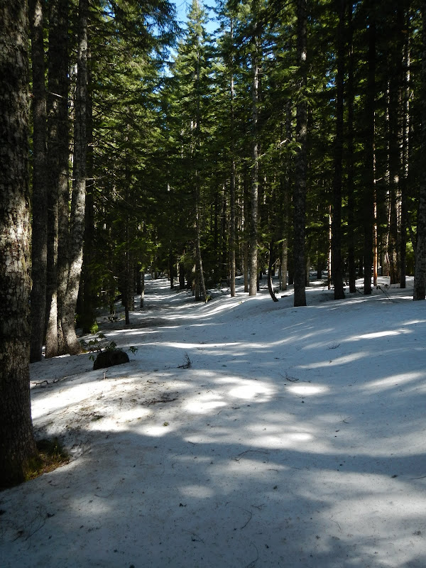
I hit solid snow at about 3000’ - the nominal location of the Moffett Tr (430). I followed up the E tributary of McCord Ck over deep but very walkable snow,
until I emerged at the power line corridor.
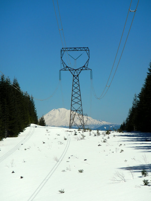
There’s a nice service road that goes almost all the way to the last tower before the drop into Tanner Ck and the start of the Upper Munra route.
The descent of Munra Ridge went fairly well, the only real challenge was the steep drop off at about 2800’. You can get around it be dropping off to the E or W – I did a little of both – but if you go W, be prepared to descend pretty far before traversing N. If you don’t like steep, dirt and moss covered, loose rock, approach this route with caution. It was pleasant walking the ridge, but I was glad to see Munra Pt come into view.
The grass widows were blooming – later here than at Catherine Ck – as I looked back the way I'd come.
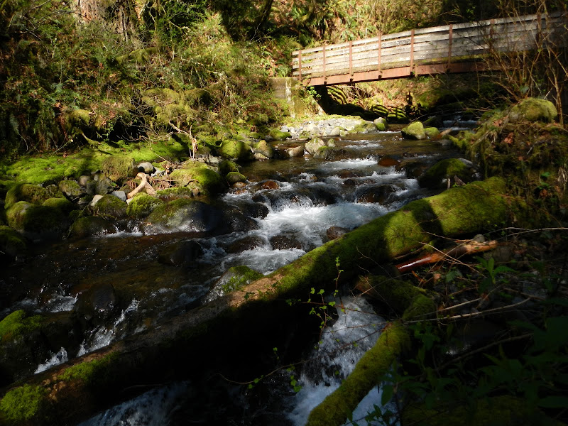
Then it was down to the 400 trail (or what’s left of it), over the bridge at Moffett Ck,
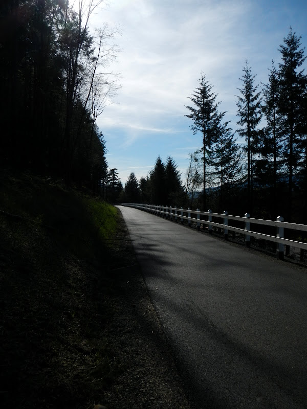
along the “new” 400 “trail” (which is pretty nice where it’s not right next to I-84),
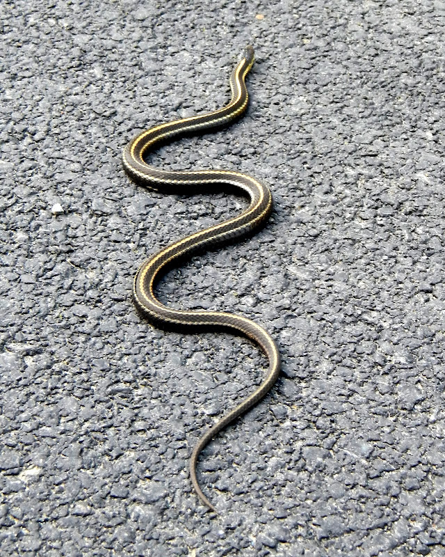
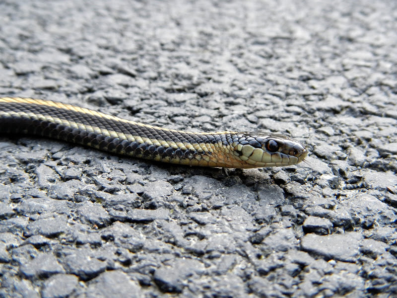
stopping to admire a really cool snake warming itself on the new asphalt,
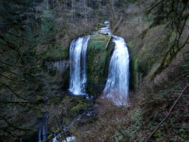
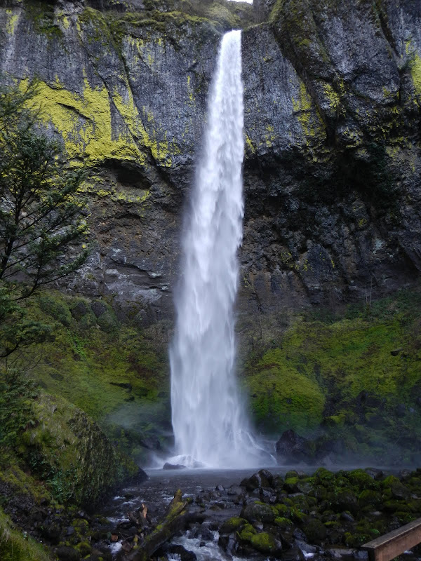
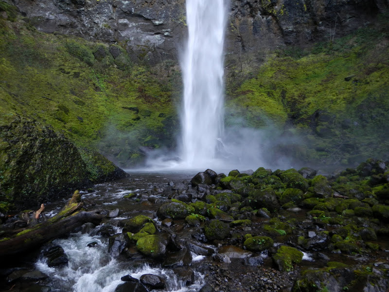
then finding part of the “old” 400 trail to get a view of (and refreshing blast of cold wet air from) Lower Elowah Falls,
before reaching the TH. A short (11.5 mi, 3500’ EG), but intense (95% essentially XC), hike thru some truly amazing and less visited parts of the Gorge.
Wauneka-Munra Loop 31-Mar-2013
Re: Wauneka-Munra Loop 31-Mar-2013
Thx for the trip report, terrific photos and for detailing this most impressive undertaking. I'm surprised the snow wasn't a problem as warm as it has been and the depth from your pictures make it look like it could all be gone there in a month. Seems like there is much less snow at this time of year than in the previous 2 years. Navigation on this route must have been fun.
Good stuff,
--Paul
Good stuff,
--Paul
The future's uncertain and the end is always near.
Re: Wauneka-Munra Loop 31-Mar-2013
Thanks! I thought the snow might be an issue too but it wasn't except for some spots under the canopy. Going fast though. Navigation was fun - easiest over the snow, trickiest getting around the "cliff" on Munra.pablo wrote:Thx for the trip report, terrific photos and for detailing this most impressive undertaking. I'm surprised the snow wasn't a problem as warm as it has been and the depth from your pictures make it look like it could all be gone there in a month. Seems like there is much less snow at this time of year than in the previous 2 years. Navigation on this route must have been fun.
Good stuff,
--Paul
Re: Wauneka-Munra Loop 31-Mar-2013
Thanks for the report. Ran into similar conditions when I did Nesmith a few weeks back. Looks like a lot of fun. Where you using snow shoes or was the snow easy enough to walk across without?
Go! Just Go right now! Go!
Re: Wauneka-Munra Loop 31-Mar-2013
No snow shoes, just boots. A little post holing but not enough to justify hauling snow shoes up the side of Wauneka Point!Badknee wrote:Thanks for the report. Ran into similar conditions when I did Nesmith a few weeks back. Looks like a lot of fun. Where you using snow shoes or was the snow easy enough to walk across without?
- Splintercat
- Posts: 8334
- Joined: May 28th, 2008, 10:03 pm
- Location: Portland
- Contact:
Re: Wauneka-Munra Loop 31-Mar-2013
Thanks, Van - excellent report! Great pictures from the vision quest "field", too -- great perspectives!
Tom
Tom
Re: Wauneka-Munra Loop 31-Mar-2013
Bruce - That is quite the epic loop at this time of year! I have been thinking about doing it too... and I also did the Munra ridge before I acquired a GPS.
Some people are really fit at eighty; thankfully I still have many years to get into shape…
- acorn woodpecker
- Posts: 240
- Joined: January 4th, 2013, 8:35 pm
Re: Wauneka-Munra Loop 31-Mar-2013
So funny that you posted this because I did the exact same loop in reverse on 3/29! Glad I didn't write up a TR yet since you covered much of the same things I did.
In lieu of my own TR, I'll just piggy-back off of your TR within this thread:
The flowers coming up Munra and south along Munra Ridge are outstanding. I bypassed the steep cliff on upper Munra Ridge by going west, which resulted in a strenuous schwack straight up the hillside to gain a few hundred feet to attain the ridge after at least a quarter mile. Shortly thereafter, I hit snow around 2900 ft and hit the power line road. You might have come across my snowshoe tracks, but they likely would have melted significantly after two warm days. The snow was so soft by afternoon that I scooted back into the forest to harder snow and caught the Wauneka Trail north of its junction with Moffett Creek trail. I thought I needed snowshoes but I question whether it was worth using them for a quarter of the hike and deal with them getting snagged on branches along both ridges below the snow line. The trail maintenance on upper Wauneka Ridge last year was certainly appreciated! The vision quest pits coupled with the view might just be one of my new favorite spots in the Gorge. Good thing it's difficult enough to get to that it's truly special to be up there! You had a clearer day than I did, but the view was still spectacular. Descending off Wauneka Ridge to McCord Creek was steep and route finding was tricky, at times. The game trails and flagging were sporadic, at best, but that just made the adventure factor and route finding skill-building all the better!
Wonderful that you were able to enjoy the remote splendors of the Gorge! There are some truly incredible loops to be done utilizing all those ridges! Thanks for your TR!
Re: Wauneka-Munra Loop 31-Mar-2013
Thanks and didn't mean to steal you chance for a TR. I wondered about those snow shoe tracks - still quite visible as I approached the turn toward Munra. Carrying snow shoes up Munra and then down Wauneka counts as totally heroic - no way I was going to do that even if it meant post holing the entire power line corridor (which wasn't necessary because the service road was nicely compacted).acorn woodpecker wrote:So funny that you posted this because I did the exact same loop in reverse on 3/29! Glad I didn't write up a TR yet since you covered much of the same things I did.
[...]
Wonderful that you were able to enjoy the remote splendors of the Gorge! There are some truly incredible loops to be done utilizing all those ridges! Thanks for your TR!
I did the Rudolph Spur - Ruckel Ridge loop yesterday - which seemed almost easy after the Wauneka-Munra adventure. Now I've spotted yet another ridge on Silver Star...
Re: Wauneka-Munra Loop 31-Mar-2013
Great report! I have been wondering about snow levels. Still a bit too much for my tastes. That's a great hike btw, we do different versions at times but almost always go up Munra Point first. Sometimes we come down The Gap and other down to McCord Falls. There is a pretty good log crossing a little ways up McCord Creek.
Here's a bit of a warning for hikers doing this hike. Going up from The Gap to the Indian Pits is pretty straight forward but note your terrain as you go. Coming back down is the problem, my first trip my hikers wanted to head back the wrong way. I even lost one last year on the way down. He stopped to tie his shoe and then promptly headed off the wrong way. Finally found his way out down Moffet Creek. Its sort of like Mt Hood in the fog.