
We'll be working with the Trailkeepers of Oregon to build the first section of the route starting just north of the powerlines. It will climb through the oak forest taking advantage of some parts of an old road grade. If you'd like to lend a hand building this trail with me on March 16/17, sign up at: https://docs.google.com/spreadsheet/vie ... c6MA#gid=0
I'll be leading crews there Saturday and Sunday. You can come for either day or both. On Saturday we'll be having a potluck at the Fisher Hill Campground. After the work party on Saturday, Cyndi Solitz will give a 20 min. presentation on how to ID invasive weeds and report them for rapid response.
The trail will wind up the side-hill adjacent to this old road grade.
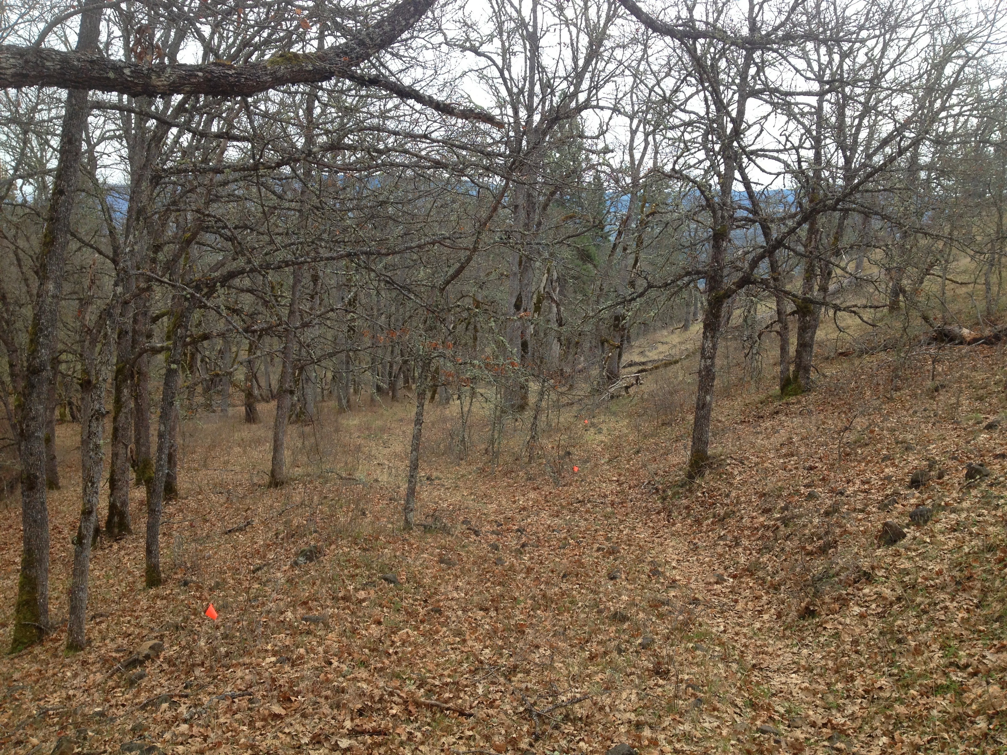
Catherine Creek - Ca3
As it climbs out of the valley it will curve around some nice big evergreens.
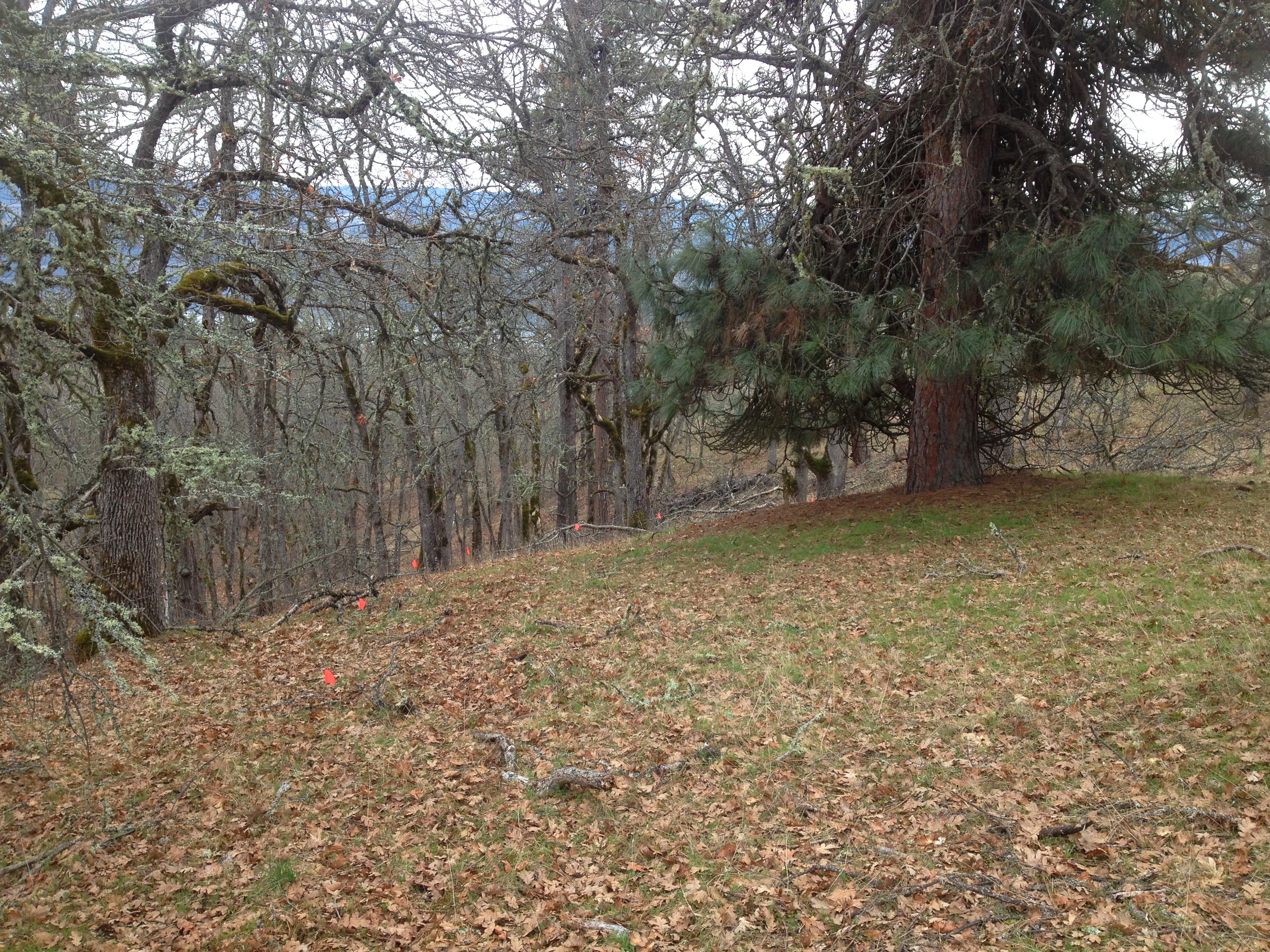
Catherine Creek - Ca3
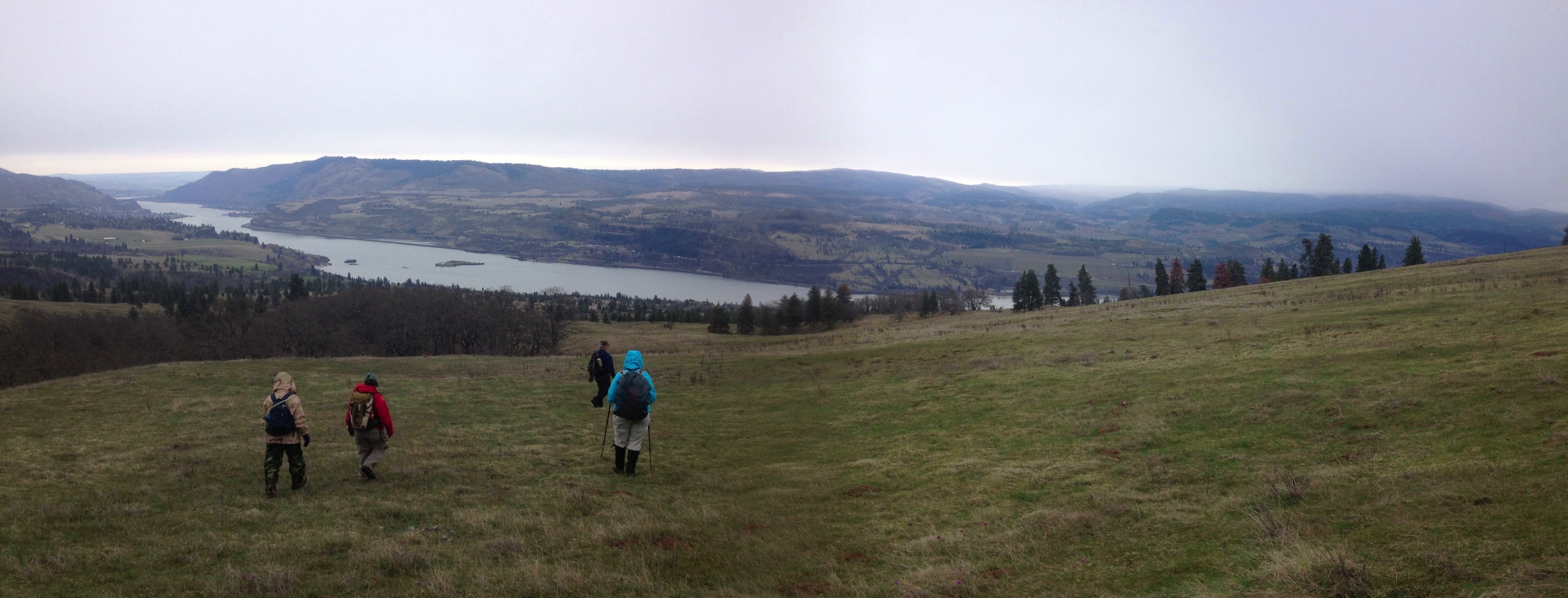
At the top of the Meadows the views are spectacular. Building a trail up there is a challenge since trails on such meadows tend to turn into ruts, then multiple braids. So we're not going to build anything up there now until we figure out the best route. For now I encourage folks to spread out and practice good off-trail etiquette.
Catherine Creek - Ca3
This map shoes the conceptual layout, but it will likely be tweaked depending on conditions on the ground.
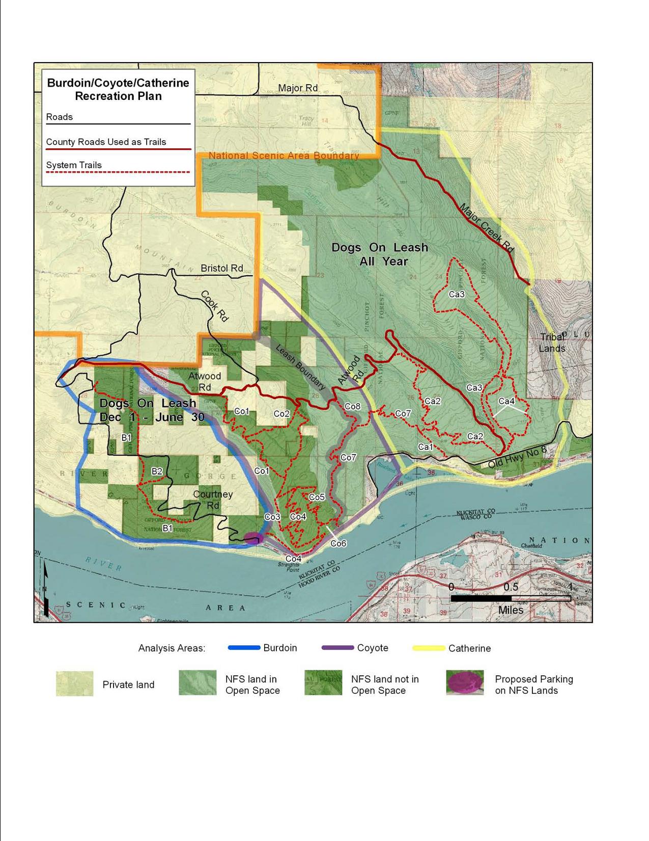
CoyoteWall-CatherineCrk_Map
Here is a link to the map track with photos of the section we'll be working on next weekend (March 16/17)
http://www.everytrail.com/view_trip.php?trip_id=2041701

