A Long March to Larch 01-Mar-2013

This forum is used to share your experiences out on the trails.
Post Reply
User avatar
VanMarmot
Posts: 1924
Joined: May 28th, 2008, 10:03 pm
Contact:

A Long March to Larch 01-Mar-2013

Post by VanMarmot » March 2nd, 2013, 8:06 am

After getting a taste for the roads behind Devils Rest last month (Palmer Rd TR), reading Jack’s informative TR about conditions on Larch Mtn last week (Jack’s TR), and spending probably more time than I should looking at maps, a plan for a big loop over Larch Mtn emerged. I left the Wahkeena Falls TH under low clouds into what would be a graybird day, all day.

Image

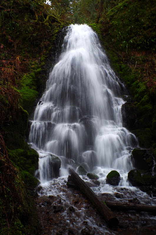
Fairy Falls were going nicely as I passed them on the way to the Devils Rest (420C) trail.

Image

Once on the 420C, I had a great “view” of the inside of the grayjay.

Image

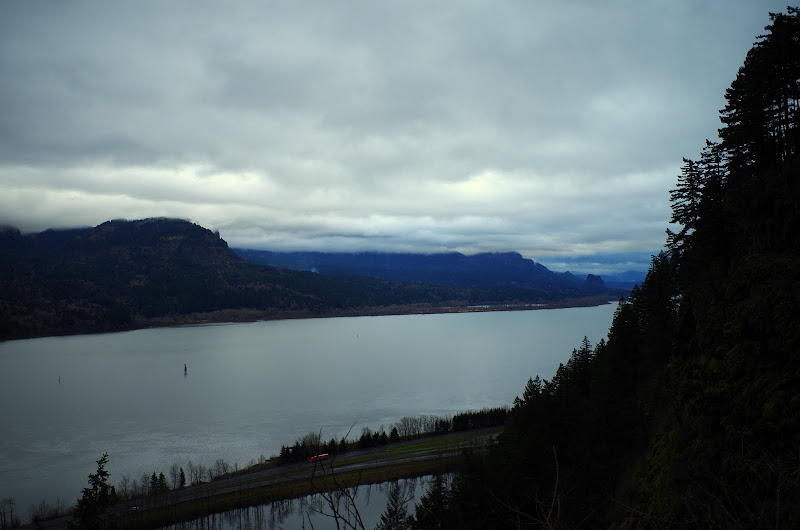
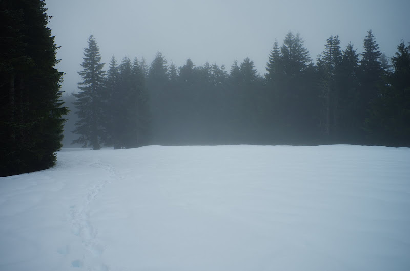
The trails to this point had been entirely snow-free, but that changed once I reached Rd 129.

Image

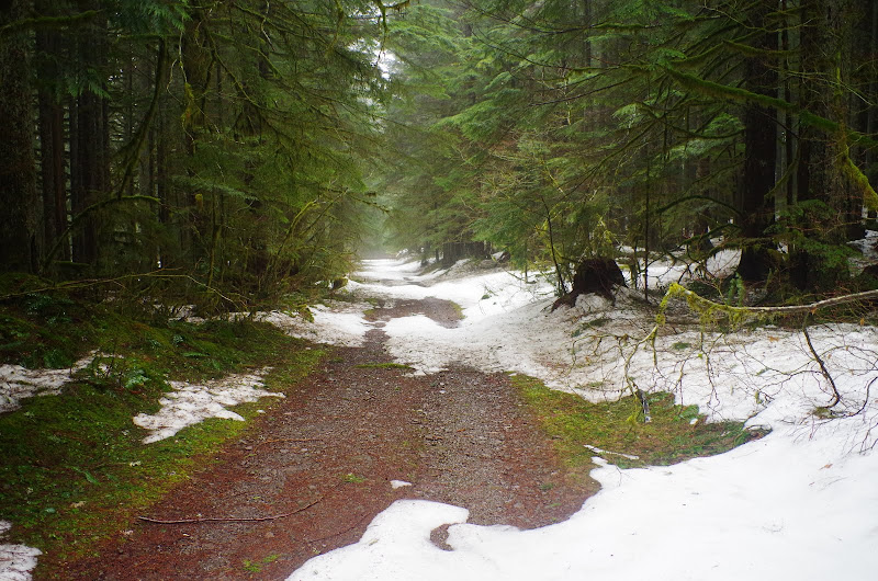
I took Rd 129 S to its junction with Rd 1520, and continued S on Rd 1520 through ever deepening snow. The snow shoes went on here and stayed on all the way to the Franklin Rdg / Oneonta Ck trail junction on the other side of Larch.

Image

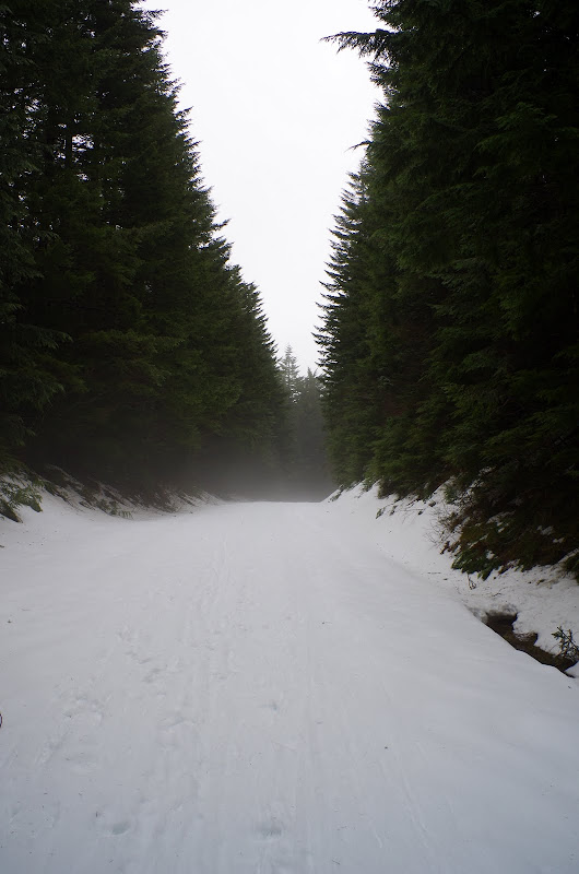
After about a mile on 1520, I left it and went briefly XC to intersect the Larch Mtn Rd (Rd 15) near MP 10. This road is, of course, completely snow-covered.

Image

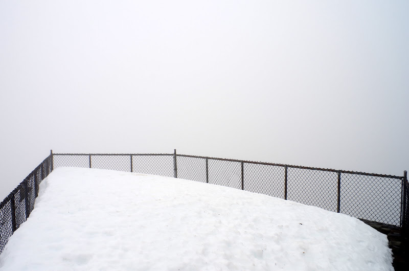
I proceeded up the road and then cut over to the Larch Mtn trail (441), which I took to Sherrard Point,

Image

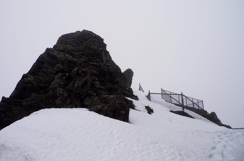
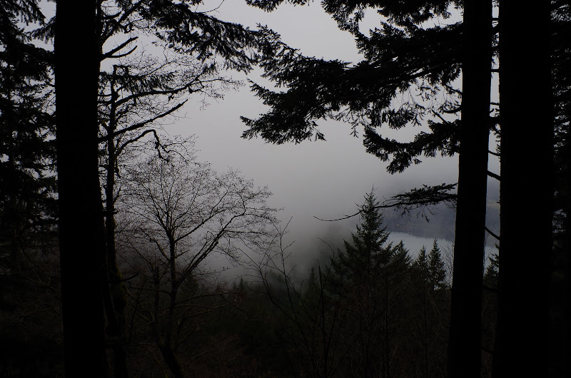
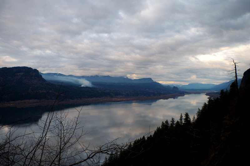
which was not forthcoming with “views” today.

Image

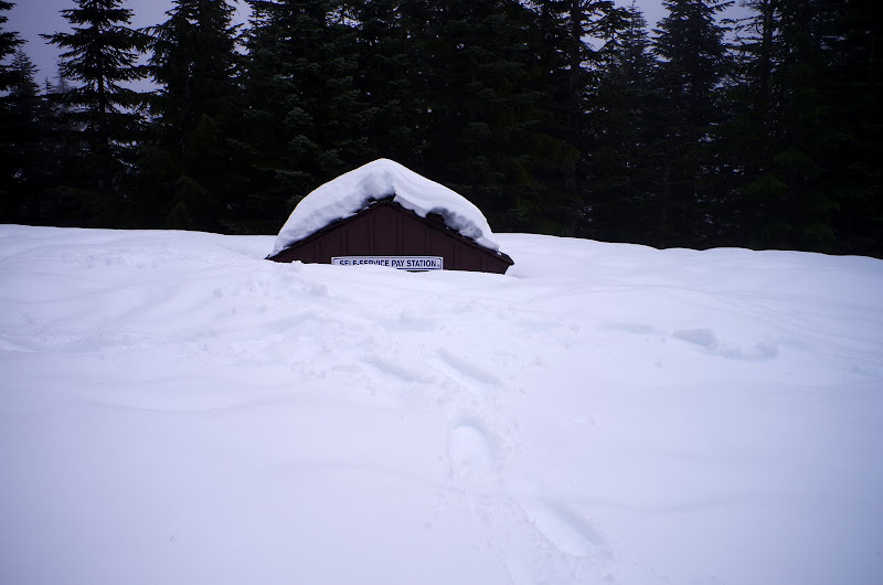
After a quick lunch, I headed through the Larch Mtn parking lot, which, although a sea of largely untracked deep snow,

Image

still provided an opportunity to pay. (I'd followed a set of posthole tracks up the 441 - these holes continued, getting deeper, across the parking lot and down the road, presumably back to the snow gate. If so, it was a pretty serious workout!)

Image

The route from the Larch Mtn Rd / Tr 424 junction over to Franklin Rdg was all XC on untracked snow. The GPS came in real handy here. I hit the Oneonta / Bell Ck trail junction spot on,

Image

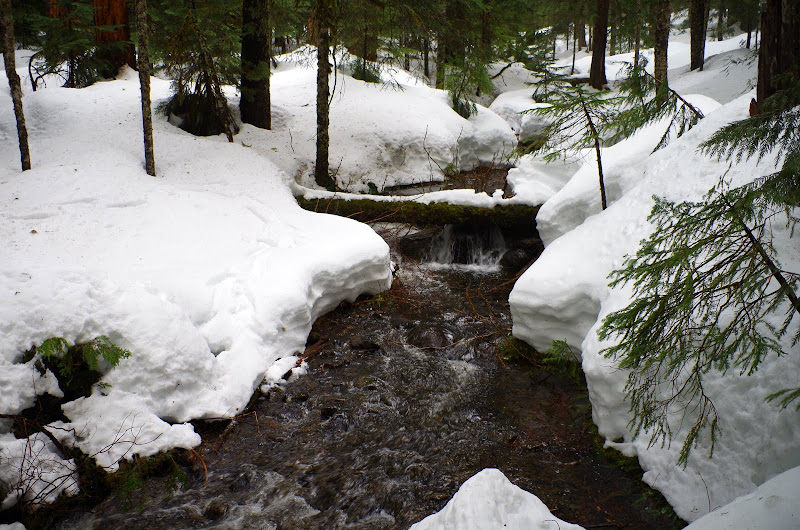
in snow that was at least 4-5’ deep, as evidenced by this view of upper Oneonta Ck.

Image

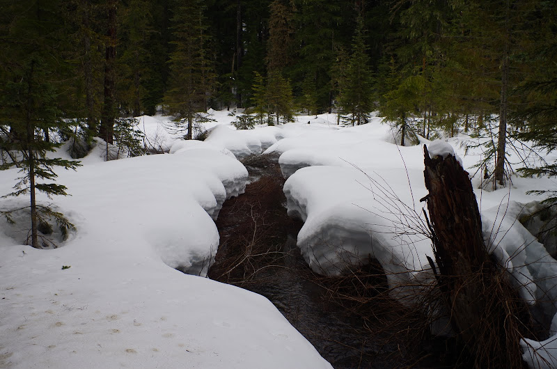
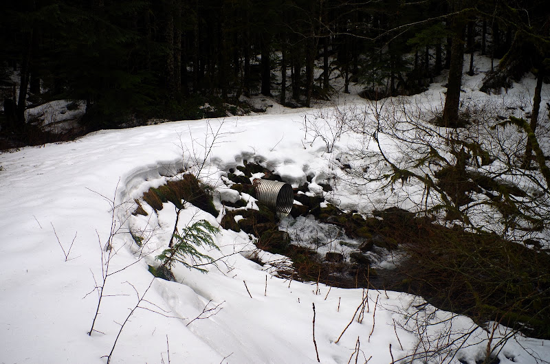
Another tributary of Oneonta Ck had to be crossed,

Image

enroute to Franklin Rdg, where the snow finally abated and the snow shoes came off. Then it was down the Franklin Rdg and Larch Mtn trails to above Multonomah Falls, where a brief trip through h*ll (My boots are good, but I feared for their immortal soles. :twisted: ), provided a less cloudy view of the Gorge and a shorter return to the TH and my car.

Image

This was a slightly longer (17.5 mi RT, 4200’ EG) way to get to Larch Mtn than out-and-back on the Larch Mtn Tr (441) but the chance to explore the untracked winter landscape in the upper Oneonta Ck drainage (and that passage through h*ll :twisted: ) were well worth it.

Image

User avatar
kepPNW
Posts: 6411
Joined: June 21st, 2012, 9:55 am
Location: Salmon Creek

Re: A Long March to Larch 01-Mar-2013

Post by kepPNW » March 2nd, 2013, 8:34 am

I really like that loop idea! Gotta keep that one in mind for "something different" someday.

And that last shot, with the reflections on the Columbia, is beautiful. I wonder what all that smoke is about, though?

Looks like a great day!
Karl
Back on the trail, again...

User avatar
Crusak
Posts: 3617
Joined: August 6th, 2009, 7:33 pm
Location: Oregon

Re: A Long March to Larch 01-Mar-2013

Post by Crusak » March 2nd, 2013, 10:30 am

Nice report! The roads around the Larch Mtn and Multnomah Basin area are on my list of things I want to explore soon. Doing them in the snow appears to be an excellent choice.

The snow doesn't look that deep until you compare it to the signs on the trees, and the channel of the creek. Still quite a bit of snow up there!
Jim's Hikes

Solvitur Ambulando

User avatar
Jack
Posts: 325
Joined: November 22nd, 2011, 3:36 pm

Re: A Long March to Larch 01-Mar-2013

Post by Jack » March 2nd, 2013, 11:14 am

Another remarkable loop creation, VM! Making your way through the upper Oneonta Tr., where the snow reallly piles up must have been a workout in itself. I can't even imagine doing the passage through "h" detour after covering those first 16 miles. I agree with Karl, I particularly like that last pic, among others. Nice TR!

User avatar
VanMarmot
Posts: 1924
Joined: May 28th, 2008, 10:03 pm
Contact:

Re: A Long March to Larch 01-Mar-2013

Post by VanMarmot » March 2nd, 2013, 5:36 pm

Jack wrote:Another remarkable loop creation, VM! Making your way through the upper Oneonta Tr., where the snow reallly piles up must have been a workout in itself. I can't even imagine doing the passage through "h" detour after covering those first 16 miles. I agree with Karl, I particularly like that last pic, among others. Nice TR!
Thanks! I always felt bad for having taken the "h" detour for granted - figuring it would always be there - so a quiet day in winter seemed like the best time to remedy my oversight.

User avatar
Splintercat
Posts: 8333
Joined: May 28th, 2008, 10:03 pm
Location: Portland
Contact:

Re: A Long March to Larch 01-Mar-2013

Post by Splintercat » March 2nd, 2013, 6:57 pm

...a brief trip through h*ll (My boots are good, but I feared for their immortal soles.)
Excellent, Van! I do look forward to the day when eternal damnation is once again a legitimate hiking destination...

Tom :)

Chelle
Posts: 9
Joined: February 10th, 2011, 7:37 pm
Location: Forest Grove

Re: A Long March to Larch 01-Mar-2013

Post by Chelle » March 5th, 2013, 4:05 pm

Nice....go there so often, was wondering about variable options. Thanks!

Post Reply