This was my second hike of this loop from the Dog Mtn TH, over Augspurger, over Dog, and back to the TH. Once again, I was lured out by promises of "partly sunny" which only provided partially (very partially) true. The "slog" part involved an early (to minimize exposure to traffic) hike E on Hwy 14 to the Cook-Underwood Road.
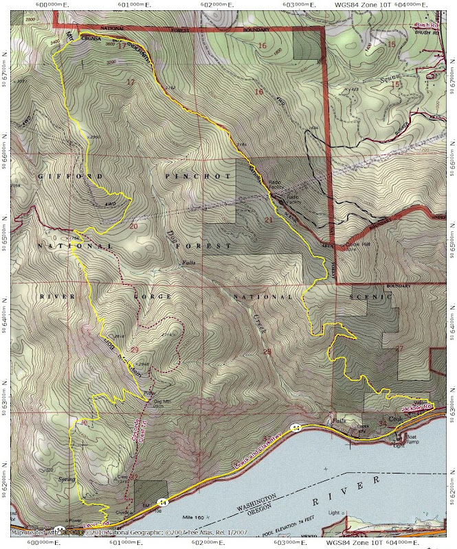
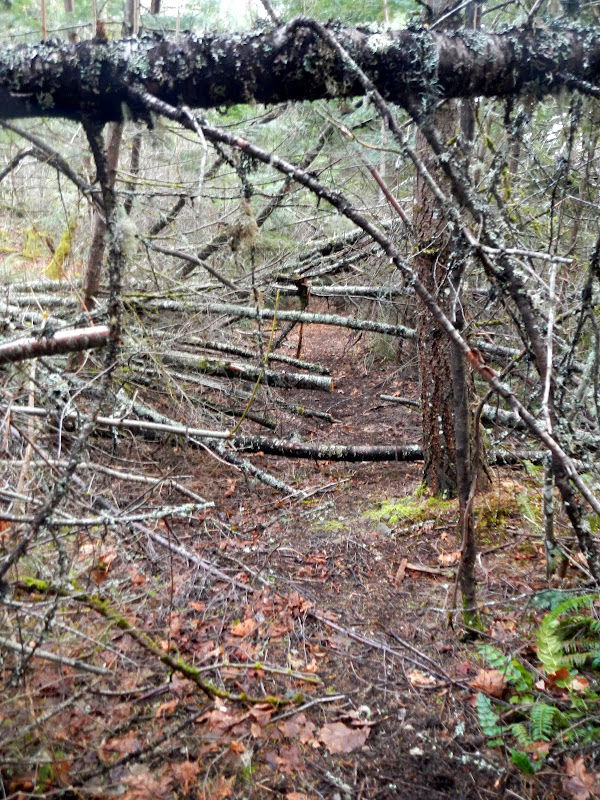
From there, I worked my way on to the old dirt road that goes all the way up to the radio facility on the saddle N of Cook Mtn. There was more blowdown on the road than when I hiked it last year - and some had been cleared - but what remained wasn't too hard to get through.
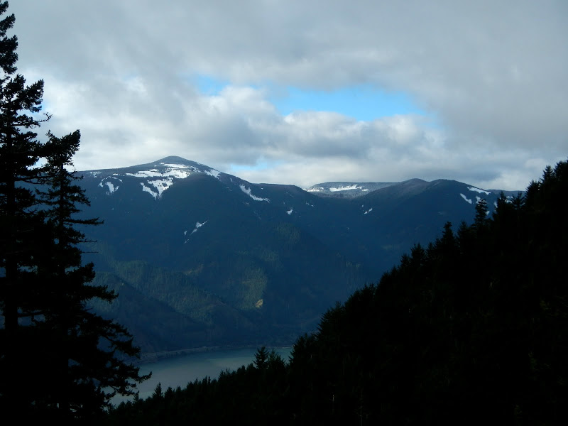
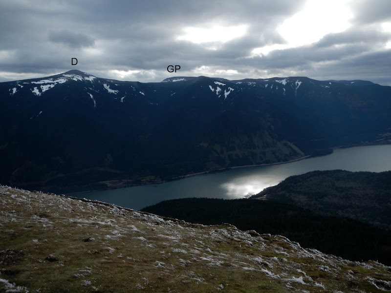
The day started out partly sunny but by the time I'd climbed to a view of Defiance (with Green Point Mtn beyond), clouds were starting to work their way in,
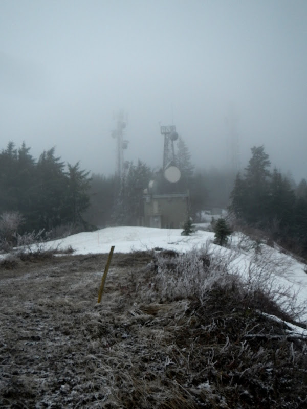
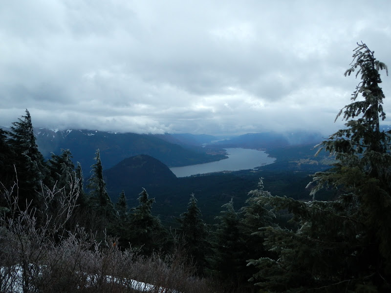
leading to low visibililty conditions at the radio facility.
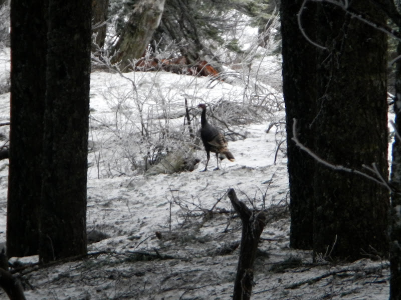
I used snow shoes part way up the road, and all the way to Augspurger, but only for traction. Microspikes would have been fine (and easier to carry). Just beyond the radio towers I came across a wild turkey wandering on the icy, wind-swept ridge. So I wasn't the only turkey out hiking in these partly sunny conditions.
There are a few spots on Augspurger's SE ridge where you can see Adams - but not today. All this misty gloom made me think of Jack's photos from Dog about a month ago - a lot of gray. I didn't realize how prophetic this thought would be.
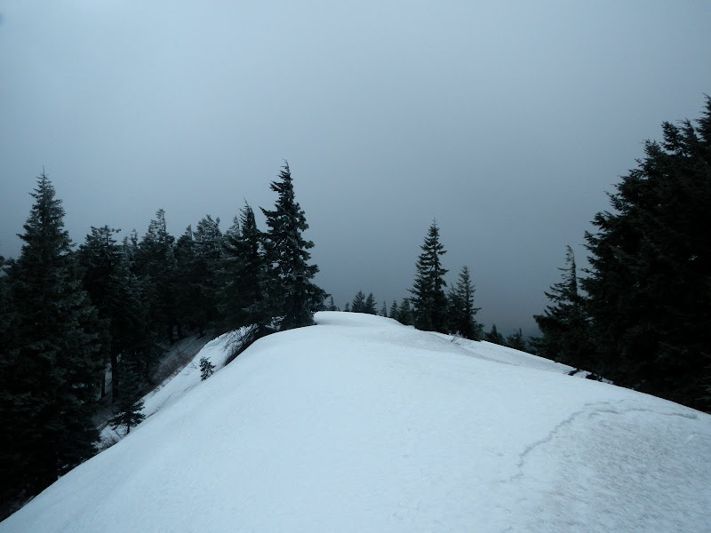
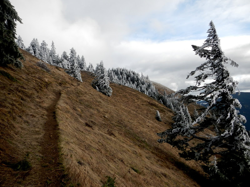
I was worried that the ridge might present snow/brush problems, but the snow buried the brush into a smooth, somewhat icy highway all the way to the summit. It was actually easier - even with snow shoes - than in the summer when you have work your way over and around brush and fallen trees.
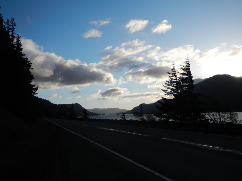
It was a bit cold and windy on the summit, so I had a quick lunch and headed on down Augspurger's S ridge. Almost immediately I ran into four people coming up - Clark, Lin-ae, Spitfire, and (of course) Jack! I almost took a photo of the mist in his honor! We had a nice chat, then they continued on up and I continued down for my rendezvous with Dog. On the way, I had a view of Wind Mtn and the "partly sunny" conditions in the Gorge.
It was a little windy and quite cold on the open ridge above the powerlines.
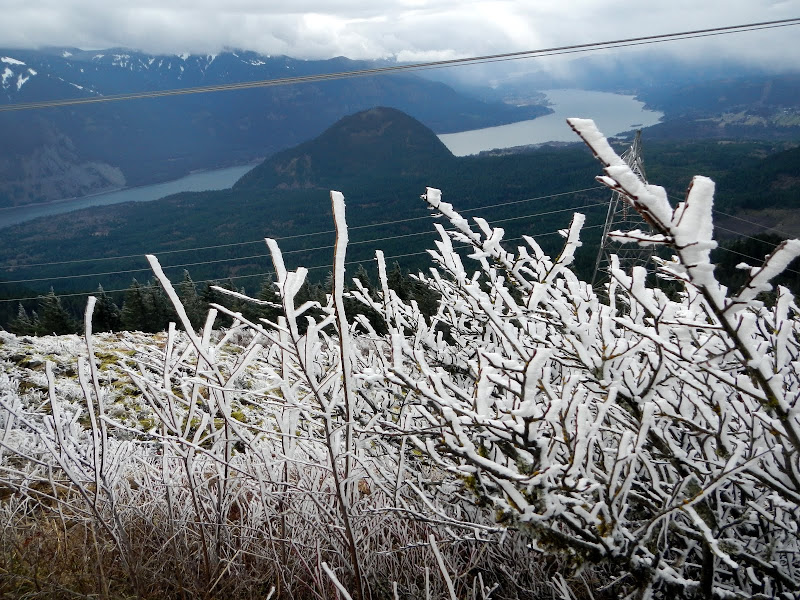
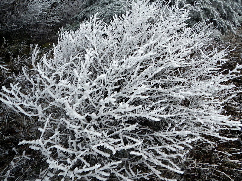
The trail cuts back into a snow-packed canyon shortly after this point, so I took a short-cut directly down to the power line road and headed toward the continuation of the trail, only to discover that 100 yds or so of the road had been dismantled presumably to discourage what - ATVs, traffic, drag racing? A new tread is being formed but right now it's up and down over dirt piles and slash. There was no snow on the trail up to Dog or on its slopes but all the trees were trimmed in rime ice.
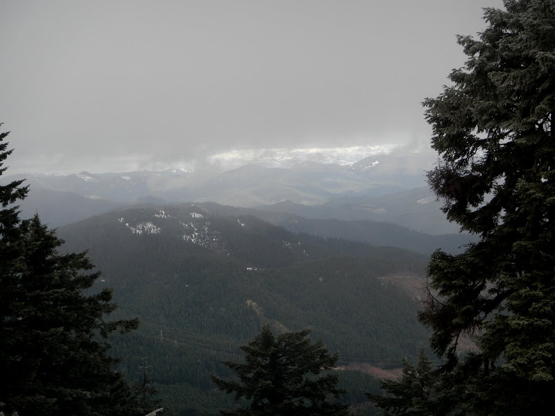
Partly sunny over Defiance (D) and Green Point Mtn (GP!).
It wasn't exactly toasty on the summit of Dog but there were still a few folks bravely hiking up in jeans and sneakers, without a hat or gloves. Going under-equipped must build character. Warm, but possibly lacking in character, I made a beeline for the TH and the even warmer confines of my car. This is a good hike (16 mi RT, 4700' EG) - I just have to do it on a warm, fully sunny, clear day!
The SAD (Slog/Aug/Dog) Loop - 17-Feb-2013
- Sean Thomas
- Posts: 1647
- Joined: February 25th, 2012, 11:33 pm
Re: The SAD (Slog/Aug/Dog) Loop - 17-Feb-2013
Nice report, Van. That shot of the dog mtn trail with the rime covered trees looks pretty cool with the snowless ground. I used to hike in jeans Bill Sullivan style too, turns out they make pretty good fire starter
Re: The SAD (Slog/Aug/Dog) Loop - 17-Feb-2013
That's a great hike and greater workout. Not that I can say so from personal experience (I've never been on the Augspurger side of things up there).
During spring/summer isn't there a problem on the Augspurger side with poison oak? I seem to recall reading about that in TRs. That would be an excellent reason to do that on the snow.
Re: The SAD (Slog/Aug/Dog) Loop - 17-Feb-2013
Great Report Bruce, that loop has been on my radar for a while, I'm going to pencil it in for a Sunny Day though :^)..
Re: The SAD (Slog/Aug/Dog) Loop - 17-Feb-2013
Poison oak is probably only an issue on the short section from Johnson Rd (off Cook-Underwood Rd) to the old dirt road. You can avoid this by staying on Johnson until it becomes the dirt road. After that, PO is not an issue.Crusak wrote:That's a great hike and greater workout. Not that I can say so from personal experience (I've never been on the Augspurger side of things up there).
During spring/summer isn't there a problem on the Augspurger side with poison oak? I seem to recall reading about that in TRs. That would be an excellent reason to do that on the snow.
Last edited by VanMarmot on February 19th, 2013, 7:47 am, edited 1 time in total.
Re: The SAD (Slog/Aug/Dog) Loop - 17-Feb-2013
Nice Van! Thanks for the report. I'd heard the southern approach up Cook Hill (a peak ironically slightly higher than Dog Mtn) got slammed in the big ice storm last winter and was curious about its status.
If you bear right at the radio facility, there's an old road that runs along the crest over to the saddle just before Cook. Short trail up through a narrow band of forest and you can head up open meadows to tag Cook's summit. This turns the route into "The CAT (C-ook / A-ugsperger / T-raverse) & The Dog" for a triple summit day. Good workout. The route between Cook & Augsperger is pretty cool with the pop-tin tops affixed to the trees to mark the way.
- Eric Peterson
- Posts: 4097
- Joined: May 11th, 2009, 5:39 am
- Location: Oregon
- Contact:
Re: The SAD (Slog/Aug/Dog) Loop - 17-Feb-2013
Been wondering about those pop tin tops, quite a few over on the approach to Augspurger as well. Is that a Mazama thing?
Re: The SAD (Slog/Aug/Dog) Loop - 17-Feb-2013
I hope you weren't still in them when the fire started?Sean Thomas wrote:Nice report, Van. That shot of the dog mtn trail with the rime covered trees looks pretty cool with the snowless ground. I used to hike in jeans Bill Sullivan style too, turns out they make pretty good fire starter
Re: The SAD (Slog/Aug/Dog) Loop - 17-Feb-2013
Thanks! I'll put this (the SCAD Loop? ) on my "to do" list for that warm, sunny,clear day which is sure to happen eventually.mandrake wrote:Nice Van! Thanks for the report. I'd heard the southern approach up Cook Hill (a peak ironically slightly higher than Dog Mtn) got slammed in the big ice storm last winter and was curious about its status.
If you bear right at the radio facility, there's an old road that runs along the crest over to the saddle just before Cook. Short trail up through a narrow band of forest and you can head up open meadows to tag Cook's summit. This turns the route into "The CAT (C-ook / A-ugsperger / T-raverse) & The Dog" for a triple summit day. Good workout. The route between Cook & Augsperger is pretty cool with the pop-tin tops affixed to the trees to mark the way.
Last edited by VanMarmot on February 26th, 2013, 7:44 am, edited 1 time in total.
Re: The SAD (Slog/Aug/Dog) Loop - 17-Feb-2013
Probably not "official" Mazamas.Eric Peterson wrote:Been wondering about those pop tin tops, quite a few over on the approach to Augspurger as well. Is that a Mazama thing?
Last edited by VanMarmot on February 20th, 2013, 4:39 pm, edited 1 time in total.