Archer Mtn Loop 15-Feb-2013

This forum is used to share your experiences out on the trails.
User avatar
VanMarmot
Posts: 1924
Joined: May 28th, 2008, 10:03 pm
Contact:

Archer Mtn Loop 15-Feb-2013

Post by VanMarmot » February 15th, 2013, 5:01 pm

Archer Mtn came to mind because I'd never been there before and it seemed a short enough hike to allow me to pretend that I was only going to be away from work for the morning. :roll: The overcast in Portland evaporated just past Camas and it was (of course) bluebird conditions by the time I reached the parking area at the end of the Smith-Cripe Rd. Using Don Nelsen's route description from SummitPost as a guide, I was soon off. At the "Y" in the road with the metal post, I made a sharp RT turn toward Archer - later I would find that the Ridge Top Trail comes out on this same road.

Image

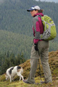
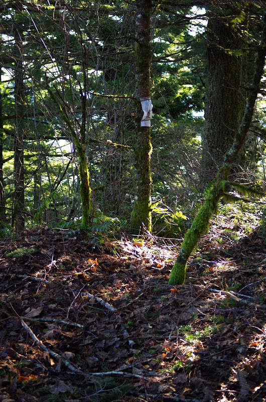
The route is all use trails and old roads but - if you pay attention - it's not too hard to follow.

Image

Down, across the creek, and then up the side of Archer on a decent use trail, with a good view of my return route - the ridge top across the valley.

Image

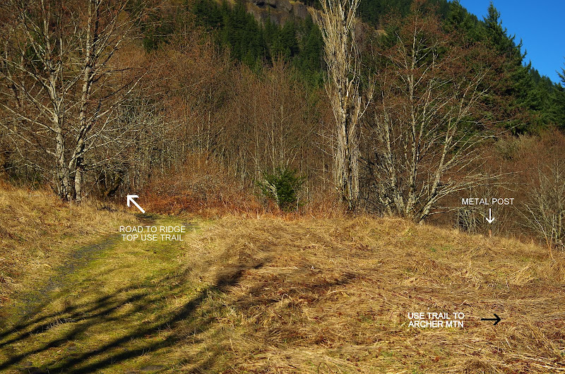
I had planned to cross the hanging meadows part way up Archer so as to contour out to the view point at its southern end but I became beguiled by some new flagging that went straight up toward the summit - and hence missed the meadow traverse (giving me a good reason to come back). Archer's summit is apparently not known for its views.

Image

From the summit, I contoured down to meet a very old road/trail that took me N to the powerline service road.

Image

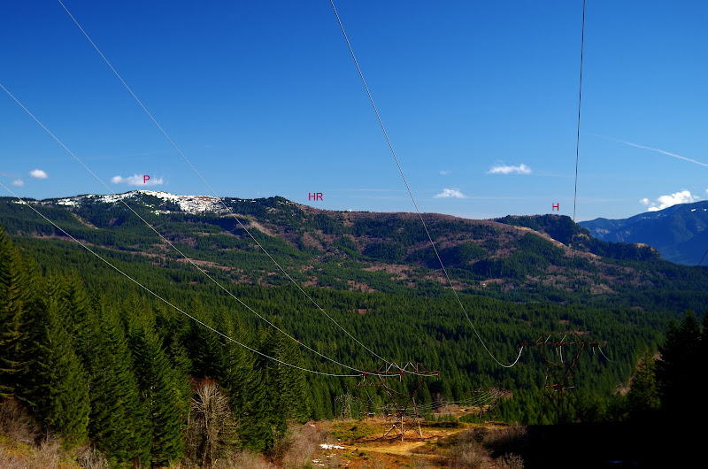
The service road climbs as it heads W, so you get a good view of Phlox Point (P), Hardy Ridge (HR), and Hamilton (H) to the E.

Image

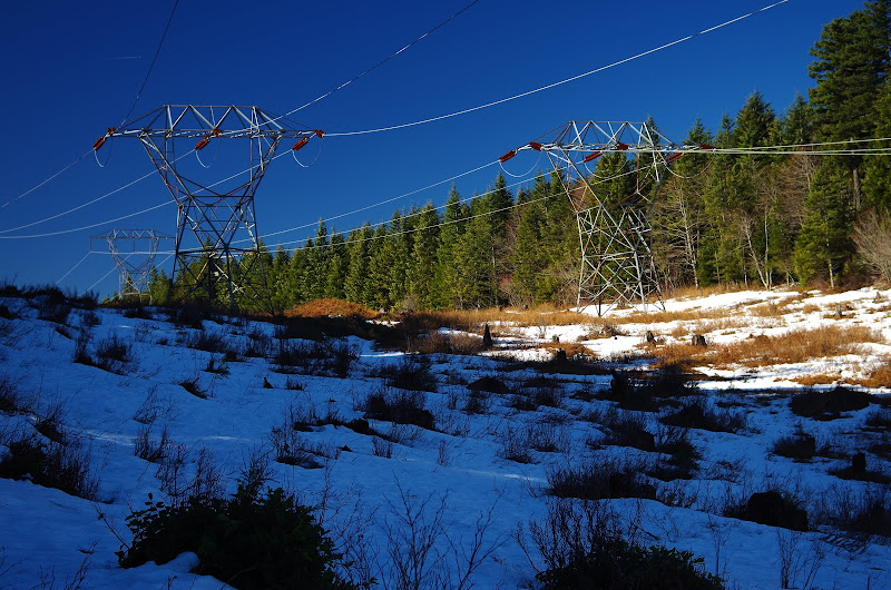
There was still snow at the top of the ridge - just enough and just soft enough to make walking on it tedious.

Image

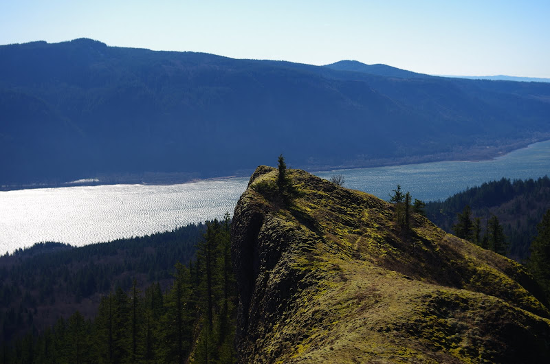
When the power line road topped out, I turned S and headed - more or less in a straight line - for the ridge top. The brush/snow mix inside the forest killed my enthusiasm for finding the view point for 214' Archer Falls (next time). After some thrashing - and passing 4 folks and a dog coming up the ridge - I found the old, old road that runs out to the end of the ridge. From there a really fun use trail takes you out along and down the ridge - think Munra Point but on a bigger scale.

Image

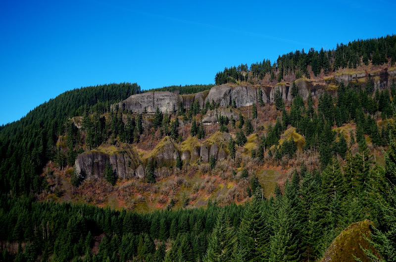
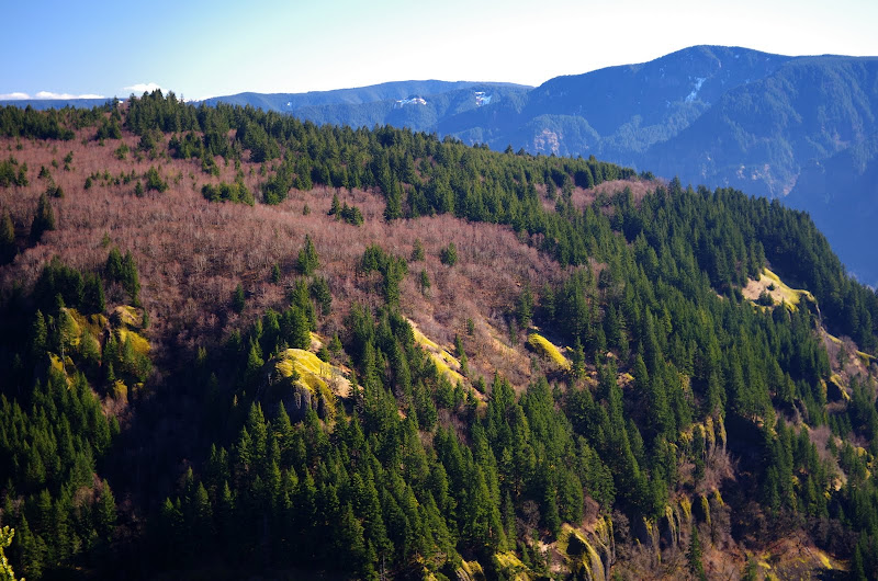
Walking along the ridge, I got a great view of Archer,

Image

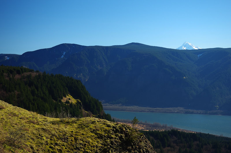
and of Archer and Hood.

Image

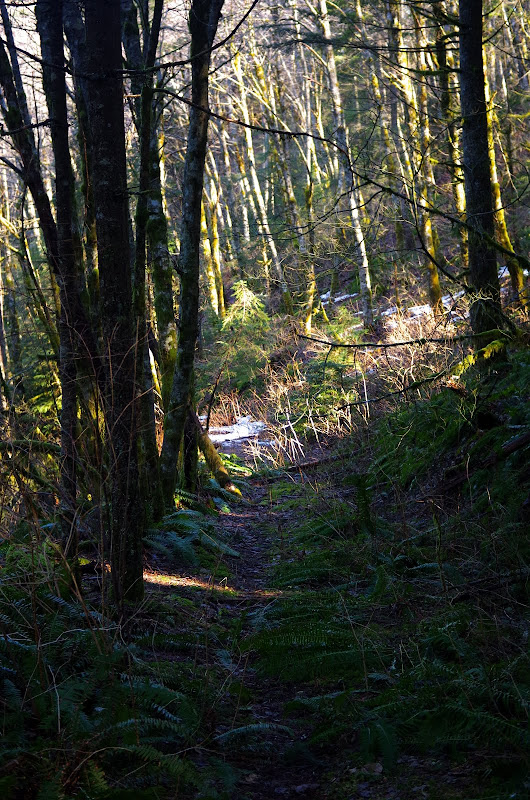
The use trail down the ridge is only steep in a few places and, lower down, it turns into nice switchbacks which end at an old homestead just a short ways up the road from the turnoff to Archer. A perfect loop! :D Only 6.2 mi RT and 1600' EG, so I was - technically - back at "work" by early afternoon.

Image

cfm
Posts: 1097
Joined: June 18th, 2008, 6:49 am

Re: Archer Mtn Loop 15-Feb-2013

Post by cfm » February 15th, 2013, 5:29 pm

Nice to meet you!

We did a slightly different route( and reverse) of your trip. What a great day!
Attachments
Archer Route.jpg
Archer Route.jpg (110.63 KiB) Viewed 3421 times

User avatar
Don Nelsen
Posts: 4380
Joined: May 28th, 2008, 10:03 pm
Location: Vancouver, WA

Re: Archer Mtn Loop 15-Feb-2013

Post by Don Nelsen » February 15th, 2013, 5:51 pm

Wow - nice report and really nice pics! Archer is a real treasure, for sure.

dn
"Everything works in the planning stage" - Kelly

"If you don't do it this year, you will be one year older when you do" - Warren Miller

User avatar
awildman
Posts: 918
Joined: June 6th, 2009, 5:20 pm
Location: Portland

Re: Archer Mtn Loop 15-Feb-2013

Post by awildman » February 15th, 2013, 6:04 pm

The Archer Falls overlook is a worthwhile detour. I am curious about your route up Archer. It looked like we were farther east, which was also quite nice. The mossy scree slope north of the natural gas line was my favorite bit. Great report!

-One of the four plus dog :)
Rambling on at Allison Outside

User avatar
Eric Peterson
Posts: 4097
Joined: May 11th, 2009, 5:39 am
Location: Oregon
Contact:

Re: Archer Mtn Loop 15-Feb-2013

Post by Eric Peterson » February 15th, 2013, 6:22 pm

Nice job all!

Here's another screen shot taken from the Gorge Mapset I've been compiling from PH'rs
tracks -

Image

Green = USFS
Blue = WA DNR
White = Private

User avatar
Born2BBrad
Posts: 1086
Joined: May 1st, 2011, 7:26 pm
Location: The Dalles

Re: Archer Mtn Loop 15-Feb-2013

Post by Born2BBrad » February 15th, 2013, 7:42 pm

Ah, the Archer Mt. Complex. One of my favorite areas.

The DN Summit Post map is how I came to know the area too. It's one of those areas you just have to explore to find out what is all there.

Hike on,
Brad
Make now always the most precious time. Now will never come again.
- Jean Luc Picard

Link to GPX tracks
Link to Trip Reports

User avatar
Peder
Posts: 3401
Joined: May 28th, 2008, 10:02 pm
Location: Lake Oswego

Re: Archer Mtn Loop 15-Feb-2013

Post by Peder » February 15th, 2013, 10:19 pm

Great weather and report Bruce! You also need to visit the viewpoint/picnic spot below the "n" in Archer Mtn; the little ridge leads to a great overlook.

EP: I see from your map set that I have some more exploring to do!

cfm: You go down the south face?! I tend to come up that way, but always have "problems" on the last 50 yards before the trail.
Some people are really fit at eighty; thankfully I still have many years to get into shape…

User avatar
acorn woodpecker
Posts: 240
Joined: January 4th, 2013, 8:35 pm

Re: Archer Mtn Loop 15-Feb-2013

Post by acorn woodpecker » February 15th, 2013, 10:33 pm

Great pictures and a great day, indeed. Glad the fog lifted in the Gorge.

quote="Peder"]You also need to visit the viewpoint/picnic spot below the "n" in Archer Mtn; the little ridge leads to a great overlook.EP: I see from your map set that I have some more exploring to do![/quote

That spur ridge overlook is the best spot on the east side of Archer.
Peder wrote:EP: I see from your map set that I have some more exploring to do!
[

No kidding, EP. That is the most extensively named map of Archer I've seen!

cfm
Posts: 1097
Joined: June 18th, 2008, 6:49 am

Re: Archer Mtn Loop 15-Feb-2013

Post by cfm » February 15th, 2013, 10:35 pm

I've been visiting this area since 2003 I think I've been up here about 6 or 7 times, and this is the first time I've ever seen another human. I always take a different route, and still there is so much more to discover.

Here is the view from our early lunch spot right before we ran into Mr Vanmarmot.
Archerfalls.jpg

User avatar
romann
Posts: 2417
Joined: May 28th, 2008, 10:03 pm
Location: Vancouver, WA

Re: Archer Mtn Loop 15-Feb-2013

Post by romann » February 16th, 2013, 1:31 am

It's a great place for orienteering exercise. Last year I did both sides but not the loop. Even with the map it was a challenge to find trail standing next to it.

Very nice views up there too.

Post Reply