

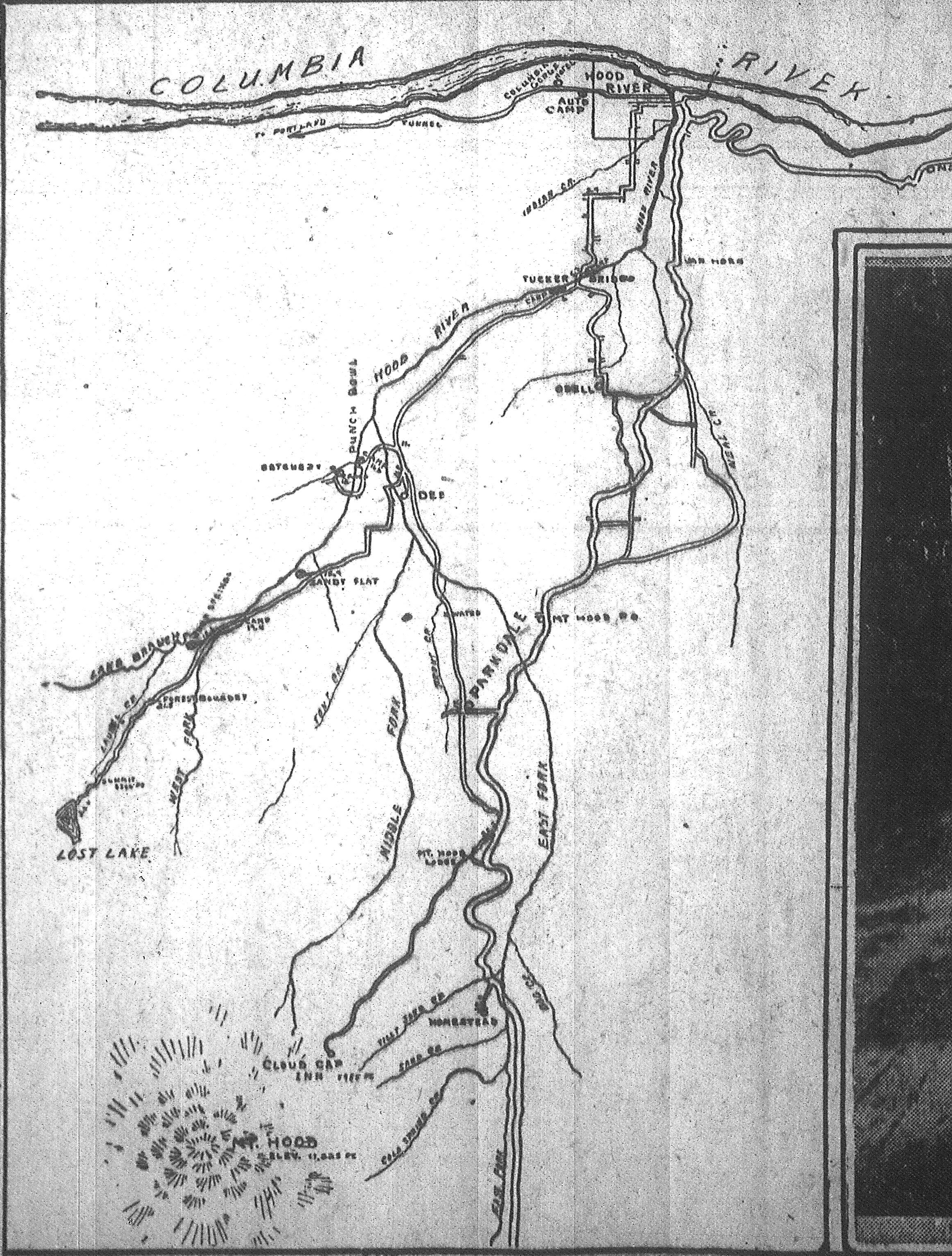
I'm focusing on the area along the Lost Lake Highway, stretching from the mill down of Dee to Lost Lake. I can't make out some of the place names along the way, but so far among the names lost to time is Sandy Flat. I'm pretty sure the point labeled just west of where the road leaves the West Fork reads "forest boundary". Also in the area is Punch Bowl, Hatchery and several mileage ticks along the highway(with distances from Hood River). There was another spot called Camp Overall somewhere along the West Fork Hood River, but I don't see it on this map.
So, if you know this area, and have any insights, let me know! Here's a much larger version of the map:
Large Stranahan Map
Thanks!
Tom
