Trip recommendations, current conditions, and other trail related Q&A
-
dhaval257
- Posts: 22
- Joined: June 27th, 2016, 11:39 am
Post
by dhaval257 » January 7th, 2021, 10:22 am
Hello all fellow hikers,
Recently I came across this picture from amazing photographer Andrew Studer. He is such an amazing photographer (
https://andrewstuder.com/)
One of his picture has been itching me,
Would anyone know what trail is this where photographer has setup camp?
Note: Image may have been flipped horizontally. 
Thank you in advance.

Best Regards
-
Don Nelsen
- Posts: 4382
- Joined: May 28th, 2008, 10:03 pm
- Location: Vancouver, WA
Post
by Don Nelsen » January 7th, 2021, 10:48 am
It looks about right for the view from Tom, Dick and Harry Mountain. Mt. Adams is on the left shoulder of Hood.
"Everything works in the planning stage" - Kelly
"If you don't do it this year, you will be one year older when you do" - Warren Miller
-
Webfoot
- Posts: 1765
- Joined: November 25th, 2015, 11:06 am
- Location: Troutdale
Post
by Webfoot » January 7th, 2021, 6:46 pm
I guess that Mirror Lake is hidden in the fog behind the man on the rocks.
-
mjirving
- Posts: 1185
- Joined: July 5th, 2011, 10:40 am
Post
by mjirving » January 7th, 2021, 9:58 pm
Yep, that dark stripe is Mississippi Head, so that’s my assumption too.
-
retired jerry
- Posts: 14425
- Joined: May 28th, 2008, 10:03 pm
Post
by retired jerry » January 8th, 2021, 6:12 am
does anyone recognize the rock with the man on it?
I like that that picture has two "easter eggs" you only see when staring at it - man on rock and Mt Adams
-
justpeachy
- Posts: 3069
- Joined: May 28th, 2008, 10:03 pm
- Location: Portland, OR
-
Contact:
Post
by justpeachy » January 8th, 2021, 7:32 am
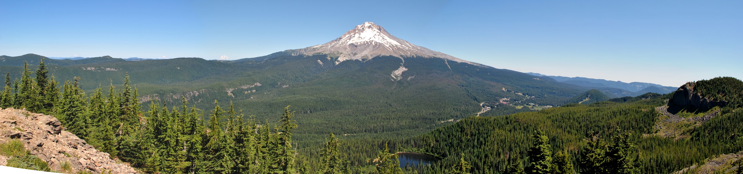
Below is the view from the spot on THD that everyone goes to. I don't see that rock below, and in other photos I have Mt. Adams is further to the left from the slopes of Mt. Hood. My guess is that the photo was taken from one of the other summits of TDH that people don't normally visit because the official trail doesn't go there.

-
Webfoot
- Posts: 1765
- Joined: November 25th, 2015, 11:06 am
- Location: Troutdale
Post
by Webfoot » January 8th, 2021, 8:49 am
This panorama,
not mine, shows much of the area above Mirror Lake. The ridge dropping into the fog/clouds behind the man on the rocks matches the ridge east of Mirror Lake.
This LiDAR image of the ridge may help you find the rock outcrop.


