A while back, Peder posted a TR for a Horsetail Ridge/Rock of Ages loop (http://www.portlandhikers.org/forum/vie ... =horsetail). Having been turned away from Bull of the Woods on Sunday, I needed a hike and Horsetail Ridge – which I’d never tried before – looked promising. By cleverly switching today for my usual Friday off (with its promise of rain), I was able to go hiking in (yes!) bluebird weather. I left the Multnomah Falls parking lot early,
and headed E on the 400 trail to where Ponytail Falls first comes into view as you round the lower end of Horsetail Ridge. There was no sign, but a use trail was pretty evident.
There was one use trail at the start but soon there was more than one and those that went right toward the ridge top took me into some pretty exposed terrain with slippery vegetation. What eventually worked was a use trail that contoured S below the cliffs blocking access to the top of the ridge to an opening in those cliffs that a sane person could scramble up. This was the steepest part of the hike but fairly short and I was soon on the much less steep ridge top. From there I had a view toward Hamilton and Table,
and down the steep slope.
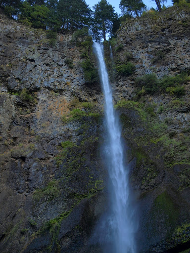
Walking along the top of the ridge was easy – there was a faint use trail in places, little brush, the slope was not severe, and outcrops on the ridge could be easily by-passed. It reminded me of Ruckle Ridge before it became popular.
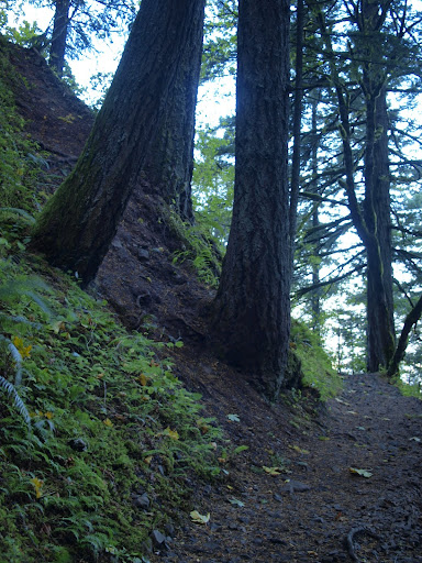
There was even an arch.
I followed the ridge top to the 2600’ level where I expected to meet the 425 trail coming up from Oneonta Creek. I may have actually caught a glimpse of it but kept on toward the mapped position of the 425/459 trail junction, forgetting that the alignment between maps and reality in this area is poor at best. The 425 (red dotted line) actually runs along the W side of the ridge – if there ever was a trail on the E side (as shown on the map) it’s now long gone. So if you’re hiking Horsetail Ridge make a right turn at 2600’ to hit the trail and save yourself a bush whack.
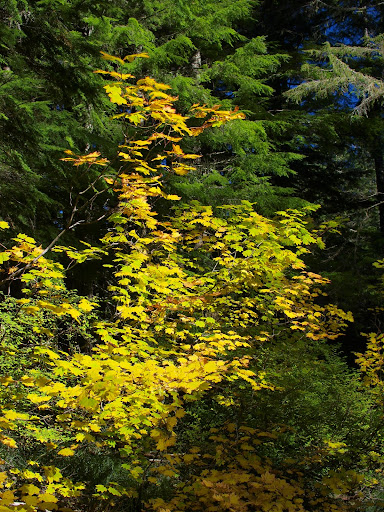
After my invigorating bush thrash to the 425/459 junction, I took the 459 (Bell Ck trail) W toward Larch Mountain. The Fall colors were amazing in the soft afternoon light.
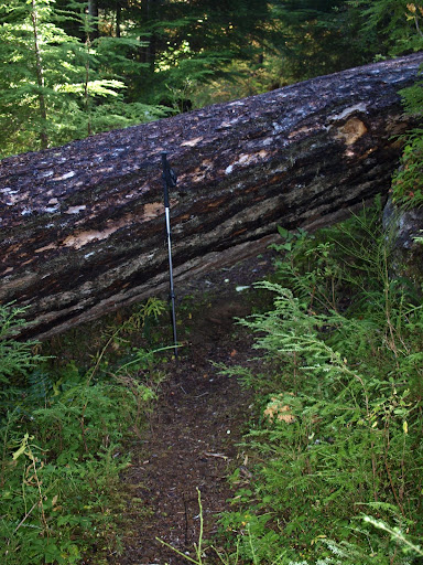
There had been some maintenance on the 459 but also a lot of new blow downs, including this whopper. My pole is about 5’ tall so this thing sits about 7’ above the ground.
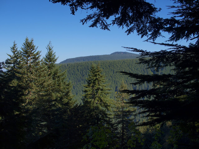
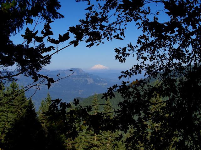
The 459 connects with the 424, which heads up toward Larch Mtn or down to the Franklin Ridge trail. The other mapped trails in this area apparently no longer exist. I followed the 424 down to the Franklin Ridge trail and then took that back to the TH. There aren’t a lot of views on this route, but at one point I could see across to gently sloping Horsetail Ridge (in the foreground),
and out to Mt. Adams.
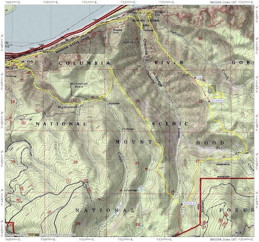
Excellent weather, a new trail, some off-trail exploring, Fall colors, and few tourists at Multnomah Falls. Tough combination to beat . 16.3 mi, about 3,000’ gain.
Horsetail Ridge/Bell Ck/Franklin Ridge Loop 18-Oct-2011
Re: Horsetail Ridge/Bell Ck/Franklin Ridge Loop 18-Oct-2011
thats an excellent overall idea of a hike and even better after getting turned down the other day. A lot of amazing things to see in that area.
cool find on the rock arch too, it wasnt too bad for exposure?
- Eric Peterson
- Posts: 4097
- Joined: May 11th, 2009, 5:39 am
- Location: Oregon
- Contact:
Re: Horsetail Ridge/Bell Ck/Franklin Ridge Loop 18-Oct-2011
I knew there would be a great 'Van Marmot Tuesday' TR today!
On your second picture, so just a little bit more around that corner and find a MUCH easier
way to start your ridge hike. Those use trails you mentioned are fairly used too!
This has been on my to do list as well since doing half of the Horsetail Ridge/Bell Creek
loop myself back in May this year...
Re: Horsetail Ridge/Bell Ck/Franklin Ridge Loop 18-Oct-2011
YES! That was also my discovery and the vegetation is pretty dense there. You sure got in you exercise, adding the Bell Creek loop to that. I guess you are super fit after your recent expeditions!VanMarmot wrote:So if you’re hiking Horsetail Ridge make a right turn at 2600’ to hit the trail and save yourself a bush whack.
Some people are really fit at eighty; thankfully I still have many years to get into shape…
Re: Horsetail Ridge/Bell Ck/Franklin Ridge Loop 18-Oct-2011
Congrats on finding the second arch! now shhhhhhhh!
Re: Horsetail Ridge/Bell Ck/Franklin Ridge Loop 18-Oct-2011
On the side of the arch from where I took the photo it was a flat ridge. I poked my head through the arch itself and found quite a drop off. So no exposure unless you go looking for it.Thum wrote:thats an excellent overall idea of a hike and even better after getting turned down the other day. A lot of amazing things to see in that area.
cool find on the rock arch too, it wasnt too bad for exposure?
Re: Horsetail Ridge/Bell Ck/Franklin Ridge Loop 18-Oct-2011
Well, after a week in Canada (mostly on a train) and then coming back to Portland in time for a week of rain, I was feeling a little unfit. Or maybe I'm just a hiking addict who needed a mileage fix. Anyway, thank you for your TR as it gave me this opportunity to do a cool hike.Peder wrote:YES! That was also my discovery and the vegetation is pretty dense there. You sure got in you exercise, adding the Bell Creek loop to that. I guess you are super fit after your recent expeditions!VanMarmot wrote:So if you’re hiking Horsetail Ridge make a right turn at 2600’ to hit the trail and save yourself a bush whack.
Re: Horsetail Ridge/Bell Ck/Franklin Ridge Loop 18-Oct-2011
I doubt it! Maybe we can work on your fitness with a car2car hike one of these days?!VanMarmot wrote:I was feeling a little unfit.
Some people are really fit at eighty; thankfully I still have many years to get into shape…